{
	"@context": "https://project-open-data.cio.gov/v1.1/schema/catalog.jsonld",
	"@type": "dcat:Catalog",
	"conformsTo": "https://project-open-data.cio.gov/v1.1/schema",
	"describedBy": "https://project-open-data.cio.gov/v1.1/schema/catalog.json",
	"dataset": [
		{
			"@type": "dcat:Dataset",
			"identifier": "https://www.arcgis.com/home/item.html?id=831615388b7f42799542489f12b94602",
			"landingPage": "https://communities-amerigeoss.opendata.arcgis.com/apps/esri::water-balance-app",
			"title": "Water Balance App",
			"description": "<p style='background-image: initial; background-position: initial; background-size: initial; background-repeat: initial; background-attachment: initial; background-origin: initial; background-clip: initial; border: 0px; margin-top: 0px; margin-bottom: 10px; padding: 0px; vertical-align: baseline;'>Click anywhere on earth to see how the water balance is changing over time. This app is based on data from <a href='https://ldas.gsfc.nasa.gov/' target='_blank'>GLDAS version 2.1</a>, which uses weather observations like temperature, humidity, and rainfall to run the <a href='https://www.jsg.utexas.edu/noah-mp' style='background-image: initial; background-position: initial; background-size: initial; background-repeat: initial; background-attachment: initial; background-origin: initial; background-clip: initial; border: 0px; margin: 0px; padding: 0px; vertical-align: baseline; cursor: pointer;'>Noah </a>land surface model. This model estimates how much of the rain becomes runoff, how much evaporates, and how much infiltrates into the soil. These output variables, calculated every three hours, are aggregated into monthly averages, giving us a record of the hydrologic cycle going all the way back to January 2000. </p><p style='background-image: initial; background-position: initial; background-size: initial; background-repeat: initial; background-attachment: initial; background-origin: initial; background-clip: initial; border: 0px; margin-top: 0px; margin-bottom: 10px; padding: 0px; vertical-align: baseline;'>Because the model is run with 0.25 degree spatial resolution (~30 km), these data should only be used for regional analysis. A specific farm or other small area might experience very different conditions than the region around it, especially because human influences like irrigation are not included.</p><p style='background-image: initial; background-position: initial; background-size: initial; background-repeat: initial; background-attachment: initial; background-origin: initial; background-clip: initial; border: 0px; margin-top: 0px; margin-bottom: 10px; padding: 0px; vertical-align: baseline;'>This app can also be seen as a useful template for sharing other climate datasets. If you would like to customize it for your own organization, or use it as a starting point for your own scientific application, the source code is <a href='https://github.com/vannizhang/waterbalance' style='background-image: initial; background-position: initial; background-size: initial; background-repeat: initial; background-attachment: initial; background-origin: initial; background-clip: initial; border: 0px; margin: 0px; padding: 0px; vertical-align: baseline; cursor: pointer;'>available on github</a> for anyone to use. </p>",
			"keyword": [
				"GLDAS",
				"NASA",
				"hydrology",
				"earth observations",
				"landscape",
				"climate",
				"weather"
			],
			"issued": "2017-09-28T18:12:28.000Z",
			"modified": "2026-10-27T17:38:19.000Z",
			"publisher": {
				"name": "Esri"
			},
			"contactPoint": {
				"@type": "vcard:Contact",
				"fn": "esri_hydro",
				"hasEmail": "{{orgContactEmail}}"
			},
			"accessLevel": "public",
			"spatial": "-179.0000,-89.9900,179.0000,89.9900",
			"license": "<p><img src='https://downloads.esri.com/blogs/arcgisonline/esrilogo_new.png' /> &nbsp;This work is licensed under the Esri Master License Agreement.</p><div><a target='_blank' href='https://goto.arcgis.com/termsofuse/viewsummary' rel='nofollow ugc noopener noreferrer'><strong>View Summary</strong></a> | <a target='_blank' href='https://goto.arcgis.com/termsofuse/viewtermsofuse' rel='nofollow ugc noopener noreferrer'><strong>View Terms of Use</strong></a></div>",
			"distribution": [
				{
					"@type": "dcat:Distribution",
					"title": "ArcGIS Hub Dataset",
					"format": "Web Page",
					"mediaType": "text/html",
					"accessURL": "https://communities-amerigeoss.opendata.arcgis.com/apps/esri::water-balance-app"
				},
				{
					"@type": "dcat:Distribution",
					"title": "ArcGIS GeoService",
					"format": "ArcGIS GeoServices REST API",
					"mediaType": "application/json",
					"accessURL": "https://livingatlas.arcgis.com/waterbalance/"
				}
			],
			"theme": [
				"geospatial"
			]
		},
		{
			"@type": "dcat:Dataset",
			"identifier": "https://www.arcgis.com/home/item.html?id=7906c80cea694f3f867de02e2c7c6061",
			"landingPage": "https://communities-amerigeoss.opendata.arcgis.com/content/amerigeoss::amerigeo-imagery-",
			"title": "AmeriGEO Imagery ",
			"description": "DO NOT DELETE OR MODIFY THIS ITEM. This item is managed by the ArcGIS Hub application. To make changes to this site, please visit https://hub.arcgis.com/admin/sites/new",
			"keyword": [
				"Hub Site"
			],
			"issued": "2018-03-14T15:38:12.000Z",
			"modified": "2026-09-19T17:22:35.000Z",
			"publisher": {
				"name": "AmeriGEO"
			},
			"contactPoint": {
				"@type": "vcard:Contact",
				"fn": "vsheth_amerigeoss",
				"hasEmail": "mailto:support@amerigeo.org"
			},
			"accessLevel": "public",
			"spatial": "-168.6592,-57.1468,-177.7999,62.0948",
			"license": "",
			"distribution": [
				{
					"@type": "dcat:Distribution",
					"title": "ArcGIS Hub Dataset",
					"format": "Web Page",
					"mediaType": "text/html",
					"accessURL": "https://communities-amerigeoss.opendata.arcgis.com/content/amerigeoss::amerigeo-imagery-"
				},
				{
					"@type": "dcat:Distribution",
					"title": "ArcGIS GeoService",
					"format": "ArcGIS GeoServices REST API",
					"mediaType": "application/json",
					"accessURL": "https://imagery-amerigeoss.opendata.arcgis.com"
				}
			],
			"theme": [
				"geospatial"
			]
		},
		{
			"@type": "dcat:Dataset",
			"identifier": "https://www.arcgis.com/home/item.html?id=e732ee81a9c14c238a14df554a8e3225",
			"landingPage": "https://communities-amerigeoss.opendata.arcgis.com/content/esri::land-cover-classification-landsat-8",
			"title": "Land Cover Classification (Landsat 8)",
			"description": "<p style='font-family:&quot;Avenir Next W01&quot;, &quot;Avenir Next W00&quot;, &quot;Avenir Next&quot;, Avenir, &quot;Helvetica Neue&quot;, sans-serif; font-size:16px; margin-bottom:1.5rem; margin-top:0px;'><font style='font-family:inherit;'>Land cover describes the surface of the earth. Land cover maps are useful in urban planning, resource management, change detection, agriculture, and a variety of other applications in which information related to earth surface is required.&nbsp;Land cover classification is a complex&nbsp;exercise&nbsp;and is hard to capture using traditional means.&nbsp;Deep learning models are highly capable of learning these complex semantics and can produce superior results.</font></p><div style='font-family:&quot;Avenir Next W01&quot;, &quot;Avenir Next W00&quot;, &quot;Avenir Next&quot;, Avenir, &quot;Helvetica Neue&quot;, sans-serif; font-size:16px;'><span style='font-size:large;'><font style='font-family:inherit;'><strong>Using the model</strong></font></span></div><div style='font-family:&quot;Avenir Next W01&quot;, &quot;Avenir Next W00&quot;, &quot;Avenir Next&quot;, Avenir, &quot;Helvetica Neue&quot;, sans-serif; font-size:16px;'><p><span style='font-size:medium;'><font style='font-family:inherit;'>Follow the&nbsp;</font></span><a target='_blank' href='https://doc.arcgis.com/en/pretrained-models/latest/imagery/using-land-cover-classification-landsat-8-.htm' rel='nofollow ugc noopener noreferrer'>guide</a><span style='font-size:medium;'><font style='font-family:inherit;'>&nbsp;to use the model<i>.&nbsp;</i>Before&nbsp;using this model,</font></span><font style='font-family:inherit;'>&nbsp;ensure that the supported deep learning&nbsp;</font><span style='font-size:17px;'><font style='font-family:inherit;'>libraries&nbsp;</font></span><font style='font-family:inherit;'>are installed.&nbsp;</font><span style='font-size:medium;'><font style='font-family:inherit;'>For more details, check&nbsp;</font></span><a style='font-family:inherit;' target='_blank' href='https://github.com/esri/deep-learning-frameworks' rel='nofollow ugc noopener noreferrer'><span style='font-size:medium;'><font style='font-family:inherit;'>Deep Learning Libraries Installer for ArcGIS</font></span></a><span style='font-size:medium;'><font style='font-family:inherit;'>.</font></span></p><p style='margin:0in 52.9pt 0.95pt 0in;'><span style='font-size:large;'><font style='font-family:inherit;'><strong>Fine-tuning the model</strong></font></span></p><p style='margin:0in 52.9pt 0.95pt 0in;'><span style='font-size:medium;'><font style='font-family:inherit;'>This model can be fine-tuned using the Train Deep Learning Model tool. Follow the&nbsp;</font></span><a target='_blank' href='https://doc.arcgis.com/en/pretrained-models/latest/imagery/finetuning-the-land-cover-classification-landsat-8-.htm' rel='nofollow ugc noopener noreferrer'>guide</a><font style='font-family:inherit;'>&nbsp;</font><span style='font-size:medium;'><font style='font-family:inherit;'>to fine-tune this model.</font></span><br />&nbsp;</p></div><div style='font-family:&quot;Avenir Next W01&quot;, &quot;Avenir Next W00&quot;, &quot;Avenir Next&quot;, Avenir, &quot;Helvetica Neue&quot;, sans-serif; font-size:16px;'><span style='font-size:large;'><font style='font-family:inherit;'><strong>Input</strong></font></span></div><div style='font-family:&quot;Avenir Next W01&quot;, &quot;Avenir Next W00&quot;, &quot;Avenir Next&quot;, Avenir, &quot;Helvetica Neue&quot;, sans-serif; font-size:16px;'><p style='margin-bottom:1.5rem; margin-top:0px; text-align:justify;'><span style='font-size:medium;'><span style='text-align:start;'>Raster</span></span>, mosaic dataset, or image service. (<font style='font-family:inherit;'>Preferred cell size is</font>&nbsp;30 meters.)</p></div><div style='font-family:&quot;Avenir Next W01&quot;, &quot;Avenir Next W00&quot;, &quot;Avenir Next&quot;, Avenir, &quot;Helvetica Neue&quot;, sans-serif; font-size:16px;'><span style='font-size:large;'><font style='font-family:inherit;'><strong>Output</strong></font></span></div><p style='font-family:&quot;Avenir Next W01&quot;, &quot;Avenir Next W00&quot;, &quot;Avenir Next&quot;, Avenir, &quot;Helvetica Neue&quot;, sans-serif; font-size:16px; margin-bottom:1.5rem; margin-top:0px; text-align:justify;'><span style='font-size:medium;'><font style='text-align:start;'>Classified raster with the same classes as in the National Land Cover Database (NLCD) 2016.</font></span><br /><span style='font-size:medium;'><font style='font-family:inherit; text-align:start;'>Note:&nbsp;</font></span><font style='text-align:start;'>The classified raster contains 20 classes based on a modified Anderson Level II classification system as used by the National Land Cover Database.</font></p><div style='font-family:&quot;Avenir Next W01&quot;, &quot;Avenir Next W00&quot;, &quot;Avenir Next&quot;, Avenir, &quot;Helvetica Neue&quot;, sans-serif; font-size:16px;'><span style='font-size:large;'><font style='font-family:inherit;'><strong>Applicable geographies</strong></font></span></div><div style='font-family:inherit;'><span style='font-size:16px;'>This model is expected to work well in the United States.</span></div><p style='font-family:&quot;Avenir Next W01&quot;, &quot;Avenir Next W00&quot;, &quot;Avenir Next&quot;, Avenir, &quot;Helvetica Neue&quot;, sans-serif; font-size:16px; margin-bottom:0px; margin-top:0px;'>&nbsp;</p><div style='font-family:&quot;Avenir Next W01&quot;, &quot;Avenir Next W00&quot;, &quot;Avenir Next&quot;, Avenir, &quot;Helvetica Neue&quot;, sans-serif; font-size:16px;'><span style='font-size:large;'><font style='font-family:inherit;'><strong>Model architecture</strong></font></span></div><div style='font-family:&quot;Avenir Next W01&quot;, &quot;Avenir Next W00&quot;, &quot;Avenir Next&quot;, Avenir, &quot;Helvetica Neue&quot;, sans-serif; font-size:16px;'><font style='font-family:inherit;'>This model uses the&nbsp;</font><a style='font-family:inherit;' target='_blank' href='https://developers.arcgis.com/python/guide/how-unet-works/' rel='nofollow ugc noopener noreferrer'><font style='font-family:inherit;'>UNet</font></a><font style='font-family:inherit;'>&nbsp;model architecture implemented in ArcGIS API for Python.</font></div><p style='font-family:&quot;Avenir Next W01&quot;, &quot;Avenir Next W00&quot;, &quot;Avenir Next&quot;, Avenir, &quot;Helvetica Neue&quot;, sans-serif; font-size:16px; margin-bottom:0px; margin-top:0px;'>&nbsp;</p><div style='font-family:&quot;Avenir Next W01&quot;, &quot;Avenir Next W00&quot;, &quot;Avenir Next&quot;, Avenir, &quot;Helvetica Neue&quot;, sans-serif; font-size:16px;'><span style='font-size:large;'><font style='font-family:inherit;'><strong>Accuracy metrics</strong></font></span></div><p style='font-family:&quot;Avenir Next W01&quot;, &quot;Avenir Next W00&quot;, &quot;Avenir Next&quot;, Avenir, &quot;Helvetica Neue&quot;, sans-serif; font-size:16px; margin-bottom:1.5rem; margin-top:0px; text-align:justify;'><font style='font-family:inherit; text-align:start;'>This model has an overall accuracy of&nbsp;77 percent.&nbsp;</font><font style='text-align:start;'>The table below summarizes the precision, recall and F1-score of the model on the validation dataset.</font></p><figure><table style='border-collapse:collapse; border-spacing:0px; border:1px solid rgb(204, 204, 204); font-family:&quot;Avenir Next W01&quot;, &quot;Avenir Next W00&quot;, &quot;Avenir Next&quot;, Avenir, &quot;Helvetica Neue&quot;, sans-serif; font-size:0.875rem; margin-bottom:1.5rem;' width='651' cellpadding='0' cellspacing='0' border='0'><tbody><tr style='border-bottom:1px solid rgb(204, 204, 204); height:30pt;' height='40'><td style='border-left:1px solid rgb(204, 204, 204); border-right:1px solid rgb(204, 204, 204); height:45pt; padding:0.5rem; width:169pt;' rowspan='2' height='60' width='225'><strong>C</strong><font style='font-family:inherit;'><strong>lass</strong></font></td><td style='border-left-style:none; border-right:1px solid rgb(204, 204, 204); padding:0.5rem; width:155pt;' colspan='3' width='206'><strong>Collection 2 Level 2 Imagery</strong></td><td style='border-left-style:none; border-right:1px solid rgb(204, 204, 204); padding:0.5rem; width:165pt;' colspan='3' width='220'><strong>Collection 1 Level 1 Imagery</strong></td></tr><tr style='border-bottom:1px solid rgb(204, 204, 204); height:15pt;' height='20'><td style='border-left-style:none; border-right:1px solid rgb(204, 204, 204); border-top-style:none; height:15pt; padding:0.5rem; width:58pt;' height='20' width='77'><strong>Precision</strong></td><td style='border-left-style:none; border-right:1px solid rgb(204, 204, 204); border-top-style:none; padding:0.5rem; width:44pt;' width='59'><strong>Recall</strong></td><td style='border-left-style:none; border-right:1px solid rgb(204, 204, 204); border-top-style:none; padding:0.5rem; width:53pt;' width='70'><strong>F1 Score</strong></td><td style='border-left-style:none; border-right:1px solid rgb(204, 204, 204); border-top-style:none; padding:0.5rem; width:61pt;' width='81'><strong>Precision</strong></td><td style='border-left-style:none; border-right:1px solid rgb(204, 204, 204); border-top-style:none; padding:0.5rem; width:41pt;' width='55'><strong>Recall</strong></td><td style='border-left-style:none; border-right:1px solid rgb(204, 204, 204); border-top-style:none; padding:0.5rem; width:63pt;' width='84'><strong>F1 Score</strong></td></tr><tr style='border-bottom:1px solid rgb(204, 204, 204); height:15pt;' height='20'><td style='border-left:1px solid rgb(204, 204, 204); border-right:1px solid rgb(204, 204, 204); border-top-style:none; height:15pt; padding:0.5rem; width:169pt;' height='20' width='225'>Open Water</td><td style='border-left-style:none; border-right:1px solid rgb(204, 204, 204); border-top-style:none; padding:0.5rem; width:58pt;' width='77'>0.96</td><td style='border-left-style:none; border-right:1px solid rgb(204, 204, 204); border-top-style:none; padding:0.5rem; width:44pt;' width='59'>0.97</td><td style='border-left-style:none; border-right:1px solid rgb(204, 204, 204); border-top-style:none; padding:0.5rem; width:53pt;' width='70'>0.96</td><td style='border-left-style:none; border-right:1px solid rgb(204, 204, 204); border-top-style:none; padding:0.5rem; width:61pt;' width='81'>0.95</td><td style='border-left-style:none; border-right:1px solid rgb(204, 204, 204); border-top-style:none; padding:0.5rem; width:41pt;' width='55'>0.97</td><td style='border-left-style:none; border-right:1px solid rgb(204, 204, 204); border-top-style:none; padding:0.5rem; width:63pt;' width='84'>0.96</td></tr><tr style='border-bottom:1px solid rgb(204, 204, 204); height:15pt;' height='20'><td style='border-left:1px solid rgb(204, 204, 204); border-right:1px solid rgb(204, 204, 204); border-top-style:none; height:15pt; padding:0.5rem; width:169pt;' height='20' width='225'>Perennial Snow/Ice</td><td style='border-left-style:none; border-right:1px solid rgb(204, 204, 204); border-top-style:none; padding:0.5rem; width:58pt;' width='77'>0.86</td><td style='border-left-style:none; border-right:1px solid rgb(204, 204, 204); border-top-style:none; padding:0.5rem; width:44pt;' width='59'>0.69</td><td style='border-left-style:none; border-right:1px solid rgb(204, 204, 204); border-top-style:none; padding:0.5rem; width:53pt;' width='70'>0.77</td><td style='border-left-style:none; border-right:1px solid rgb(204, 204, 204); border-top-style:none; padding:0.5rem; width:61pt;' width='81'>0.49</td><td style='border-left-style:none; border-right:1px solid rgb(204, 204, 204); border-top-style:none; padding:0.5rem; width:41pt;' width='55'>0.94</td><td style='border-left-style:none; border-right:1px solid rgb(204, 204, 204); border-top-style:none; padding:0.5rem; width:63pt;' width='84'>0.64</td></tr><tr style='border-bottom:1px solid rgb(204, 204, 204); height:15pt;' height='20'><td style='border-left:1px solid rgb(204, 204, 204); border-right:1px solid rgb(204, 204, 204); border-top-style:none; height:15pt; padding:0.5rem; width:169pt;' height='20' width='225'>Developed, Open Space</td><td style='border-left-style:none; border-right:1px solid rgb(204, 204, 204); border-top-style:none; padding:0.5rem; width:58pt;' width='77'>0.51</td><td style='border-left-style:none; border-right:1px solid rgb(204, 204, 204); border-top-style:none; padding:0.5rem; width:44pt;' width='59'>0.38</td><td style='border-left-style:none; border-right:1px solid rgb(204, 204, 204); border-top-style:none; padding:0.5rem; width:53pt;' width='70'>0.44</td><td style='border-left-style:none; border-right:1px solid rgb(204, 204, 204); border-top-style:none; padding:0.5rem; width:61pt;' width='81'>0.43</td><td style='border-left-style:none; border-right:1px solid rgb(204, 204, 204); border-top-style:none; padding:0.5rem; width:41pt;' width='55'>0.38</td><td style='border-left-style:none; border-right:1px solid rgb(204, 204, 204); border-top-style:none; padding:0.5rem; width:63pt;' width='84'>0.4</td></tr><tr style='border-bottom:1px solid rgb(204, 204, 204); height:15pt;' height='20'><td style='border-left:1px solid rgb(204, 204, 204); border-right:1px solid rgb(204, 204, 204); border-top-style:none; height:15pt; padding:0.5rem; width:169pt;' height='20' width='225'>Developed, Low Intensity</td><td style='border-left-style:none; border-right:1px solid rgb(204, 204, 204); border-top-style:none; padding:0.5rem; width:58pt;' width='77'>0.52</td><td style='border-left-style:none; border-right:1px solid rgb(204, 204, 204); border-top-style:none; padding:0.5rem; width:44pt;' width='59'>0.46</td><td style='border-left-style:none; border-right:1px solid rgb(204, 204, 204); border-top-style:none; padding:0.5rem; width:53pt;' width='70'>0.49</td><td style='border-left-style:none; border-right:1px solid rgb(204, 204, 204); border-top-style:none; padding:0.5rem; width:61pt;' width='81'>0.47</td><td style='border-left-style:none; border-right:1px solid rgb(204, 204, 204); border-top-style:none; padding:0.5rem; width:41pt;' width='55'>0.48</td><td style='border-left-style:none; border-right:1px solid rgb(204, 204, 204); border-top-style:none; padding:0.5rem; width:63pt;' width='84'>0.47</td></tr><tr style='border-bottom:1px solid rgb(204, 204, 204); height:15pt;' height='20'><td style='border-left:1px solid rgb(204, 204, 204); border-right:1px solid rgb(204, 204, 204); border-top-style:none; height:15pt; padding:0.5rem; width:169pt;' height='20' width='225'>Developed, Medium Intensity</td><td style='border-left-style:none; border-right:1px solid rgb(204, 204, 204); border-top-style:none; padding:0.5rem; width:58pt;' width='77'>0.54</td><td style='border-left-style:none; border-right:1px solid rgb(204, 204, 204); border-top-style:none; padding:0.5rem; width:44pt;' width='59'>0.5</td><td style='border-left-style:none; border-right:1px solid rgb(204, 204, 204); border-top-style:none; padding:0.5rem; width:53pt;' width='70'>0.52</td><td style='border-left-style:none; border-right:1px solid rgb(204, 204, 204); border-top-style:none; padding:0.5rem; width:61pt;' width='81'>0.49</td><td style='border-left-style:none; border-right:1px solid rgb(204, 204, 204); border-top-style:none; padding:0.5rem; width:41pt;' width='55'>0.54</td><td style='border-left-style:none; border-right:1px solid rgb(204, 204, 204); border-top-style:none; padding:0.5rem; width:63pt;' width='84'>0.51</td></tr><tr style='border-bottom:1px solid rgb(204, 204, 204); height:15pt;' height='20'><td style='border-left:1px solid rgb(204, 204, 204); border-right:1px solid rgb(204, 204, 204); border-top-style:none; height:15pt; padding:0.5rem; width:169pt;' height='20' width='225'>Developed, High Intensity</td><td style='border-left-style:none; border-right:1px solid rgb(204, 204, 204); border-top-style:none; padding:0.5rem; width:58pt;' width='77'>0.67</td><td style='border-left-style:none; border-right:1px solid rgb(204, 204, 204); border-top-style:none; padding:0.5rem; width:44pt;' width='59'>0.54</td><td style='border-left-style:none; border-right:1px solid rgb(204, 204, 204); border-top-style:none; padding:0.5rem; width:53pt;' width='70'>0.6</td><td style='border-left-style:none; border-right:1px solid rgb(204, 204, 204); border-top-style:none; padding:0.5rem; width:61pt;' width='81'>0.55</td><td style='border-left-style:none; border-right:1px solid rgb(204, 204, 204); border-top-style:none; padding:0.5rem; width:41pt;' width='55'>0.68</td><td style='border-left-style:none; border-right:1px solid rgb(204, 204, 204); border-top-style:none; padding:0.5rem; width:63pt;' width='84'>0.61</td></tr><tr style='border-bottom:1px solid rgb(204, 204, 204); height:15pt;' height='20'><td style='border-left:1px solid rgb(204, 204, 204); border-right:1px solid rgb(204, 204, 204); border-top-style:none; height:15pt; padding:0.5rem; width:169pt;' height='20' width='225'>Barren Land</td><td style='border-left-style:none; border-right:1px solid rgb(204, 204, 204); border-top-style:none; padding:0.5rem; width:58pt;' width='77'>0.76</td><td style='border-left-style:none; border-right:1px solid rgb(204, 204, 204); border-top-style:none; padding:0.5rem; width:44pt;' width='59'>0.59</td><td style='border-left-style:none; border-right:1px solid rgb(204, 204, 204); border-top-style:none; padding:0.5rem; width:53pt;' width='70'>0.66</td><td style='border-left-style:none; border-right:1px solid rgb(204, 204, 204); border-top-style:none; padding:0.5rem; width:61pt;' width='81'>0.6</td><td style='border-left-style:none; border-right:1px solid rgb(204, 204, 204); border-top-style:none; padding:0.5rem; width:41pt;' width='55'>0.77</td><td style='border-left-style:none; border-right:1px solid rgb(204, 204, 204); border-top-style:none; padding:0.5rem; width:63pt;' width='84'>0.68</td></tr><tr style='border-bottom:1px solid rgb(204, 204, 204); height:15pt;' height='20'><td style='border-left:1px solid rgb(204, 204, 204); border-right:1px solid rgb(204, 204, 204); border-top-style:none; height:15pt; padding:0.5rem; width:169pt;' height='20' width='225'>Deciduous Forest</td><td style='border-left-style:none; border-right:1px solid rgb(204, 204, 204); border-top-style:none; padding:0.5rem; width:58pt;' width='77'>0.74</td><td style='border-left-style:none; border-right:1px solid rgb(204, 204, 204); border-top-style:none; padding:0.5rem; width:44pt;' width='59'>0.81</td><td style='border-left-style:none; border-right:1px solid rgb(204, 204, 204); border-top-style:none; padding:0.5rem; width:53pt;' width='70'>0.78</td><td style='border-left-style:none; border-right:1px solid rgb(204, 204, 204); border-top-style:none; padding:0.5rem; width:61pt;' width='81'>0.78</td><td style='border-left-style:none; border-right:1px solid rgb(204, 204, 204); border-top-style:none; padding:0.5rem; width:41pt;' width='55'>0.76</td><td style='border-left-style:none; border-right:1px solid rgb(204, 204, 204); border-top-style:none; padding:0.5rem; width:63pt;' width='84'>0.77</td></tr><tr style='border-bottom:1px solid rgb(204, 204, 204); height:15pt;' height='20'><td style='border-left:1px solid rgb(204, 204, 204); border-right:1px solid rgb(204, 204, 204); border-top-style:none; height:15pt; padding:0.5rem; width:169pt;' height='20' width='225'>Evergreen Forest</td><td style='border-left-style:none; border-right:1px solid rgb(204, 204, 204); border-top-style:none; padding:0.5rem; width:58pt;' width='77'>0.77</td><td style='border-left-style:none; border-right:1px solid rgb(204, 204, 204); border-top-style:none; padding:0.5rem; width:44pt;' width='59'>0.82</td><td style='border-left-style:none; border-right:1px solid rgb(204, 204, 204); border-top-style:none; padding:0.5rem; width:53pt;' width='70'>0.79</td><td style='border-left-style:none; border-right:1px solid rgb(204, 204, 204); border-top-style:none; padding:0.5rem; width:61pt;' width='81'>0.8</td><td style='border-left-style:none; border-right:1px solid rgb(204, 204, 204); border-top-style:none; padding:0.5rem; width:41pt;' width='55'>0.82</td><td style='border-left-style:none; border-right:1px solid rgb(204, 204, 204); border-top-style:none; padding:0.5rem; width:63pt;' width='84'>0.81</td></tr><tr style='border-bottom:1px solid rgb(204, 204, 204); height:15pt;' height='20'><td style='border-left:1px solid rgb(204, 204, 204); border-right:1px solid rgb(204, 204, 204); border-top-style:none; height:15pt; padding:0.5rem; width:169pt;' height='20' width='225'>Mixed Forest</td><td style='border-left-style:none; border-right:1px solid rgb(204, 204, 204); border-top-style:none; padding:0.5rem; width:58pt;' width='77'>0.56</td><td style='border-left-style:none; border-right:1px solid rgb(204, 204, 204); border-top-style:none; padding:0.5rem; width:44pt;' width='59'>0.47</td><td style='border-left-style:none; border-right:1px solid rgb(204, 204, 204); border-top-style:none; padding:0.5rem; width:53pt;' width='70'>0.51</td><td style='border-left-style:none; border-right:1px solid rgb(204, 204, 204); border-top-style:none; padding:0.5rem; width:61pt;' width='81'>0.5</td><td style='border-left-style:none; border-right:1px solid rgb(204, 204, 204); border-top-style:none; padding:0.5rem; width:41pt;' width='55'>0.53</td><td style='border-left-style:none; border-right:1px solid rgb(204, 204, 204); border-top-style:none; padding:0.5rem; width:63pt;' width='84'>0.51</td></tr><tr style='border-bottom:1px solid rgb(204, 204, 204); height:15pt;' height='20'><td style='border-left:1px solid rgb(204, 204, 204); border-right:1px solid rgb(204, 204, 204); border-top-style:none; height:15pt; padding:0.5rem; width:169pt;' height='20' width='225'>Shrub/Scrub</td><td style='border-left-style:none; border-right:1px solid rgb(204, 204, 204); border-top-style:none; padding:0.5rem; width:58pt;' width='77'>0.82</td><td style='border-left-style:none; border-right:1px solid rgb(204, 204, 204); border-top-style:none; padding:0.5rem; width:44pt;' width='59'>0.82</td><td style='border-left-style:none; border-right:1px solid rgb(204, 204, 204); border-top-style:none; padding:0.5rem; width:53pt;' width='70'>0.82</td><td style='border-left-style:none; border-right:1px solid rgb(204, 204, 204); border-top-style:none; padding:0.5rem; width:61pt;' width='81'>0.84</td><td style='border-left-style:none; border-right:1px solid rgb(204, 204, 204); border-top-style:none; padding:0.5rem; width:41pt;' width='55'>0.81</td><td style='border-left-style:none; border-right:1px solid rgb(204, 204, 204); border-top-style:none; padding:0.5rem; width:63pt;' width='84'>0.83</td></tr><tr style='border-bottom:1px solid rgb(204, 204, 204); height:15pt;' height='20'><td style='border-left:1px solid rgb(204, 204, 204); border-right:1px solid rgb(204, 204, 204); border-top-style:none; height:15pt; padding:0.5rem; width:169pt;' height='20' width='225'>Herbaceous</td><td style='border-left-style:none; border-right:1px solid rgb(204, 204, 204); border-top-style:none; padding:0.5rem; width:58pt;' width='77'>0.78</td><td style='border-left-style:none; border-right:1px solid rgb(204, 204, 204); border-top-style:none; padding:0.5rem; width:44pt;' width='59'>0.74</td><td style='border-left-style:none; border-right:1px solid rgb(204, 204, 204); border-top-style:none; padding:0.5rem; width:53pt;' width='70'>0.76</td><td style='border-left-style:none; border-right:1px solid rgb(204, 204, 204); border-top-style:none; padding:0.5rem; width:61pt;' width='81'>0.79</td><td style='border-left-style:none; border-right:1px solid rgb(204, 204, 204); border-top-style:none; padding:0.5rem; width:41pt;' width='55'>0.77</td><td style='border-left-style:none; border-right:1px solid rgb(204, 204, 204); border-top-style:none; padding:0.5rem; width:63pt;' width='84'>0.78</td></tr><tr style='border-bottom:1px solid rgb(204, 204, 204); height:15pt;' height='20'><td style='border-left:1px solid rgb(204, 204, 204); border-right:1px solid rgb(204, 204, 204); border-top-style:none; height:15pt; padding:0.5rem; width:169pt;' height='20' width='225'>Hay/Pasture</td><td style='border-left-style:none; border-right:1px solid rgb(204, 204, 204); border-top-style:none; padding:0.5rem; width:58pt;' width='77'>0.7</td><td style='border-left-style:none; border-right:1px solid rgb(204, 204, 204); border-top-style:none; padding:0.5rem; width:44pt;' width='59'>0.74</td><td style='border-left-style:none; border-right:1px solid rgb(204, 204, 204); border-top-style:none; padding:0.5rem; width:53pt;' width='70'>0.72</td><td style='border-left-style:none; border-right:1px solid rgb(204, 204, 204); border-top-style:none; padding:0.5rem; width:61pt;' width='81'>0.67</td><td style='border-left-style:none; border-right:1px solid rgb(204, 204, 204); border-top-style:none; padding:0.5rem; width:41pt;' width='55'>0.75</td><td style='border-left-style:none; border-right:1px solid rgb(204, 204, 204); border-top-style:none; padding:0.5rem; width:63pt;' width='84'>0.71</td></tr><tr style='border-bottom:1px solid rgb(204, 204, 204); height:15pt;' height='20'><td style='border-left:1px solid rgb(204, 204, 204); border-right:1px solid rgb(204, 204, 204); border-top-style:none; height:15pt; padding:0.5rem; width:169pt;' height='20' width='225'>Cultivated Crops</td><td style='border-left-style:none; border-right:1px solid rgb(204, 204, 204); border-top-style:none; padding:0.5rem; width:58pt;' width='77'>0.87</td><td style='border-left-style:none; border-right:1px solid rgb(204, 204, 204); border-top-style:none; padding:0.5rem; width:44pt;' width='59'>0.91</td><td style='border-left-style:none; border-right:1px solid rgb(204, 204, 204); border-top-style:none; padding:0.5rem; width:53pt;' width='70'>0.89</td><td style='border-left-style:none; border-right:1px solid rgb(204, 204, 204); border-top-style:none; padding:0.5rem; width:61pt;' width='81'>0.91</td><td style='border-left-style:none; border-right:1px solid rgb(204, 204, 204); border-top-style:none; padding:0.5rem; width:41pt;' width='55'>0.9</td><td style='border-left-style:none; border-right:1px solid rgb(204, 204, 204); border-top-style:none; padding:0.5rem; width:63pt;' width='84'>0.9</td></tr><tr style='border-bottom:1px solid rgb(204, 204, 204); height:15pt;' height='20'><td style='border-left:1px solid rgb(204, 204, 204); border-right:1px solid rgb(204, 204, 204); border-top-style:none; height:15pt; padding:0.5rem; width:169pt;' height='20' width='225'>Woody Wetlands</td><td style='border-left-style:none; border-right:1px solid rgb(204, 204, 204); border-top-style:none; padding:0.5rem; width:58pt;' width='77'>0.7</td><td style='border-left-style:none; border-right:1px solid rgb(204, 204, 204); border-top-style:none; padding:0.5rem; width:44pt;' width='59'>0.68</td><td style='border-left-style:none; border-right:1px solid rgb(204, 204, 204); border-top-style:none; padding:0.5rem; width:53pt;' width='70'>0.69</td><td style='border-left-style:none; border-right:1px solid rgb(204, 204, 204); border-top-style:none; padding:0.5rem; width:61pt;' width='81'>0.67</td><td style='border-left-style:none; border-right:1px solid rgb(204, 204, 204); border-top-style:none; padding:0.5rem; width:41pt;' width='55'>0.68</td><td style='border-left-style:none; border-right:1px solid rgb(204, 204, 204); border-top-style:none; padding:0.5rem; width:63pt;' width='84'>0.68</td></tr><tr style='border-bottom-style:none; height:15pt;' height='20'><td style='border-left:1px solid rgb(204, 204, 204); border-right:1px solid rgb(204, 204, 204); border-top-style:none; height:15pt; padding:0.5rem; width:169pt;' height='20' width='225'>Emergent Herbaceous Wetlands</td><td style='border-left-style:none; border-right:1px solid rgb(204, 204, 204); border-top-style:none; padding:0.5rem; width:58pt;' width='77'>0.72</td><td style='border-left-style:none; border-right:1px solid rgb(204, 204, 204); border-top-style:none; padding:0.5rem; width:44pt;' width='59'>0.54</td><td style='border-left-style:none; border-right:1px solid rgb(204, 204, 204); border-top-style:none; padding:0.5rem; width:53pt;' width='70'>0.62</td><td style='border-left-style:none; border-right:1px solid rgb(204, 204, 204); border-top-style:none; padding:0.5rem; width:61pt;' width='81'>0.54</td><td style='border-left-style:none; border-right:1px solid rgb(204, 204, 204); border-top-style:none; padding:0.5rem; width:41pt;' width='55'>0.61</td><td style='border-left-style:none; border-right:1px solid rgb(204, 204, 204); border-top-style:none; padding:0.5rem; width:63pt;' width='84'>0.57</td></tr></tbody></table></figure><div style='font-family:&quot;Avenir Next W01&quot;, &quot;Avenir Next W00&quot;, &quot;Avenir Next&quot;, Avenir, &quot;Helvetica Neue&quot;, sans-serif; font-size:16px;'><br />&nbsp;</div><div style='font-family:&quot;Avenir Next W01&quot;, &quot;Avenir Next W00&quot;, &quot;Avenir Next&quot;, Avenir, &quot;Helvetica Neue&quot;, sans-serif; font-size:16px;'><span style='font-size:large;'><font style='font-family:inherit;'><strong>Training data</strong></font></span></div><div style='font-family:inherit;'><font style='font-family:inherit; font-size:16px;'>This model has been trained on the&nbsp;</font><span style='font-size:16px;'>National Land Cover Database (NLCD) 2016 with the same Landsat 8 scenes that were used to produce the database. Scene IDs for the imagery were available in the metadata of the dataset.</span><br /><br />&nbsp;</div><div style='font-family:inherit;'><div style='font-family:&quot;Avenir Next W01&quot;, &quot;Avenir Next W00&quot;, &quot;Avenir Next&quot;, Avenir, &quot;Helvetica Neue&quot;, sans-serif; font-size:16px;'><span style='font-size:large;'><font style='font-family:inherit;'><strong>Sample results</strong></font></span></div><div style='font-family:&quot;Avenir Next W01&quot;, &quot;Avenir Next W00&quot;, &quot;Avenir Next&quot;, Avenir, &quot;Helvetica Neue&quot;, sans-serif;'>Here are a few results from the model.</div></div><p style='font-family:&quot;Avenir Next W01&quot;, &quot;Avenir Next W00&quot;, &quot;Avenir Next&quot;, Avenir, &quot;Helvetica Neue&quot;, sans-serif; font-size:16px; margin-bottom:0px; margin-top:0px;'>&nbsp;</p><p style='font-family:&quot;Avenir Next W01&quot;, &quot;Avenir Next W00&quot;, &quot;Avenir Next&quot;, Avenir, &quot;Helvetica Neue&quot;, sans-serif; font-size:16px; margin-bottom:1.5rem; margin-top:0px;'><img style='font-family:&quot;Avenir Next&quot;, Avenir, &quot;Helvetica Neue&quot;, Helvetica, Arial, sans-serif; font-size:15px; height:auto; max-width:100%;' src='https://esri.maps.arcgis.com/sharing/rest/content/items/d35e8d8067de4ced91687dfc0e6721ad/data' alt='Figure 1' /></p><p style='font-family:&quot;Avenir Next W01&quot;, &quot;Avenir Next W00&quot;, &quot;Avenir Next&quot;, Avenir, &quot;Helvetica Neue&quot;, sans-serif; font-size:16px; margin-bottom:1.5rem; margin-top:0px;'><img style='font-family:&quot;Avenir Next&quot;, Avenir, &quot;Helvetica Neue&quot;, Helvetica, Arial, sans-serif; font-size:15px; height:auto; max-width:100%;' src='https://esri.maps.arcgis.com/sharing/rest/content/items/f93abb41bee64d70a6694c4331229c13/data' alt='figure2' /><br />&nbsp;</p><p style='font-family:&quot;Avenir Next W01&quot;, &quot;Avenir Next W00&quot;, &quot;Avenir Next&quot;, Avenir, &quot;Helvetica Neue&quot;, sans-serif; font-size:16px; margin-bottom:1.5rem; margin-top:0px;'><img src='https://esri.maps.arcgis.com/sharing/rest/content/items/4c7c04562cc84349b3e3a5fe07abbb06/data' alt='figure2' /><br />&nbsp;</p><p style='font-family:&quot;Avenir Next W01&quot;, &quot;Avenir Next W00&quot;, &quot;Avenir Next&quot;, Avenir, &quot;Helvetica Neue&quot;, sans-serif; font-size:16px; margin-bottom:1.5rem; margin-top:0px;'><img src='https://esri.maps.arcgis.com/sharing/rest/content/items/5a8c5fe5fa354c7f8d43eeeef05a6ce2/data' alt='figure2' /></p>",
			"keyword": [
				"dlpk",
				"landcover",
				"deep learning",
				"living atlas",
				"unet"
			],
			"issued": "2020-09-19T23:08:58.000Z",
			"modified": "2026-09-01T07:10:37.000Z",
			"publisher": {
				"name": "Esri"
			},
			"contactPoint": {
				"@type": "vcard:Contact",
				"fn": "esri_analytics",
				"hasEmail": "{{orgContactEmail}}"
			},
			"accessLevel": "public",
			"spatial": "-180.0000,-59.2767,173.3546,71.9806",
			"license": "<p><img src='https://downloads.esri.com/blogs/arcgisonline/esrilogo_new.png' /> &nbsp;This work is licensed under the Esri Master License Agreement<p><a target='_blank' href='https://goto.arcgis.com/termsofuse/viewsummary' rel='nofollow ugc noopener noreferrer'><strong>View Summary | <a target='_blank' href='https://goto.arcgis.com/termsofuse/viewtermsofuse' rel='nofollow ugc noopener noreferrer'><strong>View Terms of Use</p></p></a></a></strong></strong>",
			"distribution": [
				{
					"@type": "dcat:Distribution",
					"title": "ArcGIS Hub Dataset",
					"format": "Web Page",
					"mediaType": "text/html",
					"accessURL": "https://communities-amerigeoss.opendata.arcgis.com/content/esri::land-cover-classification-landsat-8"
				}
			],
			"theme": [
				"geospatial"
			]
		},
		{
			"@type": "dcat:Dataset",
			"identifier": "https://www.arcgis.com/home/item.html?id=5ff454d2e9ea420ba1f810076ce70ec2",
			"landingPage": "https://communities-amerigeoss.opendata.arcgis.com/datasets/esri::sentinel-2-imagery-bathymetric-with-dra",
			"title": "Sentinel-2 Imagery: Bathymetric with DRA",
			"description": "<p style='background-attachment:initial; background-clip:initial; background-image:initial; background-origin:initial; background-position:initial; background-repeat:initial; background-size:initial;'><span style='color:#b22222;'><strong>Retirement Notice:</strong></span><strong>&nbsp;This item is currently in&nbsp;</strong><a target='_blank' href='https://goto.arcgis.com/termsofuse/beta' rel='nofollow ugc noopener noreferrer'><strong>beta</strong></a><strong> and will be retired in December 2026.&nbsp;</strong> A replacement item has not been identified at this time. It is&nbsp;not recommended for production use, as functionality and content are subject to change&nbsp;without notice.</p><p style='background-attachment:initial; background-clip:initial; background-image:initial; background-origin:initial; background-position:initial; background-repeat:initial; background-size:initial;'><span style='font-size:medium;'>Sentinel-2, 10 and 60m Multispectral 13-band imagery, rendered on-the-fly. Available for visualization and analytics, this Imagery Layer pulls directly from the&nbsp;</span><a target='_blank' href='https://registry.opendata.aws/sentinel-2/' rel='nofollow ugc noopener noreferrer'><span style='font-size:medium;'>Sentinel-2 on AWS</span></a><span style='font-size:medium;'>&nbsp;collection and is updated daily with new imagery.</span></p><p style='background-attachment:initial; background-clip:initial; background-image:initial; background-origin:initial; background-position:initial; background-repeat:initial; background-size:initial;'><span style='font-size:medium;'>This imagery layer can be used for multiple purposes including but not limited to bathymetric mapping applications, changing lands and marine environmental monitoring.</span></p><p><span style='font-size:medium;'>Geographic Coverage</span></p><ul><li><span style='font-size:medium;'>Global</span></li><li><span style='font-size:medium;'>Continental land masses from&nbsp;65.4° South to 72.1° North, with these special guidelines:</span><ul><li><span style='font-size:medium;'>All coastal waters up to 20 km from the shore</span></li><li><span style='font-size:medium;'>All islands greater than 100 km2</span></li><li><span style='font-size:medium;'>All EU islands</span></li><li><span style='font-size:medium;'>All closed seas (e.g. Caspian Sea)</span></li><li><span style='font-size:medium;'>The Mediterranean Sea</span></li><li><span style='font-size:medium;'>Note: Areas of interest going beyond the Mission baseline (as laid out in the&nbsp;</span><a target='_blank' href='https://esamultimedia.esa.int/docs/GMES/Sentinel-2_MRD.pdf' rel='nofollow ugc noopener noreferrer'><span style='font-size:medium;'>Mission Requirements Document</span></a><span style='font-size:medium;'>) will be assessed, and may be added to the baseline if sufficient resources are identified.</span></li></ul></li></ul><p><span style='font-size:medium;'>Temporal Coverage</span></p><ul><li><span style='font-size:medium;'>The revisit time for each point on Earth is every 5 days.</span></li><li><span style='font-size:medium;'>This layer is updated daily with new imagery.</span></li><li><span style='font-size:medium;'>This imagery layer is designed to include imagery collected within the past 14 months.&nbsp; Custom Image Services can be created for access to images older than 14 months.</span></li><li><span style='font-size:medium;'>The number of images available will vary depending on location.</span></li></ul><p><span style='font-size:medium;'>Image Selection/Filtering</span></p><ul><li><span style='font-size:medium;'>The most recent and cloud free image, for any location, is displayed by default.</span></li><li><span style='font-size:medium;'>Any image available, within the past 14 months, can be displayed via custom filtering.</span></li><li><span style='font-size:medium;'>Filtering can be done based on Acquisition Date, Estimated Cloud Cover, and Tile ID.</span></li><li><span style='font-size:medium;'>Tile_ID is computed as&nbsp;[year][month][day]T[hours][minutes][seconds]_<span style='background-attachment:initial; background-clip:initial; background-image:initial; background-origin:initial; background-position:initial; background-repeat:initial; background-size:initial;'>[UTMcode][latitudeband][square]_[sequence]</span>.&nbsp;</span><a target='_blank' href='https://sentinel-pds.s3-website.eu-central-1.amazonaws.com/' rel='nofollow ugc noopener noreferrer'><span style='font-size:medium;'>More…</span></a><ul><li><span style='font-size:medium;'>NOTE:&nbsp; Not using filters, and loading the entire archive, may affect performance.</span></li></ul></li></ul><p><span style='font-size:medium;'>Analysis Ready</span></p><ul><li><span style='font-size:medium;'>This imagery layer is analysis ready with TOA correction applied.</span></li></ul><p><span style='font-size:medium;'>Visual Rendering</span></p><ul><li><span style='font-size:medium;'>Default rendering is Bathymetric (bands 4,3,1) with Dynamic Range Adjustment (DRA). This DRA version enables visualization of the full dynamic range of the images. The non-DRA version of this layer can be viewed by switching to the pre-defined Bathymetric raster function.</span></li><li><span style='font-size:medium;'>Bands red, green, coastal/aerosol with dynamic range adjustment applied. Useful in bathymetric mapping applications.</span></li><li><span style='font-size:medium;'>Rendering (or display) of band combinations and calculated indices is done on-the-fly from the source images via Raster Functions.</span></li><li><span style='font-size:medium;'>Various pre-defined Raster Functions can be selected or custom functions created.</span></li><li><span style='font-size:medium;'>Available renderings include:&nbsp;</span><a target='_blank' href='https://www.arcgis.com/home/item.html?id=1f650908c00c42338aa3da3d654dfe59' rel='nofollow ugc noopener noreferrer'><span style='font-size:medium;'>Agriculture with DRA</span></a><span style='font-size:medium;'>,&nbsp;</span><a target='_blank' href='https://www.arcgis.com/home/item.html?id=2658178ff00e440aae303452bfcec6cf' rel='nofollow ugc noopener noreferrer'><span style='font-size:medium;'>Color-Infrared with DRA</span></a><span style='font-size:medium;'>,&nbsp;</span><a target='_blank' href='https://www.arcgis.com/home/item.html?id=41c1069f84eb40ff90940c0299f31c77' rel='nofollow ugc noopener noreferrer'><span style='font-size:medium;'>Natural Color with DRA</span></a><span style='font-size:medium;'>,&nbsp;</span><a target='_blank' href='https://www.arcgis.com/home/item.html?id=972c8f73028a4a358160e449d458bdf7' rel='nofollow ugc noopener noreferrer'><span style='font-size:medium;'>Short-wave Infrared with DRA</span></a><span style='font-size:medium;'>,&nbsp;</span><a target='_blank' href='https://www.arcgis.com/home/item.html?id=b9701ce2f0184c058ad132d28f0495b9' rel='nofollow ugc noopener noreferrer'><span style='font-size:medium;'>Geology with DRA</span></a><span style='font-size:medium;'>,&nbsp;</span><a target='_blank' href='https://www.arcgis.com/home/item.html?id=c9fe8496820442c08a531fb20c0cded6' rel='nofollow ugc noopener noreferrer'><span style='font-size:medium;'>NDMI Colorized</span></a><span style='font-size:medium;'>,&nbsp;</span><a target='_blank' href='https://www.arcgis.com/home/item.html?id=3cf4e98f035e47279091dc74d43392a5' rel='nofollow ugc noopener noreferrer'><span style='font-size:medium;'>Normalized Difference Built-Up Index (NDBI)</span></a><span style='font-size:medium;'>,&nbsp;</span><a target='_blank' href='https://www.arcgis.com/home/item.html?id=112db40d3640473aacb0d1f891462496' rel='nofollow ugc noopener noreferrer'><span style='font-size:medium;'>NDWI Raw</span></a><span style='font-size:medium;'>,&nbsp;</span><a target='_blank' href='https://www.arcgis.com/home/item.html?id=69478c5dc15a4b128d36de858602e275' rel='nofollow ugc noopener noreferrer'><span style='font-size:medium;'>NDWI - with VRE Raw</span></a><span style='font-size:medium;'>,&nbsp;</span><a target='_blank' href='https://www.arcgis.com/home/item.html?id=807d13b07c95425a99b9559d7c6d8579' rel='nofollow ugc noopener noreferrer'><span style='font-size:medium;'>NDVI – with VRE Raw (NDRE)</span></a><span style='font-size:medium;'>,&nbsp;</span><a target='_blank' href='https://www.arcgis.com/home/item.html?id=d74d10dc48444cf5bbbc48faecd65442' rel='nofollow ugc noopener noreferrer'><span style='font-size:medium;'>NDVI - VRE only Raw</span></a><span style='font-size:medium;'>,&nbsp;</span><a target='_blank' href='https://www.arcgis.com/home/item.html?id=1e5fe250cdb8444c9d8b16bb14bd1140' rel='nofollow ugc noopener noreferrer'><span style='font-size:medium;'>NDVI Raw</span></a><span style='font-size:medium;'>,&nbsp;</span><a target='_blank' href='https://www.arcgis.com/home/item.html?id=5cbafcf777e845129771e601701aaae7' rel='nofollow ugc noopener noreferrer'><span style='font-size:medium;'>Normalized Burn Ratio</span></a><span style='font-size:medium;'>,&nbsp;</span><a target='_blank' href='https://www.arcgis.com/home/item.html?id=dccafe125bbe4e2bb3315393acbd4701' rel='nofollow ugc noopener noreferrer'><span style='font-size:medium;'>NDVI Colormap</span></a><span style='font-size:medium;'>.</span></li></ul><p><span style='font-size:medium;'>Multispectral Bands</span></p><figure><table style='border-collapse:collapse;' width='708' cellpadding='0' cellspacing='0' border='1'><tbody><tr style='height:15pt;'><td style='border:1pt solid windowtext; height:15pt; padding:0in 5.4pt;'><p style='margin-bottom:0.0001pt; text-align:center;'><span style='font-size:medium;'>Band</span></p></td><td style='border-bottom:1pt solid windowtext; border-image:initial; border-left-style:none; border-right:1pt solid windowtext; border-top:1pt solid windowtext; height:15pt; padding:0in 5.4pt; width:249.6pt;' width='333'><p style='margin-bottom:0.0001pt; text-align:center;'><span style='font-size:medium;'>Description</span></p></td><td style='border-bottom:1pt solid windowtext; border-image:initial; border-left-style:none; border-right:1pt solid windowtext; border-top:1pt solid windowtext; height:15pt; padding:0in 5.4pt; width:2in;' width='192'><p style='margin-bottom:0.0001pt; text-align:center;'><span style='font-size:medium;'>Wavelength (µm)</span></p></td><td style='border-bottom:1pt solid windowtext; border-image:initial; border-left-style:none; border-right:1pt solid windowtext; border-top:1pt solid windowtext; height:15pt; padding:0in 5.4pt; width:103.5pt;' width='138'><p style='margin-bottom:0.0001pt; text-align:center;'><span style='font-size:medium;'>Resolution (m)</span></p></td></tr><tr style='height:15pt;'><td style='border-bottom:1pt solid windowtext; border-image:initial; border-left:1pt solid windowtext; border-right:1pt solid windowtext; border-top-style:none; height:15pt; padding:0in 5.4pt;'><p style='margin-bottom:0.0001pt; text-align:center;'><span style='font-size:medium;'>1</span></p></td><td style='border-bottom:1pt solid windowtext; border-left-style:none; border-right:1pt solid windowtext; border-top-style:none; height:15pt; padding:0in 5.4pt; width:249.6pt;' width='333'><p style='margin-bottom:0.0001pt;'><span style='font-size:medium;'>Coastal aerosol</span></p></td><td style='border-bottom:1pt solid windowtext; border-left-style:none; border-right:1pt solid windowtext; border-top-style:none; height:15pt; padding:0in 5.4pt; width:2in;' width='192'><p style='margin-bottom:0.0001pt; text-align:center;'><span style='font-size:medium;'>0.433 - 0.453</span></p></td><td style='border-bottom:1pt solid windowtext; border-left-style:none; border-right:1pt solid windowtext; border-top-style:none; height:15pt; padding:0in 5.4pt; width:103.5pt;' width='138'><p style='margin-bottom:0.0001pt; text-align:center;'><span style='font-size:medium;'>60</span></p></td></tr><tr style='height:15pt;'><td style='border-bottom:1pt solid windowtext; border-image:initial; border-left:1pt solid windowtext; border-right:1pt solid windowtext; border-top-style:none; height:15pt; padding:0in 5.4pt;'><p style='margin-bottom:0.0001pt; text-align:center;'><span style='font-size:medium;'>2</span></p></td><td style='border-bottom:1pt solid windowtext; border-left-style:none; border-right:1pt solid windowtext; border-top-style:none; height:15pt; padding:0in 5.4pt; width:249.6pt;' width='333'><p style='margin-bottom:0.0001pt;'><span style='font-size:medium;'>Blue</span></p></td><td style='border-bottom:1pt solid windowtext; border-left-style:none; border-right:1pt solid windowtext; border-top-style:none; height:15pt; padding:0in 5.4pt; width:2in;' width='192'><p style='margin-bottom:0.0001pt; text-align:center;'><span style='font-size:medium;'>0.458 - 0.523</span></p></td><td style='border-bottom:1pt solid windowtext; border-left-style:none; border-right:1pt solid windowtext; border-top-style:none; height:15pt; padding:0in 5.4pt; width:103.5pt;' width='138'><p style='margin-bottom:0.0001pt; text-align:center;'><span style='font-size:medium;'>10</span></p></td></tr><tr style='height:15pt;'><td style='border-bottom:1pt solid windowtext; border-image:initial; border-left:1pt solid windowtext; border-right:1pt solid windowtext; border-top-style:none; height:15pt; padding:0in 5.4pt;'><p style='margin-bottom:0.0001pt; text-align:center;'><span style='font-size:medium;'>3</span></p></td><td style='border-bottom:1pt solid windowtext; border-left-style:none; border-right:1pt solid windowtext; border-top-style:none; height:15pt; padding:0in 5.4pt; width:249.6pt;' width='333'><p style='margin-bottom:0.0001pt;'><span style='font-size:medium;'>Green</span></p></td><td style='border-bottom:1pt solid windowtext; border-left-style:none; border-right:1pt solid windowtext; border-top-style:none; height:15pt; padding:0in 5.4pt; width:2in;' width='192'><p style='margin-bottom:0.0001pt; text-align:center;'><span style='font-size:medium;'>0.543 - 0.578</span></p></td><td style='border-bottom:1pt solid windowtext; border-left-style:none; border-right:1pt solid windowtext; border-top-style:none; height:15pt; padding:0in 5.4pt; width:103.5pt;' width='138'><p style='margin-bottom:0.0001pt; text-align:center;'><span style='font-size:medium;'>10</span></p></td></tr><tr style='height:15pt;'><td style='border-bottom:1pt solid windowtext; border-image:initial; border-left:1pt solid windowtext; border-right:1pt solid windowtext; border-top-style:none; height:15pt; padding:0in 5.4pt;'><p style='margin-bottom:0.0001pt; text-align:center;'><span style='font-size:medium;'>4</span></p></td><td style='border-bottom:1pt solid windowtext; border-left-style:none; border-right:1pt solid windowtext; border-top-style:none; height:15pt; padding:0in 5.4pt; width:249.6pt;' width='333'><p style='margin-bottom:0.0001pt;'><span style='font-size:medium;'>Red</span></p></td><td style='border-bottom:1pt solid windowtext; border-left-style:none; border-right:1pt solid windowtext; border-top-style:none; height:15pt; padding:0in 5.4pt; width:2in;' width='192'><p style='margin-bottom:0.0001pt; text-align:center;'><span style='font-size:medium;'>0.650 - 0.680</span></p></td><td style='border-bottom:1pt solid windowtext; border-left-style:none; border-right:1pt solid windowtext; border-top-style:none; height:15pt; padding:0in 5.4pt; width:103.5pt;' width='138'><p style='margin-bottom:0.0001pt; text-align:center;'><span style='font-size:medium;'>10</span></p></td></tr><tr style='height:15pt;'><td style='border-bottom:1pt solid windowtext; border-image:initial; border-left:1pt solid windowtext; border-right:1pt solid windowtext; border-top-style:none; height:15pt; padding:0in 5.4pt;'><p style='margin-bottom:0.0001pt; text-align:center;'><span style='font-size:medium;'>5</span></p></td><td style='border-bottom:1pt solid windowtext; border-left-style:none; border-right:1pt solid windowtext; border-top-style:none; height:15pt; padding:0in 5.4pt; width:249.6pt;' width='333'><p style='margin-bottom:0.0001pt;'><span style='font-size:medium;'>Vegetation Red Edge</span></p></td><td style='border-bottom:1pt solid windowtext; border-left-style:none; border-right:1pt solid windowtext; border-top-style:none; height:15pt; padding:0in 5.4pt; width:2in;' width='192'><p style='margin-bottom:0.0001pt; text-align:center;'><span style='font-size:medium;'>0.698 - 0.713</span></p></td><td style='border-bottom:1pt solid windowtext; border-left-style:none; border-right:1pt solid windowtext; border-top-style:none; height:15pt; padding:0in 5.4pt; width:103.5pt;' width='138'><p style='margin-bottom:0.0001pt; text-align:center;'><span style='font-size:medium;'>20</span></p></td></tr><tr style='height:15pt;'><td style='border-bottom:1pt solid windowtext; border-image:initial; border-left:1pt solid windowtext; border-right:1pt solid windowtext; border-top-style:none; height:15pt; padding:0in 5.4pt;'><p style='margin-bottom:0.0001pt; text-align:center;'><span style='font-size:medium;'>6</span></p></td><td style='border-bottom:1pt solid windowtext; border-left-style:none; border-right:1pt solid windowtext; border-top-style:none; height:15pt; padding:0in 5.4pt; width:249.6pt;' width='333'><p style='margin-bottom:0.0001pt;'><span style='font-size:medium;'>Vegetation Red Edge</span></p></td><td style='border-bottom:1pt solid windowtext; border-left-style:none; border-right:1pt solid windowtext; border-top-style:none; height:15pt; padding:0in 5.4pt; width:2in;' width='192'><p style='margin-bottom:0.0001pt; text-align:center;'><span style='font-size:medium;'>0.733 - 0.748</span></p></td><td style='border-bottom:1pt solid windowtext; border-left-style:none; border-right:1pt solid windowtext; border-top-style:none; height:15pt; padding:0in 5.4pt; width:103.5pt;' width='138'><p style='margin-bottom:0.0001pt; text-align:center;'><span style='font-size:medium;'>20</span></p></td></tr><tr style='height:15pt;'><td style='border-bottom:1pt solid windowtext; border-image:initial; border-left:1pt solid windowtext; border-right:1pt solid windowtext; border-top-style:none; height:15pt; padding:0in 5.4pt;'><p style='margin-bottom:0.0001pt; text-align:center;'><span style='font-size:medium;'>7</span></p></td><td style='border-bottom:1pt solid windowtext; border-left-style:none; border-right:1pt solid windowtext; border-top-style:none; height:15pt; padding:0in 5.4pt; width:249.6pt;' width='333'><p style='margin-bottom:0.0001pt;'><span style='font-size:medium;'>Vegetation Red Edge</span></p></td><td style='border-bottom:1pt solid windowtext; border-left-style:none; border-right:1pt solid windowtext; border-top-style:none; height:15pt; padding:0in 5.4pt; width:2in;' width='192'><p style='margin-bottom:0.0001pt; text-align:center;'><span style='font-size:medium;'>0.773 - 0.793</span></p></td><td style='border-bottom:1pt solid windowtext; border-left-style:none; border-right:1pt solid windowtext; border-top-style:none; height:15pt; padding:0in 5.4pt; width:103.5pt;' width='138'><p style='margin-bottom:0.0001pt; text-align:center;'><span style='font-size:medium;'>20</span></p></td></tr><tr style='height:15pt;'><td style='border-bottom:1pt solid windowtext; border-image:initial; border-left:1pt solid windowtext; border-right:1pt solid windowtext; border-top-style:none; height:15pt; padding:0in 5.4pt;'><p style='margin-bottom:0.0001pt; text-align:center;'><span style='font-size:medium;'>8</span></p></td><td style='border-bottom:1pt solid windowtext; border-left-style:none; border-right:1pt solid windowtext; border-top-style:none; height:15pt; padding:0in 5.4pt; width:249.6pt;' width='333'><p style='margin-bottom:0.0001pt;'><span style='font-size:medium;'>NIR</span></p></td><td style='border-bottom:1pt solid windowtext; border-left-style:none; border-right:1pt solid windowtext; border-top-style:none; height:15pt; padding:0in 5.4pt; width:2in;' width='192'><p style='margin-bottom:0.0001pt; text-align:center;'><span style='font-size:medium;'>0.785 - 0.900</span></p></td><td style='border-bottom:1pt solid windowtext; border-left-style:none; border-right:1pt solid windowtext; border-top-style:none; height:15pt; padding:0in 5.4pt; width:103.5pt;' width='138'><p style='margin-bottom:0.0001pt; text-align:center;'><span style='font-size:medium;'>10</span></p></td></tr><tr style='height:15pt;'><td style='border-bottom:1pt solid windowtext; border-image:initial; border-left:1pt solid windowtext; border-right:1pt solid windowtext; border-top-style:none; height:15pt; padding:0in 5.4pt;'><p style='margin-bottom:0.0001pt; text-align:center;'><span style='font-size:medium;'>8A</span></p></td><td style='border-bottom:1pt solid windowtext; border-left-style:none; border-right:1pt solid windowtext; border-top-style:none; height:15pt; padding:0in 5.4pt; width:249.6pt;' width='333'><p style='margin-bottom:0.0001pt;'><span style='font-size:medium;'>Narrow NIR</span></p></td><td style='border-bottom:1pt solid windowtext; border-left-style:none; border-right:1pt solid windowtext; border-top-style:none; height:15pt; padding:0in 5.4pt; width:2in;' width='192'><p style='margin-bottom:0.0001pt; text-align:center;'><span style='font-size:medium;'>0.855 - 0.875</span></p></td><td style='border-bottom:1pt solid windowtext; border-left-style:none; border-right:1pt solid windowtext; border-top-style:none; height:15pt; padding:0in 5.4pt; width:103.5pt;' width='138'><p style='margin-bottom:0.0001pt; text-align:center;'><span style='font-size:medium;'>20</span></p></td></tr><tr style='height:15pt;'><td style='border-bottom:1pt solid windowtext; border-image:initial; border-left:1pt solid windowtext; border-right:1pt solid windowtext; border-top-style:none; height:15pt; padding:0in 5.4pt;'><p style='margin-bottom:0.0001pt; text-align:center;'><span style='font-size:medium;'>9</span></p></td><td style='border-bottom:1pt solid windowtext; border-left-style:none; border-right:1pt solid windowtext; border-top-style:none; height:15pt; padding:0in 5.4pt; width:249.6pt;' width='333'><p style='margin-bottom:0.0001pt;'><span style='font-size:medium;'>Water vapour</span></p></td><td style='border-bottom:1pt solid windowtext; border-left-style:none; border-right:1pt solid windowtext; border-top-style:none; height:15pt; padding:0in 5.4pt; width:2in;' width='192'><p style='margin-bottom:0.0001pt; text-align:center;'><span style='font-size:medium;'>0.935 - 0.955</span></p></td><td style='border-bottom:1pt solid windowtext; border-left-style:none; border-right:1pt solid windowtext; border-top-style:none; height:15pt; padding:0in 5.4pt; width:103.5pt;' width='138'><p style='margin-bottom:0.0001pt; text-align:center;'><span style='font-size:medium;'>60</span></p></td></tr><tr style='height:15pt;'><td style='border-bottom:1pt solid windowtext; border-image:initial; border-left:1pt solid windowtext; border-right:1pt solid windowtext; border-top-style:none; height:15pt; padding:0in 5.4pt;'><p style='margin-bottom:0.0001pt; text-align:center;'><span style='font-size:medium;'>10</span></p></td><td style='border-bottom:1pt solid windowtext; border-left-style:none; border-right:1pt solid windowtext; border-top-style:none; height:15pt; padding:0in 5.4pt; width:249.6pt;' width='333'><p style='margin-bottom:0.0001pt;'><span style='font-size:medium;'>SWIR – Cirrus</span></p></td><td style='border-bottom:1pt solid windowtext; border-left-style:none; border-right:1pt solid windowtext; border-top-style:none; height:15pt; padding:0in 5.4pt; width:2in;' width='192'><p style='margin-bottom:0.0001pt; text-align:center;'><span style='font-size:medium;'>1.365 - 1.385</span></p></td><td style='border-bottom:1pt solid windowtext; border-left-style:none; border-right:1pt solid windowtext; border-top-style:none; height:15pt; padding:0in 5.4pt; width:103.5pt;' width='138'><p style='margin-bottom:0.0001pt; text-align:center;'><span style='font-size:medium;'>60</span></p></td></tr><tr style='height:15pt;'><td style='border-bottom:1pt solid windowtext; border-image:initial; border-left:1pt solid windowtext; border-right:1pt solid windowtext; border-top-style:none; height:15pt; padding:0in 5.4pt;'><p style='margin-bottom:0.0001pt; text-align:center;'><span style='font-size:medium;'>11</span></p></td><td style='border-bottom:1pt solid windowtext; border-left-style:none; border-right:1pt solid windowtext; border-top-style:none; height:15pt; padding:0in 5.4pt; width:249.6pt;' width='333'><p style='margin-bottom:0.0001pt;'><span style='font-size:medium;'>SWIR-1</span></p></td><td style='border-bottom:1pt solid windowtext; border-left-style:none; border-right:1pt solid windowtext; border-top-style:none; height:15pt; padding:0in 5.4pt; width:2in;' width='192'><p style='margin-bottom:0.0001pt; text-align:center;'><span style='font-size:medium;'>1.565 - 1.655</span></p></td><td style='border-bottom:1pt solid windowtext; border-left-style:none; border-right:1pt solid windowtext; border-top-style:none; height:15pt; padding:0in 5.4pt; width:103.5pt;' width='138'><p style='margin-bottom:0.0001pt; text-align:center;'><span style='font-size:medium;'>20</span></p></td></tr><tr style='height:15pt;'><td style='border-bottom:1pt solid windowtext; border-image:initial; border-left:1pt solid windowtext; border-right:1pt solid windowtext; border-top-style:none; height:15pt; padding:0in 5.4pt;'><p style='margin-bottom:0.0001pt; text-align:center;'><span style='font-size:medium;'>12</span></p></td><td style='border-bottom:1pt solid windowtext; border-left-style:none; border-right:1pt solid windowtext; border-top-style:none; height:15pt; padding:0in 5.4pt; width:249.6pt;' width='333'><p style='margin-bottom:0.0001pt;'><span style='font-size:medium;'>SWIR-2</span></p></td><td style='border-bottom:1pt solid windowtext; border-left-style:none; border-right:1pt solid windowtext; border-top-style:none; height:15pt; padding:0in 5.4pt; width:2in;' width='192'><p style='margin-bottom:0.0001pt; text-align:center;'><span style='font-size:medium;'>2.100 - 2.280</span></p></td><td style='border-bottom:1pt solid windowtext; border-left-style:none; border-right:1pt solid windowtext; border-top-style:none; height:15pt; padding:0in 5.4pt; width:103.5pt;' width='138'><p style='margin-bottom:0.0001pt; text-align:center;'><span style='font-size:medium;'>20</span></p></td></tr></tbody></table></figure><p><span style='font-size:medium;'>Additional Notes</span></p><ul><li><span style='font-size:medium;'>Overviews exist with a spatial resolution of 150m and are updated every quarter based on the best and latest imagery available at that time.</span></li><li><span style='font-size:medium;'>To work with source images at all scales, the ‘Lock Raster’ functionality is available.</span><ul><li><span style='font-size:medium;'>NOTE:&nbsp; ‘Lock Raster’ should only be used on the layer for short periods of time, as the imagery and associated record Object IDs may change daily.</span></li></ul></li><li><span style='font-size:medium;'>This ArcGIS Server dynamic imagery layer can be used in Web Maps and ArcGIS Desktop as well as Web and Mobile applications using the REST based Image services API.</span></li><li><span style='font-size:medium;'>Images can be exported up to a maximum of 4,000 columns x 4,000 rows per request.</span></li></ul><p><span style='font-size:medium;'>Data Source</span></p><p><span style='font-size:medium;'>Sentinel-2 imagery is the result of close collaboration between the (European Space Agency) ESA, the European Commission and USGS. Data is hosted by the Amazon Web Services as part of their&nbsp;</span><a target='_blank' href='https://registry.opendata.aws/' rel='nofollow ugc noopener noreferrer'><span style='font-size:medium;'>Registry of Open Data</span></a><span style='font-size:medium;'>. Users can access the imagery from&nbsp;</span><a target='_blank' href='https://registry.opendata.aws/sentinel-2/' rel='nofollow ugc noopener noreferrer'><span style='font-size:medium;'>Sentinel-2 on AWS</span></a><span style='font-size:medium;'>&nbsp;, </span><a target='_blank' href='https://earthexplorer.usgs.gov/' rel='nofollow ugc noopener noreferrer'><span style='font-size:medium;'>EarthExplorer</span></a><span style='font-size:medium;'>&nbsp;or the&nbsp;</span><a target='_blank' href='https://scihub.copernicus.eu/' rel='nofollow ugc noopener noreferrer'><span style='font-size:medium;'>Copernicus Open Access Hub</span></a><span style='font-size:medium;'>&nbsp;to download the scenes.</span></p>",
			"keyword": [
				"sentinel2",
				"sentinel",
				"imagery",
				"multispectral",
				"temporal",
				"sentinel2 on aws",
				"amazon",
				"MS",
				"bathymetric",
				"bathymetric with dra",
				"marine",
				"esa",
				"sentinel-2",
				"retiring-2026-12"
			],
			"issued": "2018-05-02T15:47:01.000Z",
			"modified": "2026-05-21T19:27:01.000Z",
			"publisher": {
				"name": "Esri"
			},
			"contactPoint": {
				"@type": "vcard:Contact",
				"fn": "esri",
				"hasEmail": "{{orgContactEmail}}"
			},
			"accessLevel": "public",
			"spatial": "-179.9973,-66.8050,179.9973,72.9957",
			"license": "<div style='background-color:rgb(255, 255, 255); display:inherit; font-family:&quot;Avenir Next W01&quot;, &quot;Avenir Next W00&quot;, &quot;Avenir Next&quot;, Avenir, &quot;Helvetica Neue&quot;, sans-serif; font-size:17px; max-width:100%; word-wrap:break-word;'><div style='display:inherit; max-width:100%; word-wrap:break-word;'><div style='display:inherit; font-size:15px; max-width:100%; word-wrap:break-word;'><div style='display:inherit; font-family:&quot;Avenir LT W01 35 Light&quot;, &quot;Avenir Next&quot;, Avenir, &quot;Helvetica Neue&quot;, Helvetica, Arial, sans-serif; max-width:100%; word-wrap:break-word;'>The Sentinel-2 data available through this service is licensed under the Copernicus Open Access Hub Terms and Conditions.&nbsp; <span>Esri services are&nbsp;</span>licensed under the Esri Master License Agreement.&nbsp;&nbsp;</div><div style='display:inherit; font-family:&quot;Avenir LT W01 35 Light&quot;, &quot;Avenir Next&quot;, Avenir, &quot;Helvetica Neue&quot;, Helvetica, Arial, sans-serif; max-width:100%; word-wrap:break-word;'>&nbsp;</div><div style='display:inherit; font-family:&quot;Avenir LT W01 35 Light&quot;, &quot;Avenir Next&quot;, Avenir, &quot;Helvetica Neue&quot;, Helvetica, Arial, sans-serif; max-width:100%; word-wrap:break-word;'><a target='_blank' href='https://scihub.copernicus.eu/twiki/do/view/SciHubWebPortal/TermsConditions' rel='nofollow ugc noopener noreferrer'><span>View Sentinel-2 Terms of Use</span></a><span>&nbsp;|&nbsp;</span><a target='_blank' href='https://links.esri.com/tou_summary' rel='nofollow ugc noopener noreferrer'><span>View Summary</span></a><span>&nbsp;|&nbsp;</span><a target='_blank' href='https://links.esri.com/agol_tou' rel='nofollow ugc noopener noreferrer'>View Esri Terms of Use</a></div><div style='display:inherit; font-family:&quot;Avenir LT W01 35 Light&quot;, &quot;Avenir Next&quot;, Avenir, &quot;Helvetica Neue&quot;, Helvetica, Arial, sans-serif; max-width:100%; word-wrap:break-word;'>&nbsp;</div><div style='display:inherit; font-family:&quot;Avenir LT W01 35 Light&quot;, &quot;Avenir Next&quot;, Avenir, &quot;Helvetica Neue&quot;, Helvetica, Arial, sans-serif; max-width:100%; word-wrap:break-word;'><div><span style='color:#b22222;'>Important Note:&nbsp;</span><span>Use of this item does not consume credits but must be used&nbsp;with an ArcGIS Online organizational subscription or an ArcGIS Developer account.&nbsp;To access this item, you'll need to&nbsp;sign in with one of the following:</span></div><div><ul><li><span>An account that is a member of an organizational subscription</span></li><li><span>A developer account</span></li><li><a target='_blank' href='https://goto.arcgisonline.com/developers/register' rel='nofollow ugc noopener noreferrer'>Register an application</a><span>&nbsp;and use your application's credentials</span></li></ul><p><span>If you don't have an account, you can sign up for a&nbsp;</span><a target='_blank' href='https://goto.arcgisonline.com/features/trial' rel='nofollow ugc noopener noreferrer'>free trial of ArcGIS</a><span>&nbsp;or a&nbsp;</span><a target='_blank' href='https://goto.arcgisonline.com/developers/signup' rel='nofollow ugc noopener noreferrer'>free ArcGIS Developer account</a><span>.</span></p></div></div></div></div></div>",
			"distribution": [
				{
					"@type": "dcat:Distribution",
					"title": "ArcGIS Hub Dataset",
					"format": "Web Page",
					"mediaType": "text/html",
					"accessURL": "https://communities-amerigeoss.opendata.arcgis.com/datasets/esri::sentinel-2-imagery-bathymetric-with-dra"
				},
				{
					"@type": "dcat:Distribution",
					"title": "ArcGIS GeoService",
					"format": "ArcGIS GeoServices REST API",
					"mediaType": "application/json",
					"accessURL": "https://sentinel.arcgis.com/arcgis/rest/services/Sentinel2/ImageServer"
				}
			],
			"theme": [
				"geospatial"
			]
		},
		{
			"@type": "dcat:Dataset",
			"identifier": "https://www.arcgis.com/home/item.html?id=dccafe125bbe4e2bb3315393acbd4701",
			"landingPage": "https://communities-amerigeoss.opendata.arcgis.com/datasets/esri::sentinel-2-imagery-ndvi-colormap",
			"title": "Sentinel-2 Imagery: NDVI Colormap",
			"description": "<p style='background-attachment:initial; background-clip:initial; background-image:initial; background-origin:initial; background-position:initial; background-repeat:initial; background-size:initial;'><span style='color:#b22222;'><strong>Retirement Notice:</strong></span><strong>&nbsp;This item is currently in&nbsp;</strong><a target='_blank' href='https://goto.arcgis.com/termsofuse/beta' rel='nofollow ugc noopener noreferrer'><strong>beta</strong></a><strong> and will be retired in December 2026.&nbsp;</strong> A replacement item has not been identified at this time. It is&nbsp;not recommended for production use, as functionality and content are subject to change&nbsp;without notice.</p><p style='background-attachment:initial; background-clip:initial; background-image:initial; background-origin:initial; background-position:initial; background-repeat:initial; background-size:initial;'><span style='font-size:medium;'>Sentinel-2, 10m Multispectral 13-band imagery, rendered on-the-fly. Available for visualization and analytics, this Imagery Layer pulls directly from the&nbsp;</span><a target='_blank' href='https://registry.opendata.aws/sentinel-2/' rel='nofollow ugc noopener noreferrer'><span style='font-size:medium;'>Sentinel-2 on AWS</span></a><span style='font-size:medium;'>&nbsp;collection and is updated daily with new imagery.</span></p><p style='background-attachment:initial; background-clip:initial; background-image:initial; background-origin:initial; background-position:initial; background-repeat:initial; background-size:initial;'><span style='font-size:medium;'>This imagery layer can be used for multiple purposes including but not limited to vegetation, land cover, plant health, deforestation and environmental monitoring.</span></p><p><span style='font-size:medium;'>Geographic Coverage</span></p><ul><li><span style='font-size:medium;'>Global</span></li><li><span style='font-size:medium;'>Continental land masses from&nbsp;65.4° South to 72.1° North, with these special guidelines:</span><ul><li><span style='font-size:medium;'>All coastal waters up to 20 km from the shore</span></li><li><span style='font-size:medium;'>All islands greater than 100 km2</span></li><li><span style='font-size:medium;'>All EU islands</span></li><li><span style='font-size:medium;'>All closed seas (e.g. Caspian Sea)</span></li><li><span style='font-size:medium;'>The Mediterranean Sea</span></li><li><span style='font-size:medium;'>Note: Areas of interest going beyond the Mission baseline (as laid out in the&nbsp;</span><a target='_blank' href='https://esamultimedia.esa.int/docs/GMES/Sentinel-2_MRD.pdf' rel='nofollow ugc noopener noreferrer'><span style='font-size:medium;'>Mission Requirements Document</span></a><span style='font-size:medium;'>) will be assessed, and may be added to the baseline if sufficient resources are identified.</span></li></ul></li></ul><p><span style='font-size:medium;'>Temporal Coverage</span></p><ul><li><span style='font-size:medium;'>The revisit time for each point on Earth is every 5 days.</span></li><li><span style='font-size:medium;'>This layer is updated daily with new imagery.</span></li><li><span style='font-size:medium;'>This imagery layer is designed to include imagery collected within the past 14 months.&nbsp; Custom Image Services can be created for access to images older than 14 months.</span></li><li><span style='font-size:medium;'>The number of images available will vary depending on location.</span><br />&nbsp;</li></ul><p><span style='font-size:medium;'>Image Selection/Filtering</span></p><ul><li><span style='font-size:medium;'>The most recent and cloud free image, for any location, is displayed by default.</span></li><li><span style='font-size:medium;'>Any image available, within the past 14 months, can be displayed via custom filtering.</span></li><li><span style='font-size:medium;'>Filtering can be done based on Acquisition Date, Estimated Cloud Cover, and Tile ID.</span></li><li><span style='font-size:medium;'>Tile_ID is computed as&nbsp;[year][month][day]T[hours][minutes][seconds]_<span style='background-attachment:initial; background-clip:initial; background-image:initial; background-origin:initial; background-position:initial; background-repeat:initial; background-size:initial;'>[UTMcode][latitudeband][square]_[sequence]</span>.&nbsp; </span><a target='_blank' href='https://sentinel-pds.s3-website.eu-central-1.amazonaws.com/' rel='nofollow ugc noopener noreferrer'><span style='font-size:medium;'>More…</span></a><ul><li><span style='font-size:medium;'>NOTE:&nbsp; Not using filters, and loading the entire archive, may affect performance.</span></li></ul></li></ul><p><span style='font-size:medium;'>Analysis Ready</span></p><ul><li><span style='font-size:medium;'>This imagery layer is analysis ready with TOA correction applied.</span><br />&nbsp;</li></ul><p><span style='font-size:medium;'>Visual Rendering</span></p><ul><li><span style='font-size:medium;'>Default rendering is NDVI Colormap&nbsp;(Normalized Difference vegetation index with colormap) computed as NIR(Band8)-Red(Band4)/NIR(Band8)+Red(Band4) . The raw version of this layer is&nbsp;</span><a target='_blank' href='https://www.arcgis.com/home/item.html?id=1e5fe250cdb8444c9d8b16bb14bd1140' rel='nofollow ugc noopener noreferrer'><span style='font-size:medium;'>NDVI-Raw</span></a><span style='font-size:medium;'>.</span></li><li><span style='font-size:medium;'>Green represents vigorous vegetation and brown represents sparse vegetation.</span></li><li><span style='font-size:medium;'>Rendering (or display) of band combinations and calculated indices is done on-the-fly from the source images via Raster Functions.</span></li><li><span style='font-size:medium;'>Various pre-defined Raster Functions can be selected or custom functions created.</span></li><li><span style='font-size:medium;'>Available renderings include:&nbsp;</span><a target='_blank' href='https://www.arcgis.com/home/item.html?id=1f650908c00c42338aa3da3d654dfe59' rel='nofollow ugc noopener noreferrer'><span style='font-size:medium;'>Agriculture with DRA</span></a><span style='font-size:medium;'>,&nbsp;</span><a target='_blank' href='https://www.arcgis.com/home/item.html?id=5ff454d2e9ea420ba1f810076ce70ec2' rel='nofollow ugc noopener noreferrer'><span style='font-size:medium;'>Bathymetric with DRA</span></a><span style='font-size:medium;'>,&nbsp;</span><a target='_blank' href='https://www.arcgis.com/home/item.html?id=2658178ff00e440aae303452bfcec6cf' rel='nofollow ugc noopener noreferrer'><span style='font-size:medium;'>Color-Infrared with DRA</span></a><span style='font-size:medium;'>,&nbsp;</span><a target='_blank' href='https://www.arcgis.com/home/item.html?id=41c1069f84eb40ff90940c0299f31c77' rel='nofollow ugc noopener noreferrer'><span style='font-size:medium;'>Natural Color with DRA</span></a><span style='font-size:medium;'>,&nbsp;</span><a target='_blank' href='https://www.arcgis.com/home/item.html?id=972c8f73028a4a358160e449d458bdf7' rel='nofollow ugc noopener noreferrer'><span style='font-size:medium;'>Short-wave Infrared with DRA</span></a><span style='font-size:medium;'>,&nbsp;</span><a target='_blank' href='https://www.arcgis.com/home/item.html?id=b9701ce2f0184c058ad132d28f0495b9' rel='nofollow ugc noopener noreferrer'><span style='font-size:medium;'>Geology with DRA</span></a><span style='font-size:medium;'>,&nbsp;</span><a target='_blank' href='https://www.arcgis.com/home/item.html?id=c9fe8496820442c08a531fb20c0cded6' rel='nofollow ugc noopener noreferrer'><span style='font-size:medium;'>NDMI Colorized</span></a><span style='font-size:medium;'>,&nbsp;</span><a target='_blank' href='https://www.arcgis.com/home/item.html?id=3cf4e98f035e47279091dc74d43392a5' rel='nofollow ugc noopener noreferrer'><span style='font-size:medium;'>Normalized Difference Built-Up Index (NDBI)</span></a><span style='font-size:medium;'>,&nbsp;</span><a target='_blank' href='https://www.arcgis.com/home/item.html?id=112db40d3640473aacb0d1f891462496' rel='nofollow ugc noopener noreferrer'><span style='font-size:medium;'>NDWI Raw</span></a><span style='font-size:medium;'>,&nbsp;</span><a target='_blank' href='https://www.arcgis.com/home/item.html?id=69478c5dc15a4b128d36de858602e275' rel='nofollow ugc noopener noreferrer'><span style='font-size:medium;'>NDWI - with VRE Raw</span></a><span style='font-size:medium;'>,&nbsp;</span><a target='_blank' href='https://www.arcgis.com/home/item.html?id=807d13b07c95425a99b9559d7c6d8579' rel='nofollow ugc noopener noreferrer'><span style='font-size:medium;'>NDVI – with VRE Raw (NDRE)</span></a><span style='font-size:medium;'>,&nbsp;</span><a target='_blank' href='https://www.arcgis.com/home/item.html?id=d74d10dc48444cf5bbbc48faecd65442' rel='nofollow ugc noopener noreferrer'><span style='font-size:medium;'>NDVI - VRE only Raw</span></a><span style='font-size:medium;'>,&nbsp;</span><a target='_blank' href='https://www.arcgis.com/home/item.html?id=1e5fe250cdb8444c9d8b16bb14bd1140' rel='nofollow ugc noopener noreferrer'><span style='font-size:medium;'>NDVI Raw</span></a><span style='font-size:medium;'>,&nbsp;</span><a target='_blank' href='https://www.arcgis.com/home/item.html?id=5cbafcf777e845129771e601701aaae7' rel='nofollow ugc noopener noreferrer'><span style='font-size:medium;'>Normalized Burn Ratio</span></a></li></ul><p>&nbsp;</p><p><span style='font-size:medium;'>Multispectral Bands</span><br />&nbsp;</p><figure><table style='border-collapse:collapse;' width='708' cellpadding='0' cellspacing='0' border='1'><tbody><tr style='height:15pt;'><td style='border:1pt solid windowtext; height:15pt; padding:0in 5.4pt;'><p style='margin-bottom:0.0001pt; text-align:center;'><span style='font-size:medium;'>Band</span></p></td><td style='border-bottom:1pt solid windowtext; border-image:initial; border-left-style:none; border-right:1pt solid windowtext; border-top:1pt solid windowtext; height:15pt; padding:0in 5.4pt; width:249.6pt;' width='333'><p style='margin-bottom:0.0001pt; text-align:center;'><span style='font-size:medium;'>Description</span></p></td><td style='border-bottom:1pt solid windowtext; border-image:initial; border-left-style:none; border-right:1pt solid windowtext; border-top:1pt solid windowtext; height:15pt; padding:0in 5.4pt; width:2in;' width='192'><p style='margin-bottom:0.0001pt; text-align:center;'><span style='font-size:medium;'>Wavelength (µm)</span></p></td><td style='border-bottom:1pt solid windowtext; border-image:initial; border-left-style:none; border-right:1pt solid windowtext; border-top:1pt solid windowtext; height:15pt; padding:0in 5.4pt; width:103.5pt;' width='138'><p style='margin-bottom:0.0001pt; text-align:center;'><span style='font-size:medium;'>Resolution (m)</span></p></td></tr><tr style='height:15pt;'><td style='border-bottom:1pt solid windowtext; border-image:initial; border-left:1pt solid windowtext; border-right:1pt solid windowtext; border-top-style:none; height:15pt; padding:0in 5.4pt;'><p style='margin-bottom:0.0001pt; text-align:center;'><span style='font-size:medium;'>1</span></p></td><td style='border-bottom:1pt solid windowtext; border-left-style:none; border-right:1pt solid windowtext; border-top-style:none; height:15pt; padding:0in 5.4pt; width:249.6pt;' width='333'><p style='margin-bottom:0.0001pt;'><span style='font-size:medium;'>Coastal aerosol</span></p></td><td style='border-bottom:1pt solid windowtext; border-left-style:none; border-right:1pt solid windowtext; border-top-style:none; height:15pt; padding:0in 5.4pt; width:2in;' width='192'><p style='margin-bottom:0.0001pt; text-align:center;'><span style='font-size:medium;'>0.433 - 0.453</span></p></td><td style='border-bottom:1pt solid windowtext; border-left-style:none; border-right:1pt solid windowtext; border-top-style:none; height:15pt; padding:0in 5.4pt; width:103.5pt;' width='138'><p style='margin-bottom:0.0001pt; text-align:center;'><span style='font-size:medium;'>60</span></p></td></tr><tr style='height:15pt;'><td style='border-bottom:1pt solid windowtext; border-image:initial; border-left:1pt solid windowtext; border-right:1pt solid windowtext; border-top-style:none; height:15pt; padding:0in 5.4pt;'><p style='margin-bottom:0.0001pt; text-align:center;'><span style='font-size:medium;'>2</span></p></td><td style='border-bottom:1pt solid windowtext; border-left-style:none; border-right:1pt solid windowtext; border-top-style:none; height:15pt; padding:0in 5.4pt; width:249.6pt;' width='333'><p style='margin-bottom:0.0001pt;'><span style='font-size:medium;'>Blue</span></p></td><td style='border-bottom:1pt solid windowtext; border-left-style:none; border-right:1pt solid windowtext; border-top-style:none; height:15pt; padding:0in 5.4pt; width:2in;' width='192'><p style='margin-bottom:0.0001pt; text-align:center;'><span style='font-size:medium;'>0.458 - 0.523</span></p></td><td style='border-bottom:1pt solid windowtext; border-left-style:none; border-right:1pt solid windowtext; border-top-style:none; height:15pt; padding:0in 5.4pt; width:103.5pt;' width='138'><p style='margin-bottom:0.0001pt; text-align:center;'><span style='font-size:medium;'>10</span></p></td></tr><tr style='height:15pt;'><td style='border-bottom:1pt solid windowtext; border-image:initial; border-left:1pt solid windowtext; border-right:1pt solid windowtext; border-top-style:none; height:15pt; padding:0in 5.4pt;'><p style='margin-bottom:0.0001pt; text-align:center;'><span style='font-size:medium;'>3</span></p></td><td style='border-bottom:1pt solid windowtext; border-left-style:none; border-right:1pt solid windowtext; border-top-style:none; height:15pt; padding:0in 5.4pt; width:249.6pt;' width='333'><p style='margin-bottom:0.0001pt;'><span style='font-size:medium;'>Green</span></p></td><td style='border-bottom:1pt solid windowtext; border-left-style:none; border-right:1pt solid windowtext; border-top-style:none; height:15pt; padding:0in 5.4pt; width:2in;' width='192'><p style='margin-bottom:0.0001pt; text-align:center;'><span style='font-size:medium;'>0.543 - 0.578</span></p></td><td style='border-bottom:1pt solid windowtext; border-left-style:none; border-right:1pt solid windowtext; border-top-style:none; height:15pt; padding:0in 5.4pt; width:103.5pt;' width='138'><p style='margin-bottom:0.0001pt; text-align:center;'><span style='font-size:medium;'>10</span></p></td></tr><tr style='height:15pt;'><td style='border-bottom:1pt solid windowtext; border-image:initial; border-left:1pt solid windowtext; border-right:1pt solid windowtext; border-top-style:none; height:15pt; padding:0in 5.4pt;'><p style='margin-bottom:0.0001pt; text-align:center;'><span style='font-size:medium;'>4</span></p></td><td style='border-bottom:1pt solid windowtext; border-left-style:none; border-right:1pt solid windowtext; border-top-style:none; height:15pt; padding:0in 5.4pt; width:249.6pt;' width='333'><p style='margin-bottom:0.0001pt;'><span style='font-size:medium;'>Red</span></p></td><td style='border-bottom:1pt solid windowtext; border-left-style:none; border-right:1pt solid windowtext; border-top-style:none; height:15pt; padding:0in 5.4pt; width:2in;' width='192'><p style='margin-bottom:0.0001pt; text-align:center;'><span style='font-size:medium;'>0.650 - 0.680</span></p></td><td style='border-bottom:1pt solid windowtext; border-left-style:none; border-right:1pt solid windowtext; border-top-style:none; height:15pt; padding:0in 5.4pt; width:103.5pt;' width='138'><p style='margin-bottom:0.0001pt; text-align:center;'><span style='font-size:medium;'>10</span></p></td></tr><tr style='height:15pt;'><td style='border-bottom:1pt solid windowtext; border-image:initial; border-left:1pt solid windowtext; border-right:1pt solid windowtext; border-top-style:none; height:15pt; padding:0in 5.4pt;'><p style='margin-bottom:0.0001pt; text-align:center;'><span style='font-size:medium;'>5</span></p></td><td style='border-bottom:1pt solid windowtext; border-left-style:none; border-right:1pt solid windowtext; border-top-style:none; height:15pt; padding:0in 5.4pt; width:249.6pt;' width='333'><p style='margin-bottom:0.0001pt;'><span style='font-size:medium;'>Vegetation Red Edge</span></p></td><td style='border-bottom:1pt solid windowtext; border-left-style:none; border-right:1pt solid windowtext; border-top-style:none; height:15pt; padding:0in 5.4pt; width:2in;' width='192'><p style='margin-bottom:0.0001pt; text-align:center;'><span style='font-size:medium;'>0.698 - 0.713</span></p></td><td style='border-bottom:1pt solid windowtext; border-left-style:none; border-right:1pt solid windowtext; border-top-style:none; height:15pt; padding:0in 5.4pt; width:103.5pt;' width='138'><p style='margin-bottom:0.0001pt; text-align:center;'><span style='font-size:medium;'>20</span></p></td></tr><tr style='height:15pt;'><td style='border-bottom:1pt solid windowtext; border-image:initial; border-left:1pt solid windowtext; border-right:1pt solid windowtext; border-top-style:none; height:15pt; padding:0in 5.4pt;'><p style='margin-bottom:0.0001pt; text-align:center;'><span style='font-size:medium;'>6</span></p></td><td style='border-bottom:1pt solid windowtext; border-left-style:none; border-right:1pt solid windowtext; border-top-style:none; height:15pt; padding:0in 5.4pt; width:249.6pt;' width='333'><p style='margin-bottom:0.0001pt;'><span style='font-size:medium;'>Vegetation Red Edge</span></p></td><td style='border-bottom:1pt solid windowtext; border-left-style:none; border-right:1pt solid windowtext; border-top-style:none; height:15pt; padding:0in 5.4pt; width:2in;' width='192'><p style='margin-bottom:0.0001pt; text-align:center;'><span style='font-size:medium;'>0.733 - 0.748</span></p></td><td style='border-bottom:1pt solid windowtext; border-left-style:none; border-right:1pt solid windowtext; border-top-style:none; height:15pt; padding:0in 5.4pt; width:103.5pt;' width='138'><p style='margin-bottom:0.0001pt; text-align:center;'><span style='font-size:medium;'>20</span></p></td></tr><tr style='height:15pt;'><td style='border-bottom:1pt solid windowtext; border-image:initial; border-left:1pt solid windowtext; border-right:1pt solid windowtext; border-top-style:none; height:15pt; padding:0in 5.4pt;'><p style='margin-bottom:0.0001pt; text-align:center;'><span style='font-size:medium;'>7</span></p></td><td style='border-bottom:1pt solid windowtext; border-left-style:none; border-right:1pt solid windowtext; border-top-style:none; height:15pt; padding:0in 5.4pt; width:249.6pt;' width='333'><p style='margin-bottom:0.0001pt;'><span style='font-size:medium;'>Vegetation Red Edge</span></p></td><td style='border-bottom:1pt solid windowtext; border-left-style:none; border-right:1pt solid windowtext; border-top-style:none; height:15pt; padding:0in 5.4pt; width:2in;' width='192'><p style='margin-bottom:0.0001pt; text-align:center;'><span style='font-size:medium;'>0.773 - 0.793</span></p></td><td style='border-bottom:1pt solid windowtext; border-left-style:none; border-right:1pt solid windowtext; border-top-style:none; height:15pt; padding:0in 5.4pt; width:103.5pt;' width='138'><p style='margin-bottom:0.0001pt; text-align:center;'><span style='font-size:medium;'>20</span></p></td></tr><tr style='height:15pt;'><td style='border-bottom:1pt solid windowtext; border-image:initial; border-left:1pt solid windowtext; border-right:1pt solid windowtext; border-top-style:none; height:15pt; padding:0in 5.4pt;'><p style='margin-bottom:0.0001pt; text-align:center;'><span style='font-size:medium;'>8</span></p></td><td style='border-bottom:1pt solid windowtext; border-left-style:none; border-right:1pt solid windowtext; border-top-style:none; height:15pt; padding:0in 5.4pt; width:249.6pt;' width='333'><p style='margin-bottom:0.0001pt;'><span style='font-size:medium;'>NIR</span></p></td><td style='border-bottom:1pt solid windowtext; border-left-style:none; border-right:1pt solid windowtext; border-top-style:none; height:15pt; padding:0in 5.4pt; width:2in;' width='192'><p style='margin-bottom:0.0001pt; text-align:center;'><span style='font-size:medium;'>0.785 - 0.900</span></p></td><td style='border-bottom:1pt solid windowtext; border-left-style:none; border-right:1pt solid windowtext; border-top-style:none; height:15pt; padding:0in 5.4pt; width:103.5pt;' width='138'><p style='margin-bottom:0.0001pt; text-align:center;'><span style='font-size:medium;'>10</span></p></td></tr><tr style='height:15pt;'><td style='border-bottom:1pt solid windowtext; border-image:initial; border-left:1pt solid windowtext; border-right:1pt solid windowtext; border-top-style:none; height:15pt; padding:0in 5.4pt;'><p style='margin-bottom:0.0001pt; text-align:center;'><span style='font-size:medium;'>8A</span></p></td><td style='border-bottom:1pt solid windowtext; border-left-style:none; border-right:1pt solid windowtext; border-top-style:none; height:15pt; padding:0in 5.4pt; width:249.6pt;' width='333'><p style='margin-bottom:0.0001pt;'><span style='font-size:medium;'>Narrow NIR</span></p></td><td style='border-bottom:1pt solid windowtext; border-left-style:none; border-right:1pt solid windowtext; border-top-style:none; height:15pt; padding:0in 5.4pt; width:2in;' width='192'><p style='margin-bottom:0.0001pt; text-align:center;'><span style='font-size:medium;'>0.855 - 0.875</span></p></td><td style='border-bottom:1pt solid windowtext; border-left-style:none; border-right:1pt solid windowtext; border-top-style:none; height:15pt; padding:0in 5.4pt; width:103.5pt;' width='138'><p style='margin-bottom:0.0001pt; text-align:center;'><span style='font-size:medium;'>20</span></p></td></tr><tr style='height:15pt;'><td style='border-bottom:1pt solid windowtext; border-image:initial; border-left:1pt solid windowtext; border-right:1pt solid windowtext; border-top-style:none; height:15pt; padding:0in 5.4pt;'><p style='margin-bottom:0.0001pt; text-align:center;'><span style='font-size:medium;'>9</span></p></td><td style='border-bottom:1pt solid windowtext; border-left-style:none; border-right:1pt solid windowtext; border-top-style:none; height:15pt; padding:0in 5.4pt; width:249.6pt;' width='333'><p style='margin-bottom:0.0001pt;'><span style='font-size:medium;'>Water vapour</span></p></td><td style='border-bottom:1pt solid windowtext; border-left-style:none; border-right:1pt solid windowtext; border-top-style:none; height:15pt; padding:0in 5.4pt; width:2in;' width='192'><p style='margin-bottom:0.0001pt; text-align:center;'><span style='font-size:medium;'>0.935 - 0.955</span></p></td><td style='border-bottom:1pt solid windowtext; border-left-style:none; border-right:1pt solid windowtext; border-top-style:none; height:15pt; padding:0in 5.4pt; width:103.5pt;' width='138'><p style='margin-bottom:0.0001pt; text-align:center;'><span style='font-size:medium;'>60</span></p></td></tr><tr style='height:15pt;'><td style='border-bottom:1pt solid windowtext; border-image:initial; border-left:1pt solid windowtext; border-right:1pt solid windowtext; border-top-style:none; height:15pt; padding:0in 5.4pt;'><p style='margin-bottom:0.0001pt; text-align:center;'><span style='font-size:medium;'>10</span></p></td><td style='border-bottom:1pt solid windowtext; border-left-style:none; border-right:1pt solid windowtext; border-top-style:none; height:15pt; padding:0in 5.4pt; width:249.6pt;' width='333'><p style='margin-bottom:0.0001pt;'><span style='font-size:medium;'>SWIR – Cirrus</span></p></td><td style='border-bottom:1pt solid windowtext; border-left-style:none; border-right:1pt solid windowtext; border-top-style:none; height:15pt; padding:0in 5.4pt; width:2in;' width='192'><p style='margin-bottom:0.0001pt; text-align:center;'><span style='font-size:medium;'>1.365 - 1.385</span></p></td><td style='border-bottom:1pt solid windowtext; border-left-style:none; border-right:1pt solid windowtext; border-top-style:none; height:15pt; padding:0in 5.4pt; width:103.5pt;' width='138'><p style='margin-bottom:0.0001pt; text-align:center;'><span style='font-size:medium;'>60</span></p></td></tr><tr style='height:15pt;'><td style='border-bottom:1pt solid windowtext; border-image:initial; border-left:1pt solid windowtext; border-right:1pt solid windowtext; border-top-style:none; height:15pt; padding:0in 5.4pt;'><p style='margin-bottom:0.0001pt; text-align:center;'><span style='font-size:medium;'>11</span></p></td><td style='border-bottom:1pt solid windowtext; border-left-style:none; border-right:1pt solid windowtext; border-top-style:none; height:15pt; padding:0in 5.4pt; width:249.6pt;' width='333'><p style='margin-bottom:0.0001pt;'><span style='font-size:medium;'>SWIR-1</span></p></td><td style='border-bottom:1pt solid windowtext; border-left-style:none; border-right:1pt solid windowtext; border-top-style:none; height:15pt; padding:0in 5.4pt; width:2in;' width='192'><p style='margin-bottom:0.0001pt; text-align:center;'><span style='font-size:medium;'>1.565 - 1.655</span></p></td><td style='border-bottom:1pt solid windowtext; border-left-style:none; border-right:1pt solid windowtext; border-top-style:none; height:15pt; padding:0in 5.4pt; width:103.5pt;' width='138'><p style='margin-bottom:0.0001pt; text-align:center;'><span style='font-size:medium;'>20</span></p></td></tr><tr style='height:15pt;'><td style='border-bottom:1pt solid windowtext; border-image:initial; border-left:1pt solid windowtext; border-right:1pt solid windowtext; border-top-style:none; height:15pt; padding:0in 5.4pt;'><p style='margin-bottom:0.0001pt; text-align:center;'><span style='font-size:medium;'>12</span></p></td><td style='border-bottom:1pt solid windowtext; border-left-style:none; border-right:1pt solid windowtext; border-top-style:none; height:15pt; padding:0in 5.4pt; width:249.6pt;' width='333'><p style='margin-bottom:0.0001pt;'><span style='font-size:medium;'>SWIR-2</span></p></td><td style='border-bottom:1pt solid windowtext; border-left-style:none; border-right:1pt solid windowtext; border-top-style:none; height:15pt; padding:0in 5.4pt; width:2in;' width='192'><p style='margin-bottom:0.0001pt; text-align:center;'><span style='font-size:medium;'>2.100 - 2.280</span></p></td><td style='border-bottom:1pt solid windowtext; border-left-style:none; border-right:1pt solid windowtext; border-top-style:none; height:15pt; padding:0in 5.4pt; width:103.5pt;' width='138'><p style='margin-bottom:0.0001pt; text-align:center;'><span style='font-size:medium;'>20</span></p></td></tr></tbody></table></figure><p><span style='font-size:medium;'>Additional Notes</span><br />&nbsp;</p><ul><li><span style='font-size:medium;'>Overviews exist with a spatial resolution of 150m and are updated every quarter based on the best and latest imagery available at that time.</span></li><li><span style='font-size:medium;'>To work with source images at all scales, the ‘Lock Raster’ functionality is available.</span><br />&nbsp;<ul><li><span style='font-size:medium;'>NOTE:&nbsp; ‘Lock Raster’ should only be used on the layer for short periods of time, as the imagery and associated record Object IDs may change daily.</span></li></ul></li><li><span style='font-size:medium;'>This ArcGIS Server dynamic imagery layer can be used in Web Maps and ArcGIS Desktop as well as Web and Mobile applications using the REST based Image services API.</span></li><li><span style='font-size:medium;'>Images can be exported up to a maximum of 4,000 columns x 4,000 rows per request.</span></li></ul><p><span style='font-size:medium;'>Data Source</span></p><p><span style='font-size:medium;'>Sentinel-2 imagery is the result of close collaboration between the (European Space Agency) ESA, the European Commission and USGS. Data is hosted by the Amazon Web Services as part of their&nbsp;</span><a target='_blank' href='https://registry.opendata.aws/' rel='nofollow ugc noopener noreferrer'><span style='font-size:medium;'>Registry of Open Data</span></a><span style='font-size:medium;'>. Users can access the imagery from&nbsp;</span><a target='_blank' href='https://registry.opendata.aws/sentinel-2/' rel='nofollow ugc noopener noreferrer'><span style='font-size:medium;'>Sentinel-2 on AWS</span></a><span style='font-size:medium;'>&nbsp;, </span><a target='_blank' href='https://earthexplorer.usgs.gov/' rel='nofollow ugc noopener noreferrer'><span style='font-size:medium;'>EarthExplorer</span></a><span style='font-size:medium;'>&nbsp;or the&nbsp;</span><a target='_blank' href='https://scihub.copernicus.eu/' rel='nofollow ugc noopener noreferrer'><span style='font-size:medium;'>Copernicus Open Access Hub</span></a><span style='font-size:medium;'>&nbsp;to download the scenes.</span></p>",
			"keyword": [
				"sentinel2",
				"sentinel",
				"imagery",
				"multispectral",
				"temporal",
				"sentinel2 on aws",
				"amazon",
				"MS",
				"ndvi",
				"ndvi classified",
				"vegetation",
				"esa",
				"sentinel-2",
				"retiring-2026-12"
			],
			"issued": "2018-05-02T15:47:11.000Z",
			"modified": "2026-05-21T19:26:42.000Z",
			"publisher": {
				"name": "Esri"
			},
			"contactPoint": {
				"@type": "vcard:Contact",
				"fn": "esri",
				"hasEmail": "{{orgContactEmail}}"
			},
			"accessLevel": "public",
			"spatial": "-179.9973,-66.8050,179.9973,72.9957",
			"license": "<div>The Sentinel-2 data available through this service is licensed under the Copernicus Open Access Hub Terms and Conditions.&nbsp; Esri services are licensed under the Esri Master License Agreement.&nbsp;&nbsp;</div><div>&nbsp;</div><div><a target='_blank' href='https://scihub.copernicus.eu/twiki/do/view/SciHubWebPortal/TermsConditions' rel='nofollow ugc noopener noreferrer'><strong>View Sentinel-2 Terms of Use</strong></a>&nbsp;|&nbsp;<a target='_blank' href='https://goto.arcgis.com/termsofuse/viewsummary' rel='nofollow ugc noopener noreferrer'><strong>View Summary</strong></a>&nbsp;|&nbsp;<a target='_blank' href='https://goto.arcgis.com/termsofuse/viewtermsofuse' rel='nofollow ugc noopener noreferrer'><strong>View Esri Terms of Use</strong></a></div><div>&nbsp;</div><div><span style='color:#b22222;'>Important Note:</span>&nbsp;This item requires an ArcGIS Online organizational subscription or an ArcGIS Developer account and does not consume credits. To access this item, you'll need to do one of the following:</div><div><ul><li>Sign in with an account that is a member of an organizational subscription</li><li>Sign in with a developer account</li><li><a target='_blank' href='https://goto.arcgis.com/termsofuse/registeranapplication' rel='nofollow ugc noopener noreferrer'>Register an application</a>&nbsp;and use your application's credentials.</li></ul><p>If you don't have an account, you can sign up for a&nbsp;<a target='_blank' href='https://goto.arcgis.com/features/trial' rel='nofollow ugc noopener noreferrer'>free trial of ArcGIS</a>&nbsp;or a&nbsp;<a target='_blank' href='https://goto.arcgis.com/developers/signup' rel='nofollow ugc noopener noreferrer'>free ArcGIS Developer account</a>.</p></div>",
			"distribution": [
				{
					"@type": "dcat:Distribution",
					"title": "ArcGIS Hub Dataset",
					"format": "Web Page",
					"mediaType": "text/html",
					"accessURL": "https://communities-amerigeoss.opendata.arcgis.com/datasets/esri::sentinel-2-imagery-ndvi-colormap"
				},
				{
					"@type": "dcat:Distribution",
					"title": "ArcGIS GeoService",
					"format": "ArcGIS GeoServices REST API",
					"mediaType": "application/json",
					"accessURL": "https://sentinel.arcgis.com/arcgis/rest/services/Sentinel2/ImageServer"
				}
			],
			"theme": [
				"geospatial"
			]
		},
		{
			"@type": "dcat:Dataset",
			"identifier": "https://www.arcgis.com/home/item.html?id=3d355e34cbd3405dbb3f031286f7b39b",
			"landingPage": "https://communities-amerigeoss.opendata.arcgis.com/maps/esri::daily-planet-imagery",
			"title": "Daily Planet Imagery",
			"description": "<div style='color:rgb(77, 77, 77); margin:0px; padding:0px;'><span>This series of products from MODIS represents the only daily global composites available and is suitable for use at global and regional levels. This True Color band composition (Bands 1 4 3 | Red, Green, Blue) most accurately shows how we see the earth’s surface with our own eyes. It is a natural looking image that is useful for land surface, oceanic and atmospheric analysis. There are four True Color products in total. For each satellite (Aqua and Terra) there is a 250 meter corrected reflectance product and a 500 meter surface reflectance product. Although the resolution is coarser than other satellites, this allows for a global collection of imagery on a daily basis, which is made available in near real-time. In contrast, Landsat needs 16 days to collect a global composite. Besides the maximum resolution difference, the surface and corrected reflectance products also differ in the algorithm used for atmospheric correction.</span></div><div style='color:rgb(77, 77, 77); margin:0px; padding:0px;'>&nbsp;</div><div style='color:rgb(77, 77, 77); margin:0px; padding:0px;'><span style='font-size:medium;'>NASA Global Imagery Browse Services (GIBS)</span></div><div style='color:rgb(77, 77, 77); margin:0px; padding:0px;'>&nbsp;</div><div style='color:rgb(77, 77, 77); margin:0px; padding:0px;'>This image layer provides access to a subset of the NASA&nbsp;<a target='_blank' href='https://www.earthdata.nasa.gov/engage/open-data-services-software/earthdata-developer-portal/gibs-api' rel='nofollow ugc noopener noreferrer'>Global Imagery Browse Services (GIBS)</a>, which are a set of standard services to deliver global, full-resolution satellite imagery. The GIBS goal is to&nbsp;enable interactive exploration of NASA's Earth imagery for a broad range of users. The purpose of this image layer, and the other GIBS image services hosted by Esri, is to enable convenient access to this beautiful and useful satellite imagery for users of ArcGIS. The source data used by this image layer is a finished image; it is not recommended for quantitative analysis.</div><div style='color:rgb(77, 77, 77); margin:0px; padding:0px;'>&nbsp;</div><div style='color:rgb(77, 77, 77); margin:0px; padding:0px;'>Several full resolution, global imagery products are built and served by GIBS in near real-time (usually within 3.5 hours of observation). These products are built from NASA Earth Observing System satellites data courtesy of LANCE data providers and other sources. The MODIS instrument aboard Terra and Aqua satellites, the AIRS instrument aboard Aqua, and the OMI instrument aboard Aura are used as sources. Several of the MODIS global products are made available on this Esri hosted service.</div><div style='color:rgb(77, 77, 77); margin:0px; padding:0px;'>&nbsp;</div><div style='color:rgb(77, 77, 77); margin:0px; padding:0px;'>This image layer hosted by Esri provides direct access to one of the GIBS image products. The Esri servers do not store any of this data itself. Instead, for each received data request, multiple image tiles are retrieved from GIBS, which are then processed and assembled into the proper image for the response. This processing takes place on-the-fly, for each and every request. This ensures that any update to the GIBS data is immediately available in the Esri mosaic service.</div><div style='color:rgb(77, 77, 77); margin:0px; padding:0px;'>&nbsp;</div><div style='color:rgb(77, 77, 77); margin:0px; padding:0px;'><strong>Note on Time</strong><span>: The image service supporting this map is time enabled, but time has been disabled on this image layer so that the most recent imagery displays by default. If you would like to view imagery over time, you can update the layer properties to enable time animation and&nbsp;</span><a style='color:rgb(33, 117, 155);' target='_blank' href='https://resources.arcgis.com/en/help/arcgisonline/index.html#//010q0000008w000000' rel='nofollow ugc noopener noreferrer'>configure time settings</a><span>. The results can be saved in a web map to use later or share with others.</span></div>",
			"keyword": [
				"MODIS",
				"Terra",
				"True Color",
				"143",
				"imagery",
				"temporal",
				"multispectral"
			],
			"issued": "2014-02-07T04:48:17.000Z",
			"modified": "2026-05-15T22:13:59.000Z",
			"publisher": {
				"name": "Esri"
			},
			"contactPoint": {
				"@type": "vcard:Contact",
				"fn": "esri_imagery",
				"hasEmail": "{{orgContactEmail}}"
			},
			"accessLevel": "public",
			"spatial": "-49.6472,-8.5901,124.0247,67.0981",
			"license": "<p><img src='https://downloads.esri.com/blogs/arcgisonline/esrilogo_new.png' /> &nbsp;This work is licensed under the Esri Master License Agreement.</p><div><a target='_blank' href='https://goto.arcgis.com/termsofuse/viewsummary' rel='nofollow ugc noopener noreferrer'><strong>View Summary</strong></a>&nbsp;|&nbsp;<a target='_blank' href='https://goto.arcgis.com/termsofuse/viewtermsofuse' rel='nofollow ugc noopener noreferrer'><strong>View Terms of Use</strong></a></div><div>&nbsp;</div><div><div>This image service hosted by Esri relies on a publicly accessible service web map service from&nbsp;<a target='_blank' href='https://www.earthdata.nasa.gov/engage/open-data-services-software/earthdata-developer-portal/gibs-api' rel='nofollow ugc noopener noreferrer'>NASA GIBS</a>&nbsp;and is subject to its availability.</div><div>GIBS is asking end users of this imagery to include the following acknowledgment in written and oral presentations:</div><div>&nbsp;</div><div><i>We acknowledge the use of imagery from the Land Atmosphere Near real-time Capability for EOS (LANCE) system and services from the Global Imagery Browse Services (GIBS), both operated by the NASA/GSFC/Earth Science Data and Information System (ESDIS, https://earthdata.nasa.gov) with funding provided by NASA/HQ.</i></div></div>",
			"distribution": [
				{
					"@type": "dcat:Distribution",
					"title": "ArcGIS Hub Dataset",
					"format": "Web Page",
					"mediaType": "text/html",
					"accessURL": "https://communities-amerigeoss.opendata.arcgis.com/maps/esri::daily-planet-imagery"
				}
			],
			"theme": [
				"geospatial"
			]
		},
		{
			"@type": "dcat:Dataset",
			"identifier": "https://www.arcgis.com/home/item.html?id=58526e3af88b46a3a1d1eb1738230ee3",
			"landingPage": "https://communities-amerigeoss.opendata.arcgis.com/apps/esri::ecological-marine-unit-emu-explorer",
			"title": "Ecological Marine Unit (EMU) Explorer",
			"description": "<p>The existence, sources, distribution, circulation, and physicochemical nature of macroscale oceanic water bodies have long been a focus of oceanographic inquiry. Building on that work, this paper describes an objectively derived and globally comprehensive set of 37 distinct volumetric region units, called ecological marine units (EMUs). They are constructed on a regularly spaced ocean point-mesh grid, from sea surface to seafloor, and attributed with data from the <a target='_blank' href='https://arcgis.com/home/item.html?id=a7661bbffa6649cfbb0d09cd308b8eae' rel='nofollow ugc noopener noreferrer'>2018 World Ocean Atlas</a>.&nbsp;</p><p>The point attribute data are the means of the decadal averages from a 57-year climatology of six physical and chemical environment parameters (temperature, salinity, dissolved oxygen, nitrate, phosphate, and silicate). The database includes over 52 million points that depict the global ocean in x, y, and z dimensions. The point data were statistically clustered to define the 37 EMUs, which represent physically and chemically distinct water volumes based on spatial variation in the six marine environmental characteristics used. The aspatial clustering to produce the 37 EMUs did not include point location or depth as a determinant, yet strong geographic and vertical separation was observed. Twenty-two of the 37 EMUs are globally or regionally extensive, and account for 99% of the ocean volume, while the remaining 15 are smaller and shallower, and occur around coastal features. We assessed the vertical distribution of EMUs in the water column and placed them into classical depth zones representing epipelagic (0 m to 200 m), mesopelagic (200 m to 1,000 m), bathypelagic (1,000 m to 4,000 m) and abyssopelagic (&gt;4,000 m) layers. The mapping and characterization of the EMUs represent a new spatial framework for organizing and understanding the physical, chemical, and ultimately biological properties and processes of oceanic water bodies.&nbsp;</p><p>The EMUs are an initial objective partitioning of the ocean using longterm historical average data, and could be extended in the future by adding new&nbsp;classification variables and by introducing functionality to develop time-specific EMU distribution maps. The EMUs are an open-access resource, and as both a standardized geographic framework and a baseline physicochemical characterization of the oceanic environment, they are intended to be useful for disturbance assessments, ecosystem&nbsp;accounting exercises, conservation priority setting, and marine protected area network design, along with other research and management applications.</p>",
			"keyword": [
				"open science",
				"emu",
				"ecological marine units",
				"ocean",
				"marine",
				"ecosystem",
				"ExU"
			],
			"issued": "2016-09-13T20:29:05.000Z",
			"modified": "2026-02-19T22:46:27.000Z",
			"publisher": {
				"name": "Esri"
			},
			"contactPoint": {
				"@type": "vcard:Contact",
				"fn": "esri_oceans",
				"hasEmail": "{{orgContactEmail}}"
			},
			"accessLevel": "public",
			"spatial": "-180.0000,-71.3458,180.0000,83.7386",
			"license": "https://creativecommons.org/licenses/by/4.0",
			"distribution": [
				{
					"@type": "dcat:Distribution",
					"title": "ArcGIS Hub Dataset",
					"format": "Web Page",
					"mediaType": "text/html",
					"accessURL": "https://communities-amerigeoss.opendata.arcgis.com/apps/esri::ecological-marine-unit-emu-explorer"
				},
				{
					"@type": "dcat:Distribution",
					"title": "ArcGIS GeoService",
					"format": "ArcGIS GeoServices REST API",
					"mediaType": "application/json",
					"accessURL": "https://livingatlas.arcgis.com/emu"
				}
			],
			"theme": [
				"geospatial"
			]
		},
		{
			"@type": "dcat:Dataset",
			"identifier": "https://www.arcgis.com/home/item.html?id=d9b466d6a9e647ce8d1dd5fe12eb434b",
			"landingPage": "https://communities-amerigeoss.opendata.arcgis.com/datasets/esri::multispectral-landsat",
			"title": "Multispectral Landsat",
			"description": "<p>This layer includes Landsat GLS, Landsat 8, and Landsat 9 imagery for use in visualization and analysis. This layer is time enabled and includes a number band combinations and indices rendered on demand. The Landsat 8 and 9 imagery includes nine multispectral bands from the Operational Land Imager (OLI) and two bands from the Thermal Infrared Sensor (TIRS). It is updated daily with new imagery directly sourced from the <a href='https://registry.opendata.aws/usgs-landsat/' target='_blank' rel='nofollow ugc noopener noreferrer'>USGS Landsat</a> collection on AWS.<br /></p><p><span style='text-align:start;'>Geographic Coverage</span><br /></p><p style='text-align:justify;'></p><ul><li>Global Land Surface.</li><li>Polar regions are available in polar-projected Imagery Layers:  <a href='https://www.arcgis.com/home/item.html?id=6334dd0f09f04a3583a37233540d73c0' target='_blank' rel='nofollow ugc noopener noreferrer'>Landsat Arctic Views</a> and <a href='https://www.arcgis.com/home/item.html?id=c391d600102e48a6bbd82ffe28941bf5' target='_blank' rel='nofollow ugc noopener noreferrer'>Landsat Antarctic Views</a>.</li></ul><p></p><p><span>Temporal Coverage</span></p><p></p><ul><li>This layer is updated daily with new imagery.<br /></li><li><span style='text-indent:-0.25in;'>Working in tandem, Landsat 8 and 9 revisit each point on Earth's land surface every 8 days.</span></li><li>Most images collected from January 2015 to present are included.<br /></li><li>Approximately 5 images for each path/row from 2013 and 2014 are also included.</li><li>This layer also includes imagery from the Global Land Survey* (circa 2010, 2005, 2000, 1990, 1975).<br /></li></ul><p></p><p><span>Product Level</span></p><p></p><p><span></span></p><ul><li>The Landsat 8 and 9 imagery in this layer is comprised of Collection 2 Level-1 data.<br /></li><li>The imagery has Top of Atmosphere (TOA) correction applied.</li><li>TOA is applied using the radiometric rescaling coefficients provided the USGS.<br /></li><li>The <span style='text-indent:-0.25in;'>TOA </span><span style='text-indent:-0.25in;'>reflectance values (ranging 0 – 1 by default) are scaled using a range of 0 – 10,000.</span></li></ul><p><span>Image Selection/Filtering</span></p><ul><li>A number of fields are available for filtering, including Acquisition Date, Estimated Cloud Cover, and Product ID.</li><li>To isolate and work with specific images, either use the ‘Image Filter’ to create custom layers or add a ‘Layer Filter’ to restrict the default layer display to a specified image or group of images.<br /></li><li>To isolate a specific mission, use the Layer Filter and the dataset_id or SensorName fields.</li></ul><p>Visual Rendering<br /></p><p></p><ul><li>The default rendering in this layer is Agriculture (bands 6,5,2) with Dynamic Range Adjustment (DRA).  Brighter green indicates more vigorous vegetation.</li><li>The DRA version of each layer enables visualization of the full dynamic range of the images.</li><li><span style='text-indent:-0.25in;'>Rendering (or display) of band combinations and calculated indices is done on-the-fly from the source images via Raster Functions.</span></li><li>Various pre-defined Raster Functions can be selected or custom functions can be created.</li><li>Pre-defined functions:  <a href='https://arcgis-content.maps.arcgis.com/home/item.html?id=b8c3f86b21be4951aa4c5f428f0bce55' target='_blank' rel='nofollow ugc noopener noreferrer'>Natural Color with DRA</a>, <a href='https://arcgis-content.maps.arcgis.com/home/item.html?id=003dff0831594cd3a1a1c18aae1447ab' target='_blank' rel='nofollow ugc noopener noreferrer'>Agriculture with DRA</a>, <a href='https://arcgis-content.maps.arcgis.com/home/item.html?id=9f9d2f7b6460497c9cbb9548d4ec0bc8' target='_blank' rel='nofollow ugc noopener noreferrer'>Geology with DRA</a>, <a href='https://arcgis-content.maps.arcgis.com/home/item.html?id=ff79a3e9dda34260b3ac412033738915' target='_blank' rel='nofollow ugc noopener noreferrer'>Color Infrared with DRA</a>, <a href='https://arcgis-content.maps.arcgis.com/home/item.html?id=024b8b91c638425a9981fca74702282d' target='_blank' rel='nofollow ugc noopener noreferrer'>Bathymetric with DRA</a>, <a href='https://arcgis-content.maps.arcgis.com/home/item.html?id=36e995cb2ed54868b9ba0181083eeb81' target='_blank' rel='nofollow ugc noopener noreferrer'>Short-wave Infrared with DRA</a>, <a href='https://arcgis-content.maps.arcgis.com/home/item.html?id=3750c9c5799043978b32b45f789d75ad' target='_blank' rel='nofollow ugc noopener noreferrer'>Normalized Difference Moisture Index Colorized</a>, <a href='https://arcgis-content.maps.arcgis.com/home/item.html?id=64b10eaf267a4fb19e050693a2ae4ae4' target='_blank' rel='nofollow ugc noopener noreferrer'>NDVI Raw</a>, <a href='https://arcgis-content.maps.arcgis.com/home/item.html?id=f6bb66f1c11e467f9a9a859343e27cf8' target='_blank' rel='nofollow ugc noopener noreferrer'>NDVI Colorized</a>, <a href='https://arcgis-content.maps.arcgis.com/home/item.html?id=cb6ffc0360424909893e589808e2a45c' target='_blank' rel='nofollow ugc noopener noreferrer'>NBR Raw</a></li><li>15 meter Landsat Imagery Layers are also available:  <a href='https://www.arcgis.com/home/item.html?id=4468be6eb4804de6bbdf65bd8826389a' style='text-indent:-0.25in;' rel='nofollow ugc'>Panchromatic</a><span style='text-indent:-0.25in;'> and </span><a href='https://www.arcgis.com/home/item.html?id=c34fd380d16f40a7bb7995ac4d7ab8de' style='text-indent:-0.25in;' rel='nofollow ugc'>Pansharpened</a><span style='text-indent:-0.25in;'>.</span><br /></li></ul><p></p><p><span>Multispectral Bands</span>  </p><table border='0' cellpadding='0' cellspacing='0' style='width:512.65pt; margin-left:13.3pt; border-collapse:collapse;' width='684'>\n <tbody><tr style='height:15.0pt;'>\n  <td style='width:33.65pt; border:solid windowtext 1.0pt; padding:0cm 5.4pt 0cm 5.4pt; height:15.0pt;' valign='bottom' width='45'>\n  <p style='margin-bottom:0cm; margin-bottom:.0001pt;'><span style='color:black;'>Band</span></p>\n  </td>\n  <td style='width:187.0pt; border:solid windowtext 1.0pt; border-left:none; padding:0cm 5.4pt 0cm 5.4pt; height:15.0pt;' valign='bottom' width='249'>\n  <p style='margin-bottom:0cm; margin-bottom:.0001pt;'><span style='color:black;'>Description</span></p>\n  </td>\n  <td style='width:129.0pt; border:solid windowtext 1.0pt; border-left:none; padding:0cm 5.4pt 0cm 5.4pt; height:15.0pt;' valign='bottom' width='172'>\n  <p style='margin-bottom:0cm; margin-bottom:.0001pt;'><span style='color:black;'>Wavelength\n  (µm)</span></p>\n  </td>\n  <td style='width:163.0pt; border:solid windowtext 1.0pt; border-left:none; padding:0cm 5.4pt 0cm 5.4pt; height:15.0pt;' valign='bottom' width='217'>\n  <p style='margin-bottom:0cm; margin-bottom:.0001pt;'><span style='color:black;'>Spatial\n  Resolution (m)</span></p>\n  </td>\n </tr>\n <tr style='height:15.0pt;'>\n  <td style='width:33.65pt; border:solid windowtext 1.0pt; border-top:none; padding:0cm 5.4pt 0cm 5.4pt; height:15.0pt;' valign='bottom' width='45'>\n  <p style='margin-bottom:0cm; margin-bottom:.0001pt; text-align:right;'><span style='color:black;'>1</span></p>\n  </td>\n  <td style='width:187.0pt; border-top:none; border-left:none; border-bottom:solid windowtext 1.0pt; border-right:solid windowtext 1.0pt; padding:0cm 5.4pt 0cm 5.4pt; height:15.0pt;' valign='bottom' width='249'>\n  <p style='margin-bottom:0cm; margin-bottom:.0001pt;'><span style='color:black;'>Coastal\n  aerosol</span></p>\n  </td>\n  <td style='width:129.0pt; border-top:none; border-left:none; border-bottom:solid windowtext 1.0pt; border-right:solid windowtext 1.0pt; padding:0cm 5.4pt 0cm 5.4pt; height:15.0pt;' valign='bottom' width='172'>\n  <p style='margin-bottom:0cm; margin-bottom:.0001pt;'><span style='color:black;'>0.43 - 0.45</span></p>\n  </td>\n  <td style='width:163.0pt; border-top:none; border-left:none; border-bottom:solid windowtext 1.0pt; border-right:solid windowtext 1.0pt; padding:0cm 5.4pt 0cm 5.4pt; height:15.0pt;' valign='bottom' width='217'>\n  <p style='margin-bottom:0cm; margin-bottom:.0001pt; text-align:right;'><span style='color:black;'>30</span></p>\n  </td>\n </tr>\n <tr style='height:15.0pt;'>\n  <td style='width:33.65pt; border:solid windowtext 1.0pt; border-top:none; padding:0cm 5.4pt 0cm 5.4pt; height:15.0pt;' valign='bottom' width='45'>\n  <p style='margin-bottom:0cm; margin-bottom:.0001pt; text-align:right;'><span style='color:black;'>2</span></p>\n  </td>\n  <td style='width:187.0pt; border-top:none; border-left:none; border-bottom:solid windowtext 1.0pt; border-right:solid windowtext 1.0pt; padding:0cm 5.4pt 0cm 5.4pt; height:15.0pt;' valign='bottom' width='249'>\n  <p style='margin-bottom:0cm; margin-bottom:.0001pt;'><span style='color:black;'>Blue</span></p>\n  </td>\n  <td style='width:129.0pt; border-top:none; border-left:none; border-bottom:solid windowtext 1.0pt; border-right:solid windowtext 1.0pt; padding:0cm 5.4pt 0cm 5.4pt; height:15.0pt;' valign='bottom' width='172'>\n  <p style='margin-bottom:0cm; margin-bottom:.0001pt;'><span style='color:black;'>0.45 - 0.51</span></p>\n  </td>\n  <td style='width:163.0pt; border-top:none; border-left:none; border-bottom:solid windowtext 1.0pt; border-right:solid windowtext 1.0pt; padding:0cm 5.4pt 0cm 5.4pt; height:15.0pt;' valign='bottom' width='217'>\n  <p style='margin-bottom:0cm; margin-bottom:.0001pt; text-align:right;'><span style='color:black;'>30</span></p>\n  </td>\n </tr>\n <tr style='height:15.0pt;'>\n  <td style='width:33.65pt; border:solid windowtext 1.0pt; border-top:none; padding:0cm 5.4pt 0cm 5.4pt; height:15.0pt;' valign='bottom' width='45'>\n  <p style='margin-bottom:0cm; margin-bottom:.0001pt; text-align:right;'><span style='color:black;'>3</span></p>\n  </td>\n  <td style='width:187.0pt; border-top:none; border-left:none; border-bottom:solid windowtext 1.0pt; border-right:solid windowtext 1.0pt; padding:0cm 5.4pt 0cm 5.4pt; height:15.0pt;' valign='bottom' width='249'>\n  <p style='margin-bottom:0cm; margin-bottom:.0001pt;'><span style='color:black;'>Green</span></p>\n  </td>\n  <td style='width:129.0pt; border-top:none; border-left:none; border-bottom:solid windowtext 1.0pt; border-right:solid windowtext 1.0pt; padding:0cm 5.4pt 0cm 5.4pt; height:15.0pt;' valign='bottom' width='172'>\n  <p style='margin-bottom:0cm; margin-bottom:.0001pt;'><span style='color:black;'>0.53 - 0.59</span></p>\n  </td>\n  <td style='width:163.0pt; border-top:none; border-left:none; border-bottom:solid windowtext 1.0pt; border-right:solid windowtext 1.0pt; padding:0cm 5.4pt 0cm 5.4pt; height:15.0pt;' valign='bottom' width='217'>\n  <p style='margin-bottom:0cm; margin-bottom:.0001pt; text-align:right;'><span style='color:black;'>30</span></p>\n  </td>\n </tr>\n <tr style='height:15.0pt;'>\n  <td style='width:33.65pt; border:solid windowtext 1.0pt; border-top:none; padding:0cm 5.4pt 0cm 5.4pt; height:15.0pt;' valign='bottom' width='45'>\n  <p style='margin-bottom:0cm; margin-bottom:.0001pt; text-align:right;'><span style='color:black;'>4</span></p>\n  </td>\n  <td style='width:187.0pt; border-top:none; border-left:none; border-bottom:solid windowtext 1.0pt; border-right:solid windowtext 1.0pt; padding:0cm 5.4pt 0cm 5.4pt; height:15.0pt;' valign='bottom' width='249'>\n  <p style='margin-bottom:0cm; margin-bottom:.0001pt;'><span style='color:black;'>Red</span></p>\n  </td>\n  <td style='width:129.0pt; border-top:none; border-left:none; border-bottom:solid windowtext 1.0pt; border-right:solid windowtext 1.0pt; padding:0cm 5.4pt 0cm 5.4pt; height:15.0pt;' valign='bottom' width='172'>\n  <p style='margin-bottom:0cm; margin-bottom:.0001pt;'><span style='color:black;'>0.64 - 0.67</span></p>\n  </td>\n  <td style='width:163.0pt; border-top:none; border-left:none; border-bottom:solid windowtext 1.0pt; border-right:solid windowtext 1.0pt; padding:0cm 5.4pt 0cm 5.4pt; height:15.0pt;' valign='bottom' width='217'>\n  <p style='margin-bottom:0cm; margin-bottom:.0001pt; text-align:right;'><span style='color:black;'>30</span></p>\n  </td>\n </tr>\n <tr style='height:15.0pt;'>\n  <td style='width:33.65pt; border:solid windowtext 1.0pt; border-top:none; padding:0cm 5.4pt 0cm 5.4pt; height:15.0pt;' valign='bottom' width='45'>\n  <p style='margin-bottom:0cm; margin-bottom:.0001pt; text-align:right;'><span style='color:black;'>5</span></p>\n  </td>\n  <td style='width:187.0pt; border-top:none; border-left:none; border-bottom:solid windowtext 1.0pt; border-right:solid windowtext 1.0pt; padding:0cm 5.4pt 0cm 5.4pt; height:15.0pt;' valign='bottom' width='249'>\n  <p style='margin-bottom:0cm; margin-bottom:.0001pt;'><span style='color:black;'>Near Infrared\n  (NIR)</span></p>\n  </td>\n  <td style='width:129.0pt; border-top:none; border-left:none; border-bottom:solid windowtext 1.0pt; border-right:solid windowtext 1.0pt; padding:0cm 5.4pt 0cm 5.4pt; height:15.0pt;' valign='bottom' width='172'>\n  <p style='margin-bottom:0cm; margin-bottom:.0001pt;'><span style='color:black;'>0.85 - 0.88</span></p>\n  </td>\n  <td style='width:163.0pt; border-top:none; border-left:none; border-bottom:solid windowtext 1.0pt; border-right:solid windowtext 1.0pt; padding:0cm 5.4pt 0cm 5.4pt; height:15.0pt;' valign='bottom' width='217'>\n  <p style='margin-bottom:0cm; margin-bottom:.0001pt; text-align:right;'><span style='color:black;'>30</span></p>\n  </td>\n </tr>\n <tr style='height:15.0pt;'>\n  <td style='width:33.65pt; border:solid windowtext 1.0pt; border-top:none; padding:0cm 5.4pt 0cm 5.4pt; height:15.0pt;' valign='bottom' width='45'>\n  <p style='margin-bottom:0cm; margin-bottom:.0001pt; text-align:right;'><span style='color:black;'>6</span></p>\n  </td>\n  <td style='width:187.0pt; border-top:none; border-left:none; border-bottom:solid windowtext 1.0pt; border-right:solid windowtext 1.0pt; padding:0cm 5.4pt 0cm 5.4pt; height:15.0pt;' valign='bottom' width='249'>\n  <p style='margin-bottom:0cm; margin-bottom:.0001pt;'><span style='color:black;'>SWIR 1</span></p>\n  </td>\n  <td style='width:129.0pt; border-top:none; border-left:none; border-bottom:solid windowtext 1.0pt; border-right:solid windowtext 1.0pt; padding:0cm 5.4pt 0cm 5.4pt; height:15.0pt;' valign='bottom' width='172'>\n  <p style='margin-bottom:0cm; margin-bottom:.0001pt;'><span style='color:black;'>1.57 - 1.65</span></p>\n  </td>\n  <td style='width:163.0pt; border-top:none; border-left:none; border-bottom:solid windowtext 1.0pt; border-right:solid windowtext 1.0pt; padding:0cm 5.4pt 0cm 5.4pt; height:15.0pt;' valign='bottom' width='217'>\n  <p style='margin-bottom:0cm; margin-bottom:.0001pt; text-align:right;'><span style='color:black;'>30</span></p>\n  </td>\n </tr>\n <tr style='height:15.0pt;'>\n  <td style='width:33.65pt; border:solid windowtext 1.0pt; border-top:none; padding:0cm 5.4pt 0cm 5.4pt; height:15.0pt;' valign='bottom' width='45'>\n  <p style='margin-bottom:0cm; margin-bottom:.0001pt; text-align:right;'><span style='color:black;'>7</span></p>\n  </td>\n  <td style='width:187.0pt; border-top:none; border-left:none; border-bottom:solid windowtext 1.0pt; border-right:solid windowtext 1.0pt; padding:0cm 5.4pt 0cm 5.4pt; height:15.0pt;' valign='bottom' width='249'>\n  <p style='margin-bottom:0cm; margin-bottom:.0001pt;'><span style='color:black;'>SWIR 2</span></p>\n  </td>\n  <td style='width:129.0pt; border-top:none; border-left:none; border-bottom:solid windowtext 1.0pt; border-right:solid windowtext 1.0pt; padding:0cm 5.4pt 0cm 5.4pt; height:15.0pt;' valign='bottom' width='172'>\n  <p style='margin-bottom:0cm; margin-bottom:.0001pt;'><span style='color:black;'>2.11 - 2.29</span></p>\n  </td>\n  <td style='width:163.0pt; border-top:none; border-left:none; border-bottom:solid windowtext 1.0pt; border-right:solid windowtext 1.0pt; padding:0cm 5.4pt 0cm 5.4pt; height:15.0pt;' valign='bottom' width='217'>\n  <p style='margin-bottom:0cm; margin-bottom:.0001pt; text-align:right;'><span style='color:black;'>30</span></p>\n  </td>\n </tr>\n <tr style='height:15.0pt;'>\n  <td style='width:33.65pt; border:solid windowtext 1.0pt; border-top:none; padding:0cm 5.4pt 0cm 5.4pt; height:15.0pt;' valign='bottom' width='45'>\n  <p style='margin-bottom:0cm; margin-bottom:.0001pt; text-align:right;'><span style='color:black;'>8</span></p>\n  </td>\n  <td style='width:187.0pt; border-top:none; border-left:none; border-bottom:solid windowtext 1.0pt; border-right:solid windowtext 1.0pt; padding:0cm 5.4pt 0cm 5.4pt; height:15.0pt;' valign='bottom' width='249'>\n  <p style='margin-bottom:0cm; margin-bottom:.0001pt;'><span style='color:black;'>Cirrus (in\n  OLI this is band 9)</span></p>\n  </td>\n  <td style='width:129.0pt; border-top:none; border-left:none; border-bottom:solid windowtext 1.0pt; border-right:solid windowtext 1.0pt; padding:0cm 5.4pt 0cm 5.4pt; height:15.0pt;' valign='bottom' width='172'>\n  <p style='margin-bottom:0cm; margin-bottom:.0001pt;'><span style='color:black;'>1.36 - 1.38</span></p>\n  </td>\n  <td style='width:163.0pt; border-top:none; border-left:none; border-bottom:solid windowtext 1.0pt; border-right:solid windowtext 1.0pt; padding:0cm 5.4pt 0cm 5.4pt; height:15.0pt;' valign='bottom' width='217'>\n  <p style='margin-bottom:0cm; margin-bottom:.0001pt; text-align:right;'><span style='color:black;'>30</span></p>\n  </td>\n </tr>\n <tr style='height:15.0pt;'>\n  <td style='width:33.65pt; border:solid windowtext 1.0pt; border-top:none; padding:0cm 5.4pt 0cm 5.4pt; height:15.0pt;' valign='bottom' width='45'>\n  <p style='margin-bottom:0cm; margin-bottom:.0001pt; text-align:right;'><span style='color:black;'>9</span></p>\n  </td>\n  <td style='width:187.0pt; border-top:none; border-left:none; border-bottom:solid windowtext 1.0pt; border-right:solid windowtext 1.0pt; padding:0cm 5.4pt 0cm 5.4pt; height:15.0pt;' valign='bottom' width='249'>\n  <p style='margin-bottom:0cm; margin-bottom:.0001pt;'><span style='color:black;'>QA Band\n  (available with Collection 1)*</span></p>\n  </td>\n  <td style='width:129.0pt; border-top:none; border-left:none; border-bottom:solid windowtext 1.0pt; border-right:solid windowtext 1.0pt; padding:0cm 5.4pt 0cm 5.4pt; height:15.0pt;' valign='bottom' width='172'>\n  <p style='margin-bottom:0cm; margin-bottom:.0001pt;'><span style='color:black;'>NA</span></p>\n  </td>\n  <td style='width:163.0pt; border-top:none; border-left:none; border-bottom:solid windowtext 1.0pt; border-right:solid windowtext 1.0pt; padding:0cm 5.4pt 0cm 5.4pt; height:15.0pt;' valign='bottom' width='217'>\n  <p style='margin-bottom:0cm; margin-bottom:.0001pt; text-align:right;'><span style='color:black;'>30</span></p>\n  </td>\n </tr>\n</tbody></table><p> *More about the <a href='https://www.usgs.gov/land-resources/nli/landsat/landsat-collection-1-level-1-quality-assessment-band?qt-science_support_page_related_con=0#qt-science_support_page_related_con' target='_blank' rel='nofollow ugc noopener noreferrer'>Quality Assessment Band</a></p><p>TIRS Bands</p><table border='0' cellpadding='0' cellspacing='0' style='width:512.65pt; margin-left:13.3pt; border-collapse:collapse;' width='684'>\n <tbody><tr style='height:15.0pt;'>\n  <td style='width:33.65pt; border:solid windowtext 1.0pt; padding:0cm 5.4pt 0cm 5.4pt; height:15.0pt;' valign='bottom' width='45'>\n  <p style='margin-bottom:0cm; margin-bottom:.0001pt;'><span style='color:black;'>Band</span></p>\n  </td>\n  <td style='width:187.0pt; border:solid windowtext 1.0pt; border-left:none; padding:0cm 5.4pt 0cm 5.4pt; height:15.0pt;' valign='bottom' width='249'>\n  <p style='margin-bottom:0cm; margin-bottom:.0001pt;'><span style='color:black;'>Description</span></p>\n  </td>\n  <td style='width:129.0pt; border:solid windowtext 1.0pt; border-left:none; padding:0cm 5.4pt 0cm 5.4pt; height:15.0pt;' valign='bottom' width='172'>\n  <p style='margin-bottom:0cm; margin-bottom:.0001pt;'><span style='color:black;'>Wavelength\n  (µm)</span></p>\n  </td>\n  <td style='width:163.0pt; border:solid windowtext 1.0pt; border-left:none; padding:0cm 5.4pt 0cm 5.4pt; height:15.0pt;' valign='bottom' width='217'>\n  <p style='margin-bottom:0cm; margin-bottom:.0001pt;'><span style='color:black;'>Spatial\n  Resolution (m)</span></p>\n  </td>\n </tr>\n <tr style='height:15.0pt;'>\n  <td style='width:33.65pt; border:solid windowtext 1.0pt; border-top:none; padding:0cm 5.4pt 0cm 5.4pt; height:15.0pt;' valign='bottom' width='45'>\n  <p style='margin-bottom:0cm; margin-bottom:.0001pt; text-align:right;'><span style='color:black;'>10</span></p>\n  </td>\n  <td style='width:187.0pt; border-top:none; border-left:none; border-bottom:solid windowtext 1.0pt; border-right:solid windowtext 1.0pt; padding:0cm 5.4pt 0cm 5.4pt; height:15.0pt;' valign='bottom' width='249'>\n  <p style='margin-bottom:0cm; margin-bottom:.0001pt;'><span style='color:black;'>TIRS1</span></p>\n  </td>\n  <td style='width:129.0pt; border-top:none; border-left:none; border-bottom:solid windowtext 1.0pt; border-right:solid windowtext 1.0pt; padding:0cm 5.4pt 0cm 5.4pt; height:15.0pt;' valign='bottom' width='172'>\n  <p style='margin-bottom:0cm; margin-bottom:.0001pt;'><span style='color:black;'>10.60 - 11.19</span></p>\n  </td>\n  <td style='width:163.0pt; border-top:none; border-left:none; border-bottom:solid windowtext 1.0pt; border-right:solid windowtext 1.0pt; padding:0cm 5.4pt 0cm 5.4pt; height:15.0pt;' valign='bottom' width='217'>\n  <p style='margin-bottom:0cm; margin-bottom:.0001pt; text-align:right;'><span style='color:rgb(0, 0, 0);'>100 * (30)</span><br /></p>\n  </td>\n </tr>\n <tr style='height:15.0pt;'>\n  <td style='width:33.65pt; border:solid windowtext 1.0pt; border-top:none; padding:0cm 5.4pt 0cm 5.4pt; height:15.0pt;' valign='bottom' width='45'>\n  <p style='margin-bottom:0cm; margin-bottom:.0001pt; text-align:right;'><span style='color:black;'>11</span></p>\n  </td>\n  <td style='width:187.0pt; border-top:none; border-left:none; border-bottom:solid windowtext 1.0pt; border-right:solid windowtext 1.0pt; padding:0cm 5.4pt 0cm 5.4pt; height:15.0pt;' valign='bottom' width='249'>\n  <p style='margin-bottom:0cm; margin-bottom:.0001pt;'><span style='color:black;'>TIRS2</span></p>\n  </td>\n  <td style='width:129.0pt; border-top:none; border-left:none; border-bottom:solid windowtext 1.0pt; border-right:solid windowtext 1.0pt; padding:0cm 5.4pt 0cm 5.4pt; height:15.0pt;' valign='bottom' width='172'>\n  <p style='margin-bottom:0cm; margin-bottom:.0001pt;'><span style='color:black;'>11.50 - 12.51</span></p>\n  </td>\n  <td style='width:163.0pt; border-top:none; border-left:none; border-bottom:solid windowtext 1.0pt; border-right:solid windowtext 1.0pt; padding:0cm 5.4pt 0cm 5.4pt; height:15.0pt;' valign='bottom' width='217'>\n  <p style='margin-bottom:0cm; margin-bottom:.0001pt; text-align:right;'><span style='color:rgb(0, 0, 0);'>100 * (30)</span><br /></p>\n  </td>\n </tr>\n</tbody></table><p>*TIRS bands are acquired at 100 meter resolution, but are resampled to 30 meter in delivered data product.<br /></p><p>Additional Usage Notes</p><ul><li>Image exports are limited to 4,000 columns x 4,000 rows per request.</li><li>This dynamic imagery layer can be used in Web Maps and ArcGIS Pro as well as web and mobile applications using the ArcGIS REST APIs.</li><li>WCS and WMS compatibility means this imagery layer can be consumed as WCS or WMS services.</li><li>The <a href='https://www.arcgis.com/home/item.html?id=5670f96c2d0d4ad8ac549e092d6c2bd4' target='_blank' rel='nofollow ugc noopener noreferrer'>Landsat Explorer App</a> is another way to access and explore the imagery.</li></ul><p>Data Source<br /></p><p style='margin-bottom:0.0001pt;'>Landsat imagery is sourced from the U.S. Geological Survey (USGS) and the National Aeronautics and Space Administration (NASA). Data is hosted in Amazon Web Services as part of their <a href='https://aws.amazon.com/public-data-sets/' target='_blank' rel='nofollow ugc noopener noreferrer'>Public Data Sets program</a>.</p><p style='margin:12pt 0in;'>For information, see <a href='https://www.usgs.gov/landsat-missions/landsat-8' target='_blank' rel='nofollow ugc noopener noreferrer'>Landsat 8 </a> and <a href='https://www.usgs.gov/landsat-missions/landsat-9' target='_blank' rel='nofollow ugc noopener noreferrer'>Landsat 9</a>.</p><div>*The Global Land Survey includes images from Landsat 1 through Landsat 7. Band numbers and band combinations differ from those of Landsat 8, but have been mapped to the most appropriate band as in the above table. For more information about the Global Land Survey, visit <a href='https://www.usgs.gov/land-resources/nli/landsat/global-land-survey-gls?qt-science_support_page_related_con=0#qt-science_support_page_related_con' target='_blank' rel='nofollow ugc noopener noreferrer'>GLS</a>.<font size='4'><br /></font></div><p style='margin-top:12.0pt;'><span style='font-size:10.5pt; font-family:&quot;Lucida Sans Unicode&quot;,&quot;sans-serif&quot;; color:#4D4D4D;'></span></p>",
			"keyword": [
				"Landsat on AWS",
				"Landsat",
				"Multispectral",
				"Multitemporal",
				"imagery",
				"landsat 8",
				"temporal",
				"MS",
				"landsat 9"
			],
			"issued": "2015-03-19T16:21:14.000Z",
			"modified": "2026-02-06T21:52:35.000Z",
			"publisher": {
				"name": "Esri"
			},
			"contactPoint": {
				"@type": "vcard:Contact",
				"fn": "esri_imagery",
				"hasEmail": "{{orgContactEmail}}"
			},
			"accessLevel": "public",
			"spatial": "-180.0000,-65.3235,180.0000,65.3126",
			"license": "<img src='https://downloads.esri.com/blogs/arcgisonline/esrilogo_new.png' /> This work is licensed under the Esri Master License Agreement.<br /><div><a href='https://goto.arcgis.com/termsofuse/viewsummary' rel='nofollow ugc' target='_blank'><b>View Summary</b></a> | <b><a href='https://goto.arcgis.com/termsofuse/viewtermsofuse' rel='nofollow ugc' target='_blank'>View Terms of Use</a></b></div><div><br /></div>",
			"distribution": [
				{
					"@type": "dcat:Distribution",
					"title": "ArcGIS Hub Dataset",
					"format": "Web Page",
					"mediaType": "text/html",
					"accessURL": "https://communities-amerigeoss.opendata.arcgis.com/datasets/esri::multispectral-landsat"
				},
				{
					"@type": "dcat:Distribution",
					"title": "ArcGIS GeoService",
					"format": "ArcGIS GeoServices REST API",
					"mediaType": "application/json",
					"accessURL": "https://landsat2.arcgis.com/arcgis/rest/services/Landsat/MS/ImageServer"
				}
			],
			"theme": [
				"geospatial"
			]
		},
		{
			"@type": "dcat:Dataset",
			"identifier": "https://www.arcgis.com/home/item.html?id=42ebbb6428324a22a7a2c592b0b2935e",
			"landingPage": "https://communities-amerigeoss.opendata.arcgis.com/apps/LandscapeTeam::global-ecoexplorer-application",
			"title": "Global EcoExplorer Application",
			"description": "Explore the ecological tapestry of the world. The EcoExplorer Application provides access to the <a href='https://www.arcgis.com/home/item.html?id=77bbcb86d5eb48a8adb084d499c1f7ef' target='_blank' rel='nofollow ugc noopener noreferrer'>World Ecophysiography Map</a> and the four layers, <a href='https://www.arcgis.com/home/item.html?id=5826b14592ab4ebc99574919165bd860' target='_blank' rel='nofollow ugc noopener noreferrer'>World Bioclimate</a>, <a href='https://www.arcgis.com/home/item.html?id=53c82af69cae4c1f99902c0e0d456bf8' target='_blank' rel='nofollow ugc noopener noreferrer'>World Lithology</a>, <a href='https://www.arcgis.com/home/item.html?id=cd817a746aa7437cbd72a6d39cdb4559' target='_blank' rel='nofollow ugc noopener noreferrer'>World Landform</a>, and <a href='https://www.arcgis.com/home/item.html?id=77864b7ae87a49e7984998e63d768c77' target='_blank' rel='nofollow ugc noopener noreferrer'>World Land Cover</a>, used to create it.<div><br /></div><div>More information on the application and the data behind it are available <a href='https://blogs.esri.com/esri/esri-insider/2014/12/09/the-first-detailed-ecological-land-unitsmap-in-the-world/' target='_blank' rel='nofollow ugc noopener noreferrer'>here</a>.</div>",
			"keyword": [
				"Ecophysiography",
				"landscape",
				"ecology",
				"climate",
				"weather",
				"soils",
				"geology",
				"landcover",
				"Explore the ecological tapestry of the world"
			],
			"issued": "2014-12-10T21:27:46.000Z",
			"modified": "2026-01-16T20:02:52.000Z",
			"publisher": {
				"name": "Living Atlas – Landscape Content "
			},
			"contactPoint": {
				"@type": "vcard:Contact",
				"fn": "esri_Landscape",
				"hasEmail": "mailto:cfrye@esri.com"
			},
			"accessLevel": "public",
			"spatial": "-21.7749,-40.6139,86.8139,51.5816",
			"license": "<img src='https://downloads.esri.com/blogs/arcgisonline/esrilogo_new.png' /> This work is licensed under the Esri Master License Agreement.<br /><div><a href='https://goto.arcgis.com/termsofuse/viewsummary' rel='nofollow ugc' target='_blank'><b>View Summary</b></a> | <a href='https://goto.arcgis.com/termsofuse/viewtermsofuse' rel='nofollow ugc' target='_blank'><b>View Terms of Use</b></a></div><div><br /></div>  Landscape layers and other ArcGIS.com resources linked to in this map may require an ArcGIS.com organizational subscription. If you don't have an organizational subscription, you can sign up for a free <a href='https://www.arcgis.com/features/free-trial.html' rel='nofollow ugc' target='_blank'>30-day trial of ArcGIS Online</a>.",
			"distribution": [
				{
					"@type": "dcat:Distribution",
					"title": "ArcGIS Hub Dataset",
					"format": "Web Page",
					"mediaType": "text/html",
					"accessURL": "https://communities-amerigeoss.opendata.arcgis.com/apps/LandscapeTeam::global-ecoexplorer-application"
				},
				{
					"@type": "dcat:Distribution",
					"title": "ArcGIS GeoService",
					"format": "ArcGIS GeoServices REST API",
					"mediaType": "application/json",
					"accessURL": "https://livingatlas.arcgis.com/ecoexplorer/"
				}
			],
			"theme": [
				"geospatial"
			]
		},
		{
			"@type": "dcat:Dataset",
			"identifier": "https://www.arcgis.com/home/item.html?id=cc2c02c4280145d5a9b9f37da27b43ea",
			"landingPage": "https://communities-amerigeoss.opendata.arcgis.com/apps/amerigeoss::gis-for-disaster-prevention-management-and-recovery",
			"title": "GIS for Disaster Prevention, Management and Recovery",
			"description": "<p>Geographic Information Systems (GIS) can help in solving some of the biggest challenges when it come to disasters by:</p><ul><li><span>Preventing</span> disasters from occurring</li><li><span>Mitigating</span> impacts from disasters</li><li><span>Monitoring</span> current disasters</li><li><span>Assessing </span>damages from disasters</li><li><span>Recovering</span> from disasters</li></ul>",
			"keyword": [
				"StoryMap",
				"FGDC",
				"USGS",
				"OpenStreetMap",
				"Open Science",
				"OGC Climate and Disaster Resilience Pilot 2023",
				"OGC Climate and Disaster Resilience Pilot 2024",
				"OGC",
				"GeoPathways",
				"Ian Tobia",
				"disasters",
				"disaster response",
				"Wildfires",
				"Floods",
				"Storms",
				"drought"
			],
			"issued": "2025-04-20T20:44:45.000Z",
			"modified": "2025-12-01T07:22:57.000Z",
			"publisher": {
				"name": "AmeriGEO"
			},
			"contactPoint": {
				"@type": "vcard:Contact",
				"fn": "tobiaian30_amerigeoss",
				"hasEmail": "mailto:support@amerigeo.org"
			},
			"accessLevel": "public",
			"spatial": "",
			"license": "",
			"distribution": [
				{
					"@type": "dcat:Distribution",
					"title": "ArcGIS Hub Dataset",
					"format": "Web Page",
					"mediaType": "text/html",
					"accessURL": "https://communities-amerigeoss.opendata.arcgis.com/apps/amerigeoss::gis-for-disaster-prevention-management-and-recovery"
				},
				{
					"@type": "dcat:Distribution",
					"title": "ArcGIS GeoService",
					"format": "ArcGIS GeoServices REST API",
					"mediaType": "application/json",
					"accessURL": "https://storymaps.arcgis.com/stories/cc2c02c4280145d5a9b9f37da27b43ea"
				}
			],
			"theme": ""
		},
		{
			"@type": "dcat:Dataset",
			"identifier": "https://www.arcgis.com/home/item.html?id=f43c154ef3b9421bbda14bc17f9e98d2&sublayer=0",
			"landingPage": "https://communities-amerigeoss.opendata.arcgis.com/datasets/esri::national-water-model-10-day-forecast",
			"title": "National Water Model (10 Day Forecast)",
			"description": "<p><span style='color:#b22222;'><strong>Retirement Notice:</strong></span><strong>&nbsp;This item is in </strong><a target='_blank' href='https://goto.arcgis.com/lifecycle/content' rel='nofollow ugc noopener noreferrer'><strong>mature support</strong></a><strong> as of November 2024 and will be retired in December 2026. A&nbsp;</strong><a target='_blank' href='https://www.arcgis.com/home/item.html?id=a55049d8fb9f47d0bc40dc73bb7db1e7' rel='nofollow ugc noopener noreferrer'><strong>new version of this ite</strong></a><strong>m is available for your use.</strong> Esri recommends updating your maps and apps to use the new version.</p><div><p>The&nbsp;<a target='_blank' href='https://water.noaa.gov/about/nwm' rel='nofollow ugc noopener noreferrer'>National Water Model</a>&nbsp;(NWM) is a new product from the National Weather Service that forecasts streamflow volume and velocity over the entire continental United States. It is a hydrologic model that predicts the flow in every river reach of the&nbsp;<a target='_blank' href='https://www.arcgis.com/home/item.html?id=5600cf6b463043ec97b764fb258997be' rel='nofollow ugc noopener noreferrer'>National Hydrography Dataset</a>,&nbsp;<span>mathematically&nbsp;modeling physical processes like&nbsp;snowmelt, infiltration and the movement of water through soil layers in order to determine how much of the&nbsp;</span><a target='_blank' href='https://www.arcgis.com/home/item.html?id=b3ae384875284b8891196a2f132deb81' rel='nofollow ugc noopener noreferrer'>NWS precipitation forecast</a>&nbsp;becomes runoff, then routing that runoff through the river network.&nbsp;<span>This is the medium term forecast, which is run once a day, predicting streamflow over the next ten days at three hour intervals.</span></p><div><div><span style='font-size:medium;'><strong>What Can You Do With This Layer?</strong></span></div><div>This map service is designed for fast data visualization. Identify features by clicking on the map to reveal the pre-configured pop-ups. View the forecast data sequentially&nbsp;using the time slider, which is set to three hour intervals by default, by Enabling Time Animation. This layer type is not recommended for use in analysis.</div><div>&nbsp;</div><div><div><div><span style='font-size:x-large;'>Revisions</span></div><ul><li><strong>Sep 23, 2020</strong>: Updated '<strong>qout</strong>' field values for Water Bodies. Null values are now being replaced with '-9999' in order to correct an identify issue at small scales. Also updated Pop-Up to reflect that the '<strong>qout</strong>' value is Not Available (N/A).</li><li><strong>Nov 18, 2021</strong>: Updated Feature set to v2.1 of the NWM data. Added '<strong>qnormal</strong>' field to provide expected monthly flow for given forecast.</li></ul></div></div></div></div>",
			"keyword": [
				"livefeeds2",
				"retiring-2026-12"
			],
			"issued": "2016-08-24T14:25:41.000Z",
			"modified": "2026-11-11T14:49:30.065Z",
			"publisher": {
				"name": "Esri"
			},
			"contactPoint": {
				"@type": "vcard:Contact",
				"fn": "esri",
				"hasEmail": "{{orgContactEmail}}"
			},
			"accessLevel": "public",
			"spatial": "-124.7244,24.8743,-66.9884,52.8645",
			"license": "<p><img src='https://downloads.esri.com/blogs/arcgisonline/esrilogo_new.png' width='113' height='43' />This work is licensed under the Esri Master License Agreement.&nbsp;</p><div><a target='_blank' href='https://goto.arcgis.com/termsofuse/viewsummary' rel='nofollow ugc noopener noreferrer'>View Summary</a> | <a target='_blank' href='https://goto.arcgis.com/termsofuse/viewtermsofuse' rel='nofollow ugc noopener noreferrer'>View Terms of Use</a></div>",
			"distribution": [
				{
					"@type": "dcat:Distribution",
					"title": "ArcGIS Hub Dataset",
					"format": "Web Page",
					"mediaType": "text/html",
					"accessURL": "https://communities-amerigeoss.opendata.arcgis.com/datasets/esri::national-water-model-10-day-forecast"
				},
				{
					"@type": "dcat:Distribution",
					"title": "ArcGIS GeoService",
					"format": "ArcGIS GeoServices REST API",
					"mediaType": "application/json",
					"accessURL": "https://livefeeds2.arcgis.com/arcgis/rest/services/NFIE/NationalWaterModel_Medium/MapServer/0"
				},
				{
					"@type": "dcat:Distribution",
					"title": "CSV",
					"format": "CSV",
					"mediaType": "text/csv",
					"accessURL": "https://communities-amerigeoss.opendata.arcgis.com/api/download/v1/items/f43c154ef3b9421bbda14bc17f9e98d2/csv?layers=0"
				},
				{
					"@type": "dcat:Distribution",
					"title": "Shapefile",
					"format": "ZIP",
					"mediaType": "application/zip",
					"accessURL": "https://communities-amerigeoss.opendata.arcgis.com/api/download/v1/items/f43c154ef3b9421bbda14bc17f9e98d2/shapefile?layers=0"
				},
				{
					"@type": "dcat:Distribution",
					"title": "GeoJSON",
					"format": "GeoJSON",
					"mediaType": "application/vnd.geo+json",
					"accessURL": "https://communities-amerigeoss.opendata.arcgis.com/api/download/v1/items/f43c154ef3b9421bbda14bc17f9e98d2/geojson?layers=0"
				},
				{
					"@type": "dcat:Distribution",
					"title": "KML",
					"format": "KML",
					"mediaType": "application/vnd.google-earth.kml+xml",
					"accessURL": "https://communities-amerigeoss.opendata.arcgis.com/api/download/v1/items/f43c154ef3b9421bbda14bc17f9e98d2/kml?layers=0"
				}
			],
			"theme": [
				"geospatial"
			]
		},
		{
			"@type": "dcat:Dataset",
			"identifier": "https://www.arcgis.com/home/item.html?id=5670f96c2d0d4ad8ac549e092d6c2bd4",
			"landingPage": "https://communities-amerigeoss.opendata.arcgis.com/apps/esri::landsat-explorer-classic",
			"title": "Landsat Explorer Classic",
			"description": "<div><span style='color:#b22222;'><strong>Mature Support Notice:&nbsp;</strong></span><strong> This item is in&nbsp;</strong><a target='_blank' href='https://goto.arcgis.com/lifecycle/content' rel='nofollow ugc noopener noreferrer'><strong>mature support</strong></a><strong>&nbsp;as of February 2024. A&nbsp;</strong><a target='_blank' href='https://www.arcgis.com/home/item.html?id=7a30da7ae1ee44248e12e99c928c4939' rel='nofollow ugc noopener noreferrer'><strong>new version</strong></a><strong>&nbsp;of this item is available for your use.</strong></div><div>&nbsp;</div><div>This web application highlights some of the capabilities for accessing Landsat imagery layers, powered by ArcGIS for Server, accessing Landsat Public Datasets running on the Amazon Web Services Cloud. The layers are updated with new Landsat images on a daily basis.<br />&nbsp;</div><p><span style='background-attachment:initial; background-clip:initial; background-image:initial; background-origin:initial; background-position:initial; background-repeat:initial; background-size:initial;'>Created for you to visualize our planet and understand how the Earth has changed over time, the Esri Landsat Explorer app provides the power of Landsat satellites, which gather data beyond what the eye can see. Use this app to draw on Landsat's different bands to better explore the planet's geology, vegetation, agriculture, and cities. Additionally, access the entire Landsat archive to visualize how the Earth's surface has changed over the last forty years.</span></p><p style='background-attachment:initial; background-clip:initial; background-image:initial; background-origin:initial; background-position:initial; background-repeat:initial; background-size:initial; margin:0in 0in 0.0001pt;'>Quick access to the following band combinations and indices is provided:</p><p style='background-attachment:initial; background-clip:initial; background-image:initial; background-origin:initial; background-position:initial; background-repeat:initial; background-size:initial; margin:0in 0in 0.0001pt;'>&nbsp;</p><ul><li>Agriculture : Highlights agriculture in bright green; Bands 6, 5, 2</li><li>Natural Color : Sharpened with 15m panchromatic band; Bands 4, 3, 2 +8</li><li>Color Infrared : Healthy vegetation is bright red; Bands 5, 4 ,3&nbsp;</li><li>SWIR (Short Wave Infrared) : Highlights rock formations; Bands 7, 6, 4</li><li>Geology : Highlights geologic features; Bands 7, 6, 2</li><li>Bathymetric : Highlights underwater features; Bands 4, 3, 1</li><li>Panchromatic : Panchromatic images at 15m; Band 8</li><li>Vegetation Index : Normalized Difference Vegetation Index(NDVI); (Band 5 - Band 4)/(Band 5 + Band 4)</li><li>Moisture Index : Normalized Difference Moisture Index (NDMI); (Band 5 - Band 6)/(Band 5 + Band 6)</li><li>SAVI : Soil Adjusted Veg. Index); Offset + Scale*(1.5*(Band 5 - Band 4)/(Band 5 + Band 4 + 0.5))</li><li>Water Index : Offset + Scale*(Band 3 - Band 6)/(Band 3 + Band 6)</li><li>Burn Index : Offset + Scale*(Band 5 - Band 7)/(Band 5 + Band 7)</li><li>Urban Index : Offset + Scale*(Band 5 - Band 6)/(Band 5 + Band 6)</li></ul><div>Optionally, you can also choose the \"Custom Bands\" or \"Custom Index\" option to create your own band combinations</div><div>&nbsp;</div><div>The Time tool enables access to a temporal time slider and a temporal profile of different indices for a selected point. The Time tool is only accessible at larger zoom scales. It provides temporal profiles for NDVI (Normalized Difference Vegetation Index), NDMI (Normalized Difference Moisture Index) and Urban Index. The Identify tool enables access to information on the images, and can also provide a spectral profile for a selected point. The Stories tool will direct you to pre-selected interesting locations.</div><div>&nbsp;</div><div>The application is written using&nbsp;<a target='_blank' href='https://www.esri.com/software/web-appbuilder' rel='nofollow ugc noopener noreferrer'>Web AppBuilder for ArcGIS</a>&nbsp;accessing imagery layers using&nbsp;<a target='_blank' href='https://developers.arcgis.com/javascript/jsapi' rel='nofollow ugc noopener noreferrer'>ArcGIS API for JavaScript</a>.</div><div>&nbsp;</div><div>The following Imagery Layers are being accessed :&nbsp;</div><div><ul><li><a target='_blank' href='https://www.arcgis.com/home/item.html?id=d9b466d6a9e647ce8d1dd5fe12eb434b' rel='nofollow ugc noopener noreferrer'>Multispectral Landsat</a>&nbsp;- Provides access to 30m 8-band multispectral imagery and a range of functions that provide different band combinations and indices.</li><li><a target='_blank' href='https://www.arcgis.com/home/item.html?id=a7412d0c33be4de698ad981c8ba471e6' rel='nofollow ugc noopener noreferrer'>Pansharpened Landsat</a>&nbsp;- Provides access to 15m 4-band (Red, Green, Blue and NIR) panchromatic-sharpened imagery.</li><li><a target='_blank' href='https://www.arcgis.com/home/item.html?id=6b003010cbe64d5d8fd3ce00332593bf' rel='nofollow ugc noopener noreferrer'>Panchromatic Landsat</a>&nbsp;&nbsp;- Provides access to 15m panchromatic imagery.&nbsp;</li></ul></div><div>These imagery layers can be accessed through the public group&nbsp;<a target='_blank' href='https://www.arcgis.com/home/group.html?owner=esri&amp;title=Landsat%20Community' rel='nofollow ugc noopener noreferrer'>Landsat Community</a>&nbsp;on ArcGIS Online.</div>",
			"keyword": [
				"esri_imagery"
			],
			"issued": "2018-01-09T20:05:16.000Z",
			"modified": "2025-08-29T00:50:42.000Z",
			"publisher": {
				"name": "Esri"
			},
			"contactPoint": {
				"@type": "vcard:Contact",
				"fn": "esri_imagery",
				"hasEmail": "{{orgContactEmail}}"
			},
			"accessLevel": "public",
			"spatial": "",
			"license": "<p><img src='https://downloads.esri.com/blogs/arcgisonline/esrilogo_new.png' /> This work is licensed under the Esri Master License Agreement.</p><div><a target='_blank' href='https://goto.arcgis.com/termsofuse/viewsummary' rel='nofollow ugc noopener noreferrer'><strong>View Summary</strong></a>&nbsp;|&nbsp;<a target='_blank' href='https://goto.arcgis.com/termsofuse/viewtermsofuse' rel='nofollow ugc noopener noreferrer'><strong>View Terms of Use</strong></a><br />&nbsp;</div>",
			"distribution": [
				{
					"@type": "dcat:Distribution",
					"title": "ArcGIS Hub Dataset",
					"format": "Web Page",
					"mediaType": "text/html",
					"accessURL": "https://communities-amerigeoss.opendata.arcgis.com/apps/esri::landsat-explorer-classic"
				},
				{
					"@type": "dcat:Distribution",
					"title": "ArcGIS GeoService",
					"format": "ArcGIS GeoServices REST API",
					"mediaType": "application/json",
					"accessURL": "https://livingatlas2.arcgis.com/landsatexplorer/"
				}
			],
			"theme": ""
		},
		{
			"@type": "dcat:Dataset",
			"identifier": "https://www.arcgis.com/home/item.html?id=93ba20b268fb426c9c665a6bcd816da8",
			"landingPage": "https://communities-amerigeoss.opendata.arcgis.com/apps/esri::sentinel-explorer-classic",
			"title": "Sentinel Explorer Classic",
			"description": "<div><span style='color:#b22222;'><strong>Mature Support Notice:</strong></span><span style='color:#dc143c;'><font style='font-family:&quot;Avenir Next W01&quot;, &quot;Avenir Next W00&quot;, &quot;Avenir Next&quot;, Avenir, &quot;Helvetica Neue&quot;, sans-serif; font-size:16px;'><strong>&nbsp;</strong></font></span><strong>This item is in&nbsp;</strong><a target='_blank' href='https://goto.arcgis.com/lifecycle/content' rel='nofollow ugc noopener noreferrer'><strong>mature support</strong></a><strong>&nbsp;as of February 2025. A&nbsp;</strong><a target='_blank' href='https://arcgis.com/home/item.html?id=ffccbc21aeda4eceb952acb571ce7678' rel='nofollow ugc noopener noreferrer'><strong>new version</strong></a><strong>&nbsp;of this item is available for your use.</strong></div><div>&nbsp;</div><p><span style='background-attachment:initial; background-clip:initial; background-image:initial; background-origin:initial; background-position:initial; background-repeat:initial; background-size:initial; line-height:16.05px;'>This web application highlights some of the capabilities for accessing Sentinel-2 imagery layers, powered by ArcGIS for Server, accessing Landsat Public Datasets running on the Amazon Web Services Cloud. The layers are updated with new Sentinel-2 images on a daily basis.</span></p><p><span style='background-attachment:initial; background-clip:initial; background-image:initial; background-origin:initial; background-position:initial; background-repeat:initial; background-size:initial; line-height:16.05px;'>Created for you to visualize our planet and understand how the Earth has changed over time, the Esri Sentinel-2 Explorer app provides the power of Sentinel-2 satellites, which gather data beyond what the eye can see. Use this app to draw on Sentinel's different bands to better explore the planet's geology, vegetation, agriculture, and cities. Additionally, access the Sentinel-2 archive to visualize how the Earth's surface has changed over the last fourteen months</span></p><p style='background-attachment:initial; background-clip:initial; background-image:initial; background-origin:initial; background-position:initial; background-repeat:initial; background-size:initial; margin:0in 0in 0.0001pt;'>Quick access to the following band combinations and indices is provided:</p><p style='background-attachment:initial; background-clip:initial; background-image:initial; background-origin:initial; background-position:initial; background-repeat:initial; background-size:initial; margin:0in 0in 0.0001pt;'>&nbsp;</p><figure style='width:530.75pt;'><figure><figure><figure><table style='background-color:rgb(255, 255, 255); border-collapse:collapse; border-spacing:0px; font-family:&quot;Avenir Next W01&quot;, &quot;Avenir Next W00&quot;, &quot;Avenir Next&quot;, Avenir, &quot;Helvetica Neue&quot;, sans-serif; font-size:0.875rem; line-height:1.55rem; margin-bottom:1.55rem; overflow:auto;' width='708' cellpadding='0' cellspacing='0' border='1'><tbody><tr style='border-bottom:1px solid rgb(204, 204, 204); height:15pt;'><td style='border:1pt solid windowtext; height:15pt; padding:0in 5.4pt;'><p style='line-height:normal; margin-bottom:0.0001pt; margin-top:0px; text-align:center;'>Band</p></td><td style='border-bottom:1pt solid windowtext; border-image:initial; border-left-style:none; border-right:1pt solid windowtext; border-top:1pt solid windowtext; height:15pt; padding:0in 5.4pt; width:249.6pt;' width='333'><p style='line-height:normal; margin-bottom:0.0001pt; margin-top:0px; text-align:center;'>Description</p></td><td style='border-bottom:1pt solid windowtext; border-image:initial; border-left-style:none; border-right:1pt solid windowtext; border-top:1pt solid windowtext; height:15pt; padding:0in 5.4pt; width:2in;' width='192'><p style='line-height:normal; margin-bottom:0.0001pt; margin-top:0px; text-align:center;'>Wavelength (µm)</p></td><td style='border-bottom:1pt solid windowtext; border-image:initial; border-left-style:none; border-right:1pt solid windowtext; border-top:1pt solid windowtext; height:15pt; padding:0in 5.4pt; width:103.5pt;' width='138'><p style='line-height:normal; margin-bottom:0.0001pt; margin-top:0px; text-align:center;'>Resolution (m)</p></td></tr><tr style='border-bottom:1px solid rgb(204, 204, 204); height:15pt;'><td style='border-bottom:1pt solid windowtext; border-image:initial; border-left:1pt solid windowtext; border-right:1pt solid windowtext; border-top-style:none; height:15pt; padding:0in 5.4pt;'><p style='line-height:normal; margin-bottom:0.0001pt; margin-top:0px; text-align:center;'>1</p></td><td style='border-bottom:1pt solid windowtext; border-left-style:none; border-right:1pt solid windowtext; border-top-style:none; height:15pt; padding:0in 5.4pt; width:249.6pt;' width='333'><p style='line-height:normal; margin-bottom:0.0001pt; margin-top:0px;'>Coastal aerosol</p></td><td style='border-bottom:1pt solid windowtext; border-left-style:none; border-right:1pt solid windowtext; border-top-style:none; height:15pt; padding:0in 5.4pt; width:2in;' width='192'><p style='line-height:normal; margin-bottom:0.0001pt; margin-top:0px; text-align:center;'>0.433 - 0.453</p></td><td style='border-bottom:1pt solid windowtext; border-left-style:none; border-right:1pt solid windowtext; border-top-style:none; height:15pt; padding:0in 5.4pt; width:103.5pt;' width='138'><p style='line-height:normal; margin-bottom:0.0001pt; margin-top:0px; text-align:center;'>60</p></td></tr><tr style='border-bottom:1px solid rgb(204, 204, 204); height:15pt;'><td style='border-bottom:1pt solid windowtext; border-image:initial; border-left:1pt solid windowtext; border-right:1pt solid windowtext; border-top-style:none; height:15pt; padding:0in 5.4pt;'><p style='line-height:normal; margin-bottom:0.0001pt; margin-top:0px; text-align:center;'>2</p></td><td style='border-bottom:1pt solid windowtext; border-left-style:none; border-right:1pt solid windowtext; border-top-style:none; height:15pt; padding:0in 5.4pt; width:249.6pt;' width='333'><p style='line-height:normal; margin-bottom:0.0001pt; margin-top:0px;'>Blue</p></td><td style='border-bottom:1pt solid windowtext; border-left-style:none; border-right:1pt solid windowtext; border-top-style:none; height:15pt; padding:0in 5.4pt; width:2in;' width='192'><p style='line-height:normal; margin-bottom:0.0001pt; margin-top:0px; text-align:center;'>0.458 - 0.523</p></td><td style='border-bottom:1pt solid windowtext; border-left-style:none; border-right:1pt solid windowtext; border-top-style:none; height:15pt; padding:0in 5.4pt; width:103.5pt;' width='138'><p style='line-height:normal; margin-bottom:0.0001pt; margin-top:0px; text-align:center;'>10</p></td></tr><tr style='border-bottom:1px solid rgb(204, 204, 204); height:15pt;'><td style='border-bottom:1pt solid windowtext; border-image:initial; border-left:1pt solid windowtext; border-right:1pt solid windowtext; border-top-style:none; height:15pt; padding:0in 5.4pt;'><p style='line-height:normal; margin-bottom:0.0001pt; margin-top:0px; text-align:center;'>3</p></td><td style='border-bottom:1pt solid windowtext; border-left-style:none; border-right:1pt solid windowtext; border-top-style:none; height:15pt; padding:0in 5.4pt; width:249.6pt;' width='333'><p style='line-height:normal; margin-bottom:0.0001pt; margin-top:0px;'>Green</p></td><td style='border-bottom:1pt solid windowtext; border-left-style:none; border-right:1pt solid windowtext; border-top-style:none; height:15pt; padding:0in 5.4pt; width:2in;' width='192'><p style='line-height:normal; margin-bottom:0.0001pt; margin-top:0px; text-align:center;'>0.543 - 0.578</p></td><td style='border-bottom:1pt solid windowtext; border-left-style:none; border-right:1pt solid windowtext; border-top-style:none; height:15pt; padding:0in 5.4pt; width:103.5pt;' width='138'><p style='line-height:normal; margin-bottom:0.0001pt; margin-top:0px; text-align:center;'>10</p></td></tr><tr style='border-bottom:1px solid rgb(204, 204, 204); height:15pt;'><td style='border-bottom:1pt solid windowtext; border-image:initial; border-left:1pt solid windowtext; border-right:1pt solid windowtext; border-top-style:none; height:15pt; padding:0in 5.4pt;'><p style='line-height:normal; margin-bottom:0.0001pt; margin-top:0px; text-align:center;'>4</p></td><td style='border-bottom:1pt solid windowtext; border-left-style:none; border-right:1pt solid windowtext; border-top-style:none; height:15pt; padding:0in 5.4pt; width:249.6pt;' width='333'><p style='line-height:normal; margin-bottom:0.0001pt; margin-top:0px;'>Red</p></td><td style='border-bottom:1pt solid windowtext; border-left-style:none; border-right:1pt solid windowtext; border-top-style:none; height:15pt; padding:0in 5.4pt; width:2in;' width='192'><p style='line-height:normal; margin-bottom:0.0001pt; margin-top:0px; text-align:center;'>0.650 - 0.680</p></td><td style='border-bottom:1pt solid windowtext; border-left-style:none; border-right:1pt solid windowtext; border-top-style:none; height:15pt; padding:0in 5.4pt; width:103.5pt;' width='138'><p style='line-height:normal; margin-bottom:0.0001pt; margin-top:0px; text-align:center;'>10</p></td></tr><tr style='border-bottom:1px solid rgb(204, 204, 204); height:15pt;'><td style='border-bottom:1pt solid windowtext; border-image:initial; border-left:1pt solid windowtext; border-right:1pt solid windowtext; border-top-style:none; height:15pt; padding:0in 5.4pt;'><p style='line-height:normal; margin-bottom:0.0001pt; margin-top:0px; text-align:center;'>5</p></td><td style='border-bottom:1pt solid windowtext; border-left-style:none; border-right:1pt solid windowtext; border-top-style:none; height:15pt; padding:0in 5.4pt; width:249.6pt;' width='333'><p style='line-height:normal; margin-bottom:0.0001pt; margin-top:0px;'>Vegetation Red Edge</p></td><td style='border-bottom:1pt solid windowtext; border-left-style:none; border-right:1pt solid windowtext; border-top-style:none; height:15pt; padding:0in 5.4pt; width:2in;' width='192'><p style='line-height:normal; margin-bottom:0.0001pt; margin-top:0px; text-align:center;'>0.698 - 0.713</p></td><td style='border-bottom:1pt solid windowtext; border-left-style:none; border-right:1pt solid windowtext; border-top-style:none; height:15pt; padding:0in 5.4pt; width:103.5pt;' width='138'><p style='line-height:normal; margin-bottom:0.0001pt; margin-top:0px; text-align:center;'>20</p></td></tr><tr style='border-bottom:1px solid rgb(204, 204, 204); height:15pt;'><td style='border-bottom:1pt solid windowtext; border-image:initial; border-left:1pt solid windowtext; border-right:1pt solid windowtext; border-top-style:none; height:15pt; padding:0in 5.4pt;'><p style='line-height:normal; margin-bottom:0.0001pt; margin-top:0px; text-align:center;'>6</p></td><td style='border-bottom:1pt solid windowtext; border-left-style:none; border-right:1pt solid windowtext; border-top-style:none; height:15pt; padding:0in 5.4pt; width:249.6pt;' width='333'><p style='line-height:normal; margin-bottom:0.0001pt; margin-top:0px;'>Vegetation Red Edge</p></td><td style='border-bottom:1pt solid windowtext; border-left-style:none; border-right:1pt solid windowtext; border-top-style:none; height:15pt; padding:0in 5.4pt; width:2in;' width='192'><p style='line-height:normal; margin-bottom:0.0001pt; margin-top:0px; text-align:center;'>0.733 - 0.748</p></td><td style='border-bottom:1pt solid windowtext; border-left-style:none; border-right:1pt solid windowtext; border-top-style:none; height:15pt; padding:0in 5.4pt; width:103.5pt;' width='138'><p style='line-height:normal; margin-bottom:0.0001pt; margin-top:0px; text-align:center;'>20</p></td></tr><tr style='border-bottom:1px solid rgb(204, 204, 204); height:15pt;'><td style='border-bottom:1pt solid windowtext; border-image:initial; border-left:1pt solid windowtext; border-right:1pt solid windowtext; border-top-style:none; height:15pt; padding:0in 5.4pt;'><p style='line-height:normal; margin-bottom:0.0001pt; margin-top:0px; text-align:center;'>7</p></td><td style='border-bottom:1pt solid windowtext; border-left-style:none; border-right:1pt solid windowtext; border-top-style:none; height:15pt; padding:0in 5.4pt; width:249.6pt;' width='333'><p style='line-height:normal; margin-bottom:0.0001pt; margin-top:0px;'>Vegetation Red Edge</p></td><td style='border-bottom:1pt solid windowtext; border-left-style:none; border-right:1pt solid windowtext; border-top-style:none; height:15pt; padding:0in 5.4pt; width:2in;' width='192'><p style='line-height:normal; margin-bottom:0.0001pt; margin-top:0px; text-align:center;'>0.773 - 0.793</p></td><td style='border-bottom:1pt solid windowtext; border-left-style:none; border-right:1pt solid windowtext; border-top-style:none; height:15pt; padding:0in 5.4pt; width:103.5pt;' width='138'><p style='line-height:normal; margin-bottom:0.0001pt; margin-top:0px; text-align:center;'>20</p></td></tr><tr style='border-bottom:1px solid rgb(204, 204, 204); height:15pt;'><td style='border-bottom:1pt solid windowtext; border-image:initial; border-left:1pt solid windowtext; border-right:1pt solid windowtext; border-top-style:none; height:15pt; padding:0in 5.4pt;'><p style='line-height:normal; margin-bottom:0.0001pt; margin-top:0px; text-align:center;'>8</p></td><td style='border-bottom:1pt solid windowtext; border-left-style:none; border-right:1pt solid windowtext; border-top-style:none; height:15pt; padding:0in 5.4pt; width:249.6pt;' width='333'><p style='line-height:normal; margin-bottom:0.0001pt; margin-top:0px;'>NIR</p></td><td style='border-bottom:1pt solid windowtext; border-left-style:none; border-right:1pt solid windowtext; border-top-style:none; height:15pt; padding:0in 5.4pt; width:2in;' width='192'><p style='line-height:normal; margin-bottom:0.0001pt; margin-top:0px; text-align:center;'>0.785 - 0.900</p></td><td style='border-bottom:1pt solid windowtext; border-left-style:none; border-right:1pt solid windowtext; border-top-style:none; height:15pt; padding:0in 5.4pt; width:103.5pt;' width='138'><p style='line-height:normal; margin-bottom:0.0001pt; margin-top:0px; text-align:center;'>10</p></td></tr><tr style='border-bottom:1px solid rgb(204, 204, 204); height:15pt;'><td style='border-bottom:1pt solid windowtext; border-image:initial; border-left:1pt solid windowtext; border-right:1pt solid windowtext; border-top-style:none; height:15pt; padding:0in 5.4pt;'><p style='line-height:normal; margin-bottom:0.0001pt; margin-top:0px; text-align:center;'>8A</p></td><td style='border-bottom:1pt solid windowtext; border-left-style:none; border-right:1pt solid windowtext; border-top-style:none; height:15pt; padding:0in 5.4pt; width:249.6pt;' width='333'><p style='line-height:normal; margin-bottom:0.0001pt; margin-top:0px;'>Narrow NIR</p></td><td style='border-bottom:1pt solid windowtext; border-left-style:none; border-right:1pt solid windowtext; border-top-style:none; height:15pt; padding:0in 5.4pt; width:2in;' width='192'><p style='line-height:normal; margin-bottom:0.0001pt; margin-top:0px; text-align:center;'>0.855 - 0.875</p></td><td style='border-bottom:1pt solid windowtext; border-left-style:none; border-right:1pt solid windowtext; border-top-style:none; height:15pt; padding:0in 5.4pt; width:103.5pt;' width='138'><p style='line-height:normal; margin-bottom:0.0001pt; margin-top:0px; text-align:center;'>20</p></td></tr><tr style='border-bottom:1px solid rgb(204, 204, 204); height:15pt;'><td style='border-bottom:1pt solid windowtext; border-image:initial; border-left:1pt solid windowtext; border-right:1pt solid windowtext; border-top-style:none; height:15pt; padding:0in 5.4pt;'><p style='line-height:normal; margin-bottom:0.0001pt; margin-top:0px; text-align:center;'>9</p></td><td style='border-bottom:1pt solid windowtext; border-left-style:none; border-right:1pt solid windowtext; border-top-style:none; height:15pt; padding:0in 5.4pt; width:249.6pt;' width='333'><p style='line-height:normal; margin-bottom:0.0001pt; margin-top:0px;'>Water vapour</p></td><td style='border-bottom:1pt solid windowtext; border-left-style:none; border-right:1pt solid windowtext; border-top-style:none; height:15pt; padding:0in 5.4pt; width:2in;' width='192'><p style='line-height:normal; margin-bottom:0.0001pt; margin-top:0px; text-align:center;'>0.935 - 0.955</p></td><td style='border-bottom:1pt solid windowtext; border-left-style:none; border-right:1pt solid windowtext; border-top-style:none; height:15pt; padding:0in 5.4pt; width:103.5pt;' width='138'><p style='line-height:normal; margin-bottom:0.0001pt; margin-top:0px; text-align:center;'>60</p></td></tr><tr style='border-bottom:1px solid rgb(204, 204, 204); height:15pt;'><td style='border-bottom:1pt solid windowtext; border-image:initial; border-left:1pt solid windowtext; border-right:1pt solid windowtext; border-top-style:none; height:15pt; padding:0in 5.4pt;'><p style='line-height:normal; margin-bottom:0.0001pt; margin-top:0px; text-align:center;'>10</p></td><td style='border-bottom:1pt solid windowtext; border-left-style:none; border-right:1pt solid windowtext; border-top-style:none; height:15pt; padding:0in 5.4pt; width:249.6pt;' width='333'><p style='line-height:normal; margin-bottom:0.0001pt; margin-top:0px;'>SWIR – Cirrus</p></td><td style='border-bottom:1pt solid windowtext; border-left-style:none; border-right:1pt solid windowtext; border-top-style:none; height:15pt; padding:0in 5.4pt; width:2in;' width='192'><p style='line-height:normal; margin-bottom:0.0001pt; margin-top:0px; text-align:center;'>1.365 - 1.385</p></td><td style='border-bottom:1pt solid windowtext; border-left-style:none; border-right:1pt solid windowtext; border-top-style:none; height:15pt; padding:0in 5.4pt; width:103.5pt;' width='138'><p style='line-height:normal; margin-bottom:0.0001pt; margin-top:0px; text-align:center;'>60</p></td></tr><tr style='border-bottom:1px solid rgb(204, 204, 204); height:15pt;'><td style='border-bottom:1pt solid windowtext; border-image:initial; border-left:1pt solid windowtext; border-right:1pt solid windowtext; border-top-style:none; height:15pt; padding:0in 5.4pt;'><p style='line-height:normal; margin-bottom:0.0001pt; margin-top:0px; text-align:center;'>11</p></td><td style='border-bottom:1pt solid windowtext; border-left-style:none; border-right:1pt solid windowtext; border-top-style:none; height:15pt; padding:0in 5.4pt; width:249.6pt;' width='333'><p style='line-height:normal; margin-bottom:0.0001pt; margin-top:0px;'>SWIR-1</p></td><td style='border-bottom:1pt solid windowtext; border-left-style:none; border-right:1pt solid windowtext; border-top-style:none; height:15pt; padding:0in 5.4pt; width:2in;' width='192'><p style='line-height:normal; margin-bottom:0.0001pt; margin-top:0px; text-align:center;'>1.565 - 1.655</p></td><td style='border-bottom:1pt solid windowtext; border-left-style:none; border-right:1pt solid windowtext; border-top-style:none; height:15pt; padding:0in 5.4pt; width:103.5pt;' width='138'><p style='line-height:normal; margin-bottom:0.0001pt; margin-top:0px; text-align:center;'>20</p></td></tr><tr style='border-bottom-style:none; height:15pt;'><td style='border-bottom:1pt solid windowtext; border-image:initial; border-left:1pt solid windowtext; border-right:1pt solid windowtext; border-top-style:none; height:15pt; padding:0in 5.4pt;'><p style='line-height:normal; margin-bottom:0.0001pt; margin-top:0px; text-align:center;'>12</p></td><td style='border-bottom:1pt solid windowtext; border-left-style:none; border-right:1pt solid windowtext; border-top-style:none; height:15pt; padding:0in 5.4pt; width:249.6pt;' width='333'><p style='line-height:normal; margin-bottom:0.0001pt; margin-top:0px;'>SWIR-2</p></td><td style='border-bottom:1pt solid windowtext; border-left-style:none; border-right:1pt solid windowtext; border-top-style:none; height:15pt; padding:0in 5.4pt; width:2in;' width='192'><p style='line-height:normal; margin-bottom:0.0001pt; margin-top:0px; text-align:center;'>2.100 - 2.280</p></td><td style='border-bottom:1pt solid windowtext; border-left-style:none; border-right:1pt solid windowtext; border-top-style:none; height:15pt; padding:0in 5.4pt; width:103.5pt;' width='138'><p style='line-height:normal; margin-bottom:0.0001pt; margin-top:0px; text-align:center;'>20</p></td></tr></tbody></table></figure></figure></figure></figure><p style='background-attachment:initial; background-clip:initial; background-image:initial; background-origin:initial; background-position:initial; background-repeat:initial; background-size:initial; margin:0in 0in 0.0001pt;'>&nbsp;</p><ul><li><strong>Agriculture</strong>&nbsp;: Highlights vigorous vegetation in bright green, stressed vegetation dull green and bare areas brown; Bands 11, 8, 2</li><li><strong>Natural Color</strong>&nbsp;:&nbsp; Bands 4, 3, 2</li><li><strong>Color Infrared</strong>&nbsp;: Healthy vegetation is bright red while stressed vegetation is dull red; Bands 8, 4 ,3&nbsp;</li><li><strong>SWIR (Short-wave Infrared)</strong>&nbsp;: Highlights rock formations; Bands 12, 11, 4</li><li><strong>Geology&nbsp;</strong>: Highlights geologic features; Bands 12, 11, 2</li><li><strong>Bathymetric</strong>&nbsp;: Highlights underwater features; Bands 4, 3, 1</li><li><strong>Vegetation Index</strong>&nbsp;: Normalized Difference Vegetation Index(NDVI) with Colormap ; (Band 8 - Band 4)/(Band 8 + Band 4)</li><li><strong>Moisture Index</strong>&nbsp;: Normalized Difference Moisture Index (NDMI); (Band 8 - Band 11)/(Band 8 + Band 11)</li><li><strong>Normalized Burn Ratio</strong>&nbsp;: (Band 8 - Band 12)/(Band 8 + Band 12)</li><li><strong>Built-Up Index</strong>&nbsp;: (Band 11 - Band 8)/(Band 11 + Band 8)</li><li><strong>NDVI Raw</strong>&nbsp;: Normalized Difference Vegetation Index(NDVI); (Band 8 - Band 4)/(Band 8 + Band 4)</li><li><strong>NDVI</strong>&nbsp;<strong>- VRE only Raw</strong>&nbsp;: NDVI with VRE bands only; (Band 6 - Band 5)/(Band 6 + Band 5)</li><li><strong>NDVI</strong>&nbsp;<strong>- VRE only Colorized</strong>&nbsp;: NDVI with VRE bands only with Colormap; (Band 6 - Band 5)/(Band 6 + Band 5)</li><li><strong>NDVI</strong>&nbsp;<strong>- with VRE Raw</strong>&nbsp;: Also known as NDRE. NDVI with VRE band 5 and NIR band 8; (Band 8 - Band 5)/(Band 8 + Band 5)</li><li><strong>NDVI - with VRE Colorized</strong>&nbsp;: Also known as NDRE with Colormap; (Band 8 - Band 5)/(Band 8 + Band 5)</li><li><strong>NDWI Raw</strong>&nbsp;: Normalized Difference Water index with Green band and NIR band; (Band 3 - Band 8)/(Band 3 + Band 8)</li><li><strong>NDWI - with VRE Raw</strong>&nbsp;: Normalized Difference Water index with VRE band 5 and Green band 3; (Band 3 - Band 5)/(Band 3 + Band 5)</li><li><strong>NDWI - with VRE Colorized</strong>&nbsp;: NDWI index with VRE band 5 and Green band 3 with Colormap; (Band 3 - Band 5)/(Band 3 + Band 5)</li><li><strong>Custom SAVI</strong>&nbsp;: (Soil Adjusted Veg. Index); Offset + Scale*(1.5*(Band 8 - Band 4)/(Band 8 + Band 4 + 0.5))</li><li><strong>Custom Water Index</strong>&nbsp;: Offset + Scale*(Band 3 - Band 12)/(Band 3 + Band 12)<br />&nbsp;</li><li><strong>Custom Burn Index&nbsp;</strong>: Offset + Scale*(Band 8 - Band 13)/(Band 8 + Band 13)</li><li><strong>Urban Index</strong>&nbsp;: Offset + Scale*(Band 8 - Band 12)/(Band 8 + Band 12)</li></ul><div>Optionally, you can also choose the \"Custom Bands\" or \"Custom Index\" option to create your own band combinations</div><div>&nbsp;</div><div>The Time tool enables access to a temporal time slider and a temporal profile of different indices for a selected point. The Time tool is only accessible at larger zoom scales. It provides temporal profiles for indices like NDVI (Normalized Difference Vegetation Index), NDMI (Normalized Difference Moisture Index) and Urban Index. The Identify tool enables access to information on the images, and can also provide a spectral profile for a selected point. The Bookmark tool will direct you to pre-selected interesting locations.</div><div><div>NOTE:&nbsp; Using the Time tool to access imagery in the Sentinel-2 archive requires an ArcGIS account.</div></div><div>&nbsp;</div><div>The application is written using&nbsp;<a target='_blank' href='https://www.esri.com/software/web-appbuilder' rel='nofollow ugc noopener noreferrer'>Web AppBuilder for ArcGIS</a>&nbsp;accessing imagery layers using&nbsp;<a target='_blank' href='https://developers.arcgis.com/javascript/jsapi' rel='nofollow ugc noopener noreferrer'>ArcGIS API for JavaScript</a>.</div><div>&nbsp;</div><div>The following Imagery Layer are being accessed :&nbsp;</div><div><ul><li>Sentinel-2 - Provides access to 10, 20, and 60m 13-band multispectral imagery and a range of functions that provide different band combinations and indices.</li></ul></div><p>&nbsp;</p>",
			"keyword": [
				"imagery",
				"Sentinel",
				"Sentinel-2",
				"multispectral",
				"temporal",
				"multitemporal",
				"earth"
			],
			"issued": "2018-05-22T22:05:42.000Z",
			"modified": "2025-08-29T00:50:18.000Z",
			"publisher": {
				"name": "Esri"
			},
			"contactPoint": {
				"@type": "vcard:Contact",
				"fn": "esri_imagery",
				"hasEmail": "{{orgContactEmail}}"
			},
			"accessLevel": "public",
			"spatial": "",
			"license": "<div style='background-color:rgb(255, 255, 255); display:inherit; font-family:&quot;Avenir Next W01&quot;, &quot;Avenir Next W00&quot;, &quot;Avenir Next&quot;, Avenir, &quot;Helvetica Neue&quot;, sans-serif; font-size:17px; max-width:100%; word-wrap:break-word;'><div style='display:inherit; font-family:&quot;Avenir LT W01 35 Light&quot;, &quot;Avenir Next&quot;, Avenir, &quot;Helvetica Neue&quot;, Helvetica, Arial, sans-serif; font-size:15px; max-width:100%; word-wrap:break-word;'><div style='font-family:&quot;Avenir Next&quot;, Avenir, &quot;Helvetica Neue&quot;, Helvetica, Arial, sans-serif;'>The Sentinel-2 data available through this service is licensed under the Copernicus Open Access Hub Terms and Conditions. Esri services are licensed under the Esri Master License Agreement.</div><div style='font-family:&quot;Avenir Next&quot;, Avenir, &quot;Helvetica Neue&quot;, Helvetica, Arial, sans-serif;'>&nbsp;</div><div style='font-family:&quot;Avenir Next&quot;, Avenir, &quot;Helvetica Neue&quot;, Helvetica, Arial, sans-serif;'><a target='_blank' href='https://scihub.copernicus.eu/twiki/do/view/SciHubWebPortal/TermsConditions' rel='nofollow ugc noopener noreferrer'><strong>View Sentinel-2 Terms of Use</strong></a>&nbsp;|&nbsp;<a target='_blank' href='https://goto.arcgis.com/termsofuse/viewsummary' rel='nofollow ugc noopener noreferrer'><strong>View Summary</strong></a>&nbsp;|&nbsp;<a target='_blank' href='https://goto.arcgis.com/termsofuse/viewtermsofuse' rel='nofollow ugc noopener noreferrer'><strong>View Esri Terms of Use</strong></a></div></div></div>",
			"distribution": [
				{
					"@type": "dcat:Distribution",
					"title": "ArcGIS Hub Dataset",
					"format": "Web Page",
					"mediaType": "text/html",
					"accessURL": "https://communities-amerigeoss.opendata.arcgis.com/apps/esri::sentinel-explorer-classic"
				},
				{
					"@type": "dcat:Distribution",
					"title": "ArcGIS GeoService",
					"format": "ArcGIS GeoServices REST API",
					"mediaType": "application/json",
					"accessURL": "https://sentinel2explorer.esri.com/"
				}
			],
			"theme": ""
		},
		{
			"@type": "dcat:Dataset",
			"identifier": "https://www.arcgis.com/home/item.html?id=6389791469334abe832d3b084c5dfb92",
			"landingPage": "https://communities-amerigeoss.opendata.arcgis.com/apps/amerigeoss::firesci-tubbs-fire-santa-rosa-ca-basic-viewer",
			"title": "FireSci Tubbs Fire Santa Rosa, CA (Basic Viewer)",
			"description": "{{description}}",
			"keyword": [
				"wildfire",
				"tubbs",
				"wildfire",
				"geopathways",
				"2017",
				"GeoPathways",
				"GeoPathways 2022-2023",
				"Wildfire",
				"Wildfires",
				"Santa Rosa",
				"OGC Disaster Pilot 2023",
				"AmeriGEO",
				"Mapathon 2023",
				"Mapathon"
			],
			"issued": "2025-06-02T02:55:14.000Z",
			"modified": "2025-06-02T02:55:15.000Z",
			"publisher": {
				"name": "AmeriGEO"
			},
			"contactPoint": {
				"@type": "vcard:Contact",
				"fn": "tobiaian30_amerigeoss",
				"hasEmail": "mailto:support@amerigeo.org"
			},
			"accessLevel": "public",
			"spatial": "",
			"license": "",
			"distribution": [
				{
					"@type": "dcat:Distribution",
					"title": "ArcGIS Hub Dataset",
					"format": "Web Page",
					"mediaType": "text/html",
					"accessURL": "https://communities-amerigeoss.opendata.arcgis.com/apps/amerigeoss::firesci-tubbs-fire-santa-rosa-ca-basic-viewer"
				},
				{
					"@type": "dcat:Distribution",
					"title": "ArcGIS GeoService",
					"format": "ArcGIS GeoServices REST API",
					"mediaType": "application/json",
					"accessURL": "https://geoplatform.maps.arcgis.com/apps/instant/basic/index.html?appid=6389791469334abe832d3b084c5dfb92"
				}
			],
			"theme": ""
		},
		{
			"@type": "dcat:Dataset",
			"identifier": "https://www.arcgis.com/home/item.html?id=1d5e3e5a50334440bf7b35e34fe84f7a",
			"landingPage": "https://communities-amerigeoss.opendata.arcgis.com/apps/amerigeoss::us-active-wildfire-monitoring-dashboard",
			"title": "US Active Wildfire Monitoring Dashboard",
			"description": "",
			"keyword": [
				"FGDC",
				"USGS",
				"Ian Tobia",
				"Wildfire",
				"GeoPathways"
			],
			"issued": "2023-10-09T18:14:17.000Z",
			"modified": "2025-05-24T00:16:19.000Z",
			"publisher": {
				"name": "AmeriGEO"
			},
			"contactPoint": {
				"@type": "vcard:Contact",
				"fn": "tobiaian30_amerigeoss",
				"hasEmail": "mailto:support@amerigeo.org"
			},
			"accessLevel": "public",
			"spatial": "",
			"license": "",
			"distribution": [
				{
					"@type": "dcat:Distribution",
					"title": "ArcGIS Hub Dataset",
					"format": "Web Page",
					"mediaType": "text/html",
					"accessURL": "https://communities-amerigeoss.opendata.arcgis.com/apps/amerigeoss::us-active-wildfire-monitoring-dashboard"
				}
			],
			"theme": ""
		},
		{
			"@type": "dcat:Dataset",
			"identifier": "https://www.arcgis.com/home/item.html?id=e55c8b1919854715a0d0ca5762c4dec9",
			"landingPage": "https://communities-amerigeoss.opendata.arcgis.com/maps/e55c8b1919854715a0d0ca5762c4dec9",
			"title": "{{name}}",
			"description": "{{description}}",
			"keyword": [
				"ecophysiography",
				"landscape6",
				"esri_landscape",
				"landscape",
				"ecology"
			],
			"issued": "2014-12-03T19:05:12.000Z",
			"modified": "{{modified:toISO}}",
			"publisher": {
				"name": "{{source}}"
			},
			"contactPoint": {
				"@type": "vcard:Contact",
				"fn": "esri",
				"hasEmail": "{{orgContactEmail}}"
			},
			"accessLevel": "public",
			"spatial": "",
			"license": "<img alt='' src='https://downloads.esri.com/blogs/arcgisonline/esrilogo_new.png' />This work is licensed under the Esri Master License Agreement. <br /><div><a href='https://goto.arcgis.com/termsofuse/viewsummary' rel='nofollow ugc' target='_blank'><b>View Summary</b></a> | <a href='https://goto.arcgis.com/termsofuse/viewtermsofuse' rel='nofollow ugc' target='_blank'><b>View Terms of Use</b></a> </div><div><span style='line-height: 16.05px;'><br /></span></div><div><font color='#b22222'>Important Note:</font> This item requires an ArcGIS Online organizational subscription or an ArcGIS Developer account and does not consume credits. To access this item, you'll need to do one of the following: </div><div><ul><li>Sign in with an account that is a member of an organizational subscription </li><li>Sign in with a developer account </li><li><a href='https://goto.arcgis.com/termsofuse/registeranapplication' rel='nofollow ugc' target='_blank'>Register an application</a> and use your application's credentials.</li></ul>If you don't have an account, you can sign up for a <a href='https://goto.arcgis.com/features/trial' rel='nofollow ugc' target='_blank'>free trial of ArcGIS</a> or a <a href='https://goto.arcgis.com/developers/signup' rel='nofollow ugc' target='_blank'>free ArcGIS Developer account</a>.</div>",
			"distribution": [
				{
					"@type": "dcat:Distribution",
					"title": "ArcGIS Hub Dataset",
					"format": "Web Page",
					"mediaType": "text/html",
					"accessURL": "https://communities-amerigeoss.opendata.arcgis.com/maps/e55c8b1919854715a0d0ca5762c4dec9"
				}
			],
			"theme": ""
		},
		{
			"@type": "dcat:Dataset",
			"identifier": "https://www.arcgis.com/home/item.html?id=8e48f6209d5c4be98ebbf90502f41077",
			"landingPage": "https://communities-amerigeoss.opendata.arcgis.com/content/esri::watershed",
			"title": "Watershed",
			"description": "<div><font size='3'>Watershed works with either interactively contributing points or by specifying a layer containing points. Watershed has several optional parameters:</font></div><div><ul><li><span style='line-height: 1.38462;'><font size='3'>Point Identification Field: A string or integer field that supplies a name or ID to each point.</font></span></li><li><span style='line-height: 1.38462;'><font size='3'>Snap Distance: This is the maximum distance that an input point can be moved by the tool. Interactively contributed points or gauge locations may not be exactly coincident with stream locations in the elevation model. The service will move points to be optimally located relative to the flows in the elevation model if they are not already there.</font></span></li><li><span style='line-height: 1.38462;'><font size='3'>Snap Distance Units: The units of measurement for the Snap Distance.</font></span></li><li><span style='line-height: 1.38462;'><font size='3'>Source Database: Available source databases include US30m National Elevation Dataset (NED) for the continental United States (US Geological Survey, 2010-2011), US10m National Elevation Dataset (NED) for Hawaii, American Samoa, Northern Mariana Islands, Guam, Puerto Rico and US Virgin Islands, and the 90m HydroSHEDS for the world between 60 degrees North and 56 degrees South, plus some areas in Canada and Alaska north of 60 degrees. Please refer to the <a href='https://developers.arcgis.com/rest/elevation/api-reference/source-data-for-hydrology-analysis-tasks.htm' target='_blank'>locator map</a> for detailed information about available areas. Additional areas and resolutions will be available in the future.</font></span></li><li><font size='3'>Input Features: The maximum number of input features is 100.</font></li></ul></div><div><font size='3'><span style='line-height: 1.38462; color: rgb(77, 77, 77);'>Esri processed the source data to derive additional layers required to support high performance and scalable watershed delineation and downstream trace tasks. The source data were the same elevation, Hydrologic Unit boundaries, streams and waterbodies that were used by the Environmental Protection Agency and US Geological Survey to produce NHDPlus V2.1. </span><span style='line-height: 1.38462;'>Sinks were filled unless they fell within a </span><a href='https://nhd.usgs.gov/wbd.html' style='line-height: 1.38462;'><span style='color: blue;'>Watershed Boundary Dataset (WBD)</span></a><span style='line-height: 1.38462;'> closed basin, ensuring that flow will only terminate in endorheic regions. </span><span style='line-height: 1.38462; color: rgb(77, 77, 77);'>The Esri hydroconditioning process differs from the NHDPlus V2.1 process; therefore the resulting watershed delineations and downstream traces do not always match those from NHDPlus V2.1.</span><span style='line-height: 1.38462;'> </span> <br /></font></div><div><font size='3'><br /></font></div><div><font size='3'>To learn more, read the <a href='https://developers.arcgis.com/rest/elevation/api-reference/watershed.htm' target='_blank'>developer documentation for Watershed</a>.</font></div><div><font size='3'><br /></font></div>",
			"keyword": [
				"hydro",
				"Hydrology",
				"esri_earth",
				"water",
				"landscape",
				"elevation",
				"watershed"
			],
			"issued": "2013-07-04T19:43:47.000Z",
			"modified": "2025-04-11T17:05:55.000Z",
			"publisher": {
				"name": "Esri"
			},
			"contactPoint": {
				"@type": "vcard:Contact",
				"fn": "esri_elevation",
				"hasEmail": "{{orgContactEmail}}"
			},
			"accessLevel": "public",
			"spatial": "-175.8400,-72.8400,178.5300,84.1200",
			"license": "<img alt='' src='https://downloads.esri.com/blogs/arcgisonline/esrilogo_new.png' />This work is licensed under the Esri Master License Agreement. <br /><div><a href='https://goto.arcgis.com/termsofuse/viewsummary' target='_blank'><b>View Summary</b></a> | <a href='https://goto.arcgis.com/termsofuse/viewtermsofuse' target='_blank'><b>View Terms of Use</b></a> </div><div><span style='line-height: 16.05px;'><br /></span></div><div><font color='#b22222'>Important Note:</font> This item requires an ArcGIS Online organizational subscription or an ArcGIS Developer account and does not consume credits. To access this item, you'll need to do one of the following: </div><div><ul><li>Sign in with an account that is a member of an organizational subscription </li><li>Sign in with a developer account </li><li><a href='https://goto.arcgis.com/termsofuse/registeranapplication' target='_blank'>Register an application</a> and use your application's credentials.</li></ul>If you don't have an account, you can sign up for a <a href='https://goto.arcgis.com/features/trial' target='_blank'>free trial of ArcGIS</a> or a <a href='https://goto.arcgis.com/developers/signup' target='_blank'>free ArcGIS Developer account</a>.</div>",
			"distribution": [
				{
					"@type": "dcat:Distribution",
					"title": "ArcGIS Hub Dataset",
					"format": "Web Page",
					"mediaType": "text/html",
					"accessURL": "https://communities-amerigeoss.opendata.arcgis.com/content/esri::watershed"
				},
				{
					"@type": "dcat:Distribution",
					"title": "ArcGIS GeoService",
					"format": "ArcGIS GeoServices REST API",
					"mediaType": "application/json",
					"accessURL": "https://hydro.arcgis.com/arcgis/rest/services/Tools/Hydrology/GPServer/Watershed"
				}
			],
			"theme": [
				"geospatial"
			]
		},
		{
			"@type": "dcat:Dataset",
			"identifier": "https://www.arcgis.com/home/item.html?id=15118046711648a783844109bfdd2203",
			"landingPage": "https://communities-amerigeoss.opendata.arcgis.com/apps/esri::usgs-historical-topographic-map-explorer",
			"title": "USGS Historical Topographic Map Explorer",
			"description": "The ArcGIS Online US Geological Survey (USGS) topographic <a href='https://www.arcgis.com/home/item.html?id=ee19794feeed4e068ba99b2ddcb6c2db' target='_blank'>map collection</a> now contains over 177,000 historical quadrangle maps dating from 1882 to 2006. The <a href='https://livingatlas.arcgis.com/topoexplorer/index.html' target='_blank'>USGS Historical Topographic Map Explorer</a> app brings these maps to life through an interface that guides users through the steps for exploring the map collection:<div><ul><li>Find a location of interest.</li><li>View the maps.</li><li>Compare the maps.</li><li>Download and share the maps or open them in ArcGIS Desktop (ArcGIS Pro or ArcMap) where places will appear in their correct geographic location. </li><li>Save the maps in an ArcGIS Online web map.</li></ul><br /></div>\n\nFinding the maps of interest is simple. Users can see a footprint of the map in the map view before they decide to add it to the display, and thumbnails of the maps are shown in pop-ups on the timeline. The timeline also helps users find maps because they can zoom and pan, and maps at select scales can be turned on or off by using the legend boxes to the left of the timeline. Once maps have been added to the display, users can reorder them by dragging them. Users can also download maps as zipped GeoTIFF images. Users can also share the current state of the app through a hyperlink or social media. This ArcWatch article guides you through each of these steps: <a href='https://www.esri.com/esri-news/arcwatch/1014/envisioning-the-past' target='_blank'>https://www.esri.com/esri-news/arcwatch/1014/envisioning-the-past</a>.<div><br /></div><div>Once signed in, users can create a web map with the current map view and any maps they have selected. The web map will open in ArcGIS Online. The title of the web map will be the same as the top map on the side panel of the app. All historical maps that were selected in the app will appear in the Contents section of the web map with the earliest at the top and the latest at the bottom. Turning the historical maps on and off or setting the transparency on the layers allows users to compare the historical maps over time. Also, the web map can be opened in ArcGIS Desktop (ArcGIS Pro or ArcMap) and used for exploration or data capture.</div><div><br /></div><div>Users can find out more about the USGS topograhic map collection and the app by clicking on the information button at the upper right. This opens a pop-up with information about the maps and app. The pop-up includes a useful link to a USGS web page that provides access to documents with keys explaining the symbols on historic and current USGS topographic maps. The pop-up also has a link to send Esri questions or comments about the map collection or the app.</div><div><br /></div><div>We have shared the updated app on <a href='https://github.com/Esri/map-collection-explorer' target='_blank'>GitHub</a>, so users can download it and configure it to work with their own map collections.<br /></div>",
			"keyword": [
				"USGS",
				"Topo",
				"Topographic",
				"historical",
				"historical1",
				"Map Explorer"
			],
			"issued": "2014-06-26T08:44:01.000Z",
			"modified": "2025-04-02T20:13:04.000Z",
			"publisher": {
				"name": "Esri"
			},
			"contactPoint": {
				"@type": "vcard:Contact",
				"fn": "esri_historical",
				"hasEmail": "{{orgContactEmail}}"
			},
			"accessLevel": "public",
			"spatial": "",
			"license": "<img src='https://downloads.esri.com/blogs/arcgisonline/esrilogo_new.png' />This work is licensed under the Esri Master License Agreement. <br /><div><a href='https://goto.arcgis.com/termsofuse/viewsummary' target='_blank'><b>View Summary</b></a> | <a href='https://goto.arcgis.com/termsofuse/viewtermsofuse' target='_blank'><b>View Terms of Use</b></a> </div><div><span><br /></span></div><div><font color='#b22222'>Important Note:</font> This item requires an ArcGIS Online organizational subscription or an ArcGIS Developer account and does not consume credits. To access this item, you'll need to do one of the following: </div><div><ul><li>Sign in with an account that is a member of an organizational subscription </li><li>Sign in with a developer account </li><li><a href='https://goto.arcgis.com/termsofuse/registeranapplication' target='_blank'>Register an application</a> and use your application's credentials.</li></ul>If you don't have an account, you can sign up for a <a href='https://goto.arcgis.com/features/trial' target='_blank'>free trial of ArcGIS</a> or a <a href='https://goto.arcgis.com/developers/signup' target='_blank'>free ArcGIS Developer account</a>.</div>",
			"distribution": [
				{
					"@type": "dcat:Distribution",
					"title": "ArcGIS Hub Dataset",
					"format": "Web Page",
					"mediaType": "text/html",
					"accessURL": "https://communities-amerigeoss.opendata.arcgis.com/apps/esri::usgs-historical-topographic-map-explorer"
				},
				{
					"@type": "dcat:Distribution",
					"title": "ArcGIS GeoService",
					"format": "ArcGIS GeoServices REST API",
					"mediaType": "application/json",
					"accessURL": "https://livingatlas.arcgis.com/topoexplorer/"
				}
			],
			"theme": ""
		},
		{
			"@type": "dcat:Dataset",
			"identifier": "https://www.arcgis.com/home/item.html?id=bf071b4bd72147108ddad032a7fdc092",
			"landingPage": "https://communities-amerigeoss.opendata.arcgis.com/apps/Story::twister-dashboard-exploring-three-decades-of-violent-storms",
			"title": "Twister Dashboard: Exploring Three Decades of Violent Storms",
			"description": "Although tornadoes can occur throughout the year, prime time for twisters in the U.S. is spring and early summer. Larger symbols show more violent tornadoes. Zoom into the map to see approximate tornado tracks.<div><br /></div><div>This custom story map design was produced by Esri's story maps team for Smithsonian. It was <a href='http://www.smithsonianmag.com/science-nature/explore-every-tornado-across-united-states-1980-through-interactive-map-180950243/?no-ist' target='_blank'>published by Smithsonian</a> on March 24, 2014. For more information on story maps, visit <a href='https://storymaps.arcgis.com/' target='_blank'>storymaps.arcgis.com</a>. This story doesn't use one of the Story Map app templates.</div><div><br /></div><div>Data is from the National Oceanic and Atmospheric Administration.    </div>",
			"keyword": [
				"Tornado",
				"tornadoes",
				"severe weather",
				"twister",
				"twisters",
				"story map",
				"dashboard",
				"climate",
				"graph",
				"chart",
				"dynamic",
				"custom",
				"disaster",
				"emergency response",
				"historic",
				"history",
				"USA",
				"United States",
				"Story Maps Labs",
				"StoryMaps",
				"Telling Stories With Maps Book"
			],
			"issued": "2014-03-25T12:54:35.000Z",
			"modified": "2025-02-22T00:17:37.000Z",
			"publisher": {
				"name": "ArcGIS StoryMaps"
			},
			"contactPoint": {
				"@type": "vcard:Contact",
				"fn": "StoryMaps",
				"hasEmail": "https://www.esri.com/en-us/contact"
			},
			"accessLevel": "public",
			"spatial": "",
			"license": "<img src='https://downloads.esri.com/blogs/arcgisonline/esrilogo_new.png' style='max-width:100%; height:auto; font-family:&quot;Avenir Next W01&quot;, &quot;Avenir Next W00&quot;, &quot;Avenir Next&quot;, Avenir, &quot;Helvetica Neue&quot;, sans-serif; font-size:16px;' /><span style='font-family:&quot;Avenir Next W01&quot;, &quot;Avenir Next W00&quot;, &quot;Avenir Next&quot;, Avenir, &quot;Helvetica Neue&quot;, sans-serif; font-size:16px;'> This work is licensed under the Esri Master License Agreement.</span><br /><div style='font-family:&quot;Avenir Next W01&quot;, &quot;Avenir Next W00&quot;, &quot;Avenir Next&quot;, Avenir, &quot;Helvetica Neue&quot;, sans-serif; font-size:16px;'><a href='https://goto.arcgis.com/termsofuse/viewsummary' style='color:rgb(0, 97, 155); text-decoration-line:none;' target='_blank' rel='nofollow ugc noopener noreferrer'><b>View Summary</b></a> | <a href='https://goto.arcgis.com/termsofuse/viewtermsofuse' style='color:rgb(0, 97, 155); text-decoration-line:none;' target='_blank' rel='nofollow ugc noopener noreferrer'><b>View Terms of Use</b></a></div>",
			"distribution": [
				{
					"@type": "dcat:Distribution",
					"title": "ArcGIS Hub Dataset",
					"format": "Web Page",
					"mediaType": "text/html",
					"accessURL": "https://communities-amerigeoss.opendata.arcgis.com/apps/Story::twister-dashboard-exploring-three-decades-of-violent-storms"
				},
				{
					"@type": "dcat:Distribution",
					"title": "ArcGIS GeoService",
					"format": "ArcGIS GeoServices REST API",
					"mediaType": "application/json",
					"accessURL": "https://storymaps.esri.com/stories/2014/tornadoes/"
				}
			],
			"theme": ""
		},
		{
			"@type": "dcat:Dataset",
			"identifier": "https://www.arcgis.com/home/item.html?id=c497e6eb8d874f9c8f808aecb763fda7",
			"landingPage": "https://communities-amerigeoss.opendata.arcgis.com/apps/Story::a-gallery-of-amazing-species",
			"title": "A Gallery of Amazing Species",
			"description": "A story map co-produced by Esri and IUCN featuring a selection of threatened species from the Red List. This is a custom story map that doesn't use one of the Story Map app templates.",
			"keyword": [
				"IUCN",
				"Red List",
				"endangered species",
				"biodiversity",
				"conservation",
				"story map",
				"custom",
				"wildlife",
				"Story Maps Labs",
				"International Union for Conservation of Nature and Natural Resources"
			],
			"issued": "2012-09-10T14:19:34.000Z",
			"modified": "2025-02-08T03:24:55.000Z",
			"publisher": {
				"name": "ArcGIS StoryMaps"
			},
			"contactPoint": {
				"@type": "vcard:Contact",
				"fn": "StoryMaps",
				"hasEmail": "https://www.esri.com/en-us/contact"
			},
			"accessLevel": "public",
			"spatial": "",
			"license": "Copyright 2012 IUCN. All rights reserved.",
			"distribution": [
				{
					"@type": "dcat:Distribution",
					"title": "ArcGIS Hub Dataset",
					"format": "Web Page",
					"mediaType": "text/html",
					"accessURL": "https://communities-amerigeoss.opendata.arcgis.com/apps/Story::a-gallery-of-amazing-species"
				},
				{
					"@type": "dcat:Distribution",
					"title": "ArcGIS GeoService",
					"format": "ArcGIS GeoServices REST API",
					"mediaType": "application/json",
					"accessURL": "https://storymaps.esri.com/archives/stories/RedList"
				}
			],
			"theme": ""
		},
		{
			"@type": "dcat:Dataset",
			"identifier": "https://www.arcgis.com/home/item.html?id=971c286dd5b247459ff0a7b62854ee98",
			"landingPage": "https://communities-amerigeoss.opendata.arcgis.com/maps/amerigeoss::us-active-wildfire-map",
			"title": "US Active Wildfire Map",
			"description": "",
			"keyword": [
				"Ian Tobia",
				"Wildfires",
				"Wind",
				"Tree",
				"AmeriGEO",
				"FGDC",
				"disasters",
				"OGC Disaster Pilot 2023"
			],
			"issued": "2022-05-23T17:02:36.000Z",
			"modified": "2025-01-29T13:22:10.000Z",
			"publisher": {
				"name": "AmeriGEO"
			},
			"contactPoint": {
				"@type": "vcard:Contact",
				"fn": "tobiaian30_amerigeoss",
				"hasEmail": "mailto:support@amerigeo.org"
			},
			"accessLevel": "public",
			"spatial": "-125.7216,36.1206,-114.1421,42.3428",
			"license": "",
			"distribution": [
				{
					"@type": "dcat:Distribution",
					"title": "ArcGIS Hub Dataset",
					"format": "Web Page",
					"mediaType": "text/html",
					"accessURL": "https://communities-amerigeoss.opendata.arcgis.com/maps/amerigeoss::us-active-wildfire-map"
				}
			],
			"theme": [
				"geospatial"
			]
		},
		{
			"@type": "dcat:Dataset",
			"identifier": "https://www.arcgis.com/home/item.html?id=ae4c72d9902a4723abd05439c168cbc2",
			"landingPage": "https://communities-amerigeoss.opendata.arcgis.com/maps/amerigeoss::us-wildfire-risk-map",
			"title": "US Wildfire Risk Map",
			"description": "",
			"keyword": [
				"#wildfire",
				"#fire",
				"#wildfires",
				"#Fire Risk"
			],
			"issued": "2021-10-10T22:11:52.000Z",
			"modified": "2025-01-29T13:18:16.000Z",
			"publisher": {
				"name": "AmeriGEO"
			},
			"contactPoint": {
				"@type": "vcard:Contact",
				"fn": "tobiaian30_amerigeoss",
				"hasEmail": "mailto:support@amerigeo.org"
			},
			"accessLevel": "public",
			"spatial": "-124.4839,22.4658,-78.1656,48.2495",
			"license": "",
			"distribution": [
				{
					"@type": "dcat:Distribution",
					"title": "ArcGIS Hub Dataset",
					"format": "Web Page",
					"mediaType": "text/html",
					"accessURL": "https://communities-amerigeoss.opendata.arcgis.com/maps/amerigeoss::us-wildfire-risk-map"
				}
			],
			"theme": [
				"geospatial"
			]
		},
		{
			"@type": "dcat:Dataset",
			"identifier": "https://www.arcgis.com/home/item.html?id=de6b0c6759a94616bee4c68d5122da90",
			"landingPage": "https://communities-amerigeoss.opendata.arcgis.com/maps/amerigeoss::us-severe-weather-map",
			"title": "US Severe Weather Map",
			"description": "",
			"keyword": [
				"AmeriGEOSS",
				"AmeriGEO",
				"Ian Tobia",
				"disaster",
				"disaster response",
				"Floods",
				"USGS",
				"FGDC",
				"Storms"
			],
			"issued": "2022-05-23T20:47:22.000Z",
			"modified": "2024-09-25T00:15:29.000Z",
			"publisher": {
				"name": "AmeriGEO"
			},
			"contactPoint": {
				"@type": "vcard:Contact",
				"fn": "tobiaian30_amerigeoss",
				"hasEmail": "mailto:support@amerigeo.org"
			},
			"accessLevel": "public",
			"spatial": "-113.6853,8.4295,-67.8064,41.7226",
			"license": "",
			"distribution": [
				{
					"@type": "dcat:Distribution",
					"title": "ArcGIS Hub Dataset",
					"format": "Web Page",
					"mediaType": "text/html",
					"accessURL": "https://communities-amerigeoss.opendata.arcgis.com/maps/amerigeoss::us-severe-weather-map"
				}
			],
			"theme": [
				"geospatial"
			]
		},
		{
			"@type": "dcat:Dataset",
			"identifier": "https://www.arcgis.com/home/item.html?id=1d3364c8f5dc46658b57c5e8779ec1ce",
			"landingPage": "https://communities-amerigeoss.opendata.arcgis.com/maps/amerigeoss::colorado-marshall-wildfire-2021-risk-map",
			"title": "Colorado Marshall Wildfire (2021) Risk Map",
			"description": "",
			"keyword": [
				"#FGDC",
				"#USGS",
				"#wildfires",
				"#Ian Tobia"
			],
			"issued": "2022-02-09T22:43:01.000Z",
			"modified": "2024-09-04T16:12:22.000Z",
			"publisher": {
				"name": "AmeriGEO"
			},
			"contactPoint": {
				"@type": "vcard:Contact",
				"fn": "tobiaian30_amerigeoss",
				"hasEmail": "mailto:support@amerigeo.org"
			},
			"accessLevel": "public",
			"spatial": "-107.8120,36.7311,-103.6042,39.7842",
			"license": "",
			"distribution": [
				{
					"@type": "dcat:Distribution",
					"title": "ArcGIS Hub Dataset",
					"format": "Web Page",
					"mediaType": "text/html",
					"accessURL": "https://communities-amerigeoss.opendata.arcgis.com/maps/amerigeoss::colorado-marshall-wildfire-2021-risk-map"
				}
			],
			"theme": [
				"geospatial"
			]
		},
		{
			"@type": "dcat:Dataset",
			"identifier": "https://www.arcgis.com/home/item.html?id=fd56ead1d27a4ab28b652c2717853696",
			"landingPage": "https://communities-amerigeoss.opendata.arcgis.com/maps/amerigeoss::wildfire-risk-map-2023-maui-wildfires",
			"title": "Wildfire Risk Map - 2023 Maui Wildfires",
			"description": "",
			"keyword": [
				"AmeriGEOSS",
				"GeoPathways 2022-2023",
				"Ian Tobia",
				"Mapathon 2023",
				"Open Science",
				"GeoPathways",
				"FGDC",
				"USGS",
				"AmeriGEO",
				"Maui",
				"Lahaina",
				"wildfire",
				"fire risk"
			],
			"issued": "2023-08-12T07:07:23.000Z",
			"modified": "2024-09-04T15:30:05.000Z",
			"publisher": {
				"name": "AmeriGEO"
			},
			"contactPoint": {
				"@type": "vcard:Contact",
				"fn": "tobiaian30_amerigeoss",
				"hasEmail": "mailto:support@amerigeo.org"
			},
			"accessLevel": "public",
			"spatial": "-157.1053,20.3781,-156.0533,21.3201",
			"license": "",
			"distribution": [
				{
					"@type": "dcat:Distribution",
					"title": "ArcGIS Hub Dataset",
					"format": "Web Page",
					"mediaType": "text/html",
					"accessURL": "https://communities-amerigeoss.opendata.arcgis.com/maps/amerigeoss::wildfire-risk-map-2023-maui-wildfires"
				}
			],
			"theme": [
				"geospatial"
			]
		},
		{
			"@type": "dcat:Dataset",
			"identifier": "https://www.arcgis.com/home/item.html?id=6b89c169bd6c470eb4a936a4644f4ce8",
			"landingPage": "https://communities-amerigeoss.opendata.arcgis.com/apps/amerigeoss::us-severe-weather-dashboard",
			"title": "US Severe Weather Dashboard",
			"description": "",
			"keyword": [
				"Dashboard",
				"Ian Tobia",
				"FGDC",
				"USGS",
				"Floods",
				"Storms",
				"Disasters",
				"GeoPathways"
			],
			"issued": "2024-05-01T01:26:43.000Z",
			"modified": "2024-07-18T23:38:42.000Z",
			"publisher": {
				"name": "AmeriGEO"
			},
			"contactPoint": {
				"@type": "vcard:Contact",
				"fn": "tobiaian30_amerigeoss",
				"hasEmail": "mailto:support@amerigeo.org"
			},
			"accessLevel": "public",
			"spatial": "",
			"license": "",
			"distribution": [
				{
					"@type": "dcat:Distribution",
					"title": "ArcGIS Hub Dataset",
					"format": "Web Page",
					"mediaType": "text/html",
					"accessURL": "https://communities-amerigeoss.opendata.arcgis.com/apps/amerigeoss::us-severe-weather-dashboard"
				}
			],
			"theme": ""
		},
		{
			"@type": "dcat:Dataset",
			"identifier": "https://www.arcgis.com/home/item.html?id=f15a9af1a4c44ed785889b90f64fa588",
			"landingPage": "https://communities-amerigeoss.opendata.arcgis.com/apps/amerigeoss::us-wildfire-risk-dashboard",
			"title": "US  Wildfire Risk Dashboard",
			"description": "",
			"keyword": [
				""
			],
			"issued": "2023-08-15T04:23:09.000Z",
			"modified": "2024-07-18T23:38:42.000Z",
			"publisher": {
				"name": "AmeriGEO"
			},
			"contactPoint": {
				"@type": "vcard:Contact",
				"fn": "tobiaian30_amerigeoss",
				"hasEmail": "mailto:support@amerigeo.org"
			},
			"accessLevel": "public",
			"spatial": "",
			"license": "",
			"distribution": [
				{
					"@type": "dcat:Distribution",
					"title": "ArcGIS Hub Dataset",
					"format": "Web Page",
					"mediaType": "text/html",
					"accessURL": "https://communities-amerigeoss.opendata.arcgis.com/apps/amerigeoss::us-wildfire-risk-dashboard"
				}
			],
			"theme": ""
		},
		{
			"@type": "dcat:Dataset",
			"identifier": "https://www.arcgis.com/home/item.html?id=5f01bc7f78d74498aa942455fcd0dc10&sublayer=0",
			"landingPage": "https://communities-amerigeoss.opendata.arcgis.com/datasets/Education::tectonic-plate-boundaries-1",
			"title": "Tectonic Plate Boundaries",
			"description": "117 original plate boundaries from Esri Data and Maps (2007) edited to better match 10 years of earthquakes, land forms and bathymetry from <i>Mapping Our World</i>'s WSI_Earth image from module 2. <div><br /></div><div>Esri Canada's education layer of plate boundaries and the Smithsonian's ascii file from the download section of the 'This Dynamic Planet' site plate boundaries were used to compare the resulting final plate boundaries for significant differences. <br /></div>",
			"keyword": [
				" Convergent",
				"Divergent",
				"Transform",
				"Tectonic",
				"Plate Boundary"
			],
			"issued": "2014-09-29T02:20:38.000Z",
			"modified": "2023-05-10T19:52:05.023Z",
			"publisher": {
				"name": "Esri GIS Education"
			},
			"contactPoint": {
				"@type": "vcard:Contact",
				"fn": "Esri_TESS",
				"hasEmail": "mailto:edcommunity@esri.com"
			},
			"accessLevel": "public",
			"spatial": "-180.0000,-66.0867,180.0000,86.9970",
			"license": "Designed for Educational Use Only",
			"distribution": [
				{
					"@type": "dcat:Distribution",
					"title": "ArcGIS Hub Dataset",
					"format": "Web Page",
					"mediaType": "text/html",
					"accessURL": "https://communities-amerigeoss.opendata.arcgis.com/datasets/Education::tectonic-plate-boundaries-1"
				},
				{
					"@type": "dcat:Distribution",
					"title": "ArcGIS GeoService",
					"format": "ArcGIS GeoServices REST API",
					"mediaType": "application/json",
					"accessURL": "https://services.arcgis.com/BG6nSlhZSAWtExvp/arcgis/rest/services/TectonicPlateBoundaries/FeatureServer/0"
				},
				{
					"@type": "dcat:Distribution",
					"title": "CSV",
					"format": "CSV",
					"mediaType": "text/csv",
					"accessURL": "https://communities-amerigeoss.opendata.arcgis.com/api/download/v1/items/5f01bc7f78d74498aa942455fcd0dc10/csv?layers=0"
				},
				{
					"@type": "dcat:Distribution",
					"title": "Shapefile",
					"format": "ZIP",
					"mediaType": "application/zip",
					"accessURL": "https://communities-amerigeoss.opendata.arcgis.com/api/download/v1/items/5f01bc7f78d74498aa942455fcd0dc10/shapefile?layers=0"
				},
				{
					"@type": "dcat:Distribution",
					"title": "GeoJSON",
					"format": "GeoJSON",
					"mediaType": "application/vnd.geo+json",
					"accessURL": "https://communities-amerigeoss.opendata.arcgis.com/api/download/v1/items/5f01bc7f78d74498aa942455fcd0dc10/geojson?layers=0"
				},
				{
					"@type": "dcat:Distribution",
					"title": "KML",
					"format": "KML",
					"mediaType": "application/vnd.google-earth.kml+xml",
					"accessURL": "https://communities-amerigeoss.opendata.arcgis.com/api/download/v1/items/5f01bc7f78d74498aa942455fcd0dc10/kml?layers=0"
				}
			],
			"theme": [
				"geospatial"
			]
		},
		{
			"@type": "dcat:Dataset",
			"identifier": "https://www.arcgis.com/home/item.html?id=897878d098454e9488a1ee6f40c13d16",
			"landingPage": "https://communities-amerigeoss.opendata.arcgis.com/apps/amerigeoss::worldview",
			"title": "Worldview",
			"description": "<span style='color: rgb(50, 50, 50); font-family: &quot;Open Sans&quot;, sans-serif; font-size: 16px;'>The </span><a href='https://worldview.earthdata.nasa.gov/' style='box-sizing: inherit; color: rgb(34, 118, 172); text-decoration-line: none; font-family: &quot;Open Sans&quot;, sans-serif; font-size: 16px;' target='_blank'>Worldview</a><span style='color: rgb(50, 50, 50); font-family: &quot;Open Sans&quot;, sans-serif; font-size: 16px;'> tool from NASA's </span><a href='https://earthdata.nasa.gov/about' style='box-sizing: inherit; color: rgb(34, 118, 172); text-decoration-line: none; font-family: &quot;Open Sans&quot;, sans-serif; font-size: 16px;'>Earth Observing System Data and Information System (EOSDIS)</a><span style='color: rgb(50, 50, 50); font-family: &quot;Open Sans&quot;, sans-serif; font-size: 16px;'> provides the capability to interactively browse over 800 global, full-resolution satellite imagery layers and then download the underlying data. Many of the imagery layers are updated within three hours of observation, essentially showing the entire Earth as it looks &quot;right now&quot;. This supports time-critical application areas such as wildfire management, air quality measurements, and flood monitoring. View current natural hazards and events using the Events tab which reveals a list of natural events, including wildfires, tropical storms, and volcanic eruptions. Animate the imagery over time. Arctic and Antarctic views of many products are also available for a &quot;full globe&quot; perspective. Browsing on tablet and smartphone devices is generally supported for mobile access to the imagery.</span><div><span style='color: rgb(50, 50, 50); font-family: &quot;Open Sans&quot;, sans-serif; font-size: 16px;'><br /></span></div><div><ul><li>Worldview MODIS video: <a href='https://youtu.be/X16cfGPL2wA' style='box-sizing: inherit; background-color: transparent; color: rgb(34, 118, 172); text-decoration-line: none;' target='_blank'>NASA's Worldview: Two decades of Earth Data at your Fingertips</a></li><li>Worldview Tutorial - <a href='https://youtu.be/LI3aVTNhCKU' style='box-sizing: inherit; background-color: transparent; color: rgb(34, 118, 172); text-decoration-line: none;' target='_blank'>How to View and Share your Planet with Worldview</a></li><li>Worldview Webinar - <a href='https://www.youtube.com/watch?v=96Nt36euLJY' style='box-sizing: inherit; background-color: transparent; color: rgb(34, 118, 172); text-decoration-line: none;' target='_blank'>Explore the Entire Earth, Every Day, with Satellite Imagery from NASA Worldview</a></li></ul><div><div style='box-sizing: inherit; color: rgb(50, 50, 50); font-family: &quot;Open Sans&quot;, sans-serif; font-size: 16px;'>Powered by GIBS</div><p style='box-sizing: inherit; color: rgb(50, 50, 50); font-family: &quot;Open Sans&quot;, sans-serif; font-size: 16px;'>Worldview uses NASA's <a href='https://earthdata.nasa.gov/about/science-system-description/eosdis-components/global-imagery-browse-services-gibs' style='box-sizing: inherit; background-color: transparent; color: rgb(34, 118, 172); text-decoration-line: none;'>Global Imagery Browse Services (GIBS)</a> to rapidly retrieve its imagery for an interactive browsing experience. While Worldview uses <a href='http://openlayers.org/' style='box-sizing: inherit; background-color: transparent; color: rgb(34, 118, 172); text-decoration-line: none;' target='_blank'>OpenLayers</a> as its mapping library, GIBS imagery can also be accessed from Google Earth, NASA <a href='https://worldwind.arc.nasa.gov/' style='box-sizing: inherit; background-color: transparent; color: rgb(34, 118, 172); text-decoration-line: none;' target='_blank'>WorldWind</a>, and several other clients. We encourage interested developers to build their own clients or integrate NASA imagery into their existing ones using these services.</p><p style='box-sizing: inherit; color: rgb(50, 50, 50); font-family: &quot;Open Sans&quot;, sans-serif; font-size: 16px;'>Comments/suggestions/problem reports are welcome via <a style='box-sizing: inherit; background-color: transparent; color: rgb(34, 118, 172);'>Earthdata Support</a>. View <a href='https://earthdata.nasa.gov/faq/worldview-gibs-faq' style='box-sizing: inherit; background-color: transparent; color: rgb(34, 118, 172); text-decoration-line: none;'>frequently asked questions (FAQ)</a> about Worldview.</p><p style='box-sizing: inherit; color: rgb(50, 50, 50); font-family: &quot;Open Sans&quot;, sans-serif; font-size: 16px;'>Source Information Obtained Oct 18, 2018 from https://earthdata.nasa.gov/worldview </p></div><div style='box-sizing: inherit; color: rgb(50, 50, 50); font-family: &quot;Open Sans&quot;, sans-serif; font-size: 16px;'></div></div>",
			"keyword": [
				"Disasters",
				"Hazards",
				"Wildfire",
				"Flood",
				"volcanic",
				"arctic",
				"AmeriGEOSS",
				"GEOSS",
				"GEO",
				"UNGGIM-Americas",
				"Application",
				"disaster",
				"EuroGEOSS",
				"MODIS",
				"Landsat",
				"Storms",
				"Volcanic",
				"Volcano",
				"Arctic",
				"Wildland Fire",
				"Hazard",
				"Natural Hazards",
				"EOSDIS",
				"NASA",
				"Remote Sensing",
				"Imagery",
				"Apps"
			],
			"issued": "2018-10-19T10:45:42.000Z",
			"modified": "2022-09-26T01:28:56.000Z",
			"publisher": {
				"name": "National Aeronautics and Space Administrtion"
			},
			"contactPoint": {
				"@type": "vcard:Contact",
				"fn": "mfung_amerigeoss",
				"hasEmail": "mailto:support@amerigeo.org"
			},
			"accessLevel": "public",
			"spatial": "-178.5300,-57.4028,166.3896,83.7310",
			"license": "",
			"distribution": [
				{
					"@type": "dcat:Distribution",
					"title": "ArcGIS Hub Dataset",
					"format": "Web Page",
					"mediaType": "text/html",
					"accessURL": "https://communities-amerigeoss.opendata.arcgis.com/apps/amerigeoss::worldview"
				},
				{
					"@type": "dcat:Distribution",
					"title": "ArcGIS GeoService",
					"format": "ArcGIS GeoServices REST API",
					"mediaType": "application/json",
					"accessURL": "https://worldview.earthdata.nasa.gov"
				}
			],
			"theme": [
				"geospatial"
			]
		},
		{
			"@type": "dcat:Dataset",
			"identifier": "https://www.arcgis.com/home/item.html?id=c445c4ba6adb476f9b2769070f382309",
			"landingPage": "https://communities-amerigeoss.opendata.arcgis.com/apps/NASA::nasa-products-for-the-midwest-flooding-2019",
			"title": "NASA Products for the Midwest Flooding 2019",
			"description": "<span style='font-family: &quot;Avenir Next W01&quot;, &quot;Avenir Next W00&quot;, &quot;Avenir Next&quot;, Avenir, &quot;Helvetica Neue&quot;, sans-serif; font-size: 16px; background-color: rgb(255, 255, 255);'>NASA Products created in response to the Midwest Flooding in March 2019.</span>",
			"keyword": [
				"NASA  Disasters Program",
				"Midwest",
				"Flood",
				"Flooding",
				"2019"
			],
			"issued": "2019-03-29T13:54:34.000Z",
			"modified": "2022-04-15T17:23:13.000Z",
			"publisher": {
				"name": "NASA ArcGIS Online"
			},
			"contactPoint": {
				"@type": "vcard:Contact",
				"fn": "gwlayne_NASA",
				"hasEmail": "mailto:hq-smd-esri-software-support@mail.nasa.gov"
			},
			"accessLevel": "public",
			"spatial": "-103.2275,28.5556,-84.7705,47.2196",
			"license": "<span style='font-family: &quot;Avenir Next W01&quot;, &quot;Avenir Next W00&quot;, &quot;Avenir Next&quot;, Avenir, &quot;Helvetica Neue&quot;, sans-serif; font-size: 16px; background-color: rgb(255, 255, 255);'>NASA data and products are freely available to federal, state, public, non-profit and commercial users. This information can be experimental- or research-grade data products and may not be appropriate for operational use. These NASA data products, services, and the Disasters Mapping Portal are intended to aid decision makers and enhance situational awareness, but these data are not guaranteed to be consistently available or routinely updated. Please cite the information according to the direction provided in the metadata.</span>",
			"distribution": [
				{
					"@type": "dcat:Distribution",
					"title": "ArcGIS Hub Dataset",
					"format": "Web Page",
					"mediaType": "text/html",
					"accessURL": "https://communities-amerigeoss.opendata.arcgis.com/apps/NASA::nasa-products-for-the-midwest-flooding-2019"
				},
				{
					"@type": "dcat:Distribution",
					"title": "ArcGIS GeoService",
					"format": "ArcGIS GeoServices REST API",
					"mediaType": "application/json",
					"accessURL": "https://nasa.maps.arcgis.com/apps/MapSeries/index.html?appid=c445c4ba6adb476f9b2769070f382309"
				}
			],
			"theme": [
				"geospatial"
			]
		},
		{
			"@type": "dcat:Dataset",
			"identifier": "https://www.arcgis.com/home/item.html?id=9befcf3c23cd42848b349f22438b1371",
			"landingPage": "https://communities-amerigeoss.opendata.arcgis.com/apps/amerigeoss::oil-spill-triggered-by-tsunami-devastates-coast-of-peru",
			"title": "Oil Spill Triggered by Tsunami Devastates Coast of Peru",
			"description": "<a href='https://www.nytimes.com/2022/01/21/world/americas/peru-oil-spill-tonga-tsunami.html' target='_blank' rel='nofollow ugc noopener noreferrer'>https://www.nytimes.com/2022/01/21/world/americas/peru-oil-spill-tonga-tsunami.html</a>",
			"keyword": [
				"GeoPathways",
				"Peru",
				"Oil Spill",
				"Disasters",
				"News"
			],
			"issued": "2022-01-26T22:46:59.000Z",
			"modified": "2022-01-27T00:06:24.000Z",
			"publisher": {
				"name": "AmeriGEO"
			},
			"contactPoint": {
				"@type": "vcard:Contact",
				"fn": "sophialiu_amerigeoss",
				"hasEmail": "mailto:support@amerigeo.org"
			},
			"accessLevel": "public",
			"spatial": "",
			"license": "",
			"distribution": [
				{
					"@type": "dcat:Distribution",
					"title": "ArcGIS Hub Dataset",
					"format": "Web Page",
					"mediaType": "text/html",
					"accessURL": "https://communities-amerigeoss.opendata.arcgis.com/apps/amerigeoss::oil-spill-triggered-by-tsunami-devastates-coast-of-peru"
				},
				{
					"@type": "dcat:Distribution",
					"title": "ArcGIS GeoService",
					"format": "ArcGIS GeoServices REST API",
					"mediaType": "application/json",
					"accessURL": "https://www.nytimes.com/2022/01/21/world/americas/peru-oil-spill-tonga-tsunami.html"
				}
			],
			"theme": ""
		},
		{
			"@type": "dcat:Dataset",
			"identifier": "https://www.arcgis.com/home/item.html?id=dc4dff9aa8234ea093153692b45acdbe",
			"landingPage": "https://communities-amerigeoss.opendata.arcgis.com/apps/amerigeoss::unocha-flash-update-peru-oil-spill",
			"title": "UNOCHA Flash Update Peru Oil Spill",
			"description": "<a href='https://reliefweb.int/sites/reliefweb.int/files/resources/2022-01-23%20Flash%20Update%20No.%201%20(EN).pdf' target='_blank' rel='nofollow ugc noopener noreferrer'>https://reliefweb.int/sites/reliefweb.int/files/resources/2022-01-23%20Flash%20Update%20No.%201%20(EN).pdf</a>",
			"keyword": [
				"Peru",
				"GeoPathways",
				"News",
				"Oil Spill",
				"Disasters"
			],
			"issued": "2022-01-26T23:07:51.000Z",
			"modified": "2022-01-27T00:05:47.000Z",
			"publisher": {
				"name": "AmeriGEO"
			},
			"contactPoint": {
				"@type": "vcard:Contact",
				"fn": "sophialiu_amerigeoss",
				"hasEmail": "mailto:support@amerigeo.org"
			},
			"accessLevel": "public",
			"spatial": "",
			"license": "",
			"distribution": [
				{
					"@type": "dcat:Distribution",
					"title": "ArcGIS Hub Dataset",
					"format": "Web Page",
					"mediaType": "text/html",
					"accessURL": "https://communities-amerigeoss.opendata.arcgis.com/apps/amerigeoss::unocha-flash-update-peru-oil-spill"
				},
				{
					"@type": "dcat:Distribution",
					"title": "ArcGIS GeoService",
					"format": "ArcGIS GeoServices REST API",
					"mediaType": "application/json",
					"accessURL": "https://reliefweb.int/sites/reliefweb.int/files/resources/2022-01-23%20Flash%20Update%20No.%201%20(EN).pdf"
				}
			],
			"theme": ""
		},
		{
			"@type": "dcat:Dataset",
			"identifier": "https://www.arcgis.com/home/item.html?id=2a5e895132ea4d1580bb61156209532a",
			"landingPage": "https://communities-amerigeoss.opendata.arcgis.com/apps/amerigeoss::derrame-de-petróleo-en-ventanilla-produce-crea-grupo-de-trabajo-para-atender-al-sector-pesquero",
			"title": "Derrame de petróleo en Ventanilla: Produce crea grupo de trabajo para atender al sector pesquero",
			"description": "<a href='https://gestion.pe/economia/derrame-de-petroleo-en-ventanilla-repsol-produce-crea-grupo-de-trabajo-para-atender-al-sector-pesquero-tras-desastre-ambiental-refineria-la-pampilla-nndc-noticia/?ref=gesr' target='_blank' rel='nofollow ugc noopener noreferrer'>https://gestion.pe/economia/derrame-de-petroleo-en-ventanilla-repsol-produce-crea-grupo-de-trabajo-para-atender-al-sector-pesquero-tras-desastre-ambiental-refineria-la-pampilla-nndc-noticia/?ref=gesr</a>",
			"keyword": [
				"GeoPathways",
				"Peru",
				"Oil Spill",
				"Disasters",
				"News"
			],
			"issued": "2022-01-26T22:43:42.000Z",
			"modified": "2022-01-27T00:05:06.000Z",
			"publisher": {
				"name": "AmeriGEO"
			},
			"contactPoint": {
				"@type": "vcard:Contact",
				"fn": "sophialiu_amerigeoss",
				"hasEmail": "mailto:support@amerigeo.org"
			},
			"accessLevel": "public",
			"spatial": "",
			"license": "",
			"distribution": [
				{
					"@type": "dcat:Distribution",
					"title": "ArcGIS Hub Dataset",
					"format": "Web Page",
					"mediaType": "text/html",
					"accessURL": "https://communities-amerigeoss.opendata.arcgis.com/apps/amerigeoss::derrame-de-petróleo-en-ventanilla-produce-crea-grupo-de-trabajo-para-atender-al-sector-pesquero"
				},
				{
					"@type": "dcat:Distribution",
					"title": "ArcGIS GeoService",
					"format": "ArcGIS GeoServices REST API",
					"mediaType": "application/json",
					"accessURL": "https://Derrame de petróleo en Ventanilla: Produce crea grupo de trabajo para atender al sector pesquero"
				}
			],
			"theme": ""
		},
		{
			"@type": "dcat:Dataset",
			"identifier": "https://www.arcgis.com/home/item.html?id=379b089017d1409cab46393e6945f27f",
			"landingPage": "https://communities-amerigeoss.opendata.arcgis.com/apps/amerigeoss::peru-bishop-warns-of-harm-to-environment-livelihoods-from-oil-spill",
			"title": "Peru bishop warns of harm to environment, livelihoods from oil spill",
			"description": "<a href='https://www.ncronline.org/news/earthbeat/peru-bishop-warns-harm-environment-livelihoods-oil-spill' target='_blank' rel='nofollow ugc noopener noreferrer'>https://www.ncronline.org/news/earthbeat/peru-bishop-warns-harm-environment-livelihoods-oil-spill</a>",
			"keyword": [
				"GeoPathways",
				"Peru",
				"News",
				"Disasters",
				"Oil Spill"
			],
			"issued": "2022-01-26T22:35:33.000Z",
			"modified": "2022-01-27T00:04:37.000Z",
			"publisher": {
				"name": "AmeriGEO"
			},
			"contactPoint": {
				"@type": "vcard:Contact",
				"fn": "sophialiu_amerigeoss",
				"hasEmail": "mailto:support@amerigeo.org"
			},
			"accessLevel": "public",
			"spatial": "",
			"license": "",
			"distribution": [
				{
					"@type": "dcat:Distribution",
					"title": "ArcGIS Hub Dataset",
					"format": "Web Page",
					"mediaType": "text/html",
					"accessURL": "https://communities-amerigeoss.opendata.arcgis.com/apps/amerigeoss::peru-bishop-warns-of-harm-to-environment-livelihoods-from-oil-spill"
				},
				{
					"@type": "dcat:Distribution",
					"title": "ArcGIS GeoService",
					"format": "ArcGIS GeoServices REST API",
					"mediaType": "application/json",
					"accessURL": "https://www.ncronline.org/news/earthbeat/peru-bishop-warns-harm-environment-livelihoods-oil-spill"
				}
			],
			"theme": ""
		},
		{
			"@type": "dcat:Dataset",
			"identifier": "https://www.arcgis.com/home/item.html?id=7a2c488aad224bf0bcefbafb37630753",
			"landingPage": "https://communities-amerigeoss.opendata.arcgis.com/apps/amerigeoss::diaster-charter-activation-for-oil-spill-in-peru",
			"title": "Diaster Charter Activation for Oil Spill in Peru",
			"description": "<span style='font-family:&quot;Avenir Next W01&quot;, &quot;Avenir Next W00&quot;, &quot;Avenir Next&quot;, Avenir, &quot;Helvetica Neue&quot;, sans-serif; font-size:16px;'>The International Charter Space and Major Disasters Satellite data to support disaster response worldwide. Authorities estimate that approximately 6,000 barrels of oil were spilled in an area of rich marine biodiversity along the coast of Peru near Ventanilla, north of Lima. A discharge ship was rocked by waves caused by the eruption of the Tonga volcano causing the spill to occur on Sunday during unloading of crude oil from the ship to the La Pampilla refinery. The current concern is that winds are driving the oil plume north along the coast from Ventanilla to Chancay.</span><div><br /></div><div><a href='https://disasterscharter.org/web/guest/activations/-/article/oil-spill-in-peru-activation-745-' target='_blank' rel='nofollow ugc noopener noreferrer'>https://disasterscharter.org/web/guest/activations/-/article/oil-spill-in-peru-activation-745-</a></div>",
			"keyword": [
				"GeoPathways",
				"Peru",
				"Data",
				"Oil Spill",
				"Imagery",
				"Disasters",
				"News"
			],
			"issued": "2022-01-26T22:54:40.000Z",
			"modified": "2022-01-27T00:03:59.000Z",
			"publisher": {
				"name": "AmeriGEO"
			},
			"contactPoint": {
				"@type": "vcard:Contact",
				"fn": "sophialiu_amerigeoss",
				"hasEmail": "mailto:support@amerigeo.org"
			},
			"accessLevel": "public",
			"spatial": "",
			"license": "",
			"distribution": [
				{
					"@type": "dcat:Distribution",
					"title": "ArcGIS Hub Dataset",
					"format": "Web Page",
					"mediaType": "text/html",
					"accessURL": "https://communities-amerigeoss.opendata.arcgis.com/apps/amerigeoss::diaster-charter-activation-for-oil-spill-in-peru"
				},
				{
					"@type": "dcat:Distribution",
					"title": "ArcGIS GeoService",
					"format": "ArcGIS GeoServices REST API",
					"mediaType": "application/json",
					"accessURL": "https://disasterscharter.org/web/guest/activations/-/article/oil-spill-in-peru-activation-745-"
				}
			],
			"theme": ""
		},
		{
			"@type": "dcat:Dataset",
			"identifier": "https://www.arcgis.com/home/item.html?id=f3c78192058a4ada9c0a94550d445cca",
			"landingPage": "https://communities-amerigeoss.opendata.arcgis.com/apps/amerigeoss::photos-an-oil-spill-causes-an-environmental-emergency-in-peru",
			"title": "Photos: An Oil Spill Causes an Environmental Emergency in Peru",
			"description": "<a href='https://www.theatlantic.com/photo/2022/01/peru-oil-spill/621354/' target='_blank' rel='nofollow ugc noopener noreferrer'>https://www.theatlantic.com/photo/2022/01/peru-oil-spill/621354/</a>",
			"keyword": [
				"Peru",
				"Oil Spill",
				"Disasters",
				"GeoPathways",
				"News"
			],
			"issued": "2022-01-26T22:38:49.000Z",
			"modified": "2022-01-27T00:03:25.000Z",
			"publisher": {
				"name": "AmeriGEO"
			},
			"contactPoint": {
				"@type": "vcard:Contact",
				"fn": "sophialiu_amerigeoss",
				"hasEmail": "mailto:support@amerigeo.org"
			},
			"accessLevel": "public",
			"spatial": "",
			"license": "",
			"distribution": [
				{
					"@type": "dcat:Distribution",
					"title": "ArcGIS Hub Dataset",
					"format": "Web Page",
					"mediaType": "text/html",
					"accessURL": "https://communities-amerigeoss.opendata.arcgis.com/apps/amerigeoss::photos-an-oil-spill-causes-an-environmental-emergency-in-peru"
				},
				{
					"@type": "dcat:Distribution",
					"title": "ArcGIS GeoService",
					"format": "ArcGIS GeoServices REST API",
					"mediaType": "application/json",
					"accessURL": "https://www.theatlantic.com/photo/2022/01/peru-oil-spill/621354/"
				}
			],
			"theme": ""
		},
		{
			"@type": "dcat:Dataset",
			"identifier": "https://www.arcgis.com/home/item.html?id=53328772c8294320b086fffd056c9672",
			"landingPage": "https://communities-amerigeoss.opendata.arcgis.com/maps/amerigeoss::development-threat-index-unconventional-oil-and-gas",
			"title": "Development - Threat Index Unconventional Oil and Gas",
			"description": "A compliant implementation of WMS plus most of the SLD extension (dynamic styling). Can also generate PDF, SVG, KML, GeoRSS",
			"keyword": [
				"GeoPathways",
				"Peru",
				"oil spill",
				"disasters",
				"Unconventional Oil and Gas",
				"Development Threat Index"
			],
			"issued": "2022-01-26T23:02:20.000Z",
			"modified": "2022-01-26T23:02:22.000Z",
			"publisher": {
				"name": "AmeriGEO"
			},
			"contactPoint": {
				"@type": "vcard:Contact",
				"fn": "sophialiu_amerigeoss",
				"hasEmail": "mailto:support@amerigeo.org"
			},
			"accessLevel": "public",
			"spatial": "-180.0000,-74.4731,179.7632,84.1588",
			"license": "",
			"distribution": [
				{
					"@type": "dcat:Distribution",
					"title": "ArcGIS Hub Dataset",
					"format": "Web Page",
					"mediaType": "text/html",
					"accessURL": "https://communities-amerigeoss.opendata.arcgis.com/maps/amerigeoss::development-threat-index-unconventional-oil-and-gas"
				},
				{
					"@type": "dcat:Distribution",
					"title": "ArcGIS GeoService",
					"format": "ArcGIS GeoServices REST API",
					"mediaType": "application/json",
					"accessURL": "https://sedac.ciesin.columbia.edu/geoserver/ows"
				}
			],
			"theme": [
				"geospatial"
			]
		},
		{
			"@type": "dcat:Dataset",
			"identifier": "https://www.arcgis.com/home/item.html?id=fcfb46071ed74660ad83478b7e95a2ee",
			"landingPage": "https://communities-amerigeoss.opendata.arcgis.com/documents/amerigeoss::global-biodiversity-change-indicators",
			"title": "Global Biodiversity Change Indicators",
			"description": "GEO BON with its scientific partners\nintroduces a new generation of global\nindicators integrating biodiversity\nobservations, remote sensing data, and\nmodels for assessing progress towards\nthe CBD Strategic Plan 2011-2020 and\nAichi Targets 5, 11, 12, 14, 15 and 19. <div><br /></div><div>A GEO BON (the Group on Earth Observations\nBiodiversity Observation Network) consortium\ninvolving researchers and organizations around the\nworld has developed a novel set of global indicators\nto address important gaps in our understanding of\nbiodiversity change across scales, from national to\nglobal. These indicators are embedded in open\nonline analysis platforms following GEO data sharing\nprinciples and have the long-term commitment of\nestablished research institutions.\nThe new set of indicators is characterized by the\nrigorous use of open access large global datasets,\nstate of the art remote-sensing based information,\nmodel-based integration of multiple data sources\nand types, including in situ (ground based) observations, and online infrastructure enabling inexpensive\nand dynamic updates, with full transparency. This has\nbecome possible through direct collaboration with\ntechnical and research support partners such as\nGoogle and NASA, the development of a dedicated\ninfrastructure such as Map of Life, and the engagement of the larger GEO BON community</div>",
			"keyword": [
				"GEOBON",
				"Climate",
				"Biodiversity",
				"Ecosystems",
				"GEO",
				"GEOSS",
				"AmeriGEO",
				"GeoPathways",
				"FGDC",
				"NASA",
				"NOAA"
			],
			"issued": "2021-11-18T10:31:44.000Z",
			"modified": "2021-11-18T12:06:11.000Z",
			"publisher": {
				"name": "AmeriGEO"
			},
			"contactPoint": {
				"@type": "vcard:Contact",
				"fn": "akremer_amerigeoss",
				"hasEmail": "mailto:support@amerigeo.org"
			},
			"accessLevel": "public",
			"spatial": "",
			"license": "",
			"distribution": [
				{
					"@type": "dcat:Distribution",
					"title": "ArcGIS Hub Dataset",
					"format": "Web Page",
					"mediaType": "text/html",
					"accessURL": "https://communities-amerigeoss.opendata.arcgis.com/documents/amerigeoss::global-biodiversity-change-indicators"
				}
			],
			"theme": ""
		},
		{
			"@type": "dcat:Dataset",
			"identifier": "https://www.arcgis.com/home/item.html?id=65f1f1bfaa054a4db65cc093acda5a0c",
			"landingPage": "https://communities-amerigeoss.opendata.arcgis.com/apps/amerigeoss::socioeconomic-gallery",
			"title": "Socioeconomic Gallery",
			"description": "{{description}}",
			"keyword": [
				"socioeconomic",
				"Americas",
				"AmeriGEO",
				"AmeriGEOSS",
				"Climate",
				"Climate Change",
				"Climate Indicators",
				"Climate Initiatives",
				"GEO",
				"GeoPathways",
				"GeoPathways 2021-2022",
				"Inter-American",
				"NASA",
				"NOAA",
				"Open Science",
				"Science",
				"USGS",
				"Gallery"
			],
			"issued": "2021-11-17T23:49:52.000Z",
			"modified": "2021-11-18T10:37:43.000Z",
			"publisher": {
				"name": "AmeriGEO"
			},
			"contactPoint": {
				"@type": "vcard:Contact",
				"fn": "akremer_amerigeoss",
				"hasEmail": "mailto:support@amerigeo.org"
			},
			"accessLevel": "public",
			"spatial": "",
			"license": "",
			"distribution": [
				{
					"@type": "dcat:Distribution",
					"title": "ArcGIS Hub Dataset",
					"format": "Web Page",
					"mediaType": "text/html",
					"accessURL": "https://communities-amerigeoss.opendata.arcgis.com/apps/amerigeoss::socioeconomic-gallery"
				},
				{
					"@type": "dcat:Distribution",
					"title": "ArcGIS GeoService",
					"format": "ArcGIS GeoServices REST API",
					"mediaType": "application/json",
					"accessURL": "https://amerigeoss.maps.arcgis.com/apps/MinimalGallery/index.html?appid=65f1f1bfaa054a4db65cc093acda5a0c"
				}
			],
			"theme": ""
		},
		{
			"@type": "dcat:Dataset",
			"identifier": "https://www.arcgis.com/home/item.html?id=5912c31a92c244ac8e859e91010c8f35",
			"landingPage": "https://communities-amerigeoss.opendata.arcgis.com/apps/amerigeoss::biodiversity-ecosystems-gallery",
			"title": "Biodiversity & Ecosystems Gallery",
			"description": "{{description}}",
			"keyword": [
				"Biodiversity",
				"Ecosystems",
				"Gallery"
			],
			"issued": "2021-11-18T01:03:58.000Z",
			"modified": "2021-11-18T02:10:46.000Z",
			"publisher": {
				"name": "AmeriGEO"
			},
			"contactPoint": {
				"@type": "vcard:Contact",
				"fn": "akremer_amerigeoss",
				"hasEmail": "mailto:support@amerigeo.org"
			},
			"accessLevel": "public",
			"spatial": "",
			"license": "",
			"distribution": [
				{
					"@type": "dcat:Distribution",
					"title": "ArcGIS Hub Dataset",
					"format": "Web Page",
					"mediaType": "text/html",
					"accessURL": "https://communities-amerigeoss.opendata.arcgis.com/apps/amerigeoss::biodiversity-ecosystems-gallery"
				},
				{
					"@type": "dcat:Distribution",
					"title": "ArcGIS GeoService",
					"format": "ArcGIS GeoServices REST API",
					"mediaType": "application/json",
					"accessURL": "https://amerigeoss.maps.arcgis.com/apps/MinimalGallery/index.html?appid=5912c31a92c244ac8e859e91010c8f35"
				}
			],
			"theme": ""
		},
		{
			"@type": "dcat:Dataset",
			"identifier": "https://www.arcgis.com/home/item.html?id=72b4c0690f39451c93b177057301fb14",
			"landingPage": "https://communities-amerigeoss.opendata.arcgis.com/documents/amerigeoss::global-stream-flood-forecasting-kyotoplenary-final",
			"title": "Global Stream Flood Forecasting - KyotoPlenary final",
			"description": "\n\n\n\n\n\n\n\n<p style='language:en-US;margin-top:0pt;margin-bottom:0pt;margin-left:0in;\ntext-align:left;direction:ltr;unicode-bidi:embed;mso-line-break-override:none;\nword-break:normal;punctuation-wrap:hanging'><span style='font-size:12.0pt;\nfont-family:Calibri;mso-ascii-font-family:Calibri;mso-fareast-font-family:+mn-ea;\nmso-bidi-font-family:+mn-cs;mso-ascii-theme-font:minor-latin;mso-fareast-theme-font:\nminor-fareast;mso-bidi-theme-font:minor-bidi;color:black;mso-color-index:1;\nmso-font-kerning:12.0pt;language:en-US;mso-style-textfill-type:solid;\nmso-style-textfill-fill-themecolor:text1;mso-style-textfill-fill-color:black;\nmso-style-textfill-fill-alpha:100.0%'>The vision of GEO is to realize a future\nwhere decisions and actions, for the benefit of humankind, are informed by\ncoordinated, comprehensive and sustained Earth Observation information and\nservices.</span></p>\n\n<p style='language:en-US;margin-top:0pt;margin-bottom:0pt;margin-left:0in;\ntext-align:left;direction:ltr;unicode-bidi:embed;mso-line-break-override:none;\nword-break:normal;punctuation-wrap:hanging'><span style='font-size:12.0pt;\nfont-family:Calibri;mso-ascii-font-family:Calibri;mso-fareast-font-family:+mn-ea;\nmso-bidi-font-family:+mn-cs;mso-ascii-theme-font:minor-latin;mso-fareast-theme-font:\nminor-fareast;mso-bidi-theme-font:minor-bidi;color:black;mso-color-index:1;\nmso-font-kerning:12.0pt;language:en-US;mso-style-textfill-type:solid;\nmso-style-textfill-fill-themecolor:text1;mso-style-textfill-fill-color:black;\nmso-style-textfill-fill-alpha:100.0%'>With this in mind, the GEO Global Water\nSustainability Initiative (GEOGLOWS) is working to provide relevant, actionable\ninformation about water that promotes the use of earth observations while\nstrengthening observational networks in local operational frameworks.</span><span style='font-size:12.0pt;font-family:Calibri;mso-ascii-font-family:Calibri;\nmso-fareast-font-family:+mn-ea;mso-bidi-font-family:+mn-cs;mso-ascii-theme-font:\nminor-latin;mso-fareast-theme-font:minor-fareast;mso-bidi-theme-font:minor-bidi;\ncolor:black;mso-color-index:1;mso-font-kerning:12.0pt;language:en-US;\nmso-style-textfill-type:solid;mso-style-textfill-fill-themecolor:text1;\nmso-style-textfill-fill-color:black;mso-style-textfill-fill-alpha:100.0%'> </span></p>\n\n",
			"keyword": [
				"hydrological forecasting",
				"Flood",
				"Stream flow forecasting",
				"Water",
				"agua",
				"Inundación",
				"Sistemas de pronóstico hidrológico global",
				"Sequía",
				"GEOGLOWS",
				"GEO",
				"GEOSS",
				"Hydrology",
				"Hidrología",
				"Americas",
				"AmeriGEO",
				"AmeriGEOSS",
				"Climate",
				"Climate Change",
				"Climate Indicators",
				"Climate Initiatives",
				"GeoPathways",
				"GeoPathways 2021-2022",
				"Inter-American",
				"NASA",
				"NOAA",
				"Open Science",
				"Science",
				"USGS"
			],
			"issued": "2018-12-03T22:07:37.000Z",
			"modified": "2021-11-18T00:41:52.000Z",
			"publisher": {
				"name": "AmeriGEO"
			},
			"contactPoint": {
				"@type": "vcard:Contact",
				"fn": "AngelicaGutierrez_amerigeoss",
				"hasEmail": "mailto:support@amerigeo.org"
			},
			"accessLevel": "public",
			"spatial": "",
			"license": "",
			"distribution": [
				{
					"@type": "dcat:Distribution",
					"title": "ArcGIS Hub Dataset",
					"format": "Web Page",
					"mediaType": "text/html",
					"accessURL": "https://communities-amerigeoss.opendata.arcgis.com/documents/amerigeoss::global-stream-flood-forecasting-kyotoplenary-final"
				}
			],
			"theme": ""
		},
		{
			"@type": "dcat:Dataset",
			"identifier": "https://www.arcgis.com/home/item.html?id=c078a168b1d44fbf88f0454deb32b1ad",
			"landingPage": "https://communities-amerigeoss.opendata.arcgis.com/apps/amerigeoss::global-agriculture-disaster-assessment-system-gadas-data-hub",
			"title": "Global Agriculture Disaster Assessment System (GADAS) Data Hub",
			"description": "{{description}}",
			"keyword": [
				"Agriculture",
				"Disaster",
				"Elevation",
				"Volcano",
				"volcanic",
				"droughts",
				"typhoon",
				"hurricane",
				"eruption",
				"irrigation",
				"water",
				"infrastructure",
				"land cover",
				"crop",
				"vegetation",
				"AmeriGEOSS",
				"GEOSS",
				"GEO",
				"UNGGIM-Americas",
				"Application",
				"disaster",
				"hazard",
				"EuroGEOSS",
				"Americas",
				"AmeriGEO",
				"Climate",
				"Climate Change",
				"Climate Indicators",
				"Climate Initiatives",
				"GeoPathways",
				"GeoPathways 2021-2022",
				"Inter-American",
				"NASA",
				"NOAA",
				"Open Science",
				"Science",
				"USGS"
			],
			"issued": "2018-10-23T13:02:23.000Z",
			"modified": "2021-11-18T00:41:52.000Z",
			"publisher": {
				"name": "AmeriGEO"
			},
			"contactPoint": {
				"@type": "vcard:Contact",
				"fn": "rich_amerigeoss",
				"hasEmail": "mailto:support@amerigeo.org"
			},
			"accessLevel": "public",
			"spatial": "",
			"license": "",
			"distribution": [
				{
					"@type": "dcat:Distribution",
					"title": "ArcGIS Hub Dataset",
					"format": "Web Page",
					"mediaType": "text/html",
					"accessURL": "https://communities-amerigeoss.opendata.arcgis.com/apps/amerigeoss::global-agriculture-disaster-assessment-system-gadas-data-hub"
				},
				{
					"@type": "dcat:Distribution",
					"title": "ArcGIS GeoService",
					"format": "ArcGIS GeoServices REST API",
					"mediaType": "application/json",
					"accessURL": "https://hub-fasgis.opendata.arcgis.com/"
				}
			],
			"theme": ""
		},
		{
			"@type": "dcat:Dataset",
			"identifier": "https://www.arcgis.com/home/item.html?id=c8997996dba34793911305ef46b7b45b",
			"landingPage": "https://communities-amerigeoss.opendata.arcgis.com/apps/amerigeoss::global-visualization-viewer-glovis",
			"title": "Global Visualization Viewer (GloVis",
			"description": "GloVis<div style='color: rgb(85, 85, 85); font-size: 14.4px;'><div><div><img alt='GloVis' height='367' src='https://lpdaac.usgs.gov/sites/default/files/public/getdata/glovis_0.png' style='border: 0px; float: right; padding-left: 10px;' width='563' /></div></div></div><div style='color: rgb(85, 85, 85); font-size: 14.4px;'><div><div><p>The USGS Global Visualization Viewer (GloVis) is an online search and order tool for selected satellite data. Through a graphic map display, the user can select any area of interest and immediately view all available browse images for the specified location. From the browse image viewer page, the user may either navigate to view adjacent scene locations or select a new area of interest. GloVis also offers additional features such as cloud cover limits, date limits, user-specified map layer displays, scene list curation, and access to metadata. The viewer provides access to Thermal Infrared (TIR) and Visible and Near Infrared (VNIR) data from the LP DAAC’s <a href='https://doi.org/10.5067/aster/ast_l1t.003'>ASTER L1T</a> data product. A selection of data collected by Landsat satellites and other remote sensing instruments are also available. A full listing of available data products can be found in the <a href='https://lta.cr.usgs.gov/GloVis_FAQs'>GloVis FAQ’s</a>.</p><p><a href='https://lta.cr.usgs.gov/glovis_quickstart' target='_blank'>Guide</a> · <a href='http://glovis.usgs.gov/' target='_blank'>Launch GloVis</a></p></div></div></div>",
			"keyword": [
				"AmeriGEOSS",
				"GEO",
				"GEOSS",
				"Imagery",
				"Landsat",
				"ASTER",
				"Hyperion",
				"Global Land Survey",
				"USGS",
				"NASA",
				"LPDAAC",
				"Landsat 8",
				"Americas",
				"AmeriGEO",
				"Climate",
				"Climate Change",
				"Climate Indicators",
				"Climate Initiatives",
				"GeoPathways",
				"GeoPathways 2021-2022",
				"Inter-American",
				"NOAA",
				"Open Science",
				"Science"
			],
			"issued": "2018-11-09T17:42:42.000Z",
			"modified": "2021-11-18T00:41:52.000Z",
			"publisher": {
				"name": "AmeriGEO"
			},
			"contactPoint": {
				"@type": "vcard:Contact",
				"fn": "AAlvarez_amerigeoss",
				"hasEmail": "mailto:support@amerigeo.org"
			},
			"accessLevel": "public",
			"spatial": "",
			"license": "",
			"distribution": [
				{
					"@type": "dcat:Distribution",
					"title": "ArcGIS Hub Dataset",
					"format": "Web Page",
					"mediaType": "text/html",
					"accessURL": "https://communities-amerigeoss.opendata.arcgis.com/apps/amerigeoss::global-visualization-viewer-glovis"
				},
				{
					"@type": "dcat:Distribution",
					"title": "ArcGIS GeoService",
					"format": "ArcGIS GeoServices REST API",
					"mediaType": "application/json",
					"accessURL": "https://glovis.usgs.gov/app"
				}
			],
			"theme": ""
		},
		{
			"@type": "dcat:Dataset",
			"identifier": "https://www.arcgis.com/home/item.html?id=effe032178a5455ea4f21a37730920f8",
			"landingPage": "https://communities-amerigeoss.opendata.arcgis.com/apps/amerigeoss::global-agriculture-and-disaster-assessment-system-gadas",
			"title": "Global Agriculture and Disaster Assessment System (GADAS)",
			"description": "<p style='box-sizing: border-box; margin-top: 0px; margin-bottom: 10px; color: rgb(51, 51, 51); font-family: Arial, Helvetica, sans-serif; font-size: 14px;'>The International Production Assessment Division (IPAD) is part of the Office of Global Analysis (OGA) within the Foreign Agricultural Service (FAS), an agency within the US Department of Agriculture (USDA). FAS-IPAD uses satellite imagery and remote sensing data to assist in its agricultural estimates of global crop conditions. The division provides monthly estimates of area, yield and production for 17 distinct commodities in over 160 countries around the world, including post-disaster assessments. GADAS is a powerful visualization tool based on an ArcGIS platform that enables FAS-IPAD analysts, and other users, to rapidly assess real-time crop conditions using a wide variety of data layers from a multitude of sources.</p><p style='box-sizing: border-box; margin-top: 0px; margin-bottom: 10px; color: rgb(51, 51, 51); font-family: Arial, Helvetica, sans-serif; font-size: 14px;'>GADAS integrates a vast array of highly detailed data streams to include daily precipitation data, vegetation index, crop masks, land cover data, irrigation and water data, elevation and infrastructure, political data, and much more. In addition, FAS-IPAD has partnered with the Pacific Disaster Center (PDC) in Hawaii to incorporate real-time data streams into GADAS for worldwide monitoring, tracking, and pre- and post-disaster agricultural assessments resulting from hurricanes, typhoons, tsunamis, floods, droughts, earthquakes and volcanic eruptions.</p><p style='box-sizing: border-box; margin-top: 0px; margin-bottom: 10px; color: rgb(51, 51, 51); font-family: Arial, Helvetica, sans-serif; font-size: 14px;'>You may want to begin exploring GADAS for the many things it can be used for, such as:</p><ul><li>Global agricultural monitoring and commodity forecasting</li><li>Comparative climatic and satellite-derived vegetation analysis</li><li>Environmental change detection studies and analysis</li><li>Drought monitoring</li><li>Natural disaster assessment and analysis</li><li>Tracking current and historical disaster events</li><li>Highlighting regional risk posed by natural disasters</li><li>Spatial modeling of potential disaster impacts</li><li>Delineation of major land-use categories worldwide</li><li>Regional planning and climate-resilience studies</li><li>Program or project-specific data archive and data mining</li></ul><p style='box-sizing: border-box; margin-top: 0px; margin-bottom: 10px; color: rgb(51, 51, 51); font-family: Arial, Helvetica, sans-serif; font-size: 14px;'>We welcome your feedback on how GADAS has worked or is working for you, and are enthusiastic about expanding the data layers, utilization, and future development of this very powerful GIS tool. Please contact us at OGA.IPAD@fas.usda.gov to provide your valued comments…we look forward to hearing from you!</p><p style='border: 0px; font-family: &quot;Open Sans&quot;, &quot;Helvetica Neue&quot;, Helvetica, Arial, sans-serif; font-size: 14px; margin-top: 0px; margin-bottom: 1.5em; outline: 0px; padding: 0px; vertical-align: baseline; transition: opacity 0.3s linear 0s; color: rgb(68, 68, 68);'>Here’s a screenshot centered over the northern Atlantic Ocean:</p><p style='border: 0px; font-family: &quot;Open Sans&quot;, &quot;Helvetica Neue&quot;, Helvetica, Arial, sans-serif; font-size: 14px; margin-top: 0px; margin-bottom: 1.5em; outline: 0px; padding: 0px; vertical-align: baseline; transition: opacity 0.3s linear 0s; color: rgb(68, 68, 68);'></p>",
			"keyword": [
				"Disaster",
				"Agriculture",
				"Elevation",
				"Volcano",
				"volcanic",
				"droughts",
				"typhoon",
				"hurricane",
				"eruption",
				"irrigation",
				"water",
				"infrastructure",
				"land cover",
				"crop",
				"vegetation",
				"AmeriGEOSS",
				"GEOSS",
				"GEO",
				"UNGGIM-Americas",
				"Americas",
				"AmeriGEO",
				"Climate",
				"Climate Change",
				"Climate Indicators",
				"Climate Initiatives",
				"GeoPathways",
				"GeoPathways 2021-2022",
				"Inter-American",
				"NASA",
				"NOAA",
				"Open Science",
				"Science",
				"USGS"
			],
			"issued": "2018-10-23T12:36:36.000Z",
			"modified": "2021-11-18T00:41:51.000Z",
			"publisher": {
				"name": "AmeriGEO"
			},
			"contactPoint": {
				"@type": "vcard:Contact",
				"fn": "AmeriGEOSS",
				"hasEmail": "mailto:support@amerigeo.org"
			},
			"accessLevel": "public",
			"spatial": "",
			"license": "",
			"distribution": [
				{
					"@type": "dcat:Distribution",
					"title": "ArcGIS Hub Dataset",
					"format": "Web Page",
					"mediaType": "text/html",
					"accessURL": "https://communities-amerigeoss.opendata.arcgis.com/apps/amerigeoss::global-agriculture-and-disaster-assessment-system-gadas"
				},
				{
					"@type": "dcat:Distribution",
					"title": "ArcGIS GeoService",
					"format": "ArcGIS GeoServices REST API",
					"mediaType": "application/json",
					"accessURL": "https://geo.fas.usda.gov/GADAS/index.html"
				}
			],
			"theme": ""
		},
		{
			"@type": "dcat:Dataset",
			"identifier": "https://www.arcgis.com/home/item.html?id=37ad3058effb4cc5bc230b629d232738",
			"landingPage": "https://communities-amerigeoss.opendata.arcgis.com/maps/RHSB::mega-volcanoes-and-buffers",
			"title": "Mega Volcanoes and buffers",
			"description": "{{description}}",
			"keyword": [
				"rhsb",
				"mega volcanoe",
				"volcanoe",
				"volcano",
				"apocalypse",
				"buffers"
			],
			"issued": "2015-04-24T20:25:27.000Z",
			"modified": "2020-11-18T08:31:14.000Z",
			"publisher": {
				"name": "Royal High School Bath"
			},
			"contactPoint": {
				"@type": "vcard:Contact",
				"fn": "raphael.heath",
				"hasEmail": "{{orgContactEmail}}"
			},
			"accessLevel": "public",
			"spatial": "-180.0000,-65.0160,180.0000,78.9295",
			"license": "",
			"distribution": [
				{
					"@type": "dcat:Distribution",
					"title": "ArcGIS Hub Dataset",
					"format": "Web Page",
					"mediaType": "text/html",
					"accessURL": "https://communities-amerigeoss.opendata.arcgis.com/maps/RHSB::mega-volcanoes-and-buffers"
				}
			],
			"theme": [
				"geospatial"
			]
		},
		{
			"@type": "dcat:Dataset",
			"identifier": "https://www.arcgis.com/home/item.html?id=a3c245d93ca640d5a40fd9c37a0b27fb",
			"landingPage": "https://communities-amerigeoss.opendata.arcgis.com/apps/amerigeoss::tethys-streamflow-prediction-service",
			"title": "Tethys- Streamflow Prediction Service",
			"description": "{{description}}",
			"keyword": [
				"Water"
			],
			"issued": "2020-09-23T23:00:28.000Z",
			"modified": "2020-09-23T23:03:43.000Z",
			"publisher": {
				"name": "AmeriGEO"
			},
			"contactPoint": {
				"@type": "vcard:Contact",
				"fn": "rich_amerigeoss",
				"hasEmail": "mailto:support@amerigeo.org"
			},
			"accessLevel": "public",
			"spatial": "",
			"license": "",
			"distribution": [
				{
					"@type": "dcat:Distribution",
					"title": "ArcGIS Hub Dataset",
					"format": "Web Page",
					"mediaType": "text/html",
					"accessURL": "https://communities-amerigeoss.opendata.arcgis.com/apps/amerigeoss::tethys-streamflow-prediction-service"
				},
				{
					"@type": "dcat:Distribution",
					"title": "ArcGIS GeoService",
					"format": "ArcGIS GeoServices REST API",
					"mediaType": "application/json",
					"accessURL": "https://tethys-staging.byu.edu/apps/geoglows-hydroviewer/"
				}
			],
			"theme": ""
		},
		{
			"@type": "dcat:Dataset",
			"identifier": "https://www.arcgis.com/home/item.html?id=090e51d12f334c5e9593afe4d82bea86",
			"landingPage": "https://communities-amerigeoss.opendata.arcgis.com/apps/noaa::noaa-coastal-imagery-viewer",
			"title": "NOAA Coastal Imagery Viewer",
			"description": "<em>Abstract: </em>The imagery posted on this site is in response to \nIntegrated Ocean and Coastal Mapping requirements. The aerial \nphotography missions were conducted by NOAA’s National Geodetic Survey, \nRemote Sensing Division. Images were acquired from various altitudes \nranging from 3,500 to 7,500 feet, using a Trimble Digital Sensor System \n(DSS) at a 37.5 degree look angle. <div><br /></div><div><em>Purpose: </em>This imagery was acquired to satisfy a wide range of \nIntegrated Ocean and Coastal Mapping (IOCM) requirements, such as \nemergency response and coastal zone management.  It is not intended for \nmapping, charting or navigation. </div><div><br /></div><div><em>Supplemental Information: </em>The ground sample distance (GSD) \nvaries between 15 to 35cm within the image. In an effort to acquire \nimagery in a timely manner, clouds may be present. Be advised that the \nbounding coordinates reflect the extents of the images acquired in the \nUnited States coastal zone.  It does not imply full image coverage of \nthe bounding box area.</div><div><br /><a href='https://geodesy.noaa.gov/storm_archive/storms/common/coastal_oblique_metadata.htm' rel='nofollow ugc' target='_blank'>Link to full metadata record </a><br /></div>",
			"keyword": [
				"coastal imagery",
				"NGS",
				"storm imagery",
				"king air",
				"hurricane imagery"
			],
			"issued": "2017-08-25T13:55:19.000Z",
			"modified": "2020-09-08T19:11:11.000Z",
			"publisher": {
				"name": "NOAA GeoPlatform"
			},
			"contactPoint": {
				"@type": "vcard:Contact",
				"fn": "NOAA.GeoPlatform",
				"hasEmail": "mailto: gis.community@noaa.gov"
			},
			"accessLevel": "public",
			"spatial": "",
			"license": "<div> <p>The data provided on this site is for informational and planning purposes only. </p> <p> Absolutely no accuracy or completeness guarantee is implied or intended.       </p></div>",
			"distribution": [
				{
					"@type": "dcat:Distribution",
					"title": "ArcGIS Hub Dataset",
					"format": "Web Page",
					"mediaType": "text/html",
					"accessURL": "https://communities-amerigeoss.opendata.arcgis.com/apps/noaa::noaa-coastal-imagery-viewer"
				},
				{
					"@type": "dcat:Distribution",
					"title": "ArcGIS GeoService",
					"format": "ArcGIS GeoServices REST API",
					"mediaType": "application/json",
					"accessURL": "https://geodesy.noaa.gov/storm_archive/coastal/viewer/index.html"
				}
			],
			"theme": ""
		},
		{
			"@type": "dcat:Dataset",
			"identifier": "https://www.arcgis.com/home/item.html?id=426b56439ad74f78b4d7dcd164b979b3",
			"landingPage": "https://communities-amerigeoss.opendata.arcgis.com/apps/NASA::nasa-products-for-the-central-us-floods-in-late-spring-2019-1",
			"title": "NASA Products for the Central US Floods in Late Spring 2019",
			"description": "NASA Products for the Central US Floods in Late Spring 2019",
			"keyword": [
				"NASA",
				"NASA  Disasters Program",
				"Central US",
				"Flood",
				"2019",
				"Spring",
				"Hazards",
				"Natural Hazards",
				"AmeriGEO",
				"AmeriGEOSS"
			],
			"issued": "2020-05-04T18:59:25.000Z",
			"modified": "2020-05-04T19:03:44.000Z",
			"publisher": {
				"name": "NASA ArcGIS Online"
			},
			"contactPoint": {
				"@type": "vcard:Contact",
				"fn": "jkirkend_NASA",
				"hasEmail": "mailto:hq-smd-esri-software-support@mail.nasa.gov"
			},
			"accessLevel": "public",
			"spatial": "",
			"license": "<strong>NASA data and products are freely available to federal, state,  public, non-profit and commercial users. This information can be  experimental- or research-grade data products and may not be appropriate  for operational use. These NASA data products, services, and the  Disasters Mapping Portal are intended to aid decision makers and enhance  situational awareness, but these data are not guaranteed to be  consistently available or routinely updated. Please cite the information  according to the direction provided in the metadata.</strong>",
			"distribution": [
				{
					"@type": "dcat:Distribution",
					"title": "ArcGIS Hub Dataset",
					"format": "Web Page",
					"mediaType": "text/html",
					"accessURL": "https://communities-amerigeoss.opendata.arcgis.com/apps/NASA::nasa-products-for-the-central-us-floods-in-late-spring-2019-1"
				},
				{
					"@type": "dcat:Distribution",
					"title": "ArcGIS GeoService",
					"format": "ArcGIS GeoServices REST API",
					"mediaType": "application/json",
					"accessURL": "https://maps.disasters.nasa.gov/arcgis/apps/MapSeries/index.html?appid=23ae6d01282047d6ae0f6e5d84f91d70"
				}
			],
			"theme": ""
		},
		{
			"@type": "dcat:Dataset",
			"identifier": "https://www.arcgis.com/home/item.html?id=9497dbc933bc46efacc5236722cebde6",
			"landingPage": "https://communities-amerigeoss.opendata.arcgis.com/apps/nation::seeing-green-infrastructure",
			"title": "Seeing Green Infrastructure",
			"description": "Green Infrastructure is a way to view the land around us to see how it best contributes to our needs for water, ecological soundness, scenic environments, and healthy surroundings. This Cascade story <span style='line-height: 26.35px;'>introduces the concept of green infrastructure and d</span>escribes its many benefits to the environment, economy, and community.<br /><br />The habitat cores shown were derived using a model built by the Green Infrastructure Center Inc. and adapted by Esri.",
			"keyword": [
				"Story Map",
				"Cascade",
				"map",
				"agriculture",
				"trails",
				"mountains",
				"apps",
				"floodplains",
				"historic",
				"cultural",
				"viewshed",
				"vegetation",
				"water",
				"coastal",
				"Green Infrastructure",
				"planning",
				"development",
				"conservation",
				"environment",
				"benefits",
				"policy",
				"ecology",
				"landscape",
				"urban",
				"disturbance",
				"impact",
				"landcover",
				"geology",
				"subsurface",
				"parcels",
				"people",
				"public",
				"work"
			],
			"issued": "2016-06-16T20:21:29.000Z",
			"modified": "2020-03-03T21:13:56.000Z",
			"publisher": {
				"name": "ArcGIS Maps for the Nation"
			},
			"contactPoint": {
				"@type": "vcard:Contact",
				"fn": "jbell_nation",
				"hasEmail": "mailto:jherries@esri.com"
			},
			"accessLevel": "public",
			"spatial": "",
			"license": "<img src='http://downloads.esri.com/blogs/arcgisonline/esrilogo_new.png' style='border: 0px none; font-family: Verdana, Helvetica, sans-serif; font-size: 12px; line-height: 18px; background-color: rgb(255, 255, 255);' /><span style='font-family: Verdana, Helvetica, sans-serif; font-size: 12px; line-height: 18px; background-color: rgb(255, 255, 255);'>This work is licensed under the Web Services and API Terms of Use.   </span><br /><span style='font-family: Verdana, Helvetica, sans-serif; font-size: 12px; line-height: 18px; background-color: rgb(255, 255, 255);'>                           </span><a href='http://links.esri.com/e800-summary' rel='nofollow ugc' style='color: rgb(33, 117, 155); font-family: Verdana, Helvetica, sans-serif; font-size: 12px; line-height: 18px; outline: none !important; background-color: rgb(255, 255, 255);' target='_blank'><b>View Summary</b></a><span style='font-family: Verdana, Helvetica, sans-serif; font-size: 12px; line-height: 18px; background-color: rgb(255, 255, 255);'>  |  </span><a href='http://links.esri.com/agol_tou' rel='nofollow ugc' style='color: rgb(33, 117, 155); font-family: Verdana, Helvetica, sans-serif; font-size: 12px; line-height: 18px; outline: none !important; background-color: rgb(255, 255, 255);' target='_blank'><b>View Terms of Use</b></a><span style='font-family: Verdana, Helvetica, sans-serif; font-size: 12px; line-height: 18px; background-color: rgb(255, 255, 255);'> </span>",
			"distribution": [
				{
					"@type": "dcat:Distribution",
					"title": "ArcGIS Hub Dataset",
					"format": "Web Page",
					"mediaType": "text/html",
					"accessURL": "https://communities-amerigeoss.opendata.arcgis.com/apps/nation::seeing-green-infrastructure"
				},
				{
					"@type": "dcat:Distribution",
					"title": "ArcGIS GeoService",
					"format": "ArcGIS GeoServices REST API",
					"mediaType": "application/json",
					"accessURL": "https://nation.maps.arcgis.com/apps/Cascade/index.html?appid=9497dbc933bc46efacc5236722cebde6"
				}
			],
			"theme": ""
		},
		{
			"@type": "dcat:Dataset",
			"identifier": "https://www.arcgis.com/home/item.html?id=fd508c644a5b4cd3b4d2758a1ac07e91",
			"landingPage": "https://communities-amerigeoss.opendata.arcgis.com/apps/TNC::the-humboldt-current-ecosystem-how-earth-systems-influence-ocean-productivity-and-biodiversity",
			"title": "The Humboldt Current Ecosystem: \n\nHow Earth Systems Influence Ocean Productivity \n\nand Biodiversity",
			"description": "{{description}}",
			"keyword": [
				"Story Map",
				"Map Journal",
				"Humboldt Current",
				"Sea Lions",
				"Biodiversity",
				"ENSO",
				"El Nino",
				"Upwelling",
				"Phytoplankton",
				"Peru",
				"TNC",
				"NWE",
				"Nature Works Everywhere",
				"The Nature Conservancy",
				"Science and Technology"
			],
			"issued": "2015-10-29T20:03:13.000Z",
			"modified": "2019-10-15T21:04:43.000Z",
			"publisher": {
				"name": "{{source}}"
			},
			"contactPoint": {
				"@type": "vcard:Contact",
				"fn": "ximena.marquez@tnc.org_TNC",
				"hasEmail": "{{orgContactEmail}}"
			},
			"accessLevel": "public",
			"spatial": "",
			"license": "",
			"distribution": [
				{
					"@type": "dcat:Distribution",
					"title": "ArcGIS Hub Dataset",
					"format": "Web Page",
					"mediaType": "text/html",
					"accessURL": "https://communities-amerigeoss.opendata.arcgis.com/apps/TNC::the-humboldt-current-ecosystem-how-earth-systems-influence-ocean-productivity-and-biodiversity"
				},
				{
					"@type": "dcat:Distribution",
					"title": "ArcGIS GeoService",
					"format": "ArcGIS GeoServices REST API",
					"mediaType": "application/json",
					"accessURL": "https://tnc.maps.arcgis.com/apps/MapJournal/index.html?appid=fd508c644a5b4cd3b4d2758a1ac07e91"
				}
			],
			"theme": ""
		},
		{
			"@type": "dcat:Dataset",
			"identifier": "https://www.arcgis.com/home/item.html?id=c87457f6aace42798587d926ea5f794f",
			"landingPage": "https://communities-amerigeoss.opendata.arcgis.com/apps/amerigeoss::amazon-has-been-burning",
			"title": "Amazon has been burning!",
			"description": "<span style='max-height: 999999px;'>The biodiversity in the vegetation, the animals, the ecosystems are here in our Amazon. Today, Brazil and Bolivia are suffering a great forest fire that affects all people around the world.</span>",
			"keyword": [
				"Bolivia",
				"2019 Platform Training",
				"AmeriGEO",
				"AmeriGEOSS",
				"Course 5",
				"GEO",
				"GEOSS",
				"Peru"
			],
			"issued": "2019-08-22T17:04:10.000Z",
			"modified": "2019-08-23T16:50:41.000Z",
			"publisher": {
				"name": "AmeriGEO"
			},
			"contactPoint": {
				"@type": "vcard:Contact",
				"fn": "dina-2019_amerigeo",
				"hasEmail": "mailto:support@amerigeo.org"
			},
			"accessLevel": "public",
			"spatial": "",
			"license": "",
			"distribution": [
				{
					"@type": "dcat:Distribution",
					"title": "ArcGIS Hub Dataset",
					"format": "Web Page",
					"mediaType": "text/html",
					"accessURL": "https://communities-amerigeoss.opendata.arcgis.com/apps/amerigeoss::amazon-has-been-burning"
				},
				{
					"@type": "dcat:Distribution",
					"title": "ArcGIS GeoService",
					"format": "ArcGIS GeoServices REST API",
					"mediaType": "application/json",
					"accessURL": "https://amerigeoss.maps.arcgis.com/apps/Cascade/index.html?appid=c87457f6aace42798587d926ea5f794f"
				}
			],
			"theme": ""
		},
		{
			"@type": "dcat:Dataset",
			"identifier": "https://www.arcgis.com/home/item.html?id=db6238df958148108cceb3b05619a7f6",
			"landingPage": "https://communities-amerigeoss.opendata.arcgis.com/apps/disasterresponse::hurricanes-and-tropical-cyclones-overview",
			"title": "Hurricanes and Tropical Cyclones Overview",
			"description": "This Story Map Series presents maps, data, and apps for hurricanes and tropical cyclones around the world.<div><br /></div><div><div style='font-family: &quot;Avenir Next W01&quot;, &quot;Avenir Next W00&quot;, &quot;Avenir Next&quot;, Avenir, &quot;Helvetica Neue&quot;, Helvetica, Arial, sans-serif; background-color: rgb(255, 255, 255);'><font size='3'><span style='font-family: &quot;Avenir LT W05_35 Light&quot;, Arial, Helvetica, sans-serif; color: rgb(110, 110, 110);'>Esri is supporting organizations that are responding to hurricane/cyclone disasters with software, data, imagery, project services, and technical support. If you are in need of software or support, complete the </span><a href='http://www.esri.com/services/disaster-response/form' style='color: rgb(0, 121, 193); text-decoration-line: none;' target='_blank'>Request Assistance form</a><span style='font-family: &quot;Avenir LT W05_35 Light&quot;, Arial, Helvetica, sans-serif; color: rgb(110, 110, 110);'>. All requests should be justified in the message section of the form and are subject to approval.</span></font></div><div style='font-family: &quot;Avenir Next W01&quot;, &quot;Avenir Next W00&quot;, &quot;Avenir Next&quot;, Avenir, &quot;Helvetica Neue&quot;, Helvetica, Arial, sans-serif; background-color: rgb(255, 255, 255);'><span style='font-family: &quot;Avenir LT W05_35 Light&quot;, Arial, Helvetica, sans-serif; color: rgb(110, 110, 110);'><font size='3' style='font-family: &quot;Avenir Next W01&quot;, &quot;Avenir Next W00&quot;, &quot;Avenir Next&quot;, Avenir, &quot;Helvetica Neue&quot;, Helvetica, Arial, sans-serif !important;'><br /></font></span></div><div style='font-family: &quot;Avenir Next W01&quot;, &quot;Avenir Next W00&quot;, &quot;Avenir Next&quot;, Avenir, &quot;Helvetica Neue&quot;, Helvetica, Arial, sans-serif; background-color: rgb(255, 255, 255);'><a href='http://www.esri.com/services/disaster-response' target='_blank'>More information</a><br /></div></div>",
			"keyword": [
				"Hurricane",
				"World",
				"data",
				"apps",
				"Tropical Cyclones",
				"Story Map",
				"Story Map Series"
			],
			"issued": "2016-08-28T23:39:51.000Z",
			"modified": "2019-08-01T21:24:42.000Z",
			"publisher": {
				"name": "Esri’s Disaster Response Program"
			},
			"contactPoint": {
				"@type": "vcard:Contact",
				"fn": "EsriDRP_Admin",
				"hasEmail": "mailto:disaster_help@esri.com"
			},
			"accessLevel": "public",
			"spatial": "",
			"license": "",
			"distribution": [
				{
					"@type": "dcat:Distribution",
					"title": "ArcGIS Hub Dataset",
					"format": "Web Page",
					"mediaType": "text/html",
					"accessURL": "https://communities-amerigeoss.opendata.arcgis.com/apps/disasterresponse::hurricanes-and-tropical-cyclones-overview"
				},
				{
					"@type": "dcat:Distribution",
					"title": "ArcGIS GeoService",
					"format": "ArcGIS GeoServices REST API",
					"mediaType": "application/json",
					"accessURL": "https://disasterresponse.maps.arcgis.com/apps/MapSeries/index.html?appid=db6238df958148108cceb3b05619a7f6"
				}
			],
			"theme": ""
		},
		{
			"@type": "dcat:Dataset",
			"identifier": "https://www.arcgis.com/home/item.html?id=414730116a3c4c119b80ec9d1727ab74",
			"landingPage": "https://communities-amerigeoss.opendata.arcgis.com/apps/414730116a3c4c119b80ec9d1727ab74",
			"title": "GEOGLOWS",
			"description": "{{description}}",
			"keyword": [
				"Story Map",
				"Cascade"
			],
			"issued": "2018-04-11T02:20:47.000Z",
			"modified": "2019-07-22T16:02:57.000Z",
			"publisher": {
				"name": "{{source}}"
			},
			"contactPoint": {
				"@type": "vcard:Contact",
				"fn": "spence97",
				"hasEmail": "{{orgContactEmail}}"
			},
			"accessLevel": "public",
			"spatial": "",
			"license": "",
			"distribution": [
				{
					"@type": "dcat:Distribution",
					"title": "ArcGIS Hub Dataset",
					"format": "Web Page",
					"mediaType": "text/html",
					"accessURL": "https://communities-amerigeoss.opendata.arcgis.com/apps/414730116a3c4c119b80ec9d1727ab74"
				},
				{
					"@type": "dcat:Distribution",
					"title": "ArcGIS GeoService",
					"format": "ArcGIS GeoServices REST API",
					"mediaType": "application/json",
					"accessURL": "https://www.arcgis.com/apps/Cascade/index.html?appid=414730116a3c4c119b80ec9d1727ab74"
				}
			],
			"theme": ""
		},
		{
			"@type": "dcat:Dataset",
			"identifier": "https://www.arcgis.com/home/item.html?id=0f70757eb88b4fc1bf4f6c6cf2f5de4f",
			"landingPage": "https://communities-amerigeoss.opendata.arcgis.com/documents/amerigeoss::extreme-flood-events",
			"title": "Extreme Flood Events",
			"description": "{{description}}",
			"keyword": [
				"Flood",
				"Disaster",
				"Hazards",
				"AmeriGEOSS",
				"Brazil",
				"GEOSS",
				"GEO",
				"UNGGIM-Americas",
				"AmeriGEO",
				"amerigeoss"
			],
			"issued": "2018-10-15T14:34:13.000Z",
			"modified": "2019-05-09T17:02:46.000Z",
			"publisher": {
				"name": "AmeriGEO"
			},
			"contactPoint": {
				"@type": "vcard:Contact",
				"fn": "rich_amerigeoss",
				"hasEmail": "mailto:support@amerigeo.org"
			},
			"accessLevel": "public",
			"spatial": "",
			"license": "",
			"distribution": [
				{
					"@type": "dcat:Distribution",
					"title": "ArcGIS Hub Dataset",
					"format": "Web Page",
					"mediaType": "text/html",
					"accessURL": "https://communities-amerigeoss.opendata.arcgis.com/documents/amerigeoss::extreme-flood-events"
				},
				{
					"@type": "dcat:Distribution",
					"title": "ArcGIS GeoService",
					"format": "ArcGIS GeoServices REST API",
					"mediaType": "application/json",
					"accessURL": "https://www.arcgis.com/apps/StorytellingSwipe/index.html?appid=dee0f4bbcffa4df09cd4a8c273a37e7a"
				}
			],
			"theme": ""
		},
		{
			"@type": "dcat:Dataset",
			"identifier": "https://www.arcgis.com/home/item.html?id=6bc6fb0f9a604a698535e707c8b62b25",
			"landingPage": "https://communities-amerigeoss.opendata.arcgis.com/apps/amerigeoss::flood-risk-tool",
			"title": "Flood Risk Tool",
			"description": "<div style='margin: 0px 0px 0px -500px; padding: 0px; position: absolute; left: 710.5px; top: 0px; height: 0px; z-index: 1; width: 1000px;'><div style='margin: 0px; padding: 0px; background: rgba(255, 255, 255, 0); border-style: none; border-radius: 0px; left: 0px; top: 1711px; z-index: 20; width: 475px; height: auto; position: absolute;'><p style='margin-top: 0px; margin-bottom: 0px; padding: 0px; line-height: 38px;'><span style='line-height: 0; font-family: Muli; font-weight: 700; font-size: 24px; color: rgb(42, 52, 64);'>Billions in real estate investments</span><span style='line-height: 0;'><span style='line-height: 0; font-weight: 700;'><span style='line-height: 0; font-family: Muli;'><br /></span></span></span><span style='line-height: 0; font-family: Muli; font-weight: 700; font-size: 24px; color: rgb(42, 52, 64);'>near the coast are going to reprice.</span></p></div><div style='margin: 0px; padding: 0px; background: rgba(255, 255, 255, 0); border-style: none; border-radius: 0px; left: 0px; top: 1803px; z-index: 21; width: 479px; height: auto; position: absolute;'><p style='margin-top: 0px; margin-bottom: 0px; padding: 0px; line-height: 28px;'><span style='line-height: 0; font-family: Muli; font-size: 16px; color: rgb(124, 144, 160);'>Coastal flooding is accelerating and coming to new locations. Some may be in your portfolio. Real estate values are already taking a hit – directly by flood damage and indirectly when insurance, roads and services are impacted and as the market becomes increasingly aware of this threat.</span></p></div><div style='margin: 0px; padding: 0px; background: rgba(255, 255, 255, 0); left: 0px; top: 2261px; z-index: 22; position: absolute;'><div style='margin: 0px; padding: 0px; border-style: none; border-radius: 0px; width: 999px; height: 413px; overflow: hidden;'><img alt='' src='https://d9hhrg4mnvzow.cloudfront.net/go.climatecentral.org/real-estate/d9251269-asset12_0rr0bh0rr0bh000000.png' style='border: 0px; vertical-align: top; width: 999px; height: 413px;' /></div></div><div style='margin: 0px; padding: 0px; background: rgba(255, 255, 255, 0); border-style: none; border-radius: 0px; left: 142px; top: 2271px; z-index: 23; width: 716px; height: auto; position: absolute;'><p style='margin-top: 0px; margin-bottom: 0px; padding: 0px; line-height: 38px; text-align: center;'><span style='line-height: 0; font-family: Muli; font-weight: 700; font-size: 24px; color: rgb(255, 255, 255);'>Climate Central provides measures of coastal flood</span><span style='line-height: 0;'><span style='line-height: 0; font-weight: 700;'><span style='line-height: 0; font-family: Muli;'><br /></span></span></span><span style='line-height: 0; font-family: Muli; font-weight: 700; font-size: 24px; color: rgb(255, 255, 255);'>risk for any place on earth.</span></p></div><div style='margin: 0px; padding: 0px; background: rgba(255, 255, 255, 0); border-style: none; border-radius: 0px; left: 0px; top: 2387px; z-index: 24; width: 471px; height: auto; position: absolute;'><p style='margin-top: 0px; margin-bottom: 0px; padding: 0px; line-height: 28px;'><span style='line-height: 0; font-family: Muli; font-size: 16px; color: rgb(255, 255, 255);'>Give us the addresses of your investments near the coast. We'll forecast how many times your properties could flood each decade as the sea rises higher.</span></p></div><div style='margin: 0px; padding: 0px; background: rgba(255, 255, 255, 0); border-style: none; border-radius: 0px; left: 529px; top: 2387px; z-index: 25; width: 471px; height: auto; position: absolute;'><p style='margin-top: 0px; margin-bottom: 0px; padding: 0px; line-height: 28px;'><span style='line-height: 0; font-family: Muli; font-size: 16px; color: rgb(255, 255, 255);'>Combine forecasted floods with value and you have a great start on understanding the new risks to your portfolio, balance sheet or community. Speak to a Climate Central analyst today.</span></p></div><a href='https://go.climatecentral.org/real-estate/?utm_source=GoogleAds&amp;utm_medium=cpc&amp;utm_term=flood%20risk&amp;utm_content=327859979925&amp;utm_adgroup=%20flood%20risk&amp;utm_campaign=Real%20Estate%20Portfolio%20-%20Coastal%20States%20-%20SE&amp;d=c&amp;gclid=EAIaIQobChMIhpDIhuiq4AIVxuDICh2YVQmcEAAYASAAEgLwDfD_BwE#lp-pom-box-101' style='color: rgb(255, 255, 255); text-decoration-line: none; display: block; cursor: pointer; background: no-repeat rgb(237, 156, 27); border-style: none; border-radius: 5px; left: 247px; top: 2543px; z-index: 27; width: 234px; height: 60px; position: absolute; box-shadow: none; text-shadow: none; font-size: 16px; line-height: 19px; font-weight: 600; font-family: Muli; text-align: center;' target='_self'><span style='position: absolute; top: 30px; display: block; left: 0px; right: 0px; padding: 0px 8px; cursor: pointer; margin-top: -10px;'>SPEAK TO AN ANALYST</span></a><a href='https://go.climatecentral.org/real-estate/clkn/tel/1-609-986-1990' style='color: rgb(237, 156, 27); text-decoration-line: none; display: block; cursor: pointer; background-image: initial; background-position: initial; background-size: initial; background-repeat: no-repeat; background-attachment: initial; background-origin: initial; background-clip: initial; border-style: none; border-radius: 5px; left: 518px; top: 2543px; z-index: 26; width: 234px; height: 60px; position: absolute; box-shadow: none; text-shadow: none; font-size: 18px; line-height: 22px; font-weight: 600; font-family: Muli; text-align: center;' target='_top'><span style='position: absolute; top: 30px; display: block; left: 0px; right: 0px; padding: 0px 8px; cursor: pointer; margin-top: -11px;'>+1.609.986.1990</span></a><div style='margin: 0px; padding: 0px; background: rgba(255, 255, 255, 0); border-style: none; border-radius: 0px; left: 314px; top: 2744px; z-index: 28; width: 371px; height: auto; position: absolute;'><p style='margin-top: 0px; margin-bottom: 0px; padding: 0px; line-height: 32px; text-align: center;'><span style='line-height: 0; font-family: Muli; font-size: 16px; color: rgb(106, 115, 122);'>also featured on</span></p></div><div style='margin: 0px; padding: 0px; background: rgba(255, 255, 255, 0); left: 0px; top: 2822px; z-index: 29; position: absolute;'><div style='margin: 0px; padding: 0px; border-style: none; border-radius: 0px; width: 165px; height: 75px; overflow: hidden;'><img alt='' src='https://d9hhrg4mnvzow.cloudfront.net/go.climatecentral.org/real-estate/c948e817-asset13.svg' style='border: 0px; vertical-align: top; width: 165px; height: 75px;' /></div></div><div style='margin: 0px; padding: 0px; background: rgba(255, 255, 255, 0); left: 184px; top: 2837.5px; z-index: 30; position: absolute;'><div style='margin: 0px; padding: 0px; border-style: none; border-radius: 0px; width: 161px; height: 44px; overflow: hidden;'><img alt='' src='https://d9hhrg4mnvzow.cloudfront.net/go.climatecentral.org/real-estate/55a5af89-asset14.svg' style='border: 0px; vertical-align: top; width: 161px; height: 44px;' /></div></div><div style='margin: 0px; padding: 0px; background: rgba(255, 255, 255, 0); left: 398px; top: 2832.5px; z-index: 31; position: absolute;'><div style='margin: 0px; padding: 0px; border-style: none; border-radius: 0px; width: 118px; height: 54px; overflow: hidden;'><img alt='' src='https://d9hhrg4mnvzow.cloudfront.net/go.climatecentral.org/real-estate/71eab912-asset15.svg' style='border: 0px; vertical-align: top; width: 118px; height: 54px;' /></div></div><div style='margin: 0px; padding: 0px; background: rgba(255, 255, 255, 0); left: 574px; top: 2826.5px; z-index: 32; position: absolute;'><div style='margin: 0px; padding: 0px; border-style: none; border-radius: 0px; width: 101px; height: 66px; overflow: hidden;'><img alt='' src='https://d9hhrg4mnvzow.cloudfront.net/go.climatecentral.org/real-estate/af76c067-asset16.svg' style='border: 0px; vertical-align: top; width: 101px; height: 66px;' /></div></div><div style='margin: 0px; padding: 0px; background: rgba(255, 255, 255, 0); left: 720px; top: 2817px; z-index: 33; position: absolute;'><div style='margin: 0px; padding: 0px; border-style: none; border-radius: 0px; width: 85px; height: 85px; overflow: hidden;'><img alt='' src='https://d9hhrg4mnvzow.cloudfront.net/go.climatecentral.org/real-estate/d44f4dc9-asset17.svg' style='border: 0px; vertical-align: top; width: 85px; height: 85px;' /></div></div><div style='margin: 0px; padding: 0px; background: rgba(255, 255, 255, 0); left: 848px; top: 2840px; z-index: 34; position: absolute;'><div style='margin: 0px; padding: 0px; border-style: none; border-radius: 0px; width: 152px; height: 39px; overflow: hidden;'><img alt='' src='https://d9hhrg4mnvzow.cloudfront.net/go.climatecentral.org/real-estate/91b7763b-asset18.svg' style='border: 0px; vertical-align: top; width: 152px; height: 39px;' /></div></div><div style='margin: 0px; padding: 0px; background: rgba(255, 255, 255, 0); border-style: none; border-radius: 0px; left: 521px; top: 3157px; z-index: 36; width: 475px; height: auto; position: absolute;'><p style='margin-top: 0px; margin-bottom: 0px; padding: 0px; line-height: 38px;'><span style='line-height: 0; font-family: Muli; font-weight: 700; font-size: 24px; color: rgb(42, 52, 64);'>Climate Central is a non-profit</span><span style='line-height: 0;'><span style='line-height: 0; font-weight: 700;'><span style='line-height: 0; font-family: Muli;'><br /></span></span></span><span style='line-height: 0; font-family: Muli; font-weight: 700; font-size: 24px; color: rgb(42, 52, 64);'>research organization</span></p></div><div style='margin: 0px; padding: 0px; background: rgba(255, 255, 255, 0); border-style: none; border-radius: 0px; left: 521px; top: 3237px; z-index: 37; width: 475px; height: auto; position: absolute;'><p style='margin-top: 0px; margin-bottom: 0px; padding: 0px; line-height: 28px;'><span style='line-height: 0; font-family: Muli; font-size: 16px; color: rgb(124, 144, 160);'>providing authoritative science-based information products to help public and corporate stakeholders make sound decisions about climate and energy. Hundreds of thousands have used our tools including professionals in real estate, insurance, banking and government.</span></p></div><div style='margin: 0px; padding: 0px; background: rgba(255, 255, 255, 0); border-style: none; border-radius: 0px; left: 521px; top: 3116px; z-index: 35; width: 93px; height: auto; position: absolute;'><p style='margin-top: 0px; margin-bottom: 0px; padding: 0px; line-height: 38px;'><span style='line-height: 0; font-family: Muli; font-weight: 600; font-size: 14px; color: rgb(0, 121, 194);'>ABOUT US</span></p></div><div style='margin: 0px; padding: 0px; background: rgba(255, 255, 255, 0); border-style: none; border-radius: 0px; left: 521px; top: 3482px; z-index: 38; width: 479px; height: auto; position: absolute;'><p style='margin-top: 0px; margin-bottom: 0px; padding: 0px; line-height: 28px;'><span style='line-height: 0; font-family: Muli; font-size: 16px; color: rgb(124, 144, 160);'>Our analysts bring you top research to help you manage risk in a changing climate. We provide practical information you can use in your business, organization or community.</span></p></div><div style='margin: 0px; padding: 0px; background: rgba(255, 255, 255, 0); border-style: none; border-radius: 0px; left: 521px; top: 3433px; z-index: 39; width: 198px; height: auto; position: absolute;'><p style='margin-top: 0px; margin-bottom: 0px; padding: 0px; line-height: 38px;'><span style='line-height: 0; font-family: Muli; font-weight: 600; font-size: 14px; color: rgb(0, 121, 194);'>WHAT WE DO</span></p></div><div style='margin: 0px; padding: 0px; background: rgba(255, 255, 255, 0); border-style: none; border-radius: 0px; left: 393.5px; top: 3935px; z-index: 40; width: 213px; height: auto; position: absolute;'><p style='margin-top: 0px; margin-bottom: 0px; padding: 0px; line-height: 38px; text-align: center;'><span style='line-height: 0; font-family: Muli; font-weight: 600; font-size: 14px; color: rgb(183, 227, 249);'>GET IN TOUCH</span></p></div><div style='margin: 0px; padding: 0px; background: rgba(255, 255, 255, 0); border-style: none; border-radius: 0px; left: 101px; top: 3977px; z-index: 41; width: 798px; height: auto; position: absolute;'><p style='margin-top: 0px; margin-bottom: 0px; padding: 0px; line-height: 38px; text-align: center;'><span style='line-height: 0; font-family: Muli; font-weight: 700; font-size: 24px; color: rgb(255, 255, 255);'>You worked hard to build your portfolio.</span><span style='line-height: 0;'><span style='line-height: 0; font-weight: 700;'><span style='line-height: 0; font-family: Muli;'><br /></span></span></span><span style='line-height: 0; font-family: Muli; font-weight: 700; font-size: 24px; color: rgb(255, 255, 255);'>Don’t be surprised. Our analysis can shed light on your risk.</span></p></div><div style='margin: 0px; padding: 0px; background: rgba(255, 255, 255, 0); border-style: none; border-radius: 0px; left: 258.5px; top: 4075px; z-index: 42; width: 479px; height: auto; position: absolute;'><p style='margin-top: 0px; margin-bottom: 0px; padding: 0px; line-height: 28px; text-align: center;'><span style='line-height: 0; font-family: Muli; font-size: 16px; color: rgb(255, 255, 255);'>Fill out the form below and find out how Climate Central can help you make informed decisions about your portfolio.</span></p></div><div style='margin: 0px; padding: 0px; left: 258.5px; top: 4181px; z-index: 43; width: 483px; height: 0px; position: absolute; font-variant-numeric: normal; font-variant-east-asian: normal; font-family: Muli, sans-serif !important;'><div style='margin: -9px; padding: 0px; box-sizing: border-box; display: flex; justify-content: flex-start;'><div style='margin: 0px; padding: 0px; box-sizing: border-box; position: absolute; top: 0px; left: 0px; width: 483px; height: 46px;'></div><div style='margin: 0px; padding: 0px; box-sizing: border-box; position: absolute; top: 64px; left: 0px; width: 483px; height: 46px;'></div><div style='margin: 0px; padding: 0px; box-sizing: border-box; position: absolute; top: 128px; left: 0px; width: 483px; height: 46px;'></div><div style='margin: 0px; padding: 0px; box-sizing: border-box; position: absolute; top: 192px; left: 0px; width: 483px; height: 46px;'></div></div><a href='https://go.climatecentral.org/real-estate/?utm_source=GoogleAds&amp;utm_medium=cpc&amp;utm_term=flood%20risk&amp;utm_content=327859979925&amp;utm_adgroup=%20flood%20risk&amp;utm_campaign=Real%20Estate%20Portfolio%20-%20Coastal%20States%20-%20SE&amp;d=c&amp;gclid=EAIaIQobChMIhpDIhuiq4AIVxuDICh2YVQmcEAAYASAAEgLwDfD_BwE#' style='color: rgb(255, 255, 255); text-decoration-line: none; box-sizing: border-box; display: block; cursor: pointer; background: no-repeat rgb(237, 156, 27); border-style: none; border-radius: 5px; left: 0px; top: 252px; z-index: 44; width: 483px; height: 60px; position: absolute; box-shadow: none; text-shadow: none; font-size: 18px; line-height: 22px; font-weight: 600; font-family: Muli; text-align: center;'><span style='box-sizing: border-box; position: absolute; top: 30px; display: block; left: 0px; right: 0px; padding: 0px 8px; cursor: pointer; margin-top: -11px;'>SPEAK TO AN ANALYST</span></a></div><div style='margin: 0px; padding: 0px; background: rgba(255, 255, 255, 0); border-style: none; border-radius: 0px; left: 184px; top: 4573px; z-index: 45; width: 632px; height: auto; position: absolute;'><p style='margin-top: 0px; margin-bottom: 0px; padding: 0px; line-height: 38px; text-align: center;'><span style='line-height: 0; font-family: Muli; font-weight: 700; font-size: 24px; color: rgb(255, 255, 255);'>Get in touch with a Climate Central</span><span style='line-height: 0;'><span style='line-height: 0; font-weight: 700;'><span style='line-height: 0; font-family: Muli;'><br /></span></span></span><span style='line-height: 0; font-family: Muli; font-weight: 700; font-size: 24px; color: rgb(255, 255, 255);'>analyst today</span></p></div><a href='https://go.climatecentral.org/real-estate/clkn/tel/1-609-986-1990' style='color: rgb(255, 255, 255); text-decoration-line: none; display: block; cursor: pointer; background: no-repeat rgb(237, 156, 27); border-style: none; border-radius: 5px; left: 383px; top: 4673px; z-index: 46; width: 234px; height: 60px; position: absolute; box-shadow: none; text-shadow: none; font-size: 18px; line-height: 22px; font-weight: 600; font-family: Muli; text-align: center;' target='_top'><span style='position: absolute; top: 30px; display: block; left: 0px; right: 0px; padding: 0px 8px; cursor: pointer; margin-top: -11px;'>+1.609.986.1990</span></a><div style='margin: 0px; padding: 0px; background: rgba(255, 255, 255, 0); left: 383px; top: 4805px; z-index: 47; position: absolute;'><div style='margin: 0px; padding: 0px; border-style: none; border-radius: 0px; width: 233px; height: 27px; overflow: hidden;'><img alt='' src='https://d9hhrg4mnvzow.cloudfront.net/go.climatecentral.org/real-estate/90de0082-asset21.svg' style='border: 0px; vertical-align: top; width: 233px; height: 27px;' /></div></div><div style='margin: 0px; padding: 0px; background: rgba(255, 255, 255, 0); border-style: none; border-radius: 0px; left: 371.5px; top: 4840px; z-index: 48; width: 257px; height: auto; position: absolute;'><p style='margin-top: 0px; margin-bottom: 0px; padding: 0px; line-height: 28px; text-align: center;'><span style='line-height: 0; font-family: Muli; font-size: 12px; color: rgb(207, 217, 229);'>© Climate Central. All rights reserved.</span></p></div><div style='margin: 0px; padding: 0px; background: none; border-style: none; border-radius: 0px; left: auto; top: 0px; z-index: 999; width: 1421px; height: 90px; position: fixed; bottom: auto; border-width: 0px;'><div style='margin: 0px; padding: 0px; background: rgba(255, 255, 255, 0); left: 0px; top: 31.5px; z-index: 50; position: absolute;'><div style='margin: 0px; padding: 0px; border-style: none; border-radius: 0px; width: 233px; height: 27px; overflow: hidden;'><img alt='' src='https://d9hhrg4mnvzow.cloudfront.net/go.climatecentral.org/real-estate/90de0082-asset21.svg' style='border: 0px; vertical-align: top; width: 233px; height: 27px;' /></div></div><a href='https://go.climatecentral.org/real-estate/clkn/tel/1-609-986-1990' style='color: rgb(255, 255, 255); text-decoration-line: none; display: block; cursor: pointer; background: no-repeat rgb(237, 156, 27); border-style: none; border-radius: 5px; left: 766px; top: 15px; z-index: 51; width: 234px; height: 60px; position: absolute; box-shadow: none; text-shadow: none; font-size: 18px; line-height: 22px; font-weight: 600; font-family: Muli; text-align: center;' target='_top'><span style='position: absolute; top: 30px; display: block; left: 0px; right: 0px; padding: 0px 8px; cursor: pointer; margin-top: -11px;'>+1.609.986.1990</span></a><div style='margin: 0px; padding: 0px; background: rgba(255, 255, 255, 0); border-style: none; border-radius: 0px; left: 536px; top: 31px; z-index: 52; width: 228px; height: auto; position: absolute;'><p style='margin-top: 0px; margin-bottom: 0px; padding: 0px; line-height: 28px; text-align: center;'><span style='line-height: 0; font-family: Muli; font-size: 16px; color: rgb(124, 144, 160);'>Speak to an analyst today.</span></p></div></div><div style='margin: 0px; padding: 0px; background: rgba(255, 255, 255, 0); border-style: none; border-radius: 0px; left: 450px; top: 3792px; z-index: 53; width: 100px; height: 114px; position: absolute;'><div style='margin: 0px; padding: 0px; position: absolute; background: none; height: 114px; width: 100px;'></div></div><div style='margin: 0px; padding: 0px; background: rgba(255, 255, 255, 0); left: 468px; top: 2196px; z-index: 67; position: absolute;'><div style='margin: 0px; padding: 0px; border-style: none; border-radius: 0px; width: 64px; height: 33px; overflow: hidden;'><img alt='' src='https://d9hhrg4mnvzow.cloudfront.net/go.climatecentral.org/real-estate/b718f816-asset25.svg' style='border: 0px; vertical-align: top; width: 64px; height: 33px;' /></div></div><div style='margin: 0px; padding: 0px; background-image: initial; background-position: initial; background-size: initial; background-repeat: initial; background-attachment: initial; background-origin: initial; background-clip: initial; border-style: none; border-radius: 0px; left: 0px; top: 0px; z-index: 899; width: 1421px; height: 90px; position: fixed; bottom: auto;'></div><div style='margin: 0px; padding: 0px; background: none; border-style: none; border-radius: 0px; left: 0px; top: 0px; z-index: 899; width: 1421px; height: 90px; position: fixed; bottom: auto; border-width: 0px;'><div style='margin: 0px; padding: 0px; position: fixed; background: none; height: 90px; width: 1421px; box-shadow: rgba(0, 0, 0, 0.2) 0px 1px 5px; left: 0px; top: 0px; bottom: auto; z-index: auto; border-style: none;'></div></div></div><div style='margin: 0px auto; padding: 0px; background: url(&quot;//d9hhrg4mnvzow.cloudfront.net/go.climatecentral.org/real-estate/eae9f636-asset23.jpg&quot;) center center / cover no-repeat rgba(255, 255, 255, 0); border-style: none; border-radius: 0px; width: 1421px; height: 695px; position: relative;'><div style='margin: 0px; padding: 0px; position: absolute; background: rgba(255, 255, 255, 0); height: 695px; width: 1421px;'></div><div style='margin: 0px auto; padding: 0px; position: relative; height: 695px; width: 1000px;'></div></div><div style='margin: 0px auto; padding: 0px; background-image: initial; background-position: initial; background-size: initial; background-repeat: initial; background-attachment: initial; background-origin: initial; background-clip: initial; border-style: none; border-radius: 0px; width: 1421px; height: 1454px; position: relative;'><div style='margin: 0px; padding: 0px; position: absolute; background: none; height: 1454px; width: 1421px;'></div><div style='margin: 0px auto; padding: 0px; position: relative; height: 1454px; width: 1000px;'></div></div><div style='margin: 0px auto; padding: 0px; background: linear-gradient(rgb(0, 121, 194), rgb(0, 95, 165)); border-style: none; border-radius: 0px; width: 1421px; height: 525px; position: relative;'><div style='margin: 0px; padding: 0px; position: absolute; background: none rgb(238, 238, 238); height: 525px; width: 1421px; color: rgb(0, 0, 0); font-family: Arial, sans-serif; font-size: 14px;'></div></div>",
			"keyword": [
				"AmeriGEOSS",
				"GEOSS",
				"AmeriGEO",
				"Flood",
				"Water",
				"Disasters",
				"Natural Hazards",
				"UN-GGIM",
				"amerigeoss"
			],
			"issued": "2019-02-07T23:34:23.000Z",
			"modified": "2019-05-09T17:02:46.000Z",
			"publisher": {
				"name": "AmeriGEO"
			},
			"contactPoint": {
				"@type": "vcard:Contact",
				"fn": "rich_amerigeoss",
				"hasEmail": "mailto:support@amerigeo.org"
			},
			"accessLevel": "public",
			"spatial": "",
			"license": "",
			"distribution": [
				{
					"@type": "dcat:Distribution",
					"title": "ArcGIS Hub Dataset",
					"format": "Web Page",
					"mediaType": "text/html",
					"accessURL": "https://communities-amerigeoss.opendata.arcgis.com/apps/amerigeoss::flood-risk-tool"
				},
				{
					"@type": "dcat:Distribution",
					"title": "ArcGIS GeoService",
					"format": "ArcGIS GeoServices REST API",
					"mediaType": "application/json",
					"accessURL": "http://www.floodtools.com/Map.aspx"
				}
			],
			"theme": ""
		},
		{
			"@type": "dcat:Dataset",
			"identifier": "https://www.arcgis.com/home/item.html?id=475c0ec4b7f04bddb9dbd670391f7ed1",
			"landingPage": "https://communities-amerigeoss.opendata.arcgis.com/pages/amerigeoss::earthquake",
			"title": "Earthquake",
			"description": "Capacity Building Resources to Support Earthquake Resilience ",
			"keyword": [
				"Disaster",
				"Hazard",
				"Earthquake",
				"AmeriGEOSS",
				"GEOSS",
				"GEO",
				"UNGGIM-Americas"
			],
			"issued": "2018-10-15T18:52:19.000Z",
			"modified": "2019-04-30T03:58:05.000Z",
			"publisher": {
				"name": "AmeriGEO"
			},
			"contactPoint": {
				"@type": "vcard:Contact",
				"fn": "rich_amerigeoss",
				"hasEmail": "mailto:support@amerigeo.org"
			},
			"accessLevel": "public",
			"spatial": "",
			"license": "",
			"distribution": [
				{
					"@type": "dcat:Distribution",
					"title": "ArcGIS Hub Dataset",
					"format": "Web Page",
					"mediaType": "text/html",
					"accessURL": "https://communities-amerigeoss.opendata.arcgis.com/pages/amerigeoss::earthquake"
				},
				{
					"@type": "dcat:Distribution",
					"title": "ArcGIS GeoService",
					"format": "ArcGIS GeoServices REST API",
					"mediaType": "application/json",
					"accessURL": "https://opendata.arcgis.com/admin/"
				}
			],
			"theme": ""
		},
		{
			"@type": "dcat:Dataset",
			"identifier": "https://www.arcgis.com/home/item.html?id=ee704b0055784c74b8edff318d971b74",
			"landingPage": "https://communities-amerigeoss.opendata.arcgis.com/datasets/fasgis::total-rainfall-cmorph-month",
			"title": "Total Rainfall CMORPH (Month)",
			"description": "The Climate Prediction Center morphing method (CMORPH) provides precipitation estimates obtained every \nthirty minutes from passive microwave satellite scans that are propagated by motion vectors derived from \ngeostationary satellite infrared data. In addition, the shape and intensity of the precipitation features are modified \n(morphed) during the time between microwave sensor scans by performing a time-weighted linear interpolation. \nThis process yields spatially and temporally complete microwave-derived precipitation analyses, independent of \nthe infrared temperature field. CMORPH showed substantial improvements over both simple averaging of the \nmicrowave estimates and over techniques that blend microwave and infrared information but that derive estimates \nof precipitation from infrared data when passive microwave information is unavailable. CMORPH provides precipitation \nat a global scale at high spatial and temporal resolution. 60N - 60S precipitation.",
			"keyword": [
				"Weather",
				"Precipitation",
				"Rainfall",
				"CMORPH",
				"GADAS"
			],
			"issued": "2017-05-30T15:44:52.000Z",
			"modified": "2026-11-03T18:17:48.876Z",
			"publisher": {
				"name": "USDA FAS"
			},
			"contactPoint": {
				"@type": "vcard:Contact",
				"fn": "lucy.dixon",
				"hasEmail": "{{orgContactEmail}}"
			},
			"accessLevel": "public",
			"spatial": "-180.0000,-90.0000,180.0000,90.0000",
			"license": "",
			"distribution": [
				{
					"@type": "dcat:Distribution",
					"title": "ArcGIS Hub Dataset",
					"format": "Web Page",
					"mediaType": "text/html",
					"accessURL": "https://communities-amerigeoss.opendata.arcgis.com/datasets/fasgis::total-rainfall-cmorph-month"
				},
				{
					"@type": "dcat:Distribution",
					"title": "ArcGIS GeoService",
					"format": "ArcGIS GeoServices REST API",
					"mediaType": "application/json",
					"accessURL": "https://geo.fas.usda.gov/arcgis1/rest/services/G_Precipitation/Month/ImageServer"
				}
			],
			"theme": [
				"geospatial"
			]
		},
		{
			"@type": "dcat:Dataset",
			"identifier": "https://www.arcgis.com/home/item.html?id=d230a7c44aa44c60870c0ebe0867f40a",
			"landingPage": "https://communities-amerigeoss.opendata.arcgis.com/documents/amerigeoss::geo-logo-white-tb-1500-1",
			"title": "GEO logo white tb 1500 1",
			"description": "This is the GEO Logo - <font color='#ff0000'><b>Note it is transparent so you won't be able to see a thumbnail!!!!!<span style='background-color: rgb(47, 79, 79);'><img alt='' src='https://amerigeoss.maps.arcgis.com/sharing/rest/content/items/d230a7c44aa44c60870c0ebe0867f40a/data' /></span></b></font><div><br /></div><div><div style='box-sizing: border-box; width: 1170px; margin-right: auto; margin-left: auto; padding-left: 15px; padding-right: 15px;'><div style='box-sizing: border-box; margin: 15px -15px; display: flex;'><div style='box-sizing: border-box; position: relative; min-height: 1px; padding-left: 15px; padding-right: 15px; float: left; width: 974.984px;'><div style='box-sizing: border-box;'><font size='4'><img alt='GEO Logo' src='https://amerigeoss.maps.arcgis.com/sharing/rest/content/items/d230a7c44aa44c60870c0ebe0867f40a/data' /></font><br /></div></div></div></div></div>",
			"keyword": [
				"image",
				"picture",
				"AmeriGEOSS",
				"geo"
			],
			"issued": "2019-02-14T22:06:23.000Z",
			"modified": "2019-02-26T19:52:46.000Z",
			"publisher": {
				"name": "AmeriGEO"
			},
			"contactPoint": {
				"@type": "vcard:Contact",
				"fn": "BakalDagnachew_amerigeoss",
				"hasEmail": "mailto:support@amerigeo.org"
			},
			"accessLevel": "public",
			"spatial": "",
			"license": "",
			"distribution": [
				{
					"@type": "dcat:Distribution",
					"title": "ArcGIS Hub Dataset",
					"format": "Web Page",
					"mediaType": "text/html",
					"accessURL": "https://communities-amerigeoss.opendata.arcgis.com/documents/amerigeoss::geo-logo-white-tb-1500-1"
				}
			],
			"theme": ""
		},
		{
			"@type": "dcat:Dataset",
			"identifier": "https://www.arcgis.com/home/item.html?id=a070ff68da9a46ab938d5ef4caef1a19",
			"landingPage": "https://communities-amerigeoss.opendata.arcgis.com/apps/amerigeoss::esa-sentinel-hub-playground-imagery",
			"title": "ESA Sentinel Hub Playground (Imagery)",
			"description": "{{description}}",
			"keyword": [
				"drought",
				"disaster",
				"disasters",
				"AmeriGEO",
				"AmeriGEOSS",
				"moisture"
			],
			"issued": "2019-02-24T19:28:41.000Z",
			"modified": "2019-02-24T19:31:03.000Z",
			"publisher": {
				"name": "AmeriGEO"
			},
			"contactPoint": {
				"@type": "vcard:Contact",
				"fn": "MiaPoynor_amerigeoss",
				"hasEmail": "mailto:support@amerigeo.org"
			},
			"accessLevel": "public",
			"spatial": "",
			"license": "",
			"distribution": [
				{
					"@type": "dcat:Distribution",
					"title": "ArcGIS Hub Dataset",
					"format": "Web Page",
					"mediaType": "text/html",
					"accessURL": "https://communities-amerigeoss.opendata.arcgis.com/apps/amerigeoss::esa-sentinel-hub-playground-imagery"
				},
				{
					"@type": "dcat:Distribution",
					"title": "ArcGIS GeoService",
					"format": "ArcGIS GeoServices REST API",
					"mediaType": "application/json",
					"accessURL": "https://apps.sentinel-hub.com/sentinel-playground/?source=S2&lat=40.4&lng=-3.730000000000018&zoom=12&preset=1-NATURAL-COLOR&layers=B01,B02,B03&maxcc=20&gain=1.0&gamma=1.0&time=2018-08-01%7C2019-02-24&atmFilter=&showDates=false"
				}
			],
			"theme": ""
		},
		{
			"@type": "dcat:Dataset",
			"identifier": "https://www.arcgis.com/home/item.html?id=d84c392d01234d64892c1610f0670260",
			"landingPage": "https://communities-amerigeoss.opendata.arcgis.com/apps/amerigeoss::monitoreo-de-sequías-y-excesos-de-precipitación-en-el-sur-de-américa-del-sur-drought-and-excessive-precipitation-monitor-in-the-south-of-south-america",
			"title": "Monitoreo de Sequías y excesos de Precipitación en el Sur de América del Sur (Drought and Excessive Precipitation Monitor in the South of South America)",
			"description": "{{description}}",
			"keyword": [
				"drought",
				"sequía",
				"AmeriGEO",
				"AmeriGEOSS",
				"disaster",
				"disasters"
			],
			"issued": "2019-02-24T01:21:13.000Z",
			"modified": "2019-02-24T02:12:58.000Z",
			"publisher": {
				"name": "AmeriGEO"
			},
			"contactPoint": {
				"@type": "vcard:Contact",
				"fn": "MiaPoynor_amerigeoss",
				"hasEmail": "mailto:support@amerigeo.org"
			},
			"accessLevel": "public",
			"spatial": "",
			"license": "",
			"distribution": [
				{
					"@type": "dcat:Distribution",
					"title": "ArcGIS Hub Dataset",
					"format": "Web Page",
					"mediaType": "text/html",
					"accessURL": "https://communities-amerigeoss.opendata.arcgis.com/apps/amerigeoss::monitoreo-de-sequías-y-excesos-de-precipitación-en-el-sur-de-américa-del-sur-drought-and-excessive-precipitation-monitor-in-the-south-of-south-america"
				},
				{
					"@type": "dcat:Distribution",
					"title": "ArcGIS GeoService",
					"format": "ArcGIS GeoServices REST API",
					"mediaType": "application/json",
					"accessURL": "http://www.crc-sas.org/es/monitoreo_sequias.php"
				}
			],
			"theme": ""
		},
		{
			"@type": "dcat:Dataset",
			"identifier": "https://www.arcgis.com/home/item.html?id=47c7adb1b34540429c708da5bceff467",
			"landingPage": "https://communities-amerigeoss.opendata.arcgis.com/apps/amerigeoss::aqueduct-water-risk-atlas",
			"title": "AQUEDUCT Water Risk Atlas",
			"description": "{{description}}",
			"keyword": [
				"drought",
				"disaster",
				"disasters",
				"AmeriGEO",
				"AmeriGEOSS"
			],
			"issued": "2019-02-24T01:11:55.000Z",
			"modified": "2019-02-24T01:13:52.000Z",
			"publisher": {
				"name": "AmeriGEO"
			},
			"contactPoint": {
				"@type": "vcard:Contact",
				"fn": "MiaPoynor_amerigeoss",
				"hasEmail": "mailto:support@amerigeo.org"
			},
			"accessLevel": "public",
			"spatial": "",
			"license": "",
			"distribution": [
				{
					"@type": "dcat:Distribution",
					"title": "ArcGIS Hub Dataset",
					"format": "Web Page",
					"mediaType": "text/html",
					"accessURL": "https://communities-amerigeoss.opendata.arcgis.com/apps/amerigeoss::aqueduct-water-risk-atlas"
				},
				{
					"@type": "dcat:Distribution",
					"title": "ArcGIS GeoService",
					"format": "ArcGIS GeoServices REST API",
					"mediaType": "application/json",
					"accessURL": "https://www.wri.org/applications/maps/aqueduct-atlas/#x=-2.55&y=-11.75&s=ws!20!28!c&t=waterrisk&w=def&g=0&i=BWS-16!WSV-4!SV-2!HFO-4!DRO-4!STOR-8!GW-8!WRI-4!ECOS-2!MC-4!WCG-8!ECOV-2!&tr=ind-1!prj-1&l=3&b=terrain&m=group"
				}
			],
			"theme": ""
		},
		{
			"@type": "dcat:Dataset",
			"identifier": "https://www.arcgis.com/home/item.html?id=13954a318c044a3291b15827f08a76b6",
			"landingPage": "https://communities-amerigeoss.opendata.arcgis.com/apps/amerigeoss::spei-global-drought-monitor",
			"title": "SPEI Global Drought Monitor",
			"description": "{{description}}",
			"keyword": [
				"drought",
				"disasters",
				"AmeriGEO",
				"AmeriGEOSS"
			],
			"issued": "2019-02-24T00:57:26.000Z",
			"modified": "2019-02-24T01:08:42.000Z",
			"publisher": {
				"name": "AmeriGEO"
			},
			"contactPoint": {
				"@type": "vcard:Contact",
				"fn": "MiaPoynor_amerigeoss",
				"hasEmail": "mailto:support@amerigeo.org"
			},
			"accessLevel": "public",
			"spatial": "",
			"license": "",
			"distribution": [
				{
					"@type": "dcat:Distribution",
					"title": "ArcGIS Hub Dataset",
					"format": "Web Page",
					"mediaType": "text/html",
					"accessURL": "https://communities-amerigeoss.opendata.arcgis.com/apps/amerigeoss::spei-global-drought-monitor"
				},
				{
					"@type": "dcat:Distribution",
					"title": "ArcGIS GeoService",
					"format": "ArcGIS GeoServices REST API",
					"mediaType": "application/json",
					"accessURL": "http://spei.csic.es/map/maps.html#months=1#month=0#year=2019"
				}
			],
			"theme": ""
		},
		{
			"@type": "dcat:Dataset",
			"identifier": "https://www.arcgis.com/home/item.html?id=52e68a0db5f7456ca169bb561d8bda91",
			"landingPage": "https://communities-amerigeoss.opendata.arcgis.com/apps/amerigeoss::usgs-water-watch",
			"title": "USGS Water Watch",
			"description": "{{description}}",
			"keyword": [
				"drought",
				"disasters",
				"AmeriGEO",
				"AmeriGEOSS"
			],
			"issued": "2019-02-24T00:43:57.000Z",
			"modified": "2019-02-24T00:51:14.000Z",
			"publisher": {
				"name": "AmeriGEO"
			},
			"contactPoint": {
				"@type": "vcard:Contact",
				"fn": "MiaPoynor_amerigeoss",
				"hasEmail": "mailto:support@amerigeo.org"
			},
			"accessLevel": "public",
			"spatial": "",
			"license": "",
			"distribution": [
				{
					"@type": "dcat:Distribution",
					"title": "ArcGIS Hub Dataset",
					"format": "Web Page",
					"mediaType": "text/html",
					"accessURL": "https://communities-amerigeoss.opendata.arcgis.com/apps/amerigeoss::usgs-water-watch"
				},
				{
					"@type": "dcat:Distribution",
					"title": "ArcGIS GeoService",
					"format": "ArcGIS GeoServices REST API",
					"mediaType": "application/json",
					"accessURL": "https://waterwatch.usgs.gov/index.php?id=ww_drought"
				}
			],
			"theme": ""
		},
		{
			"@type": "dcat:Dataset",
			"identifier": "https://www.arcgis.com/home/item.html?id=62c880b2a2154444b3f8efa35a6cbefe",
			"landingPage": "https://communities-amerigeoss.opendata.arcgis.com/apps/amerigeoss::soil-moisture-",
			"title": "Soil Moisture ",
			"description": "{{description}}",
			"keyword": [
				"drought",
				"soil",
				"soil moisture"
			],
			"issued": "2019-02-17T23:28:58.000Z",
			"modified": "2019-02-24T00:41:23.000Z",
			"publisher": {
				"name": "AmeriGEO"
			},
			"contactPoint": {
				"@type": "vcard:Contact",
				"fn": "MiaPoynor_amerigeoss",
				"hasEmail": "mailto:support@amerigeo.org"
			},
			"accessLevel": "public",
			"spatial": "",
			"license": "",
			"distribution": [
				{
					"@type": "dcat:Distribution",
					"title": "ArcGIS Hub Dataset",
					"format": "Web Page",
					"mediaType": "text/html",
					"accessURL": "https://communities-amerigeoss.opendata.arcgis.com/apps/amerigeoss::soil-moisture-"
				},
				{
					"@type": "dcat:Distribution",
					"title": "ArcGIS GeoService",
					"format": "ArcGIS GeoServices REST API",
					"mediaType": "application/json",
					"accessURL": "https://www.cpc.ncep.noaa.gov/products/Soilmst_Monitoring/US/Soilmst/Soilmst.shtml"
				}
			],
			"theme": ""
		},
		{
			"@type": "dcat:Dataset",
			"identifier": "https://www.arcgis.com/home/item.html?id=bc2dc0ccc64349929893b9cf28b47f3c",
			"landingPage": "https://communities-amerigeoss.opendata.arcgis.com/documents/amerigeoss::amerigeossflags2018",
			"title": "AmeriGEOSSFLAGS2018",
			"description": "{{description}}",
			"keyword": [
				"flag",
				"flags",
				"AmeriGEO",
				"AmeriGEOSS"
			],
			"issued": "2019-02-14T21:52:12.000Z",
			"modified": "2019-02-14T21:54:03.000Z",
			"publisher": {
				"name": "AmeriGEO"
			},
			"contactPoint": {
				"@type": "vcard:Contact",
				"fn": "MiaPoynor_amerigeoss",
				"hasEmail": "mailto:support@amerigeo.org"
			},
			"accessLevel": "public",
			"spatial": "",
			"license": "",
			"distribution": [
				{
					"@type": "dcat:Distribution",
					"title": "ArcGIS Hub Dataset",
					"format": "Web Page",
					"mediaType": "text/html",
					"accessURL": "https://communities-amerigeoss.opendata.arcgis.com/documents/amerigeoss::amerigeossflags2018"
				}
			],
			"theme": ""
		},
		{
			"@type": "dcat:Dataset",
			"identifier": "https://www.arcgis.com/home/item.html?id=443fb2cf944a41ae8055d64449d534af",
			"landingPage": "https://communities-amerigeoss.opendata.arcgis.com/apps/amerigeoss::drought-monitor-application",
			"title": "Drought Monitor Application",
			"description": "{{description}}",
			"keyword": [
				"AmeriGEOSS",
				"drought",
				"disasters",
				"natural hazards",
				"AmeriGEO",
				"GEOSS",
				"disaster"
			],
			"issued": "2019-02-07T23:34:28.000Z",
			"modified": "2019-02-14T20:37:56.000Z",
			"publisher": {
				"name": "AmeriGEO"
			},
			"contactPoint": {
				"@type": "vcard:Contact",
				"fn": "MiaPoynor_amerigeoss",
				"hasEmail": "mailto:support@amerigeo.org"
			},
			"accessLevel": "public",
			"spatial": "",
			"license": "",
			"distribution": [
				{
					"@type": "dcat:Distribution",
					"title": "ArcGIS Hub Dataset",
					"format": "Web Page",
					"mediaType": "text/html",
					"accessURL": "https://communities-amerigeoss.opendata.arcgis.com/apps/amerigeoss::drought-monitor-application"
				},
				{
					"@type": "dcat:Distribution",
					"title": "ArcGIS GeoService",
					"format": "ArcGIS GeoServices REST API",
					"mediaType": "application/json",
					"accessURL": "https://droughtmonitor.unl.edu/"
				}
			],
			"theme": ""
		},
		{
			"@type": "dcat:Dataset",
			"identifier": "https://www.arcgis.com/home/item.html?id=8c5677ee1ef04456ae7ae6e4fb66f440&sublayer=92",
			"landingPage": "https://communities-amerigeoss.opendata.arcgis.com/datasets/amerigeoss::us1hz050-110m-arc-1",
			"title": "US1hz050 1:10M arc",
			"description": "Probabilistic seismic-hazard maps were prepared for the conterminous United States portraying peak horizontal acceleration and horizontal spectral response acceleration for 0.2- and 1.0-second periods with probabilities of exceedance of 10 percent in 50 years and 2 percent in 50 years.  This particular data set is for horizontal spectral response acceleration for 1.0-second period  with a 10 percent probability of exceedance in 50 years.  All of the maps were prepared by combining the hazard derived from spatially smoothed historic seismicity with the hazard from fault-specific sources.  The acceleration values contoured are the random horizontal component.  The reference site condition is firm rock, defined as having an average shear-wave velocity of 760 m/sec in the top 30 meters corresponding to the boundary between NEHRP (National Earthquake Hazards Reduction program) site classes B and C.\n\nFor more information online visit:\nhttp://pubs.usgs.gov/sim/3195/,\nhttp://pubs.usgs.gov/of/2008/1128/, and \nhttp://earthquake.usgs.gov/hazards/",
			"keyword": [
				"earthquake",
				"hazard",
				"1Hz",
				"1.0-second",
				"seismic",
				"AmeriGEOSS",
				"GEOSS",
				"GEO",
				"UNGGIM-Americas"
			],
			"issued": "2018-03-13T20:19:04.000Z",
			"modified": "2018-11-09T02:45:09.000Z",
			"publisher": {
				"name": "AmeriGEO"
			},
			"contactPoint": {
				"@type": "vcard:Contact",
				"fn": "AmeriGEOSS",
				"hasEmail": "mailto:support@amerigeo.org"
			},
			"accessLevel": "public",
			"spatial": "-125.0000,27.3878,-65.1307,49.0013",
			"license": "",
			"distribution": [
				{
					"@type": "dcat:Distribution",
					"title": "ArcGIS Hub Dataset",
					"format": "Web Page",
					"mediaType": "text/html",
					"accessURL": "https://communities-amerigeoss.opendata.arcgis.com/datasets/amerigeoss::us1hz050-110m-arc-1"
				},
				{
					"@type": "dcat:Distribution",
					"title": "ArcGIS GeoService",
					"format": "ArcGIS GeoServices REST API",
					"mediaType": "application/json",
					"accessURL": "https://earthquake.usgs.gov/arcgis/rest/services/haz/US1hz050_2008/MapServer/92"
				},
				{
					"@type": "dcat:Distribution",
					"title": "OGC WMS",
					"format": "OGC WMS",
					"mediaType": "application/vnd.ogc.wms_xml",
					"accessURL": "https://earthquake.usgs.gov/arcgis/services/haz/US1hz050_2008/MapServer/WMSServer?request=GetCapabilities&service=WMS"
				},
				{
					"@type": "dcat:Distribution",
					"title": "CSV",
					"format": "CSV",
					"mediaType": "text/csv",
					"accessURL": "https://communities-amerigeoss.opendata.arcgis.com/api/download/v1/items/8c5677ee1ef04456ae7ae6e4fb66f440/csv?layers=92"
				},
				{
					"@type": "dcat:Distribution",
					"title": "Shapefile",
					"format": "ZIP",
					"mediaType": "application/zip",
					"accessURL": "https://communities-amerigeoss.opendata.arcgis.com/api/download/v1/items/8c5677ee1ef04456ae7ae6e4fb66f440/shapefile?layers=92"
				},
				{
					"@type": "dcat:Distribution",
					"title": "GeoJSON",
					"format": "GeoJSON",
					"mediaType": "application/vnd.geo+json",
					"accessURL": "https://communities-amerigeoss.opendata.arcgis.com/api/download/v1/items/8c5677ee1ef04456ae7ae6e4fb66f440/geojson?layers=92"
				},
				{
					"@type": "dcat:Distribution",
					"title": "KML",
					"format": "KML",
					"mediaType": "application/vnd.google-earth.kml+xml",
					"accessURL": "https://communities-amerigeoss.opendata.arcgis.com/api/download/v1/items/8c5677ee1ef04456ae7ae6e4fb66f440/kml?layers=92"
				}
			],
			"theme": [
				"geospatial"
			]
		},
		{
			"@type": "dcat:Dataset",
			"identifier": "https://www.arcgis.com/home/item.html?id=8c5677ee1ef04456ae7ae6e4fb66f440&sublayer=101",
			"landingPage": "https://communities-amerigeoss.opendata.arcgis.com/datasets/amerigeoss::uscoast-arcl12-5",
			"title": "UScoast arcL12",
			"description": "Probabilistic seismic-hazard maps were prepared for the conterminous United States portraying peak horizontal acceleration and horizontal spectral response acceleration for 0.2- and 1.0-second periods with probabilities of exceedance of 10 percent in 50 years and 2 percent in 50 years.  This particular data set is for horizontal spectral response acceleration for 1.0-second period  with a 10 percent probability of exceedance in 50 years.  All of the maps were prepared by combining the hazard derived from spatially smoothed historic seismicity with the hazard from fault-specific sources.  The acceleration values contoured are the random horizontal component.  The reference site condition is firm rock, defined as having an average shear-wave velocity of 760 m/sec in the top 30 meters corresponding to the boundary between NEHRP (National Earthquake Hazards Reduction program) site classes B and C.\n\nFor more information online visit:\nhttp://pubs.usgs.gov/sim/3195/,\nhttp://pubs.usgs.gov/of/2008/1128/, and \nhttp://earthquake.usgs.gov/hazards/",
			"keyword": [
				"earthquake",
				"hazard",
				"1Hz",
				"1.0-second",
				"seismic",
				"AmeriGEOSS",
				"GEOSS",
				"GEO",
				"UNGGIM-Americas"
			],
			"issued": "2018-03-13T20:19:04.000Z",
			"modified": "2018-11-09T02:45:09.000Z",
			"publisher": {
				"name": "AmeriGEO"
			},
			"contactPoint": {
				"@type": "vcard:Contact",
				"fn": "AmeriGEOSS",
				"hasEmail": "mailto:support@amerigeo.org"
			},
			"accessLevel": "public",
			"spatial": "-179.1473,17.8812,179.7785,71.3905",
			"license": "",
			"distribution": [
				{
					"@type": "dcat:Distribution",
					"title": "ArcGIS Hub Dataset",
					"format": "Web Page",
					"mediaType": "text/html",
					"accessURL": "https://communities-amerigeoss.opendata.arcgis.com/datasets/amerigeoss::uscoast-arcl12-5"
				},
				{
					"@type": "dcat:Distribution",
					"title": "ArcGIS GeoService",
					"format": "ArcGIS GeoServices REST API",
					"mediaType": "application/json",
					"accessURL": "https://earthquake.usgs.gov/arcgis/rest/services/haz/US1hz050_2008/MapServer/101"
				},
				{
					"@type": "dcat:Distribution",
					"title": "OGC WMS",
					"format": "OGC WMS",
					"mediaType": "application/vnd.ogc.wms_xml",
					"accessURL": "https://earthquake.usgs.gov/arcgis/services/haz/US1hz050_2008/MapServer/WMSServer?request=GetCapabilities&service=WMS"
				},
				{
					"@type": "dcat:Distribution",
					"title": "CSV",
					"format": "CSV",
					"mediaType": "text/csv",
					"accessURL": "https://communities-amerigeoss.opendata.arcgis.com/api/download/v1/items/8c5677ee1ef04456ae7ae6e4fb66f440/csv?layers=101"
				},
				{
					"@type": "dcat:Distribution",
					"title": "Shapefile",
					"format": "ZIP",
					"mediaType": "application/zip",
					"accessURL": "https://communities-amerigeoss.opendata.arcgis.com/api/download/v1/items/8c5677ee1ef04456ae7ae6e4fb66f440/shapefile?layers=101"
				},
				{
					"@type": "dcat:Distribution",
					"title": "GeoJSON",
					"format": "GeoJSON",
					"mediaType": "application/vnd.geo+json",
					"accessURL": "https://communities-amerigeoss.opendata.arcgis.com/api/download/v1/items/8c5677ee1ef04456ae7ae6e4fb66f440/geojson?layers=101"
				},
				{
					"@type": "dcat:Distribution",
					"title": "KML",
					"format": "KML",
					"mediaType": "application/vnd.google-earth.kml+xml",
					"accessURL": "https://communities-amerigeoss.opendata.arcgis.com/api/download/v1/items/8c5677ee1ef04456ae7ae6e4fb66f440/kml?layers=101"
				}
			],
			"theme": [
				"geospatial"
			]
		},
		{
			"@type": "dcat:Dataset",
			"identifier": "https://www.arcgis.com/home/item.html?id=21f38cc189c3418292523028ab867cd6",
			"landingPage": "https://communities-amerigeoss.opendata.arcgis.com/apps/amerigeoss::noaa-inundation-analysis-tool",
			"title": "NOAA Inundation Analysis Tool",
			"description": "<p style='margin-top: 0px; margin-bottom: 10px; color: rgb(0, 0, 0); font-family: &quot;Helvetica Neue&quot;, Helvetica, Arial, sans-serif; text-align: justify;'><font size='3'><img alt='Image result for noaa logo' src='https://upload.wikimedia.org/wikipedia/commons/7/79/NOAA_logo.svg' /></font><br /></p><p style='margin-top: 0px; margin-bottom: 10px; color: rgb(0, 0, 0); font-family: &quot;Helvetica Neue&quot;, Helvetica, Arial, sans-serif; font-size: 13px; text-align: justify;'>Coastal storms and other meteorological phenomenon can have a significant impact on how high water levels rise and how often. The inundation analysis program is extremely beneficial in determining the frequency (or the occurrence of high waters for different elevations above a specified threshold) and duration (or the amount of time that the specified location is inundated by water) of observed high waters (tides). Statistical output from these analyses can be useful in planning marsh restoration activities. Additionally, the analyses have broader applications for the coastal engineering and mapping community, such as, ecosystem management and regional climate change. Since these statistical outputs are station specific, use for evaluating surrounding areas may be limited.</p><div style='color: rgb(0, 0, 0); font-family: &quot;Helvetica Neue&quot;, Helvetica, Arial, sans-serif; font-size: 13px; margin: 10px;'><b>Products</b></div><div align='center' style='color: rgb(0, 0, 0); font-family: &quot;Helvetica Neue&quot;, Helvetica, Arial, sans-serif; font-size: 13px; text-align: -webkit-center;'><p style='margin-top: 0px; margin-bottom: 10px; text-align: justify;'>The data input for this tool is 6-minute water level data time series and the tabulated times and heights of the high tides over a user specified time period, relative to a desired tidal datum or user-specified datum. The data output of this tool provides summary statistics, which includes the number of occurrences of inundation above the threshold (events) and length of duration of inundation of each events above the threshold elevation for a specified time period. In addition to summary statistics, graphical outputs are provided using three plots. The first plot is a histogram of frequency of occurrence relative to the threshold elevation, the second plot is a histogram of the frequency of duration of inundation, and the third plot is an X-Y plot of frequency of elevation versus duration of inundation for each event. Input data time series are presently limited to the verified data from a set of operating and historical tide stations in the NOAA CO-OPS data base.</p><br /><br /><div style='text-align: left; margin: 10px;'><b>Data and Resources</b> <br /><br /><ul><li>CO-OPS Frequency and Duration of Inundation Analysis Tool: <a href='https://tidesandcurrents.noaa.gov/inundation/usersguide/usersguide.pdf' style='color: rgb(0, 77, 122); text-decoration-line: none;'>User's Guide</a></li><li>CO-OPS Frequency and Duration of Inundation Analysis Tool: <a href='https://tidesandcurrents.noaa.gov/inundation/userguide?a=l' style='color: rgb(0, 77, 122); text-decoration-line: none;'>Limitations and Uncertainty Assessment</a></li></ul></div></div>",
			"keyword": [
				"Flood",
				"Tsunami",
				"AmeriGEOSS",
				"Disasters",
				"AmeriGEO",
				"UNGGIM Americas",
				"GEOSS"
			],
			"issued": "2019-02-08T00:28:03.000Z",
			"modified": "2019-02-08T00:32:43.000Z",
			"publisher": {
				"name": "AmeriGEO"
			},
			"contactPoint": {
				"@type": "vcard:Contact",
				"fn": "rich_amerigeoss",
				"hasEmail": "mailto:support@amerigeo.org"
			},
			"accessLevel": "public",
			"spatial": "",
			"license": "",
			"distribution": [
				{
					"@type": "dcat:Distribution",
					"title": "ArcGIS Hub Dataset",
					"format": "Web Page",
					"mediaType": "text/html",
					"accessURL": "https://communities-amerigeoss.opendata.arcgis.com/apps/amerigeoss::noaa-inundation-analysis-tool"
				},
				{
					"@type": "dcat:Distribution",
					"title": "ArcGIS GeoService",
					"format": "ArcGIS GeoServices REST API",
					"mediaType": "application/json",
					"accessURL": "https://tidesandcurrents.noaa.gov/inundation/"
				}
			],
			"theme": ""
		},
		{
			"@type": "dcat:Dataset",
			"identifier": "https://www.arcgis.com/home/item.html?id=93ab59ddbeb5418b98aae40e3e42d3e4",
			"landingPage": "https://communities-amerigeoss.opendata.arcgis.com/apps/amerigeoss::earthquake-risk-tool",
			"title": "Earthquake Risk Tool",
			"description": "{{description}}",
			"keyword": [
				"earthquake",
				"AmeriGEO",
				"AmeriGEOSS",
				"disaster",
				"tool",
				"risk"
			],
			"issued": "2019-02-08T00:21:35.000Z",
			"modified": "2019-02-08T00:23:59.000Z",
			"publisher": {
				"name": "AmeriGEO"
			},
			"contactPoint": {
				"@type": "vcard:Contact",
				"fn": "NormanDelaFuente_amerigeoss",
				"hasEmail": "mailto:support@amerigeo.org"
			},
			"accessLevel": "public",
			"spatial": "",
			"license": "",
			"distribution": [
				{
					"@type": "dcat:Distribution",
					"title": "ArcGIS Hub Dataset",
					"format": "Web Page",
					"mediaType": "text/html",
					"accessURL": "https://communities-amerigeoss.opendata.arcgis.com/apps/amerigeoss::earthquake-risk-tool"
				},
				{
					"@type": "dcat:Distribution",
					"title": "ArcGIS GeoService",
					"format": "ArcGIS GeoServices REST API",
					"mediaType": "application/json",
					"accessURL": "https://www.iclr.org/earthquake-risk/"
				}
			],
			"theme": ""
		},
		{
			"@type": "dcat:Dataset",
			"identifier": "https://www.arcgis.com/home/item.html?id=a527d5ce37dd4b608f4ced89f85edc5a",
			"landingPage": "https://communities-amerigeoss.opendata.arcgis.com/apps/amerigeoss::alaska-geologic-map",
			"title": "Alaska Geologic Map",
			"description": "{{description}}",
			"keyword": [
				"earthquake",
				"alaska",
				"faults",
				"geologic",
				"disaster",
				"disasters",
				"AmeriGEOSS",
				"AmeriGEO"
			],
			"issued": "2019-01-28T00:18:18.000Z",
			"modified": "2019-02-08T00:19:52.000Z",
			"publisher": {
				"name": "AmeriGEO"
			},
			"contactPoint": {
				"@type": "vcard:Contact",
				"fn": "AmeriGEOSS",
				"hasEmail": "mailto:support@amerigeo.org"
			},
			"accessLevel": "public",
			"spatial": "",
			"license": "",
			"distribution": [
				{
					"@type": "dcat:Distribution",
					"title": "ArcGIS Hub Dataset",
					"format": "Web Page",
					"mediaType": "text/html",
					"accessURL": "https://communities-amerigeoss.opendata.arcgis.com/apps/amerigeoss::alaska-geologic-map"
				},
				{
					"@type": "dcat:Distribution",
					"title": "ArcGIS GeoService",
					"format": "ArcGIS GeoServices REST API",
					"mediaType": "application/json",
					"accessURL": "https://alaska.usgs.gov/science/geology/state_map/interactive_map/AKgeologic_map.html"
				}
			],
			"theme": ""
		},
		{
			"@type": "dcat:Dataset",
			"identifier": "https://www.arcgis.com/home/item.html?id=09fc39dfe91f43bcbc9eefd669f41bfa",
			"landingPage": "https://communities-amerigeoss.opendata.arcgis.com/apps/amerigeoss::flood-risk-tool-trial",
			"title": "Flood Risk Tool trial",
			"description": "{{description}}",
			"keyword": [
				"AmeriGEOSS",
				"flood",
				"disaster",
				"AmeriGeo"
			],
			"issued": "2019-02-07T23:31:52.000Z",
			"modified": "2019-02-08T00:17:21.000Z",
			"publisher": {
				"name": "AmeriGEO"
			},
			"contactPoint": {
				"@type": "vcard:Contact",
				"fn": "BakalDagnachew_amerigeoss",
				"hasEmail": "mailto:support@amerigeo.org"
			},
			"accessLevel": "public",
			"spatial": "",
			"license": "",
			"distribution": [
				{
					"@type": "dcat:Distribution",
					"title": "ArcGIS Hub Dataset",
					"format": "Web Page",
					"mediaType": "text/html",
					"accessURL": "https://communities-amerigeoss.opendata.arcgis.com/apps/amerigeoss::flood-risk-tool-trial"
				},
				{
					"@type": "dcat:Distribution",
					"title": "ArcGIS GeoService",
					"format": "ArcGIS GeoServices REST API",
					"mediaType": "application/json",
					"accessURL": "http://floodtools.com/Map.aspx "
				}
			],
			"theme": ""
		},
		{
			"@type": "dcat:Dataset",
			"identifier": "https://www.arcgis.com/home/item.html?id=b7689107649f4ecb9d2f7373dca06f5e",
			"landingPage": "https://communities-amerigeoss.opendata.arcgis.com/pages/amerigeoss::water-accounting-framework",
			"title": "Water Accounting Framework",
			"description": "GEOGLOWS Americas Water Sanitation Community",
			"keyword": [
				"Water",
				"AmeriGEOSS",
				"SDG 6",
				"Community",
				"GEO",
				"water",
				"GEOSS",
				"UNGGIM-Americas"
			],
			"issued": "2018-10-16T16:37:38.000Z",
			"modified": "2019-01-13T19:37:57.000Z",
			"publisher": {
				"name": "AmeriGEO"
			},
			"contactPoint": {
				"@type": "vcard:Contact",
				"fn": "BakalDagnachew_amerigeoss",
				"hasEmail": "mailto:support@amerigeo.org"
			},
			"accessLevel": "public",
			"spatial": "",
			"license": "",
			"distribution": [
				{
					"@type": "dcat:Distribution",
					"title": "ArcGIS Hub Dataset",
					"format": "Web Page",
					"mediaType": "text/html",
					"accessURL": "https://communities-amerigeoss.opendata.arcgis.com/pages/amerigeoss::water-accounting-framework"
				},
				{
					"@type": "dcat:Distribution",
					"title": "ArcGIS GeoService",
					"format": "ArcGIS GeoServices REST API",
					"mediaType": "application/json",
					"accessURL": "https://opendata.arcgis.com/admin/"
				}
			],
			"theme": ""
		},
		{
			"@type": "dcat:Dataset",
			"identifier": "https://www.arcgis.com/home/item.html?id=7a6597137daa452d9fb6a032e651870c",
			"landingPage": "https://communities-amerigeoss.opendata.arcgis.com/maps/amerigeoss::flood-risk-and-critical-infrastructure-",
			"title": "Flood Risk and Critical Infrastructure ",
			"description": "{{description}}",
			"keyword": [
				"government",
				"U.S. government",
				"buildings",
				"flood",
				"Sea Level Rise"
			],
			"issued": "2018-01-31T22:53:48.000Z",
			"modified": "2018-12-19T22:30:08.000Z",
			"publisher": {
				"name": "AmeriGEO"
			},
			"contactPoint": {
				"@type": "vcard:Contact",
				"fn": "AndrewWeitzel_amerigeoss",
				"hasEmail": "mailto:support@amerigeo.org"
			},
			"accessLevel": "public",
			"spatial": "-76.9315,35.5477,-74.1080,37.2193",
			"license": "",
			"distribution": [
				{
					"@type": "dcat:Distribution",
					"title": "ArcGIS Hub Dataset",
					"format": "Web Page",
					"mediaType": "text/html",
					"accessURL": "https://communities-amerigeoss.opendata.arcgis.com/maps/amerigeoss::flood-risk-and-critical-infrastructure-"
				}
			],
			"theme": [
				"geospatial"
			]
		},
		{
			"@type": "dcat:Dataset",
			"identifier": "https://www.arcgis.com/home/item.html?id=3effa376259d4a4db998328fad6eb1d4",
			"landingPage": "https://communities-amerigeoss.opendata.arcgis.com/documents/amerigeoss::geoglows-work-program-2018-update",
			"title": "GEOGLOWS Work program 2018 Update",
			"description": "<font color='#000000' size='3' style='background-color: rgb(255, 255, 255);'>GEO Global Water Sustainability (GEOGLOWS)</font><div style='box-sizing: inherit; margin: 0px; padding: 3px; font-family: Verdana, Arial, Helvetica, sans-serif; width: 200px; overflow: hidden; zoom: 1; float: right; position: relative; text-align: right;'><font color='#000000' size='3' style='background-color: rgb(255, 255, 255);'>Activity ID: 118</font></div><div style='box-sizing: inherit; margin: 0px; padding: 0px; font-family: Calibri, Arial, Verdana, Helvetica, sans-serif;'><p style='box-sizing: inherit; margin-top: 0px; margin-bottom: 1rem; padding: 0px; line-height: 1.7rem; text-rendering: optimizelegibility;'><strong><font color='#000000' size='3' style='background-color: rgb(255, 255, 255);'>Overview</font></strong></p><p style='box-sizing: inherit; margin-top: 0px; margin-bottom: 1rem; padding: 0px; line-height: 1.7rem; text-rendering: optimizelegibility;'><font color='#000000' size='3' style='background-color: rgb(255, 255, 255);'>Download here the <a href='https://www.earthobservations.org/documents/work_programme/201802_geo_global_water_sustainability_update.pdf' style='box-sizing: inherit; text-decoration-line: none; line-height: inherit; cursor: pointer; border-bottom: 1px solid rgb(0, 102, 204);' target='_blank'>2018-2019 update on the GEO Global Water Sustainability</a>.</font></p><p style='box-sizing: inherit; margin-top: 0px; margin-bottom: 1rem; padding: 0px; line-height: 1.7rem; text-rendering: optimizelegibility;'><font color='#000000' size='3' style='background-color: rgb(255, 255, 255);'>This Initiative consolidates the positive elements of the water activities in the first phase of GEO and ensures that strong coordination and commitment is in place for links between data, information, knowledge, and applications and policy.  There are many contributions being made to these goals by various GEO Member countries but these contributions are unlikely to be included in planning or in synthesis or to be linked with policy at the global scale unless they are part of a larger framework for coordinating water within and beyond GEO. Thus, when mature, GEOGLOWS could provide a coordination framework for all water initiatives under the GEO programme.</font></p><p style='box-sizing: inherit; margin-top: 0px; margin-bottom: 1rem; padding: 0px; line-height: 1.7rem; text-rendering: optimizelegibility;'><font color='#000000' size='3' style='background-color: rgb(255, 255, 255);'>This Initiative is intended to facilitate the use of Earth observation assets to contribute to mitigating water shortages, excesses and degraded quality arising from population growth, climate change and industrial development.  The Initiative is relevant to GEO Strategic Objectives and follows the model of GEO projects. It will achieve its objectives by facilitating collaborations, enabling projects, and encouraging conversations that will strengthen these programmes, increasing awareness of related activities, and promoting the leverage of existing or planned activities.</font></p><p style='box-sizing: inherit; margin-top: 0px; margin-bottom: 1rem; padding: 0px; line-height: 1.7rem; text-rendering: optimizelegibility;'><font color='#000000' size='3' style='background-color: rgb(255, 255, 255);'>The Initiative will develop knowledge based on an analysis of Essential Water Variables (EWVs) and use the knowledge to inform applications related to minimizing Basin and Regional Risk, policies related to enhancing global water sustainability and capacity building through regional programs and alliances such as AmeriGEOSS.  To achieve this objective it strives to enhance observational programs, innovate on ways to make more effective use of data, adhere to GEO principles of good data management, and implement the policy of free and open data exchange.</font></p><p style='box-sizing: inherit; margin-top: 0px; margin-bottom: 1rem; padding: 0px; line-height: 1.7rem; text-rendering: optimizelegibility;'><strong><font color='#000000' size='3' style='background-color: rgb(255, 255, 255);'>Activities for the period</font></strong></p><p style='box-sizing: inherit; margin-top: 0px; margin-bottom: 1rem; padding: 0px; line-height: 1.7rem; text-rendering: optimizelegibility;'><font color='#000000' size='3' style='background-color: rgb(255, 255, 255);'>This Initiative will involve the collection, processing, and analysis of data to produce a better understanding of water processes, improved predictions, and insights into strategies for more effective water management; models and tools that will be applied in the provision of monitoring and prediction services for water management; and general evidence and support for policy development. The scope of this work will initially cover the responsibility areas of the member nations involved and will provide the global overviews needed to make the connections between data and policy.  The scientific approaches are supported by the enhancement of data collection and processing, the improvement of data services, and the expansion of capabilities to use the data by all segments of society and in all parts of the world. </font></p><p style='box-sizing: inherit; margin-top: 0px; margin-bottom: 1rem; padding: 0px; line-height: 1.7rem; text-rendering: optimizelegibility;'><font color='#000000' size='3' style='background-color: rgb(255, 255, 255);'>The GEOGLOWS framework includes activities focusing on:</font></p><ol><li><font color='#000000' size='3' style='background-color: rgb(255, 255, 255);'>Enhancing Global Water Sustainability (Sustainable Development Goals; water scarcity and access; climate change; cold regions; user engagement);</font></li><li><font color='#000000' size='3' style='background-color: rgb(255, 255, 255);'>Minimizing Basin and Regional Risk (integrated water prediction including floods and droughts; transboundary issues and Integrated Water Resources Management; Water-Energy-Food-Environment-Health Nexus; Climate Change Adaptation);</font></li><li><font color='#000000' size='3' style='background-color: rgb(255, 255, 255);'>Essential Water Variable (EWV) Understanding (water quality and use; water cycle Variables);</font></li><li><font color='#000000' size='3' style='background-color: rgb(255, 255, 255);'>Earth Observations, Integrated Data Products and Applications, and Tool Development;</font></li><li><font color='#000000' size='3' style='background-color: rgb(255, 255, 255);'>Data Sharing, Dissemination of Data, Information, Products, and Knowledge;</font></li><li><font color='#000000' size='3' style='background-color: rgb(255, 255, 255);'>User Engagement, Capacity Building, and AmeriGEOSS.</font></li></ol><p style='box-sizing: inherit; margin-top: 0px; margin-bottom: 1rem; padding: 0px; line-height: 1.7rem; text-rendering: optimizelegibility;'><strong><font color='#000000' size='3' style='background-color: rgb(255, 255, 255);'>User engagement</font></strong></p><p style='box-sizing: inherit; margin-top: 0px; margin-bottom: 1rem; padding: 0px; line-height: 1.7rem; text-rendering: optimizelegibility;'><font color='#000000' size='3' style='background-color: rgb(255, 255, 255);'>End users will be engaged in the definition of needs for data, products and services.  Emerging applications such as water quality applications and extreme event monitoring should lead to new services.  Once user requirements are further clarified, an evaluation of global data centers’ current holdings should be carried out to determine where new initiatives and services are required.   They will assist in the conduct of gap analysis to clarify the adequacy of existing products and services and the need for new services.</font></p><p style='box-sizing: inherit; margin-top: 0px; margin-bottom: 1rem; padding: 0px; line-height: 1.7rem; text-rendering: optimizelegibility;'><font color='#000000' size='3' style='background-color: rgb(255, 255, 255);'>AmeriGEOSS functions as a User Engagement element through the surveys it undertakes at its meetings and training sessions to address this need. Other user engagement will be achieved through continuous active participation in the Integrated Global Water Cycle Observations (IGWCO) Community of Practice (CoP) where emphasis will be placed on engagements with users around the world.  In addition GEOGLOWS will organize side events at the GEO Work Planning Symposium and Plenary meetings to inform experts in other SBAs of their activities and to stimulate cross-SBA activities. GEOLGLOWS members will be encouraged to organize scientific sessions and town halls at international science meetings to expand their activities.  </font></p><p style='box-sizing: inherit; margin-top: 0px; margin-bottom: 1rem; padding: 0px; line-height: 1.7rem; text-rendering: optimizelegibility;'><strong><font color='#000000' size='3' style='background-color: rgb(255, 255, 255);'>Future plans</font></strong></p><p style='box-sizing: inherit; margin-top: 0px; margin-bottom: 1rem; padding: 0px; line-height: 1.7rem; text-rendering: optimizelegibility;'><font color='#000000' size='3' style='background-color: rgb(255, 255, 255);'>In addition to suggesting a strategy for coordination, this Initiative will also provide a set of recommendations for implementation including preliminary proposals for new activities.  Part of this will involve expanding the geographical scope of GEOGLOWS by bringing more GEO Members into the Initiative.</font></p><p style='box-sizing: inherit; margin-top: 0px; margin-bottom: 1rem; padding: 0px; line-height: 1.7rem; text-rendering: optimizelegibility;'><strong><font color='#000000' size='3' style='background-color: rgb(255, 255, 255);'>Resources</font></strong></p><ul><li><font color='#000000' size='3' style='background-color: rgb(255, 255, 255);'>The investment in this Initiative currently comes from NASA, NOAA, USGS and USAID on behalf of the US Government and JRC (Europe) and Columbia for the international funding. Columbia and JRC provide $10K per year for their projects.  The support from NOAA, NASA and USGS is all in-kind support at present;</font></li><li><font color='#000000' size='3' style='background-color: rgb(255, 255, 255);'>Together with contributions by NASA for funded projects and new initiatives funded through research calls and water-related projects and training funded by Latin American contributions, NASA’s investment is roughly estimated to be $750K with another $35K spent on coordination;</font></li><li><font color='#000000' size='3' style='background-color: rgb(255, 255, 255);'>NOAA in-kind contributions amount to approximately $400K per year.  These include GEONETCAST services, AmeriGEOSS projects in Latin America, and NOAA GEOGLOWS and AmeriGEOSS coordination.    In addition, NOAA supports GEOGLOWS efforts related to Integrated Water Prediction at levels which are currently difficult to determine. NOAA and the GEO Secretariat contribute with technical support for CIEHLYC’s monthly webinars. Data products supplied through the GEONETCast are in-kind contributions from the contributing countries.  USGS activities have been carried out by staff involved in delivering on their normal responsibilities so it is hard to assign additional investments associated with USGS GEOGLOWS contributions.</font></li></ul><p style='box-sizing: inherit; margin-top: 0px; margin-bottom: 1rem; padding: 0px; line-height: 1.7rem; text-rendering: optimizelegibility;'><strong><font color='#000000' size='3' style='background-color: rgb(255, 255, 255);'>Leadership</font></strong></p><ul><li><font color='#000000' size='3' style='background-color: rgb(255, 255, 255);'>Angelica Gutierrez (NOAA/USA), <a href='mailto:angelica.gutierrez@noaa.gov' href='mailto:angelica.gutierrez@noaa.gov' style='box-sizing: inherit; text-decoration-line: none; line-height: inherit; cursor: pointer; border-bottom: 1px solid rgb(0, 102, 204);'>angelica.gutierrez@noaa.gov</a></font></li><li><font color='#000000' size='3' style='background-color: rgb(255, 255, 255);'>Rose Alabaster (WaterLex), <a href='mailto:rose.alabaster@gmail.com' href='mailto:rose.alabaster@gmail.com' style='box-sizing: inherit; text-decoration-line: none; line-height: inherit; cursor: pointer; border-bottom: 1px solid rgb(0, 102, 204);'>rose.alabaster@gmail.com</a></font></li></ul><p style='box-sizing: inherit; margin-top: 0px; margin-bottom: 1rem; padding: 0px; line-height: 1.7rem; text-rendering: optimizelegibility;'><strong><font color='#000000' size='3' style='background-color: rgb(255, 255, 255);'>Contributors</font></strong></p><p style='box-sizing: inherit; margin-top: 0px; margin-bottom: 1rem; padding: 0px; line-height: 1.7rem; text-rendering: optimizelegibility;'><font color='#000000' size='3' style='background-color: rgb(255, 255, 255);'><em>Members</em>: Brazil, Canada, Colombia, Costa Rica, EC, Germany, Mexico, the Netherlands, USA.</font></p><p style='box-sizing: inherit; margin-top: 0px; margin-bottom: 1rem; padding: 0px; line-height: 1.7rem; text-rendering: optimizelegibility;'><font color='#000000' size='3' style='background-color: rgb(255, 255, 255);'><em>Participating Organizations</em>: CODATA, WMO.</font></p><p style='box-sizing: inherit; margin-top: 0px; margin-bottom: 1rem; padding: 0px; line-height: 1.7rem; text-rendering: optimizelegibility;'><font color='#000000' size='3' style='background-color: rgb(255, 255, 255);'><em>Others</em>: Barbados, El Salvador, International Association of Hydrological Sciences (IAHS).</font></p><p style='box-sizing: inherit; margin-top: 0px; margin-bottom: 1rem; padding: 0px; line-height: 1.7rem; text-rendering: optimizelegibility;'><strong><font color='#000000' size='3' style='background-color: rgb(255, 255, 255);'>Linkages across the Work Programme</font></strong></p><p style='box-sizing: inherit; margin-top: 0px; margin-bottom: 1rem; padding: 0px; line-height: 1.7rem; text-rendering: optimizelegibility;'><font color='#000000' size='3' style='background-color: rgb(255, 255, 255);'><em>Initiatives</em>: AmeriGEOSS; Earth Observations in Service of the 2030 Agenda for Sustainable Development.</font></p><p style='box-sizing: inherit; margin-top: 0px; margin-bottom: 1rem; padding: 0px; line-height: 1.7rem; text-rendering: optimizelegibility;'><strong><font color='#000000' size='3' style='background-color: rgb(255, 255, 255);'>Leadership &amp; Contributors (this list is being populated)</font></strong></p><table style='box-sizing: inherit; border-collapse: collapse; border-spacing: 0px; width: 1556px; margin-bottom: 1rem; border-radius: 0px;' width='100%'><tbody><tr style='box-sizing: inherit;'><th style='box-sizing: inherit; padding: 0.5rem 0.625rem 0.625rem; margin: 0px;'><p style='box-sizing: inherit; margin-top: 0px; margin-bottom: 1rem; padding: 0px; font-size: 1.45rem; line-height: 1.7rem; text-rendering: optimizelegibility; color: inherit;'><strong><font color='#000000' size='3' style='background-color: rgb(255, 255, 255);'>Role</font></strong></p></th><th style='box-sizing: inherit; padding: 0.5rem 0.625rem 0.625rem; margin: 0px;'><p style='box-sizing: inherit; margin-top: 0px; margin-bottom: 1rem; padding: 0px; font-size: 1.45rem; line-height: 1.7rem; text-rendering: optimizelegibility; color: inherit;'><strong><font color='#000000' size='3' style='background-color: rgb(255, 255, 255);'>Name</font></strong></p></th><th style='box-sizing: inherit; padding: 0.5rem 0.625rem 0.625rem; margin: 0px;'><p style='box-sizing: inherit; margin-top: 0px; margin-bottom: 1rem; padding: 0px; font-size: 1.45rem; line-height: 1.7rem; text-rendering: optimizelegibility; color: inherit;'><strong><font color='#000000' size='3' style='background-color: rgb(255, 255, 255);'>Member/PO</font></strong></p></th><th style='box-sizing: inherit; padding: 0.5rem 0.625rem 0.625rem; margin: 0px;'><p style='box-sizing: inherit; margin-top: 0px; margin-bottom: 1rem; padding: 0px; font-size: 1.45rem; line-height: 1.7rem; text-rendering: optimizelegibility; color: inherit;'><strong><font color='#000000' size='3' style='background-color: rgb(255, 255, 255);'>Implementing Entity</font></strong></p></th><th style='box-sizing: inherit; padding: 0.5rem 0.625rem 0.625rem; margin: 0px;'><p style='box-sizing: inherit; margin-top: 0px; margin-bottom: 1rem; padding: 0px; font-size: 1.45rem; line-height: 1.7rem; text-rendering: optimizelegibility; color: inherit;'><strong><font color='#000000' size='3' style='background-color: rgb(255, 255, 255);'>Email</font></strong></p></th></tr><tr style='box-sizing: inherit; background-color: rgb(241, 241, 241);'><td style='box-sizing: inherit; padding: 0.5rem 0.625rem 0.625rem; margin: 0px;'><p style='box-sizing: inherit; margin-top: 0px; margin-bottom: 1rem; padding: 0px; font-size: 1.45rem; line-height: 1.7rem; text-rendering: optimizelegibility; color: inherit;'><font color='#000000' size='3' style='background-color: rgb(255, 255, 255);'>Lead</font></p></td><td style='box-sizing: inherit; padding: 0.5rem 0.625rem 0.625rem; margin: 0px;'><p style='box-sizing: inherit; margin-top: 0px; margin-bottom: 1rem; padding: 0px; font-size: 1.45rem; line-height: 1.7rem; text-rendering: optimizelegibility; color: inherit;'><font color='#000000' size='3' style='background-color: rgb(255, 255, 255);'>Rose Alabaster</font></p></td><td style='box-sizing: inherit; padding: 0.5rem 0.625rem 0.625rem; margin: 0px;'><p style='box-sizing: inherit; margin-top: 0px; margin-bottom: 1rem; padding: 0px; font-size: 1.45rem; line-height: 1.7rem; text-rendering: optimizelegibility; color: inherit;'></p></td><td style='box-sizing: inherit; padding: 0.5rem 0.625rem 0.625rem; margin: 0px;'><p style='box-sizing: inherit; margin-top: 0px; margin-bottom: 1rem; padding: 0px; font-size: 1.45rem; line-height: 1.7rem; text-rendering: optimizelegibility; color: inherit;'><font color='#000000' size='3' style='background-color: rgb(255, 255, 255);'>n/a</font></p></td><td style='box-sizing: inherit; padding: 0.5rem 0.625rem 0.625rem; margin: 0px;'><p style='box-sizing: inherit; margin-top: 0px; margin-bottom: 1rem; padding: 0px; font-size: 1.45rem; line-height: 1.7rem; text-rendering: optimizelegibility; color: inherit;'><font color='#000000' size='3' style='background-color: rgb(255, 255, 255);'>rose.alabaster@gmail.com</font></p></td></tr><tr style='box-sizing: inherit;'><td style='box-sizing: inherit; padding: 0.5rem 0.625rem 0.625rem; margin: 0px;'><p style='box-sizing: inherit; margin-top: 0px; margin-bottom: 1rem; padding: 0px; font-size: 1.45rem; line-height: 1.7rem; text-rendering: optimizelegibility; color: inherit;'><font color='#000000' size='3' style='background-color: rgb(255, 255, 255);'>Lead</font></p></td><td style='box-sizing: inherit; padding: 0.5rem 0.625rem 0.625rem; margin: 0px;'><p style='box-sizing: inherit; margin-top: 0px; margin-bottom: 1rem; padding: 0px; font-size: 1.45rem; line-height: 1.7rem; text-rendering: optimizelegibility; color: inherit;'><font color='#000000' size='3' style='background-color: rgb(255, 255, 255);'>Angelica Gutierrez</font></p></td><td style='box-sizing: inherit; padding: 0.5rem 0.625rem 0.625rem; margin: 0px;'><p style='box-sizing: inherit; margin-top: 0px; margin-bottom: 1rem; padding: 0px; font-size: 1.45rem; line-height: 1.7rem; text-rendering: optimizelegibility; color: inherit;'><font color='#000000' size='3' style='background-color: rgb(255, 255, 255);'>United States</font></p></td><td style='box-sizing: inherit; padding: 0.5rem 0.625rem 0.625rem; margin: 0px;'><p style='box-sizing: inherit; margin-top: 0px; margin-bottom: 1rem; padding: 0px; font-size: 1.45rem; line-height: 1.7rem; text-rendering: optimizelegibility; color: inherit;'><font color='#000000' size='3' style='background-color: rgb(255, 255, 255);'>NOAA</font></p></td><td style='box-sizing: inherit; padding: 0.5rem 0.625rem 0.625rem; margin: 0px;'><p style='box-sizing: inherit; margin-top: 0px; margin-bottom: 1rem; padding: 0px; font-size: 1.45rem; line-height: 1.7rem; text-rendering: optimizelegibility; color: inherit;'><font color='#000000' size='3' style='background-color: rgb(255, 255, 255);'>angelica.gutierrez@noaa.gov</font></p></td></tr><tr style='box-sizing: inherit; background-color: rgb(241, 241, 241);'><td style='box-sizing: inherit; padding: 0.5rem 0.625rem 0.625rem; margin: 0px;'><p style='box-sizing: inherit; margin-top: 0px; margin-bottom: 1rem; padding: 0px; font-size: 1.45rem; line-height: 1.7rem; text-rendering: optimizelegibility; color: inherit;'><font color='#000000' size='3' style='background-color: rgb(255, 255, 255);'>Contributor</font></p></td><td style='box-sizing: inherit; padding: 0.5rem 0.625rem 0.625rem; margin: 0px;'><p style='box-sizing: inherit; margin-top: 0px; margin-bottom: 1rem; padding: 0px; font-size: 1.45rem; line-height: 1.7rem; text-rendering: optimizelegibility; color: inherit;'><font color='#000000' size='3' style='background-color: rgb(255, 255, 255);'>Stephan Dietrich</font></p></td><td style='box-sizing: inherit; padding: 0.5rem 0.625rem 0.625rem; margin: 0px;'><p style='box-sizing: inherit; margin-top: 0px; margin-bottom: 1rem; padding: 0px; font-size: 1.45rem; line-height: 1.7rem; text-rendering: optimizelegibility; color: inherit;'><font color='#000000' size='3' style='background-color: rgb(255, 255, 255);'>Germany</font></p></td><td style='box-sizing: inherit; padding: 0.5rem 0.625rem 0.625rem; margin: 0px;'><p style='box-sizing: inherit; margin-top: 0px; margin-bottom: 1rem; padding: 0px; font-size: 1.45rem; line-height: 1.7rem; text-rendering: optimizelegibility; color: inherit;'><font color='#000000' size='3' style='background-color: rgb(255, 255, 255);'>BfG</font></p></td><td style='box-sizing: inherit; padding: 0.5rem 0.625rem 0.625rem; margin: 0px;'><p style='box-sizing: inherit; margin-top: 0px; margin-bottom: 1rem; padding: 0px; font-size: 1.45rem; line-height: 1.7rem; text-rendering: optimizelegibility; color: inherit;'><font color='#000000' size='3' style='background-color: rgb(255, 255, 255);'>dietrich@bafg.de</font></p></td></tr></tbody></table></div>",
			"keyword": [
				"AmeriGEOSS",
				"AmeriGEO",
				"GEOGLOWS",
				"SDG6",
				"SDGs",
				"Agua",
				"Water",
				"GEO",
				"GEOSS",
				"Sustainable Development Goals",
				"Webpage"
			],
			"issued": "2018-12-03T21:51:22.000Z",
			"modified": "2018-12-03T22:01:32.000Z",
			"publisher": {
				"name": "AmeriGEO"
			},
			"contactPoint": {
				"@type": "vcard:Contact",
				"fn": "AngelicaGutierrez_amerigeoss",
				"hasEmail": "mailto:support@amerigeo.org"
			},
			"accessLevel": "public",
			"spatial": "",
			"license": "",
			"distribution": [
				{
					"@type": "dcat:Distribution",
					"title": "ArcGIS Hub Dataset",
					"format": "Web Page",
					"mediaType": "text/html",
					"accessURL": "https://communities-amerigeoss.opendata.arcgis.com/documents/amerigeoss::geoglows-work-program-2018-update"
				},
				{
					"@type": "dcat:Distribution",
					"title": "ArcGIS GeoService",
					"format": "ArcGIS GeoServices REST API",
					"mediaType": "application/json",
					"accessURL": "https://www.earthobservations.org/documents/work_programme/201802_geo_global_water_sustainability_update.pdf"
				}
			],
			"theme": ""
		},
		{
			"@type": "dcat:Dataset",
			"identifier": "https://www.arcgis.com/home/item.html?id=b7e84f0151ef48f59a1b8df245eed1b7",
			"landingPage": "https://communities-amerigeoss.opendata.arcgis.com/documents/amerigeoss::geo-global-water-sustainability-geoglows",
			"title": "GEO Global Water Sustainability (GEOGLOWS)",
			"description": "{{description}}",
			"keyword": [
				"AmeriGEOSS",
				"AmeriGEO",
				"GEO",
				"GEOSS",
				"Water",
				"SDG6",
				"Sustainable Development Goals",
				"Webpage"
			],
			"issued": "2018-12-03T21:44:50.000Z",
			"modified": "2018-12-03T21:47:05.000Z",
			"publisher": {
				"name": "AmeriGEO"
			},
			"contactPoint": {
				"@type": "vcard:Contact",
				"fn": "rich_amerigeoss",
				"hasEmail": "mailto:support@amerigeo.org"
			},
			"accessLevel": "public",
			"spatial": "",
			"license": "",
			"distribution": [
				{
					"@type": "dcat:Distribution",
					"title": "ArcGIS Hub Dataset",
					"format": "Web Page",
					"mediaType": "text/html",
					"accessURL": "https://communities-amerigeoss.opendata.arcgis.com/documents/amerigeoss::geo-global-water-sustainability-geoglows"
				},
				{
					"@type": "dcat:Distribution",
					"title": "ArcGIS GeoService",
					"format": "ArcGIS GeoServices REST API",
					"mediaType": "application/json",
					"accessURL": "https://www.earthobservations.org/activity.php?id=118"
				}
			],
			"theme": ""
		},
		{
			"@type": "dcat:Dataset",
			"identifier": "https://www.arcgis.com/home/item.html?id=bb1b131beda24006881d1ab019205277",
			"landingPage": "https://communities-amerigeoss.opendata.arcgis.com/apps/amerigeoss::google-earth-engine-gee",
			"title": "Google Earth Engine (GEE)",
			"description": "<div style='padding-top: 54px; padding-bottom: 0px; flex: 1 1 0%; color: rgb(0, 0, 0); font-family: Roboto, sans-serif; font-size: medium;'><div style='padding: 0px;'>Meet Earth Engine<p style='line-height: 1.5em; font-size: 21px; margin: 0px auto 60px; max-width: 1400px;'>Google Earth Engine combines a multi-petabyte catalog of satellite imagery and geospatial datasets with planetary-scale analysis capabilities and makes it available for scientists, researchers, and developers to detect changes, map trends, and quantify differences on the Earth's surface.</p><div style='padding: 0px; align-items: center; display: flex; justify-content: space-around; margin: 0px auto 60px; max-width: 900px;'><img alt='Satellite imagery' src='https://earthengine.google.com/static/images/150dpi/ee_hompage_exploration_08_07_15-09.png' style='max-height: 180px;' />SATELLITE IMAGERY+<img alt='Your algorithms' src='https://earthengine.google.com/static/images/150dpi/ee_hompage_exploration_08_07_15-10.png' style='max-height: 180px;' />YOUR ALGORITHMS+<img alt='Causes you care about' src='https://earthengine.google.com/static/images/150dpi/ee_hompage_exploration_08_07_15-11.png' style='max-height: 180px;' />REAL WORLD APPLICATIONS</div><a href='https://earthengine.google.com/faq/' style='color: rgb(66, 66, 66); text-decoration-line: none; border: 1px solid rgb(66, 66, 66); line-height: 30px; padding: 10px; text-transform: uppercase; margin: 0px auto; width: 140px;'>LEARN MORE</a></div><div style='padding: 45px; background: rgba(255, 255, 255, 0.8); margin-left: auto; max-width: 540px; text-align: right;'>GLOBAL-SCALE INSIGHT<p style='line-height: 1.5em; font-size: 21px; margin-bottom: 32px;'>Explore our interactive timelapse viewer to travel back in time and see how the world has changed over the past twenty-nine years. Timelapse is one example of how Earth Engine can help gain insight into petabyte-scale datasets.</p><a href='https://earthengine.google.com/timelapse/' style='color: rgb(66, 66, 66); text-decoration-line: none; border: 1px solid rgb(66, 66, 66); line-height: 30px; padding: 10px; text-transform: uppercase; background: none; width: 148px;'>EXPLORE TIMELAPSE</a></div><div style='padding: 45px; background: rgba(255, 255, 255, 0.8); margin-right: auto; max-width: 480px;'>READY-TO-USE DATASETS<p style='line-height: 1.5em; font-size: 21px; margin-bottom: 32px;'>The public data archive includes more than thirty years of historical imagery and scientific datasets, updated and expanded daily. It contains over twenty petabytes of geospatial data instantly available for analysis.</p><a href='https://developers.google.com/earth-engine/datasets/' style='color: rgb(66, 66, 66); text-decoration-line: none; border: 1px solid rgb(66, 66, 66); line-height: 30px; padding: 10px; text-transform: uppercase; background: none; width: 155px;'>EXPLORE DATASETS</a></div><div style='padding: 45px; background: rgba(255, 255, 255, 0.8); margin-left: auto; max-width: 540px; text-align: right;'>SIMPLE, YET POWERFUL API<p style='line-height: 1.5em; font-size: 21px; margin-bottom: 32px;'>The Earth Engine API is available in Python and JavaScript, making it easy to harness the power of Google’s cloud for your own geospatial analysis.</p><a href='https://developers.google.com/earth-engine/#api' style='color: rgb(66, 66, 66); text-decoration-line: none; border: 1px solid rgb(66, 66, 66); line-height: 30px; padding: 10px; text-transform: uppercase;'>EXPLORE THE API</a></div>Google Earth Engine has made it possible for the first time in history to rapidly and accurately process vast amounts of satellite imagery, identifying where and when tree cover change has occurred at high resolution. Global Forest Watch would not exist without it. For those who care about the future of the planet Google Earth Engine is a great blessing!-Dr. Andrew Steer, President and CEO of the World Resources Institute.<div style='padding: 45px; background: rgba(255, 255, 255, 0.8); max-width: 420px;'>CONVENIENT TOOLS<p style='line-height: 1.5em; font-size: 21px; margin-bottom: 32px;'>Use our web-based code editor for fast, interactive algorithm development with instant access to petabytes of data.</p><a href='https://developers.google.com/earth-engine/playground' style='color: rgb(66, 66, 66); text-decoration-line: none; border: 1px solid rgb(66, 66, 66); line-height: 30px; padding: 10px; text-transform: uppercase; margin-top: 30px; width: 250px;' target='_blank'>LEARN ABOUT THE CODE EDITOR</a></div><div style='padding: 45px; background: rgba(0, 0, 0, 0.5); margin-left: auto; max-width: 500px;'>SCIENTIFIC AND HUMANITARIAN IMPACT<p style='line-height: 1.5em; font-size: 21px; margin-bottom: 32px;'>Scientists and non-profits use Earth Engine for remote sensing research, predicting disease outbreaks, natural resource management, and more.</p><a href='https://earthengine.google.com/case_studies/' style='color: rgb(255, 255, 255); text-decoration-line: none; border: 1px solid rgb(255, 255, 255); line-height: 30px; padding: 10px; text-transform: uppercase; background: none; width: 148px;'>SEE CASE STUDIES</a></div><div style='padding: 5px; left: 0px; margin: 0px auto; min-width: 280px; position: absolute; right: 0px; text-align: center; width: 1691px;'>READY TO BE PART OF THE SOLUTION?<a href='https://earthengine.google.com/signup/' style='color: rgb(66, 66, 66); text-decoration-line: none; border: 1px solid rgb(30, 30, 30); line-height: 30px; padding: 10px; text-transform: uppercase; background-color: rgb(255, 255, 255);'>SIGN UP NOW</a></div></div><a href='https://earthengine.google.com/terms' style='color: rgb(255, 255, 255); text-decoration-line: none; margin: 0px 60px 0px 0px; opacity: 0.6;'>TERMS OF SERVICE</a> <a href='https://www.google.com/policies/privacy/' style='color: rgb(255, 255, 255); text-decoration-line: none; margin: 0px 60px 0px 0px; opacity: 0.6;' target='_blank'>PRIVACY</a> <a href='https://www.google.com/about/' style='color: rgb(255, 255, 255); text-decoration-line: none; margin: 0px 60px 0px 0px; opacity: 0.6;' target='_blank'>ABOUT GOOGLE</a>",
			"keyword": [
				"Landsat",
				"Sentinel",
				"AmeriGEOSS",
				"GEO",
				"GEOSS",
				"Imagery",
				"SDG1",
				"SDG2",
				"SDG3"
			],
			"issued": "2018-11-28T19:18:24.000Z",
			"modified": "2018-11-28T19:24:26.000Z",
			"publisher": {
				"name": "AmeriGEO"
			},
			"contactPoint": {
				"@type": "vcard:Contact",
				"fn": "AAlvarez_amerigeoss",
				"hasEmail": "mailto:support@amerigeo.org"
			},
			"accessLevel": "public",
			"spatial": "",
			"license": "",
			"distribution": [
				{
					"@type": "dcat:Distribution",
					"title": "ArcGIS Hub Dataset",
					"format": "Web Page",
					"mediaType": "text/html",
					"accessURL": "https://communities-amerigeoss.opendata.arcgis.com/apps/amerigeoss::google-earth-engine-gee"
				},
				{
					"@type": "dcat:Distribution",
					"title": "ArcGIS GeoService",
					"format": "ArcGIS GeoServices REST API",
					"mediaType": "application/json",
					"accessURL": "https://earthengine.google.com/"
				}
			],
			"theme": ""
		},
		{
			"@type": "dcat:Dataset",
			"identifier": "https://www.arcgis.com/home/item.html?id=9818145e51e94d09b61ccd51ac0ab5b0",
			"landingPage": "https://communities-amerigeoss.opendata.arcgis.com/apps/Story::exploring-arctic-elevation",
			"title": "Exploring Arctic Elevation",
			"description": "This Story Map Cascade provides a visual summary of new, high-resolution elevation data for Alaska and, ultimately, all Arctic lands.",
			"keyword": [
				"Story Map",
				"Cascade"
			],
			"issued": "2016-08-29T17:25:02.000Z",
			"modified": "2018-11-12T17:22:28.000Z",
			"publisher": {
				"name": "ArcGIS StoryMaps"
			},
			"contactPoint": {
				"@type": "vcard:Contact",
				"fn": "StoryMaps",
				"hasEmail": "https://www.esri.com/en-us/contact"
			},
			"accessLevel": "public",
			"spatial": "",
			"license": "",
			"distribution": [
				{
					"@type": "dcat:Distribution",
					"title": "ArcGIS Hub Dataset",
					"format": "Web Page",
					"mediaType": "text/html",
					"accessURL": "https://communities-amerigeoss.opendata.arcgis.com/apps/Story::exploring-arctic-elevation"
				},
				{
					"@type": "dcat:Distribution",
					"title": "ArcGIS GeoService",
					"format": "ArcGIS GeoServices REST API",
					"mediaType": "application/json",
					"accessURL": "https://story.maps.arcgis.com/apps/Cascade/index.html?appid=9818145e51e94d09b61ccd51ac0ab5b0"
				}
			],
			"theme": ""
		},
		{
			"@type": "dcat:Dataset",
			"identifier": "https://www.arcgis.com/home/item.html?id=62405010db2a40b8b7d2e4c95c3d0fdd",
			"landingPage": "https://communities-amerigeoss.opendata.arcgis.com/apps/amerigeoss::eruptions-earthquakes-emissions",
			"title": "Eruptions, Earthquakes & Emissions",
			"description": "<p style='background: transparent; font-size: medium; margin-top: 0px; margin-bottom: 20px; padding: 0.25em 1em; border: 0px; outline: 0px; vertical-align: top; line-height: 20px; overflow-wrap: break-word; hyphens: auto; font-family: Arial, Helvetica, sans-serif;'><a href='http://volcano.si.edu/' style='color: rgb(255, 106, 21); font-size: 13px;'><img alt='Logo link to homepage' src='http://volcano.si.edu/includes/images/GVP_logo.png' style='background: transparent; margin: 0px; padding: 0px; border: 0px; outline: 0px; vertical-align: top; line-height: 20px;' /></a></p><p style='background: transparent; font-size: medium; margin-top: 0px; margin-bottom: 20px; padding: 0.25em 1em; border: 0px; outline: 0px; vertical-align: top; line-height: 20px; overflow-wrap: break-word; hyphens: auto; font-family: Arial, Helvetica, sans-serif;'><font color='#000000'>The Smithsonian's &quot;Eruptions, Earthquakes, &amp; Emissions&quot; web application (or &quot;E3&quot;) is a time-lapse animation of volcanic eruptions and earthquakes since 1960. It also shows volcanic gas emissions (sulfur dioxide, SO<span style='background: transparent; font-size: 0.8em; margin: 0px; padding: 0px; border: 0px; outline: 0px; vertical-align: 0px; line-height: 20px; position: relative; top: 0.8ex;'>2</span>) since 1978 — the first year satellites were available to provide <a href='https://so2.gsfc.nasa.gov/' style=''>global monitoring of SO<span style='background: transparent; font-size: 0.8em; margin: 0px; padding: 0px; border: 0px; outline: 0px; vertical-align: 0px; line-height: 20px; position: relative; top: 0.8ex;'>2</span></a>. The eruption data are drawn from the Volcanoes of the World (VOTW) database maintained by the Smithsonian's <a href='http://volcano.si.edu/' style=''>Global Volcanism Program</a> (GVP). The earthquake data are pulled from the <a href='https://earthquake.usgs.gov/fdsnws/event/1/' style='' target='_blank'>United States Geological Survey (USGS) Earthquake Catalog</a>. Sulfur-dioxide emissions data incorporated into the VOTW for use here originate in <a href='https://disc.gsfc.nasa.gov/datasets/MSVOLSO2L4_V2/summary' style=''>NASA's Multi-Satellite Volcanic Sulfur Dioxide L4 Long-Term Global Database</a>. Please <a href='http://volcano.si.edu/gvp_votw.cfm' style=''>properly credit and cite</a> any use of GVP eruption and volcano data, which are available via a download button within the app, through <a href='http://volcano.si.edu/database/webservices.cfm' style=''>webservices</a>, or through options under the Database tab above. A citation for the E3 app is given below.</font></p><p style='background: transparent; font-size: medium; margin-top: 0px; margin-bottom: 20px; padding: 0.25em 1em; border: 0px; outline: 0px; vertical-align: top; line-height: 20px; overflow-wrap: break-word; hyphens: auto; font-family: Arial, Helvetica, sans-serif;'><font color='#000000'>Clicking the image will open this web application in a new tab.</font></p><p align='center' style='background: transparent; font-size: medium; margin-top: 0px; margin-bottom: 20px; padding: 0.25em 1em; border: 0px; outline: 0px; vertical-align: top; line-height: 20px; overflow-wrap: break-word; hyphens: auto; font-family: Arial, Helvetica, sans-serif;'><a href='http://volcano.si.axismaps.io/' style='' target='_blank'><font color='#000000'><img alt='Eruptions, Earthquakes &amp; Emissions Web Application' height='512' src='http://volcano.si.edu/E3/All_Events.jpg' style='background: transparent; font-size: 13px; margin: 0px; padding: 0px; border: 0px; outline: 0px; vertical-align: top; line-height: 20px;' width='640' /></font></a></p><font color='#000000'><br /><br /></font><p style='background: transparent; font-size: medium; margin-top: 0px; margin-bottom: 20px; padding: 0.25em 1em; border: 0px; outline: 0px; vertical-align: top; line-height: 20px; overflow-wrap: break-word; hyphens: auto; font-family: Arial, Helvetica, sans-serif;'></p><div style='background: rgb(255, 106, 21); font-size: medium; margin: -2em 0px 2em; padding: 0.5em 1em; border: 0px; outline: 0px; vertical-align: middle; line-height: 20px; display: inline-block; float: left; position: absolute; left: 15px; font-family: Arial, Helvetica, sans-serif; border-radius: 6px; box-shadow: rgba(0, 0, 0, 0.75) 1px 3px 4px; font-weight: bold;'><font color='#000000'>Citation (example for today)</font></div><p style='background: transparent; font-size: medium; margin-top: 0px; margin-bottom: 20px; padding: 0.25em 1em; border: 0px; outline: 0px; vertical-align: top; line-height: 20px; overflow-wrap: break-word; hyphens: auto; font-family: Arial, Helvetica, sans-serif;'></p><p style='background: transparent; font-size: medium; margin-top: 0px; margin-bottom: 20px; padding: 0.25em 1em; border: 0px; outline: 0px; vertical-align: top; line-height: 20px; overflow-wrap: break-word; hyphens: auto; font-family: Arial, Helvetica, sans-serif;'><font color='#000000'>Global Volcanism Program, 2016. Eruptions, Earthquakes &amp; Emissions, v. 1.0 (internet application). Smithsonian Institution. Accessed 19 Oct 2018 (https://volcano.si.edu/E3/).</font></p><font color='#000000'><br /></font><p style='background: transparent; font-size: medium; margin-top: 0px; margin-bottom: 20px; padding: 0.25em 1em; border: 0px; outline: 0px; vertical-align: top; line-height: 20px; overflow-wrap: break-word; hyphens: auto; font-family: Arial, Helvetica, sans-serif;'></p><div style='background: rgb(255, 106, 21); font-size: medium; margin: -2em 0px 2em; padding: 0.5em 1em; border: 0px; outline: 0px; vertical-align: middle; line-height: 20px; display: inline-block; float: left; position: absolute; left: 15px; font-family: Arial, Helvetica, sans-serif; border-radius: 6px; box-shadow: rgba(0, 0, 0, 0.75) 1px 3px 4px; font-weight: bold;'><font color='#000000'>Frequently Asked Questions</font></div><p style='background: transparent; font-size: medium; margin-top: 0px; margin-bottom: 20px; padding: 0.25em 1em; border: 0px; outline: 0px; vertical-align: top; line-height: 20px; overflow-wrap: break-word; hyphens: auto; font-family: Arial, Helvetica, sans-serif;'></p><font color='#000000'>What is the Volcanic Explosivity Index (VEI)?</font><p style='background: transparent; font-size: medium; margin-top: -0.5em; margin-bottom: 20px; padding: 0.25em 1em; border: 0px; outline: 0px; vertical-align: top; line-height: 20px; overflow-wrap: break-word; hyphens: auto; text-indent: 2em; font-family: Arial, Helvetica, sans-serif;'><font color='#000000'>VEI is the &quot;Richter Scale&quot; of volcanic eruptions. Assigning a VEI is not an automated process, but involves assessing factors such as the volume of tephra (volcanic ash or other ejected material) erupted, the height the ash plume reaches above the summit or altitude into the atmosphere, and the type of eruption (Newhall and Self, 1982). VEIs range from 1 (small eruption) to 8 (the largest eruptions in Earth's entire history).</font></p><font color='#000000'><br /></font><font color='#000000'>What about eruptions before 1960?</font><p style='background: transparent; font-size: medium; margin-top: -0.5em; margin-bottom: 20px; padding: 0.25em 1em; border: 0px; outline: 0px; vertical-align: top; line-height: 20px; overflow-wrap: break-word; hyphens: auto; text-indent: 2em; font-family: Arial, Helvetica, sans-serif;'><font color='#000000'>For information about volcanic eruptions before 1960, explore the GVP website, where we catalog eruption information going back more than 10,000 years. This E3 app only displays eruptions starting in 1960 because the catalog is much more complete after that date. For most eruptions before the 20th century we rely on the geologic record more than historical first-hand accounts — and the geologic record is inherently incomplete (due to erosion) and not fully documented.</font></p><font color='#000000'><br /></font><font color='#000000'>What are &quot;SO<span style='background: transparent; font-size: 0.8em; margin: 0px; padding: 0px; border: 0px; outline: 0px; vertical-align: 0px; line-height: 20px; position: relative; top: 0.8ex;'>2</span> emissions&quot; and what do the different circle sizes mean?</font><p style='background: transparent; font-size: medium; margin-top: -0.5em; margin-bottom: 20px; padding: 0.25em 1em; border: 0px; outline: 0px; vertical-align: top; line-height: 20px; overflow-wrap: break-word; hyphens: auto; text-indent: 2em; font-family: Arial, Helvetica, sans-serif;'><font color='#000000'>The E3 app displays emissions of sulfur dioxide gas (SO<span style='background: transparent; font-size: 0.8em; margin: 0px; padding: 0px; border: 0px; outline: 0px; vertical-align: 0px; line-height: 20px; position: relative; top: 0.8ex;'>2</span>) from erupting volcanoes, including the mass in kilotons. Even though water vapor (steam) and carbon dioxide gas (see more about CO<span style='background: transparent; font-size: 0.8em; margin: 0px; padding: 0px; border: 0px; outline: 0px; vertical-align: 0px; line-height: 20px; position: relative; top: 0.8ex;'>2</span> below) are much more abundant volcanic gases, SO<span style='background: transparent; font-size: 0.8em; margin: 0px; padding: 0px; border: 0px; outline: 0px; vertical-align: 0px; line-height: 20px; position: relative; top: 0.8ex;'>2</span>is the easiest to detect using satellite-based instruments, allowing us to obtain a global view. There is no universally accepted &quot;magnitude&quot; scale for emissions; the groupings presented here were chosen to best graphically present the relative volumes based on available data.</font></p><font color='#000000'><br /></font><font color='#000000'>What am I seeing when I click on an SO<span style='background: transparent; font-size: 0.8em; margin: 0px; padding: 0px; border: 0px; outline: 0px; vertical-align: 0px; line-height: 20px; position: relative; top: 0.8ex;'>2</span> emission event?</font><p style='background: transparent; font-size: medium; margin-top: -0.5em; margin-bottom: 20px; padding: 0.25em 1em; border: 0px; outline: 0px; vertical-align: top; line-height: 20px; overflow-wrap: break-word; hyphens: auto; text-indent: 2em; font-family: Arial, Helvetica, sans-serif;'><font color='#000000'>You are seeing a time-lapse movie of satellite measurements of SO<span style='background: transparent; font-size: 0.8em; margin: 0px; padding: 0px; border: 0px; outline: 0px; vertical-align: 0px; line-height: 20px; position: relative; top: 0.8ex;'>2</span> associated with a particular emission event. These SO<span style='background: transparent; font-size: 0.8em; margin: 0px; padding: 0px; border: 0px; outline: 0px; vertical-align: 0px; line-height: 20px; position: relative; top: 0.8ex;'>2</span> clouds, or plumes, are blown by winds and can circle the globe in about a week. As plumes travel, they mix with the air, becoming more dilute until eventually the concentration of SO<span style='background: transparent; font-size: 0.8em; margin: 0px; padding: 0px; border: 0px; outline: 0px; vertical-align: 0px; line-height: 20px; position: relative; top: 0.8ex;'>2</span> falls below the detection limit of satellites. Earth's entire atmosphere derives from outgassing of the planet — in fact, the air you breathe was once volcanic gas, and some of it might have erupted very recently!</font></p><font color='#000000'><br /></font><font color='#000000'>Why are there no SO<span style='background: transparent; font-size: 0.8em; margin: 0px; padding: 0px; border: 0px; outline: 0px; vertical-align: 0px; line-height: 20px; position: relative; top: 0.8ex;'>2</span> emissions before 1978?</font><p style='background: transparent; font-size: medium; margin-top: -0.5em; margin-bottom: 20px; padding: 0.25em 1em; border: 0px; outline: 0px; vertical-align: top; line-height: 20px; overflow-wrap: break-word; hyphens: auto; text-indent: 2em; font-family: Arial, Helvetica, sans-serif;'><font color='#000000'>E3 shows volcanic gas emissions captured from satellite-based instruments, which were first deployed in 1978. NASA launched the <a href='https://so2.gsfc.nasa.gov/' style='' target='_blank'>Total Ozone Mapping Spectrometer (TOMS)</a> in 1978, which provided the first space-borne observations of volcanic gas emissions. Numerous satellites capable of measuring volcanic gases are now in orbit.</font></p><font color='#000000'><br /></font><font color='#000000'>Why don't you include H<span style='background: transparent; font-size: 0.8em; margin: 0px; padding: 0px; border: 0px; outline: 0px; vertical-align: 0px; line-height: 20px; position: relative; top: 0.8ex;'>2</span>O and CO<span style='background: transparent; font-size: 0.8em; margin: 0px; padding: 0px; border: 0px; outline: 0px; vertical-align: 0px; line-height: 20px; position: relative; top: 0.8ex;'>2</span> emissions?</font><p style='background: transparent; font-size: medium; margin-top: -0.5em; margin-bottom: 20px; padding: 0.25em 1em; border: 0px; outline: 0px; vertical-align: top; line-height: 20px; overflow-wrap: break-word; hyphens: auto; text-indent: 2em; font-family: Arial, Helvetica, sans-serif;'><font color='#000000'>The most abundant gases expelled during a volcanic eruption are water vapor (H<span style='background: transparent; font-size: 0.8em; margin: 0px; padding: 0px; border: 0px; outline: 0px; vertical-align: 0px; line-height: 20px; position: relative; top: 0.8ex;'>2</span>O in the form of steam) and carbon dioxide (CO<span style='background: transparent; font-size: 0.8em; margin: 0px; padding: 0px; border: 0px; outline: 0px; vertical-align: 0px; line-height: 20px; position: relative; top: 0.8ex;'>2</span>). Sulfur dioxide (SO<span style='background: transparent; font-size: 0.8em; margin: 0px; padding: 0px; border: 0px; outline: 0px; vertical-align: 0px; line-height: 20px; position: relative; top: 0.8ex;'>2</span>) is typically the third most abundant gas. Hydrogen gas, carbon monoxide and other carbon species, hydrogen halides, and noble gases typically comprise a very small percentage of volcanic gas emissions. So why can't we show H<span style='background: transparent; font-size: 0.8em; margin: 0px; padding: 0px; border: 0px; outline: 0px; vertical-align: 0px; line-height: 20px; position: relative; top: 0.8ex;'>2</span>O and CO<span style='background: transparent; font-size: 0.8em; margin: 0px; padding: 0px; border: 0px; outline: 0px; vertical-align: 0px; line-height: 20px; position: relative; top: 0.8ex;'>2</span> in the E3 app? Earth's atmosphere has such high background concentrations of H<span style='background: transparent; font-size: 0.8em; margin: 0px; padding: 0px; border: 0px; outline: 0px; vertical-align: 0px; line-height: 20px; position: relative; top: 0.8ex;'>2</span>O and CO<span style='background: transparent; font-size: 0.8em; margin: 0px; padding: 0px; border: 0px; outline: 0px; vertical-align: 0px; line-height: 20px; position: relative; top: 0.8ex;'>2</span> that satellites cannot easily detect a volcano's signal over this background &quot;noise.&quot; Atmospheric SO<span style='background: transparent; font-size: 0.8em; margin: 0px; padding: 0px; border: 0px; outline: 0px; vertical-align: 0px; line-height: 20px; position: relative; top: 0.8ex;'>2</span> concentrations, however, are very low. Therefore volcanic emissions of SO<span style='background: transparent; font-size: 0.8em; margin: 0px; padding: 0px; border: 0px; outline: 0px; vertical-align: 0px; line-height: 20px; position: relative; top: 0.8ex;'>2</span> stand out and are more easily detected by satellites. Scientists are just beginning to have reliable measurements of volcanic carbon dioxide emissions because new satellites dedicated to monitoring CO<span style='background: transparent; font-size: 0.8em; margin: 0px; padding: 0px; border: 0px; outline: 0px; vertical-align: 0px; line-height: 20px; position: relative; top: 0.8ex;'>2</span> have either recently been launched or have launches planned for the coming decade.</font></p><font color='#000000'><br /></font><font color='#000000'>How much carbon is emitted by volcanoes?</font><p style='background: transparent; font-size: medium; margin-top: -0.5em; margin-bottom: 20px; padding: 0.25em 1em; border: 0px; outline: 0px; vertical-align: top; line-height: 20px; overflow-wrap: break-word; hyphens: auto; text-indent: 2em; font-family: Arial, Helvetica, sans-serif;'><font color='#000000'>We don't really know. CO<span style='background: transparent; font-size: 0.8em; margin: 0px; padding: 0px; border: 0px; outline: 0px; vertical-align: 0px; line-height: 20px; position: relative; top: 0.8ex;'>2</span>, carbon dioxide, is the dominant form of carbon in most volcanic eruptions, and can be the dominant gas emitted from volcanoes. Humans release more than 100 times more CO2 to the atmosphere than volcanoes (<a href='http://onlinelibrary.wiley.com/doi/10.1029/2011EO240001/abstract' style='' target='_blank'>Gerlach, 2011</a>) through activities like burning fossil fuels. Because of this, the background levels of CO2 in the atmosphere have risen to levels that are so high (greater than 400 parts per million, or 0.04%) that satellites cannot easily detect the CO2 from volcanic eruptions. Scientists are able to estimate the amount of carbon flowing from Earth's interior to exterior (the flux) by measuring carbon emissions directly at volcanic vents and by measuring the carbon dissolved in volcanic rocks. Scientific teams in the <a href='https://deepcarbon.net/' style='' target='_blank'>Deep Carbon Observatory</a> (one of the supporters of E3) are working to quantify the flux of carbon from Earth's interior to exterior.</font></p><font color='#000000'><br /></font><font color='#000000'>Do volcanic emissions cause global warming?</font><p style='background: transparent; font-size: medium; margin-top: -0.5em; margin-bottom: 20px; padding: 0.25em 1em; border: 0px; outline: 0px; vertical-align: top; line-height: 20px; overflow-wrap: break-word; hyphens: auto; text-indent: 2em; font-family: Arial, Helvetica, sans-serif;'><font color='#000000'>No, not in modern times. The dominant effect of volcanic eruptions is to cool the planet in the short term. This is because sulfur emissions create aerosols that block the sun's incoming rays temporarily. While volcanoes do emit powerful greenhouse gases like carbon dioxide, they do so at a rate that is likely 100 times less than humans (<a href='http://onlinelibrary.wiley.com/doi/10.1029/2011EO240001/abstract' style='' target='_blank'>Gerlach, 2011</a>). Prior to human activity in the Holocene (approximately the last 10,000 years), volcanic gas emissions did play a large role in modulating Earth's climate.</font></p><font color='#000000'><br /></font><font color='#000000'>Volcanic eruptions and earthquakes seem to occur in the same location. Why?</font><p style='background: transparent; font-size: medium; margin-top: -0.5em; margin-bottom: 20px; padding: 0.25em 1em; border: 0px; outline: 0px; vertical-align: top; line-height: 20px; overflow-wrap: break-word; hyphens: auto; text-indent: 2em; font-family: Arial, Helvetica, sans-serif;'><font color='#000000'>Eruptions and earthquakes occur at Earth's plate boundaries — places where Earth's tectonic plates converge, diverge, or slip past one another. The forces operating at these plate boundaries cause both earthquakes and eruptions. For example, the Pacific &quot;Ring of Fire&quot; describes the plate boundaries that surround the Pacific basin. Around most of the Pacific Rim, the seafloor (Earth's oceanic crust) is &quot;subducting&quot; beneath the continents. This means that the seafloor is being dragged down into Earth's interior. You might think of this as Earth's way of recycling! In this process, ocean water is released to Earth's solid rocky mantle, melting the mantle rock and generating magma that erupts through volcanoes on the continents where the plates converge. In contrast, mid-ocean ridges, chains of seafloor volcanoes, define divergent plate boundaries. The Mid-Atlantic Ridge that runs from Iceland to the Antarctic in the middle of the Atlantic Ocean is one example of a divergent plate boundary. Earth's crust is torn apart at the ridge, as North and South America move away from Europe and Africa. New lava erupts to fill the gap. This lava cools, creating new ocean crust. All these episodes where solid rock collides or is torn apart generate earthquakes. And boom! You have co-located eruptions and earthquakes. To learn more about plate margins using E3, <a href='https://www.youtube.com/watch?v=VVpqvk521B0' style='' target='_blank'>watch this video</a>.</font></p><font color='#000000'><br /></font><font color='#000000'>Is this the first time eruptions, emissions, and earthquakes have been animated on a map?</font><p style='background: transparent; font-size: medium; margin-top: -0.5em; margin-bottom: 20px; padding: 0.25em 1em; border: 0px; outline: 0px; vertical-align: top; line-height: 20px; overflow-wrap: break-word; hyphens: auto; text-indent: 2em; font-family: Arial, Helvetica, sans-serif;'><font color='#000000'>E3 is a successor to the program <a href='http://bingweb.binghamton.edu/~ajones/#Seismic-Eruptions' style='' target='_blank'>Seismic/Eruption developed by Alan Jones (Binghamton University)</a>. That program was one of the first to show the global occurrence of earthquakes (USGS data) and eruptions (GVP data) through space and time with animations and sound. The program ran in the Smithsonian's Geology, Gems, and Minerals Hall from 1997 to 2016, and was also available on the <a href='http://volcano.si.edu/learn_resources.cfm?p=8' style='' target='_blank'>&quot;Earthquakes and Eruptions&quot; CD-ROM</a>. E3 builds upon Seismic/Eruption with the addition of emissions data and automated data updates.</font></p><font color='#000000'><br /></font><font color='#000000'>How many eruptions and emissions are shown, and from how many volcanoes?</font><p style='background: transparent; font-size: medium; margin-top: -0.5em; margin-bottom: 20px; padding: 0.25em 1em; border: 0px; outline: 0px; vertical-align: top; line-height: 20px; overflow-wrap: break-word; hyphens: auto; text-indent: 2em; font-family: Arial, Helvetica, sans-serif;'><font color='#000000'>The application is currently showing 2,065 eruptions from 334 volcanoes. It is also showing 360 emission activity periods from 118 different volcanoes. In addition, there are 67 animations available showing the movement of SO<span style='background: transparent; font-size: 0.8em; margin: 0px; padding: 0px; border: 0px; outline: 0px; vertical-align: 0px; line-height: 20px; position: relative; top: 0.8ex;'>2</span> clouds from 44 volcanoes.</font></p><font color='#000000'><br /></font><font color='#000000'>How often do you update the data represented in the web application?</font><p style='background: transparent; font-size: medium; margin-top: -0.5em; margin-bottom: 20px; padding: 0.25em 1em; border: 0px; outline: 0px; vertical-align: top; line-height: 20px; overflow-wrap: break-word; hyphens: auto; text-indent: 2em; font-family: Arial, Helvetica, sans-serif;'><font color='#000000'>The application checks for updates once a week. Earthquake data, being instrumentally recorded, is typically very current. Eruption data, which relies on observational reports and analysis by GVP staff, is generally updated every few months; however, known ongoing eruptions will continue through the most recent update check. Emissions data is collected by satellite instruments and also must be processed by scientists, so updates will be provided as soon as they are available following an event, on the schedule with eruption updates.</font></p><font color='#000000'><br /></font><font color='#000000'>Is my computer system/browser supported? Something isn't working right.</font><p style='background: transparent; font-size: medium; margin-top: -0.5em; margin-bottom: 20px; padding: 0.25em 1em; border: 0px; outline: 0px; vertical-align: top; line-height: 20px; overflow-wrap: break-word; hyphens: auto; text-indent: 2em; font-family: Arial, Helvetica, sans-serif;'><font color='#000000'>To run the map, your computer and browser must support WebGL. For more information on WebGL, please visit <a href='https://get.webgl.org/' style=''>https://get.webgl.org</a> to test if it should work.</font></p><p style='background: transparent; margin-top: -0.5em; margin-bottom: 20px; padding: 0.25em 1em; border: 0px; outline: 0px; vertical-align: top; line-height: 20px; overflow-wrap: break-word; hyphens: auto; text-indent: 2em;'><font color='#000000' style='font-family: Arial, Helvetica, sans-serif; font-size: medium;'>Source Obtained from </font><a href='http://volcano.si.edu/E3/' target='_blank'>http://volcano.si.edu/E3/ </a></p>",
			"keyword": [
				"Hazards",
				"Disasters",
				"Volcano",
				"Volcanic",
				"AmeriGEOSS",
				"GEOSS",
				"GEO",
				"Earthquakes",
				"Emissions",
				"Sulfur Dioxide",
				"UNGGIM-Americas",
				"Application",
				"disaster",
				"hazard",
				"EuroGEOSS"
			],
			"issued": "2018-10-19T12:13:15.000Z",
			"modified": "2018-11-11T13:48:59.000Z",
			"publisher": {
				"name": "AmeriGEO"
			},
			"contactPoint": {
				"@type": "vcard:Contact",
				"fn": "AmeriGEOSS",
				"hasEmail": "mailto:support@amerigeo.org"
			},
			"accessLevel": "public",
			"spatial": "",
			"license": "",
			"distribution": [
				{
					"@type": "dcat:Distribution",
					"title": "ArcGIS Hub Dataset",
					"format": "Web Page",
					"mediaType": "text/html",
					"accessURL": "https://communities-amerigeoss.opendata.arcgis.com/apps/amerigeoss::eruptions-earthquakes-emissions"
				},
				{
					"@type": "dcat:Distribution",
					"title": "ArcGIS GeoService",
					"format": "ArcGIS GeoServices REST API",
					"mediaType": "application/json",
					"accessURL": "https://volcano.si.axismaps.io"
				}
			],
			"theme": ""
		},
		{
			"@type": "dcat:Dataset",
			"identifier": "https://www.arcgis.com/home/item.html?id=61a7eb3f37344191914ecdde6db8a038",
			"landingPage": "https://communities-amerigeoss.opendata.arcgis.com/apps/amerigeoss::landsatlook-viewer",
			"title": "LandsatLook Viewer",
			"description": "<div style='box-sizing: border-box; margin-right: auto; margin-left: auto; padding-left: 15px; padding-right: 15px;'><div style='box-sizing: border-box;'></div></div><div style='box-sizing: border-box; font-family: &quot;Source Sans Pro&quot;, sans-serif; font-size: 14px; line-height: 1.42857; color: rgb(51, 51, 51); padding-left: 15px; padding-right: 15px;'><div style='box-sizing: border-box;'><div style='box-sizing: border-box; float: right; padding-left: 40px; padding-right: 20px;'></div><div style='box-sizing: border-box; margin-right: auto; margin-left: auto; padding-left: 15px; padding-right: 15px;'><div style='box-sizing: border-box;'><a href='https://www.usgs.gov/' style='box-sizing: border-box; text-decoration-line: none; background: 0px 0px; cursor: auto;' target='_blank'><img alt='Home' src='https://landsatlook.usgs.gov/images/logoUSGS.png' style='box-sizing: border-box; margin-top: 8px; margin-bottom: 8px; border: 0px; max-width: 100%; height: 65px;' /></a></div></div><div style='box-sizing: border-box; line-height: 1.42857; padding-left: 15px; padding-right: 15px;'><div style='box-sizing: border-box;'><div style='box-sizing: border-box; float: right; padding-left: 40px; padding-right: 20px;'><a href='https://landsatlook.usgs.gov/viewer.html' style='box-sizing: border-box;'><img alt='LandsatLook Viewer Image' src='https://landsatlook.usgs.gov/images/llook_screenshot.jpg' style='box-sizing: border-box; margin-left: 20px !important;' width='500' /></a></div>Welcome to the LandsatLook Viewer!</div></div></div></div><p style='color: rgb(0, 0, 0); font-family: Arial, Helvetica, sans-serif; font-size: medium;'>The LandsatLook Viewer is a prototype tool that was developed to allow rapid online viewing and access to the USGS Landsat image archives. This viewer allows you to:</p><ul><li>Interactively explore the Landsat archive at up to full resolution directly from a common web browser</li><li>Search for specific Landsat images based on area of interest, acquisition date, or cloud cover</li><li>Compare image features and view changes through time</li><li>Display configurable map information layers in combination with the Landsat imagery</li><li>Create a customized image display and export as a simple graphic file</li><li>View metadata and download the full-band source imagery</li><li>Search by address or place, or zoom to a point, bounding box, or Sentinel-2 Tile or Landsat WRS-1 or WRS-2 Path/Row</li><li>Generate and download a video animation of the oldest to newest images displayed in the viewer</li></ul><p style='color: rgb(0, 0, 0); font-family: Arial, Helvetica, sans-serif; font-size: medium;'>We welcome feedback and input for future versions of this Viewer! Please provide your <a href='https://landsat.usgs.gov/contact' target='_blank'>comments or suggestions </a>.</p>About the Imagery<p style='color: rgb(0, 0, 0); font-family: Arial, Helvetica, sans-serif; font-size: medium;'>This viewer provides visual and download access to the USGS <a href='https://landsat.usgs.gov/landsatlook-images' target='_blank'>LandsatLook &quot;Natural Color&quot; image</a>product archive.</p>Background<p style='color: rgb(0, 0, 0); font-family: Arial, Helvetica, sans-serif; font-size: medium;'>The Landsat satellites have been collecting multispectral images of Earth from space since 1972. Each image contains multiple bands of spectral information which may require significant user time, system resources, and technical expertise to obtain a visual result. As a result, the use and access to Landsat data has been historically limited to the scientific and technical user communities.</p><p style='color: rgb(0, 0, 0); font-family: Arial, Helvetica, sans-serif; font-size: medium;'>The LandsatLook “Natural Color” image product option was created to provide Landsat imagery in a simple user-friendly and viewer-ready format, based on specific bands that have been selected and arranged to simulate natural color. This type of product allows easy visualization of the archived Landsat image without any need for specialized software or technical expertise.</p>LandsatLook Viewer<p style='color: rgb(0, 0, 0); font-family: Arial, Helvetica, sans-serif; font-size: medium;'>The LandsatLook Viewer displays the LandsatLook Natural Color image product for all Landsat 1-8 images in the USGS archive and was designed primarily for visualization purposes.</p><p style='color: rgb(0, 0, 0); font-family: Arial, Helvetica, sans-serif; font-size: medium;'>The imagery within this Viewer will be of value to anyone who wants to quickly see the full Landsat record for an area, along with major image features or obvious changes to Earth’s surface through time. An area of interest may be extracted and downloaded as a simple graphic file directly through the viewer, and the original full image tile is also available if needed. Any downloaded LandsatLook image product is a georeferenced file and will be compatible within most GIS and Web mapping applications.</p><p style='color: rgb(0, 0, 0); font-family: Arial, Helvetica, sans-serif; font-size: medium;'>If the user needs to perform detailed technical analysis, the full bands of Landsat source data may also be accessed through direct links provided on the LandsatLook Viewer.</p>Image Services<p style='color: rgb(0, 0, 0); font-family: Arial, Helvetica, sans-serif; font-size: medium;'>The imagery that is visible on this LandsatLook Viewer is based on Web-based ArcGIS image services. The underlying REST service endpoints for the LandsatLook imagery are available at <a href='https://landsatlook.usgs.gov/arcgis/rest/services/LandsatLook/ImageServer' target='_blank'>https://landsatlook.usgs.gov/arcgis/rest/services/LandsatLook/ImageServer </a>.</p>Useful linksLandsat- <a href='https://landsat.usgs.gov/' target='_blank'>Landsat Mission (USGS)</a>- <a href='https://landsat.gsfc.nasa.gov/' target='_blank'>Landsat Science (NASA)</a>LandsatLook- <a href='https://landsat.usgs.gov/landsatlook-images' target='_blank'>Product Description</a>- <a href='https://pubs.usgs.gov/fs/2011/3153/pdf/fs2011-3153.pdf' target='_blank'>USGS Fact Sheet</a>- <a href='https://landsatlook.usgs.gov/arcgis/rest/services/LandsatLook/ImageServer' target='_blank'>LandsatLook image services (REST)</a>Landsat Products- <a href='https://lta.cr.usgs.gov/L8' target='_blank'>Landsat 8 OLI/TIRS</a>- <a href='https://lta.cr.usgs.gov/LETMP' target='_blank'>Landsat 7 ETM+</a>- <a href='https://lta.cr.usgs.gov/TM' target='_blank'>Landsat 4-5 TM</a>- <a href='https://lta.cr.usgs.gov/MSS' target='_blank'>Landsat 1-5 MSS</a>- <a href='https://landsat.usgs.gov/what-are-band-designations-landsat-satellites' target='_blank'>Landsat Band Designations</a><p style='margin-top: 0px; margin-bottom: 10px; box-sizing: border-box; line-height: 24px; color: rgb(0, 0, 0); font-family: &quot;Open Sans&quot;, HelveticaNeue, &quot;Helvetica Neue&quot;, Helvetica, Arial, sans-serif;'>LandsatLook images are full-resolution files derived from Landsat Level-1 data products. The images are compressed and stretched to create an image optimized for image selection and visual interpretation. It is recommended that these images not be used in image analysis.</p><p style='margin-top: 0px; margin-bottom: 10px; box-sizing: border-box; line-height: 24px; color: rgb(0, 0, 0); font-family: &quot;Open Sans&quot;, HelveticaNeue, &quot;Helvetica Neue&quot;, Helvetica, Arial, sans-serif;'>LandsatLook image files are included as options when downloading Landsat scenes from <a href='https://earthexplorer.usgs.gov/' style='box-sizing: border-box; background: 0px 0px; color: rgb(0, 49, 163); text-decoration-line: none;' target='_blank'>EarthExplorer</a>, <a href='https://glovis.usgs.gov/' style='box-sizing: border-box; background: 0px 0px; color: rgb(0, 49, 163); text-decoration-line: none;' target='_blank'>GloVis</a>, or the <a href='https://landsatlook.usgs.gov/' style='box-sizing: border-box; background: 0px 0px; color: rgb(0, 49, 163); text-decoration-line: none;' target='_blank'>LandsatLook Viewer</a> (See Figure 1).</p><p style='margin-top: 0px; margin-bottom: 10px; box-sizing: border-box; line-height: 24px; color: rgb(0, 0, 0); font-family: &quot;Open Sans&quot;, HelveticaNeue, &quot;Helvetica Neue&quot;, Helvetica, Arial, sans-serif;'><br /><span style='box-sizing: border-box; font-weight: 700;'>Figure 1.</span> LandsatLook and Level-1 product download options</p>LandsatLook Natural Color Image<p style='margin-top: 0px; margin-bottom: 10px; box-sizing: border-box; line-height: 24px; color: rgb(0, 0, 0); font-family: &quot;Open Sans&quot;, HelveticaNeue, &quot;Helvetica Neue&quot;, Helvetica, Arial, sans-serif;'>The LandsatLook Natural Color image is a .jpg composite of three bands to show a “natural” looking (false color) image. Reflectance values were calculated from the calibrated scaled digital number (DN) image data. The reflectance values were scaled to a 1-255 range using a gamma stretch with a gamma=2.0. This stretch was designed to emphasize vegetation without clipping the extreme values.</p><ul><li>Landsat 8 OLI = Bands 6,5,4</li><li>Landsat 7 ETM+ and Landsat 4-5 TM = Bands 5,4,3</li><li>Landsat 4-5 MSS = Bands 2,4,1</li><li><p style='margin-top: 0px; margin-bottom: 10px; box-sizing: border-box; line-height: 24px;'>Landsat 1-3 MSS = Bands 7,5,4</p></li></ul>LandsatLook Thermal Image<p style='margin-top: 0px; margin-bottom: 10px; box-sizing: border-box; line-height: 24px; color: rgb(0, 0, 0); font-family: &quot;Open Sans&quot;, HelveticaNeue, &quot;Helvetica Neue&quot;, Helvetica, Arial, sans-serif;'>The LandsatLook Thermal image is a one-band gray scale .jpg image that displays thermal properties of a Landsat scene. Image brightness temperature values were calculated from the calibrated scaled digital number (DN) image data. An image specific 2 percent clip and a linear stretch to 1-255 were applied to the brightness temperature values.</p><ul><li>Landsat 8 TIRS = Band 10</li><li>Landsat 7 ETM+ = Band 61-high gain</li><li>Landsat 4-5 TM = Band 6</li><li><p style='margin-top: 0px; margin-bottom: 10px; box-sizing: border-box; line-height: 24px;'>Landsat 1-5 MSS = not available</p></li></ul>LandsatLook Quality Image<p style='margin-top: 0px; margin-bottom: 10px; box-sizing: border-box; line-height: 24px; color: rgb(0, 0, 0); font-family: &quot;Open Sans&quot;, HelveticaNeue, &quot;Helvetica Neue&quot;, Helvetica, Arial, sans-serif;'>LandsatLook Quality images are 8-bit files generated from the Landsat Level-1 Quality band to provide a quick view of the quality of the pixels within the scene to determine if a particular scene would work best for the user's application. This file includes values representing bit-packed combinations of surface, atmosphere, and sensor conditions that can affect the overall usefulness of a given pixel. Color mapping assignments can be seen in the tables below.  </p><p style='margin-top: 0px; margin-bottom: 10px; box-sizing: border-box; line-height: 24px; color: rgb(0, 0, 0); font-family: &quot;Open Sans&quot;, HelveticaNeue, &quot;Helvetica Neue&quot;, Helvetica, Arial, sans-serif;'>For each Landsat scene, LandsatLook Quality images can be downloaded individually in .jpg format, or as a GeoTIFF format file (_QB.TIF) within the <span style='box-sizing: border-box; font-weight: 700;'>LandsatLook Images with Geographic Reference</span> file.</p><table border='1' cellpadding='1' cellspacing='1' style='box-sizing: border-box; border-collapse: collapse; border-spacing: 0px; max-width: 100%; color: rgb(0, 0, 0); font-family: &quot;Open Sans&quot;, HelveticaNeue, &quot;Helvetica Neue&quot;, Helvetica, Arial, sans-serif; width: 1000px;'><tbody><tr style='box-sizing: border-box;'><td colspan='7' style='box-sizing: border-box; padding: 0px; font-family: Verdana, Arial, Helvetica, sans-serif; text-align: center; vertical-align: bottom; background-color: rgb(204, 204, 204);'><span style='box-sizing: border-box; font-weight: 700;'>Landsat Collection 1 LandsatLook 8-bit Quality Images Designations</span></td></tr><tr style='box-sizing: border-box;'><td colspan='2' rowspan='1' style='box-sizing: border-box; padding: 0px; font-family: Verdana, Arial, Helvetica, sans-serif; text-align: center; vertical-align: bottom; background-color: rgb(204, 204, 204);'><span style='box-sizing: border-box; font-weight: 700;'>Landsat 8 OLI/TIRS</span></td><td colspan='2' rowspan='1' style='box-sizing: border-box; padding: 0px; font-family: Verdana, Arial, Helvetica, sans-serif; text-align: center; vertical-align: bottom; background-color: rgb(204, 204, 204);'><span style='box-sizing: border-box; font-weight: 700;'>Landsat 7 ETM+, Landsat 4-5 TM</span></td><td colspan='2' rowspan='1' style='box-sizing: border-box; padding: 0px; font-family: Verdana, Arial, Helvetica, sans-serif; text-align: center; vertical-align: bottom; background-color: rgb(204, 204, 204);'><span style='box-sizing: border-box; font-weight: 700;'>Landsat 1-5 MSS</span></td><td style='box-sizing: border-box; padding: 0px; font-family: Verdana, Arial, Helvetica, sans-serif; text-align: center; vertical-align: bottom; background-color: rgb(204, 204, 204);'><span style='box-sizing: border-box; font-weight: 700;'>Color</span></td></tr><tr style='box-sizing: border-box;'><td style='box-sizing: border-box; padding: 0px; font-family: Verdana, Arial, Helvetica, sans-serif; text-align: center; background-color: rgb(204, 204, 204);'><span style='box-sizing: border-box; font-weight: 700;'>Bit</span></td><td style='box-sizing: border-box; padding: 0px; font-family: Verdana, Arial, Helvetica, sans-serif; text-align: center; background-color: rgb(204, 204, 204);'><span style='box-sizing: border-box; font-weight: 700;'>Description</span></td><td style='box-sizing: border-box; padding: 0px; font-family: Verdana, Arial, Helvetica, sans-serif; text-align: center; background-color: rgb(204, 204, 204);'><span style='box-sizing: border-box; font-weight: 700;'>Bit</span></td><td style='box-sizing: border-box; padding: 0px; font-family: Verdana, Arial, Helvetica, sans-serif; text-align: center; background-color: rgb(204, 204, 204);'><span style='box-sizing: border-box; font-weight: 700;'>Description</span></td><td style='box-sizing: border-box; padding: 0px; font-family: Verdana, Arial, Helvetica, sans-serif; text-align: center; background-color: rgb(204, 204, 204);'><span style='box-sizing: border-box; font-weight: 700;'>Bit</span></td><td style='box-sizing: border-box; padding: 0px; font-family: Verdana, Arial, Helvetica, sans-serif; text-align: center; background-color: rgb(204, 204, 204);'><span style='box-sizing: border-box; font-weight: 700;'>Description</span></td><td style='box-sizing: border-box; padding: 0px; font-family: Verdana, Arial, Helvetica, sans-serif; text-align: center; background-color: rgb(204, 204, 204);'> </td></tr><tr style='box-sizing: border-box;'><td style='box-sizing: border-box; padding: 0px; font-family: Verdana, Arial, Helvetica, sans-serif; text-align: center;'>0</td><td style='box-sizing: border-box; padding: 0px; font-family: Verdana, Arial, Helvetica, sans-serif; text-align: center;'>Designated Fill</td><td style='box-sizing: border-box; padding: 0px; font-family: Verdana, Arial, Helvetica, sans-serif; text-align: center;'>0</td><td style='box-sizing: border-box; padding: 0px; font-family: Verdana, Arial, Helvetica, sans-serif; text-align: center;'>Designated Fill</td><td style='box-sizing: border-box; padding: 0px; font-family: Verdana, Arial, Helvetica, sans-serif; text-align: center;'>0</td><td style='box-sizing: border-box; padding: 0px; font-family: Verdana, Arial, Helvetica, sans-serif; text-align: center;'>Designated Fill</td><td style='box-sizing: border-box; padding: 0px; font-family: Verdana, Arial, Helvetica, sans-serif; text-align: center; background-color: rgb(0, 0, 0);'><p style='margin-top: 0px; margin-bottom: 10px; box-sizing: border-box; line-height: 24px;'> </p></td></tr><tr style='box-sizing: border-box;'><td style='box-sizing: border-box; padding: 0px; font-family: Verdana, Arial, Helvetica, sans-serif; text-align: center;'>1</td><td style='box-sizing: border-box; padding: 0px; font-family: Verdana, Arial, Helvetica, sans-serif; text-align: center;'>Terrain Occlusion</td><td style='box-sizing: border-box; padding: 0px; font-family: Verdana, Arial, Helvetica, sans-serif; text-align: center;'>1</td><td style='box-sizing: border-box; padding: 0px; font-family: Verdana, Arial, Helvetica, sans-serif; text-align: center;'>Dropped Pixel</td><td style='box-sizing: border-box; padding: 0px; font-family: Verdana, Arial, Helvetica, sans-serif; text-align: center;'>1</td><td style='box-sizing: border-box; padding: 0px; font-family: Verdana, Arial, Helvetica, sans-serif; text-align: center;'>Dropped Pixel </td><td style='box-sizing: border-box; padding: 0px; font-family: Verdana, Arial, Helvetica, sans-serif; text-align: center; background-color: rgb(255, 102, 0);'><p style='margin-top: 0px; margin-bottom: 10px; box-sizing: border-box; line-height: 24px;'> </p></td></tr><tr style='box-sizing: border-box;'><td style='box-sizing: border-box; padding: 0px; font-family: Verdana, Arial, Helvetica, sans-serif; text-align: center;'>2</td><td style='box-sizing: border-box; padding: 0px; font-family: Verdana, Arial, Helvetica, sans-serif; text-align: center;'>Radiometric Saturation </td><td style='box-sizing: border-box; padding: 0px; font-family: Verdana, Arial, Helvetica, sans-serif; text-align: center;'>2</td><td style='box-sizing: border-box; padding: 0px; font-family: Verdana, Arial, Helvetica, sans-serif; text-align: center;'>Radiometric Saturation<span style='box-sizing: border-box; font-size: 11.25px; line-height: 0; position: relative; vertical-align: baseline; top: -0.5em;'> </span><span style='box-sizing: border-box; font-size: 11.25px; line-height: 0; position: relative; vertical-align: baseline; top: -0.5em;'><span style='box-sizing: border-box; font-size: 10.8333px;'>​</span></span></td><td style='box-sizing: border-box; padding: 0px; font-family: Verdana, Arial, Helvetica, sans-serif; text-align: center;'>2</td><td style='box-sizing: border-box; padding: 0px; font-family: Verdana, Arial, Helvetica, sans-serif; text-align: center;'>Radiometric Saturation </td><td style='box-sizing: border-box; padding: 0px; font-family: Verdana, Arial, Helvetica, sans-serif; text-align: center; background-color: rgb(204, 0, 0);'><p style='margin-top: 0px; margin-bottom: 10px; box-sizing: border-box; line-height: 24px;'> </p></td></tr><tr style='box-sizing: border-box;'><td style='box-sizing: border-box; padding: 0px; font-family: Verdana, Arial, Helvetica, sans-serif; text-align: center;'>3</td><td style='box-sizing: border-box; padding: 0px; font-family: Verdana, Arial, Helvetica, sans-serif; text-align: center;'>Cloud</td><td style='box-sizing: border-box; padding: 0px; font-family: Verdana, Arial, Helvetica, sans-serif; text-align: center;'>3</td><td style='box-sizing: border-box; padding: 0px; font-family: Verdana, Arial, Helvetica, sans-serif; text-align: center;'>Cloud</td><td style='box-sizing: border-box; padding: 0px; font-family: Verdana, Arial, Helvetica, sans-serif; text-align: center;'>3</td><td style='box-sizing: border-box; padding: 0px; font-family: Verdana, Arial, Helvetica, sans-serif; text-align: center;'>Cloud</td><td style='box-sizing: border-box; padding: 0px; font-family: Verdana, Arial, Helvetica, sans-serif; text-align: center;'><p style='margin-top: 0px; margin-bottom: 10px; box-sizing: border-box; line-height: 24px;'> </p></td></tr><tr style='box-sizing: border-box;'><td style='box-sizing: border-box; padding: 0px; font-family: Verdana, Arial, Helvetica, sans-serif; text-align: center;'>4</td><td style='box-sizing: border-box; padding: 0px; font-family: Verdana, Arial, Helvetica, sans-serif; text-align: center;'>Cloud Shadow</td><td style='box-sizing: border-box; padding: 0px; font-family: Verdana, Arial, Helvetica, sans-serif; text-align: center;'>4</td><td style='box-sizing: border-box; padding: 0px; font-family: Verdana, Arial, Helvetica, sans-serif; text-align: center;'>Cloud Shadow </td><td style='box-sizing: border-box; padding: 0px; font-family: Verdana, Arial, Helvetica, sans-serif; text-align: center; background-color: rgb(204, 204, 204);'>4</td><td style='box-sizing: border-box; padding: 0px; font-family: Verdana, Arial, Helvetica, sans-serif; text-align: center; background-color: rgb(204, 204, 204);'>Unused</td><td style='box-sizing: border-box; padding: 0px; font-family: Verdana, Arial, Helvetica, sans-serif; text-align: center; background-color: rgb(51, 0, 255);'><p style='margin-top: 0px; margin-bottom: 10px; box-sizing: border-box; line-height: 24px;'> </p></td></tr><tr style='box-sizing: border-box;'><td style='box-sizing: border-box; padding: 0px; font-family: Verdana, Arial, Helvetica, sans-serif; text-align: center;'>5</td><td style='box-sizing: border-box; padding: 0px; font-family: Verdana, Arial, Helvetica, sans-serif; text-align: center;'>Snow/Ice </td><td style='box-sizing: border-box; padding: 0px; font-family: Verdana, Arial, Helvetica, sans-serif; text-align: center;'>5</td><td style='box-sizing: border-box; padding: 0px; font-family: Verdana, Arial, Helvetica, sans-serif; text-align: center;'>Snow/Ice </td><td style='box-sizing: border-box; padding: 0px; font-family: Verdana, Arial, Helvetica, sans-serif; text-align: center; background-color: rgb(204, 204, 204);'>5</td><td style='box-sizing: border-box; padding: 0px; font-family: Verdana, Arial, Helvetica, sans-serif; text-align: center; background-color: rgb(204, 204, 204);'>Unused</td><td style='box-sizing: border-box; padding: 0px; font-family: Verdana, Arial, Helvetica, sans-serif; text-align: center; background-color: rgb(51, 255, 255);'><p style='margin-top: 0px; margin-bottom: 10px; box-sizing: border-box; line-height: 24px;'> </p></td></tr><tr style='box-sizing: border-box;'><td style='box-sizing: border-box; padding: 0px; font-family: Verdana, Arial, Helvetica, sans-serif; text-align: center;'>6</td><td style='box-sizing: border-box; padding: 0px; font-family: Verdana, Arial, Helvetica, sans-serif; text-align: center;'>Cirrus </td><td style='box-sizing: border-box; padding: 0px; font-family: Verdana, Arial, Helvetica, sans-serif; text-align: center; background-color: rgb(204, 204, 204);'>6</td><td style='box-sizing: border-box; padding: 0px; font-family: Verdana, Arial, Helvetica, sans-serif; text-align: center; background-color: rgb(204, 204, 204);'>Unused</td><td style='box-sizing: border-box; padding: 0px; font-family: Verdana, Arial, Helvetica, sans-serif; text-align: center; background-color: rgb(204, 204, 204);'>6</td><td style='box-sizing: border-box; padding: 0px; font-family: Verdana, Arial, Helvetica, sans-serif; text-align: center; background-color: rgb(204, 204, 204);'>Unused</td><td style='box-sizing: border-box; padding: 0px; font-family: Verdana, Arial, Helvetica, sans-serif; text-align: center; background-color: rgb(255, 255, 0);'><p style='margin-top: 0px; margin-bottom: 10px; box-sizing: border-box; line-height: 24px;'> </p></td></tr><tr style='box-sizing: border-box;'><td style='box-sizing: border-box; padding: 0px; font-family: Verdana, Arial, Helvetica, sans-serif; text-align: center; background-color: rgb(204, 204, 204);'>7</td><td style='box-sizing: border-box; padding: 0px; font-family: Verdana, Arial, Helvetica, sans-serif; text-align: center; background-color: rgb(204, 204, 204);'>Unused</td><td style='box-sizing: border-box; padding: 0px; font-family: Verdana, Arial, Helvetica, sans-serif; text-align: center; background-color: rgb(204, 204, 204);'>7</td><td style='box-sizing: border-box; padding: 0px; font-family: Verdana, Arial, Helvetica, sans-serif; text-align: center; background-color: rgb(204, 204, 204);'>Unused</td><td style='box-sizing: border-box; padding: 0px; font-family: Verdana, Arial, Helvetica, sans-serif; text-align: center; background-color: rgb(204, 204, 204);'>7</td><td style='box-sizing: border-box; padding: 0px; font-family: Verdana, Arial, Helvetica, sans-serif; text-align: center; background-color: rgb(204, 204, 204);'>Unused</td><td style='box-sizing: border-box; padding: 0px; font-family: Verdana, Arial, Helvetica, sans-serif; text-align: center; background-color: rgb(204, 204, 204);'><p style='margin-top: 0px; margin-bottom: 10px; box-sizing: border-box; line-height: 24px;'>Unused</p></td></tr></tbody></table><p style='margin-top: 0px; margin-bottom: 10px; box-sizing: border-box; line-height: 24px; color: rgb(0, 0, 0); font-family: &quot;Open Sans&quot;, HelveticaNeue, &quot;Helvetica Neue&quot;, Helvetica, Arial, sans-serif;'><span style='box-sizing: border-box; font-weight: 700;'>Table 1.</span> Landsat Collection 1 LandsatLook 8-bit Quality Images Designations </p><span style='box-sizing: border-box;'>LandsatLook Images with Geographic Reference</span><p style='margin-top: 0px; margin-bottom: 10px; box-sizing: border-box; line-height: 24px; color: rgb(0, 0, 0); font-family: &quot;Open Sans&quot;, HelveticaNeue, &quot;Helvetica Neue&quot;, Helvetica, Arial, sans-serif;'>The LandsatLook Image with Geographic Reference is a .zip file bundle that contains the Natural Color, Thermal, and the 8-bit Quality images in georeferenced GeoTiff (.TIF) file format.</p><div style='box-sizing: border-box; color: rgb(0, 0, 0); font-family: &quot;Open Sans&quot;, HelveticaNeue, &quot;Helvetica Neue&quot;, Helvetica, Arial, sans-serif; margin-bottom: 30px; margin-top: 30px; margin-left: 0px;'><div style='box-sizing: border-box; float: left; margin-left: 3px; width: 345px;'><br /><span style='box-sizing: border-box; font-weight: 700;'>Figure 2.</span> LandsatLook Natural Color Image: Landsat 8 Path 45 Row 30 Acquired April 23, 2013</div><div style='box-sizing: border-box; float: left; margin-left: 3px; width: 345px;'><br /><span style='box-sizing: border-box; font-weight: 700;'>Figure 3.</span> LandsatLook Thermal Image: Landsat 8 Path 45 Row 30 Acquired April 23, 2013</div><div style='box-sizing: border-box; float: left; margin-left: 3px; width: 345px;'><br /><span style='box-sizing: border-box; font-weight: 700;'>Figure 4.</span> LandsatLook Quality Image: Landsat 8 Path 45 Row 30 Acquired April 23, 2013 with background color set to dark grey.<br /> </div></div><p style='margin-top: 0px; margin-bottom: 10px; box-sizing: border-box; line-height: 24px; color: rgb(0, 0, 0); font-family: &quot;Open Sans&quot;, HelveticaNeue, &quot;Helvetica Neue&quot;, Helvetica, Arial, sans-serif;'> </p>Additional Information About LandsatLook Images<p style='margin-top: 0px; margin-bottom: 10px; box-sizing: border-box; line-height: 24px; color: rgb(0, 0, 0); font-family: &quot;Open Sans&quot;, HelveticaNeue, &quot;Helvetica Neue&quot;, Helvetica, Arial, sans-serif;'>Many geographic information systems and image processing software packages easily support .jpg images. To create these files, Landsat data is mapped to a 1-255 range, with the fill area set to zero (if a no-data value is set to zero, the compression algorithm may introduce zero-value artifacts into the data area causing very dark data values to be displayed as no-data).</p>",
			"keyword": [
				"AmeriGEOSS",
				"GEO",
				"GEOSS",
				"Imagery",
				"USGS",
				"Landsat",
				"Sentinel-2",
				"Landsat WRS-1",
				"Landsat 8",
				"Landsat 7",
				"Landsat 4",
				"Landsat 5"
			],
			"issued": "2018-11-09T16:41:56.000Z",
			"modified": "2018-11-09T16:59:00.000Z",
			"publisher": {
				"name": "USGS"
			},
			"contactPoint": {
				"@type": "vcard:Contact",
				"fn": "AmeriGEOSS",
				"hasEmail": "mailto:support@amerigeo.org"
			},
			"accessLevel": "public",
			"spatial": "",
			"license": "<br />",
			"distribution": [
				{
					"@type": "dcat:Distribution",
					"title": "ArcGIS Hub Dataset",
					"format": "Web Page",
					"mediaType": "text/html",
					"accessURL": "https://communities-amerigeoss.opendata.arcgis.com/apps/amerigeoss::landsatlook-viewer"
				},
				{
					"@type": "dcat:Distribution",
					"title": "ArcGIS GeoService",
					"format": "ArcGIS GeoServices REST API",
					"mediaType": "application/json",
					"accessURL": "https://landsatlook.usgs.gov/"
				}
			],
			"theme": ""
		},
		{
			"@type": "dcat:Dataset",
			"identifier": "https://www.arcgis.com/home/item.html?id=21a227e6c315488492d8f0a924cd487e",
			"landingPage": "https://communities-amerigeoss.opendata.arcgis.com/apps/amerigeoss::earth-explorer",
			"title": "Earth Explorer",
			"description": "EarthExplorer<div style='box-sizing: border-box; color: rgb(51, 51, 51); font-family: &quot;Source Sans Pro&quot;, sans-serif; font-size: 14px;'><div style='box-sizing: border-box;'><div style='box-sizing: border-box;'><div style='box-sizing: border-box;'><div style='box-sizing: border-box;'><div style='box-sizing: border-box;'><p style='box-sizing: border-box; margin-top: 0px; margin-bottom: 10px;'>Use the USGS EarthExplorer (EE) to search, download, and order satellite images, aerial photographs, and cartographic products. In addition to data from the Landsat missions and a variety of other data providers, EE provides access to MODIS land data products from the NASA Terra and Aqua missions, and ASTER level-1B data products over the U.S. and Territories from the NASA ASTER mission. Registered users of EE have access to more features than guest users.</p></div></div></div></div><div style='box-sizing: border-box;'><div style='box-sizing: border-box; font-weight: bold;'><div style='margin: 0px 0px 8px; padding: 0px 0px 6px; border-width: 0px 0px 1px; border-top-style: initial; border-right-style: initial; border-bottom-style: solid; border-left-style: initial; border-top-color: initial; border-right-color: initial; border-bottom-color: rgb(107, 123, 153); border-left-color: initial; border-image: initial; outline: 0px; vertical-align: baseline; background-image: initial; background-position: initial; background-size: initial; background-repeat: initial; background-attachment: initial; background-origin: initial; background-clip: initial; font-weight: 400;'><div style='margin: 0px 0px 0px 8px; padding: 12px 0px 0px; border: 0px; outline: 0px; vertical-align: baseline; background: transparent; float: left; line-height: 22px;'><div style='margin: 0px; padding: 0px; border: 0px; outline: 0px; font-size: 24px; vertical-align: baseline; background: transparent;'>Earth Explorer Distribution Download</div></div></div><div style='margin: 0px; padding: 0px; border: 0px; outline: 0px; vertical-align: baseline; background-image: initial; background-position: initial; background-size: initial; background-repeat: initial; background-attachment: initial; background-origin: initial; background-clip: initial; line-height: 22.4px; font-weight: 400;'><p style='margin-top: 0px; margin-bottom: 8px; padding: 0px; border: 0px; outline: 0px; vertical-align: baseline; background: transparent; text-indent: 24px;'><br /></p><p style='margin-top: 0px; margin-bottom: 8px; padding: 0px; border: 0px; outline: 0px; vertical-align: baseline; background: transparent; text-indent: 24px;'>The EarthExplorer user interface is an online search, discovery, and ordering tool developed by the United States Geological Survey (USGS). EarthExplorer supports the searching of satellite, aircraft, and other remote sensing inventories through interactive and textual-based query capabilities. Through the interface, users can identify search areas, datasets, and display metadata, browse and integrated visual services within the interface.</p><p style='margin-top: 0px; margin-bottom: 8px; padding: 0px; border: 0px; outline: 0px; vertical-align: baseline; background: transparent; text-indent: 24px;'>The distributable version of EarthExplorer provides the basic software to provide this functionality. Users are responsible for verification of system recommendations for hosting the application on your own servers. By default, this version of our code is not hooked up to a data source so you will have to integrate the interface with your data. Integration options include service-based API's, databases, and anything else that stores data. To integrate with a data source simply replace the contents of the 'getDataset' and 'search' functions in the CWIC.php file.</p><p style='margin-top: 0px; margin-bottom: 8px; padding: 0px; border: 0px; outline: 0px; vertical-align: baseline; background: transparent; text-indent: 24px;'>Distribution is being provided due to users requests for the codebase. The EarthExplorer source code is provided &quot;As Is&quot;, without a warranty or support of any kind. The software is in the public domain; it is available to any government or private institution.</p><p style='margin-top: 0px; margin-bottom: 8px; padding: 0px; border: 0px; outline: 0px; vertical-align: baseline; background: transparent; text-indent: 24px;'>The software code base is managed through the USGS Configuration Management Board. The software is managed through an automated configuration management tool that updates the code base when new major releases have been thoroughly reviewed and tested.</p></div></div></div><div style='box-sizing: border-box;'><div style='box-sizing: border-box; font-weight: bold;'>Link: </div><div style='box-sizing: border-box;'><div style='box-sizing: border-box;'><a href='https://earthexplorer.usgs.gov/' style='box-sizing: border-box; background: transparent; color: rgb(29, 90, 171); text-decoration-line: none;'>https://earthexplorer.usgs.gov/</a></div></div></div></div></div>",
			"keyword": [
				"AmeriGEOSS",
				"GEO",
				"GEOSS",
				"USGS",
				"Landsat",
				"Imagery",
				"Remote Sensing",
				"Landsat 8",
				"Landsat 7",
				"ARD",
				"Earth",
				"MODIS",
				"NASA Terra",
				"NASA Aqua",
				"ASTER Level-1B",
				"EarthExplorer",
				"Earth Explorer",
				"UN-GGIM Americas",
				"SDGs"
			],
			"issued": "2018-11-09T16:26:36.000Z",
			"modified": "2018-11-09T16:38:21.000Z",
			"publisher": {
				"name": "AmeriGEO"
			},
			"contactPoint": {
				"@type": "vcard:Contact",
				"fn": "AmeriGEOSS",
				"hasEmail": "mailto:support@amerigeo.org"
			},
			"accessLevel": "public",
			"spatial": "",
			"license": "",
			"distribution": [
				{
					"@type": "dcat:Distribution",
					"title": "ArcGIS Hub Dataset",
					"format": "Web Page",
					"mediaType": "text/html",
					"accessURL": "https://communities-amerigeoss.opendata.arcgis.com/apps/amerigeoss::earth-explorer"
				},
				{
					"@type": "dcat:Distribution",
					"title": "ArcGIS GeoService",
					"format": "ArcGIS GeoServices REST API",
					"mediaType": "application/json",
					"accessURL": "https://earthexplorer.usgs.gov/"
				}
			],
			"theme": ""
		},
		{
			"@type": "dcat:Dataset",
			"identifier": "https://www.arcgis.com/home/item.html?id=29835944cf544ddebc648522d0e77136",
			"landingPage": "https://communities-amerigeoss.opendata.arcgis.com/documents/amerigeoss::geohazard-supersites-and-natural-laboratory",
			"title": "Geohazard Supersites and Natural Laboratory",
			"description": "About GSNL<div style='box-sizing: inherit; border: 0px; font-family: inherit; font-style: inherit; margin: 1.5em 0px 0px; outline: 0px; padding: 0px; vertical-align: baseline;'><div style='box-sizing: inherit; border: 0px; font-family: inherit; font-style: inherit; margin: 0px; outline: 0px; padding: 0px; vertical-align: baseline;'><div style='box-sizing: inherit; border: 0px; font-family: inherit; font-style: inherit; margin: 0px; outline: 0px; padding: 0px; vertical-align: baseline; display: flex; flex-wrap: nowrap; justify-content: space-between;'><div style='box-sizing: border-box; border: 0px; font-family: inherit; font-style: inherit; margin: 0px; outline: 0px; padding: 0px; vertical-align: baseline; width: calc(100% - 0px);'><div style='box-sizing: inherit; border: 0px; font-family: inherit; font-style: inherit; margin: 0px; outline: 0px; padding: 0px; vertical-align: baseline; zoom: 1;'><div style='box-sizing: inherit; border: 0px; font-family: inherit; font-style: inherit; margin: 0px; outline: 0px; padding: 0px; vertical-align: baseline;'><div style='box-sizing: inherit; border: 0px; font-family: inherit; font-style: inherit; margin: 0px; outline: 0px; padding: 0px; vertical-align: baseline;'>WHAT IS GSNL<p style='font-weight: inherit; box-sizing: inherit; border: 0px; font-family: inherit; font-style: inherit; margin-top: 0px; margin-bottom: 0.5em; outline: 0px; padding: 0px; vertical-align: baseline;'>The concept for the Geohazard Supersites and Natural Laboratory was conceived during  the <a href='http://www.iag-ggos.org/ggosws_2007/3rd_International_Geohazards_Workshop.pdf' style='box-sizing: inherit; border: 0px; font-family: inherit; font-style: inherit; font-weight: inherit; margin: 0px; outline: 0px; padding: 0px; vertical-align: baseline; text-decoration-line: none; color: rgb(0, 96, 170);' target='_blank'>3rd International Geohazards workshop</a> held in November 2007 at ESA-ESRIN. In 2010 it was established as an initiative within the Group on Earth Observation (GEO), and is organised as a voluntary international partnership which aims to improve geophysical scientific research and geohazard assessment, promoting rapid and effective uptake of scientific results for enhanced societal benefits in Disaster Risk Reduction (DRR). The focus of the initiative are areas with important scientific problems and high risk levels: the <a href='http://geo-gsnl.org/supersites/permanent-supersites/' style='box-sizing: inherit; border: 0px; font-family: inherit; font-style: inherit; font-weight: inherit; margin: 0px; outline: 0px; padding: 0px; vertical-align: baseline; text-decoration-line: none; color: rgb(0, 96, 170);'>Supersites </a>and the <a href='http://geo-gsnl.org/supersites/natural-laboratories/' style='box-sizing: inherit; border: 0px; font-family: inherit; font-style: inherit; font-weight: inherit; margin: 0px; outline: 0px; padding: 0px; vertical-align: baseline; text-decoration-line: none; color: rgb(0, 96, 170);'>Natural Laboratories</a>.</p><p style='font-weight: inherit; box-sizing: inherit; border: 0px; font-family: inherit; font-style: inherit; margin-top: 0px; margin-bottom: 0.5em; outline: 0px; padding: 0px; vertical-align: baseline;'> </p>WHO ARE WE?<p style='font-weight: inherit; box-sizing: inherit; border: 0px; font-family: inherit; font-style: inherit; margin-top: 0px; margin-bottom: 0.5em; outline: 0px; padding: 0px; vertical-align: baseline;'>The <strong>space agencies</strong> under the <a href='http://ceos.org/' style='box-sizing: inherit; border: 0px; font-family: inherit; font-style: inherit; font-weight: inherit; margin: 0px; outline: 0px; padding: 0px; vertical-align: baseline; text-decoration-line: none; color: rgb(0, 96, 170);'>Committee for Earth Observation Satellites</a> (CEOS) support the initiative by contributing satellite imagery at no cost over the Supersite areas, within a specific quota agreed in advance.</p><p style='font-weight: inherit; box-sizing: inherit; border: 0px; font-family: inherit; font-style: inherit; margin-top: 0px; margin-bottom: 0.5em; outline: 0px; padding: 0px; vertical-align: baseline;'><strong>In situ data providers</strong>, as geophysical monitoring institutes and research infrastructure consortiums, provide open access to data and research products, and contribute in kind resources for the management of the Supersites and their data infrastructures.</p><p style='font-weight: inherit; box-sizing: inherit; border: 0px; font-family: inherit; font-style: inherit; margin-top: 0px; margin-bottom: 0.5em; outline: 0px; padding: 0px; vertical-align: baseline;'>The <strong>international scientific community</strong> exploits the openly shared EO data to investigate the volcanic or tectonic processes ongoing at the Supersites. They in turn are expected to share the results of their research in a reusable format.</p><p style='font-weight: inherit; box-sizing: inherit; border: 0px; font-family: inherit; font-style: inherit; margin-top: 0px; margin-bottom: 0.5em; outline: 0px; padding: 0px; vertical-align: baseline;'>The <strong>end-users and decision makers</strong> involved in Disaster Risk Management receive updated scientific information which can greatly benefit their Prevention or Response activities at the Supersites.</p><p style='font-weight: inherit; box-sizing: inherit; border: 0px; font-family: inherit; font-style: inherit; margin-top: 0px; margin-bottom: 0.5em; outline: 0px; padding: 0px; vertical-align: baseline;'>Details on the composition of our Partnership are available <a href='http://geo-gsnl.org/about/partnership/' style='box-sizing: inherit; border: 0px; font-family: inherit; font-style: inherit; font-weight: inherit; margin: 0px; outline: 0px; padding: 0px; vertical-align: baseline; text-decoration-line: none; color: rgb(0, 96, 170);'>here</a>.</p><p style='font-weight: inherit; box-sizing: inherit; border: 0px; font-family: inherit; font-style: inherit; margin-top: 0px; margin-bottom: 0.5em; outline: 0px; padding: 0px; vertical-align: baseline;'> </p>WHY GSNL<p style='font-weight: inherit; box-sizing: inherit; border: 0px; font-family: inherit; font-style: inherit; margin-top: 0px; margin-bottom: 0.5em; outline: 0px; padding: 0px; vertical-align: baseline;'>The incomplete knowledge of seismic and volcanic phenomena and the slow uptake of scientific results by decision makers often increase the consequences of eruptions and earthquakes, especially in less developed countries. The lack of knowledge may be caused by lack of observations, but can also be due to a difficult access to existing data and reusable scientific results. Other relevant causes could be the lack of local capacities, technologies, resources.</p><p style='font-weight: inherit; box-sizing: inherit; border: 0px; font-family: inherit; font-style: inherit; margin-top: 0px; margin-bottom: 0.5em; outline: 0px; padding: 0px; vertical-align: baseline;'>By establishing a Supersite, the local scientific community can increase the level of international collaboration and attention on important scientific questions. The advancements generated by the focused scientific investigations will be transferred to end-users and decision makers by the Supersite Coordinator, ensuring a smooth and rapid uptake of information.</p><p style='font-weight: inherit; box-sizing: inherit; border: 0px; font-family: inherit; font-style: inherit; margin-top: 0px; margin-bottom: 0.5em; outline: 0px; padding: 0px; vertical-align: baseline;'> </p>HOW GSNL WORKS<p style='font-weight: inherit; box-sizing: inherit; border: 0px; font-family: inherit; font-style: inherit; margin-top: 0px; margin-bottom: 0.5em; outline: 0px; padding: 0px; vertical-align: baseline;'>Supersite proposals are first evaluated by the GSNL Scientific Advisory Committee and independent reviewers. The CEOS Data Coordination Team (DCT) collects the various space agencies' commitments to support the Supersite image requests (with archive data and new acquisitions). The space agencies then provide open access to satellite imagery for the Supersite scientific community. The in situ data providers (which in most cases are the Supersite Coordinators) commit to provide open access to ground-based data. The Supersite data and resources are open for the international scientific community (licensing may apply), and this stimulates collaboration, knowledge transfer, capacity building, and generation of new scientific results, which are shared within the community.<br />The research results which are relevant to geohazard assessment are then communicated by the Supersite Coordinator to the end-users and decision makers, using the national institutional channels.</p><p style='font-weight: inherit; box-sizing: inherit; border: 0px; font-family: inherit; font-style: inherit; margin-top: 0px; margin-bottom: 0.5em; outline: 0px; padding: 0px; vertical-align: baseline;'> </p>GSNL OBJECTIVES<ol><li>to enable Open Science for the  global Geohazard scientific community providing open, full and easy access to a variety of space- and ground-based data over the Supersites and the Natural Laboratories;</li><li>to promote advancements in geohazard science over the selected sites;</li><li>to promote rapid uptake of scientific results by DRR stakeholders and decision makers;</li><li>to innovate technologies, processes, and communication models, enhancing data sharing, global scientific collaboration, and capacity building in geohazard science.</li></ol><div style=''><b>Reference: </b><span style='font-weight: inherit;'> https://geo-gsnl.org/about/about-gsnl/</span></div></div></div></div></div></div></div></div>",
			"keyword": [
				"AmeriGEOSS",
				"GEO",
				"GEOSS",
				"UN-GGIM Americas",
				"Volcano",
				"Earthquake",
				"Disaster",
				"Scientific",
				"Satellite",
				"In-situ",
				"GSNL",
				"CEOS"
			],
			"issued": "2018-11-09T14:07:37.000Z",
			"modified": "2018-11-09T14:11:45.000Z",
			"publisher": {
				"name": "AmeriGEO"
			},
			"contactPoint": {
				"@type": "vcard:Contact",
				"fn": "AmeriGEOSS",
				"hasEmail": "mailto:support@amerigeo.org"
			},
			"accessLevel": "public",
			"spatial": "",
			"license": "",
			"distribution": [
				{
					"@type": "dcat:Distribution",
					"title": "ArcGIS Hub Dataset",
					"format": "Web Page",
					"mediaType": "text/html",
					"accessURL": "https://communities-amerigeoss.opendata.arcgis.com/documents/amerigeoss::geohazard-supersites-and-natural-laboratory"
				},
				{
					"@type": "dcat:Distribution",
					"title": "ArcGIS GeoService",
					"format": "ArcGIS GeoServices REST API",
					"mediaType": "application/json",
					"accessURL": "https://geo-gsnl.org/"
				}
			],
			"theme": ""
		},
		{
			"@type": "dcat:Dataset",
			"identifier": "https://www.arcgis.com/home/item.html?id=9403c9558f8e442a897ed67b64bf4a90",
			"landingPage": "https://communities-amerigeoss.opendata.arcgis.com/apps/amerigeoss::global-wildfire-information-system-gwis",
			"title": "Global Wildfire Information System (GWIS)",
			"description": "Global Wildfire Information System (GWIS)<div style='box-sizing: border-box; margin-right: -15px; margin-left: -15px; color: rgb(119, 119, 119); font-family: &quot;Open Sans&quot;, sans-serif; font-size: 16px;'><div style='box-sizing: border-box; position: relative; min-height: 1px; padding-right: 15px; padding-left: 15px; float: left; width: 877.5px;'><table border='0' cellpadding='1' cellspacing='1' style='box-sizing: border-box; border-spacing: 0px; border-collapse: collapse; background-color: transparent; margin-bottom: 12.5px; width: 847px;'><tbody><tr style='box-sizing: border-box;'><td style='box-sizing: border-box; padding: 0px; text-align: center;'><img alt='Copernicus' src='http://gwis.jrc.ec.europa.eu/media/filer_public/ee/8a/ee8a196d-055d-494d-929a-7772aee3310e/copernicus.png' style='box-sizing: border-box; border: 0px; vertical-align: middle; max-width: 100%;' /></td><td style='box-sizing: border-box; padding: 0px; text-align: center;'><img alt='geo.png' src='http://gwis.jrc.ec.europa.eu/media/filer_public/2e/95/2e957b0c-983a-419a-904c-9a95a535aae9/geo.png' style='box-sizing: border-box; border: 0px; vertical-align: middle; max-width: 100%;' /></td></tr></tbody></table><p style='box-sizing: border-box; margin-top: 0px; margin-bottom: 12.5px;'>The Global Wildfire Information System is a joint initiative of the <a href='http://www.earthobservations.org/geoss_wp.php' style='box-sizing: border-box; background-color: transparent; text-decoration-line: none; -webkit-font-smoothing: antialiased; color: rgb(51, 51, 51) !important;'>GEO</a> and the <a href='http://copernicus.eu/main/emergency-management' style='box-sizing: border-box; background-color: transparent; text-decoration-line: none; -webkit-font-smoothing: antialiased; color: rgb(51, 51, 51) !important;'>Copernicus</a> Work Programs. The<a href='https://www.earthobservations.org/activity.php?id=42' style='box-sizing: border-box; background-color: transparent; text-decoration-line: none; -webkit-font-smoothing: antialiased; color: rgb(51, 51, 51) !important;'>Global Wildfire Information System (GWIS)</a> aims at bringing together existing information sources at regional and national level in order to provide a comprehensive view and evaluation of fire regimes and fire effects at global level.</p><p style='box-sizing: border-box; margin-top: 0px; margin-bottom: 12.5px;'>GWIS builds on the ongoing activities of the European Forest Fire Information System (<a href='http://effis.jrc.ec.europa.eu/' style='box-sizing: border-box; background-color: transparent; text-decoration-line: none; -webkit-font-smoothing: antialiased; color: rgb(51, 51, 51) !important;'>EFFIS</a>), the Global Terrestrial Observing System (GTOS) Global Observation of Forest Cover- Global Observation of Land Dynamics (GOFC-GOLD) Fire Implementation Team (<a href='http://gofc-fire.umd.edu/' style='box-sizing: border-box; background-color: transparent; text-decoration-line: none; -webkit-font-smoothing: antialiased; color: rgb(51, 51, 51) !important;'>GOFC Fire IT</a>), and the associated Regional Networks, complementing existing activities that are on-going around the world with respect to wildfire information gathering. The development of GWIS is supported by the partner organizations and space agencies. Support to GWIS was just launched by NASA through its <a href='https://nspires.nasaprs.com/external/solicitations/summary.do?method=init&amp;solId=%7B8AECC2CF-1D3C-6180-625D-8ECE14C72FEC%7D&amp;path=open' style='box-sizing: border-box; background-color: transparent; text-decoration-line: none; -webkit-font-smoothing: antialiased; color: rgb(51, 51, 51) !important;'>ROSES program</a></p><p style='box-sizing: border-box; margin-top: 0px; margin-bottom: 12.5px;'>Access to worldwide information on wildfires is available through the GWIS viewer at <a href='http://gwis.jrc.ec.europa.eu/applications/current-situation/' style='box-sizing: border-box; background-color: transparent; text-decoration-line: none; -webkit-font-smoothing: antialiased; color: rgb(51, 51, 51) !important;'>http://gwis.jrc.ec.europa.eu/static/gwis_current_situation/public/index.html</a></p><p style='box-sizing: border-box; margin-top: 0px; margin-bottom: 12.5px;'> </p><p style='box-sizing: border-box; margin-top: 0px; margin-bottom: 12.5px; text-align: center;'><a href='http://gwis.jrc.ec.europa.eu/applications/current-situation/' style='box-sizing: border-box; background-color: transparent; text-decoration-line: none; -webkit-font-smoothing: antialiased; outline: 0px; color: rgb(7, 74, 139) !important;'><img alt='gwis-viewer.png' src='http://gwis.jrc.ec.europa.eu/media/filer_public_thumbnails/filer_public/b5/1d/b51d9930-81a1-442f-b502-85d08dc406a2/gwis-viewer.png__1424x781_q85_crop_subsampling-2_upscale.png' style='box-sizing: border-box; border: none; vertical-align: middle; max-width: 100%;' /></a></p><p style='text-align: left; box-sizing: border-box; margin-top: 0px; margin-bottom: 12.5px;'>Reference:  http://gwis.jrc.ec.europa.eu/ </p></div></div>",
			"keyword": [
				"AmeriGEOSS",
				"EuroGEOSS",
				"GEOSS",
				"GEO",
				"Wildfire",
				"Fire",
				"Application",
				"GTOS",
				"NASA",
				"Disasters",
				"Hazard",
				"disaster",
				"hazard"
			],
			"issued": "2018-11-09T11:29:12.000Z",
			"modified": "2018-11-09T11:44:16.000Z",
			"publisher": {
				"name": "AmeriGEO"
			},
			"contactPoint": {
				"@type": "vcard:Contact",
				"fn": "rich_amerigeoss",
				"hasEmail": "mailto:support@amerigeo.org"
			},
			"accessLevel": "public",
			"spatial": "",
			"license": "",
			"distribution": [
				{
					"@type": "dcat:Distribution",
					"title": "ArcGIS Hub Dataset",
					"format": "Web Page",
					"mediaType": "text/html",
					"accessURL": "https://communities-amerigeoss.opendata.arcgis.com/apps/amerigeoss::global-wildfire-information-system-gwis"
				},
				{
					"@type": "dcat:Distribution",
					"title": "ArcGIS GeoService",
					"format": "ArcGIS GeoServices REST API",
					"mediaType": "application/json",
					"accessURL": "http://gwis.jrc.ec.europa.eu/static/gwis_current_situation/public/index.html"
				}
			],
			"theme": ""
		},
		{
			"@type": "dcat:Dataset",
			"identifier": "https://www.arcgis.com/home/item.html?id=32e52c89a2d94abca979e522d9061a84",
			"landingPage": "https://communities-amerigeoss.opendata.arcgis.com/documents/amerigeoss::united-nations-sustainable-development-goals",
			"title": "United Nations Sustainable Development Goals",
			"description": "{{description}}",
			"keyword": [
				"SDGS",
				"AmeriGEOSS",
				"GEOSS",
				"GEO"
			],
			"issued": "2018-11-09T03:00:22.000Z",
			"modified": "2018-11-09T03:03:56.000Z",
			"publisher": {
				"name": "AmeriGEO"
			},
			"contactPoint": {
				"@type": "vcard:Contact",
				"fn": "rich_amerigeoss",
				"hasEmail": "mailto:support@amerigeo.org"
			},
			"accessLevel": "public",
			"spatial": "",
			"license": "",
			"distribution": [
				{
					"@type": "dcat:Distribution",
					"title": "ArcGIS Hub Dataset",
					"format": "Web Page",
					"mediaType": "text/html",
					"accessURL": "https://communities-amerigeoss.opendata.arcgis.com/documents/amerigeoss::united-nations-sustainable-development-goals"
				},
				{
					"@type": "dcat:Distribution",
					"title": "ArcGIS GeoService",
					"format": "ArcGIS GeoServices REST API",
					"mediaType": "application/json",
					"accessURL": "https://sustainabledevelopment.un.org/"
				}
			],
			"theme": ""
		},
		{
			"@type": "dcat:Dataset",
			"identifier": "https://www.arcgis.com/home/item.html?id=096fefd364f2471d8319be629b811f17",
			"landingPage": "https://communities-amerigeoss.opendata.arcgis.com/maps/amerigeoss::probabilistic-seismic-hazard-maps-us-50-years-2014",
			"title": "Probabilistic seismic-hazard maps US 50 Years (2014)",
			"description": "Probabilistic seismic-hazard maps were prepared for the conterminous United States portraying peak horizontal acceleration and horizontal spectral response acceleration for 0.2- and 1.0-second periods with probabilities of exceedance of 10 percent in 50 years and 2 percent in 50 years.  This particular data set is for horizontal spectral response acceleration for 1.0-second period  with a 10 percent probability of exceedance in 50 years.  All of the maps were prepared by combining the hazard derived from spatially smoothed historic seismicity with the hazard from fault-specific sources.  The acceleration values contoured are the random horizontal component.  The reference site condition is firm rock, defined as having an average shear-wave velocity of 760 m/sec in the top 30 meters corresponding to the boundary between NEHRP (National Earthquake Hazards Reduction program) site classes B and C.\n\nFor more information online visit:\nhttp://pubs.usgs.gov/sim/3195/,\nhttp://pubs.usgs.gov/of/2008/1128/, and \nhttp://earthquake.usgs.gov/hazards/",
			"keyword": [
				"earthquake",
				"hazard",
				"1Hz",
				"1.0-second",
				"seismic",
				"AmeriGEOSS",
				"GEOSS",
				"GEO",
				"UNGGIM-Americas"
			],
			"issued": "2018-03-13T20:21:03.000Z",
			"modified": "2018-11-09T02:45:09.000Z",
			"publisher": {
				"name": "AmeriGEO"
			},
			"contactPoint": {
				"@type": "vcard:Contact",
				"fn": "AmeriGEOSS",
				"hasEmail": "mailto:support@amerigeo.org"
			},
			"accessLevel": "public",
			"spatial": "-125.0000,24.0000,-65.0000,50.0000",
			"license": "",
			"distribution": [
				{
					"@type": "dcat:Distribution",
					"title": "ArcGIS Hub Dataset",
					"format": "Web Page",
					"mediaType": "text/html",
					"accessURL": "https://communities-amerigeoss.opendata.arcgis.com/maps/amerigeoss::probabilistic-seismic-hazard-maps-us-50-years-2014"
				},
				{
					"@type": "dcat:Distribution",
					"title": "ArcGIS GeoService",
					"format": "ArcGIS GeoServices REST API",
					"mediaType": "application/json",
					"accessURL": "https://earthquake.usgs.gov/arcgis/rest/services/haz/US1hz050_2014/MapServer"
				},
				{
					"@type": "dcat:Distribution",
					"title": "OGC WMS",
					"format": "OGC WMS",
					"mediaType": "application/vnd.ogc.wms_xml",
					"accessURL": "https://earthquake.usgs.gov/arcgis/services/haz/US1hz050_2014/MapServer"
				}
			],
			"theme": [
				"geospatial"
			]
		},
		{
			"@type": "dcat:Dataset",
			"identifier": "https://www.arcgis.com/home/item.html?id=096fefd364f2471d8319be629b811f17&sublayer=0",
			"landingPage": "https://communities-amerigeoss.opendata.arcgis.com/content/amerigeoss::11128-l1",
			"title": "1:1,128 (L1)",
			"description": "Probabilistic seismic-hazard maps were prepared for the conterminous United States portraying peak horizontal acceleration and horizontal spectral response acceleration for 0.2- and 1.0-second periods with probabilities of exceedance of 10 percent in 50 years and 2 percent in 50 years.  This particular data set is for horizontal spectral response acceleration for 1.0-second period  with a 10 percent probability of exceedance in 50 years.  All of the maps were prepared by combining the hazard derived from spatially smoothed historic seismicity with the hazard from fault-specific sources.  The acceleration values contoured are the random horizontal component.  The reference site condition is firm rock, defined as having an average shear-wave velocity of 760 m/sec in the top 30 meters corresponding to the boundary between NEHRP (National Earthquake Hazards Reduction program) site classes B and C.\n\nFor more information online visit:\nhttp://pubs.usgs.gov/sim/3195/,\nhttp://pubs.usgs.gov/of/2008/1128/, and \nhttp://earthquake.usgs.gov/hazards/",
			"keyword": [
				"earthquake",
				"hazard",
				"1Hz",
				"1.0-second",
				"seismic",
				"AmeriGEOSS",
				"GEOSS",
				"GEO",
				"UNGGIM-Americas"
			],
			"issued": "2018-03-13T20:21:03.000Z",
			"modified": "2018-11-09T02:45:09.000Z",
			"publisher": {
				"name": "AmeriGEO"
			},
			"contactPoint": {
				"@type": "vcard:Contact",
				"fn": "AmeriGEOSS",
				"hasEmail": "mailto:support@amerigeo.org"
			},
			"accessLevel": "public",
			"spatial": "-179.1473,17.8812,179.7785,71.3905",
			"license": "",
			"distribution": [
				{
					"@type": "dcat:Distribution",
					"title": "ArcGIS Hub Dataset",
					"format": "Web Page",
					"mediaType": "text/html",
					"accessURL": "https://communities-amerigeoss.opendata.arcgis.com/content/amerigeoss::11128-l1"
				},
				{
					"@type": "dcat:Distribution",
					"title": "ArcGIS GeoService",
					"format": "ArcGIS GeoServices REST API",
					"mediaType": "application/json",
					"accessURL": "https://earthquake.usgs.gov/arcgis/rest/services/haz/US1hz050_2014/MapServer/0"
				},
				{
					"@type": "dcat:Distribution",
					"title": "OGC WMS",
					"format": "OGC WMS",
					"mediaType": "application/vnd.ogc.wms_xml",
					"accessURL": "https://earthquake.usgs.gov/arcgis/services/haz/US1hz050_2014/MapServer/WMSServer?request=GetCapabilities&service=WMS"
				},
				{
					"@type": "dcat:Distribution",
					"title": "CSV",
					"format": "CSV",
					"mediaType": "text/csv",
					"accessURL": "https://communities-amerigeoss.opendata.arcgis.com/api/download/v1/items/096fefd364f2471d8319be629b811f17/csv?layers=0"
				},
				{
					"@type": "dcat:Distribution",
					"title": "Shapefile",
					"format": "ZIP",
					"mediaType": "application/zip",
					"accessURL": "https://communities-amerigeoss.opendata.arcgis.com/api/download/v1/items/096fefd364f2471d8319be629b811f17/shapefile?layers=0"
				},
				{
					"@type": "dcat:Distribution",
					"title": "GeoJSON",
					"format": "GeoJSON",
					"mediaType": "application/vnd.geo+json",
					"accessURL": "https://communities-amerigeoss.opendata.arcgis.com/api/download/v1/items/096fefd364f2471d8319be629b811f17/geojson?layers=0"
				},
				{
					"@type": "dcat:Distribution",
					"title": "KML",
					"format": "KML",
					"mediaType": "application/vnd.google-earth.kml+xml",
					"accessURL": "https://communities-amerigeoss.opendata.arcgis.com/api/download/v1/items/096fefd364f2471d8319be629b811f17/kml?layers=0"
				}
			],
			"theme": [
				"geospatial"
			]
		},
		{
			"@type": "dcat:Dataset",
			"identifier": "https://www.arcgis.com/home/item.html?id=096fefd364f2471d8319be629b811f17&sublayer=1",
			"landingPage": "https://communities-amerigeoss.opendata.arcgis.com/datasets/amerigeoss::us1hz050-15m-arc",
			"title": "US1hz050 1:5M arc",
			"description": "Probabilistic seismic-hazard maps were prepared for the conterminous United States portraying peak horizontal acceleration and horizontal spectral response acceleration for 0.2- and 1.0-second periods with probabilities of exceedance of 10 percent in 50 years and 2 percent in 50 years.  This particular data set is for horizontal spectral response acceleration for 1.0-second period  with a 10 percent probability of exceedance in 50 years.  All of the maps were prepared by combining the hazard derived from spatially smoothed historic seismicity with the hazard from fault-specific sources.  The acceleration values contoured are the random horizontal component.  The reference site condition is firm rock, defined as having an average shear-wave velocity of 760 m/sec in the top 30 meters corresponding to the boundary between NEHRP (National Earthquake Hazards Reduction program) site classes B and C.\n\nFor more information online visit:\nhttp://pubs.usgs.gov/sim/3195/,\nhttp://pubs.usgs.gov/of/2008/1128/, and \nhttp://earthquake.usgs.gov/hazards/",
			"keyword": [
				"earthquake",
				"hazard",
				"1Hz",
				"1.0-second",
				"seismic",
				"AmeriGEOSS",
				"GEOSS",
				"GEO",
				"UNGGIM-Americas"
			],
			"issued": "2018-03-13T20:21:03.000Z",
			"modified": "2018-11-09T02:45:09.000Z",
			"publisher": {
				"name": "AmeriGEO"
			},
			"contactPoint": {
				"@type": "vcard:Contact",
				"fn": "AmeriGEOSS",
				"hasEmail": "mailto:support@amerigeo.org"
			},
			"accessLevel": "public",
			"spatial": "-125.0000,26.8972,-65.0000,49.0005",
			"license": "",
			"distribution": [
				{
					"@type": "dcat:Distribution",
					"title": "ArcGIS Hub Dataset",
					"format": "Web Page",
					"mediaType": "text/html",
					"accessURL": "https://communities-amerigeoss.opendata.arcgis.com/datasets/amerigeoss::us1hz050-15m-arc"
				},
				{
					"@type": "dcat:Distribution",
					"title": "ArcGIS GeoService",
					"format": "ArcGIS GeoServices REST API",
					"mediaType": "application/json",
					"accessURL": "https://earthquake.usgs.gov/arcgis/rest/services/haz/US1hz050_2014/MapServer/1"
				},
				{
					"@type": "dcat:Distribution",
					"title": "OGC WMS",
					"format": "OGC WMS",
					"mediaType": "application/vnd.ogc.wms_xml",
					"accessURL": "https://earthquake.usgs.gov/arcgis/services/haz/US1hz050_2014/MapServer/WMSServer?request=GetCapabilities&service=WMS"
				},
				{
					"@type": "dcat:Distribution",
					"title": "CSV",
					"format": "CSV",
					"mediaType": "text/csv",
					"accessURL": "https://communities-amerigeoss.opendata.arcgis.com/api/download/v1/items/096fefd364f2471d8319be629b811f17/csv?layers=1"
				},
				{
					"@type": "dcat:Distribution",
					"title": "Shapefile",
					"format": "ZIP",
					"mediaType": "application/zip",
					"accessURL": "https://communities-amerigeoss.opendata.arcgis.com/api/download/v1/items/096fefd364f2471d8319be629b811f17/shapefile?layers=1"
				},
				{
					"@type": "dcat:Distribution",
					"title": "GeoJSON",
					"format": "GeoJSON",
					"mediaType": "application/vnd.geo+json",
					"accessURL": "https://communities-amerigeoss.opendata.arcgis.com/api/download/v1/items/096fefd364f2471d8319be629b811f17/geojson?layers=1"
				},
				{
					"@type": "dcat:Distribution",
					"title": "KML",
					"format": "KML",
					"mediaType": "application/vnd.google-earth.kml+xml",
					"accessURL": "https://communities-amerigeoss.opendata.arcgis.com/api/download/v1/items/096fefd364f2471d8319be629b811f17/kml?layers=1"
				}
			],
			"theme": [
				"geospatial"
			]
		},
		{
			"@type": "dcat:Dataset",
			"identifier": "https://www.arcgis.com/home/item.html?id=096fefd364f2471d8319be629b811f17&sublayer=10",
			"landingPage": "https://communities-amerigeoss.opendata.arcgis.com/datasets/amerigeoss::usstates-arcl1",
			"title": "USstates arcL1",
			"description": "Probabilistic seismic-hazard maps were prepared for the conterminous United States portraying peak horizontal acceleration and horizontal spectral response acceleration for 0.2- and 1.0-second periods with probabilities of exceedance of 10 percent in 50 years and 2 percent in 50 years.  This particular data set is for horizontal spectral response acceleration for 1.0-second period  with a 10 percent probability of exceedance in 50 years.  All of the maps were prepared by combining the hazard derived from spatially smoothed historic seismicity with the hazard from fault-specific sources.  The acceleration values contoured are the random horizontal component.  The reference site condition is firm rock, defined as having an average shear-wave velocity of 760 m/sec in the top 30 meters corresponding to the boundary between NEHRP (National Earthquake Hazards Reduction program) site classes B and C.\n\nFor more information online visit:\nhttp://pubs.usgs.gov/sim/3195/,\nhttp://pubs.usgs.gov/of/2008/1128/, and \nhttp://earthquake.usgs.gov/hazards/",
			"keyword": [
				"earthquake",
				"hazard",
				"1Hz",
				"1.0-second",
				"seismic",
				"AmeriGEOSS",
				"GEOSS",
				"GEO",
				"UNGGIM-Americas"
			],
			"issued": "2018-03-13T20:21:03.000Z",
			"modified": "2018-11-09T02:45:09.000Z",
			"publisher": {
				"name": "AmeriGEO"
			},
			"contactPoint": {
				"@type": "vcard:Contact",
				"fn": "AmeriGEOSS",
				"hasEmail": "mailto:support@amerigeo.org"
			},
			"accessLevel": "public",
			"spatial": "-124.2116,29.6906,-70.8096,49.0009",
			"license": "",
			"distribution": [
				{
					"@type": "dcat:Distribution",
					"title": "ArcGIS Hub Dataset",
					"format": "Web Page",
					"mediaType": "text/html",
					"accessURL": "https://communities-amerigeoss.opendata.arcgis.com/datasets/amerigeoss::usstates-arcl1"
				},
				{
					"@type": "dcat:Distribution",
					"title": "ArcGIS GeoService",
					"format": "ArcGIS GeoServices REST API",
					"mediaType": "application/json",
					"accessURL": "https://earthquake.usgs.gov/arcgis/rest/services/haz/US1hz050_2014/MapServer/10"
				},
				{
					"@type": "dcat:Distribution",
					"title": "OGC WMS",
					"format": "OGC WMS",
					"mediaType": "application/vnd.ogc.wms_xml",
					"accessURL": "https://earthquake.usgs.gov/arcgis/services/haz/US1hz050_2014/MapServer/WMSServer?request=GetCapabilities&service=WMS"
				},
				{
					"@type": "dcat:Distribution",
					"title": "CSV",
					"format": "CSV",
					"mediaType": "text/csv",
					"accessURL": "https://communities-amerigeoss.opendata.arcgis.com/api/download/v1/items/096fefd364f2471d8319be629b811f17/csv?layers=10"
				},
				{
					"@type": "dcat:Distribution",
					"title": "Shapefile",
					"format": "ZIP",
					"mediaType": "application/zip",
					"accessURL": "https://communities-amerigeoss.opendata.arcgis.com/api/download/v1/items/096fefd364f2471d8319be629b811f17/shapefile?layers=10"
				},
				{
					"@type": "dcat:Distribution",
					"title": "GeoJSON",
					"format": "GeoJSON",
					"mediaType": "application/vnd.geo+json",
					"accessURL": "https://communities-amerigeoss.opendata.arcgis.com/api/download/v1/items/096fefd364f2471d8319be629b811f17/geojson?layers=10"
				},
				{
					"@type": "dcat:Distribution",
					"title": "KML",
					"format": "KML",
					"mediaType": "application/vnd.google-earth.kml+xml",
					"accessURL": "https://communities-amerigeoss.opendata.arcgis.com/api/download/v1/items/096fefd364f2471d8319be629b811f17/kml?layers=10"
				}
			],
			"theme": [
				"geospatial"
			]
		},
		{
			"@type": "dcat:Dataset",
			"identifier": "https://www.arcgis.com/home/item.html?id=096fefd364f2471d8319be629b811f17&sublayer=100",
			"landingPage": "https://communities-amerigeoss.opendata.arcgis.com/datasets/amerigeoss::usstates-arcl14",
			"title": "USstates arcL14",
			"description": "Probabilistic seismic-hazard maps were prepared for the conterminous United States portraying peak horizontal acceleration and horizontal spectral response acceleration for 0.2- and 1.0-second periods with probabilities of exceedance of 10 percent in 50 years and 2 percent in 50 years.  This particular data set is for horizontal spectral response acceleration for 1.0-second period  with a 10 percent probability of exceedance in 50 years.  All of the maps were prepared by combining the hazard derived from spatially smoothed historic seismicity with the hazard from fault-specific sources.  The acceleration values contoured are the random horizontal component.  The reference site condition is firm rock, defined as having an average shear-wave velocity of 760 m/sec in the top 30 meters corresponding to the boundary between NEHRP (National Earthquake Hazards Reduction program) site classes B and C.\n\nFor more information online visit:\nhttp://pubs.usgs.gov/sim/3195/,\nhttp://pubs.usgs.gov/of/2008/1128/, and \nhttp://earthquake.usgs.gov/hazards/",
			"keyword": [
				"earthquake",
				"hazard",
				"1Hz",
				"1.0-second",
				"seismic",
				"AmeriGEOSS",
				"GEOSS",
				"GEO",
				"UNGGIM-Americas"
			],
			"issued": "2018-03-13T20:21:03.000Z",
			"modified": "2018-11-09T02:45:09.000Z",
			"publisher": {
				"name": "AmeriGEO"
			},
			"contactPoint": {
				"@type": "vcard:Contact",
				"fn": "AmeriGEOSS",
				"hasEmail": "mailto:support@amerigeo.org"
			},
			"accessLevel": "public",
			"spatial": "-124.2116,29.6906,-70.8096,49.0009",
			"license": "",
			"distribution": [
				{
					"@type": "dcat:Distribution",
					"title": "ArcGIS Hub Dataset",
					"format": "Web Page",
					"mediaType": "text/html",
					"accessURL": "https://communities-amerigeoss.opendata.arcgis.com/datasets/amerigeoss::usstates-arcl14"
				},
				{
					"@type": "dcat:Distribution",
					"title": "ArcGIS GeoService",
					"format": "ArcGIS GeoServices REST API",
					"mediaType": "application/json",
					"accessURL": "https://earthquake.usgs.gov/arcgis/rest/services/haz/US1hz050_2014/MapServer/100"
				},
				{
					"@type": "dcat:Distribution",
					"title": "OGC WMS",
					"format": "OGC WMS",
					"mediaType": "application/vnd.ogc.wms_xml",
					"accessURL": "https://earthquake.usgs.gov/arcgis/services/haz/US1hz050_2014/MapServer/WMSServer?request=GetCapabilities&service=WMS"
				},
				{
					"@type": "dcat:Distribution",
					"title": "CSV",
					"format": "CSV",
					"mediaType": "text/csv",
					"accessURL": "https://communities-amerigeoss.opendata.arcgis.com/api/download/v1/items/096fefd364f2471d8319be629b811f17/csv?layers=100"
				},
				{
					"@type": "dcat:Distribution",
					"title": "Shapefile",
					"format": "ZIP",
					"mediaType": "application/zip",
					"accessURL": "https://communities-amerigeoss.opendata.arcgis.com/api/download/v1/items/096fefd364f2471d8319be629b811f17/shapefile?layers=100"
				},
				{
					"@type": "dcat:Distribution",
					"title": "GeoJSON",
					"format": "GeoJSON",
					"mediaType": "application/vnd.geo+json",
					"accessURL": "https://communities-amerigeoss.opendata.arcgis.com/api/download/v1/items/096fefd364f2471d8319be629b811f17/geojson?layers=100"
				},
				{
					"@type": "dcat:Distribution",
					"title": "KML",
					"format": "KML",
					"mediaType": "application/vnd.google-earth.kml+xml",
					"accessURL": "https://communities-amerigeoss.opendata.arcgis.com/api/download/v1/items/096fefd364f2471d8319be629b811f17/kml?layers=100"
				}
			],
			"theme": [
				"geospatial"
			]
		},
		{
			"@type": "dcat:Dataset",
			"identifier": "https://www.arcgis.com/home/item.html?id=096fefd364f2471d8319be629b811f17&sublayer=101",
			"landingPage": "https://communities-amerigeoss.opendata.arcgis.com/datasets/amerigeoss::uscoast-arcl12",
			"title": "UScoast arcL12",
			"description": "Probabilistic seismic-hazard maps were prepared for the conterminous United States portraying peak horizontal acceleration and horizontal spectral response acceleration for 0.2- and 1.0-second periods with probabilities of exceedance of 10 percent in 50 years and 2 percent in 50 years.  This particular data set is for horizontal spectral response acceleration for 1.0-second period  with a 10 percent probability of exceedance in 50 years.  All of the maps were prepared by combining the hazard derived from spatially smoothed historic seismicity with the hazard from fault-specific sources.  The acceleration values contoured are the random horizontal component.  The reference site condition is firm rock, defined as having an average shear-wave velocity of 760 m/sec in the top 30 meters corresponding to the boundary between NEHRP (National Earthquake Hazards Reduction program) site classes B and C.\n\nFor more information online visit:\nhttp://pubs.usgs.gov/sim/3195/,\nhttp://pubs.usgs.gov/of/2008/1128/, and \nhttp://earthquake.usgs.gov/hazards/",
			"keyword": [
				"earthquake",
				"hazard",
				"1Hz",
				"1.0-second",
				"seismic",
				"AmeriGEOSS",
				"GEOSS",
				"GEO",
				"UNGGIM-Americas"
			],
			"issued": "2018-03-13T20:21:03.000Z",
			"modified": "2018-11-09T02:45:09.000Z",
			"publisher": {
				"name": "AmeriGEO"
			},
			"contactPoint": {
				"@type": "vcard:Contact",
				"fn": "AmeriGEOSS",
				"hasEmail": "mailto:support@amerigeo.org"
			},
			"accessLevel": "public",
			"spatial": "-179.1473,17.8812,179.7785,71.3905",
			"license": "",
			"distribution": [
				{
					"@type": "dcat:Distribution",
					"title": "ArcGIS Hub Dataset",
					"format": "Web Page",
					"mediaType": "text/html",
					"accessURL": "https://communities-amerigeoss.opendata.arcgis.com/datasets/amerigeoss::uscoast-arcl12"
				},
				{
					"@type": "dcat:Distribution",
					"title": "ArcGIS GeoService",
					"format": "ArcGIS GeoServices REST API",
					"mediaType": "application/json",
					"accessURL": "https://earthquake.usgs.gov/arcgis/rest/services/haz/US1hz050_2014/MapServer/101"
				},
				{
					"@type": "dcat:Distribution",
					"title": "OGC WMS",
					"format": "OGC WMS",
					"mediaType": "application/vnd.ogc.wms_xml",
					"accessURL": "https://earthquake.usgs.gov/arcgis/services/haz/US1hz050_2014/MapServer/WMSServer?request=GetCapabilities&service=WMS"
				},
				{
					"@type": "dcat:Distribution",
					"title": "CSV",
					"format": "CSV",
					"mediaType": "text/csv",
					"accessURL": "https://communities-amerigeoss.opendata.arcgis.com/api/download/v1/items/096fefd364f2471d8319be629b811f17/csv?layers=101"
				},
				{
					"@type": "dcat:Distribution",
					"title": "Shapefile",
					"format": "ZIP",
					"mediaType": "application/zip",
					"accessURL": "https://communities-amerigeoss.opendata.arcgis.com/api/download/v1/items/096fefd364f2471d8319be629b811f17/shapefile?layers=101"
				},
				{
					"@type": "dcat:Distribution",
					"title": "GeoJSON",
					"format": "GeoJSON",
					"mediaType": "application/vnd.geo+json",
					"accessURL": "https://communities-amerigeoss.opendata.arcgis.com/api/download/v1/items/096fefd364f2471d8319be629b811f17/geojson?layers=101"
				},
				{
					"@type": "dcat:Distribution",
					"title": "KML",
					"format": "KML",
					"mediaType": "application/vnd.google-earth.kml+xml",
					"accessURL": "https://communities-amerigeoss.opendata.arcgis.com/api/download/v1/items/096fefd364f2471d8319be629b811f17/kml?layers=101"
				}
			],
			"theme": [
				"geospatial"
			]
		},
		{
			"@type": "dcat:Dataset",
			"identifier": "https://www.arcgis.com/home/item.html?id=096fefd364f2471d8319be629b811f17&sublayer=102",
			"landingPage": "https://communities-amerigeoss.opendata.arcgis.com/datasets/amerigeoss::us1hz050-115m-poly",
			"title": "US1hz050 1:15M poly",
			"description": "Probabilistic seismic-hazard maps were prepared for the conterminous United States portraying peak horizontal acceleration and horizontal spectral response acceleration for 0.2- and 1.0-second periods with probabilities of exceedance of 10 percent in 50 years and 2 percent in 50 years.  This particular data set is for horizontal spectral response acceleration for 1.0-second period  with a 10 percent probability of exceedance in 50 years.  All of the maps were prepared by combining the hazard derived from spatially smoothed historic seismicity with the hazard from fault-specific sources.  The acceleration values contoured are the random horizontal component.  The reference site condition is firm rock, defined as having an average shear-wave velocity of 760 m/sec in the top 30 meters corresponding to the boundary between NEHRP (National Earthquake Hazards Reduction program) site classes B and C.\n\nFor more information online visit:\nhttp://pubs.usgs.gov/sim/3195/,\nhttp://pubs.usgs.gov/of/2008/1128/, and \nhttp://earthquake.usgs.gov/hazards/",
			"keyword": [
				"earthquake",
				"hazard",
				"1Hz",
				"1.0-second",
				"seismic",
				"AmeriGEOSS",
				"GEOSS",
				"GEO",
				"UNGGIM-Americas"
			],
			"issued": "2018-03-13T20:21:03.000Z",
			"modified": "2018-11-09T02:45:09.000Z",
			"publisher": {
				"name": "AmeriGEO"
			},
			"contactPoint": {
				"@type": "vcard:Contact",
				"fn": "AmeriGEOSS",
				"hasEmail": "mailto:support@amerigeo.org"
			},
			"accessLevel": "public",
			"spatial": "-124.7626,24.6000,-66.9500,49.3844",
			"license": "",
			"distribution": [
				{
					"@type": "dcat:Distribution",
					"title": "ArcGIS Hub Dataset",
					"format": "Web Page",
					"mediaType": "text/html",
					"accessURL": "https://communities-amerigeoss.opendata.arcgis.com/datasets/amerigeoss::us1hz050-115m-poly"
				},
				{
					"@type": "dcat:Distribution",
					"title": "ArcGIS GeoService",
					"format": "ArcGIS GeoServices REST API",
					"mediaType": "application/json",
					"accessURL": "https://earthquake.usgs.gov/arcgis/rest/services/haz/US1hz050_2014/MapServer/102"
				},
				{
					"@type": "dcat:Distribution",
					"title": "OGC WMS",
					"format": "OGC WMS",
					"mediaType": "application/vnd.ogc.wms_xml",
					"accessURL": "https://earthquake.usgs.gov/arcgis/services/haz/US1hz050_2014/MapServer/WMSServer?request=GetCapabilities&service=WMS"
				},
				{
					"@type": "dcat:Distribution",
					"title": "CSV",
					"format": "CSV",
					"mediaType": "text/csv",
					"accessURL": "https://communities-amerigeoss.opendata.arcgis.com/api/download/v1/items/096fefd364f2471d8319be629b811f17/csv?layers=102"
				},
				{
					"@type": "dcat:Distribution",
					"title": "Shapefile",
					"format": "ZIP",
					"mediaType": "application/zip",
					"accessURL": "https://communities-amerigeoss.opendata.arcgis.com/api/download/v1/items/096fefd364f2471d8319be629b811f17/shapefile?layers=102"
				},
				{
					"@type": "dcat:Distribution",
					"title": "GeoJSON",
					"format": "GeoJSON",
					"mediaType": "application/vnd.geo+json",
					"accessURL": "https://communities-amerigeoss.opendata.arcgis.com/api/download/v1/items/096fefd364f2471d8319be629b811f17/geojson?layers=102"
				},
				{
					"@type": "dcat:Distribution",
					"title": "KML",
					"format": "KML",
					"mediaType": "application/vnd.google-earth.kml+xml",
					"accessURL": "https://communities-amerigeoss.opendata.arcgis.com/api/download/v1/items/096fefd364f2471d8319be629b811f17/kml?layers=102"
				}
			],
			"theme": [
				"geospatial"
			]
		},
		{
			"@type": "dcat:Dataset",
			"identifier": "https://www.arcgis.com/home/item.html?id=096fefd364f2471d8319be629b811f17&sublayer=103",
			"landingPage": "https://communities-amerigeoss.opendata.arcgis.com/content/amerigeoss::136978595-l16",
			"title": "1:36,978,595 (L16)",
			"description": "Probabilistic seismic-hazard maps were prepared for the conterminous United States portraying peak horizontal acceleration and horizontal spectral response acceleration for 0.2- and 1.0-second periods with probabilities of exceedance of 10 percent in 50 years and 2 percent in 50 years.  This particular data set is for horizontal spectral response acceleration for 1.0-second period  with a 10 percent probability of exceedance in 50 years.  All of the maps were prepared by combining the hazard derived from spatially smoothed historic seismicity with the hazard from fault-specific sources.  The acceleration values contoured are the random horizontal component.  The reference site condition is firm rock, defined as having an average shear-wave velocity of 760 m/sec in the top 30 meters corresponding to the boundary between NEHRP (National Earthquake Hazards Reduction program) site classes B and C.\n\nFor more information online visit:\nhttp://pubs.usgs.gov/sim/3195/,\nhttp://pubs.usgs.gov/of/2008/1128/, and \nhttp://earthquake.usgs.gov/hazards/",
			"keyword": [
				"earthquake",
				"hazard",
				"1Hz",
				"1.0-second",
				"seismic",
				"AmeriGEOSS",
				"GEOSS",
				"GEO",
				"UNGGIM-Americas"
			],
			"issued": "2018-03-13T20:21:03.000Z",
			"modified": "2018-11-09T02:45:09.000Z",
			"publisher": {
				"name": "AmeriGEO"
			},
			"contactPoint": {
				"@type": "vcard:Contact",
				"fn": "AmeriGEOSS",
				"hasEmail": "mailto:support@amerigeo.org"
			},
			"accessLevel": "public",
			"spatial": "-179.1473,17.8812,179.7785,71.3905",
			"license": "",
			"distribution": [
				{
					"@type": "dcat:Distribution",
					"title": "ArcGIS Hub Dataset",
					"format": "Web Page",
					"mediaType": "text/html",
					"accessURL": "https://communities-amerigeoss.opendata.arcgis.com/content/amerigeoss::136978595-l16"
				},
				{
					"@type": "dcat:Distribution",
					"title": "ArcGIS GeoService",
					"format": "ArcGIS GeoServices REST API",
					"mediaType": "application/json",
					"accessURL": "https://earthquake.usgs.gov/arcgis/rest/services/haz/US1hz050_2014/MapServer/103"
				},
				{
					"@type": "dcat:Distribution",
					"title": "OGC WMS",
					"format": "OGC WMS",
					"mediaType": "application/vnd.ogc.wms_xml",
					"accessURL": "https://earthquake.usgs.gov/arcgis/services/haz/US1hz050_2014/MapServer/WMSServer?request=GetCapabilities&service=WMS"
				},
				{
					"@type": "dcat:Distribution",
					"title": "CSV",
					"format": "CSV",
					"mediaType": "text/csv",
					"accessURL": "https://communities-amerigeoss.opendata.arcgis.com/api/download/v1/items/096fefd364f2471d8319be629b811f17/csv?layers=103"
				},
				{
					"@type": "dcat:Distribution",
					"title": "Shapefile",
					"format": "ZIP",
					"mediaType": "application/zip",
					"accessURL": "https://communities-amerigeoss.opendata.arcgis.com/api/download/v1/items/096fefd364f2471d8319be629b811f17/shapefile?layers=103"
				},
				{
					"@type": "dcat:Distribution",
					"title": "GeoJSON",
					"format": "GeoJSON",
					"mediaType": "application/vnd.geo+json",
					"accessURL": "https://communities-amerigeoss.opendata.arcgis.com/api/download/v1/items/096fefd364f2471d8319be629b811f17/geojson?layers=103"
				},
				{
					"@type": "dcat:Distribution",
					"title": "KML",
					"format": "KML",
					"mediaType": "application/vnd.google-earth.kml+xml",
					"accessURL": "https://communities-amerigeoss.opendata.arcgis.com/api/download/v1/items/096fefd364f2471d8319be629b811f17/kml?layers=103"
				}
			],
			"theme": [
				"geospatial"
			]
		},
		{
			"@type": "dcat:Dataset",
			"identifier": "https://www.arcgis.com/home/item.html?id=096fefd364f2471d8319be629b811f17&sublayer=104",
			"landingPage": "https://communities-amerigeoss.opendata.arcgis.com/datasets/amerigeoss::us1hz050-115m-arc",
			"title": "US1hz050 1:15M arc",
			"description": "Probabilistic seismic-hazard maps were prepared for the conterminous United States portraying peak horizontal acceleration and horizontal spectral response acceleration for 0.2- and 1.0-second periods with probabilities of exceedance of 10 percent in 50 years and 2 percent in 50 years.  This particular data set is for horizontal spectral response acceleration for 1.0-second period  with a 10 percent probability of exceedance in 50 years.  All of the maps were prepared by combining the hazard derived from spatially smoothed historic seismicity with the hazard from fault-specific sources.  The acceleration values contoured are the random horizontal component.  The reference site condition is firm rock, defined as having an average shear-wave velocity of 760 m/sec in the top 30 meters corresponding to the boundary between NEHRP (National Earthquake Hazards Reduction program) site classes B and C.\n\nFor more information online visit:\nhttp://pubs.usgs.gov/sim/3195/,\nhttp://pubs.usgs.gov/of/2008/1128/, and \nhttp://earthquake.usgs.gov/hazards/",
			"keyword": [
				"earthquake",
				"hazard",
				"1Hz",
				"1.0-second",
				"seismic",
				"AmeriGEOSS",
				"GEOSS",
				"GEO",
				"UNGGIM-Americas"
			],
			"issued": "2018-03-13T20:21:03.000Z",
			"modified": "2018-11-09T02:45:09.000Z",
			"publisher": {
				"name": "AmeriGEO"
			},
			"contactPoint": {
				"@type": "vcard:Contact",
				"fn": "AmeriGEOSS",
				"hasEmail": "mailto:support@amerigeo.org"
			},
			"accessLevel": "public",
			"spatial": "-125.0000,26.8972,-65.0000,49.0005",
			"license": "",
			"distribution": [
				{
					"@type": "dcat:Distribution",
					"title": "ArcGIS Hub Dataset",
					"format": "Web Page",
					"mediaType": "text/html",
					"accessURL": "https://communities-amerigeoss.opendata.arcgis.com/datasets/amerigeoss::us1hz050-115m-arc"
				},
				{
					"@type": "dcat:Distribution",
					"title": "ArcGIS GeoService",
					"format": "ArcGIS GeoServices REST API",
					"mediaType": "application/json",
					"accessURL": "https://earthquake.usgs.gov/arcgis/rest/services/haz/US1hz050_2014/MapServer/104"
				},
				{
					"@type": "dcat:Distribution",
					"title": "OGC WMS",
					"format": "OGC WMS",
					"mediaType": "application/vnd.ogc.wms_xml",
					"accessURL": "https://earthquake.usgs.gov/arcgis/services/haz/US1hz050_2014/MapServer/WMSServer?request=GetCapabilities&service=WMS"
				},
				{
					"@type": "dcat:Distribution",
					"title": "CSV",
					"format": "CSV",
					"mediaType": "text/csv",
					"accessURL": "https://communities-amerigeoss.opendata.arcgis.com/api/download/v1/items/096fefd364f2471d8319be629b811f17/csv?layers=104"
				},
				{
					"@type": "dcat:Distribution",
					"title": "Shapefile",
					"format": "ZIP",
					"mediaType": "application/zip",
					"accessURL": "https://communities-amerigeoss.opendata.arcgis.com/api/download/v1/items/096fefd364f2471d8319be629b811f17/shapefile?layers=104"
				},
				{
					"@type": "dcat:Distribution",
					"title": "GeoJSON",
					"format": "GeoJSON",
					"mediaType": "application/vnd.geo+json",
					"accessURL": "https://communities-amerigeoss.opendata.arcgis.com/api/download/v1/items/096fefd364f2471d8319be629b811f17/geojson?layers=104"
				},
				{
					"@type": "dcat:Distribution",
					"title": "KML",
					"format": "KML",
					"mediaType": "application/vnd.google-earth.kml+xml",
					"accessURL": "https://communities-amerigeoss.opendata.arcgis.com/api/download/v1/items/096fefd364f2471d8319be629b811f17/kml?layers=104"
				}
			],
			"theme": [
				"geospatial"
			]
		},
		{
			"@type": "dcat:Dataset",
			"identifier": "https://www.arcgis.com/home/item.html?id=096fefd364f2471d8319be629b811f17&sublayer=105",
			"landingPage": "https://communities-amerigeoss.opendata.arcgis.com/datasets/amerigeoss::usinternational-arcl15",
			"title": "USinternational arcL15",
			"description": "Probabilistic seismic-hazard maps were prepared for the conterminous United States portraying peak horizontal acceleration and horizontal spectral response acceleration for 0.2- and 1.0-second periods with probabilities of exceedance of 10 percent in 50 years and 2 percent in 50 years.  This particular data set is for horizontal spectral response acceleration for 1.0-second period  with a 10 percent probability of exceedance in 50 years.  All of the maps were prepared by combining the hazard derived from spatially smoothed historic seismicity with the hazard from fault-specific sources.  The acceleration values contoured are the random horizontal component.  The reference site condition is firm rock, defined as having an average shear-wave velocity of 760 m/sec in the top 30 meters corresponding to the boundary between NEHRP (National Earthquake Hazards Reduction program) site classes B and C.\n\nFor more information online visit:\nhttp://pubs.usgs.gov/sim/3195/,\nhttp://pubs.usgs.gov/of/2008/1128/, and \nhttp://earthquake.usgs.gov/hazards/",
			"keyword": [
				"earthquake",
				"hazard",
				"1Hz",
				"1.0-second",
				"seismic",
				"AmeriGEOSS",
				"GEOSS",
				"GEO",
				"UNGGIM-Americas"
			],
			"issued": "2018-03-13T20:21:03.000Z",
			"modified": "2018-11-09T02:45:09.000Z",
			"publisher": {
				"name": "AmeriGEO"
			},
			"contactPoint": {
				"@type": "vcard:Contact",
				"fn": "AmeriGEOSS",
				"hasEmail": "mailto:support@amerigeo.org"
			},
			"accessLevel": "public",
			"spatial": "-141.0029,25.8371,-67.2700,69.6467",
			"license": "",
			"distribution": [
				{
					"@type": "dcat:Distribution",
					"title": "ArcGIS Hub Dataset",
					"format": "Web Page",
					"mediaType": "text/html",
					"accessURL": "https://communities-amerigeoss.opendata.arcgis.com/datasets/amerigeoss::usinternational-arcl15"
				},
				{
					"@type": "dcat:Distribution",
					"title": "ArcGIS GeoService",
					"format": "ArcGIS GeoServices REST API",
					"mediaType": "application/json",
					"accessURL": "https://earthquake.usgs.gov/arcgis/rest/services/haz/US1hz050_2014/MapServer/105"
				},
				{
					"@type": "dcat:Distribution",
					"title": "OGC WMS",
					"format": "OGC WMS",
					"mediaType": "application/vnd.ogc.wms_xml",
					"accessURL": "https://earthquake.usgs.gov/arcgis/services/haz/US1hz050_2014/MapServer/WMSServer?request=GetCapabilities&service=WMS"
				},
				{
					"@type": "dcat:Distribution",
					"title": "CSV",
					"format": "CSV",
					"mediaType": "text/csv",
					"accessURL": "https://communities-amerigeoss.opendata.arcgis.com/api/download/v1/items/096fefd364f2471d8319be629b811f17/csv?layers=105"
				},
				{
					"@type": "dcat:Distribution",
					"title": "Shapefile",
					"format": "ZIP",
					"mediaType": "application/zip",
					"accessURL": "https://communities-amerigeoss.opendata.arcgis.com/api/download/v1/items/096fefd364f2471d8319be629b811f17/shapefile?layers=105"
				},
				{
					"@type": "dcat:Distribution",
					"title": "GeoJSON",
					"format": "GeoJSON",
					"mediaType": "application/vnd.geo+json",
					"accessURL": "https://communities-amerigeoss.opendata.arcgis.com/api/download/v1/items/096fefd364f2471d8319be629b811f17/geojson?layers=105"
				},
				{
					"@type": "dcat:Distribution",
					"title": "KML",
					"format": "KML",
					"mediaType": "application/vnd.google-earth.kml+xml",
					"accessURL": "https://communities-amerigeoss.opendata.arcgis.com/api/download/v1/items/096fefd364f2471d8319be629b811f17/kml?layers=105"
				}
			],
			"theme": [
				"geospatial"
			]
		},
		{
			"@type": "dcat:Dataset",
			"identifier": "https://www.arcgis.com/home/item.html?id=096fefd364f2471d8319be629b811f17&sublayer=106",
			"landingPage": "https://communities-amerigeoss.opendata.arcgis.com/datasets/amerigeoss::usstates-arcl14-1",
			"title": "USstates arcL14",
			"description": "Probabilistic seismic-hazard maps were prepared for the conterminous United States portraying peak horizontal acceleration and horizontal spectral response acceleration for 0.2- and 1.0-second periods with probabilities of exceedance of 10 percent in 50 years and 2 percent in 50 years.  This particular data set is for horizontal spectral response acceleration for 1.0-second period  with a 10 percent probability of exceedance in 50 years.  All of the maps were prepared by combining the hazard derived from spatially smoothed historic seismicity with the hazard from fault-specific sources.  The acceleration values contoured are the random horizontal component.  The reference site condition is firm rock, defined as having an average shear-wave velocity of 760 m/sec in the top 30 meters corresponding to the boundary between NEHRP (National Earthquake Hazards Reduction program) site classes B and C.\n\nFor more information online visit:\nhttp://pubs.usgs.gov/sim/3195/,\nhttp://pubs.usgs.gov/of/2008/1128/, and \nhttp://earthquake.usgs.gov/hazards/",
			"keyword": [
				"earthquake",
				"hazard",
				"1Hz",
				"1.0-second",
				"seismic",
				"AmeriGEOSS",
				"GEOSS",
				"GEO",
				"UNGGIM-Americas"
			],
			"issued": "2018-03-13T20:21:03.000Z",
			"modified": "2018-11-09T02:45:09.000Z",
			"publisher": {
				"name": "AmeriGEO"
			},
			"contactPoint": {
				"@type": "vcard:Contact",
				"fn": "AmeriGEOSS",
				"hasEmail": "mailto:support@amerigeo.org"
			},
			"accessLevel": "public",
			"spatial": "-124.2116,29.6906,-70.8096,49.0009",
			"license": "",
			"distribution": [
				{
					"@type": "dcat:Distribution",
					"title": "ArcGIS Hub Dataset",
					"format": "Web Page",
					"mediaType": "text/html",
					"accessURL": "https://communities-amerigeoss.opendata.arcgis.com/datasets/amerigeoss::usstates-arcl14-1"
				},
				{
					"@type": "dcat:Distribution",
					"title": "ArcGIS GeoService",
					"format": "ArcGIS GeoServices REST API",
					"mediaType": "application/json",
					"accessURL": "https://earthquake.usgs.gov/arcgis/rest/services/haz/US1hz050_2014/MapServer/106"
				},
				{
					"@type": "dcat:Distribution",
					"title": "OGC WMS",
					"format": "OGC WMS",
					"mediaType": "application/vnd.ogc.wms_xml",
					"accessURL": "https://earthquake.usgs.gov/arcgis/services/haz/US1hz050_2014/MapServer/WMSServer?request=GetCapabilities&service=WMS"
				},
				{
					"@type": "dcat:Distribution",
					"title": "CSV",
					"format": "CSV",
					"mediaType": "text/csv",
					"accessURL": "https://communities-amerigeoss.opendata.arcgis.com/api/download/v1/items/096fefd364f2471d8319be629b811f17/csv?layers=106"
				},
				{
					"@type": "dcat:Distribution",
					"title": "Shapefile",
					"format": "ZIP",
					"mediaType": "application/zip",
					"accessURL": "https://communities-amerigeoss.opendata.arcgis.com/api/download/v1/items/096fefd364f2471d8319be629b811f17/shapefile?layers=106"
				},
				{
					"@type": "dcat:Distribution",
					"title": "GeoJSON",
					"format": "GeoJSON",
					"mediaType": "application/vnd.geo+json",
					"accessURL": "https://communities-amerigeoss.opendata.arcgis.com/api/download/v1/items/096fefd364f2471d8319be629b811f17/geojson?layers=106"
				},
				{
					"@type": "dcat:Distribution",
					"title": "KML",
					"format": "KML",
					"mediaType": "application/vnd.google-earth.kml+xml",
					"accessURL": "https://communities-amerigeoss.opendata.arcgis.com/api/download/v1/items/096fefd364f2471d8319be629b811f17/kml?layers=106"
				}
			],
			"theme": [
				"geospatial"
			]
		},
		{
			"@type": "dcat:Dataset",
			"identifier": "https://www.arcgis.com/home/item.html?id=096fefd364f2471d8319be629b811f17&sublayer=107",
			"landingPage": "https://communities-amerigeoss.opendata.arcgis.com/datasets/amerigeoss::uscoast-arcl12-1",
			"title": "UScoast arcL12",
			"description": "Probabilistic seismic-hazard maps were prepared for the conterminous United States portraying peak horizontal acceleration and horizontal spectral response acceleration for 0.2- and 1.0-second periods with probabilities of exceedance of 10 percent in 50 years and 2 percent in 50 years.  This particular data set is for horizontal spectral response acceleration for 1.0-second period  with a 10 percent probability of exceedance in 50 years.  All of the maps were prepared by combining the hazard derived from spatially smoothed historic seismicity with the hazard from fault-specific sources.  The acceleration values contoured are the random horizontal component.  The reference site condition is firm rock, defined as having an average shear-wave velocity of 760 m/sec in the top 30 meters corresponding to the boundary between NEHRP (National Earthquake Hazards Reduction program) site classes B and C.\n\nFor more information online visit:\nhttp://pubs.usgs.gov/sim/3195/,\nhttp://pubs.usgs.gov/of/2008/1128/, and \nhttp://earthquake.usgs.gov/hazards/",
			"keyword": [
				"earthquake",
				"hazard",
				"1Hz",
				"1.0-second",
				"seismic",
				"AmeriGEOSS",
				"GEOSS",
				"GEO",
				"UNGGIM-Americas"
			],
			"issued": "2018-03-13T20:21:03.000Z",
			"modified": "2018-11-09T02:45:09.000Z",
			"publisher": {
				"name": "AmeriGEO"
			},
			"contactPoint": {
				"@type": "vcard:Contact",
				"fn": "AmeriGEOSS",
				"hasEmail": "mailto:support@amerigeo.org"
			},
			"accessLevel": "public",
			"spatial": "-179.1473,17.8812,179.7785,71.3905",
			"license": "",
			"distribution": [
				{
					"@type": "dcat:Distribution",
					"title": "ArcGIS Hub Dataset",
					"format": "Web Page",
					"mediaType": "text/html",
					"accessURL": "https://communities-amerigeoss.opendata.arcgis.com/datasets/amerigeoss::uscoast-arcl12-1"
				},
				{
					"@type": "dcat:Distribution",
					"title": "ArcGIS GeoService",
					"format": "ArcGIS GeoServices REST API",
					"mediaType": "application/json",
					"accessURL": "https://earthquake.usgs.gov/arcgis/rest/services/haz/US1hz050_2014/MapServer/107"
				},
				{
					"@type": "dcat:Distribution",
					"title": "OGC WMS",
					"format": "OGC WMS",
					"mediaType": "application/vnd.ogc.wms_xml",
					"accessURL": "https://earthquake.usgs.gov/arcgis/services/haz/US1hz050_2014/MapServer/WMSServer?request=GetCapabilities&service=WMS"
				},
				{
					"@type": "dcat:Distribution",
					"title": "CSV",
					"format": "CSV",
					"mediaType": "text/csv",
					"accessURL": "https://communities-amerigeoss.opendata.arcgis.com/api/download/v1/items/096fefd364f2471d8319be629b811f17/csv?layers=107"
				},
				{
					"@type": "dcat:Distribution",
					"title": "Shapefile",
					"format": "ZIP",
					"mediaType": "application/zip",
					"accessURL": "https://communities-amerigeoss.opendata.arcgis.com/api/download/v1/items/096fefd364f2471d8319be629b811f17/shapefile?layers=107"
				},
				{
					"@type": "dcat:Distribution",
					"title": "GeoJSON",
					"format": "GeoJSON",
					"mediaType": "application/vnd.geo+json",
					"accessURL": "https://communities-amerigeoss.opendata.arcgis.com/api/download/v1/items/096fefd364f2471d8319be629b811f17/geojson?layers=107"
				},
				{
					"@type": "dcat:Distribution",
					"title": "KML",
					"format": "KML",
					"mediaType": "application/vnd.google-earth.kml+xml",
					"accessURL": "https://communities-amerigeoss.opendata.arcgis.com/api/download/v1/items/096fefd364f2471d8319be629b811f17/kml?layers=107"
				}
			],
			"theme": [
				"geospatial"
			]
		},
		{
			"@type": "dcat:Dataset",
			"identifier": "https://www.arcgis.com/home/item.html?id=096fefd364f2471d8319be629b811f17&sublayer=108",
			"landingPage": "https://communities-amerigeoss.opendata.arcgis.com/datasets/amerigeoss::us1hz050-115m-poly-1",
			"title": "US1hz050 1:15M poly",
			"description": "Probabilistic seismic-hazard maps were prepared for the conterminous United States portraying peak horizontal acceleration and horizontal spectral response acceleration for 0.2- and 1.0-second periods with probabilities of exceedance of 10 percent in 50 years and 2 percent in 50 years.  This particular data set is for horizontal spectral response acceleration for 1.0-second period  with a 10 percent probability of exceedance in 50 years.  All of the maps were prepared by combining the hazard derived from spatially smoothed historic seismicity with the hazard from fault-specific sources.  The acceleration values contoured are the random horizontal component.  The reference site condition is firm rock, defined as having an average shear-wave velocity of 760 m/sec in the top 30 meters corresponding to the boundary between NEHRP (National Earthquake Hazards Reduction program) site classes B and C.\n\nFor more information online visit:\nhttp://pubs.usgs.gov/sim/3195/,\nhttp://pubs.usgs.gov/of/2008/1128/, and \nhttp://earthquake.usgs.gov/hazards/",
			"keyword": [
				"earthquake",
				"hazard",
				"1Hz",
				"1.0-second",
				"seismic",
				"AmeriGEOSS",
				"GEOSS",
				"GEO",
				"UNGGIM-Americas"
			],
			"issued": "2018-03-13T20:21:03.000Z",
			"modified": "2018-11-09T02:45:09.000Z",
			"publisher": {
				"name": "AmeriGEO"
			},
			"contactPoint": {
				"@type": "vcard:Contact",
				"fn": "AmeriGEOSS",
				"hasEmail": "mailto:support@amerigeo.org"
			},
			"accessLevel": "public",
			"spatial": "-124.7626,24.6000,-66.9500,49.3844",
			"license": "",
			"distribution": [
				{
					"@type": "dcat:Distribution",
					"title": "ArcGIS Hub Dataset",
					"format": "Web Page",
					"mediaType": "text/html",
					"accessURL": "https://communities-amerigeoss.opendata.arcgis.com/datasets/amerigeoss::us1hz050-115m-poly-1"
				},
				{
					"@type": "dcat:Distribution",
					"title": "ArcGIS GeoService",
					"format": "ArcGIS GeoServices REST API",
					"mediaType": "application/json",
					"accessURL": "https://earthquake.usgs.gov/arcgis/rest/services/haz/US1hz050_2014/MapServer/108"
				},
				{
					"@type": "dcat:Distribution",
					"title": "OGC WMS",
					"format": "OGC WMS",
					"mediaType": "application/vnd.ogc.wms_xml",
					"accessURL": "https://earthquake.usgs.gov/arcgis/services/haz/US1hz050_2014/MapServer/WMSServer?request=GetCapabilities&service=WMS"
				},
				{
					"@type": "dcat:Distribution",
					"title": "CSV",
					"format": "CSV",
					"mediaType": "text/csv",
					"accessURL": "https://communities-amerigeoss.opendata.arcgis.com/api/download/v1/items/096fefd364f2471d8319be629b811f17/csv?layers=108"
				},
				{
					"@type": "dcat:Distribution",
					"title": "Shapefile",
					"format": "ZIP",
					"mediaType": "application/zip",
					"accessURL": "https://communities-amerigeoss.opendata.arcgis.com/api/download/v1/items/096fefd364f2471d8319be629b811f17/shapefile?layers=108"
				},
				{
					"@type": "dcat:Distribution",
					"title": "GeoJSON",
					"format": "GeoJSON",
					"mediaType": "application/vnd.geo+json",
					"accessURL": "https://communities-amerigeoss.opendata.arcgis.com/api/download/v1/items/096fefd364f2471d8319be629b811f17/geojson?layers=108"
				},
				{
					"@type": "dcat:Distribution",
					"title": "KML",
					"format": "KML",
					"mediaType": "application/vnd.google-earth.kml+xml",
					"accessURL": "https://communities-amerigeoss.opendata.arcgis.com/api/download/v1/items/096fefd364f2471d8319be629b811f17/kml?layers=108"
				}
			],
			"theme": [
				"geospatial"
			]
		},
		{
			"@type": "dcat:Dataset",
			"identifier": "https://www.arcgis.com/home/item.html?id=096fefd364f2471d8319be629b811f17&sublayer=109",
			"landingPage": "https://communities-amerigeoss.opendata.arcgis.com/datasets/amerigeoss::ds1hz050-10m",
			"title": "ds1hz050 10M",
			"description": "Probabilistic seismic-hazard maps were prepared for the conterminous United States portraying peak horizontal acceleration and horizontal spectral response acceleration for 0.2- and 1.0-second periods with probabilities of exceedance of 10 percent in 50 years and 2 percent in 50 years.  This particular data set is for horizontal spectral response acceleration for 1.0-second period  with a 10 percent probability of exceedance in 50 years.  All of the maps were prepared by combining the hazard derived from spatially smoothed historic seismicity with the hazard from fault-specific sources.  The acceleration values contoured are the random horizontal component.  The reference site condition is firm rock, defined as having an average shear-wave velocity of 760 m/sec in the top 30 meters corresponding to the boundary between NEHRP (National Earthquake Hazards Reduction program) site classes B and C.\n\nFor more information online visit:\nhttp://pubs.usgs.gov/sim/3195/,\nhttp://pubs.usgs.gov/of/2008/1128/, and \nhttp://earthquake.usgs.gov/hazards/",
			"keyword": [
				"earthquake",
				"hazard",
				"1Hz",
				"1.0-second",
				"seismic",
				"AmeriGEOSS",
				"GEOSS",
				"GEO",
				"UNGGIM-Americas"
			],
			"issued": "2018-03-13T20:21:03.000Z",
			"modified": "2018-11-09T02:45:09.000Z",
			"publisher": {
				"name": "AmeriGEO"
			},
			"contactPoint": {
				"@type": "vcard:Contact",
				"fn": "AmeriGEOSS",
				"hasEmail": "mailto:support@amerigeo.org"
			},
			"accessLevel": "public",
			"spatial": "-125.0000,24.0000,-65.0000,50.0000",
			"license": "",
			"distribution": [
				{
					"@type": "dcat:Distribution",
					"title": "ArcGIS Hub Dataset",
					"format": "Web Page",
					"mediaType": "text/html",
					"accessURL": "https://communities-amerigeoss.opendata.arcgis.com/datasets/amerigeoss::ds1hz050-10m"
				},
				{
					"@type": "dcat:Distribution",
					"title": "ArcGIS GeoService",
					"format": "ArcGIS GeoServices REST API",
					"mediaType": "application/json",
					"accessURL": "https://earthquake.usgs.gov/arcgis/rest/services/haz/US1hz050_2014/MapServer/109"
				},
				{
					"@type": "dcat:Distribution",
					"title": "OGC WMS",
					"format": "OGC WMS",
					"mediaType": "application/vnd.ogc.wms_xml",
					"accessURL": "https://earthquake.usgs.gov/arcgis/services/haz/US1hz050_2014/MapServer/WMSServer?request=GetCapabilities&service=WMS"
				},
				{
					"@type": "dcat:Distribution",
					"title": "CSV",
					"format": "CSV",
					"mediaType": "text/csv",
					"accessURL": "https://communities-amerigeoss.opendata.arcgis.com/api/download/v1/items/096fefd364f2471d8319be629b811f17/csv?layers=109"
				},
				{
					"@type": "dcat:Distribution",
					"title": "Shapefile",
					"format": "ZIP",
					"mediaType": "application/zip",
					"accessURL": "https://communities-amerigeoss.opendata.arcgis.com/api/download/v1/items/096fefd364f2471d8319be629b811f17/shapefile?layers=109"
				},
				{
					"@type": "dcat:Distribution",
					"title": "GeoJSON",
					"format": "GeoJSON",
					"mediaType": "application/vnd.geo+json",
					"accessURL": "https://communities-amerigeoss.opendata.arcgis.com/api/download/v1/items/096fefd364f2471d8319be629b811f17/geojson?layers=109"
				},
				{
					"@type": "dcat:Distribution",
					"title": "KML",
					"format": "KML",
					"mediaType": "application/vnd.google-earth.kml+xml",
					"accessURL": "https://communities-amerigeoss.opendata.arcgis.com/api/download/v1/items/096fefd364f2471d8319be629b811f17/kml?layers=109"
				}
			],
			"theme": [
				"geospatial"
			]
		},
		{
			"@type": "dcat:Dataset",
			"identifier": "https://www.arcgis.com/home/item.html?id=096fefd364f2471d8319be629b811f17&sublayer=11",
			"landingPage": "https://communities-amerigeoss.opendata.arcgis.com/datasets/amerigeoss::uscounty-arcl1",
			"title": "UScounty arcL1",
			"description": "Probabilistic seismic-hazard maps were prepared for the conterminous United States portraying peak horizontal acceleration and horizontal spectral response acceleration for 0.2- and 1.0-second periods with probabilities of exceedance of 10 percent in 50 years and 2 percent in 50 years.  This particular data set is for horizontal spectral response acceleration for 1.0-second period  with a 10 percent probability of exceedance in 50 years.  All of the maps were prepared by combining the hazard derived from spatially smoothed historic seismicity with the hazard from fault-specific sources.  The acceleration values contoured are the random horizontal component.  The reference site condition is firm rock, defined as having an average shear-wave velocity of 760 m/sec in the top 30 meters corresponding to the boundary between NEHRP (National Earthquake Hazards Reduction program) site classes B and C.\n\nFor more information online visit:\nhttp://pubs.usgs.gov/sim/3195/,\nhttp://pubs.usgs.gov/of/2008/1128/, and \nhttp://earthquake.usgs.gov/hazards/",
			"keyword": [
				"earthquake",
				"hazard",
				"1Hz",
				"1.0-second",
				"seismic",
				"AmeriGEOSS",
				"GEOSS",
				"GEO",
				"UNGGIM-Americas"
			],
			"issued": "2018-03-13T20:21:03.000Z",
			"modified": "2018-11-09T02:45:09.000Z",
			"publisher": {
				"name": "AmeriGEO"
			},
			"contactPoint": {
				"@type": "vcard:Contact",
				"fn": "AmeriGEOSS",
				"hasEmail": "mailto:support@amerigeo.org"
			},
			"accessLevel": "public",
			"spatial": "-165.3632,17.9458,-65.6347,68.5111",
			"license": "",
			"distribution": [
				{
					"@type": "dcat:Distribution",
					"title": "ArcGIS Hub Dataset",
					"format": "Web Page",
					"mediaType": "text/html",
					"accessURL": "https://communities-amerigeoss.opendata.arcgis.com/datasets/amerigeoss::uscounty-arcl1"
				},
				{
					"@type": "dcat:Distribution",
					"title": "ArcGIS GeoService",
					"format": "ArcGIS GeoServices REST API",
					"mediaType": "application/json",
					"accessURL": "https://earthquake.usgs.gov/arcgis/rest/services/haz/US1hz050_2014/MapServer/11"
				},
				{
					"@type": "dcat:Distribution",
					"title": "OGC WMS",
					"format": "OGC WMS",
					"mediaType": "application/vnd.ogc.wms_xml",
					"accessURL": "https://earthquake.usgs.gov/arcgis/services/haz/US1hz050_2014/MapServer/WMSServer?request=GetCapabilities&service=WMS"
				},
				{
					"@type": "dcat:Distribution",
					"title": "CSV",
					"format": "CSV",
					"mediaType": "text/csv",
					"accessURL": "https://communities-amerigeoss.opendata.arcgis.com/api/download/v1/items/096fefd364f2471d8319be629b811f17/csv?layers=11"
				},
				{
					"@type": "dcat:Distribution",
					"title": "Shapefile",
					"format": "ZIP",
					"mediaType": "application/zip",
					"accessURL": "https://communities-amerigeoss.opendata.arcgis.com/api/download/v1/items/096fefd364f2471d8319be629b811f17/shapefile?layers=11"
				},
				{
					"@type": "dcat:Distribution",
					"title": "GeoJSON",
					"format": "GeoJSON",
					"mediaType": "application/vnd.geo+json",
					"accessURL": "https://communities-amerigeoss.opendata.arcgis.com/api/download/v1/items/096fefd364f2471d8319be629b811f17/geojson?layers=11"
				},
				{
					"@type": "dcat:Distribution",
					"title": "KML",
					"format": "KML",
					"mediaType": "application/vnd.google-earth.kml+xml",
					"accessURL": "https://communities-amerigeoss.opendata.arcgis.com/api/download/v1/items/096fefd364f2471d8319be629b811f17/kml?layers=11"
				}
			],
			"theme": [
				"geospatial"
			]
		},
		{
			"@type": "dcat:Dataset",
			"identifier": "https://www.arcgis.com/home/item.html?id=096fefd364f2471d8319be629b811f17&sublayer=110",
			"landingPage": "https://communities-amerigeoss.opendata.arcgis.com/datasets/amerigeoss::ds1hz050-15m",
			"title": "ds1hz050 15M",
			"description": "Probabilistic seismic-hazard maps were prepared for the conterminous United States portraying peak horizontal acceleration and horizontal spectral response acceleration for 0.2- and 1.0-second periods with probabilities of exceedance of 10 percent in 50 years and 2 percent in 50 years.  This particular data set is for horizontal spectral response acceleration for 1.0-second period  with a 10 percent probability of exceedance in 50 years.  All of the maps were prepared by combining the hazard derived from spatially smoothed historic seismicity with the hazard from fault-specific sources.  The acceleration values contoured are the random horizontal component.  The reference site condition is firm rock, defined as having an average shear-wave velocity of 760 m/sec in the top 30 meters corresponding to the boundary between NEHRP (National Earthquake Hazards Reduction program) site classes B and C.\n\nFor more information online visit:\nhttp://pubs.usgs.gov/sim/3195/,\nhttp://pubs.usgs.gov/of/2008/1128/, and \nhttp://earthquake.usgs.gov/hazards/",
			"keyword": [
				"earthquake",
				"hazard",
				"1Hz",
				"1.0-second",
				"seismic",
				"AmeriGEOSS",
				"GEOSS",
				"GEO",
				"UNGGIM-Americas"
			],
			"issued": "2018-03-13T20:21:03.000Z",
			"modified": "2018-11-09T02:45:09.000Z",
			"publisher": {
				"name": "AmeriGEO"
			},
			"contactPoint": {
				"@type": "vcard:Contact",
				"fn": "AmeriGEOSS",
				"hasEmail": "mailto:support@amerigeo.org"
			},
			"accessLevel": "public",
			"spatial": "-125.0000,24.0000,-65.0000,50.0000",
			"license": "",
			"distribution": [
				{
					"@type": "dcat:Distribution",
					"title": "ArcGIS Hub Dataset",
					"format": "Web Page",
					"mediaType": "text/html",
					"accessURL": "https://communities-amerigeoss.opendata.arcgis.com/datasets/amerigeoss::ds1hz050-15m"
				},
				{
					"@type": "dcat:Distribution",
					"title": "ArcGIS GeoService",
					"format": "ArcGIS GeoServices REST API",
					"mediaType": "application/json",
					"accessURL": "https://earthquake.usgs.gov/arcgis/rest/services/haz/US1hz050_2014/MapServer/110"
				},
				{
					"@type": "dcat:Distribution",
					"title": "OGC WMS",
					"format": "OGC WMS",
					"mediaType": "application/vnd.ogc.wms_xml",
					"accessURL": "https://earthquake.usgs.gov/arcgis/services/haz/US1hz050_2014/MapServer/WMSServer?request=GetCapabilities&service=WMS"
				},
				{
					"@type": "dcat:Distribution",
					"title": "CSV",
					"format": "CSV",
					"mediaType": "text/csv",
					"accessURL": "https://communities-amerigeoss.opendata.arcgis.com/api/download/v1/items/096fefd364f2471d8319be629b811f17/csv?layers=110"
				},
				{
					"@type": "dcat:Distribution",
					"title": "Shapefile",
					"format": "ZIP",
					"mediaType": "application/zip",
					"accessURL": "https://communities-amerigeoss.opendata.arcgis.com/api/download/v1/items/096fefd364f2471d8319be629b811f17/shapefile?layers=110"
				},
				{
					"@type": "dcat:Distribution",
					"title": "GeoJSON",
					"format": "GeoJSON",
					"mediaType": "application/vnd.geo+json",
					"accessURL": "https://communities-amerigeoss.opendata.arcgis.com/api/download/v1/items/096fefd364f2471d8319be629b811f17/geojson?layers=110"
				},
				{
					"@type": "dcat:Distribution",
					"title": "KML",
					"format": "KML",
					"mediaType": "application/vnd.google-earth.kml+xml",
					"accessURL": "https://communities-amerigeoss.opendata.arcgis.com/api/download/v1/items/096fefd364f2471d8319be629b811f17/kml?layers=110"
				}
			],
			"theme": [
				"geospatial"
			]
		},
		{
			"@type": "dcat:Dataset",
			"identifier": "https://www.arcgis.com/home/item.html?id=096fefd364f2471d8319be629b811f17&sublayer=111",
			"landingPage": "https://communities-amerigeoss.opendata.arcgis.com/datasets/amerigeoss::ds1hz050-5m",
			"title": "ds1hz050 5M",
			"description": "Probabilistic seismic-hazard maps were prepared for the conterminous United States portraying peak horizontal acceleration and horizontal spectral response acceleration for 0.2- and 1.0-second periods with probabilities of exceedance of 10 percent in 50 years and 2 percent in 50 years.  This particular data set is for horizontal spectral response acceleration for 1.0-second period  with a 10 percent probability of exceedance in 50 years.  All of the maps were prepared by combining the hazard derived from spatially smoothed historic seismicity with the hazard from fault-specific sources.  The acceleration values contoured are the random horizontal component.  The reference site condition is firm rock, defined as having an average shear-wave velocity of 760 m/sec in the top 30 meters corresponding to the boundary between NEHRP (National Earthquake Hazards Reduction program) site classes B and C.\n\nFor more information online visit:\nhttp://pubs.usgs.gov/sim/3195/,\nhttp://pubs.usgs.gov/of/2008/1128/, and \nhttp://earthquake.usgs.gov/hazards/",
			"keyword": [
				"earthquake",
				"hazard",
				"1Hz",
				"1.0-second",
				"seismic",
				"AmeriGEOSS",
				"GEOSS",
				"GEO",
				"UNGGIM-Americas"
			],
			"issued": "2018-03-13T20:21:03.000Z",
			"modified": "2018-11-09T02:45:09.000Z",
			"publisher": {
				"name": "AmeriGEO"
			},
			"contactPoint": {
				"@type": "vcard:Contact",
				"fn": "AmeriGEOSS",
				"hasEmail": "mailto:support@amerigeo.org"
			},
			"accessLevel": "public",
			"spatial": "-125.0000,24.0000,-65.0000,50.0000",
			"license": "",
			"distribution": [
				{
					"@type": "dcat:Distribution",
					"title": "ArcGIS Hub Dataset",
					"format": "Web Page",
					"mediaType": "text/html",
					"accessURL": "https://communities-amerigeoss.opendata.arcgis.com/datasets/amerigeoss::ds1hz050-5m"
				},
				{
					"@type": "dcat:Distribution",
					"title": "ArcGIS GeoService",
					"format": "ArcGIS GeoServices REST API",
					"mediaType": "application/json",
					"accessURL": "https://earthquake.usgs.gov/arcgis/rest/services/haz/US1hz050_2014/MapServer/111"
				},
				{
					"@type": "dcat:Distribution",
					"title": "OGC WMS",
					"format": "OGC WMS",
					"mediaType": "application/vnd.ogc.wms_xml",
					"accessURL": "https://earthquake.usgs.gov/arcgis/services/haz/US1hz050_2014/MapServer/WMSServer?request=GetCapabilities&service=WMS"
				},
				{
					"@type": "dcat:Distribution",
					"title": "CSV",
					"format": "CSV",
					"mediaType": "text/csv",
					"accessURL": "https://communities-amerigeoss.opendata.arcgis.com/api/download/v1/items/096fefd364f2471d8319be629b811f17/csv?layers=111"
				},
				{
					"@type": "dcat:Distribution",
					"title": "Shapefile",
					"format": "ZIP",
					"mediaType": "application/zip",
					"accessURL": "https://communities-amerigeoss.opendata.arcgis.com/api/download/v1/items/096fefd364f2471d8319be629b811f17/shapefile?layers=111"
				},
				{
					"@type": "dcat:Distribution",
					"title": "GeoJSON",
					"format": "GeoJSON",
					"mediaType": "application/vnd.geo+json",
					"accessURL": "https://communities-amerigeoss.opendata.arcgis.com/api/download/v1/items/096fefd364f2471d8319be629b811f17/geojson?layers=111"
				},
				{
					"@type": "dcat:Distribution",
					"title": "KML",
					"format": "KML",
					"mediaType": "application/vnd.google-earth.kml+xml",
					"accessURL": "https://communities-amerigeoss.opendata.arcgis.com/api/download/v1/items/096fefd364f2471d8319be629b811f17/kml?layers=111"
				}
			],
			"theme": [
				"geospatial"
			]
		},
		{
			"@type": "dcat:Dataset",
			"identifier": "https://www.arcgis.com/home/item.html?id=096fefd364f2471d8319be629b811f17&sublayer=12",
			"landingPage": "https://communities-amerigeoss.opendata.arcgis.com/datasets/amerigeoss::uscoast-arcl1",
			"title": "UScoast arcL1",
			"description": "Probabilistic seismic-hazard maps were prepared for the conterminous United States portraying peak horizontal acceleration and horizontal spectral response acceleration for 0.2- and 1.0-second periods with probabilities of exceedance of 10 percent in 50 years and 2 percent in 50 years.  This particular data set is for horizontal spectral response acceleration for 1.0-second period  with a 10 percent probability of exceedance in 50 years.  All of the maps were prepared by combining the hazard derived from spatially smoothed historic seismicity with the hazard from fault-specific sources.  The acceleration values contoured are the random horizontal component.  The reference site condition is firm rock, defined as having an average shear-wave velocity of 760 m/sec in the top 30 meters corresponding to the boundary between NEHRP (National Earthquake Hazards Reduction program) site classes B and C.\n\nFor more information online visit:\nhttp://pubs.usgs.gov/sim/3195/,\nhttp://pubs.usgs.gov/of/2008/1128/, and \nhttp://earthquake.usgs.gov/hazards/",
			"keyword": [
				"earthquake",
				"hazard",
				"1Hz",
				"1.0-second",
				"seismic",
				"AmeriGEOSS",
				"GEOSS",
				"GEO",
				"UNGGIM-Americas"
			],
			"issued": "2018-03-13T20:21:03.000Z",
			"modified": "2018-11-09T02:45:09.000Z",
			"publisher": {
				"name": "AmeriGEO"
			},
			"contactPoint": {
				"@type": "vcard:Contact",
				"fn": "AmeriGEOSS",
				"hasEmail": "mailto:support@amerigeo.org"
			},
			"accessLevel": "public",
			"spatial": "-179.1473,17.8812,179.7785,71.3905",
			"license": "",
			"distribution": [
				{
					"@type": "dcat:Distribution",
					"title": "ArcGIS Hub Dataset",
					"format": "Web Page",
					"mediaType": "text/html",
					"accessURL": "https://communities-amerigeoss.opendata.arcgis.com/datasets/amerigeoss::uscoast-arcl1"
				},
				{
					"@type": "dcat:Distribution",
					"title": "ArcGIS GeoService",
					"format": "ArcGIS GeoServices REST API",
					"mediaType": "application/json",
					"accessURL": "https://earthquake.usgs.gov/arcgis/rest/services/haz/US1hz050_2014/MapServer/12"
				},
				{
					"@type": "dcat:Distribution",
					"title": "OGC WMS",
					"format": "OGC WMS",
					"mediaType": "application/vnd.ogc.wms_xml",
					"accessURL": "https://earthquake.usgs.gov/arcgis/services/haz/US1hz050_2014/MapServer/WMSServer?request=GetCapabilities&service=WMS"
				},
				{
					"@type": "dcat:Distribution",
					"title": "CSV",
					"format": "CSV",
					"mediaType": "text/csv",
					"accessURL": "https://communities-amerigeoss.opendata.arcgis.com/api/download/v1/items/096fefd364f2471d8319be629b811f17/csv?layers=12"
				},
				{
					"@type": "dcat:Distribution",
					"title": "Shapefile",
					"format": "ZIP",
					"mediaType": "application/zip",
					"accessURL": "https://communities-amerigeoss.opendata.arcgis.com/api/download/v1/items/096fefd364f2471d8319be629b811f17/shapefile?layers=12"
				},
				{
					"@type": "dcat:Distribution",
					"title": "GeoJSON",
					"format": "GeoJSON",
					"mediaType": "application/vnd.geo+json",
					"accessURL": "https://communities-amerigeoss.opendata.arcgis.com/api/download/v1/items/096fefd364f2471d8319be629b811f17/geojson?layers=12"
				},
				{
					"@type": "dcat:Distribution",
					"title": "KML",
					"format": "KML",
					"mediaType": "application/vnd.google-earth.kml+xml",
					"accessURL": "https://communities-amerigeoss.opendata.arcgis.com/api/download/v1/items/096fefd364f2471d8319be629b811f17/kml?layers=12"
				}
			],
			"theme": [
				"geospatial"
			]
		},
		{
			"@type": "dcat:Dataset",
			"identifier": "https://www.arcgis.com/home/item.html?id=8c5677ee1ef04456ae7ae6e4fb66f440&sublayer=93",
			"landingPage": "https://communities-amerigeoss.opendata.arcgis.com/datasets/amerigeoss::usinternational-arcl10-9",
			"title": "USinternational arcL10",
			"description": "Probabilistic seismic-hazard maps were prepared for the conterminous United States portraying peak horizontal acceleration and horizontal spectral response acceleration for 0.2- and 1.0-second periods with probabilities of exceedance of 10 percent in 50 years and 2 percent in 50 years.  This particular data set is for horizontal spectral response acceleration for 1.0-second period  with a 10 percent probability of exceedance in 50 years.  All of the maps were prepared by combining the hazard derived from spatially smoothed historic seismicity with the hazard from fault-specific sources.  The acceleration values contoured are the random horizontal component.  The reference site condition is firm rock, defined as having an average shear-wave velocity of 760 m/sec in the top 30 meters corresponding to the boundary between NEHRP (National Earthquake Hazards Reduction program) site classes B and C.\n\nFor more information online visit:\nhttp://pubs.usgs.gov/sim/3195/,\nhttp://pubs.usgs.gov/of/2008/1128/, and \nhttp://earthquake.usgs.gov/hazards/",
			"keyword": [
				"earthquake",
				"hazard",
				"1Hz",
				"1.0-second",
				"seismic",
				"AmeriGEOSS",
				"GEOSS",
				"GEO",
				"UNGGIM-Americas"
			],
			"issued": "2018-03-13T20:19:04.000Z",
			"modified": "2018-11-09T02:45:09.000Z",
			"publisher": {
				"name": "AmeriGEO"
			},
			"contactPoint": {
				"@type": "vcard:Contact",
				"fn": "AmeriGEOSS",
				"hasEmail": "mailto:support@amerigeo.org"
			},
			"accessLevel": "public",
			"spatial": "-141.0029,25.8371,-67.2700,69.6467",
			"license": "",
			"distribution": [
				{
					"@type": "dcat:Distribution",
					"title": "ArcGIS Hub Dataset",
					"format": "Web Page",
					"mediaType": "text/html",
					"accessURL": "https://communities-amerigeoss.opendata.arcgis.com/datasets/amerigeoss::usinternational-arcl10-9"
				},
				{
					"@type": "dcat:Distribution",
					"title": "ArcGIS GeoService",
					"format": "ArcGIS GeoServices REST API",
					"mediaType": "application/json",
					"accessURL": "https://earthquake.usgs.gov/arcgis/rest/services/haz/US1hz050_2008/MapServer/93"
				},
				{
					"@type": "dcat:Distribution",
					"title": "OGC WMS",
					"format": "OGC WMS",
					"mediaType": "application/vnd.ogc.wms_xml",
					"accessURL": "https://earthquake.usgs.gov/arcgis/services/haz/US1hz050_2008/MapServer/WMSServer?request=GetCapabilities&service=WMS"
				},
				{
					"@type": "dcat:Distribution",
					"title": "CSV",
					"format": "CSV",
					"mediaType": "text/csv",
					"accessURL": "https://communities-amerigeoss.opendata.arcgis.com/api/download/v1/items/8c5677ee1ef04456ae7ae6e4fb66f440/csv?layers=93"
				},
				{
					"@type": "dcat:Distribution",
					"title": "Shapefile",
					"format": "ZIP",
					"mediaType": "application/zip",
					"accessURL": "https://communities-amerigeoss.opendata.arcgis.com/api/download/v1/items/8c5677ee1ef04456ae7ae6e4fb66f440/shapefile?layers=93"
				},
				{
					"@type": "dcat:Distribution",
					"title": "GeoJSON",
					"format": "GeoJSON",
					"mediaType": "application/vnd.geo+json",
					"accessURL": "https://communities-amerigeoss.opendata.arcgis.com/api/download/v1/items/8c5677ee1ef04456ae7ae6e4fb66f440/geojson?layers=93"
				},
				{
					"@type": "dcat:Distribution",
					"title": "KML",
					"format": "KML",
					"mediaType": "application/vnd.google-earth.kml+xml",
					"accessURL": "https://communities-amerigeoss.opendata.arcgis.com/api/download/v1/items/8c5677ee1ef04456ae7ae6e4fb66f440/kml?layers=93"
				}
			],
			"theme": [
				"geospatial"
			]
		},
		{
			"@type": "dcat:Dataset",
			"identifier": "https://www.arcgis.com/home/item.html?id=8c5677ee1ef04456ae7ae6e4fb66f440&sublayer=94",
			"landingPage": "https://communities-amerigeoss.opendata.arcgis.com/datasets/amerigeoss::usstates-arcl14-5",
			"title": "USstates arcL14",
			"description": "Probabilistic seismic-hazard maps were prepared for the conterminous United States portraying peak horizontal acceleration and horizontal spectral response acceleration for 0.2- and 1.0-second periods with probabilities of exceedance of 10 percent in 50 years and 2 percent in 50 years.  This particular data set is for horizontal spectral response acceleration for 1.0-second period  with a 10 percent probability of exceedance in 50 years.  All of the maps were prepared by combining the hazard derived from spatially smoothed historic seismicity with the hazard from fault-specific sources.  The acceleration values contoured are the random horizontal component.  The reference site condition is firm rock, defined as having an average shear-wave velocity of 760 m/sec in the top 30 meters corresponding to the boundary between NEHRP (National Earthquake Hazards Reduction program) site classes B and C.\n\nFor more information online visit:\nhttp://pubs.usgs.gov/sim/3195/,\nhttp://pubs.usgs.gov/of/2008/1128/, and \nhttp://earthquake.usgs.gov/hazards/",
			"keyword": [
				"earthquake",
				"hazard",
				"1Hz",
				"1.0-second",
				"seismic",
				"AmeriGEOSS",
				"GEOSS",
				"GEO",
				"UNGGIM-Americas"
			],
			"issued": "2018-03-13T20:19:04.000Z",
			"modified": "2018-11-09T02:45:09.000Z",
			"publisher": {
				"name": "AmeriGEO"
			},
			"contactPoint": {
				"@type": "vcard:Contact",
				"fn": "AmeriGEOSS",
				"hasEmail": "mailto:support@amerigeo.org"
			},
			"accessLevel": "public",
			"spatial": "-124.2116,29.6906,-70.8096,49.0009",
			"license": "",
			"distribution": [
				{
					"@type": "dcat:Distribution",
					"title": "ArcGIS Hub Dataset",
					"format": "Web Page",
					"mediaType": "text/html",
					"accessURL": "https://communities-amerigeoss.opendata.arcgis.com/datasets/amerigeoss::usstates-arcl14-5"
				},
				{
					"@type": "dcat:Distribution",
					"title": "ArcGIS GeoService",
					"format": "ArcGIS GeoServices REST API",
					"mediaType": "application/json",
					"accessURL": "https://earthquake.usgs.gov/arcgis/rest/services/haz/US1hz050_2008/MapServer/94"
				},
				{
					"@type": "dcat:Distribution",
					"title": "OGC WMS",
					"format": "OGC WMS",
					"mediaType": "application/vnd.ogc.wms_xml",
					"accessURL": "https://earthquake.usgs.gov/arcgis/services/haz/US1hz050_2008/MapServer/WMSServer?request=GetCapabilities&service=WMS"
				},
				{
					"@type": "dcat:Distribution",
					"title": "CSV",
					"format": "CSV",
					"mediaType": "text/csv",
					"accessURL": "https://communities-amerigeoss.opendata.arcgis.com/api/download/v1/items/8c5677ee1ef04456ae7ae6e4fb66f440/csv?layers=94"
				},
				{
					"@type": "dcat:Distribution",
					"title": "Shapefile",
					"format": "ZIP",
					"mediaType": "application/zip",
					"accessURL": "https://communities-amerigeoss.opendata.arcgis.com/api/download/v1/items/8c5677ee1ef04456ae7ae6e4fb66f440/shapefile?layers=94"
				},
				{
					"@type": "dcat:Distribution",
					"title": "GeoJSON",
					"format": "GeoJSON",
					"mediaType": "application/vnd.geo+json",
					"accessURL": "https://communities-amerigeoss.opendata.arcgis.com/api/download/v1/items/8c5677ee1ef04456ae7ae6e4fb66f440/geojson?layers=94"
				},
				{
					"@type": "dcat:Distribution",
					"title": "KML",
					"format": "KML",
					"mediaType": "application/vnd.google-earth.kml+xml",
					"accessURL": "https://communities-amerigeoss.opendata.arcgis.com/api/download/v1/items/8c5677ee1ef04456ae7ae6e4fb66f440/kml?layers=94"
				}
			],
			"theme": [
				"geospatial"
			]
		},
		{
			"@type": "dcat:Dataset",
			"identifier": "https://www.arcgis.com/home/item.html?id=8c5677ee1ef04456ae7ae6e4fb66f440&sublayer=95",
			"landingPage": "https://communities-amerigeoss.opendata.arcgis.com/datasets/amerigeoss::uscoast-arcl12-9",
			"title": "UScoast arcL12",
			"description": "Probabilistic seismic-hazard maps were prepared for the conterminous United States portraying peak horizontal acceleration and horizontal spectral response acceleration for 0.2- and 1.0-second periods with probabilities of exceedance of 10 percent in 50 years and 2 percent in 50 years.  This particular data set is for horizontal spectral response acceleration for 1.0-second period  with a 10 percent probability of exceedance in 50 years.  All of the maps were prepared by combining the hazard derived from spatially smoothed historic seismicity with the hazard from fault-specific sources.  The acceleration values contoured are the random horizontal component.  The reference site condition is firm rock, defined as having an average shear-wave velocity of 760 m/sec in the top 30 meters corresponding to the boundary between NEHRP (National Earthquake Hazards Reduction program) site classes B and C.\n\nFor more information online visit:\nhttp://pubs.usgs.gov/sim/3195/,\nhttp://pubs.usgs.gov/of/2008/1128/, and \nhttp://earthquake.usgs.gov/hazards/",
			"keyword": [
				"earthquake",
				"hazard",
				"1Hz",
				"1.0-second",
				"seismic",
				"AmeriGEOSS",
				"GEOSS",
				"GEO",
				"UNGGIM-Americas"
			],
			"issued": "2018-03-13T20:19:04.000Z",
			"modified": "2018-11-09T02:45:09.000Z",
			"publisher": {
				"name": "AmeriGEO"
			},
			"contactPoint": {
				"@type": "vcard:Contact",
				"fn": "AmeriGEOSS",
				"hasEmail": "mailto:support@amerigeo.org"
			},
			"accessLevel": "public",
			"spatial": "-179.1473,17.8812,179.7785,71.3905",
			"license": "",
			"distribution": [
				{
					"@type": "dcat:Distribution",
					"title": "ArcGIS Hub Dataset",
					"format": "Web Page",
					"mediaType": "text/html",
					"accessURL": "https://communities-amerigeoss.opendata.arcgis.com/datasets/amerigeoss::uscoast-arcl12-9"
				},
				{
					"@type": "dcat:Distribution",
					"title": "ArcGIS GeoService",
					"format": "ArcGIS GeoServices REST API",
					"mediaType": "application/json",
					"accessURL": "https://earthquake.usgs.gov/arcgis/rest/services/haz/US1hz050_2008/MapServer/95"
				},
				{
					"@type": "dcat:Distribution",
					"title": "OGC WMS",
					"format": "OGC WMS",
					"mediaType": "application/vnd.ogc.wms_xml",
					"accessURL": "https://earthquake.usgs.gov/arcgis/services/haz/US1hz050_2008/MapServer/WMSServer?request=GetCapabilities&service=WMS"
				},
				{
					"@type": "dcat:Distribution",
					"title": "CSV",
					"format": "CSV",
					"mediaType": "text/csv",
					"accessURL": "https://communities-amerigeoss.opendata.arcgis.com/api/download/v1/items/8c5677ee1ef04456ae7ae6e4fb66f440/csv?layers=95"
				},
				{
					"@type": "dcat:Distribution",
					"title": "Shapefile",
					"format": "ZIP",
					"mediaType": "application/zip",
					"accessURL": "https://communities-amerigeoss.opendata.arcgis.com/api/download/v1/items/8c5677ee1ef04456ae7ae6e4fb66f440/shapefile?layers=95"
				},
				{
					"@type": "dcat:Distribution",
					"title": "GeoJSON",
					"format": "GeoJSON",
					"mediaType": "application/vnd.geo+json",
					"accessURL": "https://communities-amerigeoss.opendata.arcgis.com/api/download/v1/items/8c5677ee1ef04456ae7ae6e4fb66f440/geojson?layers=95"
				},
				{
					"@type": "dcat:Distribution",
					"title": "KML",
					"format": "KML",
					"mediaType": "application/vnd.google-earth.kml+xml",
					"accessURL": "https://communities-amerigeoss.opendata.arcgis.com/api/download/v1/items/8c5677ee1ef04456ae7ae6e4fb66f440/kml?layers=95"
				}
			],
			"theme": [
				"geospatial"
			]
		},
		{
			"@type": "dcat:Dataset",
			"identifier": "https://www.arcgis.com/home/item.html?id=8c5677ee1ef04456ae7ae6e4fb66f440&sublayer=96",
			"landingPage": "https://communities-amerigeoss.opendata.arcgis.com/datasets/amerigeoss::us1hz050-110m-poly-1",
			"title": "US1hz050 1:10M poly",
			"description": "Probabilistic seismic-hazard maps were prepared for the conterminous United States portraying peak horizontal acceleration and horizontal spectral response acceleration for 0.2- and 1.0-second periods with probabilities of exceedance of 10 percent in 50 years and 2 percent in 50 years.  This particular data set is for horizontal spectral response acceleration for 1.0-second period  with a 10 percent probability of exceedance in 50 years.  All of the maps were prepared by combining the hazard derived from spatially smoothed historic seismicity with the hazard from fault-specific sources.  The acceleration values contoured are the random horizontal component.  The reference site condition is firm rock, defined as having an average shear-wave velocity of 760 m/sec in the top 30 meters corresponding to the boundary between NEHRP (National Earthquake Hazards Reduction program) site classes B and C.\n\nFor more information online visit:\nhttp://pubs.usgs.gov/sim/3195/,\nhttp://pubs.usgs.gov/of/2008/1128/, and \nhttp://earthquake.usgs.gov/hazards/",
			"keyword": [
				"earthquake",
				"hazard",
				"1Hz",
				"1.0-second",
				"seismic",
				"AmeriGEOSS",
				"GEOSS",
				"GEO",
				"UNGGIM-Americas"
			],
			"issued": "2018-03-13T20:19:04.000Z",
			"modified": "2018-11-09T02:45:09.000Z",
			"publisher": {
				"name": "AmeriGEO"
			},
			"contactPoint": {
				"@type": "vcard:Contact",
				"fn": "AmeriGEOSS",
				"hasEmail": "mailto:support@amerigeo.org"
			},
			"accessLevel": "public",
			"spatial": "-124.7626,24.6000,-66.9500,49.3844",
			"license": "",
			"distribution": [
				{
					"@type": "dcat:Distribution",
					"title": "ArcGIS Hub Dataset",
					"format": "Web Page",
					"mediaType": "text/html",
					"accessURL": "https://communities-amerigeoss.opendata.arcgis.com/datasets/amerigeoss::us1hz050-110m-poly-1"
				},
				{
					"@type": "dcat:Distribution",
					"title": "ArcGIS GeoService",
					"format": "ArcGIS GeoServices REST API",
					"mediaType": "application/json",
					"accessURL": "https://earthquake.usgs.gov/arcgis/rest/services/haz/US1hz050_2008/MapServer/96"
				},
				{
					"@type": "dcat:Distribution",
					"title": "OGC WMS",
					"format": "OGC WMS",
					"mediaType": "application/vnd.ogc.wms_xml",
					"accessURL": "https://earthquake.usgs.gov/arcgis/services/haz/US1hz050_2008/MapServer/WMSServer?request=GetCapabilities&service=WMS"
				},
				{
					"@type": "dcat:Distribution",
					"title": "CSV",
					"format": "CSV",
					"mediaType": "text/csv",
					"accessURL": "https://communities-amerigeoss.opendata.arcgis.com/api/download/v1/items/8c5677ee1ef04456ae7ae6e4fb66f440/csv?layers=96"
				},
				{
					"@type": "dcat:Distribution",
					"title": "Shapefile",
					"format": "ZIP",
					"mediaType": "application/zip",
					"accessURL": "https://communities-amerigeoss.opendata.arcgis.com/api/download/v1/items/8c5677ee1ef04456ae7ae6e4fb66f440/shapefile?layers=96"
				},
				{
					"@type": "dcat:Distribution",
					"title": "GeoJSON",
					"format": "GeoJSON",
					"mediaType": "application/vnd.geo+json",
					"accessURL": "https://communities-amerigeoss.opendata.arcgis.com/api/download/v1/items/8c5677ee1ef04456ae7ae6e4fb66f440/geojson?layers=96"
				},
				{
					"@type": "dcat:Distribution",
					"title": "KML",
					"format": "KML",
					"mediaType": "application/vnd.google-earth.kml+xml",
					"accessURL": "https://communities-amerigeoss.opendata.arcgis.com/api/download/v1/items/8c5677ee1ef04456ae7ae6e4fb66f440/kml?layers=96"
				}
			],
			"theme": [
				"geospatial"
			]
		},
		{
			"@type": "dcat:Dataset",
			"identifier": "https://www.arcgis.com/home/item.html?id=8c5677ee1ef04456ae7ae6e4fb66f440&sublayer=97",
			"landingPage": "https://communities-amerigeoss.opendata.arcgis.com/content/amerigeoss::118489298-l15-1",
			"title": "1:18,489,298 (L15)",
			"description": "Probabilistic seismic-hazard maps were prepared for the conterminous United States portraying peak horizontal acceleration and horizontal spectral response acceleration for 0.2- and 1.0-second periods with probabilities of exceedance of 10 percent in 50 years and 2 percent in 50 years.  This particular data set is for horizontal spectral response acceleration for 1.0-second period  with a 10 percent probability of exceedance in 50 years.  All of the maps were prepared by combining the hazard derived from spatially smoothed historic seismicity with the hazard from fault-specific sources.  The acceleration values contoured are the random horizontal component.  The reference site condition is firm rock, defined as having an average shear-wave velocity of 760 m/sec in the top 30 meters corresponding to the boundary between NEHRP (National Earthquake Hazards Reduction program) site classes B and C.\n\nFor more information online visit:\nhttp://pubs.usgs.gov/sim/3195/,\nhttp://pubs.usgs.gov/of/2008/1128/, and \nhttp://earthquake.usgs.gov/hazards/",
			"keyword": [
				"earthquake",
				"hazard",
				"1Hz",
				"1.0-second",
				"seismic",
				"AmeriGEOSS",
				"GEOSS",
				"GEO",
				"UNGGIM-Americas"
			],
			"issued": "2018-03-13T20:19:04.000Z",
			"modified": "2018-11-09T02:45:09.000Z",
			"publisher": {
				"name": "AmeriGEO"
			},
			"contactPoint": {
				"@type": "vcard:Contact",
				"fn": "AmeriGEOSS",
				"hasEmail": "mailto:support@amerigeo.org"
			},
			"accessLevel": "public",
			"spatial": "-179.1473,17.8812,179.7785,71.3905",
			"license": "",
			"distribution": [
				{
					"@type": "dcat:Distribution",
					"title": "ArcGIS Hub Dataset",
					"format": "Web Page",
					"mediaType": "text/html",
					"accessURL": "https://communities-amerigeoss.opendata.arcgis.com/content/amerigeoss::118489298-l15-1"
				},
				{
					"@type": "dcat:Distribution",
					"title": "ArcGIS GeoService",
					"format": "ArcGIS GeoServices REST API",
					"mediaType": "application/json",
					"accessURL": "https://earthquake.usgs.gov/arcgis/rest/services/haz/US1hz050_2008/MapServer/97"
				},
				{
					"@type": "dcat:Distribution",
					"title": "OGC WMS",
					"format": "OGC WMS",
					"mediaType": "application/vnd.ogc.wms_xml",
					"accessURL": "https://earthquake.usgs.gov/arcgis/services/haz/US1hz050_2008/MapServer/WMSServer?request=GetCapabilities&service=WMS"
				},
				{
					"@type": "dcat:Distribution",
					"title": "CSV",
					"format": "CSV",
					"mediaType": "text/csv",
					"accessURL": "https://communities-amerigeoss.opendata.arcgis.com/api/download/v1/items/8c5677ee1ef04456ae7ae6e4fb66f440/csv?layers=97"
				},
				{
					"@type": "dcat:Distribution",
					"title": "Shapefile",
					"format": "ZIP",
					"mediaType": "application/zip",
					"accessURL": "https://communities-amerigeoss.opendata.arcgis.com/api/download/v1/items/8c5677ee1ef04456ae7ae6e4fb66f440/shapefile?layers=97"
				},
				{
					"@type": "dcat:Distribution",
					"title": "GeoJSON",
					"format": "GeoJSON",
					"mediaType": "application/vnd.geo+json",
					"accessURL": "https://communities-amerigeoss.opendata.arcgis.com/api/download/v1/items/8c5677ee1ef04456ae7ae6e4fb66f440/geojson?layers=97"
				},
				{
					"@type": "dcat:Distribution",
					"title": "KML",
					"format": "KML",
					"mediaType": "application/vnd.google-earth.kml+xml",
					"accessURL": "https://communities-amerigeoss.opendata.arcgis.com/api/download/v1/items/8c5677ee1ef04456ae7ae6e4fb66f440/kml?layers=97"
				}
			],
			"theme": [
				"geospatial"
			]
		},
		{
			"@type": "dcat:Dataset",
			"identifier": "https://www.arcgis.com/home/item.html?id=8c5677ee1ef04456ae7ae6e4fb66f440&sublayer=98",
			"landingPage": "https://communities-amerigeoss.opendata.arcgis.com/datasets/amerigeoss::us1hz050-115m-arc-3",
			"title": "US1hz050 1:15M arc",
			"description": "Probabilistic seismic-hazard maps were prepared for the conterminous United States portraying peak horizontal acceleration and horizontal spectral response acceleration for 0.2- and 1.0-second periods with probabilities of exceedance of 10 percent in 50 years and 2 percent in 50 years.  This particular data set is for horizontal spectral response acceleration for 1.0-second period  with a 10 percent probability of exceedance in 50 years.  All of the maps were prepared by combining the hazard derived from spatially smoothed historic seismicity with the hazard from fault-specific sources.  The acceleration values contoured are the random horizontal component.  The reference site condition is firm rock, defined as having an average shear-wave velocity of 760 m/sec in the top 30 meters corresponding to the boundary between NEHRP (National Earthquake Hazards Reduction program) site classes B and C.\n\nFor more information online visit:\nhttp://pubs.usgs.gov/sim/3195/,\nhttp://pubs.usgs.gov/of/2008/1128/, and \nhttp://earthquake.usgs.gov/hazards/",
			"keyword": [
				"earthquake",
				"hazard",
				"1Hz",
				"1.0-second",
				"seismic",
				"AmeriGEOSS",
				"GEOSS",
				"GEO",
				"UNGGIM-Americas"
			],
			"issued": "2018-03-13T20:19:04.000Z",
			"modified": "2018-11-09T02:45:09.000Z",
			"publisher": {
				"name": "AmeriGEO"
			},
			"contactPoint": {
				"@type": "vcard:Contact",
				"fn": "AmeriGEOSS",
				"hasEmail": "mailto:support@amerigeo.org"
			},
			"accessLevel": "public",
			"spatial": "-125.0000,27.3878,-65.1307,49.0013",
			"license": "",
			"distribution": [
				{
					"@type": "dcat:Distribution",
					"title": "ArcGIS Hub Dataset",
					"format": "Web Page",
					"mediaType": "text/html",
					"accessURL": "https://communities-amerigeoss.opendata.arcgis.com/datasets/amerigeoss::us1hz050-115m-arc-3"
				},
				{
					"@type": "dcat:Distribution",
					"title": "ArcGIS GeoService",
					"format": "ArcGIS GeoServices REST API",
					"mediaType": "application/json",
					"accessURL": "https://earthquake.usgs.gov/arcgis/rest/services/haz/US1hz050_2008/MapServer/98"
				},
				{
					"@type": "dcat:Distribution",
					"title": "OGC WMS",
					"format": "OGC WMS",
					"mediaType": "application/vnd.ogc.wms_xml",
					"accessURL": "https://earthquake.usgs.gov/arcgis/services/haz/US1hz050_2008/MapServer/WMSServer?request=GetCapabilities&service=WMS"
				},
				{
					"@type": "dcat:Distribution",
					"title": "CSV",
					"format": "CSV",
					"mediaType": "text/csv",
					"accessURL": "https://communities-amerigeoss.opendata.arcgis.com/api/download/v1/items/8c5677ee1ef04456ae7ae6e4fb66f440/csv?layers=98"
				},
				{
					"@type": "dcat:Distribution",
					"title": "Shapefile",
					"format": "ZIP",
					"mediaType": "application/zip",
					"accessURL": "https://communities-amerigeoss.opendata.arcgis.com/api/download/v1/items/8c5677ee1ef04456ae7ae6e4fb66f440/shapefile?layers=98"
				},
				{
					"@type": "dcat:Distribution",
					"title": "GeoJSON",
					"format": "GeoJSON",
					"mediaType": "application/vnd.geo+json",
					"accessURL": "https://communities-amerigeoss.opendata.arcgis.com/api/download/v1/items/8c5677ee1ef04456ae7ae6e4fb66f440/geojson?layers=98"
				},
				{
					"@type": "dcat:Distribution",
					"title": "KML",
					"format": "KML",
					"mediaType": "application/vnd.google-earth.kml+xml",
					"accessURL": "https://communities-amerigeoss.opendata.arcgis.com/api/download/v1/items/8c5677ee1ef04456ae7ae6e4fb66f440/kml?layers=98"
				}
			],
			"theme": [
				"geospatial"
			]
		},
		{
			"@type": "dcat:Dataset",
			"identifier": "https://www.arcgis.com/home/item.html?id=8c5677ee1ef04456ae7ae6e4fb66f440&sublayer=99",
			"landingPage": "https://communities-amerigeoss.opendata.arcgis.com/datasets/amerigeoss::usinternational-arcl15-3",
			"title": "USinternational arcL15",
			"description": "Probabilistic seismic-hazard maps were prepared for the conterminous United States portraying peak horizontal acceleration and horizontal spectral response acceleration for 0.2- and 1.0-second periods with probabilities of exceedance of 10 percent in 50 years and 2 percent in 50 years.  This particular data set is for horizontal spectral response acceleration for 1.0-second period  with a 10 percent probability of exceedance in 50 years.  All of the maps were prepared by combining the hazard derived from spatially smoothed historic seismicity with the hazard from fault-specific sources.  The acceleration values contoured are the random horizontal component.  The reference site condition is firm rock, defined as having an average shear-wave velocity of 760 m/sec in the top 30 meters corresponding to the boundary between NEHRP (National Earthquake Hazards Reduction program) site classes B and C.\n\nFor more information online visit:\nhttp://pubs.usgs.gov/sim/3195/,\nhttp://pubs.usgs.gov/of/2008/1128/, and \nhttp://earthquake.usgs.gov/hazards/",
			"keyword": [
				"earthquake",
				"hazard",
				"1Hz",
				"1.0-second",
				"seismic",
				"AmeriGEOSS",
				"GEOSS",
				"GEO",
				"UNGGIM-Americas"
			],
			"issued": "2018-03-13T20:19:04.000Z",
			"modified": "2018-11-09T02:45:09.000Z",
			"publisher": {
				"name": "AmeriGEO"
			},
			"contactPoint": {
				"@type": "vcard:Contact",
				"fn": "AmeriGEOSS",
				"hasEmail": "mailto:support@amerigeo.org"
			},
			"accessLevel": "public",
			"spatial": "-141.0029,25.8371,-67.2700,69.6467",
			"license": "",
			"distribution": [
				{
					"@type": "dcat:Distribution",
					"title": "ArcGIS Hub Dataset",
					"format": "Web Page",
					"mediaType": "text/html",
					"accessURL": "https://communities-amerigeoss.opendata.arcgis.com/datasets/amerigeoss::usinternational-arcl15-3"
				},
				{
					"@type": "dcat:Distribution",
					"title": "ArcGIS GeoService",
					"format": "ArcGIS GeoServices REST API",
					"mediaType": "application/json",
					"accessURL": "https://earthquake.usgs.gov/arcgis/rest/services/haz/US1hz050_2008/MapServer/99"
				},
				{
					"@type": "dcat:Distribution",
					"title": "OGC WMS",
					"format": "OGC WMS",
					"mediaType": "application/vnd.ogc.wms_xml",
					"accessURL": "https://earthquake.usgs.gov/arcgis/services/haz/US1hz050_2008/MapServer/WMSServer?request=GetCapabilities&service=WMS"
				},
				{
					"@type": "dcat:Distribution",
					"title": "CSV",
					"format": "CSV",
					"mediaType": "text/csv",
					"accessURL": "https://communities-amerigeoss.opendata.arcgis.com/api/download/v1/items/8c5677ee1ef04456ae7ae6e4fb66f440/csv?layers=99"
				},
				{
					"@type": "dcat:Distribution",
					"title": "Shapefile",
					"format": "ZIP",
					"mediaType": "application/zip",
					"accessURL": "https://communities-amerigeoss.opendata.arcgis.com/api/download/v1/items/8c5677ee1ef04456ae7ae6e4fb66f440/shapefile?layers=99"
				},
				{
					"@type": "dcat:Distribution",
					"title": "GeoJSON",
					"format": "GeoJSON",
					"mediaType": "application/vnd.geo+json",
					"accessURL": "https://communities-amerigeoss.opendata.arcgis.com/api/download/v1/items/8c5677ee1ef04456ae7ae6e4fb66f440/geojson?layers=99"
				},
				{
					"@type": "dcat:Distribution",
					"title": "KML",
					"format": "KML",
					"mediaType": "application/vnd.google-earth.kml+xml",
					"accessURL": "https://communities-amerigeoss.opendata.arcgis.com/api/download/v1/items/8c5677ee1ef04456ae7ae6e4fb66f440/kml?layers=99"
				}
			],
			"theme": [
				"geospatial"
			]
		},
		{
			"@type": "dcat:Dataset",
			"identifier": "https://www.arcgis.com/home/item.html?id=19798f70de5b44369762c32d6ce532b0",
			"landingPage": "https://communities-amerigeoss.opendata.arcgis.com/datasets/amerigeoss::landsat-layer-2018-02-13-natural-color",
			"title": "Landsat layer - 2018/02/13 - Natural Color",
			"description": "Landsat layer with Natural Color applied on it.",
			"keyword": [
				"Landsat",
				"AmeriGEOSS",
				"GEOSS",
				"GEO",
				"UNGGIM-Americas"
			],
			"issued": "2018-02-13T15:19:05.000Z",
			"modified": "2018-11-09T01:30:39.000Z",
			"publisher": {
				"name": "AmeriGEOSS"
			},
			"contactPoint": {
				"@type": "vcard:Contact",
				"fn": "AAlvarez_amerigeoss",
				"hasEmail": "mailto:amerigeoss@gmail.com"
			},
			"accessLevel": "public",
			"spatial": "-180.0000,-65.3235,180.0000,65.3126",
			"license": "",
			"distribution": [
				{
					"@type": "dcat:Distribution",
					"title": "ArcGIS Hub Dataset",
					"format": "Web Page",
					"mediaType": "text/html",
					"accessURL": "https://communities-amerigeoss.opendata.arcgis.com/datasets/amerigeoss::landsat-layer-2018-02-13-natural-color"
				},
				{
					"@type": "dcat:Distribution",
					"title": "ArcGIS GeoService",
					"format": "ArcGIS GeoServices REST API",
					"mediaType": "application/json",
					"accessURL": "https://landsat2.arcgis.com/arcgis/rest/services/Landsat/PS/ImageServer"
				}
			],
			"theme": [
				"geospatial"
			]
		},
		{
			"@type": "dcat:Dataset",
			"identifier": "https://www.arcgis.com/home/item.html?id=3b2e282a79664bed8a579f27de046a02",
			"landingPage": "https://communities-amerigeoss.opendata.arcgis.com/maps/amerigeoss::landsat-layers",
			"title": "Landsat Layers",
			"description": "<p style='margin: 12pt 0in 0.0001pt; background-image: initial; background-attachment: initial; background-size: initial; background-origin: initial; background-clip: initial; background-position: initial; background-repeat: initial;'>This map contains a number of world-wide dynamic image services providing\naccess to various Landsat scenes covering the landmass of the World for\nvisual interpretation. Landsat 8 collects new scenes for each location on Earth every 16 days, assuming limited cloud coverage. Newest and near cloud-free scenes are displayed by default on top. Most scenes collected since 1st January 2015 are included. The service also includes scenes from the Global Land Survey* (circa 2010, 2005, 2000, 1990, 1975).</p><p style='margin: 12pt 0in 0.0001pt; background-image: initial; background-attachment: initial; background-size: initial; background-origin: initial; background-clip: initial; background-position: initial; background-repeat: initial;'>The service contains a range of different predefined renderers for Multispectral, Panchromatic as well as Pansharpened scenes.&nbsp;<span style='line-height: 1.38462;'>The layers in the service can be time-enabled\nso that the applications can restrict the displayed scenes to a specific date range.&nbsp;</span></p><p style='margin-bottom: 0.0001pt; padding: 0px;'>This ArcGIS Server dynamic service can be used in Web Maps and ArcGIS Desktop, Web and Mobile applications using the REST based image services API.&nbsp;<span style='line-height: 1.38462;'>Users can also export images, but the exported area is limited to maximum of 2,000 columns x 2,000 rows per request.</span></p><p><span style='background-image: initial; background-attachment: initial; background-size: initial; background-origin: initial; background-clip: initial; background-position: initial; background-repeat: initial;'><b>Data Source:</b></span><span style='background-image: initial; background-attachment: initial; background-size: initial; background-origin: initial; background-clip: initial; background-position: initial; background-repeat: initial;'>&nbsp;</span><span style='background-image: initial; background-attachment: initial; background-size: initial; background-origin: initial; background-clip: initial; background-position: initial; background-repeat: initial;'></span><span style='background-image: initial; background-attachment: initial; background-size: initial; background-origin: initial; background-clip: initial; background-position: initial; background-repeat: initial;'>The imagery in these services is sourced from the U.S. Geological Survey (USGS) and the National Aeronautics and Space Administration (NASA)<span style='background-image: initial; background-attachment: initial; background-size: initial; background-origin: initial; background-clip: initial; background-position: initial; background-repeat: initial;'>. The data for these services reside on the Landsat Public Datasets hosted on the Amazon Web Service cloud.</span>&nbsp;Users can access full scenes from</span>&nbsp;<a href='https://github.com/landsat-pds/landsat_ingestor/wiki/Accessing-Landsat-on-AWS' style='outline: none !important;'><span style='background-image: initial; background-attachment: initial; background-size: initial; background-origin: initial; background-clip: initial; background-position: initial; background-repeat: initial;'>https://github.com/landsat-pds/landsat_ingestor/wiki/Accessing-Landsat-on-AWS</span></a><span style='background-image: initial; background-attachment: initial; background-size: initial; background-origin: initial; background-clip: initial; background-position: initial; background-repeat: initial;'>,&nbsp;or alternatively access&nbsp;<a href='http://landsatlook.usgs.gov/' style='outline: none !important;'>http://landsatlook.usgs.gov</a>&nbsp;to review and download full scenes from the complete USGS archive</span>.</p><p style='margin: 12pt 0in; background-image: initial; background-attachment: initial; background-size: initial; background-origin: initial; background-clip: initial; background-position: initial; background-repeat: initial;'>For more information on Landsat 8 images, see&nbsp;<a href='http://landsat.usgs.gov/landsat8.php' target='_blank'>http://landsat.usgs.gov/landsat8.php</a>.</p><p style='margin: 12pt 0in; background-image: initial; background-attachment: initial; background-size: initial; background-origin: initial; background-clip: initial; background-position: initial; background-repeat: initial;'></p><p>*The Global Land Survey includes images from Landsat 1 through Landsat 7. Band numbers and band combinations differ from those of Landsat 8, but have been mapped to the most appropriate band as in the above table. For more information about the Global Land Survey, visit&nbsp;<a href='http://landsat.usgs.gov/science_GLS.php'>http://landsat.usgs.gov/science_GLS.php</a>.</p><p>For more information on each of the individual layers, see&nbsp;</p><p><a href='http://landsat.usgs.gov/science_GLS.php' style='line-height: 1.38462;'>http://www.arcgis.com/home/item.html?id=d9b466d6a9e647ce8d1dd5fe12eb434b</a>&nbsp;;&nbsp;</p><p><a href='http://landsat.usgs.gov/science_GLS.php' style='line-height: 1.38462;'>http://www.arcgis.com/home/item.html?id=6b003010cbe64d5d8fd3ce00332593bf</a>&nbsp;;&nbsp;</p><p><a href='http://landsat.usgs.gov/science_GLS.php' style='line-height: 1.38462;'>http://www.arcgis.com/home/item.html?id=a7412d0c33be4de698ad981c8ba471e6</a>&nbsp;&nbsp;</p>",
			"keyword": [
				"imagery",
				"temporal",
				"multispectral",
				"landsat",
				"landsat 8",
				"GLS",
				"panchromatic",
				"pansharpened",
				"AmeriGEOSS",
				"GEOSS",
				"GEO",
				"UNGGIM-Americas"
			],
			"issued": "2017-12-15T12:50:51.000Z",
			"modified": "2018-11-09T01:30:39.000Z",
			"publisher": {
				"name": "AmeriGEO"
			},
			"contactPoint": {
				"@type": "vcard:Contact",
				"fn": "AAlvarez_amerigeoss",
				"hasEmail": "mailto:support@amerigeo.org"
			},
			"accessLevel": "public",
			"spatial": "-38.0767,-34.8320,91.3862,36.4388",
			"license": "<span style='font-family: Verdana, Helvetica, sans-serif; font-size: 12px; overflow: auto; background-color: rgb(255, 255, 255);'><span style='overflow: auto;'><img alt='Esri logo' src='http://downloads.esri.com/blogs/arcgisonline/esrilogo_new.png' style='border: 0px currentcolor;' />&nbsp;</span></span><span style='font-family: Verdana, Helvetica, sans-serif; font-size: 12px; background-color: rgb(255, 255, 255);'>This work is licensed under the Esri Master License Agreement.</span><div style='margin: 0px; padding: 0px; font-family: Verdana, Helvetica, sans-serif; font-size: 12px; background-color: rgb(255, 255, 255);'><span style='line-height: 1.3846;'><font size='2' style='background-color: rgb(0, 0, 0);'><br /></font></span><a href='http://links.esri.com/tou_summary' style='color: rgb(33, 117, 155); outline: none !important;' target='_blank'><b>View Summary</b></a><span style='line-height: 1.3846;'>&nbsp;|&nbsp;</span><a href='http://links.esri.com/agol_tou' style='color: rgb(33, 117, 155); line-height: 1.3846; outline: none !important;' target='_blank'><b>View Terms of Use</b></a><div style='margin: 0px; padding: 0px;'><div style='margin: 0px; padding: 0px;'><br /></div><div style='margin: 0px; padding: 0px;'><b><font color='#8b0000'>Important Note:</font></b>&nbsp;This item is in&nbsp;<a href='http://links.esri.com/agol-help/beta' style='color: rgb(33, 117, 155); outline: none !important;' target='_blank'>beta release</a>.</div></div></div>",
			"distribution": [
				{
					"@type": "dcat:Distribution",
					"title": "ArcGIS Hub Dataset",
					"format": "Web Page",
					"mediaType": "text/html",
					"accessURL": "https://communities-amerigeoss.opendata.arcgis.com/maps/amerigeoss::landsat-layers"
				}
			],
			"theme": [
				"geospatial"
			]
		},
		{
			"@type": "dcat:Dataset",
			"identifier": "https://www.arcgis.com/home/item.html?id=b2072b0cc091464288864ed3e1f9dc3a&sublayer=0",
			"landingPage": "https://communities-amerigeoss.opendata.arcgis.com/datasets/amerigeoss::global-volcano-risk-by-country",
			"title": "Global Volcano Risk - By Country",
			"description": "Feature layer generated from running the Join Features solution",
			"keyword": [
				"Analysis Result",
				"Join Features",
				"Volcano",
				"AmeriGEOSS",
				"GEOSS",
				"GEO",
				"UNGGIM-Americas"
			],
			"issued": "2017-12-15T10:47:53.000Z",
			"modified": "2017-11-28T17:26:29.719Z",
			"publisher": {
				"name": "AmeriGEO"
			},
			"contactPoint": {
				"@type": "vcard:Contact",
				"fn": "rich_amerigeoss",
				"hasEmail": "mailto:support@amerigeo.org"
			},
			"accessLevel": "public",
			"spatial": "-180.0000,-55.9022,180.0000,83.1139",
			"license": "",
			"distribution": [
				{
					"@type": "dcat:Distribution",
					"title": "ArcGIS Hub Dataset",
					"format": "Web Page",
					"mediaType": "text/html",
					"accessURL": "https://communities-amerigeoss.opendata.arcgis.com/datasets/amerigeoss::global-volcano-risk-by-country"
				},
				{
					"@type": "dcat:Distribution",
					"title": "ArcGIS GeoService",
					"format": "ArcGIS GeoServices REST API",
					"mediaType": "application/json",
					"accessURL": "https://services3.arcgis.com/80SCmgj6pZGiNLhd/arcgis/rest/services/Volcanos%20by%20Country/FeatureServer/0"
				},
				{
					"@type": "dcat:Distribution",
					"title": "CSV",
					"format": "CSV",
					"mediaType": "text/csv",
					"accessURL": "https://communities-amerigeoss.opendata.arcgis.com/api/download/v1/items/b2072b0cc091464288864ed3e1f9dc3a/csv?layers=0"
				},
				{
					"@type": "dcat:Distribution",
					"title": "Shapefile",
					"format": "ZIP",
					"mediaType": "application/zip",
					"accessURL": "https://communities-amerigeoss.opendata.arcgis.com/api/download/v1/items/b2072b0cc091464288864ed3e1f9dc3a/shapefile?layers=0"
				},
				{
					"@type": "dcat:Distribution",
					"title": "GeoJSON",
					"format": "GeoJSON",
					"mediaType": "application/vnd.geo+json",
					"accessURL": "https://communities-amerigeoss.opendata.arcgis.com/api/download/v1/items/b2072b0cc091464288864ed3e1f9dc3a/geojson?layers=0"
				},
				{
					"@type": "dcat:Distribution",
					"title": "KML",
					"format": "KML",
					"mediaType": "application/vnd.google-earth.kml+xml",
					"accessURL": "https://communities-amerigeoss.opendata.arcgis.com/api/download/v1/items/b2072b0cc091464288864ed3e1f9dc3a/kml?layers=0"
				}
			],
			"theme": [
				"geospatial"
			]
		},
		{
			"@type": "dcat:Dataset",
			"identifier": "https://www.arcgis.com/home/item.html?id=8c5677ee1ef04456ae7ae6e4fb66f440&sublayer=102",
			"landingPage": "https://communities-amerigeoss.opendata.arcgis.com/datasets/amerigeoss::us1hz050-115m-poly-2",
			"title": "US1hz050 1:15M poly",
			"description": "Probabilistic seismic-hazard maps were prepared for the conterminous United States portraying peak horizontal acceleration and horizontal spectral response acceleration for 0.2- and 1.0-second periods with probabilities of exceedance of 10 percent in 50 years and 2 percent in 50 years.  This particular data set is for horizontal spectral response acceleration for 1.0-second period  with a 10 percent probability of exceedance in 50 years.  All of the maps were prepared by combining the hazard derived from spatially smoothed historic seismicity with the hazard from fault-specific sources.  The acceleration values contoured are the random horizontal component.  The reference site condition is firm rock, defined as having an average shear-wave velocity of 760 m/sec in the top 30 meters corresponding to the boundary between NEHRP (National Earthquake Hazards Reduction program) site classes B and C.\n\nFor more information online visit:\nhttp://pubs.usgs.gov/sim/3195/,\nhttp://pubs.usgs.gov/of/2008/1128/, and \nhttp://earthquake.usgs.gov/hazards/",
			"keyword": [
				"earthquake",
				"hazard",
				"1Hz",
				"1.0-second",
				"seismic",
				"AmeriGEOSS",
				"GEOSS",
				"GEO",
				"UNGGIM-Americas"
			],
			"issued": "2018-03-13T20:19:04.000Z",
			"modified": "2018-11-09T02:45:09.000Z",
			"publisher": {
				"name": "AmeriGEO"
			},
			"contactPoint": {
				"@type": "vcard:Contact",
				"fn": "AmeriGEOSS",
				"hasEmail": "mailto:support@amerigeo.org"
			},
			"accessLevel": "public",
			"spatial": "-124.7626,24.6000,-66.9500,49.3844",
			"license": "",
			"distribution": [
				{
					"@type": "dcat:Distribution",
					"title": "ArcGIS Hub Dataset",
					"format": "Web Page",
					"mediaType": "text/html",
					"accessURL": "https://communities-amerigeoss.opendata.arcgis.com/datasets/amerigeoss::us1hz050-115m-poly-2"
				},
				{
					"@type": "dcat:Distribution",
					"title": "ArcGIS GeoService",
					"format": "ArcGIS GeoServices REST API",
					"mediaType": "application/json",
					"accessURL": "https://earthquake.usgs.gov/arcgis/rest/services/haz/US1hz050_2008/MapServer/102"
				},
				{
					"@type": "dcat:Distribution",
					"title": "OGC WMS",
					"format": "OGC WMS",
					"mediaType": "application/vnd.ogc.wms_xml",
					"accessURL": "https://earthquake.usgs.gov/arcgis/services/haz/US1hz050_2008/MapServer/WMSServer?request=GetCapabilities&service=WMS"
				},
				{
					"@type": "dcat:Distribution",
					"title": "CSV",
					"format": "CSV",
					"mediaType": "text/csv",
					"accessURL": "https://communities-amerigeoss.opendata.arcgis.com/api/download/v1/items/8c5677ee1ef04456ae7ae6e4fb66f440/csv?layers=102"
				},
				{
					"@type": "dcat:Distribution",
					"title": "Shapefile",
					"format": "ZIP",
					"mediaType": "application/zip",
					"accessURL": "https://communities-amerigeoss.opendata.arcgis.com/api/download/v1/items/8c5677ee1ef04456ae7ae6e4fb66f440/shapefile?layers=102"
				},
				{
					"@type": "dcat:Distribution",
					"title": "GeoJSON",
					"format": "GeoJSON",
					"mediaType": "application/vnd.geo+json",
					"accessURL": "https://communities-amerigeoss.opendata.arcgis.com/api/download/v1/items/8c5677ee1ef04456ae7ae6e4fb66f440/geojson?layers=102"
				},
				{
					"@type": "dcat:Distribution",
					"title": "KML",
					"format": "KML",
					"mediaType": "application/vnd.google-earth.kml+xml",
					"accessURL": "https://communities-amerigeoss.opendata.arcgis.com/api/download/v1/items/8c5677ee1ef04456ae7ae6e4fb66f440/kml?layers=102"
				}
			],
			"theme": [
				"geospatial"
			]
		},
		{
			"@type": "dcat:Dataset",
			"identifier": "https://www.arcgis.com/home/item.html?id=096fefd364f2471d8319be629b811f17&sublayer=13",
			"landingPage": "https://communities-amerigeoss.opendata.arcgis.com/datasets/amerigeoss::us1hz050-15m-poly",
			"title": "US1hz050 1:5M poly",
			"description": "Probabilistic seismic-hazard maps were prepared for the conterminous United States portraying peak horizontal acceleration and horizontal spectral response acceleration for 0.2- and 1.0-second periods with probabilities of exceedance of 10 percent in 50 years and 2 percent in 50 years.  This particular data set is for horizontal spectral response acceleration for 1.0-second period  with a 10 percent probability of exceedance in 50 years.  All of the maps were prepared by combining the hazard derived from spatially smoothed historic seismicity with the hazard from fault-specific sources.  The acceleration values contoured are the random horizontal component.  The reference site condition is firm rock, defined as having an average shear-wave velocity of 760 m/sec in the top 30 meters corresponding to the boundary between NEHRP (National Earthquake Hazards Reduction program) site classes B and C.\n\nFor more information online visit:\nhttp://pubs.usgs.gov/sim/3195/,\nhttp://pubs.usgs.gov/of/2008/1128/, and \nhttp://earthquake.usgs.gov/hazards/",
			"keyword": [
				"earthquake",
				"hazard",
				"1Hz",
				"1.0-second",
				"seismic",
				"AmeriGEOSS",
				"GEOSS",
				"GEO",
				"UNGGIM-Americas"
			],
			"issued": "2018-03-13T20:21:03.000Z",
			"modified": "2018-11-09T02:45:09.000Z",
			"publisher": {
				"name": "AmeriGEO"
			},
			"contactPoint": {
				"@type": "vcard:Contact",
				"fn": "AmeriGEOSS",
				"hasEmail": "mailto:support@amerigeo.org"
			},
			"accessLevel": "public",
			"spatial": "-124.7626,24.6000,-66.9500,49.3844",
			"license": "",
			"distribution": [
				{
					"@type": "dcat:Distribution",
					"title": "ArcGIS Hub Dataset",
					"format": "Web Page",
					"mediaType": "text/html",
					"accessURL": "https://communities-amerigeoss.opendata.arcgis.com/datasets/amerigeoss::us1hz050-15m-poly"
				},
				{
					"@type": "dcat:Distribution",
					"title": "ArcGIS GeoService",
					"format": "ArcGIS GeoServices REST API",
					"mediaType": "application/json",
					"accessURL": "https://earthquake.usgs.gov/arcgis/rest/services/haz/US1hz050_2014/MapServer/13"
				},
				{
					"@type": "dcat:Distribution",
					"title": "OGC WMS",
					"format": "OGC WMS",
					"mediaType": "application/vnd.ogc.wms_xml",
					"accessURL": "https://earthquake.usgs.gov/arcgis/services/haz/US1hz050_2014/MapServer/WMSServer?request=GetCapabilities&service=WMS"
				},
				{
					"@type": "dcat:Distribution",
					"title": "CSV",
					"format": "CSV",
					"mediaType": "text/csv",
					"accessURL": "https://communities-amerigeoss.opendata.arcgis.com/api/download/v1/items/096fefd364f2471d8319be629b811f17/csv?layers=13"
				},
				{
					"@type": "dcat:Distribution",
					"title": "Shapefile",
					"format": "ZIP",
					"mediaType": "application/zip",
					"accessURL": "https://communities-amerigeoss.opendata.arcgis.com/api/download/v1/items/096fefd364f2471d8319be629b811f17/shapefile?layers=13"
				},
				{
					"@type": "dcat:Distribution",
					"title": "GeoJSON",
					"format": "GeoJSON",
					"mediaType": "application/vnd.geo+json",
					"accessURL": "https://communities-amerigeoss.opendata.arcgis.com/api/download/v1/items/096fefd364f2471d8319be629b811f17/geojson?layers=13"
				},
				{
					"@type": "dcat:Distribution",
					"title": "KML",
					"format": "KML",
					"mediaType": "application/vnd.google-earth.kml+xml",
					"accessURL": "https://communities-amerigeoss.opendata.arcgis.com/api/download/v1/items/096fefd364f2471d8319be629b811f17/kml?layers=13"
				}
			],
			"theme": [
				"geospatial"
			]
		},
		{
			"@type": "dcat:Dataset",
			"identifier": "https://www.arcgis.com/home/item.html?id=fc2d9ecc475d4e758ccc4571bc305973",
			"landingPage": "https://communities-amerigeoss.opendata.arcgis.com/maps/amerigeoss::puerto-gaitan-meta",
			"title": "Puerto Gaitan, Meta",
			"description": "{{description}}",
			"keyword": [
				"Land Use",
				"AmeriGEOSS",
				"GEOSS",
				"GEO",
				"UNGGIM-Americas"
			],
			"issued": "2018-02-06T12:42:30.000Z",
			"modified": "2018-11-09T01:30:39.000Z",
			"publisher": {
				"name": "AmeriGEO"
			},
			"contactPoint": {
				"@type": "vcard:Contact",
				"fn": "rich_amerigeoss",
				"hasEmail": "mailto:support@amerigeo.org"
			},
			"accessLevel": "public",
			"spatial": "-71.5729,4.2195,-70.7310,4.7384",
			"license": "",
			"distribution": [
				{
					"@type": "dcat:Distribution",
					"title": "ArcGIS Hub Dataset",
					"format": "Web Page",
					"mediaType": "text/html",
					"accessURL": "https://communities-amerigeoss.opendata.arcgis.com/maps/amerigeoss::puerto-gaitan-meta"
				}
			],
			"theme": [
				"geospatial"
			]
		},
		{
			"@type": "dcat:Dataset",
			"identifier": "https://www.arcgis.com/home/item.html?id=276cbb1e9df14da4bc6b3fe42a820c82",
			"landingPage": "https://communities-amerigeoss.opendata.arcgis.com/documents/amerigeoss::streamflow-prediction-tool-argentina",
			"title": "Streamflow Prediction Tool Argentina",
			"description": "{{description}}",
			"keyword": [
				"Water",
				"GEOGlows",
				"AmeriGEOSS",
				"GEOSS",
				"GEO",
				"UNGGIM-Americas"
			],
			"issued": "2018-10-16T13:48:18.000Z",
			"modified": "2018-11-09T01:30:38.000Z",
			"publisher": {
				"name": "AmeriGEO"
			},
			"contactPoint": {
				"@type": "vcard:Contact",
				"fn": "rich_amerigeoss",
				"hasEmail": "mailto:support@amerigeo.org"
			},
			"accessLevel": "public",
			"spatial": "",
			"license": "",
			"distribution": [
				{
					"@type": "dcat:Distribution",
					"title": "ArcGIS Hub Dataset",
					"format": "Web Page",
					"mediaType": "text/html",
					"accessURL": "https://communities-amerigeoss.opendata.arcgis.com/documents/amerigeoss::streamflow-prediction-tool-argentina"
				},
				{
					"@type": "dcat:Distribution",
					"title": "ArcGIS GeoService",
					"format": "ArcGIS GeoServices REST API",
					"mediaType": "application/json",
					"accessURL": "https://arcg.is/1Saamb"
				}
			],
			"theme": ""
		},
		{
			"@type": "dcat:Dataset",
			"identifier": "https://www.arcgis.com/home/item.html?id=7252b7785f6d438e8a6129d8643d3649",
			"landingPage": "https://communities-amerigeoss.opendata.arcgis.com/datasets/amerigeoss::quake-data-2017-oct-nov",
			"title": "Quake Data 2017 Oct-Nov",
			"description": "{{description}}",
			"keyword": [
				"Earthquake",
				"Hazard",
				"AmeriGEOSS",
				"GEOSS",
				"GEO",
				"UNGGIM-Americas"
			],
			"issued": "2017-11-29T11:49:44.000Z",
			"modified": "2018-11-09T01:30:38.000Z",
			"publisher": {
				"name": "AmeriGEO"
			},
			"contactPoint": {
				"@type": "vcard:Contact",
				"fn": "rich_amerigeoss",
				"hasEmail": "mailto:support@amerigeo.org"
			},
			"accessLevel": "public",
			"spatial": "-179.8431,-41.1829,178.7725,72.5964",
			"license": "",
			"distribution": [
				{
					"@type": "dcat:Distribution",
					"title": "ArcGIS Hub Dataset",
					"format": "Web Page",
					"mediaType": "text/html",
					"accessURL": "https://communities-amerigeoss.opendata.arcgis.com/datasets/amerigeoss::quake-data-2017-oct-nov"
				}
			],
			"theme": [
				"geospatial"
			]
		},
		{
			"@type": "dcat:Dataset",
			"identifier": "https://www.arcgis.com/home/item.html?id=b0d3fd52dbf9439fac94f4505cabf1a3",
			"landingPage": "https://communities-amerigeoss.opendata.arcgis.com/documents/amerigeoss::advanced-webinar-radar-remote-sensing-for-land-water-disaster-applications",
			"title": "Advanced Webinar: Radar Remote Sensing for Land, Water, & Disaster Applications",
			"description": "<div style='box-sizing: border-box; margin-bottom: 0px; display: inline; color: rgb(0, 0, 0); font-family: &quot;Helvetica Neue&quot;, Helvetica, Arial, sans-serif; font-size: 14px;'><div style='box-sizing: border-box; font-weight: 700; float: left;'>Dates: </div><div style='box-sizing: border-box; float: left; position: relative;'><div style='box-sizing: border-box; position: relative;'><span style='box-sizing: border-box;'><span style='box-sizing: border-box;'>Tuesday, August 7, 2018</span> to <span style='box-sizing: border-box;'>Thursday, August 16, 2018</span></span></div></div></div><div style='box-sizing: border-box; padding-bottom: 0.5em; margin-bottom: 0px; margin-top: 1em; color: rgb(0, 0, 0); font-family: &quot;Helvetica Neue&quot;, Helvetica, Arial, sans-serif; font-size: 14px;'><div style='box-sizing: border-box; position: relative;'><div style='box-sizing: border-box; position: relative;'><p style='box-sizing: border-box; margin-top: 0px; vertical-align: middle;'><br /></p><p style='box-sizing: border-box; margin-top: 0px; vertical-align: middle;'>Optical satellite remote sensing depends on cloudless, well-illuminated areas to produce quality data. This is especially problematic for collecting data during nighttime or when there is cloud cover. Radar is an ideal sensor because of its ability to “see” the surface through clouds or regardless of day or night conditions. In addition, the radar signal can penetrate through the vegetation canopy and provide information about conditions underneath, such as whether there is flooding. Also, techniques such as interferometry can track surface deformation on the order of centimeters, such as displacement caused by earthquakes.</p><p style='box-sizing: border-box; margin-top: 0px; vertical-align: middle;'>This webinar series builds on ARSET's previous webinar: Introduction to Synthetic Aperture Radar. The training will focus on different techniques such as time-series, polarimetry, and interferometry for mapping and monitoring disasters, water and land cover applications such as deforestation, crops, flooding, and earthquakes.</p><p style='box-sizing: border-box; margin-top: 0px; vertical-align: middle;'>La teledetección satelital óptica depende de áreas sin nubes y bien iluminadas para producir datos de calidad. Esto es especialmente problemático para la recolección de datos durante la noche o cuando hay cobertura nubosa. El radar es un sensor ideal debido a su habilidad de “ver” la superficie a través de las nubes o independientemente si es de día o de noche. Además, la señal de radar puede penetrar a través del dosel de vegetación y proporcionar información sobre las condiciones en la superficie, como por ejemplo si el área esta inundada. Las técnicas como la interferometría pueden detectar deformación en la superficie en escala de centímetros, como por ejemplo el desplazamiento causado por terremotos.</p><p style='box-sizing: border-box; margin-top: 0px; vertical-align: middle;'>Esta serie en línea tiene como base la capacitación ARSET: Introducción al Radar de Apertura Sintética. Esta capacitación se enfocará en diferentes técnicas tales como series temporales, polarimetría e interferometría para el mapeo y monitoreo de aplicaciones relacionadas a desastres y cobertura terrestre como la deforestación, los cultivos, las inundaciones y los terremotos.</p><p style='box-sizing: border-box; margin-top: 0px; vertical-align: middle;'><br /></p><p style='box-sizing: border-box; margin-top: 0px; vertical-align: middle;'>SOURCE:  https://arset.gsfc.nasa.gov/disasters/webinars/advanced-SAR-18</p><p style='box-sizing: border-box; margin-top: 0px; vertical-align: middle;'><br /></p><div style='box-sizing: border-box; padding-bottom: 0.5em; margin-bottom: 0px; margin-top: 1em;'><div style='box-sizing: border-box; position: relative;'><div style='box-sizing: border-box; position: relative;'><p style='box-sizing: border-box; margin-top: 0px; margin-bottom: 0px; vertical-align: middle;'><a href='https://arset.gsfc.nasa.gov/sites/default/files/disasters/Adv-SAR/Adv_SAR_Portals.xlsx' style='box-sizing: border-box; background: url(&quot;../img/icons-excel.jpg&quot;) 0% 0% / 16px 16px no-repeat transparent; text-decoration-line: none; overflow-wrap: break-word; word-break: break-word; font-weight: 600; padding-left: 24px; color: rgb(42, 100, 150) !important;' target='_blank'>List of Relevant Tools &amp; Data Portals/Lista de Herramientas Relevantes y Portales de Datos</a></p></div></div></div><div style='box-sizing: border-box;'><div style='box-sizing: border-box; font-weight: 700; font-size: 16px; padding-bottom: 1em; padding-top: 1em;'>Learning Objectives: </div><div style='box-sizing: border-box; position: relative;'><div style='box-sizing: border-box; position: relative;'><p style='box-sizing: border-box; margin-top: 0px; vertical-align: middle;'>By the end of this training, attendees will be able to:</p><ul><li>use SAR data to map deforestation, floods, crop growth, and surface deformation as a result of an earthquake</li></ul>Objetivos de Aprendizaje:<p style='box-sizing: border-box; margin-top: 0px; vertical-align: middle;'>Al concluir esta capacitación, los(las) participantes podrán:</p><ul><li>utilizar datos SAR para mapear la deforestación, inundaciónes, cultivos y desplazamiento en la superficie como resultado de un terremoto</li></ul></div></div></div><div style='box-sizing: border-box;'><div style='box-sizing: border-box; font-weight: 700; font-size: 16px; padding-bottom: 1em; padding-top: 1em;'>Course Format: </div><div style='box-sizing: border-box; position: relative;'><div style='box-sizing: border-box; position: relative;'><ul><li>Four, two-hour webinars</li></ul>Formato del Curso<ul><li>Cuatro sesiones de dos horas cada una</li></ul></div></div></div><div style='box-sizing: border-box;'><div style='box-sizing: border-box; font-weight: 700; font-size: 16px; padding-bottom: 1em; padding-top: 1em;'>Prerequisites: </div><div style='box-sizing: border-box; position: relative;'><div style='box-sizing: border-box; position: relative;'><ul><li>Complete <a href='https://arset.gsfc.nasa.gov/disasters/webinars/intro-SAR' style='box-sizing: border-box; background: transparent; text-decoration-line: none; overflow-wrap: break-word; word-break: break-word; font-weight: 600; color: rgb(42, 100, 150) !important;' target='_blank'><em>Introduction to Synthetic Aperture Radar</em></a>, or have equivalent knowledge</li><li>Attendees that do not complete the prerequisite may not be adequately prepared for this training</li></ul>Prerrequisitos<ul><li>Completar la capacitación <a href='https://arset.gsfc.nasa.gov/disasters/webinars/intro-SAR' style='box-sizing: border-box; background: transparent; text-decoration-line: none; overflow-wrap: break-word; word-break: break-word; font-weight: 600; color: rgb(42, 100, 150) !important;' target='_blank'><em>Introducción al Radar de Apertura Sintética</em></a> o tener el conocimiento equivalente</li><li>Aquellos participantes que no cumplan con los prerrequisitos podrán estar insuficientemente preparados para esta capacitación.</li></ul></div></div></div><div style='box-sizing: border-box;'><div style='box-sizing: border-box; font-weight: 700; font-size: 16px; padding-bottom: 1em; padding-top: 1em;'>Audience: </div><div style='box-sizing: border-box; position: relative;'><div style='box-sizing: border-box; position: relative;'><p style='box-sizing: border-box; margin-top: 0px; vertical-align: middle;'>Remote sensing users from local, regional, state, federal, and international organizations interested in using SAR for terrestrial applications such as inundation mapping, land cover land use change studies, and surface deformation for volcanic and earthquake activity.</p>Participantes<p style='box-sizing: border-box; margin-top: 0px; margin-bottom: 0px; vertical-align: middle;'>Usuarios de la teledetección de organizaciones locales, regionales, estatales, federales e internacionales interesados en utilizar SAR para aplicaciones terrestres como el mapeo de inundaciones, estudios de cambios en la cobertura terrestre y el uso del suelo y deformación superficial para actividad volcánica y terremotos.</p></div></div></div><div style='box-sizing: border-box; border-bottom: 0px; margin-bottom: 0px !important;'><div style='box-sizing: border-box; margin-top: 1em;'><div style='box-sizing: border-box; padding-top: 0px !important; padding-bottom: 0px !important; position: relative;'><div style='box-sizing: border-box; margin-top: 0.5em; margin-bottom: 10px; position: relative; padding-top: 0px !important; padding-bottom: 0px !important;'><div style='box-sizing: border-box; padding-top: 0px !important; padding-right: 0px; padding-bottom: 0px !important; padding-left: 0px; margin: 0px 1em 0px 0px; border: none;'><div style='box-sizing: border-box; padding-top: 0px !important; padding-right: 0px; padding-bottom: 0px !important; padding-left: 0px; float: left; width: 643px;'><div style='box-sizing: border-box; max-width: 100%; padding-top: 0px !important; padding-bottom: 0px !important; margin-top: 0px; width: 643px;'><div style='box-sizing: border-box; padding-top: 0px !important; padding-right: 0.5em; padding-bottom: 0px !important; padding-left: 0.5em; margin-left: -0.5em; margin-bottom: 1em; font-weight: 700;'><div style='box-sizing: border-box; padding-top: 0px !important; padding-bottom: 0px !important; position: relative;'><div style='box-sizing: border-box; padding-top: 0px !important; padding-bottom: 0px !important; margin-top: 0.5em; margin-bottom: 0px; font-size: 1.2em; position: relative;'>Session One</div></div></div><div style='box-sizing: border-box; padding-top: 0px !important; padding-bottom: 0px !important; margin-bottom: 1em;'><div style='box-sizing: border-box; padding-top: 0px !important; padding-bottom: 0px !important; position: relative;'><div style='box-sizing: border-box; margin-top: 0.5em; margin-bottom: 0px; position: relative; padding-top: 0px !important; padding-bottom: 0px !important;'><p style='box-sizing: border-box; margin-top: 0px; vertical-align: middle;'>This session will cover synthetic aperture radar (SAR) applications for mapping land cover and land cover change, including deforestation. We will address the challenges encountered when mapping these types of applications, and how to best address them. </p><ul><li><a href='https://youtu.be/IDxBgK1VY_4' style='box-sizing: border-box; background: transparent; text-decoration-line: none; overflow-wrap: break-word; word-break: break-word; font-weight: 600; color: rgb(42, 100, 150) !important;' target='_blank'>View the Recording »</a></li><li><a href='https://arset.gsfc.nasa.gov/sites/default/files/disasters/Adv-SAR/session1-%20AdvSAR.pdf' style='box-sizing: border-box; background: url(&quot;../img/icons-pdf.jpg&quot;) 0% 0% / 16px 16px no-repeat transparent; text-decoration-line: none; overflow-wrap: break-word; word-break: break-word; font-weight: 600; padding-left: 24px; color: rgb(42, 100, 150) !important;' target='_blank'>Presentation Slides »</a></li></ul><p style='box-sizing: border-box; margin-top: 0px; vertical-align: middle;'><strong>Primera Sesión: 7 de agosto</strong></p><p style='box-sizing: border-box; margin-top: 0px; vertical-align: middle;'>Esta sesión cubrirá aplicaciones de radar de apertura sintética (SAR por sus siglas en inglés) para el mapeo de la cobertura terrestre y sus cambios, incluyendo la deforestacion.  Abordaremos los retos que enfrentamos al mapear este tipo de aplicaciones y la mejor manera de superarlos.</p><ul><li><a href='https://attendee.gotowebinar.com/register/4347891581311297794' style='box-sizing: border-box; background: transparent; text-decoration-line: none; overflow-wrap: break-word; word-break: break-word; font-weight: 600; color: rgb(42, 100, 150) !important;' target='_blank'>Ver grabación »</a></li><li><a href='https://arset.gsfc.nasa.gov/sites/default/files/disasters/Adv-SAR/session1-AdvSAR%20%28Spanish%29.pdf' style='box-sizing: border-box; background: url(&quot;../img/icons-pdf.jpg&quot;) 0% 0% / 16px 16px no-repeat transparent; text-decoration-line: none; overflow-wrap: break-word; word-break: break-word; font-weight: 600; padding-left: 24px; color: rgb(42, 100, 150) !important;' target='_blank'>Diapositivas de la Presentación »</a></li></ul><p style='box-sizing: border-box; margin-top: 0px; margin-bottom: 0px; vertical-align: middle;'> </p></div></div></div></div></div></div></div><div style='box-sizing: border-box; margin-top: 0.5em; margin-bottom: 10px; position: relative; padding-top: 0px !important; padding-bottom: 0px !important;'><div style='box-sizing: border-box; padding-top: 0px !important; padding-right: 0px; padding-bottom: 0px !important; padding-left: 0px; margin: 0px 1em 0px 0px; border: none;'><div style='box-sizing: border-box; padding-top: 0px !important; padding-right: 0px; padding-bottom: 0px !important; padding-left: 0px; float: left; width: 643px;'><div style='box-sizing: border-box; max-width: 100%; padding-top: 0px !important; padding-bottom: 0px !important; margin-top: 0px; width: 643px;'><div style='box-sizing: border-box; padding-top: 0px !important; padding-right: 0.5em; padding-bottom: 0px !important; padding-left: 0.5em; margin-left: -0.5em; margin-bottom: 1em; font-weight: 700;'><div style='box-sizing: border-box; padding-top: 0px !important; padding-bottom: 0px !important; position: relative;'><div style='box-sizing: border-box; padding-top: 0px !important; padding-bottom: 0px !important; margin-top: 0.5em; margin-bottom: 0px; font-size: 1.2em; position: relative;'>Session Two</div></div></div><div style='box-sizing: border-box; padding-top: 0px !important; padding-bottom: 0px !important; margin-bottom: 1em;'><div style='box-sizing: border-box; padding-top: 0px !important; padding-bottom: 0px !important; position: relative;'><div style='box-sizing: border-box; margin-top: 0.5em; margin-bottom: 0px; position: relative; padding-top: 0px !important; padding-bottom: 0px !important;'><p style='box-sizing: border-box; margin-top: 0px; vertical-align: middle;'>This session will cover using SAR for mapping flooded areas and flood dynamics in natural and urban environments. </p><ul><li><a href='https://youtu.be/QKrG5jYZe10' style='box-sizing: border-box; background: transparent; text-decoration-line: none; overflow-wrap: break-word; word-break: break-word; font-weight: 600; color: rgb(42, 100, 150) !important;' target='_blank'>View the Recording »</a></li><li><a href='https://arset.gsfc.nasa.gov/sites/default/files/disasters/Adv-SAR/session2-%20AdvSAR_0.pdf' style='box-sizing: border-box; background: url(&quot;../img/icons-pdf.jpg&quot;) 0% 0% / 16px 16px no-repeat transparent; text-decoration-line: none; overflow-wrap: break-word; word-break: break-word; font-weight: 600; padding-left: 24px; color: rgb(42, 100, 150) !important;' target='_blank'>Presentation Slides »</a></li></ul><p style='box-sizing: border-box; margin-top: 0px; vertical-align: middle;'><strong>Segunda Sesión: 9 de agosto</strong></p><p style='box-sizing: border-box; margin-top: 0px; vertical-align: middle;'>Esta sesión cubrirá el uso de SAR para el mapeo de áreas inundadas y la dinámica de inundaciones en ambientes naturales y urbanos.</p><ul><li><a href='https://attendee.gotowebinar.com/register/1273816499300960003' style='box-sizing: border-box; background: transparent; text-decoration-line: none; overflow-wrap: break-word; word-break: break-word; font-weight: 600; color: rgb(42, 100, 150) !important;' target='_blank'>Ver grabación »</a></li><li><a href='https://arset.gsfc.nasa.gov/sites/default/files/disasters/Adv-SAR/session2-AdvSAR%20%28Spanish%29_0.pdf' style='box-sizing: border-box; background: url(&quot;../img/icons-pdf.jpg&quot;) 0% 0% / 16px 16px no-repeat transparent; text-decoration-line: none; overflow-wrap: break-word; word-break: break-word; font-weight: 600; padding-left: 24px; color: rgb(42, 100, 150) !important;' target='_blank'>Diapositivas de la Presentación »</a></li></ul></div></div></div></div></div></div></div><div style='box-sizing: border-box; margin-top: 0.5em; margin-bottom: 10px; position: relative; padding-top: 0px !important; padding-bottom: 0px !important;'><div style='box-sizing: border-box; padding-top: 0px !important; padding-right: 0px; padding-bottom: 0px !important; padding-left: 0px; margin: 0px 1em 0px 0px; border: none;'><div style='box-sizing: border-box; padding-top: 0px !important; padding-right: 0px; padding-bottom: 0px !important; padding-left: 0px; float: left; width: 643px;'><div style='box-sizing: border-box; max-width: 100%; padding-top: 0px !important; padding-bottom: 0px !important; margin-top: 0px; width: 643px;'><div style='box-sizing: border-box; padding-top: 0px !important; padding-right: 0.5em; padding-bottom: 0px !important; padding-left: 0.5em; margin-left: -0.5em; margin-bottom: 1em; font-weight: 700;'><div style='box-sizing: border-box; padding-top: 0px !important; padding-bottom: 0px !important; position: relative;'><div style='box-sizing: border-box; padding-top: 0px !important; padding-bottom: 0px !important; margin-top: 0.5em; margin-bottom: 0px; font-size: 1.2em; position: relative;'>Session Three</div></div></div><div style='box-sizing: border-box; padding-top: 0px !important; padding-bottom: 0px !important; margin-bottom: 1em;'><div style='box-sizing: border-box; padding-top: 0px !important; padding-bottom: 0px !important; position: relative;'><div style='box-sizing: border-box; margin-top: 0.5em; margin-bottom: 0px; position: relative; padding-top: 0px !important; padding-bottom: 0px !important;'><p style='box-sizing: border-box; margin-top: 0px; vertical-align: middle;'>This session will cover using cover using SAR for mapping crop growth.</p><ul><li><a href='https://youtu.be/yoEu2P1i5xE' style='box-sizing: border-box; background: transparent; text-decoration-line: none; overflow-wrap: break-word; word-break: break-word; font-weight: 600; color: rgb(42, 100, 150) !important;' target='_blank'>View the Recording »</a></li><li><a href='https://arset.gsfc.nasa.gov/sites/default/files/disasters/Adv-SAR/session3-final.pdf' style='box-sizing: border-box; background: url(&quot;../img/icons-pdf.jpg&quot;) 0% 0% / 16px 16px no-repeat transparent; text-decoration-line: none; overflow-wrap: break-word; word-break: break-word; font-weight: 600; padding-left: 24px; color: rgb(42, 100, 150) !important;' target='_blank'>Presentation Slides »</a></li></ul><p style='box-sizing: border-box; margin-top: 0px; vertical-align: middle;'><strong>Tercera Sesión: 14 de agosto</strong></p><p style='box-sizing: border-box; margin-top: 0px; vertical-align: middle;'>Esta sesión cubrirá el uso de SAR para el mapeo de el crecimiento de cultivos.</p><ul><li><a href='https://youtu.be/WjR6O7cpo1Y' style='box-sizing: border-box; background: transparent; text-decoration-line: none; overflow-wrap: break-word; word-break: break-word; font-weight: 600; color: rgb(42, 100, 150) !important;' target='_blank'>Ver grabación »</a></li><li><a href='https://arset.gsfc.nasa.gov/sites/default/files/disasters/Adv-SAR/SAR_S3-spanish.pdf' style='box-sizing: border-box; background: url(&quot;../img/icons-pdf.jpg&quot;) 0% 0% / 16px 16px no-repeat transparent; text-decoration-line: none; overflow-wrap: break-word; word-break: break-word; font-weight: 600; padding-left: 24px; color: rgb(42, 100, 150) !important;' target='_blank'>Diapositivas de la Presentación »</a></li></ul><p style='box-sizing: border-box; margin-top: 0px; margin-bottom: 0px; vertical-align: middle;'> </p></div></div></div></div></div></div></div><div style='box-sizing: border-box; margin-top: 0.5em; margin-bottom: 10px; position: relative; padding-top: 0px !important; padding-bottom: 0px !important;'><div style='box-sizing: border-box; padding-top: 0px !important; padding-right: 0px; padding-bottom: 0px !important; padding-left: 0px; margin: 0px 1em 0px 0px; border: none;'><div style='box-sizing: border-box; padding-top: 0px !important; padding-right: 0px; padding-bottom: 0px !important; padding-left: 0px; float: left; width: 643px;'><div style='box-sizing: border-box; max-width: 100%; padding-top: 0px !important; padding-bottom: 0px !important; margin-top: 0px; width: 643px;'><div style='box-sizing: border-box; padding-top: 0px !important; padding-right: 0.5em; padding-bottom: 0px !important; padding-left: 0.5em; margin-left: -0.5em; margin-bottom: 1em; font-weight: 700;'><div style='box-sizing: border-box; padding-top: 0px !important; padding-bottom: 0px !important; position: relative;'><div style='box-sizing: border-box; padding-top: 0px !important; padding-bottom: 0px !important; margin-top: 0.5em; margin-bottom: 0px; font-size: 1.2em; position: relative;'>Session Four</div></div></div><div style='box-sizing: border-box; padding-top: 0px !important; padding-bottom: 0px !important; margin-bottom: 1em;'><div style='box-sizing: border-box; padding-top: 0px !important; padding-bottom: 0px !important; position: relative;'><div style='box-sizing: border-box; margin-top: 0.5em; margin-bottom: 0px; position: relative; padding-top: 0px !important; padding-bottom: 0px !important;'><p style='box-sizing: border-box; margin-top: 0px; vertical-align: middle;'>This session will cover using interferometric SAR to map surface deformation related to earthquakes.</p><ul><li><a href='https://youtu.be/P8lQ7pjkRlw' style='box-sizing: border-box; background: transparent; text-decoration-line: none; overflow-wrap: break-word; word-break: break-word; font-weight: 600; color: rgb(42, 100, 150) !important;' target='_blank'>View the Recording »</a></li><li><a href='https://arset.gsfc.nasa.gov/sites/default/files/disasters/Adv-SAR/SAR-session4.pdf' style='box-sizing: border-box; background: url(&quot;../img/icons-pdf.jpg&quot;) 0% 0% / 16px 16px no-repeat transparent; text-decoration-line: none; overflow-wrap: break-word; word-break: break-word; font-weight: 600; padding-left: 24px; color: rgb(42, 100, 150) !important;' target='_blank'>Presentation Slides »</a></li></ul><p style='box-sizing: border-box; margin-top: 0px; vertical-align: middle;'><strong>Sesión Cuatro: Agosto 16</strong></p><p style='box-sizing: border-box; margin-top: 0px; vertical-align: middle;'>Esta sesión cubrirá el uso de SAR interferométrico para mapear deformación en la superficie terrestre relacionada con terremotos. </p><ul><li><a href='https://youtu.be/Qj35zb5W-gk' style='box-sizing: border-box; background: transparent; text-decoration-line: none; overflow-wrap: break-word; word-break: break-word; font-weight: 600; color: rgb(42, 100, 150) !important;' target='_blank'>Ver grabación »</a></li><li><a href='https://arset.gsfc.nasa.gov/sites/default/files/disasters/Adv-SAR/SAR_S4-spanish.pdf' style='box-sizing: border-box; background: url(&quot;../img/icons-pdf.jpg&quot;) 0% 0% / 16px 16px no-repeat transparent; text-decoration-line: none; overflow-wrap: break-word; word-break: break-word; font-weight: 600; padding-left: 24px; color: rgb(42, 100, 150) !important;' target='_blank'>Diapositivas de la Presentación »</a></li></ul><p style='box-sizing: border-box; margin-top: 0px; vertical-align: middle;'> </p><p style='box-sizing: border-box; margin-top: 0px; margin-bottom: 0px; vertical-align: middle;'> </p></div></div></div></div></div></div></div></div></div></div><div style='box-sizing: border-box;'><div style='box-sizing: border-box; font-weight: 700; float: left;'>Application Area: </div><div style='box-sizing: border-box; float: left; position: relative;'><div style='box-sizing: border-box; display: inline; position: relative;'><a href='https://arset.gsfc.nasa.gov/disasters' style='box-sizing: border-box; background: transparent; text-decoration-line: none; overflow-wrap: break-word; word-break: break-word; font-weight: 600; color: rgb(42, 100, 150) !important;'>Disasters</a></div></div></div><div style='box-sizing: border-box;'><div style='box-sizing: border-box; font-weight: 700; float: left;'>Available Languages: </div><div style='box-sizing: border-box; float: left; position: relative;'><div style='box-sizing: border-box; display: inline; position: relative;'><a href='https://arset.gsfc.nasa.gov/available-languages/english' style='box-sizing: border-box; background: transparent; text-decoration-line: none; overflow-wrap: break-word; word-break: break-word; font-weight: 600; color: rgb(42, 100, 150) !important;'>English</a></div><div style='box-sizing: border-box; display: inline; position: relative;'><a href='https://arset.gsfc.nasa.gov/available-languages/spanish' style='box-sizing: border-box; background: transparent; text-decoration-line: none; overflow-wrap: break-word; word-break: break-word; font-weight: 600; color: rgb(42, 100, 150) !important;'>Spanish</a></div></div></div><div style='box-sizing: border-box; padding-bottom: 0px; margin-bottom: 0px; border-bottom: 0px !important;'><div style='box-sizing: border-box; font-weight: 700; float: left;'>Instruments/Missions: </div><div style='box-sizing: border-box; float: left; position: relative;'><div style='box-sizing: border-box; display: inline; position: relative;'><a href='https://arset.gsfc.nasa.gov/instrumentsmissions/uavsar' style='box-sizing: border-box; background: transparent; text-decoration-line: none; overflow-wrap: break-word; word-break: break-word; font-weight: 600; color: rgb(42, 100, 150) !important;'>UAVSAR</a></div><div style='box-sizing: border-box; display: inline; position: relative;'><a href='https://arset.gsfc.nasa.gov/instrumentsmissions/sentinel' style='box-sizing: border-box; background: transparent; text-decoration-line: none; overflow-wrap: break-word; word-break: break-word; font-weight: 600; color: rgb(42, 100, 150) !important;'>Sentinel</a></div><div style='box-sizing: border-box; display: inline; position: relative;'><a href='https://arset.gsfc.nasa.gov/instrumentsmissions/nisar' style='box-sizing: border-box; background: transparent; text-decoration-line: none; overflow-wrap: break-word; word-break: break-word; font-weight: 600; color: rgb(42, 100, 150) !important;'>NISAR</a></div></div></div><div style='box-sizing: border-box;'><div style='box-sizing: border-box; font-weight: 700; float: left;'>Keywords: </div><div style='box-sizing: border-box; float: left; position: relative;'><div style='box-sizing: border-box; display: inline; position: relative;'><a href='https://arset.gsfc.nasa.gov/topics/flooding' style='box-sizing: border-box; background: transparent; text-decoration-line: none; overflow-wrap: break-word; word-break: break-word; font-weight: 600; color: rgb(42, 100, 150) !important;'>Flooding</a></div><div style='box-sizing: border-box; display: inline; position: relative;'><a href='https://arset.gsfc.nasa.gov/topics/land-cover-and-land-use-change-lcluc' style='box-sizing: border-box; background: transparent; text-decoration-line: none; overflow-wrap: break-word; word-break: break-word; font-weight: 600; color: rgb(42, 100, 150) !important;'>Land-Cover and Land-Use Change (LCLUC)</a></div><div style='box-sizing: border-box; display: inline; position: relative;'><a href='https://arset.gsfc.nasa.gov/topics/satellite-imagery' style='box-sizing: border-box; background: transparent; text-decoration-line: none; overflow-wrap: break-word; word-break: break-word; font-weight: 600; color: rgb(42, 100, 150) !important;'>Satellite Imagery</a></div><div style='box-sizing: border-box; display: inline; position: relative;'><a href='https://arset.gsfc.nasa.gov/topics/tools' style='box-sizing: border-box; background: transparent; text-decoration-line: none; overflow-wrap: break-word; word-break: break-word; font-weight: 600; color: rgb(42, 100, 150) !important;'>Tools</a></div></div></div></div></div></div>",
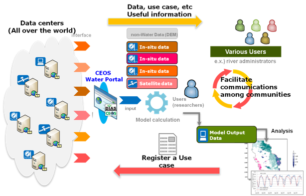
			"keyword": [
				"SAR",
				"AmeriGEOSS",
				"GEO",
				"Disasters",
				"Training",
				"water",
				"GEOSS",
				"UNGGIM-Americas"
			],
			"issued": "2018-10-19T18:45:59.000Z",
			"modified": "2018-11-09T01:30:38.000Z",
			"publisher": {
				"name": "AmeriGEO"
			},
			"contactPoint": {
				"@type": "vcard:Contact",
				"fn": "rich_amerigeoss",
				"hasEmail": "mailto:support@amerigeo.org"
			},
			"accessLevel": "public",
			"spatial": "",
			"license": "",
			"distribution": [
				{
					"@type": "dcat:Distribution",
					"title": "ArcGIS Hub Dataset",
					"format": "Web Page",
					"mediaType": "text/html",
					"accessURL": "https://communities-amerigeoss.opendata.arcgis.com/documents/amerigeoss::advanced-webinar-radar-remote-sensing-for-land-water-disaster-applications"
				},
				{
					"@type": "dcat:Distribution",
					"title": "ArcGIS GeoService",
					"format": "ArcGIS GeoServices REST API",
					"mediaType": "application/json",
					"accessURL": "https://youtu.be/IDxBgK1VY_4"
				}
			],
			"theme": ""
		},
		{
			"@type": "dcat:Dataset",
			"identifier": "https://www.arcgis.com/home/item.html?id=c3f612036e5f4d9c864ac7583c55dd45",
			"landingPage": "https://communities-amerigeoss.opendata.arcgis.com/maps/amerigeoss::volcano-countries-at-risk-map",
			"title": "Volcano Countries at Risk Map",
			"description": "{{description}}",
			"keyword": [
				"Disasters",
				"Country",
				"AmeriGEOSS",
				"GEOSS",
				"GEO",
				"UNGGIM-Americas"
			],
			"issued": "2017-12-12T13:29:38.000Z",
			"modified": "2018-11-09T01:30:38.000Z",
			"publisher": {
				"name": "AmeriGEO"
			},
			"contactPoint": {
				"@type": "vcard:Contact",
				"fn": "rich_amerigeoss",
				"hasEmail": "mailto:support@amerigeo.org"
			},
			"accessLevel": "public",
			"spatial": "-180.0000,-86.3355,180.0000,84.3016",
			"license": "",
			"distribution": [
				{
					"@type": "dcat:Distribution",
					"title": "ArcGIS Hub Dataset",
					"format": "Web Page",
					"mediaType": "text/html",
					"accessURL": "https://communities-amerigeoss.opendata.arcgis.com/maps/amerigeoss::volcano-countries-at-risk-map"
				}
			],
			"theme": [
				"geospatial"
			]
		},
		{
			"@type": "dcat:Dataset",
			"identifier": "https://www.arcgis.com/home/item.html?id=8e561e3148f742fd8ed69ac0afe6842d",
			"landingPage": "https://communities-amerigeoss.opendata.arcgis.com/pages/amerigeoss::geoglows-streamflow-forecasting",
			"title": "GEOGLOWS Streamflow forecasting",
			"description": "GEOGLOWS Streamflow forecasting",
			"keyword": [
				"Project",
				"AmeriGEOSS",
				"GEOGLOWS",
				"GEO",
				"GEOSS",
				"Streamflow",
				"Forecasting",
				"Monitoring"
			],
			"issued": "2018-10-23T17:45:19.000Z",
			"modified": "2018-10-23T18:25:12.000Z",
			"publisher": {
				"name": "AmeriGEO"
			},
			"contactPoint": {
				"@type": "vcard:Contact",
				"fn": "AngelicaGutierrez_amerigeoss",
				"hasEmail": "mailto:support@amerigeo.org"
			},
			"accessLevel": "public",
			"spatial": "",
			"license": "",
			"distribution": [
				{
					"@type": "dcat:Distribution",
					"title": "ArcGIS Hub Dataset",
					"format": "Web Page",
					"mediaType": "text/html",
					"accessURL": "https://communities-amerigeoss.opendata.arcgis.com/pages/amerigeoss::geoglows-streamflow-forecasting"
				},
				{
					"@type": "dcat:Distribution",
					"title": "ArcGIS GeoService",
					"format": "ArcGIS GeoServices REST API",
					"mediaType": "application/json",
					"accessURL": "https://opendata.arcgis.com/admin/"
				}
			],
			"theme": ""
		},
		{
			"@type": "dcat:Dataset",
			"identifier": "https://www.arcgis.com/home/item.html?id=400a946a1fab45c78bfe5f8dc65cce84",
			"landingPage": "https://communities-amerigeoss.opendata.arcgis.com/apps/amerigeoss::ceoss-water-portal",
			"title": "CEOSS Water Portal",
			"description": "Water Portal<div style='box-sizing: border-box; margin: 0px; padding: 0px; border: 0px; font-variant-numeric: inherit; font-variant-east-asian: inherit; font-stretch: inherit; font-size: 13px; line-height: inherit; font-family: &quot;Open Sans&quot;, Helvetica, &quot;Helvetica Neue&quot;, Arial, sans-serif; vertical-align: baseline; color: rgb(102, 102, 102);'><div style='box-sizing: border-box; margin: 20px; padding: 0px !important; border: 0px; font: inherit; vertical-align: baseline; background-color: rgb(239, 241, 242); box-shadow: rgb(102, 102, 102) 0px 2px 4px; text-align: center; float: right; width: 408px;'><a href='http://ceos.org/wp-content/uploads/2014/12/cwp_overall.png' style='box-sizing: border-box; background: 0px 0px; color: rgb(31, 151, 178); text-decoration-line: none; -webkit-tap-highlight-color: rgb(255, 94, 153); margin: 0px !important; padding: 0px !important;'><img alt='cwp_overall' height='255' src='http://ceos.org/wp-content/uploads/2014/12/cwp_overall-300x192.png' style='box-sizing: border-box; margin: 5px !important; padding: 0px !important; border: 0px; font: inherit; vertical-align: middle;' width='398' /></a><p style='box-sizing: border-box; margin: 0px 5px 5px !important; padding: 0px; border: 0px; font-style: inherit; font-variant: inherit; font-weight: inherit; font-stretch: inherit; font-size: 0.9em; line-height: inherit; font-family: inherit; vertical-align: baseline;'>The CEOS Water Portal Concept</p></div>Purpose<p style='box-sizing: border-box; margin-top: 0px; margin-bottom: 10px; padding: 0px; border: 0px; font: inherit; vertical-align: baseline;'>The goal of the CEOS Water Portal Project is to provide assistance to scientists and general users (or non-researchers) from the water domain in the development of data services associated with data integration and distribution.</p>Scope<p style='box-sizing: border-box; margin-top: 0px; margin-bottom: 10px; padding: 0px; border: 0px; font: inherit; vertical-align: baseline;'>The CEOS Water Portal is built around several key concepts:</p><ul><li>The Water Portal will make different types of datasets (satellite, in-situ, and model output) from various water communities accessible.</li><li>Portal users will include researchers in the hydrological domain as well as operational workers in water-related fields, such as river administrators.</li><li>The portal is connected to each data center using a standard interface protocol for real-time retrieval of the catalog and the data. (Part of the catalog is collected and stored in the portal locally.)</li><li>User registration and sharing of use cases/research summaries is encouraged.</li></ul><p style='box-sizing: border-box; margin-top: 0px; margin-bottom: 10px; padding: 0px; border: 0px; font: inherit; vertical-align: baseline;'>CEOS Water Portal Data Partners include the National Aeronautics &amp; Space Administration (NASA) and the National Oceanic &amp; Atmospheric Administration (NOAA).</p><p style='box-sizing: border-box; margin-top: 0px; margin-bottom: 10px; padding: 0px; border: 0px; font: inherit; vertical-align: baseline;'>Access the <a href='http://waterportal.ceos.org/' style='box-sizing: border-box; background: 0px 0px; color: rgb(31, 151, 178); text-decoration-line: none; -webkit-tap-highlight-color: rgb(255, 94, 153);' target='_blank'>CEOS Water Portal</a>.</p><div style='box-sizing: border-box; margin: 20px; padding: 0px !important; border: 0px; font: inherit; vertical-align: baseline; background-color: rgb(239, 241, 242); box-shadow: rgb(102, 102, 102) 0px 2px 4px; text-align: center; float: left; width: 354px;'><img alt='New Water Portal Architecture' height='233' src='http://ceos.org/wp-content/uploads/2014/12/newArch-300x202.png' style='box-sizing: border-box; margin: 5px !important; padding: 0px !important; border: 0px; font: inherit; vertical-align: middle;' width='344' /><p style='box-sizing: border-box; margin: 0px 5px 5px !important; padding: 0px; border: 0px; font-style: inherit; font-variant: inherit; font-weight: inherit; font-stretch: inherit; font-size: 0.9em; line-height: inherit; font-family: inherit; vertical-align: baseline;'>New Water Portal Architecture</p></div><p style='box-sizing: border-box; margin-top: 0px; margin-bottom: 10px; padding: 0px; border: 0px; font: inherit; vertical-align: baseline;'> </p>     <hr /> Background<p style='box-sizing: border-box; margin-top: 0px; margin-bottom: 10px; padding: 0px; border: 0px; font: inherit; vertical-align: baseline;'>For several years in 2000s, WGISS Test Facility for CEOP (WTF-CEOP) project was tackled by the lead of JAXA to meet the demand of CEOP user community to develop the data integration services. With the fulfillment of the task, the project ended in 2009.</p><p style='box-sizing: border-box; margin-top: 0px; margin-bottom: 10px; padding: 0px; border: 0px; font: inherit; vertical-align: baseline;'>The WTF-CEOP successfully having demonstrated the advantages of data integration for CEOP, the request for enhanced services for water communities was motivated by Dr.Toshio Koike, the lead scientist of CEOP, to push the data integration forward and improve the accessibility to the hydrological data, or water relevant data in broader sense, which are distributed globally.</p><p style='box-sizing: border-box; margin-top: 0px; margin-bottom: 10px; padding: 0px; border: 0px; font: inherit; vertical-align: baseline;'>JAXA has taken the roll to expand the“WTF-CEOP” prototype system into “CEOS Water Portal ”, in which more variety of datasets and features are explored. Another essential element is that of the use by not only scientists but also by non-researchers who are dealing with those data in their daily work, such as river administrators etc.<br />The lead organization representing the CEOS WGISS agencies in the CEOS Water Portal Project is JAXA, with participation by NASA and NOAA. Other WGISS members and WGISS affiliates may join at a future date. The project lead is Satoko Miura, JAXA.</p><p style='box-sizing: border-box; margin-top: 0px; margin-bottom: 10px; padding: 0px; border: 0px; font: inherit; vertical-align: baseline;'> </p><hr />Services<p style='box-sizing: border-box; margin-top: 0px; margin-bottom: 10px; padding: 0px; border: 0px; font: inherit; vertical-align: baseline;'>Take a look at the Water Portal Presentation slides presented at recent WGISS meetings and WGISS meeting minutes or download the <a href='http://ceos.org/document_management/Working_Groups/WGISS/Projects/Water_Portal/Water-Portal-Implementation-Plan_Mar2015.pdf' style='box-sizing: border-box; background: 0px 0px; color: rgb(31, 151, 178); text-decoration-line: none; -webkit-tap-highlight-color: rgb(255, 94, 153);' target='_blank'>Water Portal Implementation Plan</a> for more information.</p><table border='1' style='box-sizing: border-box; margin: 0px; padding: 0px; border: 0px; font: inherit; vertical-align: baseline; border-collapse: collapse; border-spacing: 0px; max-width: 100%; background-color: transparent; height: 223px;' width='633'><tbody><tr style='box-sizing: border-box; margin: 0px; padding: 0px; border: 0px; font: inherit; vertical-align: baseline;'><td style='box-sizing: border-box; margin: 0px; padding: 0px; border: 0px; font: inherit; vertical-align: top;'><strong>Date</strong></td><td style='box-sizing: border-box; margin: 0px; padding: 0px; border: 0px; font: inherit; vertical-align: top;'><strong>Meeting Title</strong></td><td style='box-sizing: border-box; margin: 0px; padding: 0px; border: 0px; font: inherit; vertical-align: top;'><strong>Presentation Slides</strong></td><td style='box-sizing: border-box; margin: 0px; padding: 0px; border: 0px; font: inherit; vertical-align: top;'><strong>Minutes</strong></td></tr><tr style='box-sizing: border-box; margin: 0px; padding: 0px; border: 0px; font: inherit; vertical-align: baseline;'><td style='box-sizing: border-box; margin: 0px; padding: 0px; border: 0px; font: inherit; vertical-align: top;'>Sep 29, 2015</td><td style='box-sizing: border-box; margin: 0px; padding: 0px; border: 0px; font: inherit; vertical-align: top;'>WGISS-40</td><td style='box-sizing: border-box; margin: 0px; padding: 0px; border: 0px; font: inherit; vertical-align: top;'><a href='http://ceos.org/document_management/Working_Groups/WGISS/Projects/Water_Portal/Presentations/Water-Portal-Presentation-WGISS-40_Sep2015.pdf' style='box-sizing: border-box; background: 0px 0px; color: rgb(31, 151, 178); text-decoration-line: none; -webkit-tap-highlight-color: rgb(255, 94, 153);'>pdf</a></td><td style='box-sizing: border-box; margin: 0px; padding: 0px; border: 0px; font: inherit; vertical-align: top;'><a href='http://ceos.org/document_management/Working_Groups/WGISS/Projects/Water_Portal/Presentations/Water-Portal-Minutes-WGISS-40_Sep2015.pdf' style='box-sizing: border-box; background: 0px 0px; color: rgb(31, 151, 178); text-decoration-line: none; -webkit-tap-highlight-color: rgb(255, 94, 153);'>pdf</a></td></tr><tr style='box-sizing: border-box; margin: 0px; padding: 0px; border: 0px; font: inherit; vertical-align: baseline;'><td style='box-sizing: border-box; margin: 0px; padding: 0px; border: 0px; font: inherit; vertical-align: top;'>May 13, 2015</td><td style='box-sizing: border-box; margin: 0px; padding: 0px; border: 0px; font: inherit; vertical-align: top;'>WGISS-39</td><td style='box-sizing: border-box; margin: 0px; padding: 0px; border: 0px; font: inherit; vertical-align: top;'><a href='http://ceos.org/document_management/Working_Groups/WGISS/Projects/Water_Portal/Presentations/Water-Portal-Presentation-WGISS-39_May2015.pdf' style='box-sizing: border-box; background: 0px 0px; color: rgb(31, 151, 178); text-decoration-line: none; -webkit-tap-highlight-color: rgb(255, 94, 153);' target='_blank'>pdf</a></td><td style='box-sizing: border-box; margin: 0px; padding: 0px; border: 0px; font: inherit; vertical-align: top;'><a href='http://ceos.org/document_management/Working_Groups/WGISS/Projects/Water_Portal/Presentations/Water-Portal-Minutes-WGISS-39_May2015.pdf' style='box-sizing: border-box; background: 0px 0px; color: rgb(31, 151, 178); text-decoration-line: none; -webkit-tap-highlight-color: rgb(255, 94, 153);' target='_blank'>pdf</a></td></tr><tr style='box-sizing: border-box; margin: 0px; padding: 0px; border: 0px; font: inherit; vertical-align: baseline;'><td style='box-sizing: border-box; margin: 0px; padding: 0px; border: 0px; font: inherit; vertical-align: top;'>Oct 01, 2014</td><td style='box-sizing: border-box; margin: 0px; padding: 0px; border: 0px; font: inherit; vertical-align: top;'>WGISS-38</td><td style='box-sizing: border-box; margin: 0px; padding: 0px; border: 0px; font: inherit; vertical-align: top;'><a href='http://ceos.org/document_management/Working_Groups/WGISS/Projects/Water_Portal/Presentations/Water-Portal-Presentation-WGISS-38_Oct2014.pdf' style='box-sizing: border-box; background: 0px 0px; color: rgb(31, 151, 178); text-decoration-line: none; -webkit-tap-highlight-color: rgb(255, 94, 153);' target='_blank'>pdf</a></td><td style='box-sizing: border-box; margin: 0px; padding: 0px; border: 0px; font: inherit; vertical-align: top;'><a href='http://ceos.org/document_management/Working_Groups/WGISS/Projects/Water_Portal/Presentations/Water-Portal-Minutes-WGISS-38_Oct2014.pdf' style='box-sizing: border-box; background: 0px 0px; color: rgb(31, 151, 178); text-decoration-line: none; -webkit-tap-highlight-color: rgb(255, 94, 153);' target='_blank'>pdf</a></td></tr><tr style='box-sizing: border-box; margin: 0px; padding: 0px; border: 0px; font: inherit; vertical-align: baseline;'><td style='box-sizing: border-box; margin: 0px; padding: 0px; border: 0px; font: inherit; vertical-align: top;'>Apr 17, 2014</td><td style='box-sizing: border-box; margin: 0px; padding: 0px; border: 0px; font: inherit; vertical-align: top;'>WGISS-37</td><td style='box-sizing: border-box; margin: 0px; padding: 0px; border: 0px; font: inherit; vertical-align: top;'><a href='http://ceos.org/document_management/Working_Groups/WGISS/Projects/Water_Portal/Presentations/Water-Portal-Presentation-WGISS-37_Apr2014.pdf' style='box-sizing: border-box; background: 0px 0px; color: rgb(31, 151, 178); text-decoration-line: none; -webkit-tap-highlight-color: rgb(255, 94, 153);' target='_blank'>pdf-1</a>, <a href='http://ceos.org/document_management/Working_Groups/WGISS/Projects/Water_Portal/Presentations/Water-Portal-Presentation-2-WGISS-37_Apr2014.pdf' style='box-sizing: border-box; background: 0px 0px; color: rgb(31, 151, 178); text-decoration-line: none; -webkit-tap-highlight-color: rgb(255, 94, 153);' target='_blank'>pdf-2</a></td><td style='box-sizing: border-box; margin: 0px; padding: 0px; border: 0px; font: inherit; vertical-align: top;'><a href='http://ceos.org/document_management/Working_Groups/WGISS/Projects/Water_Portal/Presentations/Water-Portal-Minutes-WGISS-37_Apr2014.pdf' style='box-sizing: border-box; background: 0px 0px; color: rgb(31, 151, 178); text-decoration-line: none; -webkit-tap-highlight-color: rgb(255, 94, 153);' target='_blank'>pdf</a></td></tr><tr style='box-sizing: border-box; margin: 0px; padding: 0px; border: 0px; font: inherit; vertical-align: baseline;'><td style='box-sizing: border-box; margin: 0px; padding: 0px; border: 0px; font: inherit; vertical-align: top;'>Sep 17, 2013</td><td style='box-sizing: border-box; margin: 0px; padding: 0px; border: 0px; font: inherit; vertical-align: top;'>WGISS-36</td><td style='box-sizing: border-box; margin: 0px; padding: 0px; border: 0px; font: inherit; vertical-align: top;'><a href='http://ceos.org/document_management/Working_Groups/WGISS/Projects/Water_Portal/Presentations/Water-Portal-Presentation-WGISS-36_Sep2013.pdf' style='box-sizing: border-box; background: 0px 0px; color: rgb(31, 151, 178); text-decoration-line: none; -webkit-tap-highlight-color: rgb(255, 94, 153);' target='_blank'>pdf-1</a>, <a href='http://ceos.org/document_management/Working_Groups/WGISS/Projects/Water_Portal/Presentations/Water-Portal-Presentation-2-WGISS-36_Sep2013.pdf' style='box-sizing: border-box; background: 0px 0px; color: rgb(31, 151, 178); text-decoration-line: none; -webkit-tap-highlight-color: rgb(255, 94, 153);' target='_blank'>pdf-2</a></td><td style='box-sizing: border-box; margin: 0px; padding: 0px; border: 0px; font: inherit; vertical-align: top;'><a href='http://ceos.org/document_management/Working_Groups/WGISS/Projects/Water_Portal/Presentations/Water-Portal-Minutes-WGISS-36_Sep2013.pdf' style='box-sizing: border-box; background: 0px 0px; color: rgb(31, 151, 178); text-decoration-line: none; -webkit-tap-highlight-color: rgb(255, 94, 153);' target='_blank'>pdf</a></td></tr><tr style='box-sizing: border-box; margin: 0px; padding: 0px; border: 0px; font: inherit; vertical-align: baseline;'><td style='box-sizing: border-box; margin: 0px; padding: 0px; border: 0px; font: inherit; vertical-align: top;'>May 9, 2013</td><td style='box-sizing: border-box; margin: 0px; padding: 0px; border: 0px; font: inherit; vertical-align: top;'>WGISS-35</td><td style='box-sizing: border-box; margin: 0px; padding: 0px; border: 0px; font: inherit; vertical-align: top;'><a href='http://ceos.org/document_management/Working_Groups/WGISS/Projects/Water_Portal/Presentations/Water-Portal-Presentation-WGISS-35_May2013.pdf' style='box-sizing: border-box; background: 0px 0px; color: rgb(31, 151, 178); text-decoration-line: none; -webkit-tap-highlight-color: rgb(255, 94, 153);' target='_blank'>pdf-1</a>, <a href='http://ceos.org/document_management/Working_Groups/WGISS/Projects/Water_Portal/Presentations/Water-Portal-Presentation-2-WGISS-35_May2013.pdf' style='box-sizing: border-box; background: 0px 0px; color: rgb(31, 151, 178); text-decoration-line: none; -webkit-tap-highlight-color: rgb(255, 94, 153);' target='_blank'>pdf-2</a></td><td style='box-sizing: border-box; margin: 0px; padding: 0px; border: 0px; font: inherit; vertical-align: top;'><a href='http://old.ceos.org/images/WGISS/WaterPortal/CEOSWaterPortal_notes_wgiss6.pdf' style='box-sizing: border-box; background: 0px 0px; color: rgb(31, 151, 178); text-decoration-line: none; -webkit-tap-highlight-color: rgb(255, 94, 153);'>pdf</a></td></tr><tr style='box-sizing: border-box; margin: 0px; padding: 0px; border: 0px; font: inherit; vertical-align: baseline;'><td style='box-sizing: border-box; margin: 0px; padding: 0px; border: 0px; font: inherit; vertical-align: top;'>Sep 25, 2012</td><td style='box-sizing: border-box; margin: 0px; padding: 0px; border: 0px; font: inherit; vertical-align: top;'>WGISS-34</td><td style='box-sizing: border-box; margin: 0px; padding: 0px; border: 0px; font: inherit; vertical-align: top;'><a href='http://ceos.org/document_management/Working_Groups/WGISS/Projects/Water_Portal/Presentations/Water-Portal-Presentation-WGISS-34_Sep2012.pdf' style='box-sizing: border-box; background: 0px 0px; color: rgb(31, 151, 178); text-decoration-line: none; -webkit-tap-highlight-color: rgb(255, 94, 153);' target='_blank'>pdf</a></td><td style='box-sizing: border-box; margin: 0px; padding: 0px; border: 0px; font: inherit; vertical-align: top;'><a href='http://ceos.org/document_management/Working_Groups/WGISS/Projects/Water_Portal/Presentations/Water-Portal-Minutes-WGISS-34_Sep2012.pdf' style='box-sizing: border-box; background: 0px 0px; color: rgb(31, 151, 178); text-decoration-line: none; -webkit-tap-highlight-color: rgb(255, 94, 153);' target='_blank'>pdf</a></td></tr><tr style='box-sizing: border-box; margin: 0px; padding: 0px; border: 0px; font: inherit; vertical-align: baseline;'><td style='box-sizing: border-box; margin: 0px; padding: 0px; border: 0px; font: inherit; vertical-align: top;'>Apr 25, 2012</td><td style='box-sizing: border-box; margin: 0px; padding: 0px; border: 0px; font: inherit; vertical-align: top;'>WGISS-33</td><td style='box-sizing: border-box; margin: 0px; padding: 0px; border: 0px; font: inherit; vertical-align: top;'><a href='http://ceos.org/document_management/Working_Groups/WGISS/Projects/Water_Portal/Presentations/Water-Portal-Presentation-WGISS-33_Apr2012.pdf' style='box-sizing: border-box; background: 0px 0px; color: rgb(31, 151, 178); text-decoration-line: none; -webkit-tap-highlight-color: rgb(255, 94, 153);' target='_blank'>pdf</a></td><td style='box-sizing: border-box; margin: 0px; padding: 0px; border: 0px; font: inherit; vertical-align: top;'><a href='http://ceos.org/document_management/Working_Groups/WGISS/Projects/Water_Portal/Presentations/Water-Portal-Minutes-WGISS-33_Apr2012.pdf' style='box-sizing: border-box; background: 0px 0px; color: rgb(31, 151, 178); text-decoration-line: none; -webkit-tap-highlight-color: rgb(255, 94, 153);' target='_blank'>pdf</a></td></tr><tr style='box-sizing: border-box; margin: 0px; padding: 0px; border: 0px; font: inherit; vertical-align: baseline;'><td style='box-sizing: border-box; margin: 0px; padding: 0px; border: 0px; font: inherit; vertical-align: top;'>Feb 24, 2012</td><td style='box-sizing: border-box; margin: 0px; padding: 0px; border: 0px; font: inherit; vertical-align: top;'>IGWCO 8th</td><td style='box-sizing: border-box; margin: 0px; padding: 0px; border: 0px; font: inherit; vertical-align: top;'><a href='http://ceos.org/document_management/Working_Groups/WGISS/Projects/Water_Portal/Presentations/Water-Portal-Presentation-IGWCO-8_Feb2012.pdf' style='box-sizing: border-box; background: 0px 0px; color: rgb(31, 151, 178); text-decoration-line: none; -webkit-tap-highlight-color: rgb(255, 94, 153);' target='_blank'>pdf</a></td><td style='box-sizing: border-box; margin: 0px; padding: 0px; border: 0px; font: inherit; vertical-align: top;'><a href='http://ceos.org/document_management/Working_Groups/WGISS/Projects/Water_Portal/Presentations/Water-Portal-Minutes-IGWCO-8_Feb2012.pdf' style='box-sizing: border-box; background: 0px 0px; color: rgb(31, 151, 178); text-decoration-line: none; -webkit-tap-highlight-color: rgb(255, 94, 153);' target='_blank'>pdf</a></td></tr><tr style='box-sizing: border-box; margin: 0px; padding: 0px; border: 0px; font: inherit; vertical-align: baseline;'><td style='box-sizing: border-box; margin: 0px; padding: 0px; border: 0px; font: inherit; vertical-align: top;'>Sep 27, 2011</td><td style='box-sizing: border-box; margin: 0px; padding: 0px; border: 0px; font: inherit; vertical-align: top;'>WGISS-32</td><td style='box-sizing: border-box; margin: 0px; padding: 0px; border: 0px; font: inherit; vertical-align: top;'><a href='http://ceos.org/document_management/Working_Groups/WGISS/Projects/Water_Portal/Presentations/Water-Portal-Presentation-WGISS-32_Sep2011.pdf' style='box-sizing: border-box; background: 0px 0px; color: rgb(31, 151, 178); text-decoration-line: none; -webkit-tap-highlight-color: rgb(255, 94, 153);' target='_blank'>pdf</a></td><td style='box-sizing: border-box; margin: 0px; padding: 0px; border: 0px; font: inherit; vertical-align: top;'><a href='http://ceos.org/document_management/Working_Groups/WGISS/Projects/Water_Portal/Presentations/Water-Portal-Minutes-WGISS-32_Sep2011.pdf' style='box-sizing: border-box; background: 0px 0px; color: rgb(31, 151, 178); text-decoration-line: none; -webkit-tap-highlight-color: rgb(255, 94, 153);' target='_blank'>pdf</a></td></tr><tr style='box-sizing: border-box; margin: 0px; padding: 0px; border: 0px; font: inherit; vertical-align: baseline;'><td style='box-sizing: border-box; margin: 0px; padding: 0px; border: 0px; font: inherit; vertical-align: top;'>Jun 16, 2011</td><td style='box-sizing: border-box; margin: 0px; padding: 0px; border: 0px; font: inherit; vertical-align: top;'>WGISS-31</td><td style='box-sizing: border-box; margin: 0px; padding: 0px; border: 0px; font: inherit; vertical-align: top;'><a href='http://ceos.org/document_management/Working_Groups/WGISS/Projects/Water_Portal/Presentations/Water-Portal-Presentation-WGISS-31_Jan2011.pdf' style='box-sizing: border-box; background: 0px 0px; color: rgb(31, 151, 178); text-decoration-line: none; -webkit-tap-highlight-color: rgb(255, 94, 153);' target='_blank'>pdf</a></td><td style='box-sizing: border-box; margin: 0px; padding: 0px; border: 0px; font: inherit; vertical-align: top;'><a href='http://ceos.org/document_management/Working_Groups/WGISS/Projects/Water_Portal/Presentations/Water-Portal-Minutes-WGISS-31_Jan2011.pdf' style='box-sizing: border-box; background: 0px 0px; color: rgb(31, 151, 178); text-decoration-line: none; -webkit-tap-highlight-color: rgb(255, 94, 153);' target='_blank'>pdf</a></td></tr></tbody></table><p style='box-sizing: border-box; margin-top: 0px; margin-bottom: 10px; padding: 0px; border: 0px; font: inherit; vertical-align: baseline;'> </p>Communication and Coordination<p style='box-sizing: border-box; margin-top: 0px; margin-bottom: 10px; padding: 0px; border: 0px; font: inherit; vertical-align: baseline;'>Portal development will continue through the end of March, 2016, at which point it becomes fully operational from April, 2016 onward.</p><p style='box-sizing: border-box; margin-top: 0px; margin-bottom: 10px; padding: 0px; border: 0px; font: inherit; vertical-align: baseline;'>Planned enhancements to the Portal include architecture renovation, which is to be complete by the end of March, 2015. The new architecture focuses on leveraging an open source catalog broker software (GI-cat) as well as outside catalog servers (or brokers), which will greatly simplify the total architecture and reduce the labor of catalog management without sacrificing service quality for users.</p><p style='box-sizing: border-box; margin-top: 0px; margin-bottom: 10px; padding: 0px; border: 0px; font: inherit; vertical-align: baseline;'>For more information, feel free to contact <a href='mailto:miura.satoko@jaxa.jp' style='box-sizing: border-box; background: 0px 0px; color: rgb(31, 151, 178); text-decoration-line: none; -webkit-tap-highlight-color: rgb(255, 94, 153);' target='_blank'>Satoko Miura</a> (Japan Aerospace Exploration Agency, JAXA).</p><p style='box-sizing: border-box; margin-top: 0px; margin-bottom: 10px; padding: 0px; border: 0px; font: inherit; vertical-align: baseline;'><br /></p><p style='box-sizing: border-box; margin-top: 0px; margin-bottom: 10px; padding: 0px; border: 0px; font: inherit; vertical-align: baseline;'>Source:  http://ceos.org/ourwork/workinggroups/wgiss/past-activities/water-portal/</p></div>",
			"keyword": [
				"CEOS",
				"Water",
				"GEOGLOWS",
				"Flood",
				"GLOWASIS",
				"NOAA",
				"NASA",
				"Application"
			],
			"issued": "2018-10-23T17:28:44.000Z",
			"modified": "2018-10-23T17:35:44.000Z",
			"publisher": {
				"name": "AmeriGEO"
			},
			"contactPoint": {
				"@type": "vcard:Contact",
				"fn": "AngelicaGutierrez_amerigeoss",
				"hasEmail": "mailto:support@amerigeo.org"
			},
			"accessLevel": "public",
			"spatial": "",
			"license": "",
			"distribution": [
				{
					"@type": "dcat:Distribution",
					"title": "ArcGIS Hub Dataset",
					"format": "Web Page",
					"mediaType": "text/html",
					"accessURL": "https://communities-amerigeoss.opendata.arcgis.com/apps/amerigeoss::ceoss-water-portal"
				},
				{
					"@type": "dcat:Distribution",
					"title": "ArcGIS GeoService",
					"format": "ArcGIS GeoServices REST API",
					"mediaType": "application/json",
					"accessURL": "http://waterportal.ceos.org/"
				}
			],
			"theme": ""
		},
		{
			"@type": "dcat:Dataset",
			"identifier": "https://www.arcgis.com/home/item.html?id=597d573e58514bdbbeb53ba2179d2359",
			"landingPage": "https://communities-amerigeoss.opendata.arcgis.com/apps/Story::katrina-10-a-decade-of-change-in-new-orleans-",
			"title": "Katrina +10: A Decade of Change in New Orleans ",
			"description": "<div><br /></div><div><p style='margin-top: 0px; margin-bottom: 0px; padding: 0px; line-height: 28.0000019073486px; color: rgb(77, 77, 77); box-sizing: border-box; background-color: rgb(255, 255, 255);'><span style='font-size: medium; line-height: 22.153844833374px; color: rgb(68, 68, 68); background-color: transparent;'>Hurricane Katrina of August, 2005, is remembered as one of the most destructive and influential storms in United States history. The densely populated city of New Orleans, one of many areas around the Gulf Coast to face catastrophic damage, endured extreme flooding and physical destruction when several levees and other flood prevention features guarding the city broke down. Many evacuated the city and fled to far corners of the country, and a large portion of these evacuees were unable to resettle in New Orleans after the storm. Dealing with the aftermath of Hurricane Katrina involved many immense challenges, but ten years later, one can see the effects of a decade of hard work in restoring this historic city. This series of maps tracks New Orleans through these ten years of change.      </span></p><p style='margin-top: 0px; margin-bottom: 0px; padding: 0px; line-height: 28.0000019073486px; color: rgb(77, 77, 77); box-sizing: border-box; background-color: rgb(255, 255, 255);'><span style='font-size: medium; line-height: 22px;'><br /></span></p><p style='margin-top: 0px; margin-bottom: 0px; padding: 0px; line-height: 28.0000019073486px; color: rgb(77, 77, 77); box-sizing: border-box; background-color: rgb(255, 255, 255);'><span style='font-size: medium; line-height: 22px;'>The story map uses the <a href='https://storymaps.arcgis.com/en/app-list/map-series/' target='_blank'>Esri Story Map Series</a> app, </span></p><p style='margin-top: 0px; margin-bottom: 0px; padding: 0px; line-height: 28.0000019073486px; color: rgb(77, 77, 77); box-sizing: border-box; background-color: rgb(255, 255, 255);'><span style='font-size: medium; line-height: 22px;'><br /></span></p><p style='margin-top: 0px; margin-bottom: 0px; padding: 0px; line-height: 28.0000019073486px; color: rgb(77, 77, 77); box-sizing: border-box; background-color: rgb(255, 255, 255);'><span style='font-size: medium; line-height: 22px;'>The story was produced by Esri in collaboration with the Smithsonian Institution. </span><font size='3' style='line-height: 28px;'><span style='line-height: 22px;'>The story can also be found on the </span></font><a href='http://www.smithsonianmag.com/history/these-maps-show-severe-impact-hurricane-katrina-new-orleans-180956364/' target='_blank'><font size='3'>Smithsonian Website</font></a><font size='3' style='line-height: 28px;'><span style='line-height: 22px;'>. Data for each map was taken from the following sources:</span></font><br /></p><p style='margin-top: 0px; margin-bottom: 0px; padding: 0px; line-height: 28.0000019073486px; color: rgb(77, 77, 77); box-sizing: border-box; background-color: rgb(255, 255, 255);'><font size='3'><span style='line-height: 22px;'><br /></span></font></p></div><div><p style='margin-top: 0px; margin-bottom: 0px; padding: 0px; line-height: 28.0000019073486px; color: rgb(77, 77, 77); box-sizing: border-box; background-color: rgb(255, 255, 255);'><font size='3'><span style='line-height: 22px;'>Katrina Diaspora: </span></font><a href='https://www.census.gov/hhes/migration/data/acs/state-to-state.html' style='line-height: normal; font-size: medium; color: rgb(7, 130, 193); background-color: transparent;' target='_blank'>2006 American Community Survey 1-year Estimates, State-to-State Migration Flows</a><span style='color: rgb(0, 0, 0); line-height: normal; font-size: medium; background-color: transparent;'>, </span><a href='http://www.nhc.noaa.gov/' style='line-height: normal; font-size: medium; color: rgb(7, 130, 193); background-color: transparent;' target='_blank'>NHC</a><span style='color: rgb(0, 0, 0); line-height: normal; font-size: medium; background-color: transparent;'>, </span><a href='http://www.noaa.gov/' style='line-height: normal; font-size: medium; color: rgb(7, 130, 193); background-color: transparent;' target='_blank'>NOAA</a><span style='color: rgb(0, 0, 0); line-height: normal; font-size: medium; background-color: transparent;'>, </span><a href='https://www.weather.gov/' style='line-height: normal; font-size: medium; color: rgb(7, 130, 193); background-color: transparent;' target='_blank'>NWS</a><span style='color: rgb(0, 0, 0); line-height: normal; font-size: medium; background-color: transparent;'>. </span></p></div><div><p style='margin-top: 0px; margin-bottom: 0px; padding: 0px; line-height: 28.0000019073486px; color: rgb(77, 77, 77); box-sizing: border-box; background-color: rgb(255, 255, 255);'><font size='3'><span style='line-height: 22px;'>Flooding: </span></font><a href='https://pubs.usgs.gov/ds/470/ds470.pdf' style='line-height: normal; font-size: medium; color: rgb(7, 130, 193); background-color: transparent;' target='_blank'>Terrestrial lidar datasets of New Orleans levee failures from Hurricane Katrina, August 29, 2005: U.S. Geological Survey Data Series</a><span style='color: rgb(0, 0, 0); line-height: normal; font-size: medium; background-color: transparent;'>, </span><font size='3' style='color: rgb(0, 0, 0); line-height: normal; background-color: transparent;'><a href='http://earthobservatory.nasa.gov/?eocn=topnav&amp;eoci=logo' style='color: rgb(7, 130, 193);' target='_blank'>NASA Earth Observatory</a>, </font><a href='http://storms.ngs.noaa.gov/katrina/' style='line-height: normal; font-size: medium; color: rgb(7, 130, 193); background-color: transparent;' target='_blank'>NOAA National Geodetic Survey</a><font size='3' style='color: rgb(0, 0, 0); line-height: normal; background-color: transparent;'>. </font></p></div><div><p style='margin-top: 0px; margin-bottom: 0px; padding: 0px; line-height: 28.0000019073486px; color: rgb(77, 77, 77); box-sizing: border-box; background-color: rgb(255, 255, 255);'><font size='3'><span style='line-height: 22px;'>Physical Damage: </span></font><a href='https://www.nps.gov/crgis/HPRM-KatrinaPRINT.pdf' style='line-height: normal; font-size: medium; color: rgb(7, 130, 193); background-color: transparent;' target='_blank'>FEMA dataset collection following Hurricane Katrina and transferred to CNO/SHPO</a></p></div><div><p style='margin-top: 0px; margin-bottom: 0px; padding: 0px; line-height: 28.0000019073486px; color: rgb(77, 77, 77); box-sizing: border-box; background-color: rgb(255, 255, 255);'><font size='3'><span style='line-height: 22px;'>Population Shift: </span></font><a href='http://www.datacenterresearch.org/data-resources/neighborhood-data/' style='font-size: medium; line-height: normal; color: rgb(7, 130, 193); background-color: transparent;' target='_blank'>The Data Center analysis of data from U.S. Census 2000 Summary File 1 (SF1) and U.S. Census 2010 Summary File 1 (SF1)</a></p></div><div><p style='margin-top: 0px; margin-bottom: 0px; padding: 0px; line-height: 28.0000019073486px; color: rgb(77, 77, 77); box-sizing: border-box; background-color: rgb(255, 255, 255);'><font size='3'><span style='line-height: 22px;'>Steady Restoration: </span></font><a href='http://www.datacenterresearch.org/reports_analysis/neighborhood-recovery-rates-growth-continues-through-2015-in-new-orleans-neighborhoods/' style='font-size: medium; line-height: normal; color: rgb(7, 130, 193);' target='_blank'>The Data Center analysis of Valassis Residential and Business Database</a><span style='color: rgb(7, 130, 193); font-size: medium; line-height: normal;'> </span></p></div><div><p style='margin-top: 0px; margin-bottom: 0px; padding: 0px; color: rgb(77, 77, 77); box-sizing: border-box; background-color: rgb(255, 255, 255);'><font size='3'><span style='line-height: 22px;'>Neighborhood Reference Map: </span></font><a href='https://data.nola.gov/Geographic-Base-Layers/NOLA-Neighborhood-Statistical-Areas/ukvx-5dku' style='color: rgb(7, 130, 193); line-height: normal;' target='_blank'><font size='3'>City of New Orleans GIS Department </font></a></p></div><div><p style='margin-top: 0px; margin-bottom: 0px; padding: 0px; color: rgb(77, 77, 77); box-sizing: border-box; background-color: rgb(255, 255, 255);'><font size='3'><span style='line-height: 22px;'><br /></span></font></p><p style='margin-top: 0px; margin-bottom: 0px; padding: 0px; line-height: 28.0000019073486px; color: rgb(77, 77, 77); box-sizing: border-box; background-color: rgb(255, 255, 255);'><font size='3'><span style='line-height: 22px;'>For more information on Esri Story Map apps, visit </span><a href='https://storymaps.arcgis.com/en/' style='color: rgb(33, 117, 155); line-height: 1.38461538461538; outline: none !important;' target='_blank'>storymaps.arcgis.com.</a><span style='line-height: 22px;'>  </span></font></p><p style='margin-top: 0px; margin-bottom: 0px; padding: 0px; line-height: 28.0000019073486px; color: rgb(77, 77, 77); box-sizing: border-box; background-color: rgb(255, 255, 255);'><font size='3'><span style='line-height: 22px;'><br /></span></font></p></div>",
			"keyword": [
				"katrina+10",
				"story map",
				"map series",
				"tabbed",
				"Smithsonian",
				"New Orleans",
				"hurricane katrina",
				"resilience",
				"Gulf Of Mexico",
				"Louisiana",
				"climate",
				"weather"
			],
			"issued": "2015-07-24T15:23:17.000Z",
			"modified": "2018-10-23T15:15:37.000Z",
			"publisher": {
				"name": "ArcGIS StoryMaps"
			},
			"contactPoint": {
				"@type": "vcard:Contact",
				"fn": "StoryMaps",
				"hasEmail": "https://www.esri.com/en-us/contact"
			},
			"accessLevel": "public",
			"spatial": "",
			"license": "",
			"distribution": [
				{
					"@type": "dcat:Distribution",
					"title": "ArcGIS Hub Dataset",
					"format": "Web Page",
					"mediaType": "text/html",
					"accessURL": "https://communities-amerigeoss.opendata.arcgis.com/apps/Story::katrina-10-a-decade-of-change-in-new-orleans-"
				},
				{
					"@type": "dcat:Distribution",
					"title": "ArcGIS GeoService",
					"format": "ArcGIS GeoServices REST API",
					"mediaType": "application/json",
					"accessURL": "https://story.maps.arcgis.com/apps/MapSeries/index.html?appid=597d573e58514bdbbeb53ba2179d2359"
				}
			],
			"theme": ""
		},
		{
			"@type": "dcat:Dataset",
			"identifier": "https://www.arcgis.com/home/item.html?id=e88791cffc5d4a5b8da0a37544f6d9d4",
			"landingPage": "https://communities-amerigeoss.opendata.arcgis.com/apps/amerigeoss::proximity-analysis",
			"title": "Proximity Analysis",
			"description": "{{description}}",
			"keyword": [
				"test",
				"earthquake"
			],
			"issued": "2017-12-10T09:17:49.000Z",
			"modified": "2018-10-05T17:18:33.000Z",
			"publisher": {
				"name": "AmeriGEO"
			},
			"contactPoint": {
				"@type": "vcard:Contact",
				"fn": "NormanDelaFuente_amerigeoss",
				"hasEmail": "mailto:support@amerigeo.org"
			},
			"accessLevel": "public",
			"spatial": "",
			"license": "",
			"distribution": [
				{
					"@type": "dcat:Distribution",
					"title": "ArcGIS Hub Dataset",
					"format": "Web Page",
					"mediaType": "text/html",
					"accessURL": "https://communities-amerigeoss.opendata.arcgis.com/apps/amerigeoss::proximity-analysis"
				},
				{
					"@type": "dcat:Distribution",
					"title": "ArcGIS GeoService",
					"format": "ArcGIS GeoServices REST API",
					"mediaType": "application/json",
					"accessURL": "https://amerigeoss.maps.arcgis.com/apps/webappviewer/index.html?id=e88791cffc5d4a5b8da0a37544f6d9d4"
				}
			],
			"theme": ""
		},
		{
			"@type": "dcat:Dataset",
			"identifier": "https://www.arcgis.com/home/item.html?id=c9f17803c48e459caf14855925bb5a78",
			"landingPage": "https://communities-amerigeoss.opendata.arcgis.com/apps/amerigeoss::public-health-safety-earthquakes",
			"title": "Public Health & Safety:  Earthquakes",
			"description": "Draft Storymap Public Health and Safety––Earthquakes<div><br /></div><div>This is a GeoPathways project to demonstrate the use of geospatial data and services.   The current resource should not be used beyond demonstration in its current state until approved for publishing. <br /></div>",
			"keyword": [
				"test",
				"Disaster",
				"Public Health",
				"Safety",
				"earthquake"
			],
			"issued": "2017-11-29T07:52:39.000Z",
			"modified": "2018-10-05T17:17:46.000Z",
			"publisher": {
				"name": "AmeriGEO"
			},
			"contactPoint": {
				"@type": "vcard:Contact",
				"fn": "NormanDelaFuente_amerigeoss",
				"hasEmail": "mailto:support@amerigeo.org"
			},
			"accessLevel": "public",
			"spatial": "",
			"license": "",
			"distribution": [
				{
					"@type": "dcat:Distribution",
					"title": "ArcGIS Hub Dataset",
					"format": "Web Page",
					"mediaType": "text/html",
					"accessURL": "https://communities-amerigeoss.opendata.arcgis.com/apps/amerigeoss::public-health-safety-earthquakes"
				},
				{
					"@type": "dcat:Distribution",
					"title": "ArcGIS GeoService",
					"format": "ArcGIS GeoServices REST API",
					"mediaType": "application/json",
					"accessURL": "https://amerigeoss.maps.arcgis.com/apps/Cascade/index.html?appid=c9f17803c48e459caf14855925bb5a78"
				}
			],
			"theme": ""
		},
		{
			"@type": "dcat:Dataset",
			"identifier": "https://www.arcgis.com/home/item.html?id=5b53ab05a43549068d58cd53ec5091b6",
			"landingPage": "https://communities-amerigeoss.opendata.arcgis.com/apps/amerigeoss::salus",
			"title": "SALUS",
			"description": "{{description}}",
			"keyword": [
				"earthquake",
				"flood"
			],
			"issued": "2018-10-05T17:06:54.000Z",
			"modified": "2018-10-05T17:06:56.000Z",
			"publisher": {
				"name": "AmeriGEO"
			},
			"contactPoint": {
				"@type": "vcard:Contact",
				"fn": "NormanDelaFuente_amerigeoss",
				"hasEmail": "mailto:support@amerigeo.org"
			},
			"accessLevel": "public",
			"spatial": "",
			"license": "",
			"distribution": [
				{
					"@type": "dcat:Distribution",
					"title": "ArcGIS Hub Dataset",
					"format": "Web Page",
					"mediaType": "text/html",
					"accessURL": "https://communities-amerigeoss.opendata.arcgis.com/apps/amerigeoss::salus"
				},
				{
					"@type": "dcat:Distribution",
					"title": "ArcGIS GeoService",
					"format": "ArcGIS GeoServices REST API",
					"mediaType": "application/json",
					"accessURL": "https://www.hsacouncil.org/salus/"
				}
			],
			"theme": ""
		},
		{
			"@type": "dcat:Dataset",
			"identifier": "https://www.arcgis.com/home/item.html?id=79158613ac5b4119a8389b97b720709a",
			"landingPage": "https://communities-amerigeoss.opendata.arcgis.com/maps/amerigeoss::water-colombia",
			"title": "Water- Colombia",
			"description": "{{description}}",
			"keyword": [
				"AmeriGEOSS"
			],
			"issued": "2018-06-15T15:49:59.000Z",
			"modified": "2018-08-15T19:11:55.000Z",
			"publisher": {
				"name": "AmeriGEO"
			},
			"contactPoint": {
				"@type": "vcard:Contact",
				"fn": "McKenzieHanlon_amerigeoss",
				"hasEmail": "mailto:support@amerigeo.org"
			},
			"accessLevel": "public",
			"spatial": "-90.1538,-7.0027,-58.1616,12.7368",
			"license": "",
			"distribution": [
				{
					"@type": "dcat:Distribution",
					"title": "ArcGIS Hub Dataset",
					"format": "Web Page",
					"mediaType": "text/html",
					"accessURL": "https://communities-amerigeoss.opendata.arcgis.com/maps/amerigeoss::water-colombia"
				}
			],
			"theme": [
				"geospatial"
			]
		},
		{
			"@type": "dcat:Dataset",
			"identifier": "https://www.arcgis.com/home/item.html?id=dc91db9f6409462b887ebb1695b9c201",
			"landingPage": "https://communities-amerigeoss.opendata.arcgis.com/apps/Story::explore-a-tapestry-of-world-ecosystems",
			"title": "Explore a Tapestry of World Ecosystems",
			"description": "<div>The United States Geological Survey has published a new <a href='http://esriurl.com/globaleco' target='_blank'><b>global ecosystems map</b></a> of unprecedented detail that lets you explore a tapestry of World ecosystems.  </div><div> </div><div>The map was produced by a team led by Roger Sayre, Ph.D., Senior Scientist for Ecosystems at the USGS Land Change Science Program. It is a mosaic of almost 4,000 unique ecological areas called Ecological Land Units (ELUs) based on four factors that are key in determining the makeup of ecosystems. Three of these—bioclimate, landforms, and rock type—are physical phenomena that drive the formation of soils and the distribution of vegetation. The fourth, land cover, is the vegetation that is found in a location as a response to the physical factors.</div><div> </div><div>This Story Map Journal has two main features, an <b>ecosystems browser</b> and an <b>ecosystem tour</b>. </div><div><br /></div><div><div>In the <b>ecosystem browser</b>, point and click at any location on the map and the name of that ecosystem appears in a pop-up box. In general, tans are deserts, yellows and light greens are savannas, darker greens are forests, mountainous regions have texture, reddish is warm and bluish is cold. The browser includes pan and zoom functions.</div><div> </div><div>​The <b>ecosystem tour</b> starts on the next page of this map journal. It features places on Earth where the diversity of Ecological Facets (EFs), the building blocks of ELUs, is highly concentrated in an area. The world is divided up into 3.5 billion cells, each one 250 meters on a side, and each of these cells represents one of 47,500 types of EFs. The areas described in the following pages are all locations with relatively high numbers of EFs. While these are areas of high ecological landscape diversity, they are not necessarily areas of high biodiversity. Many EFs have naturally low species diversity, or have been heavily modified by human activity. The areas in the ecosystem tour below include many interesting and beautiful locations that are widely scattered across our hugely diverse planet.   </div></div>",
			"keyword": [
				"Ecosystems",
				"USGS",
				"Roger Sayre",
				"story map",
				"United States Geological Survey",
				"map journal",
				"ecosystem",
				"environment",
				"environmental",
				"conservation",
				"world",
				"nature",
				"Conservation and Sustainability",
				"map tour alternative"
			],
			"issued": "2014-11-18T22:08:23.000Z",
			"modified": "2018-08-05T19:25:36.000Z",
			"publisher": {
				"name": "ArcGIS StoryMaps"
			},
			"contactPoint": {
				"@type": "vcard:Contact",
				"fn": "StoryMaps",
				"hasEmail": "https://www.esri.com/en-us/contact"
			},
			"accessLevel": "public",
			"spatial": "",
			"license": "",
			"distribution": [
				{
					"@type": "dcat:Distribution",
					"title": "ArcGIS Hub Dataset",
					"format": "Web Page",
					"mediaType": "text/html",
					"accessURL": "https://communities-amerigeoss.opendata.arcgis.com/apps/Story::explore-a-tapestry-of-world-ecosystems"
				},
				{
					"@type": "dcat:Distribution",
					"title": "ArcGIS GeoService",
					"format": "ArcGIS GeoServices REST API",
					"mediaType": "application/json",
					"accessURL": "https://story.maps.arcgis.com/apps/MapJournal/index.html?appid=dc91db9f6409462b887ebb1695b9c201&webmap=dd6f7f93d54341a69a47002696cf5744"
				}
			],
			"theme": ""
		},
		{
			"@type": "dcat:Dataset",
			"identifier": "https://www.arcgis.com/home/item.html?id=7208857a30bc47cf84142b5e7b60e6c0",
			"landingPage": "https://communities-amerigeoss.opendata.arcgis.com/maps/7208857a30bc47cf84142b5e7b60e6c0",
			"title": "Global Streamflow Forecasting",
			"description": "{{description}}",
			"keyword": [
				"Streamflow Forecasting",
				"GEOGLOWS"
			],
			"issued": "2018-04-03T11:40:18.000Z",
			"modified": "2018-08-04T10:51:32.000Z",
			"publisher": {
				"name": "{{source}}"
			},
			"contactPoint": {
				"@type": "vcard:Contact",
				"fn": "spence97",
				"hasEmail": "{{orgContactEmail}}"
			},
			"accessLevel": "public",
			"spatial": "-180.0000,-78.9151,180.0000,70.8256",
			"license": "",
			"distribution": [
				{
					"@type": "dcat:Distribution",
					"title": "ArcGIS Hub Dataset",
					"format": "Web Page",
					"mediaType": "text/html",
					"accessURL": "https://communities-amerigeoss.opendata.arcgis.com/maps/7208857a30bc47cf84142b5e7b60e6c0"
				}
			],
			"theme": [
				"geospatial"
			]
		},
		{
			"@type": "dcat:Dataset",
			"identifier": "https://www.arcgis.com/home/item.html?id=f616ec1db45f4e898970bd448b190f50",
			"landingPage": "https://communities-amerigeoss.opendata.arcgis.com/apps/f616ec1db45f4e898970bd448b190f50",
			"title": "Sargassum",
			"description": "<p style='margin-top: 0px; margin-bottom: 1.25rem; padding: 0px; font-family: Verdana, Helvetica, sans-serif; box-sizing: border-box; background-color: rgb(255, 255, 255);'><span style='box-sizing: border-box; color: rgb(34, 34, 34); text-align: justify; font-family: tahoma, geneva, sans-serif; line-height: 20px;'><font size='4'>A <a href='http://www.grida.no/' target='_blank'>GRID-Arendal</a> Story Map: The Spread of Sargassum </font></span></p><p style='margin-top: 0px; margin-bottom: 1.25rem; padding: 0px; font-size: 12px; font-family: Verdana, Helvetica, sans-serif; box-sizing: border-box; background-color: rgb(255, 255, 255);'><font color='#000000'><span style='box-sizing: border-box; text-align: justify; font-family: tahoma, geneva, sans-serif; font-size: 14px; line-height: 20px;'>In recent years <em>Sargassum</em> </span><span style='box-sizing: border-box; text-align: justify; font-family: tahoma, geneva, sans-serif; font-size: 14px; line-height: 20px;'>has increasingly been seen as a pest, washing up in vast quantities on beaches on both sides of the Atlantic. There are two species of <em>Sargassum</em> </span><span style='box-sizing: border-box; text-align: justify; font-family: tahoma, geneva, sans-serif; font-size: 14px; line-height: 20px;'>involved in this phenomenon - <em>Sargassum natans</em> </span><span style='box-sizing: border-box; text-align: justify; font-family: tahoma, geneva, sans-serif; font-size: 14px; line-height: 20px;'>and <em>Sargassum fluitans</em></span><span style='box-sizing: border-box; text-align: justify; font-family: tahoma, geneva, sans-serif; font-size: 14px; line-height: 20px;'>. They are both examples of the free-floating variety that characteristically form the large algal rafts found in the Sargasso Sea. </span><br /></font></p><p style='box-sizing: border-box; margin-top: 0px; margin-bottom: 1.25rem; padding: 0px; font-family: '><font color='#000000'><span style='box-sizing: border-box; font-family: tahoma, geneva, sans-serif; font-size: 14px; line-height: 20px;'>Something happened in 2011 to produce an ocean-wide explosion of </span><em>Sargassum</em><span style='box-sizing: border-box; font-family: tahoma, geneva, sans-serif; font-size: 14px; line-height: 20px;'> that stretched from the Caribbean to the coast of Africa. Unprecedented quantities of seaweed came ashore on coastlines on both sides of the Atlantic. Previously there had been sporadic episodes of the seaweed washing up on beaches, but nothing before on this scale.</span></font></p><p style='margin-top: 0px; margin-bottom: 1.25rem; padding: 0px; font-size: 12px; font-family: Verdana, Helvetica, sans-serif; box-sizing: border-box; background-color: rgb(255, 255, 255);'><font color='#000000'><span style='box-sizing: border-box; text-align: justify; font-family: tahoma, geneva, sans-serif; font-size: 14px; line-height: 20px;'></span></font></p><p style='box-sizing: border-box; margin-top: 0px; margin-bottom: 1.25rem; padding: 0px; font-family: '><font color='#000000'><span style='box-sizing: border-box; font-family: tahoma, geneva, sans-serif; font-size: 14px; line-height: 20px;'>Similar events have been observed since the 2011 great </span><em>Sargassum </em><span style='box-sizing: border-box; font-family: tahoma, geneva, sans-serif; font-size: 14px; line-height: 20px;'>pileup. There is uncertainty about whether the “golden tides”, as they are often referred to, will be an annual occurrence. However 2015 has seen a severe influx of </span><em>Sargassum</em><span style='box-sizing: border-box; font-family: tahoma, geneva, sans-serif; font-size: 14px; line-height: 20px;'> on both sides of the Atlantic, similar in magnitude to the 2011 event. </span><span style='box-sizing: border-box; font-family: tahoma, geneva, sans-serif; font-size: 14px; line-height: 20px;'>Learn more about </span><em>Sargassum</em><span style='box-sizing: border-box; font-family: tahoma, geneva, sans-serif; font-size: 14px; line-height: 20px;'> in this Story Map. </span></font></p>",
			"keyword": [
				"Story Map",
				"sargassum",
				"GRID-Arendal",
				"UNEP",
				"oceans",
				"biodiversity",
				"currents",
				"atlantic",
				"invasive",
				"sierra leone",
				"brazil",
				"caribbean"
			],
			"issued": "2015-10-27T11:54:19.000Z",
			"modified": "2018-05-31T09:31:19.000Z",
			"publisher": {
				"name": "GRID-Arendal"
			},
			"contactPoint": {
				"@type": "vcard:Contact",
				"fn": "GRID_Arendal",
				"hasEmail": "{{orgContactEmail}}"
			},
			"accessLevel": "public",
			"spatial": "-180.0000,-90.0000,180.0000,90.0000",
			"license": "<p style='margin-top: 0px; margin-bottom: 1.25rem; padding: 0px; font-size: 12px; font-family: Verdana, Helvetica, sans-serif; box-sizing: border-box; background-color: rgb(255, 255, 255);'>Any graphics or maps in this Story Map may be reproduced in any form of educational or non-profit purposes without special permission from the GRID-Arendal, provided acknowledgement of the source is made. GRID-Arendal would appreciate receiving a copy of any publication that features this graphic. This does <b>not</b> apply to photos. </p><p style='margin-top: 0px; margin-bottom: 1.25rem; padding: 0px; font-size: 12px; font-family: Verdana, Helvetica, sans-serif; box-sizing: border-box; background-color: rgb(255, 255, 255);'>No use of this graphic may be made for resale or any other commercial purpose whatsoever without prior permission in writing from GRID-Arendal. Applications for such permission, with a statement of the purpose and extent of the reproduction, should be addressed to grid@grida.no.</p><p style='margin-top: 0px; margin-bottom: 1.25rem; padding: 0px; font-size: 12px; font-family: Verdana, Helvetica, sans-serif; box-sizing: border-box; background-color: rgb(255, 255, 255);'>More graphics produced by GRID-Arendal can be found on our <a href='http://www.grida.no/graphicslib' style='color: rgb(33, 117, 155); outline: none !important;' target='_blank'>GRAPHICS</a> page. </p>",
			"distribution": [
				{
					"@type": "dcat:Distribution",
					"title": "ArcGIS Hub Dataset",
					"format": "Web Page",
					"mediaType": "text/html",
					"accessURL": "https://communities-amerigeoss.opendata.arcgis.com/apps/f616ec1db45f4e898970bd448b190f50"
				},
				{
					"@type": "dcat:Distribution",
					"title": "ArcGIS GeoService",
					"format": "ArcGIS GeoServices REST API",
					"mediaType": "application/json",
					"accessURL": "https://grid-arendal.maps.arcgis.com/apps/MapJournal/index.html?appid=f616ec1db45f4e898970bd448b190f50"
				}
			],
			"theme": [
				"geospatial"
			]
		},
		{
			"@type": "dcat:Dataset",
			"identifier": "https://www.arcgis.com/home/item.html?id=f5c90a30af9d4e60a9aa384b8888498b",
			"landingPage": "https://communities-amerigeoss.opendata.arcgis.com/apps/IVT::sentinel-2-explorer-2018",
			"title": "Sentinel-2 Explorer 2018",
			"description": "This is a 13-band multispectral image service application that's part of the Living Atlas of the World on ArcGIS Online. It's also multi-temporal with a 5 day revisit time and includes the last 14 months of available imagery. It's updated daily with the latest imagery. The source imagery is hosted on AWS S3 in Franfurt. Anyone with an ArcGIS subscription has access to the service and does not use credits.  <div><br /></div><div><b>Additional Notes</b></div><div><ul><li><a href='http://www.arcgis.com/home/group.html?id=658741129719420f83d503a3ba743def#overview'>Sentinel\n     Imagery</a> group provides a consolidated location for all of the Esri\n     hosted Sentinel-2 layers<br /></li><li><a href='http://www.arcgis.com/home/item.html?id=fd61b9e0c69c4e14bebd50a9a968348c'>Sentinel-2\n     Views</a> provides access to available Sentinel-2 imagery, band\n     combinations, and indices.<br /></li><li>The ‘best of’ imagery is displayed by default via a\n      custom filter.  This can be removed to explore the full 14 month\n      archive.<br /></li><li><a href='https://sentinel2explorer.esri.com/'>Sentinel\n     Explorer</a> app provides open access to the most recent and most cloud\n     free imagery available.<br /></li><li>Full service access, including 14 month rolling\n     archive, requires an ArcGIS subscription.<br /></li><li>This is a <a href='http://doc.arcgis.com/en/arcgis-online/reference/faq.htm#anchor15'>beta\n     release</a>.<br /></li></ul></div><div><br /></div>",
			"keyword": [
				"Sentinel",
				"sentinel-2",
				"imagery",
				"Image services"
			],
			"issued": "2017-02-12T20:02:31.000Z",
			"modified": "2018-05-22T18:46:47.000Z",
			"publisher": {
				"name": "Esri Imagery Virtual Team"
			},
			"contactPoint": {
				"@type": "vcard:Contact",
				"fn": "rasterteam_ivt",
				"hasEmail": "{{orgContactEmail}}"
			},
			"accessLevel": "public",
			"spatial": "",
			"license": "",
			"distribution": [
				{
					"@type": "dcat:Distribution",
					"title": "ArcGIS Hub Dataset",
					"format": "Web Page",
					"mediaType": "text/html",
					"accessURL": "https://communities-amerigeoss.opendata.arcgis.com/apps/IVT::sentinel-2-explorer-2018"
				},
				{
					"@type": "dcat:Distribution",
					"title": "ArcGIS GeoService",
					"format": "ArcGIS GeoServices REST API",
					"mediaType": "application/json",
					"accessURL": "https://sentinel2explorer.esri.com/"
				}
			],
			"theme": ""
		},
		{
			"@type": "dcat:Dataset",
			"identifier": "https://www.arcgis.com/home/item.html?id=d20787f2b20a4211ba24d63df12f8f9d",
			"landingPage": "https://communities-amerigeoss.opendata.arcgis.com/maps/d20787f2b20a4211ba24d63df12f8f9d",
			"title": "Last of the Wild, v2",
			"description": "<div>Last of the Wild, v2 represents the least human influenced or wild areas of major terrestrial biomes based on the Human Footprint Index data set. The purpose is to provide an updated map of wild areas in geographic projection which can be used in wildlife conservation planning, natural resource management, and research on human-environment interactions.</div><div><br /></div><div><font size='3'>Dataset Summary</font></div><div>The Last of the Wild Dataset of the Last of the Wild Project, Version 2, 2005 (LWP-2) is derived from the LWP-2 Human Footprint Dataset. Most wild in each biome is defined as areas with Human Footprint Index values less than or equal to 10. The gridded data are classified according to their raster value (wild = 0-10; not wild &gt;10). The ten largest polygons of more than 5 square kilometers within each biome by realm are selected and identified. The dataset is produced by the Wildlife Conservation Society (WCS) and the Columbia University Center for International Earth Science Information Network (CIESIN) and is available in the Geographic Coordinate system.</div><div><br /></div><div><font size='3'>Recommended Citation</font></div><div>Wildlife Conservation Society - WCS, and Center for International Earth Science Information Network - CIESIN - Columbia University. 2005. Last of the Wild Project, Version 2, 2005 (LWP-2): Last of the Wild Dataset (Geographic). Palisades, NY: NASA Socioeconomic Data and Applications Center (SEDAC). <a href='http://dx.doi.org/10.7927/H4348H83' target='_blank'>http://dx.doi.org/10.7927/H4348H83</a>. Accessed DAY MONTH YEAR.</div>",
			"keyword": [
				"Conservation",
				"Remote Sensing",
				"Sustainability",
				"Human Footprint",
				"Human Influence"
			],
			"issued": "2015-07-10T01:55:47.000Z",
			"modified": "2018-05-04T16:40:36.000Z",
			"publisher": {
				"name": "Columbia"
			},
			"contactPoint": {
				"@type": "vcard:Contact",
				"fn": "Columbia",
				"hasEmail": "{{orgContactEmail}}"
			},
			"accessLevel": "public",
			"spatial": "-180.0000,-55.9857,179.9999,83.6143",
			"license": "The Wildlife Conservation Society (WCS) and Trustees of Columbia University in the City of New York hold the copyright of this dataset. Users are prohibited from any commercial, non-free resale, or redistribution without explicit written permission from WCS or CIESIN. Users should acknowledge WCS and CIESIN as the source used in the creation of any reports, publications, new data sets, derived products, or services resulting from the use of this data set. WCS or CIESIN also request reprints of any publications and notification of any redistributing efforts.",
			"distribution": [
				{
					"@type": "dcat:Distribution",
					"title": "ArcGIS Hub Dataset",
					"format": "Web Page",
					"mediaType": "text/html",
					"accessURL": "https://communities-amerigeoss.opendata.arcgis.com/maps/d20787f2b20a4211ba24d63df12f8f9d"
				},
				{
					"@type": "dcat:Distribution",
					"title": "ArcGIS GeoService",
					"format": "ArcGIS GeoServices REST API",
					"mediaType": "application/json",
					"accessURL": "https://sedac.ciesin.columbia.edu/arcgis/rest/services/sedac/wildareas_v2_last_of_the_wild/MapServer"
				}
			],
			"theme": [
				"geospatial"
			]
		},
		{
			"@type": "dcat:Dataset",
			"identifier": "https://www.arcgis.com/home/item.html?id=ca5c11a7d78941f2958396fd1b35e78a",
			"landingPage": "https://communities-amerigeoss.opendata.arcgis.com/maps/beyondmaps::understanding-world-regional-geography-religions",
			"title": "Understanding World Regional Geography-Religions",
			"description": "<div style='float:left; padding-right: 10px;'><img alt='book cover' src='https://www.wiley-vch.de/books/tis/cover/0471735175.jpg' /></div>\r\n<div style='float:left;'><font size='3'>Interactive web map for <u>Understanding World Regional Geography, 1st Edition</u>.</font>\r\n<p style='margin: 4px 0;'><a href='https://www.wiley.com/WileyCDA/WileyTitle/productCd-EHEP003246.html' target='_blank'>Fouberg, Erin H., and William G. Moseley. Understanding World Regional Geography. 1st ed. John Wiley &amp; Sons, 2015.</a></p></div>\r\n<div style='clear: both;'></div>",
			"keyword": [
				"Wiley",
				"Religion",
				"UWRG",
				"Fouberg",
				"Moseley"
			],
			"issued": "2014-10-14T20:29:55.000Z",
			"modified": "2018-04-25T11:32:50.000Z",
			"publisher": {
				"name": "Maps.com"
			},
			"contactPoint": {
				"@type": "vcard:Contact",
				"fn": "Maps.com_carto",
				"hasEmail": "https://enterprise.maps.com/get-a-quote/"
			},
			"accessLevel": "public",
			"spatial": "-180.0000,-60.0353,180.0000,78.9153",
			"license": "<em>This data is free for personal and educational use only. For more information on licensing our products please contact Maps.com at sales@maps.com or call 800.929.4627.</em><br /><div> <img alt='Maps.com' src='https://beyondmaps.maps.arcgis.com/sharing/rest/content/items/5e766fe92e914b38900245f51e34ca27/data' style='width:100px;' /></div>",
			"distribution": [
				{
					"@type": "dcat:Distribution",
					"title": "ArcGIS Hub Dataset",
					"format": "Web Page",
					"mediaType": "text/html",
					"accessURL": "https://communities-amerigeoss.opendata.arcgis.com/maps/beyondmaps::understanding-world-regional-geography-religions"
				}
			],
			"theme": [
				"geospatial"
			]
		},
		{
			"@type": "dcat:Dataset",
			"identifier": "https://www.arcgis.com/home/item.html?id=f92b7e4b94ba455eadae0e55225678a5",
			"landingPage": "https://communities-amerigeoss.opendata.arcgis.com/maps/beyondmaps::understanding-world-regional-geography-population",
			"title": "Understanding World Regional Geography-Population",
			"description": "<div style='float:left; padding-right: 10px;'><img alt='book cover' src='https://www.wiley-vch.de/books/tis/cover/0471735175.jpg' /></div>\r\n<div style='float:left;'><font size='3'>Interactive web map for <u>Understanding World Regional Geography, 1st Edition</u>.</font>\r\n<p style='margin: 4px 0;'><a href='https://www.wiley.com/WileyCDA/WileyTitle/productCd-EHEP003246.html' target='_blank'>Fouberg, Erin H., and William G. Moseley. Understanding World Regional Geography. 1st ed. John Wiley &amp; Sons, 2015.</a></p></div>\r\n<div style='clear: both;'></div>",
			"keyword": [
				"Wiley",
				"Population",
				"UWRG",
				"Fouberg",
				"Moseley"
			],
			"issued": "2014-10-14T20:20:50.000Z",
			"modified": "2018-04-25T11:31:05.000Z",
			"publisher": {
				"name": "Maps.com"
			},
			"contactPoint": {
				"@type": "vcard:Contact",
				"fn": "Maps.com_carto",
				"hasEmail": "https://enterprise.maps.com/get-a-quote/"
			},
			"accessLevel": "public",
			"spatial": "-180.0000,-63.1788,180.0000,82.1351",
			"license": "<em>This data is free for personal and educational use only. For more information on licensing our products please contact Maps.com at sales@maps.com or call 800.929.4627.</em><br /><div> <img alt='Maps.com' src='https://beyondmaps.maps.arcgis.com/sharing/rest/content/items/5e766fe92e914b38900245f51e34ca27/data' style='width:100px;' /></div>",
			"distribution": [
				{
					"@type": "dcat:Distribution",
					"title": "ArcGIS Hub Dataset",
					"format": "Web Page",
					"mediaType": "text/html",
					"accessURL": "https://communities-amerigeoss.opendata.arcgis.com/maps/beyondmaps::understanding-world-regional-geography-population"
				}
			],
			"theme": [
				"geospatial"
			]
		},
		{
			"@type": "dcat:Dataset",
			"identifier": "https://www.arcgis.com/home/item.html?id=2cec0e3ddbeb4c53b37994b7d71eab04",
			"landingPage": "https://communities-amerigeoss.opendata.arcgis.com/maps/beyondmaps::understanding-world-regional-geography-languages",
			"title": "Understanding World Regional Geography-Languages",
			"description": "<div style='float:left; padding-right: 10px;'><img alt='book cover' src='https://www.wiley-vch.de/books/tis/cover/0471735175.jpg' /></div>\r\n<div style='float:left;'><font size='3'>Interactive web map for <u>Understanding World Regional Geography, 1st Edition</u>.</font>\r\n<p style='margin: 4px 0;'><a href='https://www.wiley.com/WileyCDA/WileyTitle/productCd-EHEP003246.html' target='_blank'>Fouberg, Erin H., and William G. Moseley. Understanding World Regional Geography. 1st ed. John Wiley &amp; Sons, 2015.</a></p></div>\r\n<div style='clear: both;'></div>",
			"keyword": [
				"Wiley",
				"Language",
				"UWRG",
				"Fouberg",
				"Moseley"
			],
			"issued": "2014-10-14T20:33:19.000Z",
			"modified": "2018-04-25T11:20:44.000Z",
			"publisher": {
				"name": "Maps.com"
			},
			"contactPoint": {
				"@type": "vcard:Contact",
				"fn": "Maps.com_carto",
				"hasEmail": "https://enterprise.maps.com/get-a-quote/"
			},
			"accessLevel": "public",
			"spatial": "-177.6379,-58.9261,155.6433,77.4951",
			"license": "<em>This data is free for personal and educational use only. For more information on licensing our products please contact Maps.com at sales@maps.com or call 800.929.4627.</em><br /><div> <img alt='Maps.com' src='https://beyondmaps.maps.arcgis.com/sharing/rest/content/items/5e766fe92e914b38900245f51e34ca27/data' style='width:100px;' /></div>",
			"distribution": [
				{
					"@type": "dcat:Distribution",
					"title": "ArcGIS Hub Dataset",
					"format": "Web Page",
					"mediaType": "text/html",
					"accessURL": "https://communities-amerigeoss.opendata.arcgis.com/maps/beyondmaps::understanding-world-regional-geography-languages"
				}
			],
			"theme": [
				"geospatial"
			]
		},
		{
			"@type": "dcat:Dataset",
			"identifier": "https://www.arcgis.com/home/item.html?id=26e57623a3a645d4b4fe8906c19bf82d",
			"landingPage": "https://communities-amerigeoss.opendata.arcgis.com/maps/beyondmaps::understanding-world-regional-geography-climate",
			"title": "Understanding World Regional Geography-Climate",
			"description": "<div style='float:left; padding-right: 10px;'><img alt='book cover' src='https://www.wiley-vch.de/books/tis/cover/0471735175.jpg' /></div>\r\n<div style='float:left;'><font size='3'>Interactive web map for <u>Understanding World Regional Geography, 1st Edition</u>.</font>\r\n<p style='margin: 4px 0;'><a href='https://www.wiley.com/WileyCDA/WileyTitle/productCd-EHEP003246.html' target='_blank'>Fouberg, Erin H., and William G. Moseley. Understanding World Regional Geography. 1st ed. John Wiley &amp; Sons, 2015.</a></p></div>\r\n<div style='clear: both;'></div>",
			"keyword": [
				"Fouberg",
				"wiley",
				"Climate",
				"UWRG",
				"Moseley"
			],
			"issued": "2014-10-14T21:00:58.000Z",
			"modified": "2018-04-25T11:17:47.000Z",
			"publisher": {
				"name": "Maps.com"
			},
			"contactPoint": {
				"@type": "vcard:Contact",
				"fn": "Maps.com_carto",
				"hasEmail": "https://enterprise.maps.com/get-a-quote/"
			},
			"accessLevel": "public",
			"spatial": "-135.9647,-17.4670,108.0196,73.0255",
			"license": "<em>This data is free for personal and educational use only. For more information on licensing our products please contact Maps.com at sales@maps.com or call 800.929.4627.</em><br /><div> <img alt='Maps.com' src='https://beyondmaps.maps.arcgis.com/sharing/rest/content/items/5e766fe92e914b38900245f51e34ca27/data' style='width:100px;' /></div>",
			"distribution": [
				{
					"@type": "dcat:Distribution",
					"title": "ArcGIS Hub Dataset",
					"format": "Web Page",
					"mediaType": "text/html",
					"accessURL": "https://communities-amerigeoss.opendata.arcgis.com/maps/beyondmaps::understanding-world-regional-geography-climate"
				}
			],
			"theme": [
				"geospatial"
			]
		},
		{
			"@type": "dcat:Dataset",
			"identifier": "https://www.arcgis.com/home/item.html?id=bf1ecca8ff374691871ba82be570dcdb",
			"landingPage": "https://communities-amerigeoss.opendata.arcgis.com/apps/bf1ecca8ff374691871ba82be570dcdb",
			"title": "Global Streamflow Forecasting",
			"description": "{{description}}",
			"keyword": [
				"Story Map",
				"Cascade"
			],
			"issued": "2017-10-02T21:07:09.000Z",
			"modified": "2018-04-11T02:33:27.000Z",
			"publisher": {
				"name": "{{source}}"
			},
			"contactPoint": {
				"@type": "vcard:Contact",
				"fn": "spence97",
				"hasEmail": "{{orgContactEmail}}"
			},
			"accessLevel": "public",
			"spatial": "",
			"license": "",
			"distribution": [
				{
					"@type": "dcat:Distribution",
					"title": "ArcGIS Hub Dataset",
					"format": "Web Page",
					"mediaType": "text/html",
					"accessURL": "https://communities-amerigeoss.opendata.arcgis.com/apps/bf1ecca8ff374691871ba82be570dcdb"
				},
				{
					"@type": "dcat:Distribution",
					"title": "ArcGIS GeoService",
					"format": "ArcGIS GeoServices REST API",
					"mediaType": "application/json",
					"accessURL": "https://www.arcgis.com/apps/Cascade/index.html?appid=bf1ecca8ff374691871ba82be570dcdb"
				}
			],
			"theme": ""
		},
		{
			"@type": "dcat:Dataset",
			"identifier": "https://www.arcgis.com/home/item.html?id=8c5677ee1ef04456ae7ae6e4fb66f440&sublayer=103",
			"landingPage": "https://communities-amerigeoss.opendata.arcgis.com/content/amerigeoss::136978595-l16-1",
			"title": "1:36,978,595 (L16)",
			"description": "Probabilistic seismic-hazard maps were prepared for the conterminous United States portraying peak horizontal acceleration and horizontal spectral response acceleration for 0.2- and 1.0-second periods with probabilities of exceedance of 10 percent in 50 years and 2 percent in 50 years.  This particular data set is for horizontal spectral response acceleration for 1.0-second period  with a 10 percent probability of exceedance in 50 years.  All of the maps were prepared by combining the hazard derived from spatially smoothed historic seismicity with the hazard from fault-specific sources.  The acceleration values contoured are the random horizontal component.  The reference site condition is firm rock, defined as having an average shear-wave velocity of 760 m/sec in the top 30 meters corresponding to the boundary between NEHRP (National Earthquake Hazards Reduction program) site classes B and C.\n\nFor more information online visit:\nhttp://pubs.usgs.gov/sim/3195/,\nhttp://pubs.usgs.gov/of/2008/1128/, and \nhttp://earthquake.usgs.gov/hazards/",
			"keyword": [
				"earthquake",
				"hazard",
				"1Hz",
				"1.0-second",
				"seismic",
				"AmeriGEOSS",
				"GEOSS",
				"GEO",
				"UNGGIM-Americas"
			],
			"issued": "2018-03-13T20:19:04.000Z",
			"modified": "2018-11-09T02:45:09.000Z",
			"publisher": {
				"name": "AmeriGEO"
			},
			"contactPoint": {
				"@type": "vcard:Contact",
				"fn": "AmeriGEOSS",
				"hasEmail": "mailto:support@amerigeo.org"
			},
			"accessLevel": "public",
			"spatial": "-179.1473,17.8812,179.7785,71.3905",
			"license": "",
			"distribution": [
				{
					"@type": "dcat:Distribution",
					"title": "ArcGIS Hub Dataset",
					"format": "Web Page",
					"mediaType": "text/html",
					"accessURL": "https://communities-amerigeoss.opendata.arcgis.com/content/amerigeoss::136978595-l16-1"
				},
				{
					"@type": "dcat:Distribution",
					"title": "ArcGIS GeoService",
					"format": "ArcGIS GeoServices REST API",
					"mediaType": "application/json",
					"accessURL": "https://earthquake.usgs.gov/arcgis/rest/services/haz/US1hz050_2008/MapServer/103"
				},
				{
					"@type": "dcat:Distribution",
					"title": "OGC WMS",
					"format": "OGC WMS",
					"mediaType": "application/vnd.ogc.wms_xml",
					"accessURL": "https://earthquake.usgs.gov/arcgis/services/haz/US1hz050_2008/MapServer/WMSServer?request=GetCapabilities&service=WMS"
				},
				{
					"@type": "dcat:Distribution",
					"title": "CSV",
					"format": "CSV",
					"mediaType": "text/csv",
					"accessURL": "https://communities-amerigeoss.opendata.arcgis.com/api/download/v1/items/8c5677ee1ef04456ae7ae6e4fb66f440/csv?layers=103"
				},
				{
					"@type": "dcat:Distribution",
					"title": "Shapefile",
					"format": "ZIP",
					"mediaType": "application/zip",
					"accessURL": "https://communities-amerigeoss.opendata.arcgis.com/api/download/v1/items/8c5677ee1ef04456ae7ae6e4fb66f440/shapefile?layers=103"
				},
				{
					"@type": "dcat:Distribution",
					"title": "GeoJSON",
					"format": "GeoJSON",
					"mediaType": "application/vnd.geo+json",
					"accessURL": "https://communities-amerigeoss.opendata.arcgis.com/api/download/v1/items/8c5677ee1ef04456ae7ae6e4fb66f440/geojson?layers=103"
				},
				{
					"@type": "dcat:Distribution",
					"title": "KML",
					"format": "KML",
					"mediaType": "application/vnd.google-earth.kml+xml",
					"accessURL": "https://communities-amerigeoss.opendata.arcgis.com/api/download/v1/items/8c5677ee1ef04456ae7ae6e4fb66f440/kml?layers=103"
				}
			],
			"theme": [
				"geospatial"
			]
		},
		{
			"@type": "dcat:Dataset",
			"identifier": "https://www.arcgis.com/home/item.html?id=096fefd364f2471d8319be629b811f17&sublayer=14",
			"landingPage": "https://communities-amerigeoss.opendata.arcgis.com/content/amerigeoss::14514-l3",
			"title": "1:4,514 (L3)",
			"description": "Probabilistic seismic-hazard maps were prepared for the conterminous United States portraying peak horizontal acceleration and horizontal spectral response acceleration for 0.2- and 1.0-second periods with probabilities of exceedance of 10 percent in 50 years and 2 percent in 50 years.  This particular data set is for horizontal spectral response acceleration for 1.0-second period  with a 10 percent probability of exceedance in 50 years.  All of the maps were prepared by combining the hazard derived from spatially smoothed historic seismicity with the hazard from fault-specific sources.  The acceleration values contoured are the random horizontal component.  The reference site condition is firm rock, defined as having an average shear-wave velocity of 760 m/sec in the top 30 meters corresponding to the boundary between NEHRP (National Earthquake Hazards Reduction program) site classes B and C.\n\nFor more information online visit:\nhttp://pubs.usgs.gov/sim/3195/,\nhttp://pubs.usgs.gov/of/2008/1128/, and \nhttp://earthquake.usgs.gov/hazards/",
			"keyword": [
				"earthquake",
				"hazard",
				"1Hz",
				"1.0-second",
				"seismic",
				"AmeriGEOSS",
				"GEOSS",
				"GEO",
				"UNGGIM-Americas"
			],
			"issued": "2018-03-13T20:21:03.000Z",
			"modified": "2018-11-09T02:45:09.000Z",
			"publisher": {
				"name": "AmeriGEO"
			},
			"contactPoint": {
				"@type": "vcard:Contact",
				"fn": "AmeriGEOSS",
				"hasEmail": "mailto:support@amerigeo.org"
			},
			"accessLevel": "public",
			"spatial": "-179.1473,17.8812,179.7785,71.3905",
			"license": "",
			"distribution": [
				{
					"@type": "dcat:Distribution",
					"title": "ArcGIS Hub Dataset",
					"format": "Web Page",
					"mediaType": "text/html",
					"accessURL": "https://communities-amerigeoss.opendata.arcgis.com/content/amerigeoss::14514-l3"
				},
				{
					"@type": "dcat:Distribution",
					"title": "ArcGIS GeoService",
					"format": "ArcGIS GeoServices REST API",
					"mediaType": "application/json",
					"accessURL": "https://earthquake.usgs.gov/arcgis/rest/services/haz/US1hz050_2014/MapServer/14"
				},
				{
					"@type": "dcat:Distribution",
					"title": "OGC WMS",
					"format": "OGC WMS",
					"mediaType": "application/vnd.ogc.wms_xml",
					"accessURL": "https://earthquake.usgs.gov/arcgis/services/haz/US1hz050_2014/MapServer/WMSServer?request=GetCapabilities&service=WMS"
				},
				{
					"@type": "dcat:Distribution",
					"title": "CSV",
					"format": "CSV",
					"mediaType": "text/csv",
					"accessURL": "https://communities-amerigeoss.opendata.arcgis.com/api/download/v1/items/096fefd364f2471d8319be629b811f17/csv?layers=14"
				},
				{
					"@type": "dcat:Distribution",
					"title": "Shapefile",
					"format": "ZIP",
					"mediaType": "application/zip",
					"accessURL": "https://communities-amerigeoss.opendata.arcgis.com/api/download/v1/items/096fefd364f2471d8319be629b811f17/shapefile?layers=14"
				},
				{
					"@type": "dcat:Distribution",
					"title": "GeoJSON",
					"format": "GeoJSON",
					"mediaType": "application/vnd.geo+json",
					"accessURL": "https://communities-amerigeoss.opendata.arcgis.com/api/download/v1/items/096fefd364f2471d8319be629b811f17/geojson?layers=14"
				},
				{
					"@type": "dcat:Distribution",
					"title": "KML",
					"format": "KML",
					"mediaType": "application/vnd.google-earth.kml+xml",
					"accessURL": "https://communities-amerigeoss.opendata.arcgis.com/api/download/v1/items/096fefd364f2471d8319be629b811f17/kml?layers=14"
				}
			],
			"theme": [
				"geospatial"
			]
		},
		{
			"@type": "dcat:Dataset",
			"identifier": "https://www.arcgis.com/home/item.html?id=9e37da18c31747f5bfe28c83432ae76c&sublayer=0",
			"landingPage": "https://communities-amerigeoss.opendata.arcgis.com/datasets/beyondmaps::country-demographics-1e-net-migration-per-1000-2013",
			"title": "Country Demographics (1e)-Net Migration (per 1,000), 2013",
			"description": "{{description}}",
			"keyword": [
				"countries",
				"demographics",
				"UWRG",
				"HG 11e",
				"health",
				"emmigration",
				"immigration",
				"immigrants",
				"emmigrants"
			],
			"issued": "2015-03-19T21:57:45.000Z",
			"modified": "2018-04-10T22:32:48.761Z",
			"publisher": {
				"name": "Maps.com"
			},
			"contactPoint": {
				"@type": "vcard:Contact",
				"fn": "Maps.com_carto",
				"hasEmail": "https://enterprise.maps.com/get-a-quote/"
			},
			"accessLevel": "public",
			"spatial": "-180.0000,-89.0000,180.0000,83.6341",
			"license": "<em>This data is free for personal and educational use only. For more information on licensing our products please contact Maps.com at sales@maps.com or call 800.929.4627.</em><br /><div> <img alt='Maps.com' src='http://beyondmaps.maps.arcgis.com/sharing/rest/content/items/5e766fe92e914b38900245f51e34ca27/data' style='width:100px;' /></div>",
			"distribution": [
				{
					"@type": "dcat:Distribution",
					"title": "ArcGIS Hub Dataset",
					"format": "Web Page",
					"mediaType": "text/html",
					"accessURL": "https://communities-amerigeoss.opendata.arcgis.com/datasets/beyondmaps::country-demographics-1e-net-migration-per-1000-2013"
				},
				{
					"@type": "dcat:Distribution",
					"title": "ArcGIS GeoService",
					"format": "ArcGIS GeoServices REST API",
					"mediaType": "application/json",
					"accessURL": "https://services1.arcgis.com/VAI453sU9tG9rSmh/arcgis/rest/services/Country_Demographics_WIL_publish/FeatureServer/0"
				},
				{
					"@type": "dcat:Distribution",
					"title": "CSV",
					"format": "CSV",
					"mediaType": "text/csv",
					"accessURL": "https://communities-amerigeoss.opendata.arcgis.com/api/download/v1/items/9e37da18c31747f5bfe28c83432ae76c/csv?layers=0"
				},
				{
					"@type": "dcat:Distribution",
					"title": "Shapefile",
					"format": "ZIP",
					"mediaType": "application/zip",
					"accessURL": "https://communities-amerigeoss.opendata.arcgis.com/api/download/v1/items/9e37da18c31747f5bfe28c83432ae76c/shapefile?layers=0"
				},
				{
					"@type": "dcat:Distribution",
					"title": "GeoJSON",
					"format": "GeoJSON",
					"mediaType": "application/vnd.geo+json",
					"accessURL": "https://communities-amerigeoss.opendata.arcgis.com/api/download/v1/items/9e37da18c31747f5bfe28c83432ae76c/geojson?layers=0"
				},
				{
					"@type": "dcat:Distribution",
					"title": "KML",
					"format": "KML",
					"mediaType": "application/vnd.google-earth.kml+xml",
					"accessURL": "https://communities-amerigeoss.opendata.arcgis.com/api/download/v1/items/9e37da18c31747f5bfe28c83432ae76c/kml?layers=0"
				}
			],
			"theme": [
				"geospatial"
			]
		},
		{
			"@type": "dcat:Dataset",
			"identifier": "https://www.arcgis.com/home/item.html?id=6220edca131748fd89a17e7056c4240d&sublayer=0",
			"landingPage": "https://communities-amerigeoss.opendata.arcgis.com/datasets/beyondmaps::country-demographics-1e-infant-mortality-rate-per-1000-2013",
			"title": "Country Demographics (1e)-Infant Mortality Rate (per 1,000), 2013",
			"description": "{{description}}",
			"keyword": [
				"countries",
				"demographics",
				"UWRG",
				"HG 11e",
				"childbirth",
				"Health & Disease",
				"health"
			],
			"issued": "2015-03-19T21:47:39.000Z",
			"modified": "2018-04-10T22:32:48.761Z",
			"publisher": {
				"name": "Maps.com"
			},
			"contactPoint": {
				"@type": "vcard:Contact",
				"fn": "Maps.com_carto",
				"hasEmail": "https://enterprise.maps.com/get-a-quote/"
			},
			"accessLevel": "public",
			"spatial": "-180.0000,-89.0000,180.0000,83.6341",
			"license": "<em>This data is free for personal and educational use only. For more information on licensing our products please contact Maps.com at sales@maps.com or call 800.929.4627.</em><br /><div> <img alt='Maps.com' src='http://beyondmaps.maps.arcgis.com/sharing/rest/content/items/5e766fe92e914b38900245f51e34ca27/data' style='width:100px;' /></div>",
			"distribution": [
				{
					"@type": "dcat:Distribution",
					"title": "ArcGIS Hub Dataset",
					"format": "Web Page",
					"mediaType": "text/html",
					"accessURL": "https://communities-amerigeoss.opendata.arcgis.com/datasets/beyondmaps::country-demographics-1e-infant-mortality-rate-per-1000-2013"
				},
				{
					"@type": "dcat:Distribution",
					"title": "ArcGIS GeoService",
					"format": "ArcGIS GeoServices REST API",
					"mediaType": "application/json",
					"accessURL": "https://services1.arcgis.com/VAI453sU9tG9rSmh/arcgis/rest/services/Country_Demographics_WIL_publish/FeatureServer/0"
				},
				{
					"@type": "dcat:Distribution",
					"title": "CSV",
					"format": "CSV",
					"mediaType": "text/csv",
					"accessURL": "https://communities-amerigeoss.opendata.arcgis.com/api/download/v1/items/6220edca131748fd89a17e7056c4240d/csv?layers=0"
				},
				{
					"@type": "dcat:Distribution",
					"title": "Shapefile",
					"format": "ZIP",
					"mediaType": "application/zip",
					"accessURL": "https://communities-amerigeoss.opendata.arcgis.com/api/download/v1/items/6220edca131748fd89a17e7056c4240d/shapefile?layers=0"
				},
				{
					"@type": "dcat:Distribution",
					"title": "GeoJSON",
					"format": "GeoJSON",
					"mediaType": "application/vnd.geo+json",
					"accessURL": "https://communities-amerigeoss.opendata.arcgis.com/api/download/v1/items/6220edca131748fd89a17e7056c4240d/geojson?layers=0"
				},
				{
					"@type": "dcat:Distribution",
					"title": "KML",
					"format": "KML",
					"mediaType": "application/vnd.google-earth.kml+xml",
					"accessURL": "https://communities-amerigeoss.opendata.arcgis.com/api/download/v1/items/6220edca131748fd89a17e7056c4240d/kml?layers=0"
				}
			],
			"theme": [
				"geospatial"
			]
		},
		{
			"@type": "dcat:Dataset",
			"identifier": "https://www.arcgis.com/home/item.html?id=8b01d155e03046eeb534c2dddfca3349",
			"landingPage": "https://communities-amerigeoss.opendata.arcgis.com/maps/8b01d155e03046eeb534c2dddfca3349",
			"title": "Hydroviewers",
			"description": "{{description}}",
			"keyword": [
				"Hydroviewer",
				"GEOGLOWS"
			],
			"issued": "2018-04-10T03:54:44.000Z",
			"modified": "2018-04-10T04:17:07.000Z",
			"publisher": {
				"name": "{{source}}"
			},
			"contactPoint": {
				"@type": "vcard:Contact",
				"fn": "spence97",
				"hasEmail": "{{orgContactEmail}}"
			},
			"accessLevel": "public",
			"spatial": "-82.6764,-65.0855,176.9525,53.2067",
			"license": "",
			"distribution": [
				{
					"@type": "dcat:Distribution",
					"title": "ArcGIS Hub Dataset",
					"format": "Web Page",
					"mediaType": "text/html",
					"accessURL": "https://communities-amerigeoss.opendata.arcgis.com/maps/8b01d155e03046eeb534c2dddfca3349"
				}
			],
			"theme": [
				"geospatial"
			]
		},
		{
			"@type": "dcat:Dataset",
			"identifier": "https://www.arcgis.com/home/item.html?id=ea0a3a27e85f458eb14ca32655803690",
			"landingPage": "https://communities-amerigeoss.opendata.arcgis.com/maps/ea0a3a27e85f458eb14ca32655803690",
			"title": "Global Streamflow Forecasting-South Asia",
			"description": "{{description}}",
			"keyword": [
				"Streamflow Forecasting",
				"GEOGLOWS",
				"South Asia"
			],
			"issued": "2018-04-03T12:04:40.000Z",
			"modified": "2018-04-03T12:04:46.000Z",
			"publisher": {
				"name": "{{source}}"
			},
			"contactPoint": {
				"@type": "vcard:Contact",
				"fn": "spence97",
				"hasEmail": "{{orgContactEmail}}"
			},
			"accessLevel": "public",
			"spatial": "39.6703,-8.4213,136.7015,40.2351",
			"license": "",
			"distribution": [
				{
					"@type": "dcat:Distribution",
					"title": "ArcGIS Hub Dataset",
					"format": "Web Page",
					"mediaType": "text/html",
					"accessURL": "https://communities-amerigeoss.opendata.arcgis.com/maps/ea0a3a27e85f458eb14ca32655803690"
				}
			],
			"theme": [
				"geospatial"
			]
		},
		{
			"@type": "dcat:Dataset",
			"identifier": "https://www.arcgis.com/home/item.html?id=cdb45e0ed6d344db8d66f762232167df",
			"landingPage": "https://communities-amerigeoss.opendata.arcgis.com/apps/amerigeoss::sea-level-rise-and-critical-infrastructure-draft",
			"title": "Sea Level Rise and Critical Infrastructure (Draft)",
			"description": "This is a GeoPathways project to demonstrate the use of geospatial data and services.   The current resource should not be used beyond demonstration in its current state until approved for publishing. ",
			"keyword": [
				"Story Map",
				"Cascade"
			],
			"issued": "2018-01-09T18:26:32.000Z",
			"modified": "2018-03-30T17:05:30.000Z",
			"publisher": {
				"name": "AmeriGEO"
			},
			"contactPoint": {
				"@type": "vcard:Contact",
				"fn": "AndrewWeitzel_amerigeoss",
				"hasEmail": "mailto:support@amerigeo.org"
			},
			"accessLevel": "public",
			"spatial": "",
			"license": "<b><i><font color='#ff4500'>This resource and its contents are draft for demonstration purposes only.  </font><span style='font-family: &quot;Avenir Next W01&quot;, &quot;Avenir Next W00&quot;, &quot;Avenir Next&quot;, Avenir, &quot;Helvetica Neue&quot;, sans-serif; font-size: 17px; background-color: rgb(255, 255, 255);'><font color='#ff4500'>The current resource should not be used beyond demonstration in its current state until approved for publishing. </font><font color='#ff0000'> </font></span></i></b>",
			"distribution": [
				{
					"@type": "dcat:Distribution",
					"title": "ArcGIS Hub Dataset",
					"format": "Web Page",
					"mediaType": "text/html",
					"accessURL": "https://communities-amerigeoss.opendata.arcgis.com/apps/amerigeoss::sea-level-rise-and-critical-infrastructure-draft"
				},
				{
					"@type": "dcat:Distribution",
					"title": "ArcGIS GeoService",
					"format": "ArcGIS GeoServices REST API",
					"mediaType": "application/json",
					"accessURL": "https://amerigeoss.maps.arcgis.com/apps/Cascade/index.html?appid=cdb45e0ed6d344db8d66f762232167df"
				}
			],
			"theme": ""
		},
		{
			"@type": "dcat:Dataset",
			"identifier": "https://www.arcgis.com/home/item.html?id=20457f4e69c147ca97d178ce28f434f2",
			"landingPage": "https://communities-amerigeoss.opendata.arcgis.com/apps/amerigeoss::public-health-and-safety-mayflies",
			"title": "Public Health and Safety - Mayflies",
			"description": "<span style='font-family: &quot;Avenir Next W01&quot;, &quot;Avenir Next W00&quot;, &quot;Avenir Next&quot;, Avenir, &quot;Helvetica Neue&quot;, sans-serif; font-size: 17px; background-color: rgb(255, 255, 255);'>The current resource should not be used beyond demonstration in its current state until approved for publishing. </span>",
			"keyword": [
				"AmeriGEOSS",
				"GEOSS"
			],
			"issued": "2018-01-22T16:28:40.000Z",
			"modified": "2018-03-29T19:29:21.000Z",
			"publisher": {
				"name": "AmeriGEO"
			},
			"contactPoint": {
				"@type": "vcard:Contact",
				"fn": "SarishkaDesai_amerigeoss",
				"hasEmail": "mailto:support@amerigeo.org"
			},
			"accessLevel": "public",
			"spatial": "",
			"license": "<b><i><font color='#ff4500'>This resource and its contents are draft for demonstration purposes only.  <span style='font-family: &quot;Avenir Next W01&quot;, &quot;Avenir Next W00&quot;, &quot;Avenir Next&quot;, Avenir, &quot;Helvetica Neue&quot;, sans-serif; font-size: 17px; background-color: rgb(255, 255, 255);'>The current resource should not be used beyond demonstration in its current state until approved for publishing. </span></font></i></b>",
			"distribution": [
				{
					"@type": "dcat:Distribution",
					"title": "ArcGIS Hub Dataset",
					"format": "Web Page",
					"mediaType": "text/html",
					"accessURL": "https://communities-amerigeoss.opendata.arcgis.com/apps/amerigeoss::public-health-and-safety-mayflies"
				},
				{
					"@type": "dcat:Distribution",
					"title": "ArcGIS GeoService",
					"format": "ArcGIS GeoServices REST API",
					"mediaType": "application/json",
					"accessURL": "https://amerigeoss.maps.arcgis.com/apps/Cascade/index.html?appid=20457f4e69c147ca97d178ce28f434f2"
				}
			],
			"theme": ""
		},
		{
			"@type": "dcat:Dataset",
			"identifier": "https://www.arcgis.com/home/item.html?id=5c69a461094745cf883b9464a3810d32",
			"landingPage": "https://communities-amerigeoss.opendata.arcgis.com/apps/amerigeoss::public-health-and-safety-volcano-hazards-draft",
			"title": "Public Health and Safety - Volcano Hazards (Draft)",
			"description": "This is a GeoPathways project to demonstrate the use of geospatial data and services.   The current resource should not be used beyond demonstration in its current state until approved for publishing. ",
			"keyword": [
				"AmeriGEOSS",
				"Heat map",
				"Story Map"
			],
			"issued": "2018-01-09T18:45:51.000Z",
			"modified": "2018-03-29T16:54:25.000Z",
			"publisher": {
				"name": "AmeriGEO"
			},
			"contactPoint": {
				"@type": "vcard:Contact",
				"fn": "CheyneWhite_amerigeoss",
				"hasEmail": "mailto:support@amerigeo.org"
			},
			"accessLevel": "public",
			"spatial": "",
			"license": "<font color='#ff4500'><b><i>This resource and its contents are draft for demonstration purposes only.  <span style='font-family: &quot;Avenir Next W01&quot;, &quot;Avenir Next W00&quot;, &quot;Avenir Next&quot;, Avenir, &quot;Helvetica Neue&quot;, sans-serif; font-size: 17px; background-color: rgb(255, 255, 255);'>The current resource should not be used beyond demonstration in its current state until approved for publishing. </span></i></b></font>",
			"distribution": [
				{
					"@type": "dcat:Distribution",
					"title": "ArcGIS Hub Dataset",
					"format": "Web Page",
					"mediaType": "text/html",
					"accessURL": "https://communities-amerigeoss.opendata.arcgis.com/apps/amerigeoss::public-health-and-safety-volcano-hazards-draft"
				},
				{
					"@type": "dcat:Distribution",
					"title": "ArcGIS GeoService",
					"format": "ArcGIS GeoServices REST API",
					"mediaType": "application/json",
					"accessURL": "https://amerigeoss.maps.arcgis.com/apps/Cascade/index.html?appid=5c69a461094745cf883b9464a3810d32"
				}
			],
			"theme": ""
		},
		{
			"@type": "dcat:Dataset",
			"identifier": "https://www.arcgis.com/home/item.html?id=ac81f6636e084ce49f9cc2431e2b7d52",
			"landingPage": "https://communities-amerigeoss.opendata.arcgis.com/maps/ac81f6636e084ce49f9cc2431e2b7d52",
			"title": "GEOGLOWS - Global Streamflow Forecasting",
			"description": "{{description}}",
			"keyword": [
				"ECMWF",
				"GEOGLOWS",
				"Streamflow forecasting"
			],
			"issued": "2017-10-12T03:55:04.000Z",
			"modified": "2018-03-26T09:41:12.000Z",
			"publisher": {
				"name": "{{source}}"
			},
			"contactPoint": {
				"@type": "vcard:Contact",
				"fn": "spence97",
				"hasEmail": "{{orgContactEmail}}"
			},
			"accessLevel": "public",
			"spatial": "",
			"license": "",
			"distribution": [
				{
					"@type": "dcat:Distribution",
					"title": "ArcGIS Hub Dataset",
					"format": "Web Page",
					"mediaType": "text/html",
					"accessURL": "https://communities-amerigeoss.opendata.arcgis.com/maps/ac81f6636e084ce49f9cc2431e2b7d52"
				}
			],
			"theme": ""
		},
		{
			"@type": "dcat:Dataset",
			"identifier": "https://www.arcgis.com/home/item.html?id=0c8ea39ad9134fcab0c91fff1c5c9b52",
			"landingPage": "https://communities-amerigeoss.opendata.arcgis.com/maps/USGS::mammoth-mountain-flows-long-valley-caldera-and-bishop-tuff",
			"title": "Mammoth Mountain Flows, Long Valley Caldera, and Bishop Tuff",
			"description": "<div><font size='2'>Map created to support Volcanic Landscapes—Integrative Studies of Volcanism in the Western United States geonarrative: </font><a href='http://arcg.is/0Te4rK' target='_blank'><font size='2'>http://arcg.is/0Te4rK</font></a></div><div><font size='2'><b><br /></b></font></div><div><font size='2'><b>Mammoth Mountain mafic flows:</b></font></div><div><font size='2'>Hildreth, Wes, and Fierstein, Judy, 2016, Eruptive history of Mammoth Mountain and its mafic periphery, California: U.S. Geological Survey Professional Paper 1812, 128 p., 2 plates, scale 1:24,000, <a href='https://doi.org/10.3133/pp1812' target='_blank'>https://doi.org/10.3133/pp1812</a>.</font></div><div><font size='2'><br /></font></div><div><font size='2'><b>Mammoth Mountain silicic flows:</b></font></div><div><font size='2'>Hildreth, Wes, and Fierstein, Judy, 2016, Eruptive history of Mammoth Mountain and its mafic periphery, California: U.S. Geological Survey Professional Paper 1812, 128 p., 2 plates, scale 1:24,000,<a href='#doi.org/10.3133/pp1812' target='_blank'> https://doi.org/10.3133/pp1812</a>.</font></div><div><font size='2'><br /></font></div><div><font size='2'><b>Bishop Tuff:</b></font></div><div><font size='2'>Bailey, R.A., 1989, Geologic map of Long Valley caldera, Mono-Inyo Craters volcanic chain, and vicinity, Mono County, California: U.S. Geological Survey Miscellaneous Investigations Map I–1933, scale 1:62,500, in Battaglia, M., Williams, M.J., Venezky, D.Y., Hill, D.P., Langbein, J.O., Farrar, C.D., Howle, J.F., Sneed, M., and Segall, P., 2003, The Long Valley Caldera GIS Database: U.S. Geological Survey Digital Data Series DDS–81, <a href='https://pubs.er.usgs.gov/publication/ds81' target='_blank'>https://pubs.er.usgs.gov/publication/ds81</a>.</font></div><div><font size='2'><br /></font></div><div><font size='2'><b>Long Valley caldera boundary</b>:</font></div><div><font size='2'>Bailey, R.A., 1989, Geologic map of Long Valley caldera, Mono-Inyo Craters volcanic chain, and vicinity, Mono County, California: U.S. Geological Survey Miscellaneous Investigations Map I–1933, scale 1:62,500, <i>in</i> Battaglia, M., Williams, M.J., Venezky, D.Y., Hill, D.P., Langbein, J.O., Farrar, C.D., Howle, J.F., Sneed, M., and Segall, P., 2003, The Long Valley Caldera GIS Database: U.S. Geological Survey Digital Data Series DDS–81, <a href='https://pubs.er.usgs.gov/publication/ds81' target='_blank'>https://pubs.er.usgs.gov/publication/ds81</a>.</font></div><div><font size='2'><br /></font></div><div><font size='2'><div><b>Basemap web service:</b></div><div>Esri, 2017, World Imagery: Esri map service, accessed June 11, 2017, at <a href='http://www.arcgis.com/home/item.html?id=10df2279f9684e4a9f6a7f08febac2a9' target='_blank'>http://www.arcgis.com/home/item.html?id=10df2279f9684e4a9f6a7f08febac2a9</a>. </div><div><br /></div></font></div>",
			"keyword": [
				"geology",
				"volcanoes",
				"Mammoth Mountain",
				"Long Valley Caldera",
				"Bishop Tuff",
				"California",
				"U.S.A.",
				"U.S. Geological Survey",
				"USGS"
			],
			"issued": "2017-07-11T17:49:30.000Z",
			"modified": "2018-03-22T17:38:47.000Z",
			"publisher": {
				"name": "U.S. Geological Survey"
			},
			"contactPoint": {
				"@type": "vcard:Contact",
				"fn": "raustin_USGS",
				"hasEmail": "mailto:gs-agol_admin@usgs.gov"
			},
			"accessLevel": "public",
			"spatial": "-119.2493,37.5190,-118.7422,37.7800",
			"license": "public domain",
			"distribution": [
				{
					"@type": "dcat:Distribution",
					"title": "ArcGIS Hub Dataset",
					"format": "Web Page",
					"mediaType": "text/html",
					"accessURL": "https://communities-amerigeoss.opendata.arcgis.com/maps/USGS::mammoth-mountain-flows-long-valley-caldera-and-bishop-tuff"
				}
			],
			"theme": [
				"geospatial"
			]
		},
		{
			"@type": "dcat:Dataset",
			"identifier": "https://www.arcgis.com/home/item.html?id=e462473953f440cd8857cd8085adb432",
			"landingPage": "https://communities-amerigeoss.opendata.arcgis.com/maps/amerigeoss::study-area-2-domo-planas",
			"title": "Study Area 2 - Domo Planas",
			"description": "Landuse EO demo",
			"keyword": [
				"Colombia",
				"Landuse"
			],
			"issued": "2018-02-08T17:09:21.000Z",
			"modified": "2018-02-27T23:33:20.000Z",
			"publisher": {
				"name": "Federal Geographic Data Committee"
			},
			"contactPoint": {
				"@type": "vcard:Contact",
				"fn": "CameronHill_amerigeoss",
				"hasEmail": "mailto:support@amerigeo.org"
			},
			"accessLevel": "public",
			"spatial": "-71.6642,3.9579,-70.9754,4.3408",
			"license": "Draft",
			"distribution": [
				{
					"@type": "dcat:Distribution",
					"title": "ArcGIS Hub Dataset",
					"format": "Web Page",
					"mediaType": "text/html",
					"accessURL": "https://communities-amerigeoss.opendata.arcgis.com/maps/amerigeoss::study-area-2-domo-planas"
				}
			],
			"theme": [
				"geospatial"
			]
		},
		{
			"@type": "dcat:Dataset",
			"identifier": "https://www.arcgis.com/home/item.html?id=b59b174f8546496fb21ced78d1a213fe",
			"landingPage": "https://communities-amerigeoss.opendata.arcgis.com/maps/amerigeoss::amerigeoss-volcanoes-heat-map",
			"title": "AmeriGEOSS - Volcanoes (Heat Map)",
			"description": "{{description}}",
			"keyword": [
				"AmeriGEOSS",
				"Heat map"
			],
			"issued": "2018-01-09T18:42:49.000Z",
			"modified": "2018-02-27T20:38:54.000Z",
			"publisher": {
				"name": "AmeriGEO"
			},
			"contactPoint": {
				"@type": "vcard:Contact",
				"fn": "CheyneWhite_amerigeoss",
				"hasEmail": "mailto:support@amerigeo.org"
			},
			"accessLevel": "public",
			"spatial": "-180.0000,-59.9104,149.5898,76.2585",
			"license": "",
			"distribution": [
				{
					"@type": "dcat:Distribution",
					"title": "ArcGIS Hub Dataset",
					"format": "Web Page",
					"mediaType": "text/html",
					"accessURL": "https://communities-amerigeoss.opendata.arcgis.com/maps/amerigeoss::amerigeoss-volcanoes-heat-map"
				}
			],
			"theme": [
				"geospatial"
			]
		},
		{
			"@type": "dcat:Dataset",
			"identifier": "https://www.arcgis.com/home/item.html?id=11b69439d7604ab68591f719992b9c8a",
			"landingPage": "https://communities-amerigeoss.opendata.arcgis.com/maps/amerigeoss::amerigeoss-volcanoes",
			"title": "AmeriGEOSS - Volcanoes",
			"description": "{{description}}",
			"keyword": [
				"AmeriGEOSS"
			],
			"issued": "2017-11-22T06:08:19.000Z",
			"modified": "2018-01-09T18:39:42.000Z",
			"publisher": {
				"name": "AmeriGEO"
			},
			"contactPoint": {
				"@type": "vcard:Contact",
				"fn": "CheyneWhite_amerigeoss",
				"hasEmail": "mailto:support@amerigeo.org"
			},
			"accessLevel": "public",
			"spatial": "-129.8145,-52.7755,129.8145,72.1956",
			"license": "",
			"distribution": [
				{
					"@type": "dcat:Distribution",
					"title": "ArcGIS Hub Dataset",
					"format": "Web Page",
					"mediaType": "text/html",
					"accessURL": "https://communities-amerigeoss.opendata.arcgis.com/maps/amerigeoss::amerigeoss-volcanoes"
				}
			],
			"theme": [
				"geospatial"
			]
		},
		{
			"@type": "dcat:Dataset",
			"identifier": "https://www.arcgis.com/home/item.html?id=53592dbaad62420b9ec74e43609410f6",
			"landingPage": "https://communities-amerigeoss.opendata.arcgis.com/maps/amerigeoss::dashboard-test-copy",
			"title": "Dashboard Test-Copy",
			"description": "{{description}}",
			"keyword": [
				"test"
			],
			"issued": "2017-12-10T07:08:58.000Z",
			"modified": "2017-12-11T21:28:01.000Z",
			"publisher": {
				"name": "AmeriGEO"
			},
			"contactPoint": {
				"@type": "vcard:Contact",
				"fn": "NormanDelaFuente_amerigeoss",
				"hasEmail": "mailto:support@amerigeo.org"
			},
			"accessLevel": "public",
			"spatial": "-121.8987,33.3750,-114.8070,37.1546",
			"license": "",
			"distribution": [
				{
					"@type": "dcat:Distribution",
					"title": "ArcGIS Hub Dataset",
					"format": "Web Page",
					"mediaType": "text/html",
					"accessURL": "https://communities-amerigeoss.opendata.arcgis.com/maps/amerigeoss::dashboard-test-copy"
				}
			],
			"theme": [
				"geospatial"
			]
		},
		{
			"@type": "dcat:Dataset",
			"identifier": "https://www.arcgis.com/home/item.html?id=41c4b1a20e484e8a974ee84e8e204b67&sublayer=0",
			"landingPage": "https://communities-amerigeoss.opendata.arcgis.com/datasets/amerigeoss::fault-lines",
			"title": "Fault Lines",
			"description": "{{description}}",
			"keyword": [
				"fault"
			],
			"issued": "2017-12-10T02:55:02.000Z",
			"modified": "2017-12-10T02:55:02.000Z",
			"publisher": {
				"name": "AmeriGEO"
			},
			"contactPoint": {
				"@type": "vcard:Contact",
				"fn": "NormanDelaFuente_amerigeoss",
				"hasEmail": "mailto:support@amerigeo.org"
			},
			"accessLevel": "public",
			"spatial": "-126.3812,30.4661,-103.2246,48.9245",
			"license": "",
			"distribution": [
				{
					"@type": "dcat:Distribution",
					"title": "ArcGIS Hub Dataset",
					"format": "Web Page",
					"mediaType": "text/html",
					"accessURL": "https://communities-amerigeoss.opendata.arcgis.com/datasets/amerigeoss::fault-lines"
				},
				{
					"@type": "dcat:Distribution",
					"title": "ArcGIS GeoService",
					"format": "ArcGIS GeoServices REST API",
					"mediaType": "application/json",
					"accessURL": "https://earthquake.usgs.gov/arcgis/rest/services/haz/hazfaults2014/MapServer/0"
				},
				{
					"@type": "dcat:Distribution",
					"title": "OGC WMS",
					"format": "OGC WMS",
					"mediaType": "application/vnd.ogc.wms_xml",
					"accessURL": "https://earthquake.usgs.gov/arcgis/services/haz/hazfaults2014/MapServer/WMSServer?request=GetCapabilities&service=WMS"
				},
				{
					"@type": "dcat:Distribution",
					"title": "CSV",
					"format": "CSV",
					"mediaType": "text/csv",
					"accessURL": "https://communities-amerigeoss.opendata.arcgis.com/api/download/v1/items/41c4b1a20e484e8a974ee84e8e204b67/csv?layers=0"
				},
				{
					"@type": "dcat:Distribution",
					"title": "Shapefile",
					"format": "ZIP",
					"mediaType": "application/zip",
					"accessURL": "https://communities-amerigeoss.opendata.arcgis.com/api/download/v1/items/41c4b1a20e484e8a974ee84e8e204b67/shapefile?layers=0"
				},
				{
					"@type": "dcat:Distribution",
					"title": "GeoJSON",
					"format": "GeoJSON",
					"mediaType": "application/vnd.geo+json",
					"accessURL": "https://communities-amerigeoss.opendata.arcgis.com/api/download/v1/items/41c4b1a20e484e8a974ee84e8e204b67/geojson?layers=0"
				},
				{
					"@type": "dcat:Distribution",
					"title": "KML",
					"format": "KML",
					"mediaType": "application/vnd.google-earth.kml+xml",
					"accessURL": "https://communities-amerigeoss.opendata.arcgis.com/api/download/v1/items/41c4b1a20e484e8a974ee84e8e204b67/kml?layers=0"
				}
			],
			"theme": [
				"geospatial"
			]
		},
		{
			"@type": "dcat:Dataset",
			"identifier": "https://www.arcgis.com/home/item.html?id=48b63ad4f89b4ed397636280a746f62b&sublayer=0",
			"landingPage": "https://communities-amerigeoss.opendata.arcgis.com/datasets/amerigeoss::ca-outline",
			"title": "CA Outline",
			"description": "{{description}}",
			"keyword": [
				"influence section"
			],
			"issued": "2017-12-09T16:47:32.000Z",
			"modified": "2017-12-09T16:47:32.000Z",
			"publisher": {
				"name": "AmeriGEO"
			},
			"contactPoint": {
				"@type": "vcard:Contact",
				"fn": "NormanDelaFuente_amerigeoss",
				"hasEmail": "mailto:support@amerigeo.org"
			},
			"accessLevel": "public",
			"spatial": "-124.4112,32.5304,-114.1295,42.0098",
			"license": "",
			"distribution": [
				{
					"@type": "dcat:Distribution",
					"title": "ArcGIS Hub Dataset",
					"format": "Web Page",
					"mediaType": "text/html",
					"accessURL": "https://communities-amerigeoss.opendata.arcgis.com/datasets/amerigeoss::ca-outline"
				},
				{
					"@type": "dcat:Distribution",
					"title": "ArcGIS GeoService",
					"format": "ArcGIS GeoServices REST API",
					"mediaType": "application/json",
					"accessURL": "https://services.arcgis.com/d3voDfTFbHOCRwVR/arcgis/rest/services/California/FeatureServer/0"
				},
				{
					"@type": "dcat:Distribution",
					"title": "CSV",
					"format": "CSV",
					"mediaType": "text/csv",
					"accessURL": "https://communities-amerigeoss.opendata.arcgis.com/api/download/v1/items/48b63ad4f89b4ed397636280a746f62b/csv?layers=0"
				},
				{
					"@type": "dcat:Distribution",
					"title": "Shapefile",
					"format": "ZIP",
					"mediaType": "application/zip",
					"accessURL": "https://communities-amerigeoss.opendata.arcgis.com/api/download/v1/items/48b63ad4f89b4ed397636280a746f62b/shapefile?layers=0"
				},
				{
					"@type": "dcat:Distribution",
					"title": "GeoJSON",
					"format": "GeoJSON",
					"mediaType": "application/vnd.geo+json",
					"accessURL": "https://communities-amerigeoss.opendata.arcgis.com/api/download/v1/items/48b63ad4f89b4ed397636280a746f62b/geojson?layers=0"
				},
				{
					"@type": "dcat:Distribution",
					"title": "KML",
					"format": "KML",
					"mediaType": "application/vnd.google-earth.kml+xml",
					"accessURL": "https://communities-amerigeoss.opendata.arcgis.com/api/download/v1/items/48b63ad4f89b4ed397636280a746f62b/kml?layers=0"
				}
			],
			"theme": [
				"geospatial"
			]
		},
		{
			"@type": "dcat:Dataset",
			"identifier": "https://www.arcgis.com/home/item.html?id=2a86c22183794dda91d11dc83744e754",
			"landingPage": "https://communities-amerigeoss.opendata.arcgis.com/maps/amerigeoss::brazil-extreme-events-1980-2010",
			"title": "Brazil: Extreme Events (1980-2010)",
			"description": "<span style='color: rgb(51, 51, 51); font-family: Arial, Helvetica, sans-serif; font-size: medium; line-height: normal; background-color: rgb(255, 255, 255);'>Brazil has a database of natural disasters available for public access. This database is associated to Brazilian municipalities, identifying the type of event (flood, hail, extreme wind, heavy rains, drought, etc.). These data were compiled and the results separated into two classes (drought and flood/extreme rain) and plotted in maps divided by decades.</span>",
			"keyword": [
				"WWF",
				"WWF Brazil",
				"Climate",
				"GLOBIL",
				"South America",
				"Brazil",
				"Amazon",
				"Amazon and Guianas",
				"Atlantic Forest",
				"Cerrado Pantanal",
				"climate",
				"hydrological",
				"web map",
				"Caatinga",
				"hydrology",
				"impact analysis",
				"Pampa",
				"water",
				"webmap",
				"interactive map"
			],
			"issued": "2017-11-04T16:31:04.000Z",
			"modified": "2017-11-06T12:10:44.000Z",
			"publisher": {
				"name": "AmeriGEO"
			},
			"contactPoint": {
				"@type": "vcard:Contact",
				"fn": "CheyneWhite_amerigeoss",
				"hasEmail": "mailto:support@amerigeo.org"
			},
			"accessLevel": "public",
			"spatial": "-76.9043,-27.9739,-22.9395,0.9461",
			"license": "",
			"distribution": [
				{
					"@type": "dcat:Distribution",
					"title": "ArcGIS Hub Dataset",
					"format": "Web Page",
					"mediaType": "text/html",
					"accessURL": "https://communities-amerigeoss.opendata.arcgis.com/maps/amerigeoss::brazil-extreme-events-1980-2010"
				}
			],
			"theme": [
				"geospatial"
			]
		},
		{
			"@type": "dcat:Dataset",
			"identifier": "https://www.arcgis.com/home/item.html?id=c81735a05a9648f1ab41c98174c5e924",
			"landingPage": "https://communities-amerigeoss.opendata.arcgis.com/apps/c81735a05a9648f1ab41c98174c5e924",
			"title": "SPT Argentina",
			"description": "{{description}}",
			"keyword": [
				"Story Map",
				"Map Series"
			],
			"issued": "2017-10-10T17:08:27.000Z",
			"modified": "2017-10-20T17:57:31.000Z",
			"publisher": {
				"name": "{{source}}"
			},
			"contactPoint": {
				"@type": "vcard:Contact",
				"fn": "elise.jackson",
				"hasEmail": "{{orgContactEmail}}"
			},
			"accessLevel": "public",
			"spatial": "",
			"license": "",
			"distribution": [
				{
					"@type": "dcat:Distribution",
					"title": "ArcGIS Hub Dataset",
					"format": "Web Page",
					"mediaType": "text/html",
					"accessURL": "https://communities-amerigeoss.opendata.arcgis.com/apps/c81735a05a9648f1ab41c98174c5e924"
				},
				{
					"@type": "dcat:Distribution",
					"title": "ArcGIS GeoService",
					"format": "ArcGIS GeoServices REST API",
					"mediaType": "application/json",
					"accessURL": "https://www.arcgis.com/apps/MapSeries/index.html?appid=c81735a05a9648f1ab41c98174c5e924"
				}
			],
			"theme": ""
		},
		{
			"@type": "dcat:Dataset",
			"identifier": "https://www.arcgis.com/home/item.html?id=e463abadcd9c4ef7982ae431e3fca7e7",
			"landingPage": "https://communities-amerigeoss.opendata.arcgis.com/apps/Story::sea-level-rise-storm-surge-effects-on-energy-assets",
			"title": "Sea Level Rise & Storm Surge Effects on Energy Assets",
			"description": "This report of the work undertaken by the Energy Infrastructure and Modeling and Analysis Division ( EIMA ) of the U.S. Department of Energy Office of Electricity Delivery and Energy Reliability (OE) assesses the potential sea level rise and storm surge risks to energy assets in the Metropolitan Statistical Area (MSA) of specific cities in the United States. Here's the DOE article about the report which also links to the story map: <a href='https://energy.gov/oe/articles/visualizing-energy-infrastructure-exposure-storm-surge-and-sea-level-rise' target='_blank'>https://energy.gov/oe/articles/visualizing-energy-infrastructure-exposure-storm-surge-and-sea-level-rise</a><br /><br />For author information and the view count for this story map, please see the entry for it: <a href='https://www.arcgis.com/home/item.html?id=58f90c5a5b5f4f94aaff93211c45e4ec' target='_blank'>https://www.arcgis.com/home/item.html?id=58f90c5a5b5f4f94aaff93211c45e4ec</a><br /><br />This story map was created by ICF International ( Contact Kevin Wright ): <a href='http://www.icfi.com/services/it-solutions/geospatial-solutions-gis ' target='_blank'>http://www.icfi.com/services/it-solutions/geospatial-solutions-gis </a><font color='#000000' face='open_sansregular, sans-serif'><span style='font-size: 14px; line-height: 20px; background-color: rgb(255, 255, 255);'></span></font><div><div><font color='#000000' face='open_sansregular, sans-serif'><span style='font-size: 14px; line-height: 20px; background-color: rgb(255, 255, 255);'> </span></font><br /></div></div>",
			"keyword": [
				"Story map",
				"story map series",
				"with embedded journals",
				"DOE",
				"energy.gov",
				"national government",
				"spatial analysis",
				"Department of Energy",
				"USA",
				"climate change",
				"ocean level",
				"sea level",
				"ICF International",
				"map journals embedded in tabbed map series",
				"embed map journal",
				"embed SMJ MJ",
				"main stage actions",
				"buttons for main stage actions",
				"embedded map journals",
				"hurricane",
				"hurricanes",
				"storms",
				"story surge",
				"storm water",
				"tropical depression",
				"Florida",
				"Texas",
				"Baltimore",
				"Boston",
				"Houston",
				"Los Angeles",
				"Miami",
				"Mobile",
				"New Orleans",
				"New York",
				"Norfolk",
				"Philadelphia",
				"Coastal resources",
				"electrical assets",
				"petroleium assets",
				"natural gas assets",
				"terminals",
				"energy infrastructure",
				"Alabama",
				"Louisiana",
				"Harvey",
				"Irma",
				"Jose"
			],
			"issued": "2015-09-11T01:03:20.000Z",
			"modified": "2017-10-13T01:19:36.000Z",
			"publisher": {
				"name": "ArcGIS StoryMaps"
			},
			"contactPoint": {
				"@type": "vcard:Contact",
				"fn": "Community_examples",
				"hasEmail": "https://www.esri.com/en-us/contact"
			},
			"accessLevel": "public",
			"spatial": "",
			"license": "",
			"distribution": [
				{
					"@type": "dcat:Distribution",
					"title": "ArcGIS Hub Dataset",
					"format": "Web Page",
					"mediaType": "text/html",
					"accessURL": "https://communities-amerigeoss.opendata.arcgis.com/apps/Story::sea-level-rise-storm-surge-effects-on-energy-assets"
				},
				{
					"@type": "dcat:Distribution",
					"title": "ArcGIS GeoService",
					"format": "ArcGIS GeoServices REST API",
					"mediaType": "application/json",
					"accessURL": "https://icfgeospatial.maps.arcgis.com/apps/MapSeries/index.html?appid=58f90c5a5b5f4f94aaff93211c45e4ec"
				}
			],
			"theme": ""
		},
		{
			"@type": "dcat:Dataset",
			"identifier": "https://www.arcgis.com/home/item.html?id=c2ab30a3b94f4faca54fb9e7772ac3f9",
			"landingPage": "https://communities-amerigeoss.opendata.arcgis.com/maps/c2ab30a3b94f4faca54fb9e7772ac3f9",
			"title": "{{name}}",
			"description": "{{description}}",
			"keyword": [
				"ECMWF",
				"Runoff",
				"Global"
			],
			"issued": "2017-10-12T03:28:11.000Z",
			"modified": "{{modified:toISO}}",
			"publisher": {
				"name": "{{source}}"
			},
			"contactPoint": {
				"@type": "vcard:Contact",
				"fn": "spence97",
				"hasEmail": "{{orgContactEmail}}"
			},
			"accessLevel": "public",
			"spatial": "",
			"license": "",
			"distribution": [
				{
					"@type": "dcat:Distribution",
					"title": "ArcGIS Hub Dataset",
					"format": "Web Page",
					"mediaType": "text/html",
					"accessURL": "https://communities-amerigeoss.opendata.arcgis.com/maps/c2ab30a3b94f4faca54fb9e7772ac3f9"
				}
			],
			"theme": ""
		},
		{
			"@type": "dcat:Dataset",
			"identifier": "https://www.arcgis.com/home/item.html?id=8c5677ee1ef04456ae7ae6e4fb66f440&sublayer=104",
			"landingPage": "https://communities-amerigeoss.opendata.arcgis.com/datasets/amerigeoss::us1hz050-115m-arc-2",
			"title": "US1hz050 1:15M arc",
			"description": "Probabilistic seismic-hazard maps were prepared for the conterminous United States portraying peak horizontal acceleration and horizontal spectral response acceleration for 0.2- and 1.0-second periods with probabilities of exceedance of 10 percent in 50 years and 2 percent in 50 years.  This particular data set is for horizontal spectral response acceleration for 1.0-second period  with a 10 percent probability of exceedance in 50 years.  All of the maps were prepared by combining the hazard derived from spatially smoothed historic seismicity with the hazard from fault-specific sources.  The acceleration values contoured are the random horizontal component.  The reference site condition is firm rock, defined as having an average shear-wave velocity of 760 m/sec in the top 30 meters corresponding to the boundary between NEHRP (National Earthquake Hazards Reduction program) site classes B and C.\n\nFor more information online visit:\nhttp://pubs.usgs.gov/sim/3195/,\nhttp://pubs.usgs.gov/of/2008/1128/, and \nhttp://earthquake.usgs.gov/hazards/",
			"keyword": [
				"earthquake",
				"hazard",
				"1Hz",
				"1.0-second",
				"seismic",
				"AmeriGEOSS",
				"GEOSS",
				"GEO",
				"UNGGIM-Americas"
			],
			"issued": "2018-03-13T20:19:04.000Z",
			"modified": "2018-11-09T02:45:09.000Z",
			"publisher": {
				"name": "AmeriGEO"
			},
			"contactPoint": {
				"@type": "vcard:Contact",
				"fn": "AmeriGEOSS",
				"hasEmail": "mailto:support@amerigeo.org"
			},
			"accessLevel": "public",
			"spatial": "-125.0000,27.3878,-65.1307,49.0013",
			"license": "",
			"distribution": [
				{
					"@type": "dcat:Distribution",
					"title": "ArcGIS Hub Dataset",
					"format": "Web Page",
					"mediaType": "text/html",
					"accessURL": "https://communities-amerigeoss.opendata.arcgis.com/datasets/amerigeoss::us1hz050-115m-arc-2"
				},
				{
					"@type": "dcat:Distribution",
					"title": "ArcGIS GeoService",
					"format": "ArcGIS GeoServices REST API",
					"mediaType": "application/json",
					"accessURL": "https://earthquake.usgs.gov/arcgis/rest/services/haz/US1hz050_2008/MapServer/104"
				},
				{
					"@type": "dcat:Distribution",
					"title": "OGC WMS",
					"format": "OGC WMS",
					"mediaType": "application/vnd.ogc.wms_xml",
					"accessURL": "https://earthquake.usgs.gov/arcgis/services/haz/US1hz050_2008/MapServer/WMSServer?request=GetCapabilities&service=WMS"
				},
				{
					"@type": "dcat:Distribution",
					"title": "CSV",
					"format": "CSV",
					"mediaType": "text/csv",
					"accessURL": "https://communities-amerigeoss.opendata.arcgis.com/api/download/v1/items/8c5677ee1ef04456ae7ae6e4fb66f440/csv?layers=104"
				},
				{
					"@type": "dcat:Distribution",
					"title": "Shapefile",
					"format": "ZIP",
					"mediaType": "application/zip",
					"accessURL": "https://communities-amerigeoss.opendata.arcgis.com/api/download/v1/items/8c5677ee1ef04456ae7ae6e4fb66f440/shapefile?layers=104"
				},
				{
					"@type": "dcat:Distribution",
					"title": "GeoJSON",
					"format": "GeoJSON",
					"mediaType": "application/vnd.geo+json",
					"accessURL": "https://communities-amerigeoss.opendata.arcgis.com/api/download/v1/items/8c5677ee1ef04456ae7ae6e4fb66f440/geojson?layers=104"
				},
				{
					"@type": "dcat:Distribution",
					"title": "KML",
					"format": "KML",
					"mediaType": "application/vnd.google-earth.kml+xml",
					"accessURL": "https://communities-amerigeoss.opendata.arcgis.com/api/download/v1/items/8c5677ee1ef04456ae7ae6e4fb66f440/kml?layers=104"
				}
			],
			"theme": [
				"geospatial"
			]
		},
		{
			"@type": "dcat:Dataset",
			"identifier": "https://www.arcgis.com/home/item.html?id=096fefd364f2471d8319be629b811f17&sublayer=15",
			"landingPage": "https://communities-amerigeoss.opendata.arcgis.com/datasets/amerigeoss::us1hz050-15m-arc-1",
			"title": "US1hz050 1:5M arc",
			"description": "Probabilistic seismic-hazard maps were prepared for the conterminous United States portraying peak horizontal acceleration and horizontal spectral response acceleration for 0.2- and 1.0-second periods with probabilities of exceedance of 10 percent in 50 years and 2 percent in 50 years.  This particular data set is for horizontal spectral response acceleration for 1.0-second period  with a 10 percent probability of exceedance in 50 years.  All of the maps were prepared by combining the hazard derived from spatially smoothed historic seismicity with the hazard from fault-specific sources.  The acceleration values contoured are the random horizontal component.  The reference site condition is firm rock, defined as having an average shear-wave velocity of 760 m/sec in the top 30 meters corresponding to the boundary between NEHRP (National Earthquake Hazards Reduction program) site classes B and C.\n\nFor more information online visit:\nhttp://pubs.usgs.gov/sim/3195/,\nhttp://pubs.usgs.gov/of/2008/1128/, and \nhttp://earthquake.usgs.gov/hazards/",
			"keyword": [
				"earthquake",
				"hazard",
				"1Hz",
				"1.0-second",
				"seismic",
				"AmeriGEOSS",
				"GEOSS",
				"GEO",
				"UNGGIM-Americas"
			],
			"issued": "2018-03-13T20:21:03.000Z",
			"modified": "2018-11-09T02:45:09.000Z",
			"publisher": {
				"name": "AmeriGEO"
			},
			"contactPoint": {
				"@type": "vcard:Contact",
				"fn": "AmeriGEOSS",
				"hasEmail": "mailto:support@amerigeo.org"
			},
			"accessLevel": "public",
			"spatial": "-125.0000,26.8972,-65.0000,49.0005",
			"license": "",
			"distribution": [
				{
					"@type": "dcat:Distribution",
					"title": "ArcGIS Hub Dataset",
					"format": "Web Page",
					"mediaType": "text/html",
					"accessURL": "https://communities-amerigeoss.opendata.arcgis.com/datasets/amerigeoss::us1hz050-15m-arc-1"
				},
				{
					"@type": "dcat:Distribution",
					"title": "ArcGIS GeoService",
					"format": "ArcGIS GeoServices REST API",
					"mediaType": "application/json",
					"accessURL": "https://earthquake.usgs.gov/arcgis/rest/services/haz/US1hz050_2014/MapServer/15"
				},
				{
					"@type": "dcat:Distribution",
					"title": "OGC WMS",
					"format": "OGC WMS",
					"mediaType": "application/vnd.ogc.wms_xml",
					"accessURL": "https://earthquake.usgs.gov/arcgis/services/haz/US1hz050_2014/MapServer/WMSServer?request=GetCapabilities&service=WMS"
				},
				{
					"@type": "dcat:Distribution",
					"title": "CSV",
					"format": "CSV",
					"mediaType": "text/csv",
					"accessURL": "https://communities-amerigeoss.opendata.arcgis.com/api/download/v1/items/096fefd364f2471d8319be629b811f17/csv?layers=15"
				},
				{
					"@type": "dcat:Distribution",
					"title": "Shapefile",
					"format": "ZIP",
					"mediaType": "application/zip",
					"accessURL": "https://communities-amerigeoss.opendata.arcgis.com/api/download/v1/items/096fefd364f2471d8319be629b811f17/shapefile?layers=15"
				},
				{
					"@type": "dcat:Distribution",
					"title": "GeoJSON",
					"format": "GeoJSON",
					"mediaType": "application/vnd.geo+json",
					"accessURL": "https://communities-amerigeoss.opendata.arcgis.com/api/download/v1/items/096fefd364f2471d8319be629b811f17/geojson?layers=15"
				},
				{
					"@type": "dcat:Distribution",
					"title": "KML",
					"format": "KML",
					"mediaType": "application/vnd.google-earth.kml+xml",
					"accessURL": "https://communities-amerigeoss.opendata.arcgis.com/api/download/v1/items/096fefd364f2471d8319be629b811f17/kml?layers=15"
				}
			],
			"theme": [
				"geospatial"
			]
		},
		{
			"@type": "dcat:Dataset",
			"identifier": "https://www.arcgis.com/home/item.html?id=d14f3098516b4fcfbe2243d170f0a1dc",
			"landingPage": "https://communities-amerigeoss.opendata.arcgis.com/maps/USCSSI::chile-wildfires",
			"title": "Chile Wildfires",
			"description": "{{description}}",
			"keyword": [
				"chile",
				"fire",
				"disaster",
				"final"
			],
			"issued": "2017-04-26T15:40:14.000Z",
			"modified": "2017-04-26T15:40:55.000Z",
			"publisher": {
				"name": "Spatial Sciences Institute "
			},
			"contactPoint": {
				"@type": "vcard:Contact",
				"fn": "harrisjk_USCSSI",
				"hasEmail": "mailto:spatial_support@usc.edu"
			},
			"accessLevel": "public",
			"spatial": "-114.0728,-54.0447,-27.9400,-15.4295",
			"license": "",
			"distribution": [
				{
					"@type": "dcat:Distribution",
					"title": "ArcGIS Hub Dataset",
					"format": "Web Page",
					"mediaType": "text/html",
					"accessURL": "https://communities-amerigeoss.opendata.arcgis.com/maps/USCSSI::chile-wildfires"
				}
			],
			"theme": [
				"geospatial"
			]
		},
		{
			"@type": "dcat:Dataset",
			"identifier": "https://www.arcgis.com/home/item.html?id=61dbaa16294e4cf4b449fbc8c65a0304",
			"landingPage": "https://communities-amerigeoss.opendata.arcgis.com/maps/beyondmaps::major-global-cyclones-1924-2014",
			"title": "Major Global Cyclones, 1924-2014",
			"description": "<div>Storms from <a href='http://www.ncdc.noaa.gov/ibtracs/index.php' target='_blank'>IBTrACS</a> that achieved a rating of at least 4 on the Saffir-Simpson wind scale classification. </div><div>This layer is filtered to show category H5 storms in the Eastern Pacific and North Atlantic basins, and H4 &amp; H5 storms in other basins.<br /></div><div>The <span style='line-height: 1.38462;'>IBTrACS data includes storms from 1842 to 2015, though this filtered layer only contains s</span><span style='line-height: 1.38462;'>torms included from 1924 to 2014. </span></div><div><br /></div><div>Data source: </div><div><a href='http://www.ncdc.noaa.gov/ibtracs/index.php?name=ibtracs-data' style='line-height: 1.38462;' target='_blank'>IBTrACS v03r07</a> accessed from NCDC on 12/22/2015.</div><div>Knapp, K. R., M. C. Kruk, D. H. Levinson, H. J. Diamond, and C. J. Neumann, 2010: The International Best Track Archive for Climate Stewardship (IBTrACS): Unifying tropical cyclone best track data. </div><div>Bulletin of the American Meteorological Society, 91, 363-376. </div><div>non-gonvernment domain doi:10.1175/2009BAMS2755.1</div>",
			"keyword": [
				"cyclones",
				"cyclone",
				"climate",
				"storm",
				"hurricane",
				"tropical storm",
				"weather",
				"GeoInquiries",
				"education",
				"hurricanes",
				"historic"
			],
			"issued": "2015-12-23T02:05:37.000Z",
			"modified": "2017-04-07T13:56:31.000Z",
			"publisher": {
				"name": "Maps.com"
			},
			"contactPoint": {
				"@type": "vcard:Contact",
				"fn": "Maps.com_carto",
				"hasEmail": "https://enterprise.maps.com/get-a-quote/"
			},
			"accessLevel": "public",
			"spatial": "-180.0000,-89.0000,180.0000,89.0000",
			"license": "<em>This data is free for personal and educational use only. For more information on licensing our products please contact Maps.com at <a href='mailto:sales@maps.com'>sales@maps.com</a> or call 800.929.4627.</em><br /><div><img alt='Maps.com' src='http://beyondmaps.maps.arcgis.com/sharing/rest/content/items/5e766fe92e914b38900245f51e34ca27/data' style='width:100px;' /></div>",
			"distribution": [
				{
					"@type": "dcat:Distribution",
					"title": "ArcGIS Hub Dataset",
					"format": "Web Page",
					"mediaType": "text/html",
					"accessURL": "https://communities-amerigeoss.opendata.arcgis.com/maps/beyondmaps::major-global-cyclones-1924-2014"
				},
				{
					"@type": "dcat:Distribution",
					"title": "ArcGIS GeoService",
					"format": "ArcGIS GeoServices REST API",
					"mediaType": "application/json",
					"accessURL": "https://services1.arcgis.com/VAI453sU9tG9rSmh/arcgis/rest/services/WorldGeo_Physical_Climate_features/FeatureServer"
				}
			],
			"theme": [
				"geospatial"
			]
		},
		{
			"@type": "dcat:Dataset",
			"identifier": "https://www.arcgis.com/home/item.html?id=61dbaa16294e4cf4b449fbc8c65a0304&sublayer=0",
			"landingPage": "https://communities-amerigeoss.opendata.arcgis.com/datasets/beyondmaps::layerstandin-0-1",
			"title": "LayerStandIn 0",
			"description": "<div>Storms from <a href='http://www.ncdc.noaa.gov/ibtracs/index.php' target='_blank'>IBTrACS</a> that achieved a rating of at least 4 on the Saffir-Simpson wind scale classification. </div><div>This layer is filtered to show category H5 storms in the Eastern Pacific and North Atlantic basins, and H4 &amp; H5 storms in other basins.<br /></div><div>The <span style='line-height: 1.38462;'>IBTrACS data includes storms from 1842 to 2015, though this filtered layer only contains s</span><span style='line-height: 1.38462;'>torms included from 1924 to 2014. </span></div><div><br /></div><div>Data source: </div><div><a href='http://www.ncdc.noaa.gov/ibtracs/index.php?name=ibtracs-data' style='line-height: 1.38462;' target='_blank'>IBTrACS v03r07</a> accessed from NCDC on 12/22/2015.</div><div>Knapp, K. R., M. C. Kruk, D. H. Levinson, H. J. Diamond, and C. J. Neumann, 2010: The International Best Track Archive for Climate Stewardship (IBTrACS): Unifying tropical cyclone best track data. </div><div>Bulletin of the American Meteorological Society, 91, 363-376. </div><div>non-gonvernment domain doi:10.1175/2009BAMS2755.1</div>",
			"keyword": [
				"cyclones",
				"cyclone",
				"climate",
				"storm",
				"hurricane",
				"tropical storm",
				"weather",
				"GeoInquiries",
				"education",
				"hurricanes",
				"historic"
			],
			"issued": "2015-12-23T02:05:37.000Z",
			"modified": "2016-04-05T15:13:56.128Z",
			"publisher": {
				"name": "Maps.com"
			},
			"contactPoint": {
				"@type": "vcard:Contact",
				"fn": "Maps.com_carto",
				"hasEmail": "https://enterprise.maps.com/get-a-quote/"
			},
			"accessLevel": "public",
			"spatial": "-180.0000,-89.0000,180.0000,89.0000",
			"license": "<em>This data is free for personal and educational use only. For more information on licensing our products please contact Maps.com at <a href='mailto:sales@maps.com'>sales@maps.com</a> or call 800.929.4627.</em><br /><div><img alt='Maps.com' src='http://beyondmaps.maps.arcgis.com/sharing/rest/content/items/5e766fe92e914b38900245f51e34ca27/data' style='width:100px;' /></div>",
			"distribution": [
				{
					"@type": "dcat:Distribution",
					"title": "ArcGIS Hub Dataset",
					"format": "Web Page",
					"mediaType": "text/html",
					"accessURL": "https://communities-amerigeoss.opendata.arcgis.com/datasets/beyondmaps::layerstandin-0-1"
				},
				{
					"@type": "dcat:Distribution",
					"title": "ArcGIS GeoService",
					"format": "ArcGIS GeoServices REST API",
					"mediaType": "application/json",
					"accessURL": "https://services1.arcgis.com/VAI453sU9tG9rSmh/arcgis/rest/services/WorldGeo_Physical_Climate_features/FeatureServer/0"
				},
				{
					"@type": "dcat:Distribution",
					"title": "CSV",
					"format": "CSV",
					"mediaType": "text/csv",
					"accessURL": "https://communities-amerigeoss.opendata.arcgis.com/api/download/v1/items/61dbaa16294e4cf4b449fbc8c65a0304/csv?layers=0"
				},
				{
					"@type": "dcat:Distribution",
					"title": "Shapefile",
					"format": "ZIP",
					"mediaType": "application/zip",
					"accessURL": "https://communities-amerigeoss.opendata.arcgis.com/api/download/v1/items/61dbaa16294e4cf4b449fbc8c65a0304/shapefile?layers=0"
				},
				{
					"@type": "dcat:Distribution",
					"title": "GeoJSON",
					"format": "GeoJSON",
					"mediaType": "application/vnd.geo+json",
					"accessURL": "https://communities-amerigeoss.opendata.arcgis.com/api/download/v1/items/61dbaa16294e4cf4b449fbc8c65a0304/geojson?layers=0"
				},
				{
					"@type": "dcat:Distribution",
					"title": "KML",
					"format": "KML",
					"mediaType": "application/vnd.google-earth.kml+xml",
					"accessURL": "https://communities-amerigeoss.opendata.arcgis.com/api/download/v1/items/61dbaa16294e4cf4b449fbc8c65a0304/kml?layers=0"
				}
			],
			"theme": [
				"geospatial"
			]
		},
		{
			"@type": "dcat:Dataset",
			"identifier": "https://www.arcgis.com/home/item.html?id=61dbaa16294e4cf4b449fbc8c65a0304&sublayer=1",
			"landingPage": "https://communities-amerigeoss.opendata.arcgis.com/datasets/beyondmaps::layerstandin-1-2",
			"title": "LayerStandIn 1",
			"description": "<div>Storms from <a href='http://www.ncdc.noaa.gov/ibtracs/index.php' target='_blank'>IBTrACS</a> that achieved a rating of at least 4 on the Saffir-Simpson wind scale classification. </div><div>This layer is filtered to show category H5 storms in the Eastern Pacific and North Atlantic basins, and H4 &amp; H5 storms in other basins.<br /></div><div>The <span style='line-height: 1.38462;'>IBTrACS data includes storms from 1842 to 2015, though this filtered layer only contains s</span><span style='line-height: 1.38462;'>torms included from 1924 to 2014. </span></div><div><br /></div><div>Data source: </div><div><a href='http://www.ncdc.noaa.gov/ibtracs/index.php?name=ibtracs-data' style='line-height: 1.38462;' target='_blank'>IBTrACS v03r07</a> accessed from NCDC on 12/22/2015.</div><div>Knapp, K. R., M. C. Kruk, D. H. Levinson, H. J. Diamond, and C. J. Neumann, 2010: The International Best Track Archive for Climate Stewardship (IBTrACS): Unifying tropical cyclone best track data. </div><div>Bulletin of the American Meteorological Society, 91, 363-376. </div><div>non-gonvernment domain doi:10.1175/2009BAMS2755.1</div>",
			"keyword": [
				"cyclones",
				"cyclone",
				"climate",
				"storm",
				"hurricane",
				"tropical storm",
				"weather",
				"GeoInquiries",
				"education",
				"hurricanes",
				"historic"
			],
			"issued": "2015-12-23T02:05:37.000Z",
			"modified": "2016-04-05T15:13:56.144Z",
			"publisher": {
				"name": "Maps.com"
			},
			"contactPoint": {
				"@type": "vcard:Contact",
				"fn": "Maps.com_carto",
				"hasEmail": "https://enterprise.maps.com/get-a-quote/"
			},
			"accessLevel": "public",
			"spatial": "-180.0000,-89.0000,180.0000,89.0000",
			"license": "<em>This data is free for personal and educational use only. For more information on licensing our products please contact Maps.com at <a href='mailto:sales@maps.com'>sales@maps.com</a> or call 800.929.4627.</em><br /><div><img alt='Maps.com' src='http://beyondmaps.maps.arcgis.com/sharing/rest/content/items/5e766fe92e914b38900245f51e34ca27/data' style='width:100px;' /></div>",
			"distribution": [
				{
					"@type": "dcat:Distribution",
					"title": "ArcGIS Hub Dataset",
					"format": "Web Page",
					"mediaType": "text/html",
					"accessURL": "https://communities-amerigeoss.opendata.arcgis.com/datasets/beyondmaps::layerstandin-1-2"
				},
				{
					"@type": "dcat:Distribution",
					"title": "ArcGIS GeoService",
					"format": "ArcGIS GeoServices REST API",
					"mediaType": "application/json",
					"accessURL": "https://services1.arcgis.com/VAI453sU9tG9rSmh/arcgis/rest/services/WorldGeo_Physical_Climate_features/FeatureServer/1"
				},
				{
					"@type": "dcat:Distribution",
					"title": "CSV",
					"format": "CSV",
					"mediaType": "text/csv",
					"accessURL": "https://communities-amerigeoss.opendata.arcgis.com/api/download/v1/items/61dbaa16294e4cf4b449fbc8c65a0304/csv?layers=1"
				},
				{
					"@type": "dcat:Distribution",
					"title": "Shapefile",
					"format": "ZIP",
					"mediaType": "application/zip",
					"accessURL": "https://communities-amerigeoss.opendata.arcgis.com/api/download/v1/items/61dbaa16294e4cf4b449fbc8c65a0304/shapefile?layers=1"
				},
				{
					"@type": "dcat:Distribution",
					"title": "GeoJSON",
					"format": "GeoJSON",
					"mediaType": "application/vnd.geo+json",
					"accessURL": "https://communities-amerigeoss.opendata.arcgis.com/api/download/v1/items/61dbaa16294e4cf4b449fbc8c65a0304/geojson?layers=1"
				},
				{
					"@type": "dcat:Distribution",
					"title": "KML",
					"format": "KML",
					"mediaType": "application/vnd.google-earth.kml+xml",
					"accessURL": "https://communities-amerigeoss.opendata.arcgis.com/api/download/v1/items/61dbaa16294e4cf4b449fbc8c65a0304/kml?layers=1"
				}
			],
			"theme": [
				"geospatial"
			]
		},
		{
			"@type": "dcat:Dataset",
			"identifier": "https://www.arcgis.com/home/item.html?id=61dbaa16294e4cf4b449fbc8c65a0304&sublayer=10",
			"landingPage": "https://communities-amerigeoss.opendata.arcgis.com/datasets/beyondmaps::major-ocean-currents-arrowpolys-1m-10-1",
			"title": "Major Ocean Currents arrowPolys 1m 10",
			"description": "<div>Storms from <a href='http://www.ncdc.noaa.gov/ibtracs/index.php' target='_blank'>IBTrACS</a> that achieved a rating of at least 4 on the Saffir-Simpson wind scale classification. </div><div>This layer is filtered to show category H5 storms in the Eastern Pacific and North Atlantic basins, and H4 &amp; H5 storms in other basins.<br /></div><div>The <span style='line-height: 1.38462;'>IBTrACS data includes storms from 1842 to 2015, though this filtered layer only contains s</span><span style='line-height: 1.38462;'>torms included from 1924 to 2014. </span></div><div><br /></div><div>Data source: </div><div><a href='http://www.ncdc.noaa.gov/ibtracs/index.php?name=ibtracs-data' style='line-height: 1.38462;' target='_blank'>IBTrACS v03r07</a> accessed from NCDC on 12/22/2015.</div><div>Knapp, K. R., M. C. Kruk, D. H. Levinson, H. J. Diamond, and C. J. Neumann, 2010: The International Best Track Archive for Climate Stewardship (IBTrACS): Unifying tropical cyclone best track data. </div><div>Bulletin of the American Meteorological Society, 91, 363-376. </div><div>non-gonvernment domain doi:10.1175/2009BAMS2755.1</div>",
			"keyword": [
				"cyclones",
				"cyclone",
				"climate",
				"storm",
				"hurricane",
				"tropical storm",
				"weather",
				"GeoInquiries",
				"education",
				"hurricanes",
				"historic"
			],
			"issued": "2015-12-23T02:05:37.000Z",
			"modified": "2016-04-05T15:13:56.347Z",
			"publisher": {
				"name": "Maps.com"
			},
			"contactPoint": {
				"@type": "vcard:Contact",
				"fn": "Maps.com_carto",
				"hasEmail": "https://enterprise.maps.com/get-a-quote/"
			},
			"accessLevel": "public",
			"spatial": "-180.0000,-74.2159,180.0000,83.9454",
			"license": "<em>This data is free for personal and educational use only. For more information on licensing our products please contact Maps.com at <a href='mailto:sales@maps.com'>sales@maps.com</a> or call 800.929.4627.</em><br /><div><img alt='Maps.com' src='http://beyondmaps.maps.arcgis.com/sharing/rest/content/items/5e766fe92e914b38900245f51e34ca27/data' style='width:100px;' /></div>",
			"distribution": [
				{
					"@type": "dcat:Distribution",
					"title": "ArcGIS Hub Dataset",
					"format": "Web Page",
					"mediaType": "text/html",
					"accessURL": "https://communities-amerigeoss.opendata.arcgis.com/datasets/beyondmaps::major-ocean-currents-arrowpolys-1m-10-1"
				},
				{
					"@type": "dcat:Distribution",
					"title": "ArcGIS GeoService",
					"format": "ArcGIS GeoServices REST API",
					"mediaType": "application/json",
					"accessURL": "https://services1.arcgis.com/VAI453sU9tG9rSmh/arcgis/rest/services/WorldGeo_Physical_Climate_features/FeatureServer/10"
				},
				{
					"@type": "dcat:Distribution",
					"title": "CSV",
					"format": "CSV",
					"mediaType": "text/csv",
					"accessURL": "https://communities-amerigeoss.opendata.arcgis.com/api/download/v1/items/61dbaa16294e4cf4b449fbc8c65a0304/csv?layers=10"
				},
				{
					"@type": "dcat:Distribution",
					"title": "Shapefile",
					"format": "ZIP",
					"mediaType": "application/zip",
					"accessURL": "https://communities-amerigeoss.opendata.arcgis.com/api/download/v1/items/61dbaa16294e4cf4b449fbc8c65a0304/shapefile?layers=10"
				},
				{
					"@type": "dcat:Distribution",
					"title": "GeoJSON",
					"format": "GeoJSON",
					"mediaType": "application/vnd.geo+json",
					"accessURL": "https://communities-amerigeoss.opendata.arcgis.com/api/download/v1/items/61dbaa16294e4cf4b449fbc8c65a0304/geojson?layers=10"
				},
				{
					"@type": "dcat:Distribution",
					"title": "KML",
					"format": "KML",
					"mediaType": "application/vnd.google-earth.kml+xml",
					"accessURL": "https://communities-amerigeoss.opendata.arcgis.com/api/download/v1/items/61dbaa16294e4cf4b449fbc8c65a0304/kml?layers=10"
				}
			],
			"theme": [
				"geospatial"
			]
		},
		{
			"@type": "dcat:Dataset",
			"identifier": "https://www.arcgis.com/home/item.html?id=61dbaa16294e4cf4b449fbc8c65a0304&sublayer=11",
			"landingPage": "https://communities-amerigeoss.opendata.arcgis.com/datasets/beyondmaps::major-ocean-currents-arrowpolys-11-1",
			"title": "Major Ocean Currents arrowPolys 11",
			"description": "<div>Storms from <a href='http://www.ncdc.noaa.gov/ibtracs/index.php' target='_blank'>IBTrACS</a> that achieved a rating of at least 4 on the Saffir-Simpson wind scale classification. </div><div>This layer is filtered to show category H5 storms in the Eastern Pacific and North Atlantic basins, and H4 &amp; H5 storms in other basins.<br /></div><div>The <span style='line-height: 1.38462;'>IBTrACS data includes storms from 1842 to 2015, though this filtered layer only contains s</span><span style='line-height: 1.38462;'>torms included from 1924 to 2014. </span></div><div><br /></div><div>Data source: </div><div><a href='http://www.ncdc.noaa.gov/ibtracs/index.php?name=ibtracs-data' style='line-height: 1.38462;' target='_blank'>IBTrACS v03r07</a> accessed from NCDC on 12/22/2015.</div><div>Knapp, K. R., M. C. Kruk, D. H. Levinson, H. J. Diamond, and C. J. Neumann, 2010: The International Best Track Archive for Climate Stewardship (IBTrACS): Unifying tropical cyclone best track data. </div><div>Bulletin of the American Meteorological Society, 91, 363-376. </div><div>non-gonvernment domain doi:10.1175/2009BAMS2755.1</div>",
			"keyword": [
				"cyclones",
				"cyclone",
				"climate",
				"storm",
				"hurricane",
				"tropical storm",
				"weather",
				"GeoInquiries",
				"education",
				"hurricanes",
				"historic"
			],
			"issued": "2015-12-23T02:05:37.000Z",
			"modified": "2016-04-05T15:13:56.362Z",
			"publisher": {
				"name": "Maps.com"
			},
			"contactPoint": {
				"@type": "vcard:Contact",
				"fn": "Maps.com_carto",
				"hasEmail": "https://enterprise.maps.com/get-a-quote/"
			},
			"accessLevel": "public",
			"spatial": "-180.0000,-74.3479,180.0000,83.9962",
			"license": "<em>This data is free for personal and educational use only. For more information on licensing our products please contact Maps.com at <a href='mailto:sales@maps.com'>sales@maps.com</a> or call 800.929.4627.</em><br /><div><img alt='Maps.com' src='http://beyondmaps.maps.arcgis.com/sharing/rest/content/items/5e766fe92e914b38900245f51e34ca27/data' style='width:100px;' /></div>",
			"distribution": [
				{
					"@type": "dcat:Distribution",
					"title": "ArcGIS Hub Dataset",
					"format": "Web Page",
					"mediaType": "text/html",
					"accessURL": "https://communities-amerigeoss.opendata.arcgis.com/datasets/beyondmaps::major-ocean-currents-arrowpolys-11-1"
				},
				{
					"@type": "dcat:Distribution",
					"title": "ArcGIS GeoService",
					"format": "ArcGIS GeoServices REST API",
					"mediaType": "application/json",
					"accessURL": "https://services1.arcgis.com/VAI453sU9tG9rSmh/arcgis/rest/services/WorldGeo_Physical_Climate_features/FeatureServer/11"
				},
				{
					"@type": "dcat:Distribution",
					"title": "CSV",
					"format": "CSV",
					"mediaType": "text/csv",
					"accessURL": "https://communities-amerigeoss.opendata.arcgis.com/api/download/v1/items/61dbaa16294e4cf4b449fbc8c65a0304/csv?layers=11"
				},
				{
					"@type": "dcat:Distribution",
					"title": "Shapefile",
					"format": "ZIP",
					"mediaType": "application/zip",
					"accessURL": "https://communities-amerigeoss.opendata.arcgis.com/api/download/v1/items/61dbaa16294e4cf4b449fbc8c65a0304/shapefile?layers=11"
				},
				{
					"@type": "dcat:Distribution",
					"title": "GeoJSON",
					"format": "GeoJSON",
					"mediaType": "application/vnd.geo+json",
					"accessURL": "https://communities-amerigeoss.opendata.arcgis.com/api/download/v1/items/61dbaa16294e4cf4b449fbc8c65a0304/geojson?layers=11"
				},
				{
					"@type": "dcat:Distribution",
					"title": "KML",
					"format": "KML",
					"mediaType": "application/vnd.google-earth.kml+xml",
					"accessURL": "https://communities-amerigeoss.opendata.arcgis.com/api/download/v1/items/61dbaa16294e4cf4b449fbc8c65a0304/kml?layers=11"
				}
			],
			"theme": [
				"geospatial"
			]
		},
		{
			"@type": "dcat:Dataset",
			"identifier": "https://www.arcgis.com/home/item.html?id=61dbaa16294e4cf4b449fbc8c65a0304&sublayer=2",
			"landingPage": "https://communities-amerigeoss.opendata.arcgis.com/datasets/beyondmaps::ibtracs-v03r07-all-lines-h4-h5-2-1",
			"title": "IBTrACS v03r07 all lines H4 H5 2",
			"description": "<div>Storms from <a href='http://www.ncdc.noaa.gov/ibtracs/index.php' target='_blank'>IBTrACS</a> that achieved a rating of at least 4 on the Saffir-Simpson wind scale classification. </div><div>This layer is filtered to show category H5 storms in the Eastern Pacific and North Atlantic basins, and H4 &amp; H5 storms in other basins.<br /></div><div>The <span style='line-height: 1.38462;'>IBTrACS data includes storms from 1842 to 2015, though this filtered layer only contains s</span><span style='line-height: 1.38462;'>torms included from 1924 to 2014. </span></div><div><br /></div><div>Data source: </div><div><a href='http://www.ncdc.noaa.gov/ibtracs/index.php?name=ibtracs-data' style='line-height: 1.38462;' target='_blank'>IBTrACS v03r07</a> accessed from NCDC on 12/22/2015.</div><div>Knapp, K. R., M. C. Kruk, D. H. Levinson, H. J. Diamond, and C. J. Neumann, 2010: The International Best Track Archive for Climate Stewardship (IBTrACS): Unifying tropical cyclone best track data. </div><div>Bulletin of the American Meteorological Society, 91, 363-376. </div><div>non-gonvernment domain doi:10.1175/2009BAMS2755.1</div>",
			"keyword": [
				"cyclones",
				"cyclone",
				"climate",
				"storm",
				"hurricane",
				"tropical storm",
				"weather",
				"GeoInquiries",
				"education",
				"hurricanes",
				"historic"
			],
			"issued": "2015-12-23T02:05:37.000Z",
			"modified": "2022-03-11T20:25:35.672Z",
			"publisher": {
				"name": "Maps.com"
			},
			"contactPoint": {
				"@type": "vcard:Contact",
				"fn": "Maps.com_carto",
				"hasEmail": "https://enterprise.maps.com/get-a-quote/"
			},
			"accessLevel": "public",
			"spatial": "-180.0000,-54.0000,180.0000,73.0000",
			"license": "<em>This data is free for personal and educational use only. For more information on licensing our products please contact Maps.com at <a href='mailto:sales@maps.com'>sales@maps.com</a> or call 800.929.4627.</em><br /><div><img alt='Maps.com' src='http://beyondmaps.maps.arcgis.com/sharing/rest/content/items/5e766fe92e914b38900245f51e34ca27/data' style='width:100px;' /></div>",
			"distribution": [
				{
					"@type": "dcat:Distribution",
					"title": "ArcGIS Hub Dataset",
					"format": "Web Page",
					"mediaType": "text/html",
					"accessURL": "https://communities-amerigeoss.opendata.arcgis.com/datasets/beyondmaps::ibtracs-v03r07-all-lines-h4-h5-2-1"
				},
				{
					"@type": "dcat:Distribution",
					"title": "ArcGIS GeoService",
					"format": "ArcGIS GeoServices REST API",
					"mediaType": "application/json",
					"accessURL": "https://services1.arcgis.com/VAI453sU9tG9rSmh/arcgis/rest/services/WorldGeo_Physical_Climate_features/FeatureServer/2"
				},
				{
					"@type": "dcat:Distribution",
					"title": "CSV",
					"format": "CSV",
					"mediaType": "text/csv",
					"accessURL": "https://communities-amerigeoss.opendata.arcgis.com/api/download/v1/items/61dbaa16294e4cf4b449fbc8c65a0304/csv?layers=2"
				},
				{
					"@type": "dcat:Distribution",
					"title": "Shapefile",
					"format": "ZIP",
					"mediaType": "application/zip",
					"accessURL": "https://communities-amerigeoss.opendata.arcgis.com/api/download/v1/items/61dbaa16294e4cf4b449fbc8c65a0304/shapefile?layers=2"
				},
				{
					"@type": "dcat:Distribution",
					"title": "GeoJSON",
					"format": "GeoJSON",
					"mediaType": "application/vnd.geo+json",
					"accessURL": "https://communities-amerigeoss.opendata.arcgis.com/api/download/v1/items/61dbaa16294e4cf4b449fbc8c65a0304/geojson?layers=2"
				},
				{
					"@type": "dcat:Distribution",
					"title": "KML",
					"format": "KML",
					"mediaType": "application/vnd.google-earth.kml+xml",
					"accessURL": "https://communities-amerigeoss.opendata.arcgis.com/api/download/v1/items/61dbaa16294e4cf4b449fbc8c65a0304/kml?layers=2"
				}
			],
			"theme": [
				"geospatial"
			]
		},
		{
			"@type": "dcat:Dataset",
			"identifier": "https://www.arcgis.com/home/item.html?id=61dbaa16294e4cf4b449fbc8c65a0304&sublayer=3",
			"landingPage": "https://communities-amerigeoss.opendata.arcgis.com/datasets/beyondmaps::layerstandin-3-1",
			"title": "LayerStandIn 3",
			"description": "<div>Storms from <a href='http://www.ncdc.noaa.gov/ibtracs/index.php' target='_blank'>IBTrACS</a> that achieved a rating of at least 4 on the Saffir-Simpson wind scale classification. </div><div>This layer is filtered to show category H5 storms in the Eastern Pacific and North Atlantic basins, and H4 &amp; H5 storms in other basins.<br /></div><div>The <span style='line-height: 1.38462;'>IBTrACS data includes storms from 1842 to 2015, though this filtered layer only contains s</span><span style='line-height: 1.38462;'>torms included from 1924 to 2014. </span></div><div><br /></div><div>Data source: </div><div><a href='http://www.ncdc.noaa.gov/ibtracs/index.php?name=ibtracs-data' style='line-height: 1.38462;' target='_blank'>IBTrACS v03r07</a> accessed from NCDC on 12/22/2015.</div><div>Knapp, K. R., M. C. Kruk, D. H. Levinson, H. J. Diamond, and C. J. Neumann, 2010: The International Best Track Archive for Climate Stewardship (IBTrACS): Unifying tropical cyclone best track data. </div><div>Bulletin of the American Meteorological Society, 91, 363-376. </div><div>non-gonvernment domain doi:10.1175/2009BAMS2755.1</div>",
			"keyword": [
				"cyclones",
				"cyclone",
				"climate",
				"storm",
				"hurricane",
				"tropical storm",
				"weather",
				"GeoInquiries",
				"education",
				"hurricanes",
				"historic"
			],
			"issued": "2015-12-23T02:05:37.000Z",
			"modified": "2016-04-05T15:13:56.190Z",
			"publisher": {
				"name": "Maps.com"
			},
			"contactPoint": {
				"@type": "vcard:Contact",
				"fn": "Maps.com_carto",
				"hasEmail": "https://enterprise.maps.com/get-a-quote/"
			},
			"accessLevel": "public",
			"spatial": "-180.0000,-89.0000,180.0000,89.0000",
			"license": "<em>This data is free for personal and educational use only. For more information on licensing our products please contact Maps.com at <a href='mailto:sales@maps.com'>sales@maps.com</a> or call 800.929.4627.</em><br /><div><img alt='Maps.com' src='http://beyondmaps.maps.arcgis.com/sharing/rest/content/items/5e766fe92e914b38900245f51e34ca27/data' style='width:100px;' /></div>",
			"distribution": [
				{
					"@type": "dcat:Distribution",
					"title": "ArcGIS Hub Dataset",
					"format": "Web Page",
					"mediaType": "text/html",
					"accessURL": "https://communities-amerigeoss.opendata.arcgis.com/datasets/beyondmaps::layerstandin-3-1"
				},
				{
					"@type": "dcat:Distribution",
					"title": "ArcGIS GeoService",
					"format": "ArcGIS GeoServices REST API",
					"mediaType": "application/json",
					"accessURL": "https://services1.arcgis.com/VAI453sU9tG9rSmh/arcgis/rest/services/WorldGeo_Physical_Climate_features/FeatureServer/3"
				},
				{
					"@type": "dcat:Distribution",
					"title": "CSV",
					"format": "CSV",
					"mediaType": "text/csv",
					"accessURL": "https://communities-amerigeoss.opendata.arcgis.com/api/download/v1/items/61dbaa16294e4cf4b449fbc8c65a0304/csv?layers=3"
				},
				{
					"@type": "dcat:Distribution",
					"title": "Shapefile",
					"format": "ZIP",
					"mediaType": "application/zip",
					"accessURL": "https://communities-amerigeoss.opendata.arcgis.com/api/download/v1/items/61dbaa16294e4cf4b449fbc8c65a0304/shapefile?layers=3"
				},
				{
					"@type": "dcat:Distribution",
					"title": "GeoJSON",
					"format": "GeoJSON",
					"mediaType": "application/vnd.geo+json",
					"accessURL": "https://communities-amerigeoss.opendata.arcgis.com/api/download/v1/items/61dbaa16294e4cf4b449fbc8c65a0304/geojson?layers=3"
				},
				{
					"@type": "dcat:Distribution",
					"title": "KML",
					"format": "KML",
					"mediaType": "application/vnd.google-earth.kml+xml",
					"accessURL": "https://communities-amerigeoss.opendata.arcgis.com/api/download/v1/items/61dbaa16294e4cf4b449fbc8c65a0304/kml?layers=3"
				}
			],
			"theme": [
				"geospatial"
			]
		},
		{
			"@type": "dcat:Dataset",
			"identifier": "https://www.arcgis.com/home/item.html?id=61dbaa16294e4cf4b449fbc8c65a0304&sublayer=4",
			"landingPage": "https://communities-amerigeoss.opendata.arcgis.com/datasets/beyondmaps::circumarctic-permafrost-extentd2-gen10-4-1",
			"title": "CircumArctic Permafrost ExtentD2 gen10 4",
			"description": "<div>Storms from <a href='http://www.ncdc.noaa.gov/ibtracs/index.php' target='_blank'>IBTrACS</a> that achieved a rating of at least 4 on the Saffir-Simpson wind scale classification. </div><div>This layer is filtered to show category H5 storms in the Eastern Pacific and North Atlantic basins, and H4 &amp; H5 storms in other basins.<br /></div><div>The <span style='line-height: 1.38462;'>IBTrACS data includes storms from 1842 to 2015, though this filtered layer only contains s</span><span style='line-height: 1.38462;'>torms included from 1924 to 2014. </span></div><div><br /></div><div>Data source: </div><div><a href='http://www.ncdc.noaa.gov/ibtracs/index.php?name=ibtracs-data' style='line-height: 1.38462;' target='_blank'>IBTrACS v03r07</a> accessed from NCDC on 12/22/2015.</div><div>Knapp, K. R., M. C. Kruk, D. H. Levinson, H. J. Diamond, and C. J. Neumann, 2010: The International Best Track Archive for Climate Stewardship (IBTrACS): Unifying tropical cyclone best track data. </div><div>Bulletin of the American Meteorological Society, 91, 363-376. </div><div>non-gonvernment domain doi:10.1175/2009BAMS2755.1</div>",
			"keyword": [
				"cyclones",
				"cyclone",
				"climate",
				"storm",
				"hurricane",
				"tropical storm",
				"weather",
				"GeoInquiries",
				"education",
				"hurricanes",
				"historic"
			],
			"issued": "2015-12-23T02:05:37.000Z",
			"modified": "2022-03-11T19:47:09.595Z",
			"publisher": {
				"name": "Maps.com"
			},
			"contactPoint": {
				"@type": "vcard:Contact",
				"fn": "Maps.com_carto",
				"hasEmail": "https://enterprise.maps.com/get-a-quote/"
			},
			"accessLevel": "public",
			"spatial": "-180.0000,27.4292,180.0000,83.6228",
			"license": "<em>This data is free for personal and educational use only. For more information on licensing our products please contact Maps.com at <a href='mailto:sales@maps.com'>sales@maps.com</a> or call 800.929.4627.</em><br /><div><img alt='Maps.com' src='http://beyondmaps.maps.arcgis.com/sharing/rest/content/items/5e766fe92e914b38900245f51e34ca27/data' style='width:100px;' /></div>",
			"distribution": [
				{
					"@type": "dcat:Distribution",
					"title": "ArcGIS Hub Dataset",
					"format": "Web Page",
					"mediaType": "text/html",
					"accessURL": "https://communities-amerigeoss.opendata.arcgis.com/datasets/beyondmaps::circumarctic-permafrost-extentd2-gen10-4-1"
				},
				{
					"@type": "dcat:Distribution",
					"title": "ArcGIS GeoService",
					"format": "ArcGIS GeoServices REST API",
					"mediaType": "application/json",
					"accessURL": "https://services1.arcgis.com/VAI453sU9tG9rSmh/arcgis/rest/services/WorldGeo_Physical_Climate_features/FeatureServer/4"
				},
				{
					"@type": "dcat:Distribution",
					"title": "CSV",
					"format": "CSV",
					"mediaType": "text/csv",
					"accessURL": "https://communities-amerigeoss.opendata.arcgis.com/api/download/v1/items/61dbaa16294e4cf4b449fbc8c65a0304/csv?layers=4"
				},
				{
					"@type": "dcat:Distribution",
					"title": "Shapefile",
					"format": "ZIP",
					"mediaType": "application/zip",
					"accessURL": "https://communities-amerigeoss.opendata.arcgis.com/api/download/v1/items/61dbaa16294e4cf4b449fbc8c65a0304/shapefile?layers=4"
				},
				{
					"@type": "dcat:Distribution",
					"title": "GeoJSON",
					"format": "GeoJSON",
					"mediaType": "application/vnd.geo+json",
					"accessURL": "https://communities-amerigeoss.opendata.arcgis.com/api/download/v1/items/61dbaa16294e4cf4b449fbc8c65a0304/geojson?layers=4"
				},
				{
					"@type": "dcat:Distribution",
					"title": "KML",
					"format": "KML",
					"mediaType": "application/vnd.google-earth.kml+xml",
					"accessURL": "https://communities-amerigeoss.opendata.arcgis.com/api/download/v1/items/61dbaa16294e4cf4b449fbc8c65a0304/kml?layers=4"
				}
			],
			"theme": [
				"geospatial"
			]
		},
		{
			"@type": "dcat:Dataset",
			"identifier": "https://www.arcgis.com/home/item.html?id=61dbaa16294e4cf4b449fbc8c65a0304&sublayer=5",
			"landingPage": "https://communities-amerigeoss.opendata.arcgis.com/datasets/beyondmaps::circumarctic-permafrost-gen25-5-1",
			"title": "CircumArctic Permafrost gen25 5",
			"description": "<div>Storms from <a href='http://www.ncdc.noaa.gov/ibtracs/index.php' target='_blank'>IBTrACS</a> that achieved a rating of at least 4 on the Saffir-Simpson wind scale classification. </div><div>This layer is filtered to show category H5 storms in the Eastern Pacific and North Atlantic basins, and H4 &amp; H5 storms in other basins.<br /></div><div>The <span style='line-height: 1.38462;'>IBTrACS data includes storms from 1842 to 2015, though this filtered layer only contains s</span><span style='line-height: 1.38462;'>torms included from 1924 to 2014. </span></div><div><br /></div><div>Data source: </div><div><a href='http://www.ncdc.noaa.gov/ibtracs/index.php?name=ibtracs-data' style='line-height: 1.38462;' target='_blank'>IBTrACS v03r07</a> accessed from NCDC on 12/22/2015.</div><div>Knapp, K. R., M. C. Kruk, D. H. Levinson, H. J. Diamond, and C. J. Neumann, 2010: The International Best Track Archive for Climate Stewardship (IBTrACS): Unifying tropical cyclone best track data. </div><div>Bulletin of the American Meteorological Society, 91, 363-376. </div><div>non-gonvernment domain doi:10.1175/2009BAMS2755.1</div>",
			"keyword": [
				"cyclones",
				"cyclone",
				"climate",
				"storm",
				"hurricane",
				"tropical storm",
				"weather",
				"GeoInquiries",
				"education",
				"hurricanes",
				"historic"
			],
			"issued": "2015-12-23T02:05:37.000Z",
			"modified": "2021-10-22T16:34:50.193Z",
			"publisher": {
				"name": "Maps.com"
			},
			"contactPoint": {
				"@type": "vcard:Contact",
				"fn": "Maps.com_carto",
				"hasEmail": "https://enterprise.maps.com/get-a-quote/"
			},
			"accessLevel": "public",
			"spatial": "-180.0000,25.0000,180.0000,89.0000",
			"license": "<em>This data is free for personal and educational use only. For more information on licensing our products please contact Maps.com at <a href='mailto:sales@maps.com'>sales@maps.com</a> or call 800.929.4627.</em><br /><div><img alt='Maps.com' src='http://beyondmaps.maps.arcgis.com/sharing/rest/content/items/5e766fe92e914b38900245f51e34ca27/data' style='width:100px;' /></div>",
			"distribution": [
				{
					"@type": "dcat:Distribution",
					"title": "ArcGIS Hub Dataset",
					"format": "Web Page",
					"mediaType": "text/html",
					"accessURL": "https://communities-amerigeoss.opendata.arcgis.com/datasets/beyondmaps::circumarctic-permafrost-gen25-5-1"
				},
				{
					"@type": "dcat:Distribution",
					"title": "ArcGIS GeoService",
					"format": "ArcGIS GeoServices REST API",
					"mediaType": "application/json",
					"accessURL": "https://services1.arcgis.com/VAI453sU9tG9rSmh/arcgis/rest/services/WorldGeo_Physical_Climate_features/FeatureServer/5"
				},
				{
					"@type": "dcat:Distribution",
					"title": "CSV",
					"format": "CSV",
					"mediaType": "text/csv",
					"accessURL": "https://communities-amerigeoss.opendata.arcgis.com/api/download/v1/items/61dbaa16294e4cf4b449fbc8c65a0304/csv?layers=5"
				},
				{
					"@type": "dcat:Distribution",
					"title": "Shapefile",
					"format": "ZIP",
					"mediaType": "application/zip",
					"accessURL": "https://communities-amerigeoss.opendata.arcgis.com/api/download/v1/items/61dbaa16294e4cf4b449fbc8c65a0304/shapefile?layers=5"
				},
				{
					"@type": "dcat:Distribution",
					"title": "GeoJSON",
					"format": "GeoJSON",
					"mediaType": "application/vnd.geo+json",
					"accessURL": "https://communities-amerigeoss.opendata.arcgis.com/api/download/v1/items/61dbaa16294e4cf4b449fbc8c65a0304/geojson?layers=5"
				},
				{
					"@type": "dcat:Distribution",
					"title": "KML",
					"format": "KML",
					"mediaType": "application/vnd.google-earth.kml+xml",
					"accessURL": "https://communities-amerigeoss.opendata.arcgis.com/api/download/v1/items/61dbaa16294e4cf4b449fbc8c65a0304/kml?layers=5"
				}
			],
			"theme": [
				"geospatial"
			]
		},
		{
			"@type": "dcat:Dataset",
			"identifier": "https://www.arcgis.com/home/item.html?id=61dbaa16294e4cf4b449fbc8c65a0304&sublayer=6",
			"landingPage": "https://communities-amerigeoss.opendata.arcgis.com/datasets/beyondmaps::major-ocean-currents-6-1",
			"title": "Major Ocean Currents 6",
			"description": "<div>Storms from <a href='http://www.ncdc.noaa.gov/ibtracs/index.php' target='_blank'>IBTrACS</a> that achieved a rating of at least 4 on the Saffir-Simpson wind scale classification. </div><div>This layer is filtered to show category H5 storms in the Eastern Pacific and North Atlantic basins, and H4 &amp; H5 storms in other basins.<br /></div><div>The <span style='line-height: 1.38462;'>IBTrACS data includes storms from 1842 to 2015, though this filtered layer only contains s</span><span style='line-height: 1.38462;'>torms included from 1924 to 2014. </span></div><div><br /></div><div>Data source: </div><div><a href='http://www.ncdc.noaa.gov/ibtracs/index.php?name=ibtracs-data' style='line-height: 1.38462;' target='_blank'>IBTrACS v03r07</a> accessed from NCDC on 12/22/2015.</div><div>Knapp, K. R., M. C. Kruk, D. H. Levinson, H. J. Diamond, and C. J. Neumann, 2010: The International Best Track Archive for Climate Stewardship (IBTrACS): Unifying tropical cyclone best track data. </div><div>Bulletin of the American Meteorological Society, 91, 363-376. </div><div>non-gonvernment domain doi:10.1175/2009BAMS2755.1</div>",
			"keyword": [
				"cyclones",
				"cyclone",
				"climate",
				"storm",
				"hurricane",
				"tropical storm",
				"weather",
				"GeoInquiries",
				"education",
				"hurricanes",
				"historic"
			],
			"issued": "2015-12-23T02:05:37.000Z",
			"modified": "2016-04-05T15:13:56.253Z",
			"publisher": {
				"name": "Maps.com"
			},
			"contactPoint": {
				"@type": "vcard:Contact",
				"fn": "Maps.com_carto",
				"hasEmail": "https://enterprise.maps.com/get-a-quote/"
			},
			"accessLevel": "public",
			"spatial": "-180.0000,-72.4913,180.0000,83.9283",
			"license": "<em>This data is free for personal and educational use only. For more information on licensing our products please contact Maps.com at <a href='mailto:sales@maps.com'>sales@maps.com</a> or call 800.929.4627.</em><br /><div><img alt='Maps.com' src='http://beyondmaps.maps.arcgis.com/sharing/rest/content/items/5e766fe92e914b38900245f51e34ca27/data' style='width:100px;' /></div>",
			"distribution": [
				{
					"@type": "dcat:Distribution",
					"title": "ArcGIS Hub Dataset",
					"format": "Web Page",
					"mediaType": "text/html",
					"accessURL": "https://communities-amerigeoss.opendata.arcgis.com/datasets/beyondmaps::major-ocean-currents-6-1"
				},
				{
					"@type": "dcat:Distribution",
					"title": "ArcGIS GeoService",
					"format": "ArcGIS GeoServices REST API",
					"mediaType": "application/json",
					"accessURL": "https://services1.arcgis.com/VAI453sU9tG9rSmh/arcgis/rest/services/WorldGeo_Physical_Climate_features/FeatureServer/6"
				},
				{
					"@type": "dcat:Distribution",
					"title": "CSV",
					"format": "CSV",
					"mediaType": "text/csv",
					"accessURL": "https://communities-amerigeoss.opendata.arcgis.com/api/download/v1/items/61dbaa16294e4cf4b449fbc8c65a0304/csv?layers=6"
				},
				{
					"@type": "dcat:Distribution",
					"title": "Shapefile",
					"format": "ZIP",
					"mediaType": "application/zip",
					"accessURL": "https://communities-amerigeoss.opendata.arcgis.com/api/download/v1/items/61dbaa16294e4cf4b449fbc8c65a0304/shapefile?layers=6"
				},
				{
					"@type": "dcat:Distribution",
					"title": "GeoJSON",
					"format": "GeoJSON",
					"mediaType": "application/vnd.geo+json",
					"accessURL": "https://communities-amerigeoss.opendata.arcgis.com/api/download/v1/items/61dbaa16294e4cf4b449fbc8c65a0304/geojson?layers=6"
				},
				{
					"@type": "dcat:Distribution",
					"title": "KML",
					"format": "KML",
					"mediaType": "application/vnd.google-earth.kml+xml",
					"accessURL": "https://communities-amerigeoss.opendata.arcgis.com/api/download/v1/items/61dbaa16294e4cf4b449fbc8c65a0304/kml?layers=6"
				}
			],
			"theme": [
				"geospatial"
			]
		},
		{
			"@type": "dcat:Dataset",
			"identifier": "https://www.arcgis.com/home/item.html?id=61dbaa16294e4cf4b449fbc8c65a0304&sublayer=7",
			"landingPage": "https://communities-amerigeoss.opendata.arcgis.com/datasets/beyondmaps::major-ocean-currents-arrowpolys-100m-7-1",
			"title": "Major Ocean Currents arrowPolys 100m 7",
			"description": "<div>Storms from <a href='http://www.ncdc.noaa.gov/ibtracs/index.php' target='_blank'>IBTrACS</a> that achieved a rating of at least 4 on the Saffir-Simpson wind scale classification. </div><div>This layer is filtered to show category H5 storms in the Eastern Pacific and North Atlantic basins, and H4 &amp; H5 storms in other basins.<br /></div><div>The <span style='line-height: 1.38462;'>IBTrACS data includes storms from 1842 to 2015, though this filtered layer only contains s</span><span style='line-height: 1.38462;'>torms included from 1924 to 2014. </span></div><div><br /></div><div>Data source: </div><div><a href='http://www.ncdc.noaa.gov/ibtracs/index.php?name=ibtracs-data' style='line-height: 1.38462;' target='_blank'>IBTrACS v03r07</a> accessed from NCDC on 12/22/2015.</div><div>Knapp, K. R., M. C. Kruk, D. H. Levinson, H. J. Diamond, and C. J. Neumann, 2010: The International Best Track Archive for Climate Stewardship (IBTrACS): Unifying tropical cyclone best track data. </div><div>Bulletin of the American Meteorological Society, 91, 363-376. </div><div>non-gonvernment domain doi:10.1175/2009BAMS2755.1</div>",
			"keyword": [
				"cyclones",
				"cyclone",
				"climate",
				"storm",
				"hurricane",
				"tropical storm",
				"weather",
				"GeoInquiries",
				"education",
				"hurricanes",
				"historic"
			],
			"issued": "2015-12-23T02:05:37.000Z",
			"modified": "2022-03-11T19:47:13.013Z",
			"publisher": {
				"name": "Maps.com"
			},
			"contactPoint": {
				"@type": "vcard:Contact",
				"fn": "Maps.com_carto",
				"hasEmail": "https://enterprise.maps.com/get-a-quote/"
			},
			"accessLevel": "public",
			"spatial": "-180.0000,-74.3479,180.0000,83.9962",
			"license": "<em>This data is free for personal and educational use only. For more information on licensing our products please contact Maps.com at <a href='mailto:sales@maps.com'>sales@maps.com</a> or call 800.929.4627.</em><br /><div><img alt='Maps.com' src='http://beyondmaps.maps.arcgis.com/sharing/rest/content/items/5e766fe92e914b38900245f51e34ca27/data' style='width:100px;' /></div>",
			"distribution": [
				{
					"@type": "dcat:Distribution",
					"title": "ArcGIS Hub Dataset",
					"format": "Web Page",
					"mediaType": "text/html",
					"accessURL": "https://communities-amerigeoss.opendata.arcgis.com/datasets/beyondmaps::major-ocean-currents-arrowpolys-100m-7-1"
				},
				{
					"@type": "dcat:Distribution",
					"title": "ArcGIS GeoService",
					"format": "ArcGIS GeoServices REST API",
					"mediaType": "application/json",
					"accessURL": "https://services1.arcgis.com/VAI453sU9tG9rSmh/arcgis/rest/services/WorldGeo_Physical_Climate_features/FeatureServer/7"
				},
				{
					"@type": "dcat:Distribution",
					"title": "CSV",
					"format": "CSV",
					"mediaType": "text/csv",
					"accessURL": "https://communities-amerigeoss.opendata.arcgis.com/api/download/v1/items/61dbaa16294e4cf4b449fbc8c65a0304/csv?layers=7"
				},
				{
					"@type": "dcat:Distribution",
					"title": "Shapefile",
					"format": "ZIP",
					"mediaType": "application/zip",
					"accessURL": "https://communities-amerigeoss.opendata.arcgis.com/api/download/v1/items/61dbaa16294e4cf4b449fbc8c65a0304/shapefile?layers=7"
				},
				{
					"@type": "dcat:Distribution",
					"title": "GeoJSON",
					"format": "GeoJSON",
					"mediaType": "application/vnd.geo+json",
					"accessURL": "https://communities-amerigeoss.opendata.arcgis.com/api/download/v1/items/61dbaa16294e4cf4b449fbc8c65a0304/geojson?layers=7"
				},
				{
					"@type": "dcat:Distribution",
					"title": "KML",
					"format": "KML",
					"mediaType": "application/vnd.google-earth.kml+xml",
					"accessURL": "https://communities-amerigeoss.opendata.arcgis.com/api/download/v1/items/61dbaa16294e4cf4b449fbc8c65a0304/kml?layers=7"
				}
			],
			"theme": [
				"geospatial"
			]
		},
		{
			"@type": "dcat:Dataset",
			"identifier": "https://www.arcgis.com/home/item.html?id=61dbaa16294e4cf4b449fbc8c65a0304&sublayer=8",
			"landingPage": "https://communities-amerigeoss.opendata.arcgis.com/datasets/beyondmaps::major-ocean-currents-arrowpolys-30m-8-1",
			"title": "Major Ocean Currents arrowPolys 30m 8",
			"description": "<div>Storms from <a href='http://www.ncdc.noaa.gov/ibtracs/index.php' target='_blank'>IBTrACS</a> that achieved a rating of at least 4 on the Saffir-Simpson wind scale classification. </div><div>This layer is filtered to show category H5 storms in the Eastern Pacific and North Atlantic basins, and H4 &amp; H5 storms in other basins.<br /></div><div>The <span style='line-height: 1.38462;'>IBTrACS data includes storms from 1842 to 2015, though this filtered layer only contains s</span><span style='line-height: 1.38462;'>torms included from 1924 to 2014. </span></div><div><br /></div><div>Data source: </div><div><a href='http://www.ncdc.noaa.gov/ibtracs/index.php?name=ibtracs-data' style='line-height: 1.38462;' target='_blank'>IBTrACS v03r07</a> accessed from NCDC on 12/22/2015.</div><div>Knapp, K. R., M. C. Kruk, D. H. Levinson, H. J. Diamond, and C. J. Neumann, 2010: The International Best Track Archive for Climate Stewardship (IBTrACS): Unifying tropical cyclone best track data. </div><div>Bulletin of the American Meteorological Society, 91, 363-376. </div><div>non-gonvernment domain doi:10.1175/2009BAMS2755.1</div>",
			"keyword": [
				"cyclones",
				"cyclone",
				"climate",
				"storm",
				"hurricane",
				"tropical storm",
				"weather",
				"GeoInquiries",
				"education",
				"hurricanes",
				"historic"
			],
			"issued": "2015-12-23T02:05:37.000Z",
			"modified": "2016-04-05T15:13:56.284Z",
			"publisher": {
				"name": "Maps.com"
			},
			"contactPoint": {
				"@type": "vcard:Contact",
				"fn": "Maps.com_carto",
				"hasEmail": "https://enterprise.maps.com/get-a-quote/"
			},
			"accessLevel": "public",
			"spatial": "-180.0000,-74.3131,180.0000,83.9837",
			"license": "<em>This data is free for personal and educational use only. For more information on licensing our products please contact Maps.com at <a href='mailto:sales@maps.com'>sales@maps.com</a> or call 800.929.4627.</em><br /><div><img alt='Maps.com' src='http://beyondmaps.maps.arcgis.com/sharing/rest/content/items/5e766fe92e914b38900245f51e34ca27/data' style='width:100px;' /></div>",
			"distribution": [
				{
					"@type": "dcat:Distribution",
					"title": "ArcGIS Hub Dataset",
					"format": "Web Page",
					"mediaType": "text/html",
					"accessURL": "https://communities-amerigeoss.opendata.arcgis.com/datasets/beyondmaps::major-ocean-currents-arrowpolys-30m-8-1"
				},
				{
					"@type": "dcat:Distribution",
					"title": "ArcGIS GeoService",
					"format": "ArcGIS GeoServices REST API",
					"mediaType": "application/json",
					"accessURL": "https://services1.arcgis.com/VAI453sU9tG9rSmh/arcgis/rest/services/WorldGeo_Physical_Climate_features/FeatureServer/8"
				},
				{
					"@type": "dcat:Distribution",
					"title": "CSV",
					"format": "CSV",
					"mediaType": "text/csv",
					"accessURL": "https://communities-amerigeoss.opendata.arcgis.com/api/download/v1/items/61dbaa16294e4cf4b449fbc8c65a0304/csv?layers=8"
				},
				{
					"@type": "dcat:Distribution",
					"title": "Shapefile",
					"format": "ZIP",
					"mediaType": "application/zip",
					"accessURL": "https://communities-amerigeoss.opendata.arcgis.com/api/download/v1/items/61dbaa16294e4cf4b449fbc8c65a0304/shapefile?layers=8"
				},
				{
					"@type": "dcat:Distribution",
					"title": "GeoJSON",
					"format": "GeoJSON",
					"mediaType": "application/vnd.geo+json",
					"accessURL": "https://communities-amerigeoss.opendata.arcgis.com/api/download/v1/items/61dbaa16294e4cf4b449fbc8c65a0304/geojson?layers=8"
				},
				{
					"@type": "dcat:Distribution",
					"title": "KML",
					"format": "KML",
					"mediaType": "application/vnd.google-earth.kml+xml",
					"accessURL": "https://communities-amerigeoss.opendata.arcgis.com/api/download/v1/items/61dbaa16294e4cf4b449fbc8c65a0304/kml?layers=8"
				}
			],
			"theme": [
				"geospatial"
			]
		},
		{
			"@type": "dcat:Dataset",
			"identifier": "https://www.arcgis.com/home/item.html?id=61dbaa16294e4cf4b449fbc8c65a0304&sublayer=9",
			"landingPage": "https://communities-amerigeoss.opendata.arcgis.com/datasets/beyondmaps::major-ocean-currents-arrowpolys-5m-9-1",
			"title": "Major Ocean Currents arrowPolys 5m 9",
			"description": "<div>Storms from <a href='http://www.ncdc.noaa.gov/ibtracs/index.php' target='_blank'>IBTrACS</a> that achieved a rating of at least 4 on the Saffir-Simpson wind scale classification. </div><div>This layer is filtered to show category H5 storms in the Eastern Pacific and North Atlantic basins, and H4 &amp; H5 storms in other basins.<br /></div><div>The <span style='line-height: 1.38462;'>IBTrACS data includes storms from 1842 to 2015, though this filtered layer only contains s</span><span style='line-height: 1.38462;'>torms included from 1924 to 2014. </span></div><div><br /></div><div>Data source: </div><div><a href='http://www.ncdc.noaa.gov/ibtracs/index.php?name=ibtracs-data' style='line-height: 1.38462;' target='_blank'>IBTrACS v03r07</a> accessed from NCDC on 12/22/2015.</div><div>Knapp, K. R., M. C. Kruk, D. H. Levinson, H. J. Diamond, and C. J. Neumann, 2010: The International Best Track Archive for Climate Stewardship (IBTrACS): Unifying tropical cyclone best track data. </div><div>Bulletin of the American Meteorological Society, 91, 363-376. </div><div>non-gonvernment domain doi:10.1175/2009BAMS2755.1</div>",
			"keyword": [
				"cyclones",
				"cyclone",
				"climate",
				"storm",
				"hurricane",
				"tropical storm",
				"weather",
				"GeoInquiries",
				"education",
				"hurricanes",
				"historic"
			],
			"issued": "2015-12-23T02:05:37.000Z",
			"modified": "2016-04-05T15:13:56.331Z",
			"publisher": {
				"name": "Maps.com"
			},
			"contactPoint": {
				"@type": "vcard:Contact",
				"fn": "Maps.com_carto",
				"hasEmail": "https://enterprise.maps.com/get-a-quote/"
			},
			"accessLevel": "public",
			"spatial": "-180.0000,-74.2490,180.0000,83.9570",
			"license": "<em>This data is free for personal and educational use only. For more information on licensing our products please contact Maps.com at <a href='mailto:sales@maps.com'>sales@maps.com</a> or call 800.929.4627.</em><br /><div><img alt='Maps.com' src='http://beyondmaps.maps.arcgis.com/sharing/rest/content/items/5e766fe92e914b38900245f51e34ca27/data' style='width:100px;' /></div>",
			"distribution": [
				{
					"@type": "dcat:Distribution",
					"title": "ArcGIS Hub Dataset",
					"format": "Web Page",
					"mediaType": "text/html",
					"accessURL": "https://communities-amerigeoss.opendata.arcgis.com/datasets/beyondmaps::major-ocean-currents-arrowpolys-5m-9-1"
				},
				{
					"@type": "dcat:Distribution",
					"title": "ArcGIS GeoService",
					"format": "ArcGIS GeoServices REST API",
					"mediaType": "application/json",
					"accessURL": "https://services1.arcgis.com/VAI453sU9tG9rSmh/arcgis/rest/services/WorldGeo_Physical_Climate_features/FeatureServer/9"
				},
				{
					"@type": "dcat:Distribution",
					"title": "CSV",
					"format": "CSV",
					"mediaType": "text/csv",
					"accessURL": "https://communities-amerigeoss.opendata.arcgis.com/api/download/v1/items/61dbaa16294e4cf4b449fbc8c65a0304/csv?layers=9"
				},
				{
					"@type": "dcat:Distribution",
					"title": "Shapefile",
					"format": "ZIP",
					"mediaType": "application/zip",
					"accessURL": "https://communities-amerigeoss.opendata.arcgis.com/api/download/v1/items/61dbaa16294e4cf4b449fbc8c65a0304/shapefile?layers=9"
				},
				{
					"@type": "dcat:Distribution",
					"title": "GeoJSON",
					"format": "GeoJSON",
					"mediaType": "application/vnd.geo+json",
					"accessURL": "https://communities-amerigeoss.opendata.arcgis.com/api/download/v1/items/61dbaa16294e4cf4b449fbc8c65a0304/geojson?layers=9"
				},
				{
					"@type": "dcat:Distribution",
					"title": "KML",
					"format": "KML",
					"mediaType": "application/vnd.google-earth.kml+xml",
					"accessURL": "https://communities-amerigeoss.opendata.arcgis.com/api/download/v1/items/61dbaa16294e4cf4b449fbc8c65a0304/kml?layers=9"
				}
			],
			"theme": [
				"geospatial"
			]
		},
		{
			"@type": "dcat:Dataset",
			"identifier": "https://www.arcgis.com/home/item.html?id=19fc64c89b444a2483f23ce9de43e4c8",
			"landingPage": "https://communities-amerigeoss.opendata.arcgis.com/apps/19fc64c89b444a2483f23ce9de43e4c8",
			"title": "Comparativa Imágenes MODIS los Andes",
			"description": "Aplicación para comparar imagenes del Satelite MODIS, sensor TERRA. La misma resalta las diferencias en cuanto a la cobertura de nieve entre junio de 2015 y junio de 2016. La órbita de Terra alrededor de la tierra viaja del norte al sur cruzando el Ecuador por la mañana, otorgando imagenes nuevas del mismo sitio cotidianamente. Para más información sobre estos productos <a href='http://modis.gsfc.nasa.gov/' target='_blank'>http://modis.gsfc.nasa.gov/</a>",
			"keyword": [
				"Nieve",
				"MODIS",
				"Cordillera de los Andes",
				"Montañas",
				"Nevadas",
				"Clima",
				"Temporada 2016",
				"Ski",
				"Argentina"
			],
			"issued": "2016-10-14T15:22:00.000Z",
			"modified": "2016-10-26T19:42:28.000Z",
			"publisher": {
				"name": "{{source}}"
			},
			"contactPoint": {
				"@type": "vcard:Contact",
				"fn": "lgalimany",
				"hasEmail": "{{orgContactEmail}}"
			},
			"accessLevel": "public",
			"spatial": "",
			"license": "",
			"distribution": [
				{
					"@type": "dcat:Distribution",
					"title": "ArcGIS Hub Dataset",
					"format": "Web Page",
					"mediaType": "text/html",
					"accessURL": "https://communities-amerigeoss.opendata.arcgis.com/apps/19fc64c89b444a2483f23ce9de43e4c8"
				},
				{
					"@type": "dcat:Distribution",
					"title": "ArcGIS GeoService",
					"format": "ArcGIS GeoServices REST API",
					"mediaType": "application/json",
					"accessURL": "https://arcg.is/2eaLmXG"
				}
			],
			"theme": ""
		},
		{
			"@type": "dcat:Dataset",
			"identifier": "https://www.arcgis.com/home/item.html?id=0bd845b384254cb09872d5bbae699206",
			"landingPage": "https://communities-amerigeoss.opendata.arcgis.com/maps/beyondmaps::human-development-index-by-country-2013",
			"title": "Human Development Index by country, 2013",
			"description": "Human Development Index by country for 2013. This is a filtered layer based on the &quot;Human Development Index by country, 1980-2010 time-series&quot; layer.<div><div>The Human Development Index measures achievement in 3 areas of human development: long life, good education and income. Specifically, the index is computed using life expectancy at birth, Mean years of schooling, expected years of schooling, and gross national income (GNI) per capita (PPP $).</div><div>The United Nations categorizes the HDI values into 4 groups. In 2013 these groups were defined by the following HDI values:</div>\r\n<table><tbody>\r\n<tr><td>Very High Human Development: </td><td>0.736 and higher</td></tr>\r\n<tr><td>High Human Development: </td><td> 0.615 to 0.735</td></tr>\r\n<tr><td>Medium Human Development: </td><td>0.494 to 0.614</td></tr>\r\n<tr><td>Low Human Development: </td><td>0.493 and lower</td></tr>\r\n</tbody></table>\r\n<br />\r\n<div>Country shapes from Natural Earth 50M scale data. Human Development Index attributes are from <a href='http://hdr.undp.org/en' target='_blank'>The World Bank</a>: HDRO calculations based on data from UNDESA (2013a), Barro and Lee (2013), UNESCO Institute for Statistics (2013), UN Statistics Division (2014), World Bank (2014) and IMF (2014).</div></div>",
			"keyword": [
				"Human Development Index",
				"Human Development",
				"GeoInquiries",
				"population",
				"demographics",
				"HDI",
				"education"
			],
			"issued": "2016-02-11T19:57:57.000Z",
			"modified": "2016-07-15T17:02:08.000Z",
			"publisher": {
				"name": "Maps.com"
			},
			"contactPoint": {
				"@type": "vcard:Contact",
				"fn": "Maps.com_carto",
				"hasEmail": "https://enterprise.maps.com/get-a-quote/"
			},
			"accessLevel": "public",
			"spatial": "-180.0000,-89.0000,180.0000,83.5996",
			"license": "https://creativecommons.org/licenses/by/3.0",
			"distribution": [
				{
					"@type": "dcat:Distribution",
					"title": "ArcGIS Hub Dataset",
					"format": "Web Page",
					"mediaType": "text/html",
					"accessURL": "https://communities-amerigeoss.opendata.arcgis.com/maps/beyondmaps::human-development-index-by-country-2013"
				},
				{
					"@type": "dcat:Distribution",
					"title": "ArcGIS GeoService",
					"format": "ArcGIS GeoServices REST API",
					"mediaType": "application/json",
					"accessURL": "https://services1.arcgis.com/VAI453sU9tG9rSmh/arcgis/rest/services/WorldGeo_HumanCulture_HumanDevIndex_features/FeatureServer"
				}
			],
			"theme": [
				"geospatial"
			]
		},
		{
			"@type": "dcat:Dataset",
			"identifier": "https://www.arcgis.com/home/item.html?id=0bd845b384254cb09872d5bbae699206&sublayer=0",
			"landingPage": "https://communities-amerigeoss.opendata.arcgis.com/datasets/beyondmaps::world-countries-50m-human-development-index-timeseries",
			"title": "World Countries 50M Human Development Index TimeSeries",
			"description": "Human Development Index by country for 2013. This is a filtered layer based on the &quot;Human Development Index by country, 1980-2010 time-series&quot; layer.<div><div>The Human Development Index measures achievement in 3 areas of human development: long life, good education and income. Specifically, the index is computed using life expectancy at birth, Mean years of schooling, expected years of schooling, and gross national income (GNI) per capita (PPP $).</div><div>The United Nations categorizes the HDI values into 4 groups. In 2013 these groups were defined by the following HDI values:</div>\r\n<table><tbody>\r\n<tr><td>Very High Human Development: </td><td>0.736 and higher</td></tr>\r\n<tr><td>High Human Development: </td><td> 0.615 to 0.735</td></tr>\r\n<tr><td>Medium Human Development: </td><td>0.494 to 0.614</td></tr>\r\n<tr><td>Low Human Development: </td><td>0.493 and lower</td></tr>\r\n</tbody></table>\r\n<br />\r\n<div>Country shapes from Natural Earth 50M scale data. Human Development Index attributes are from <a href='http://hdr.undp.org/en' target='_blank'>The World Bank</a>: HDRO calculations based on data from UNDESA (2013a), Barro and Lee (2013), UNESCO Institute for Statistics (2013), UN Statistics Division (2014), World Bank (2014) and IMF (2014).</div></div>",
			"keyword": [
				"Human Development Index",
				"Human Development",
				"GeoInquiries",
				"population",
				"demographics",
				"HDI",
				"education"
			],
			"issued": "2016-02-11T19:57:57.000Z",
			"modified": "2018-09-15T00:17:37.422Z",
			"publisher": {
				"name": "Maps.com"
			},
			"contactPoint": {
				"@type": "vcard:Contact",
				"fn": "Maps.com_carto",
				"hasEmail": "https://enterprise.maps.com/get-a-quote/"
			},
			"accessLevel": "public",
			"spatial": "-180.0000,-89.0000,180.0000,83.5996",
			"license": "https://creativecommons.org/licenses/by/3.0",
			"distribution": [
				{
					"@type": "dcat:Distribution",
					"title": "ArcGIS Hub Dataset",
					"format": "Web Page",
					"mediaType": "text/html",
					"accessURL": "https://communities-amerigeoss.opendata.arcgis.com/datasets/beyondmaps::world-countries-50m-human-development-index-timeseries"
				},
				{
					"@type": "dcat:Distribution",
					"title": "ArcGIS GeoService",
					"format": "ArcGIS GeoServices REST API",
					"mediaType": "application/json",
					"accessURL": "https://services1.arcgis.com/VAI453sU9tG9rSmh/arcgis/rest/services/WorldGeo_HumanCulture_HumanDevIndex_features/FeatureServer/0"
				},
				{
					"@type": "dcat:Distribution",
					"title": "CSV",
					"format": "CSV",
					"mediaType": "text/csv",
					"accessURL": "https://communities-amerigeoss.opendata.arcgis.com/api/download/v1/items/0bd845b384254cb09872d5bbae699206/csv?layers=0"
				},
				{
					"@type": "dcat:Distribution",
					"title": "Shapefile",
					"format": "ZIP",
					"mediaType": "application/zip",
					"accessURL": "https://communities-amerigeoss.opendata.arcgis.com/api/download/v1/items/0bd845b384254cb09872d5bbae699206/shapefile?layers=0"
				},
				{
					"@type": "dcat:Distribution",
					"title": "GeoJSON",
					"format": "GeoJSON",
					"mediaType": "application/vnd.geo+json",
					"accessURL": "https://communities-amerigeoss.opendata.arcgis.com/api/download/v1/items/0bd845b384254cb09872d5bbae699206/geojson?layers=0"
				},
				{
					"@type": "dcat:Distribution",
					"title": "KML",
					"format": "KML",
					"mediaType": "application/vnd.google-earth.kml+xml",
					"accessURL": "https://communities-amerigeoss.opendata.arcgis.com/api/download/v1/items/0bd845b384254cb09872d5bbae699206/kml?layers=0"
				}
			],
			"theme": [
				"geospatial"
			]
		},
		{
			"@type": "dcat:Dataset",
			"identifier": "https://www.arcgis.com/home/item.html?id=0bd845b384254cb09872d5bbae699206&sublayer=1",
			"landingPage": "https://communities-amerigeoss.opendata.arcgis.com/datasets/beyondmaps::world-countries-50m-human-development-index",
			"title": "World Countries 50M Human Development Index",
			"description": "Human Development Index by country for 2013. This is a filtered layer based on the &quot;Human Development Index by country, 1980-2010 time-series&quot; layer.<div><div>The Human Development Index measures achievement in 3 areas of human development: long life, good education and income. Specifically, the index is computed using life expectancy at birth, Mean years of schooling, expected years of schooling, and gross national income (GNI) per capita (PPP $).</div><div>The United Nations categorizes the HDI values into 4 groups. In 2013 these groups were defined by the following HDI values:</div>\r\n<table><tbody>\r\n<tr><td>Very High Human Development: </td><td>0.736 and higher</td></tr>\r\n<tr><td>High Human Development: </td><td> 0.615 to 0.735</td></tr>\r\n<tr><td>Medium Human Development: </td><td>0.494 to 0.614</td></tr>\r\n<tr><td>Low Human Development: </td><td>0.493 and lower</td></tr>\r\n</tbody></table>\r\n<br />\r\n<div>Country shapes from Natural Earth 50M scale data. Human Development Index attributes are from <a href='http://hdr.undp.org/en' target='_blank'>The World Bank</a>: HDRO calculations based on data from UNDESA (2013a), Barro and Lee (2013), UNESCO Institute for Statistics (2013), UN Statistics Division (2014), World Bank (2014) and IMF (2014).</div></div>",
			"keyword": [
				"Human Development Index",
				"Human Development",
				"GeoInquiries",
				"population",
				"demographics",
				"HDI",
				"education"
			],
			"issued": "2016-02-11T19:57:57.000Z",
			"modified": "2018-09-15T00:17:38.931Z",
			"publisher": {
				"name": "Maps.com"
			},
			"contactPoint": {
				"@type": "vcard:Contact",
				"fn": "Maps.com_carto",
				"hasEmail": "https://enterprise.maps.com/get-a-quote/"
			},
			"accessLevel": "public",
			"spatial": "-180.0000,-89.0000,180.0000,83.5996",
			"license": "https://creativecommons.org/licenses/by/3.0",
			"distribution": [
				{
					"@type": "dcat:Distribution",
					"title": "ArcGIS Hub Dataset",
					"format": "Web Page",
					"mediaType": "text/html",
					"accessURL": "https://communities-amerigeoss.opendata.arcgis.com/datasets/beyondmaps::world-countries-50m-human-development-index"
				},
				{
					"@type": "dcat:Distribution",
					"title": "ArcGIS GeoService",
					"format": "ArcGIS GeoServices REST API",
					"mediaType": "application/json",
					"accessURL": "https://services1.arcgis.com/VAI453sU9tG9rSmh/arcgis/rest/services/WorldGeo_HumanCulture_HumanDevIndex_features/FeatureServer/1"
				},
				{
					"@type": "dcat:Distribution",
					"title": "CSV",
					"format": "CSV",
					"mediaType": "text/csv",
					"accessURL": "https://communities-amerigeoss.opendata.arcgis.com/api/download/v1/items/0bd845b384254cb09872d5bbae699206/csv?layers=1"
				},
				{
					"@type": "dcat:Distribution",
					"title": "Shapefile",
					"format": "ZIP",
					"mediaType": "application/zip",
					"accessURL": "https://communities-amerigeoss.opendata.arcgis.com/api/download/v1/items/0bd845b384254cb09872d5bbae699206/shapefile?layers=1"
				},
				{
					"@type": "dcat:Distribution",
					"title": "GeoJSON",
					"format": "GeoJSON",
					"mediaType": "application/vnd.geo+json",
					"accessURL": "https://communities-amerigeoss.opendata.arcgis.com/api/download/v1/items/0bd845b384254cb09872d5bbae699206/geojson?layers=1"
				},
				{
					"@type": "dcat:Distribution",
					"title": "KML",
					"format": "KML",
					"mediaType": "application/vnd.google-earth.kml+xml",
					"accessURL": "https://communities-amerigeoss.opendata.arcgis.com/api/download/v1/items/0bd845b384254cb09872d5bbae699206/kml?layers=1"
				}
			],
			"theme": [
				"geospatial"
			]
		},
		{
			"@type": "dcat:Dataset",
			"identifier": "https://www.arcgis.com/home/item.html?id=5027e8fc80204e8e927c0fdde92e27d6&sublayer=0",
			"landingPage": "https://communities-amerigeoss.opendata.arcgis.com/datasets/beyondmaps::undernourished-population-by-country-2013",
			"title": "Undernourished population by country, 2013",
			"description": "Prevalence of Undernourishment (% of Population) by country for 2013. This is a filtered layer based on the &quot;Undernourished population by country, 2000-2010 time series&quot; layer.<div>This data shows the percentage of the population whose food intake is insufficient to meet dietary energy requirements continuously. For example, 7.5 means less than 7.5% of the population is undernourished.<br /><div>Data sources: Food and Agriculture Organization (FAO) of the United Nations (http://www.fao.org/publications/en/) via <a href='http://databank.worldbank.org' target='_blank'>World Bank</a> (World DataBank) and <a href='http://www.fao.org/economic/ess/ess-fs/ess-fadata/en/#.Vq_PW1L5-Le' target='_blank'>FAOSTAT</a>, Country shapes from Natural Earth 50M scale data.</div></div>",
			"keyword": [
				"GeoInquiries",
				"food security",
				"nutrition",
				"undernourishment",
				"undernourished",
				"health",
				"at risk",
				"demographics",
				"education"
			],
			"issued": "2016-02-09T18:23:03.000Z",
			"modified": "2022-04-24T03:35:28.145Z",
			"publisher": {
				"name": "Maps.com"
			},
			"contactPoint": {
				"@type": "vcard:Contact",
				"fn": "Maps.com_carto",
				"hasEmail": "https://enterprise.maps.com/get-a-quote/"
			},
			"accessLevel": "public",
			"spatial": "-180.0000,-89.0000,180.0000,83.5996",
			"license": "<em>This data is free for personal and educational use only. For more information on licensing our products please contact Maps.com at <a href='mailto:sales@maps.com'>sales@maps.com</a> or call 800.929.4627.</em><br /><div><img alt='Maps.com' src='http://beyondmaps.maps.arcgis.com/sharing/rest/content/items/5e766fe92e914b38900245f51e34ca27/data' style='width:100px;' /></div>",
			"distribution": [
				{
					"@type": "dcat:Distribution",
					"title": "ArcGIS Hub Dataset",
					"format": "Web Page",
					"mediaType": "text/html",
					"accessURL": "https://communities-amerigeoss.opendata.arcgis.com/datasets/beyondmaps::undernourished-population-by-country-2013"
				},
				{
					"@type": "dcat:Distribution",
					"title": "ArcGIS GeoService",
					"format": "ArcGIS GeoServices REST API",
					"mediaType": "application/json",
					"accessURL": "https://services1.arcgis.com/VAI453sU9tG9rSmh/arcgis/rest/services/WorldGeo_HumanCulture_FoodSecurity_features/FeatureServer/0"
				},
				{
					"@type": "dcat:Distribution",
					"title": "CSV",
					"format": "CSV",
					"mediaType": "text/csv",
					"accessURL": "https://communities-amerigeoss.opendata.arcgis.com/api/download/v1/items/5027e8fc80204e8e927c0fdde92e27d6/csv?layers=0"
				},
				{
					"@type": "dcat:Distribution",
					"title": "Shapefile",
					"format": "ZIP",
					"mediaType": "application/zip",
					"accessURL": "https://communities-amerigeoss.opendata.arcgis.com/api/download/v1/items/5027e8fc80204e8e927c0fdde92e27d6/shapefile?layers=0"
				},
				{
					"@type": "dcat:Distribution",
					"title": "GeoJSON",
					"format": "GeoJSON",
					"mediaType": "application/vnd.geo+json",
					"accessURL": "https://communities-amerigeoss.opendata.arcgis.com/api/download/v1/items/5027e8fc80204e8e927c0fdde92e27d6/geojson?layers=0"
				},
				{
					"@type": "dcat:Distribution",
					"title": "KML",
					"format": "KML",
					"mediaType": "application/vnd.google-earth.kml+xml",
					"accessURL": "https://communities-amerigeoss.opendata.arcgis.com/api/download/v1/items/5027e8fc80204e8e927c0fdde92e27d6/kml?layers=0"
				}
			],
			"theme": [
				"geospatial"
			]
		},
		{
			"@type": "dcat:Dataset",
			"identifier": "https://www.arcgis.com/home/item.html?id=41247b4eb01e4d549acdab33d7623824",
			"landingPage": "https://communities-amerigeoss.opendata.arcgis.com/maps/beyondmaps::world-land-elevation-zones",
			"title": "World Land Elevation Zones",
			"description": "<div><span style='line-height: 1.38462;'>Elevation ranges for land areas of the world with attributes in Meters and Feet. Elevation range for a given feature is not the specific elevation range of the feature but rather the global elevation range that it falls within - one of the following categories:</span><br /></div><div><div>Below Sea Level</div><div>0 to 249 meters</div><div>250 to 499</div><div>500 to 749</div><div>750 to 999</div><div>1000 to 1999</div><div>2000 to 2999</div><div>3000 to 3999</div><div>4000 to 4999</div><div>5000 to 8440</div></div><div><br /></div><div>Data is originally derived from ETOPO5. </div>",
			"keyword": [
				"elevation",
				"physical geography",
				"relief",
				"topography",
				"GeoInquiries",
				"education"
			],
			"issued": "2016-02-27T03:12:17.000Z",
			"modified": "2016-04-12T17:57:42.000Z",
			"publisher": {
				"name": "Maps.com"
			},
			"contactPoint": {
				"@type": "vcard:Contact",
				"fn": "Maps.com_carto",
				"hasEmail": "https://enterprise.maps.com/get-a-quote/"
			},
			"accessLevel": "public",
			"spatial": "-180.0000,-89.0000,180.0000,83.5996",
			"license": "<em>This data is free for personal and educational use or licensed users only. For more information on licensing our products please contact Maps.com at <a href='mailto:sales@maps.com'>sales@maps.com</a> or call 800.929.4627.</em><br /><div><img alt='Maps.com' src='http://beyondmaps.maps.arcgis.com/sharing/rest/content/items/5e766fe92e914b38900245f51e34ca27/data' style='width:100px;' /></div>",
			"distribution": [
				{
					"@type": "dcat:Distribution",
					"title": "ArcGIS Hub Dataset",
					"format": "Web Page",
					"mediaType": "text/html",
					"accessURL": "https://communities-amerigeoss.opendata.arcgis.com/maps/beyondmaps::world-land-elevation-zones"
				},
				{
					"@type": "dcat:Distribution",
					"title": "ArcGIS GeoService",
					"format": "ArcGIS GeoServices REST API",
					"mediaType": "application/json",
					"accessURL": "https://tiles.arcgis.com/tiles/VAI453sU9tG9rSmh/arcgis/rest/services/WorldGeo_Physical_Elevation_Zones_tiles/MapServer"
				}
			],
			"theme": [
				"geospatial"
			]
		},
		{
			"@type": "dcat:Dataset",
			"identifier": "https://www.arcgis.com/home/item.html?id=41247b4eb01e4d549acdab33d7623824&sublayer=0",
			"landingPage": "https://communities-amerigeoss.opendata.arcgis.com/datasets/beyondmaps::elevation-range-in-meters",
			"title": "Elevation Range in Meters",
			"description": "<div><span style='line-height: 1.38462;'>Elevation ranges for land areas of the world with attributes in Meters and Feet. Elevation range for a given feature is not the specific elevation range of the feature but rather the global elevation range that it falls within - one of the following categories:</span><br /></div><div><div>Below Sea Level</div><div>0 to 249 meters</div><div>250 to 499</div><div>500 to 749</div><div>750 to 999</div><div>1000 to 1999</div><div>2000 to 2999</div><div>3000 to 3999</div><div>4000 to 4999</div><div>5000 to 8440</div></div><div><br /></div><div>Data is originally derived from ETOPO5. </div>",
			"keyword": [
				"elevation",
				"physical geography",
				"relief",
				"topography",
				"GeoInquiries",
				"education"
			],
			"issued": "2016-02-27T03:12:17.000Z",
			"modified": "2016-04-12T17:57:42.000Z",
			"publisher": {
				"name": "Maps.com"
			},
			"contactPoint": {
				"@type": "vcard:Contact",
				"fn": "Maps.com_carto",
				"hasEmail": "https://enterprise.maps.com/get-a-quote/"
			},
			"accessLevel": "public",
			"spatial": "-180.0000,-89.0000,180.0000,83.5996",
			"license": "<em>This data is free for personal and educational use or licensed users only. For more information on licensing our products please contact Maps.com at <a href='mailto:sales@maps.com'>sales@maps.com</a> or call 800.929.4627.</em><br /><div><img alt='Maps.com' src='http://beyondmaps.maps.arcgis.com/sharing/rest/content/items/5e766fe92e914b38900245f51e34ca27/data' style='width:100px;' /></div>",
			"distribution": [
				{
					"@type": "dcat:Distribution",
					"title": "ArcGIS Hub Dataset",
					"format": "Web Page",
					"mediaType": "text/html",
					"accessURL": "https://communities-amerigeoss.opendata.arcgis.com/datasets/beyondmaps::elevation-range-in-meters"
				},
				{
					"@type": "dcat:Distribution",
					"title": "ArcGIS GeoService",
					"format": "ArcGIS GeoServices REST API",
					"mediaType": "application/json",
					"accessURL": "https://tiles.arcgis.com/tiles/VAI453sU9tG9rSmh/arcgis/rest/services/WorldGeo_Physical_Elevation_Zones_tiles/MapServer/0"
				}
			],
			"theme": [
				"geospatial"
			]
		},
		{
			"@type": "dcat:Dataset",
			"identifier": "https://www.arcgis.com/home/item.html?id=41247b4eb01e4d549acdab33d7623824&sublayer=1",
			"landingPage": "https://communities-amerigeoss.opendata.arcgis.com/datasets/beyondmaps::elevation-range-in-meters",
			"title": "Elevation Range in Meters",
			"description": "<div><span style='line-height: 1.38462;'>Elevation ranges for land areas of the world with attributes in Meters and Feet. Elevation range for a given feature is not the specific elevation range of the feature but rather the global elevation range that it falls within - one of the following categories:</span><br /></div><div><div>Below Sea Level</div><div>0 to 249 meters</div><div>250 to 499</div><div>500 to 749</div><div>750 to 999</div><div>1000 to 1999</div><div>2000 to 2999</div><div>3000 to 3999</div><div>4000 to 4999</div><div>5000 to 8440</div></div><div><br /></div><div>Data is originally derived from ETOPO5. </div>",
			"keyword": [
				"elevation",
				"physical geography",
				"relief",
				"topography",
				"GeoInquiries",
				"education"
			],
			"issued": "2016-02-27T03:12:17.000Z",
			"modified": "2016-04-12T17:57:42.000Z",
			"publisher": {
				"name": "Maps.com"
			},
			"contactPoint": {
				"@type": "vcard:Contact",
				"fn": "Maps.com_carto",
				"hasEmail": "https://enterprise.maps.com/get-a-quote/"
			},
			"accessLevel": "public",
			"spatial": "-180.0000,-89.0000,180.0000,83.5996",
			"license": "<em>This data is free for personal and educational use or licensed users only. For more information on licensing our products please contact Maps.com at <a href='mailto:sales@maps.com'>sales@maps.com</a> or call 800.929.4627.</em><br /><div><img alt='Maps.com' src='http://beyondmaps.maps.arcgis.com/sharing/rest/content/items/5e766fe92e914b38900245f51e34ca27/data' style='width:100px;' /></div>",
			"distribution": [
				{
					"@type": "dcat:Distribution",
					"title": "ArcGIS Hub Dataset",
					"format": "Web Page",
					"mediaType": "text/html",
					"accessURL": "https://communities-amerigeoss.opendata.arcgis.com/datasets/beyondmaps::elevation-range-in-meters"
				},
				{
					"@type": "dcat:Distribution",
					"title": "ArcGIS GeoService",
					"format": "ArcGIS GeoServices REST API",
					"mediaType": "application/json",
					"accessURL": "https://tiles.arcgis.com/tiles/VAI453sU9tG9rSmh/arcgis/rest/services/WorldGeo_Physical_Elevation_Zones_tiles/MapServer/1"
				}
			],
			"theme": [
				"geospatial"
			]
		},
		{
			"@type": "dcat:Dataset",
			"identifier": "https://www.arcgis.com/home/item.html?id=41247b4eb01e4d549acdab33d7623824&sublayer=2",
			"landingPage": "https://communities-amerigeoss.opendata.arcgis.com/datasets/beyondmaps::elevation-range-in-meters",
			"title": "Elevation Range in Meters",
			"description": "<div><span style='line-height: 1.38462;'>Elevation ranges for land areas of the world with attributes in Meters and Feet. Elevation range for a given feature is not the specific elevation range of the feature but rather the global elevation range that it falls within - one of the following categories:</span><br /></div><div><div>Below Sea Level</div><div>0 to 249 meters</div><div>250 to 499</div><div>500 to 749</div><div>750 to 999</div><div>1000 to 1999</div><div>2000 to 2999</div><div>3000 to 3999</div><div>4000 to 4999</div><div>5000 to 8440</div></div><div><br /></div><div>Data is originally derived from ETOPO5. </div>",
			"keyword": [
				"elevation",
				"physical geography",
				"relief",
				"topography",
				"GeoInquiries",
				"education"
			],
			"issued": "2016-02-27T03:12:17.000Z",
			"modified": "2016-04-12T17:57:42.000Z",
			"publisher": {
				"name": "Maps.com"
			},
			"contactPoint": {
				"@type": "vcard:Contact",
				"fn": "Maps.com_carto",
				"hasEmail": "https://enterprise.maps.com/get-a-quote/"
			},
			"accessLevel": "public",
			"spatial": "-180.0000,-89.0000,180.0000,83.5996",
			"license": "<em>This data is free for personal and educational use or licensed users only. For more information on licensing our products please contact Maps.com at <a href='mailto:sales@maps.com'>sales@maps.com</a> or call 800.929.4627.</em><br /><div><img alt='Maps.com' src='http://beyondmaps.maps.arcgis.com/sharing/rest/content/items/5e766fe92e914b38900245f51e34ca27/data' style='width:100px;' /></div>",
			"distribution": [
				{
					"@type": "dcat:Distribution",
					"title": "ArcGIS Hub Dataset",
					"format": "Web Page",
					"mediaType": "text/html",
					"accessURL": "https://communities-amerigeoss.opendata.arcgis.com/datasets/beyondmaps::elevation-range-in-meters"
				},
				{
					"@type": "dcat:Distribution",
					"title": "ArcGIS GeoService",
					"format": "ArcGIS GeoServices REST API",
					"mediaType": "application/json",
					"accessURL": "https://tiles.arcgis.com/tiles/VAI453sU9tG9rSmh/arcgis/rest/services/WorldGeo_Physical_Elevation_Zones_tiles/MapServer/2"
				}
			],
			"theme": [
				"geospatial"
			]
		},
		{
			"@type": "dcat:Dataset",
			"identifier": "https://www.arcgis.com/home/item.html?id=41247b4eb01e4d549acdab33d7623824&sublayer=3",
			"landingPage": "https://communities-amerigeoss.opendata.arcgis.com/datasets/beyondmaps::elevation-range-in-meters",
			"title": "Elevation Range in Meters",
			"description": "<div><span style='line-height: 1.38462;'>Elevation ranges for land areas of the world with attributes in Meters and Feet. Elevation range for a given feature is not the specific elevation range of the feature but rather the global elevation range that it falls within - one of the following categories:</span><br /></div><div><div>Below Sea Level</div><div>0 to 249 meters</div><div>250 to 499</div><div>500 to 749</div><div>750 to 999</div><div>1000 to 1999</div><div>2000 to 2999</div><div>3000 to 3999</div><div>4000 to 4999</div><div>5000 to 8440</div></div><div><br /></div><div>Data is originally derived from ETOPO5. </div>",
			"keyword": [
				"elevation",
				"physical geography",
				"relief",
				"topography",
				"GeoInquiries",
				"education"
			],
			"issued": "2016-02-27T03:12:17.000Z",
			"modified": "2016-04-12T17:57:42.000Z",
			"publisher": {
				"name": "Maps.com"
			},
			"contactPoint": {
				"@type": "vcard:Contact",
				"fn": "Maps.com_carto",
				"hasEmail": "https://enterprise.maps.com/get-a-quote/"
			},
			"accessLevel": "public",
			"spatial": "-180.0000,-89.0000,180.0000,83.5996",
			"license": "<em>This data is free for personal and educational use or licensed users only. For more information on licensing our products please contact Maps.com at <a href='mailto:sales@maps.com'>sales@maps.com</a> or call 800.929.4627.</em><br /><div><img alt='Maps.com' src='http://beyondmaps.maps.arcgis.com/sharing/rest/content/items/5e766fe92e914b38900245f51e34ca27/data' style='width:100px;' /></div>",
			"distribution": [
				{
					"@type": "dcat:Distribution",
					"title": "ArcGIS Hub Dataset",
					"format": "Web Page",
					"mediaType": "text/html",
					"accessURL": "https://communities-amerigeoss.opendata.arcgis.com/datasets/beyondmaps::elevation-range-in-meters"
				},
				{
					"@type": "dcat:Distribution",
					"title": "ArcGIS GeoService",
					"format": "ArcGIS GeoServices REST API",
					"mediaType": "application/json",
					"accessURL": "https://tiles.arcgis.com/tiles/VAI453sU9tG9rSmh/arcgis/rest/services/WorldGeo_Physical_Elevation_Zones_tiles/MapServer/3"
				}
			],
			"theme": [
				"geospatial"
			]
		},
		{
			"@type": "dcat:Dataset",
			"identifier": "https://www.arcgis.com/home/item.html?id=fe93c0af78d34adfa27ea823e32f68db",
			"landingPage": "https://communities-amerigeoss.opendata.arcgis.com/apps/WHO::situation-report-20160330",
			"title": "Situation Report 20160330",
			"description": "<p style='margin: 12pt 0in 0.0001pt; padding: 0px;'><font color='#4d4d4d' face='Verdana, sans-serif'><span style='font-size: 10pt; line-height: 12.75pt;'>This is the </span><span style='font-size: 13.3333px; line-height: 17px;'>20160330</span><span style='font-size: 10pt; line-height: 12.75pt;'> situation report on the Ebola Response.</span></font><font color='#4d4d4d'><span style='font-size: 10pt; font-family: Verdana, sans-serif; font-size: 10pt; line-height: 12.75pt;'></span></font></p><p style='margin: 12pt 0in 0.0001pt; padding: 0px; font-size: 14px; line-height: 12.75pt; color: rgb(77, 77, 77);'><span style='font-size: 10pt; font-family: Verdana, sans-serif;'>This interactive map journal shows the evolution of the outbreak and the global response. The report contains a review of the epidemiological situation based on official information reported by ministries of health, and an assessment of the response measured against the core Roadmap indicators where available. Substantial efforts are ongoing to improve the availability and accuracy of information about both the epidemiological situation and the implementation of response measures.</span><span style='font-size: 10pt; font-family: Verdana, sans-serif;'></span></p><p style='margin: 12pt 0in 0.0001pt; padding: 0px; font-size: 14px; line-height: 12.75pt; color: rgb(77, 77, 77);'><span style='font-size: 10pt; font-family: Verdana, sans-serif;'>The html version of the latest situation report is available on the WHO website </span><a href='http://www.who.int/csr/disease/ebola/situation-reports/en/' style='color: rgb(33, 117, 155); outline: none !important;' target='_blank'><span style='font-size: 10pt; font-family: Verdana, sans-serif;'>here</span></a><span style='font-size: 10pt; font-family: Verdana, sans-serif;'>.</span></p>",
			"keyword": [
				"Map Journal",
				"SITREP",
				"Map Journal Sit Rep",
				"PriorityItem"
			],
			"issued": "2016-03-30T15:48:32.000Z",
			"modified": "2016-03-30T16:52:40.000Z",
			"publisher": {
				"name": "World Health Organization"
			},
			"contactPoint": {
				"@type": "vcard:Contact",
				"fn": "er_admin",
				"hasEmail": "mailto:gissupport@who.int bcc:santhanagopalakr@who.int"
			},
			"accessLevel": "public",
			"spatial": "",
			"license": "",
			"distribution": [
				{
					"@type": "dcat:Distribution",
					"title": "ArcGIS Hub Dataset",
					"format": "Web Page",
					"mediaType": "text/html",
					"accessURL": "https://communities-amerigeoss.opendata.arcgis.com/apps/WHO::situation-report-20160330"
				},
				{
					"@type": "dcat:Distribution",
					"title": "ArcGIS GeoService",
					"format": "ArcGIS GeoServices REST API",
					"mediaType": "application/json",
					"accessURL": "http://maps.who.int/mapjournal/?appid=fe93c0af78d34adfa27ea823e32f68db&webmap=9347608a02f94e8fa84e4b775d8153fb"
				}
			],
			"theme": ""
		},
		{
			"@type": "dcat:Dataset",
			"identifier": "https://www.arcgis.com/home/item.html?id=2d329026a6204496b68ee78d3d424322&sublayer=0",
			"landingPage": "https://communities-amerigeoss.opendata.arcgis.com/datasets/beyondmaps::life-expectancy-by-country-2013",
			"title": "Life Expectancy by country, 2013",
			"description": "Life Expectancy by Country in 2013. This is a filtered layer based on the &quot;Life Expectancy by country, 1960-2010 time series&quot; layer.<div>Life expectancy values are included for males, females, and total population. Life expectancy at birth indicates the number of years a newborn infant would live if prevailing patterns of mortality at the time of its birth were to stay the same throughout its life. </div><div>Data Sources: United Nations Population Division. World Population Prospects, United Nations Statistical Division. Population and Vital Statistics Report, Census reports and other statistical publications from national statistical offices, Eurostat: Demographic Statistics, Secretariat of the Pacific Community: Statistics and Demography Programme, U.S. Census Bureau: International Database via <a href='http://databank.worldbank.org' target='_blank'>World Bank DataBank</a>; Natural Earth 50M scale data.</div>",
			"keyword": [
				"GeoInquiries",
				"demographics",
				"life expectancy",
				"age",
				"male",
				"female",
				"life",
				"education",
				"at risk"
			],
			"issued": "2016-02-12T12:45:28.000Z",
			"modified": "2016-02-12T12:31:10.443Z",
			"publisher": {
				"name": "Maps.com"
			},
			"contactPoint": {
				"@type": "vcard:Contact",
				"fn": "Maps.com_carto",
				"hasEmail": "https://enterprise.maps.com/get-a-quote/"
			},
			"accessLevel": "public",
			"spatial": "-180.0000,-89.0000,180.0000,83.5996",
			"license": "<em>This data is free for personal and educational use only. For more information on licensing our products please contact Maps.com at <a href='mailto:sales@maps.com'>sales@maps.com</a> or call 800.929.4627.</em><br /><div><img alt='Maps.com' src='http://beyondmaps.maps.arcgis.com/sharing/rest/content/items/5e766fe92e914b38900245f51e34ca27/data' style='width:100px;' /></div>",
			"distribution": [
				{
					"@type": "dcat:Distribution",
					"title": "ArcGIS Hub Dataset",
					"format": "Web Page",
					"mediaType": "text/html",
					"accessURL": "https://communities-amerigeoss.opendata.arcgis.com/datasets/beyondmaps::life-expectancy-by-country-2013"
				},
				{
					"@type": "dcat:Distribution",
					"title": "ArcGIS GeoService",
					"format": "ArcGIS GeoServices REST API",
					"mediaType": "application/json",
					"accessURL": "https://services1.arcgis.com/VAI453sU9tG9rSmh/arcgis/rest/services/WorldGeo_HumanCulture_LifeExpectancy_features/FeatureServer/0"
				},
				{
					"@type": "dcat:Distribution",
					"title": "CSV",
					"format": "CSV",
					"mediaType": "text/csv",
					"accessURL": "https://communities-amerigeoss.opendata.arcgis.com/api/download/v1/items/2d329026a6204496b68ee78d3d424322/csv?layers=0"
				},
				{
					"@type": "dcat:Distribution",
					"title": "Shapefile",
					"format": "ZIP",
					"mediaType": "application/zip",
					"accessURL": "https://communities-amerigeoss.opendata.arcgis.com/api/download/v1/items/2d329026a6204496b68ee78d3d424322/shapefile?layers=0"
				},
				{
					"@type": "dcat:Distribution",
					"title": "GeoJSON",
					"format": "GeoJSON",
					"mediaType": "application/vnd.geo+json",
					"accessURL": "https://communities-amerigeoss.opendata.arcgis.com/api/download/v1/items/2d329026a6204496b68ee78d3d424322/geojson?layers=0"
				},
				{
					"@type": "dcat:Distribution",
					"title": "KML",
					"format": "KML",
					"mediaType": "application/vnd.google-earth.kml+xml",
					"accessURL": "https://communities-amerigeoss.opendata.arcgis.com/api/download/v1/items/2d329026a6204496b68ee78d3d424322/kml?layers=0"
				}
			],
			"theme": [
				"geospatial"
			]
		},
		{
			"@type": "dcat:Dataset",
			"identifier": "https://www.arcgis.com/home/item.html?id=ec27d501e7474451894af92b2b6f6337",
			"landingPage": "https://communities-amerigeoss.opendata.arcgis.com/maps/ec27d501e7474451894af92b2b6f6337",
			"title": "Deforestation Amazon",
			"description": "<font size='2'>This map looks at deforestation in the Northern Bolivian Amazon near Rurrenebaque in the district of Beni between 2003-2013. Each land use descriptor listed below the Intact Forest Landscapes Layer 2003/2013 is taken from ESRI Bolivia's 2012 map &quot;<a href='http://www.arcgis.com/home/item.html?id=dd209877328c48d7ac81eb2137fcd773' style='color: rgb(77, 77, 77) !important; line-height: normal; padding-bottom: 20px !important; font-family: Verdana, Helvetica, sans-serif; text-decoration: none;'>Mapa de Uso Mayor de la Tierra en Bolivia</a>&quot;. These layers show some interesting trends: even protected areas have lost forest in the last decade, plantation agriculture covers less of the deforested area than extensive agriculture or logging from natural areas, and livestock grazing is by far the largest land user by area. The final map layer shows 2016 road map data from the <span style='line-height: 16.2px; font-family: Verdana, Helvetica, sans-serif; white-space: pre-wrap; background-color: rgb(247, 247, 247);'>Center for International Earth Science Information Network (CIESIN). While road development is often correlated to deforestation, the map shows no obvious trends connecting the two. </span></font>",
			"keyword": [
				"Deforestation",
				"roads",
				"land cover"
			],
			"issued": "2016-03-02T13:41:21.000Z",
			"modified": "2016-03-07T07:44:49.000Z",
			"publisher": {
				"name": "{{source}}"
			},
			"contactPoint": {
				"@type": "vcard:Contact",
				"fn": "nataliehoidal",
				"hasEmail": "{{orgContactEmail}}"
			},
			"accessLevel": "public",
			"spatial": "-70.9959,-17.5162,-60.9434,-11.4670",
			"license": "",
			"distribution": [
				{
					"@type": "dcat:Distribution",
					"title": "ArcGIS Hub Dataset",
					"format": "Web Page",
					"mediaType": "text/html",
					"accessURL": "https://communities-amerigeoss.opendata.arcgis.com/maps/ec27d501e7474451894af92b2b6f6337"
				}
			],
			"theme": [
				"geospatial"
			]
		},
		{
			"@type": "dcat:Dataset",
			"identifier": "https://www.arcgis.com/home/item.html?id=3bb528276ab3436a9b25976e83cc5cdd&sublayer=0",
			"landingPage": "https://communities-amerigeoss.opendata.arcgis.com/datasets/beyondmaps::adult-literacy-rate-by-country",
			"title": "Adult Literacy Rate by country",
			"description": "<div><div><div>Adult Literacy Rate for Male, Female, and Total Population by country for most recent year available. Year of data collection for each country is listed when known. </div><div>Adult literacy rates are defined as the percentage of people ages 15 and above who can both read and write with understanding a short simple statement about their everyday life. </div>Data Sources: United Nations Educational, Scientific, and Cultural Organization (UNESCO) Institute for Statistics, via <a href='http://databank.worldbank.org' target='_blank'>World Bank DataBank</a><span style='line-height: 1.38462;'>; CIA World Factbook; Country shapes from Natural Earth 50M scale data.</span></div></div>",
			"keyword": [
				"GeoInquiries",
				"demographics",
				"literacy rate",
				"literacy",
				"reading",
				"writing",
				"at risk",
				"education"
			],
			"issued": "2015-11-16T03:02:04.000Z",
			"modified": "2020-12-06T08:40:35.909Z",
			"publisher": {
				"name": "Maps.com"
			},
			"contactPoint": {
				"@type": "vcard:Contact",
				"fn": "Maps.com_carto",
				"hasEmail": "https://enterprise.maps.com/get-a-quote/"
			},
			"accessLevel": "public",
			"spatial": "-180.0000,-89.0000,180.0000,83.5996",
			"license": "<em>This data is free for personal and educational use only. For more information on licensing our products please contact Maps.com at <a href='mailto:sales@maps.com'>sales@maps.com</a> or call 800.929.4627.</em><br /><div><img alt='Maps.com' src='http://beyondmaps.maps.arcgis.com/sharing/rest/content/items/5e766fe92e914b38900245f51e34ca27/data' style='width:100px;' /></div>",
			"distribution": [
				{
					"@type": "dcat:Distribution",
					"title": "ArcGIS Hub Dataset",
					"format": "Web Page",
					"mediaType": "text/html",
					"accessURL": "https://communities-amerigeoss.opendata.arcgis.com/datasets/beyondmaps::adult-literacy-rate-by-country"
				},
				{
					"@type": "dcat:Distribution",
					"title": "ArcGIS GeoService",
					"format": "ArcGIS GeoServices REST API",
					"mediaType": "application/json",
					"accessURL": "https://services1.arcgis.com/VAI453sU9tG9rSmh/arcgis/rest/services/WorldGeo_HumanCulture_LiteracyRate_features/FeatureServer/0"
				},
				{
					"@type": "dcat:Distribution",
					"title": "CSV",
					"format": "CSV",
					"mediaType": "text/csv",
					"accessURL": "https://communities-amerigeoss.opendata.arcgis.com/api/download/v1/items/3bb528276ab3436a9b25976e83cc5cdd/csv?layers=0"
				},
				{
					"@type": "dcat:Distribution",
					"title": "Shapefile",
					"format": "ZIP",
					"mediaType": "application/zip",
					"accessURL": "https://communities-amerigeoss.opendata.arcgis.com/api/download/v1/items/3bb528276ab3436a9b25976e83cc5cdd/shapefile?layers=0"
				},
				{
					"@type": "dcat:Distribution",
					"title": "GeoJSON",
					"format": "GeoJSON",
					"mediaType": "application/vnd.geo+json",
					"accessURL": "https://communities-amerigeoss.opendata.arcgis.com/api/download/v1/items/3bb528276ab3436a9b25976e83cc5cdd/geojson?layers=0"
				},
				{
					"@type": "dcat:Distribution",
					"title": "KML",
					"format": "KML",
					"mediaType": "application/vnd.google-earth.kml+xml",
					"accessURL": "https://communities-amerigeoss.opendata.arcgis.com/api/download/v1/items/3bb528276ab3436a9b25976e83cc5cdd/kml?layers=0"
				}
			],
			"theme": [
				"geospatial"
			]
		},
		{
			"@type": "dcat:Dataset",
			"identifier": "https://www.arcgis.com/home/item.html?id=240310714f97424c80d3f7bf61e487e4&sublayer=0",
			"landingPage": "https://communities-amerigeoss.opendata.arcgis.com/datasets/beyondmaps::gross-national-income-by-country-2014",
			"title": "Gross National Income by country, 2014",
			"description": "Gross National Income (GNI) per Capita based on purchasing power parity (current international $) by country for 2014. This is a filtered layer based on the &quot;Gross National Income by country, 1990-2010 time series&quot; layer. <div><div>GNI based on purchasing power parity rates allows for easier comparison of countries by taking into account price differences between countries. </div><div>GNI is the sum of value added by all resident producers plus any product taxes (less subsidies) not included in the valuation of output plus net receipts of primary income (compensation of employees and property income) from abroad. Data are in current international dollars based on the 2011 ICP round.</div></div><div>Data Sources: <a href='http://databank.worldbank.org' target='_blank'>World Bank</a>, International Comparison Program database; Country shapes from Natural Earth 50M scale data.</div>",
			"keyword": [
				"GeoInquiries",
				"demographics",
				"income",
				"GNI",
				"Gross National Income",
				"education"
			],
			"issued": "2016-02-10T22:11:36.000Z",
			"modified": "2016-02-25T16:21:34.101Z",
			"publisher": {
				"name": "Maps.com"
			},
			"contactPoint": {
				"@type": "vcard:Contact",
				"fn": "Maps.com_carto",
				"hasEmail": "https://enterprise.maps.com/get-a-quote/"
			},
			"accessLevel": "public",
			"spatial": "-180.0000,-89.0000,180.0000,83.5996",
			"license": "<em>This data is free for personal and educational use only. For more information on licensing our products please contact Maps.com at <a href='mailto:sales@maps.com'>sales@maps.com</a> or call 800.929.4627.</em><br /><div><img alt='Maps.com' src='http://beyondmaps.maps.arcgis.com/sharing/rest/content/items/5e766fe92e914b38900245f51e34ca27/data' style='width:100px;' /></div>",
			"distribution": [
				{
					"@type": "dcat:Distribution",
					"title": "ArcGIS Hub Dataset",
					"format": "Web Page",
					"mediaType": "text/html",
					"accessURL": "https://communities-amerigeoss.opendata.arcgis.com/datasets/beyondmaps::gross-national-income-by-country-2014"
				},
				{
					"@type": "dcat:Distribution",
					"title": "ArcGIS GeoService",
					"format": "ArcGIS GeoServices REST API",
					"mediaType": "application/json",
					"accessURL": "https://services1.arcgis.com/VAI453sU9tG9rSmh/arcgis/rest/services/WorldGeo_HumanCulture_GNI_features/FeatureServer/0"
				},
				{
					"@type": "dcat:Distribution",
					"title": "CSV",
					"format": "CSV",
					"mediaType": "text/csv",
					"accessURL": "https://communities-amerigeoss.opendata.arcgis.com/api/download/v1/items/240310714f97424c80d3f7bf61e487e4/csv?layers=0"
				},
				{
					"@type": "dcat:Distribution",
					"title": "Shapefile",
					"format": "ZIP",
					"mediaType": "application/zip",
					"accessURL": "https://communities-amerigeoss.opendata.arcgis.com/api/download/v1/items/240310714f97424c80d3f7bf61e487e4/shapefile?layers=0"
				},
				{
					"@type": "dcat:Distribution",
					"title": "GeoJSON",
					"format": "GeoJSON",
					"mediaType": "application/vnd.geo+json",
					"accessURL": "https://communities-amerigeoss.opendata.arcgis.com/api/download/v1/items/240310714f97424c80d3f7bf61e487e4/geojson?layers=0"
				},
				{
					"@type": "dcat:Distribution",
					"title": "KML",
					"format": "KML",
					"mediaType": "application/vnd.google-earth.kml+xml",
					"accessURL": "https://communities-amerigeoss.opendata.arcgis.com/api/download/v1/items/240310714f97424c80d3f7bf61e487e4/kml?layers=0"
				}
			],
			"theme": [
				"geospatial"
			]
		},
		{
			"@type": "dcat:Dataset",
			"identifier": "https://www.arcgis.com/home/item.html?id=02a4e8117bbf40bdba63144b1740e507&sublayer=0",
			"landingPage": "https://communities-amerigeoss.opendata.arcgis.com/datasets/beyondmaps::population-growth-rate-by-country-2014",
			"title": "Population Growth Rate by country, 2014",
			"description": "Population Growth Rate by country for 2014. This is a filtered layer based the &quot;Population Growth Rate by country, 1960-2010 time-series&quot; layer. <div><span style='line-height: 1.38462;'>Country shapes from Natural Earth 50M scale data. </span><div><span style='line-height: 1.38462;'>Population Growth Rate attribute from the </span><a href='http://databank.worldbank.org/data/reports.aspx?source=health-nutrition-and-population-statistics:-population-estimates-and-projections&amp;Type=TABLE' target='_blank'>World Bank</a> <span style='line-height: 1.38462;'>using the following data sources</span>: (1) United Nations Population Division. World Population Prospects, (2) United Nations Statistical Division. Population and Vital Statistics Report (various years), (3) Census reports and other statistical publications from national statistical offices, (4) Eurostat: Demographic Statistics, (5) Secretariat of the Pacific Community: Statistics and Demography Programme, and (6) U.S. Census Bureau: International Database.</div></div>",
			"keyword": [
				"population growth",
				"GeoInquiries",
				"2014",
				"Population",
				"Populations",
				"population change",
				"education",
				"population",
				"demographics"
			],
			"issued": "2016-02-16T17:41:38.000Z",
			"modified": "2022-08-01T21:42:11.436Z",
			"publisher": {
				"name": "Maps.com"
			},
			"contactPoint": {
				"@type": "vcard:Contact",
				"fn": "Maps.com_carto",
				"hasEmail": "https://enterprise.maps.com/get-a-quote/"
			},
			"accessLevel": "public",
			"spatial": "-180.0000,-89.0000,180.0000,83.5996",
			"license": "<em>This data is free for personal and educational use only. For more information on licensing our products please contact Maps.com at <a href='mailto:sales@maps.com'>sales@maps.com</a> or call 800.929.4627.</em><br /><div><img alt='Maps.com' src='http://beyondmaps.maps.arcgis.com/sharing/rest/content/items/5e766fe92e914b38900245f51e34ca27/data' style='width:100px;' /></div>",
			"distribution": [
				{
					"@type": "dcat:Distribution",
					"title": "ArcGIS Hub Dataset",
					"format": "Web Page",
					"mediaType": "text/html",
					"accessURL": "https://communities-amerigeoss.opendata.arcgis.com/datasets/beyondmaps::population-growth-rate-by-country-2014"
				},
				{
					"@type": "dcat:Distribution",
					"title": "ArcGIS GeoService",
					"format": "ArcGIS GeoServices REST API",
					"mediaType": "application/json",
					"accessURL": "https://services1.arcgis.com/VAI453sU9tG9rSmh/arcgis/rest/services/WorldGeo_HumanCulture_Pop_Growth_features/FeatureServer/0"
				},
				{
					"@type": "dcat:Distribution",
					"title": "CSV",
					"format": "CSV",
					"mediaType": "text/csv",
					"accessURL": "https://communities-amerigeoss.opendata.arcgis.com/api/download/v1/items/02a4e8117bbf40bdba63144b1740e507/csv?layers=0"
				},
				{
					"@type": "dcat:Distribution",
					"title": "Shapefile",
					"format": "ZIP",
					"mediaType": "application/zip",
					"accessURL": "https://communities-amerigeoss.opendata.arcgis.com/api/download/v1/items/02a4e8117bbf40bdba63144b1740e507/shapefile?layers=0"
				},
				{
					"@type": "dcat:Distribution",
					"title": "GeoJSON",
					"format": "GeoJSON",
					"mediaType": "application/vnd.geo+json",
					"accessURL": "https://communities-amerigeoss.opendata.arcgis.com/api/download/v1/items/02a4e8117bbf40bdba63144b1740e507/geojson?layers=0"
				},
				{
					"@type": "dcat:Distribution",
					"title": "KML",
					"format": "KML",
					"mediaType": "application/vnd.google-earth.kml+xml",
					"accessURL": "https://communities-amerigeoss.opendata.arcgis.com/api/download/v1/items/02a4e8117bbf40bdba63144b1740e507/kml?layers=0"
				}
			],
			"theme": [
				"geospatial"
			]
		},
		{
			"@type": "dcat:Dataset",
			"identifier": "https://www.arcgis.com/home/item.html?id=24bfd85e97b042948e6ed4928dc45a8b",
			"landingPage": "https://communities-amerigeoss.opendata.arcgis.com/maps/beyondmaps::major-ocean-currents",
			"title": "Major Ocean Currents",
			"description": "Major wind driven ocean currents of the world for display at global scale. Currents are color coded to indicate warm and cold currents. <div>This layer is derived from the <i>WorldGeo_Physical_Climate_features</i> feature service that includes multiple versions of this ocean currents layer optimized for different map scales. The ocean currents data was compiled from the <a href='http://www.srh.noaa.gov/jetstream/ocean/currents_max.htm' target='_blank'>NOAA National Weather Service</a> and the <a href='https://commons.wikimedia.org/wiki/File:Ocean_currents_1943_(borderless)3.png' target='_blank'>US Army</a>.</div>",
			"keyword": [
				"oceans",
				"ocean",
				"currents",
				"current",
				"UWRG",
				"GeoInquiries",
				"climate",
				"landscape",
				"education"
			],
			"issued": "2016-02-17T17:43:20.000Z",
			"modified": "2016-02-24T21:06:33.000Z",
			"publisher": {
				"name": "Maps.com"
			},
			"contactPoint": {
				"@type": "vcard:Contact",
				"fn": "Maps.com_carto",
				"hasEmail": "https://enterprise.maps.com/get-a-quote/"
			},
			"accessLevel": "public",
			"spatial": "-180.0000,-89.0000,180.0000,89.0000",
			"license": "<em>This data is free for personal and educational use only. For more information on licensing our products please contact Maps.com at <a href='mailto:sales@maps.com'>sales@maps.com</a> or call 800.929.4627.</em><br /><div><img alt='Maps.com' src='http://beyondmaps.maps.arcgis.com/sharing/rest/content/items/5e766fe92e914b38900245f51e34ca27/data' style='width:100px;' /></div>",
			"distribution": [
				{
					"@type": "dcat:Distribution",
					"title": "ArcGIS Hub Dataset",
					"format": "Web Page",
					"mediaType": "text/html",
					"accessURL": "https://communities-amerigeoss.opendata.arcgis.com/maps/beyondmaps::major-ocean-currents"
				},
				{
					"@type": "dcat:Distribution",
					"title": "ArcGIS GeoService",
					"format": "ArcGIS GeoServices REST API",
					"mediaType": "application/json",
					"accessURL": "https://services1.arcgis.com/VAI453sU9tG9rSmh/arcgis/rest/services/WorldGeo_Physical_Climate_features/FeatureServer"
				}
			],
			"theme": [
				"geospatial"
			]
		},
		{
			"@type": "dcat:Dataset",
			"identifier": "https://www.arcgis.com/home/item.html?id=24bfd85e97b042948e6ed4928dc45a8b&sublayer=0",
			"landingPage": "https://communities-amerigeoss.opendata.arcgis.com/datasets/beyondmaps::layerstandin-0",
			"title": "LayerStandIn 0",
			"description": "Major wind driven ocean currents of the world for display at global scale. Currents are color coded to indicate warm and cold currents. <div>This layer is derived from the <i>WorldGeo_Physical_Climate_features</i> feature service that includes multiple versions of this ocean currents layer optimized for different map scales. The ocean currents data was compiled from the <a href='http://www.srh.noaa.gov/jetstream/ocean/currents_max.htm' target='_blank'>NOAA National Weather Service</a> and the <a href='https://commons.wikimedia.org/wiki/File:Ocean_currents_1943_(borderless)3.png' target='_blank'>US Army</a>.</div>",
			"keyword": [
				"oceans",
				"ocean",
				"currents",
				"current",
				"UWRG",
				"GeoInquiries",
				"climate",
				"landscape",
				"education"
			],
			"issued": "2016-02-17T17:43:20.000Z",
			"modified": "2016-04-05T15:13:56.128Z",
			"publisher": {
				"name": "Maps.com"
			},
			"contactPoint": {
				"@type": "vcard:Contact",
				"fn": "Maps.com_carto",
				"hasEmail": "https://enterprise.maps.com/get-a-quote/"
			},
			"accessLevel": "public",
			"spatial": "-180.0000,-89.0000,180.0000,89.0000",
			"license": "<em>This data is free for personal and educational use only. For more information on licensing our products please contact Maps.com at <a href='mailto:sales@maps.com'>sales@maps.com</a> or call 800.929.4627.</em><br /><div><img alt='Maps.com' src='http://beyondmaps.maps.arcgis.com/sharing/rest/content/items/5e766fe92e914b38900245f51e34ca27/data' style='width:100px;' /></div>",
			"distribution": [
				{
					"@type": "dcat:Distribution",
					"title": "ArcGIS Hub Dataset",
					"format": "Web Page",
					"mediaType": "text/html",
					"accessURL": "https://communities-amerigeoss.opendata.arcgis.com/datasets/beyondmaps::layerstandin-0"
				},
				{
					"@type": "dcat:Distribution",
					"title": "ArcGIS GeoService",
					"format": "ArcGIS GeoServices REST API",
					"mediaType": "application/json",
					"accessURL": "https://services1.arcgis.com/VAI453sU9tG9rSmh/arcgis/rest/services/WorldGeo_Physical_Climate_features/FeatureServer/0"
				},
				{
					"@type": "dcat:Distribution",
					"title": "CSV",
					"format": "CSV",
					"mediaType": "text/csv",
					"accessURL": "https://communities-amerigeoss.opendata.arcgis.com/api/download/v1/items/24bfd85e97b042948e6ed4928dc45a8b/csv?layers=0"
				},
				{
					"@type": "dcat:Distribution",
					"title": "Shapefile",
					"format": "ZIP",
					"mediaType": "application/zip",
					"accessURL": "https://communities-amerigeoss.opendata.arcgis.com/api/download/v1/items/24bfd85e97b042948e6ed4928dc45a8b/shapefile?layers=0"
				},
				{
					"@type": "dcat:Distribution",
					"title": "GeoJSON",
					"format": "GeoJSON",
					"mediaType": "application/vnd.geo+json",
					"accessURL": "https://communities-amerigeoss.opendata.arcgis.com/api/download/v1/items/24bfd85e97b042948e6ed4928dc45a8b/geojson?layers=0"
				},
				{
					"@type": "dcat:Distribution",
					"title": "KML",
					"format": "KML",
					"mediaType": "application/vnd.google-earth.kml+xml",
					"accessURL": "https://communities-amerigeoss.opendata.arcgis.com/api/download/v1/items/24bfd85e97b042948e6ed4928dc45a8b/kml?layers=0"
				}
			],
			"theme": [
				"geospatial"
			]
		},
		{
			"@type": "dcat:Dataset",
			"identifier": "https://www.arcgis.com/home/item.html?id=24bfd85e97b042948e6ed4928dc45a8b&sublayer=1",
			"landingPage": "https://communities-amerigeoss.opendata.arcgis.com/datasets/beyondmaps::layerstandin-1",
			"title": "LayerStandIn 1",
			"description": "Major wind driven ocean currents of the world for display at global scale. Currents are color coded to indicate warm and cold currents. <div>This layer is derived from the <i>WorldGeo_Physical_Climate_features</i> feature service that includes multiple versions of this ocean currents layer optimized for different map scales. The ocean currents data was compiled from the <a href='http://www.srh.noaa.gov/jetstream/ocean/currents_max.htm' target='_blank'>NOAA National Weather Service</a> and the <a href='https://commons.wikimedia.org/wiki/File:Ocean_currents_1943_(borderless)3.png' target='_blank'>US Army</a>.</div>",
			"keyword": [
				"oceans",
				"ocean",
				"currents",
				"current",
				"UWRG",
				"GeoInquiries",
				"climate",
				"landscape",
				"education"
			],
			"issued": "2016-02-17T17:43:20.000Z",
			"modified": "2016-04-05T15:13:56.144Z",
			"publisher": {
				"name": "Maps.com"
			},
			"contactPoint": {
				"@type": "vcard:Contact",
				"fn": "Maps.com_carto",
				"hasEmail": "https://enterprise.maps.com/get-a-quote/"
			},
			"accessLevel": "public",
			"spatial": "-180.0000,-89.0000,180.0000,89.0000",
			"license": "<em>This data is free for personal and educational use only. For more information on licensing our products please contact Maps.com at <a href='mailto:sales@maps.com'>sales@maps.com</a> or call 800.929.4627.</em><br /><div><img alt='Maps.com' src='http://beyondmaps.maps.arcgis.com/sharing/rest/content/items/5e766fe92e914b38900245f51e34ca27/data' style='width:100px;' /></div>",
			"distribution": [
				{
					"@type": "dcat:Distribution",
					"title": "ArcGIS Hub Dataset",
					"format": "Web Page",
					"mediaType": "text/html",
					"accessURL": "https://communities-amerigeoss.opendata.arcgis.com/datasets/beyondmaps::layerstandin-1"
				},
				{
					"@type": "dcat:Distribution",
					"title": "ArcGIS GeoService",
					"format": "ArcGIS GeoServices REST API",
					"mediaType": "application/json",
					"accessURL": "https://services1.arcgis.com/VAI453sU9tG9rSmh/arcgis/rest/services/WorldGeo_Physical_Climate_features/FeatureServer/1"
				},
				{
					"@type": "dcat:Distribution",
					"title": "CSV",
					"format": "CSV",
					"mediaType": "text/csv",
					"accessURL": "https://communities-amerigeoss.opendata.arcgis.com/api/download/v1/items/24bfd85e97b042948e6ed4928dc45a8b/csv?layers=1"
				},
				{
					"@type": "dcat:Distribution",
					"title": "Shapefile",
					"format": "ZIP",
					"mediaType": "application/zip",
					"accessURL": "https://communities-amerigeoss.opendata.arcgis.com/api/download/v1/items/24bfd85e97b042948e6ed4928dc45a8b/shapefile?layers=1"
				},
				{
					"@type": "dcat:Distribution",
					"title": "GeoJSON",
					"format": "GeoJSON",
					"mediaType": "application/vnd.geo+json",
					"accessURL": "https://communities-amerigeoss.opendata.arcgis.com/api/download/v1/items/24bfd85e97b042948e6ed4928dc45a8b/geojson?layers=1"
				},
				{
					"@type": "dcat:Distribution",
					"title": "KML",
					"format": "KML",
					"mediaType": "application/vnd.google-earth.kml+xml",
					"accessURL": "https://communities-amerigeoss.opendata.arcgis.com/api/download/v1/items/24bfd85e97b042948e6ed4928dc45a8b/kml?layers=1"
				}
			],
			"theme": [
				"geospatial"
			]
		},
		{
			"@type": "dcat:Dataset",
			"identifier": "https://www.arcgis.com/home/item.html?id=24bfd85e97b042948e6ed4928dc45a8b&sublayer=10",
			"landingPage": "https://communities-amerigeoss.opendata.arcgis.com/datasets/beyondmaps::major-ocean-currents-arrowpolys-1m-10",
			"title": "Major Ocean Currents arrowPolys 1m 10",
			"description": "Major wind driven ocean currents of the world for display at global scale. Currents are color coded to indicate warm and cold currents. <div>This layer is derived from the <i>WorldGeo_Physical_Climate_features</i> feature service that includes multiple versions of this ocean currents layer optimized for different map scales. The ocean currents data was compiled from the <a href='http://www.srh.noaa.gov/jetstream/ocean/currents_max.htm' target='_blank'>NOAA National Weather Service</a> and the <a href='https://commons.wikimedia.org/wiki/File:Ocean_currents_1943_(borderless)3.png' target='_blank'>US Army</a>.</div>",
			"keyword": [
				"oceans",
				"ocean",
				"currents",
				"current",
				"UWRG",
				"GeoInquiries",
				"climate",
				"landscape",
				"education"
			],
			"issued": "2016-02-17T17:43:20.000Z",
			"modified": "2016-04-05T15:13:56.347Z",
			"publisher": {
				"name": "Maps.com"
			},
			"contactPoint": {
				"@type": "vcard:Contact",
				"fn": "Maps.com_carto",
				"hasEmail": "https://enterprise.maps.com/get-a-quote/"
			},
			"accessLevel": "public",
			"spatial": "-180.0000,-74.2159,180.0000,83.9454",
			"license": "<em>This data is free for personal and educational use only. For more information on licensing our products please contact Maps.com at <a href='mailto:sales@maps.com'>sales@maps.com</a> or call 800.929.4627.</em><br /><div><img alt='Maps.com' src='http://beyondmaps.maps.arcgis.com/sharing/rest/content/items/5e766fe92e914b38900245f51e34ca27/data' style='width:100px;' /></div>",
			"distribution": [
				{
					"@type": "dcat:Distribution",
					"title": "ArcGIS Hub Dataset",
					"format": "Web Page",
					"mediaType": "text/html",
					"accessURL": "https://communities-amerigeoss.opendata.arcgis.com/datasets/beyondmaps::major-ocean-currents-arrowpolys-1m-10"
				},
				{
					"@type": "dcat:Distribution",
					"title": "ArcGIS GeoService",
					"format": "ArcGIS GeoServices REST API",
					"mediaType": "application/json",
					"accessURL": "https://services1.arcgis.com/VAI453sU9tG9rSmh/arcgis/rest/services/WorldGeo_Physical_Climate_features/FeatureServer/10"
				},
				{
					"@type": "dcat:Distribution",
					"title": "CSV",
					"format": "CSV",
					"mediaType": "text/csv",
					"accessURL": "https://communities-amerigeoss.opendata.arcgis.com/api/download/v1/items/24bfd85e97b042948e6ed4928dc45a8b/csv?layers=10"
				},
				{
					"@type": "dcat:Distribution",
					"title": "Shapefile",
					"format": "ZIP",
					"mediaType": "application/zip",
					"accessURL": "https://communities-amerigeoss.opendata.arcgis.com/api/download/v1/items/24bfd85e97b042948e6ed4928dc45a8b/shapefile?layers=10"
				},
				{
					"@type": "dcat:Distribution",
					"title": "GeoJSON",
					"format": "GeoJSON",
					"mediaType": "application/vnd.geo+json",
					"accessURL": "https://communities-amerigeoss.opendata.arcgis.com/api/download/v1/items/24bfd85e97b042948e6ed4928dc45a8b/geojson?layers=10"
				},
				{
					"@type": "dcat:Distribution",
					"title": "KML",
					"format": "KML",
					"mediaType": "application/vnd.google-earth.kml+xml",
					"accessURL": "https://communities-amerigeoss.opendata.arcgis.com/api/download/v1/items/24bfd85e97b042948e6ed4928dc45a8b/kml?layers=10"
				}
			],
			"theme": [
				"geospatial"
			]
		},
		{
			"@type": "dcat:Dataset",
			"identifier": "https://www.arcgis.com/home/item.html?id=24bfd85e97b042948e6ed4928dc45a8b&sublayer=11",
			"landingPage": "https://communities-amerigeoss.opendata.arcgis.com/datasets/beyondmaps::major-ocean-currents-arrowpolys-11",
			"title": "Major Ocean Currents arrowPolys 11",
			"description": "Major wind driven ocean currents of the world for display at global scale. Currents are color coded to indicate warm and cold currents. <div>This layer is derived from the <i>WorldGeo_Physical_Climate_features</i> feature service that includes multiple versions of this ocean currents layer optimized for different map scales. The ocean currents data was compiled from the <a href='http://www.srh.noaa.gov/jetstream/ocean/currents_max.htm' target='_blank'>NOAA National Weather Service</a> and the <a href='https://commons.wikimedia.org/wiki/File:Ocean_currents_1943_(borderless)3.png' target='_blank'>US Army</a>.</div>",
			"keyword": [
				"oceans",
				"ocean",
				"currents",
				"current",
				"UWRG",
				"GeoInquiries",
				"climate",
				"landscape",
				"education"
			],
			"issued": "2016-02-17T17:43:20.000Z",
			"modified": "2016-04-05T15:13:56.362Z",
			"publisher": {
				"name": "Maps.com"
			},
			"contactPoint": {
				"@type": "vcard:Contact",
				"fn": "Maps.com_carto",
				"hasEmail": "https://enterprise.maps.com/get-a-quote/"
			},
			"accessLevel": "public",
			"spatial": "-180.0000,-74.3479,180.0000,83.9962",
			"license": "<em>This data is free for personal and educational use only. For more information on licensing our products please contact Maps.com at <a href='mailto:sales@maps.com'>sales@maps.com</a> or call 800.929.4627.</em><br /><div><img alt='Maps.com' src='http://beyondmaps.maps.arcgis.com/sharing/rest/content/items/5e766fe92e914b38900245f51e34ca27/data' style='width:100px;' /></div>",
			"distribution": [
				{
					"@type": "dcat:Distribution",
					"title": "ArcGIS Hub Dataset",
					"format": "Web Page",
					"mediaType": "text/html",
					"accessURL": "https://communities-amerigeoss.opendata.arcgis.com/datasets/beyondmaps::major-ocean-currents-arrowpolys-11"
				},
				{
					"@type": "dcat:Distribution",
					"title": "ArcGIS GeoService",
					"format": "ArcGIS GeoServices REST API",
					"mediaType": "application/json",
					"accessURL": "https://services1.arcgis.com/VAI453sU9tG9rSmh/arcgis/rest/services/WorldGeo_Physical_Climate_features/FeatureServer/11"
				},
				{
					"@type": "dcat:Distribution",
					"title": "CSV",
					"format": "CSV",
					"mediaType": "text/csv",
					"accessURL": "https://communities-amerigeoss.opendata.arcgis.com/api/download/v1/items/24bfd85e97b042948e6ed4928dc45a8b/csv?layers=11"
				},
				{
					"@type": "dcat:Distribution",
					"title": "Shapefile",
					"format": "ZIP",
					"mediaType": "application/zip",
					"accessURL": "https://communities-amerigeoss.opendata.arcgis.com/api/download/v1/items/24bfd85e97b042948e6ed4928dc45a8b/shapefile?layers=11"
				},
				{
					"@type": "dcat:Distribution",
					"title": "GeoJSON",
					"format": "GeoJSON",
					"mediaType": "application/vnd.geo+json",
					"accessURL": "https://communities-amerigeoss.opendata.arcgis.com/api/download/v1/items/24bfd85e97b042948e6ed4928dc45a8b/geojson?layers=11"
				},
				{
					"@type": "dcat:Distribution",
					"title": "KML",
					"format": "KML",
					"mediaType": "application/vnd.google-earth.kml+xml",
					"accessURL": "https://communities-amerigeoss.opendata.arcgis.com/api/download/v1/items/24bfd85e97b042948e6ed4928dc45a8b/kml?layers=11"
				}
			],
			"theme": [
				"geospatial"
			]
		},
		{
			"@type": "dcat:Dataset",
			"identifier": "https://www.arcgis.com/home/item.html?id=24bfd85e97b042948e6ed4928dc45a8b&sublayer=2",
			"landingPage": "https://communities-amerigeoss.opendata.arcgis.com/datasets/beyondmaps::ibtracs-v03r07-all-lines-h4-h5-2",
			"title": "IBTrACS v03r07 all lines H4 H5 2",
			"description": "Major wind driven ocean currents of the world for display at global scale. Currents are color coded to indicate warm and cold currents. <div>This layer is derived from the <i>WorldGeo_Physical_Climate_features</i> feature service that includes multiple versions of this ocean currents layer optimized for different map scales. The ocean currents data was compiled from the <a href='http://www.srh.noaa.gov/jetstream/ocean/currents_max.htm' target='_blank'>NOAA National Weather Service</a> and the <a href='https://commons.wikimedia.org/wiki/File:Ocean_currents_1943_(borderless)3.png' target='_blank'>US Army</a>.</div>",
			"keyword": [
				"oceans",
				"ocean",
				"currents",
				"current",
				"UWRG",
				"GeoInquiries",
				"climate",
				"landscape",
				"education"
			],
			"issued": "2016-02-17T17:43:20.000Z",
			"modified": "2022-03-11T20:25:35.672Z",
			"publisher": {
				"name": "Maps.com"
			},
			"contactPoint": {
				"@type": "vcard:Contact",
				"fn": "Maps.com_carto",
				"hasEmail": "https://enterprise.maps.com/get-a-quote/"
			},
			"accessLevel": "public",
			"spatial": "-180.0000,-54.0000,180.0000,73.0000",
			"license": "<em>This data is free for personal and educational use only. For more information on licensing our products please contact Maps.com at <a href='mailto:sales@maps.com'>sales@maps.com</a> or call 800.929.4627.</em><br /><div><img alt='Maps.com' src='http://beyondmaps.maps.arcgis.com/sharing/rest/content/items/5e766fe92e914b38900245f51e34ca27/data' style='width:100px;' /></div>",
			"distribution": [
				{
					"@type": "dcat:Distribution",
					"title": "ArcGIS Hub Dataset",
					"format": "Web Page",
					"mediaType": "text/html",
					"accessURL": "https://communities-amerigeoss.opendata.arcgis.com/datasets/beyondmaps::ibtracs-v03r07-all-lines-h4-h5-2"
				},
				{
					"@type": "dcat:Distribution",
					"title": "ArcGIS GeoService",
					"format": "ArcGIS GeoServices REST API",
					"mediaType": "application/json",
					"accessURL": "https://services1.arcgis.com/VAI453sU9tG9rSmh/arcgis/rest/services/WorldGeo_Physical_Climate_features/FeatureServer/2"
				},
				{
					"@type": "dcat:Distribution",
					"title": "CSV",
					"format": "CSV",
					"mediaType": "text/csv",
					"accessURL": "https://communities-amerigeoss.opendata.arcgis.com/api/download/v1/items/24bfd85e97b042948e6ed4928dc45a8b/csv?layers=2"
				},
				{
					"@type": "dcat:Distribution",
					"title": "Shapefile",
					"format": "ZIP",
					"mediaType": "application/zip",
					"accessURL": "https://communities-amerigeoss.opendata.arcgis.com/api/download/v1/items/24bfd85e97b042948e6ed4928dc45a8b/shapefile?layers=2"
				},
				{
					"@type": "dcat:Distribution",
					"title": "GeoJSON",
					"format": "GeoJSON",
					"mediaType": "application/vnd.geo+json",
					"accessURL": "https://communities-amerigeoss.opendata.arcgis.com/api/download/v1/items/24bfd85e97b042948e6ed4928dc45a8b/geojson?layers=2"
				},
				{
					"@type": "dcat:Distribution",
					"title": "KML",
					"format": "KML",
					"mediaType": "application/vnd.google-earth.kml+xml",
					"accessURL": "https://communities-amerigeoss.opendata.arcgis.com/api/download/v1/items/24bfd85e97b042948e6ed4928dc45a8b/kml?layers=2"
				}
			],
			"theme": [
				"geospatial"
			]
		},
		{
			"@type": "dcat:Dataset",
			"identifier": "https://www.arcgis.com/home/item.html?id=24bfd85e97b042948e6ed4928dc45a8b&sublayer=3",
			"landingPage": "https://communities-amerigeoss.opendata.arcgis.com/datasets/beyondmaps::layerstandin-3",
			"title": "LayerStandIn 3",
			"description": "Major wind driven ocean currents of the world for display at global scale. Currents are color coded to indicate warm and cold currents. <div>This layer is derived from the <i>WorldGeo_Physical_Climate_features</i> feature service that includes multiple versions of this ocean currents layer optimized for different map scales. The ocean currents data was compiled from the <a href='http://www.srh.noaa.gov/jetstream/ocean/currents_max.htm' target='_blank'>NOAA National Weather Service</a> and the <a href='https://commons.wikimedia.org/wiki/File:Ocean_currents_1943_(borderless)3.png' target='_blank'>US Army</a>.</div>",
			"keyword": [
				"oceans",
				"ocean",
				"currents",
				"current",
				"UWRG",
				"GeoInquiries",
				"climate",
				"landscape",
				"education"
			],
			"issued": "2016-02-17T17:43:20.000Z",
			"modified": "2016-04-05T15:13:56.190Z",
			"publisher": {
				"name": "Maps.com"
			},
			"contactPoint": {
				"@type": "vcard:Contact",
				"fn": "Maps.com_carto",
				"hasEmail": "https://enterprise.maps.com/get-a-quote/"
			},
			"accessLevel": "public",
			"spatial": "-180.0000,-89.0000,180.0000,89.0000",
			"license": "<em>This data is free for personal and educational use only. For more information on licensing our products please contact Maps.com at <a href='mailto:sales@maps.com'>sales@maps.com</a> or call 800.929.4627.</em><br /><div><img alt='Maps.com' src='http://beyondmaps.maps.arcgis.com/sharing/rest/content/items/5e766fe92e914b38900245f51e34ca27/data' style='width:100px;' /></div>",
			"distribution": [
				{
					"@type": "dcat:Distribution",
					"title": "ArcGIS Hub Dataset",
					"format": "Web Page",
					"mediaType": "text/html",
					"accessURL": "https://communities-amerigeoss.opendata.arcgis.com/datasets/beyondmaps::layerstandin-3"
				},
				{
					"@type": "dcat:Distribution",
					"title": "ArcGIS GeoService",
					"format": "ArcGIS GeoServices REST API",
					"mediaType": "application/json",
					"accessURL": "https://services1.arcgis.com/VAI453sU9tG9rSmh/arcgis/rest/services/WorldGeo_Physical_Climate_features/FeatureServer/3"
				},
				{
					"@type": "dcat:Distribution",
					"title": "CSV",
					"format": "CSV",
					"mediaType": "text/csv",
					"accessURL": "https://communities-amerigeoss.opendata.arcgis.com/api/download/v1/items/24bfd85e97b042948e6ed4928dc45a8b/csv?layers=3"
				},
				{
					"@type": "dcat:Distribution",
					"title": "Shapefile",
					"format": "ZIP",
					"mediaType": "application/zip",
					"accessURL": "https://communities-amerigeoss.opendata.arcgis.com/api/download/v1/items/24bfd85e97b042948e6ed4928dc45a8b/shapefile?layers=3"
				},
				{
					"@type": "dcat:Distribution",
					"title": "GeoJSON",
					"format": "GeoJSON",
					"mediaType": "application/vnd.geo+json",
					"accessURL": "https://communities-amerigeoss.opendata.arcgis.com/api/download/v1/items/24bfd85e97b042948e6ed4928dc45a8b/geojson?layers=3"
				},
				{
					"@type": "dcat:Distribution",
					"title": "KML",
					"format": "KML",
					"mediaType": "application/vnd.google-earth.kml+xml",
					"accessURL": "https://communities-amerigeoss.opendata.arcgis.com/api/download/v1/items/24bfd85e97b042948e6ed4928dc45a8b/kml?layers=3"
				}
			],
			"theme": [
				"geospatial"
			]
		},
		{
			"@type": "dcat:Dataset",
			"identifier": "https://www.arcgis.com/home/item.html?id=24bfd85e97b042948e6ed4928dc45a8b&sublayer=4",
			"landingPage": "https://communities-amerigeoss.opendata.arcgis.com/datasets/beyondmaps::circumarctic-permafrost-extentd2-gen10-4",
			"title": "CircumArctic Permafrost ExtentD2 gen10 4",
			"description": "Major wind driven ocean currents of the world for display at global scale. Currents are color coded to indicate warm and cold currents. <div>This layer is derived from the <i>WorldGeo_Physical_Climate_features</i> feature service that includes multiple versions of this ocean currents layer optimized for different map scales. The ocean currents data was compiled from the <a href='http://www.srh.noaa.gov/jetstream/ocean/currents_max.htm' target='_blank'>NOAA National Weather Service</a> and the <a href='https://commons.wikimedia.org/wiki/File:Ocean_currents_1943_(borderless)3.png' target='_blank'>US Army</a>.</div>",
			"keyword": [
				"oceans",
				"ocean",
				"currents",
				"current",
				"UWRG",
				"GeoInquiries",
				"climate",
				"landscape",
				"education"
			],
			"issued": "2016-02-17T17:43:20.000Z",
			"modified": "2022-03-11T19:47:09.595Z",
			"publisher": {
				"name": "Maps.com"
			},
			"contactPoint": {
				"@type": "vcard:Contact",
				"fn": "Maps.com_carto",
				"hasEmail": "https://enterprise.maps.com/get-a-quote/"
			},
			"accessLevel": "public",
			"spatial": "-180.0000,27.4292,180.0000,83.6228",
			"license": "<em>This data is free for personal and educational use only. For more information on licensing our products please contact Maps.com at <a href='mailto:sales@maps.com'>sales@maps.com</a> or call 800.929.4627.</em><br /><div><img alt='Maps.com' src='http://beyondmaps.maps.arcgis.com/sharing/rest/content/items/5e766fe92e914b38900245f51e34ca27/data' style='width:100px;' /></div>",
			"distribution": [
				{
					"@type": "dcat:Distribution",
					"title": "ArcGIS Hub Dataset",
					"format": "Web Page",
					"mediaType": "text/html",
					"accessURL": "https://communities-amerigeoss.opendata.arcgis.com/datasets/beyondmaps::circumarctic-permafrost-extentd2-gen10-4"
				},
				{
					"@type": "dcat:Distribution",
					"title": "ArcGIS GeoService",
					"format": "ArcGIS GeoServices REST API",
					"mediaType": "application/json",
					"accessURL": "https://services1.arcgis.com/VAI453sU9tG9rSmh/arcgis/rest/services/WorldGeo_Physical_Climate_features/FeatureServer/4"
				},
				{
					"@type": "dcat:Distribution",
					"title": "CSV",
					"format": "CSV",
					"mediaType": "text/csv",
					"accessURL": "https://communities-amerigeoss.opendata.arcgis.com/api/download/v1/items/24bfd85e97b042948e6ed4928dc45a8b/csv?layers=4"
				},
				{
					"@type": "dcat:Distribution",
					"title": "Shapefile",
					"format": "ZIP",
					"mediaType": "application/zip",
					"accessURL": "https://communities-amerigeoss.opendata.arcgis.com/api/download/v1/items/24bfd85e97b042948e6ed4928dc45a8b/shapefile?layers=4"
				},
				{
					"@type": "dcat:Distribution",
					"title": "GeoJSON",
					"format": "GeoJSON",
					"mediaType": "application/vnd.geo+json",
					"accessURL": "https://communities-amerigeoss.opendata.arcgis.com/api/download/v1/items/24bfd85e97b042948e6ed4928dc45a8b/geojson?layers=4"
				},
				{
					"@type": "dcat:Distribution",
					"title": "KML",
					"format": "KML",
					"mediaType": "application/vnd.google-earth.kml+xml",
					"accessURL": "https://communities-amerigeoss.opendata.arcgis.com/api/download/v1/items/24bfd85e97b042948e6ed4928dc45a8b/kml?layers=4"
				}
			],
			"theme": [
				"geospatial"
			]
		},
		{
			"@type": "dcat:Dataset",
			"identifier": "https://www.arcgis.com/home/item.html?id=24bfd85e97b042948e6ed4928dc45a8b&sublayer=5",
			"landingPage": "https://communities-amerigeoss.opendata.arcgis.com/datasets/beyondmaps::circumarctic-permafrost-gen25-5",
			"title": "CircumArctic Permafrost gen25 5",
			"description": "Major wind driven ocean currents of the world for display at global scale. Currents are color coded to indicate warm and cold currents. <div>This layer is derived from the <i>WorldGeo_Physical_Climate_features</i> feature service that includes multiple versions of this ocean currents layer optimized for different map scales. The ocean currents data was compiled from the <a href='http://www.srh.noaa.gov/jetstream/ocean/currents_max.htm' target='_blank'>NOAA National Weather Service</a> and the <a href='https://commons.wikimedia.org/wiki/File:Ocean_currents_1943_(borderless)3.png' target='_blank'>US Army</a>.</div>",
			"keyword": [
				"oceans",
				"ocean",
				"currents",
				"current",
				"UWRG",
				"GeoInquiries",
				"climate",
				"landscape",
				"education"
			],
			"issued": "2016-02-17T17:43:20.000Z",
			"modified": "2021-10-22T16:34:50.193Z",
			"publisher": {
				"name": "Maps.com"
			},
			"contactPoint": {
				"@type": "vcard:Contact",
				"fn": "Maps.com_carto",
				"hasEmail": "https://enterprise.maps.com/get-a-quote/"
			},
			"accessLevel": "public",
			"spatial": "-180.0000,25.0000,180.0000,89.0000",
			"license": "<em>This data is free for personal and educational use only. For more information on licensing our products please contact Maps.com at <a href='mailto:sales@maps.com'>sales@maps.com</a> or call 800.929.4627.</em><br /><div><img alt='Maps.com' src='http://beyondmaps.maps.arcgis.com/sharing/rest/content/items/5e766fe92e914b38900245f51e34ca27/data' style='width:100px;' /></div>",
			"distribution": [
				{
					"@type": "dcat:Distribution",
					"title": "ArcGIS Hub Dataset",
					"format": "Web Page",
					"mediaType": "text/html",
					"accessURL": "https://communities-amerigeoss.opendata.arcgis.com/datasets/beyondmaps::circumarctic-permafrost-gen25-5"
				},
				{
					"@type": "dcat:Distribution",
					"title": "ArcGIS GeoService",
					"format": "ArcGIS GeoServices REST API",
					"mediaType": "application/json",
					"accessURL": "https://services1.arcgis.com/VAI453sU9tG9rSmh/arcgis/rest/services/WorldGeo_Physical_Climate_features/FeatureServer/5"
				},
				{
					"@type": "dcat:Distribution",
					"title": "CSV",
					"format": "CSV",
					"mediaType": "text/csv",
					"accessURL": "https://communities-amerigeoss.opendata.arcgis.com/api/download/v1/items/24bfd85e97b042948e6ed4928dc45a8b/csv?layers=5"
				},
				{
					"@type": "dcat:Distribution",
					"title": "Shapefile",
					"format": "ZIP",
					"mediaType": "application/zip",
					"accessURL": "https://communities-amerigeoss.opendata.arcgis.com/api/download/v1/items/24bfd85e97b042948e6ed4928dc45a8b/shapefile?layers=5"
				},
				{
					"@type": "dcat:Distribution",
					"title": "GeoJSON",
					"format": "GeoJSON",
					"mediaType": "application/vnd.geo+json",
					"accessURL": "https://communities-amerigeoss.opendata.arcgis.com/api/download/v1/items/24bfd85e97b042948e6ed4928dc45a8b/geojson?layers=5"
				},
				{
					"@type": "dcat:Distribution",
					"title": "KML",
					"format": "KML",
					"mediaType": "application/vnd.google-earth.kml+xml",
					"accessURL": "https://communities-amerigeoss.opendata.arcgis.com/api/download/v1/items/24bfd85e97b042948e6ed4928dc45a8b/kml?layers=5"
				}
			],
			"theme": [
				"geospatial"
			]
		},
		{
			"@type": "dcat:Dataset",
			"identifier": "https://www.arcgis.com/home/item.html?id=24bfd85e97b042948e6ed4928dc45a8b&sublayer=6",
			"landingPage": "https://communities-amerigeoss.opendata.arcgis.com/datasets/beyondmaps::major-ocean-currents-6",
			"title": "Major Ocean Currents 6",
			"description": "Major wind driven ocean currents of the world for display at global scale. Currents are color coded to indicate warm and cold currents. <div>This layer is derived from the <i>WorldGeo_Physical_Climate_features</i> feature service that includes multiple versions of this ocean currents layer optimized for different map scales. The ocean currents data was compiled from the <a href='http://www.srh.noaa.gov/jetstream/ocean/currents_max.htm' target='_blank'>NOAA National Weather Service</a> and the <a href='https://commons.wikimedia.org/wiki/File:Ocean_currents_1943_(borderless)3.png' target='_blank'>US Army</a>.</div>",
			"keyword": [
				"oceans",
				"ocean",
				"currents",
				"current",
				"UWRG",
				"GeoInquiries",
				"climate",
				"landscape",
				"education"
			],
			"issued": "2016-02-17T17:43:20.000Z",
			"modified": "2016-04-05T15:13:56.253Z",
			"publisher": {
				"name": "Maps.com"
			},
			"contactPoint": {
				"@type": "vcard:Contact",
				"fn": "Maps.com_carto",
				"hasEmail": "https://enterprise.maps.com/get-a-quote/"
			},
			"accessLevel": "public",
			"spatial": "-180.0000,-72.4913,180.0000,83.9283",
			"license": "<em>This data is free for personal and educational use only. For more information on licensing our products please contact Maps.com at <a href='mailto:sales@maps.com'>sales@maps.com</a> or call 800.929.4627.</em><br /><div><img alt='Maps.com' src='http://beyondmaps.maps.arcgis.com/sharing/rest/content/items/5e766fe92e914b38900245f51e34ca27/data' style='width:100px;' /></div>",
			"distribution": [
				{
					"@type": "dcat:Distribution",
					"title": "ArcGIS Hub Dataset",
					"format": "Web Page",
					"mediaType": "text/html",
					"accessURL": "https://communities-amerigeoss.opendata.arcgis.com/datasets/beyondmaps::major-ocean-currents-6"
				},
				{
					"@type": "dcat:Distribution",
					"title": "ArcGIS GeoService",
					"format": "ArcGIS GeoServices REST API",
					"mediaType": "application/json",
					"accessURL": "https://services1.arcgis.com/VAI453sU9tG9rSmh/arcgis/rest/services/WorldGeo_Physical_Climate_features/FeatureServer/6"
				},
				{
					"@type": "dcat:Distribution",
					"title": "CSV",
					"format": "CSV",
					"mediaType": "text/csv",
					"accessURL": "https://communities-amerigeoss.opendata.arcgis.com/api/download/v1/items/24bfd85e97b042948e6ed4928dc45a8b/csv?layers=6"
				},
				{
					"@type": "dcat:Distribution",
					"title": "Shapefile",
					"format": "ZIP",
					"mediaType": "application/zip",
					"accessURL": "https://communities-amerigeoss.opendata.arcgis.com/api/download/v1/items/24bfd85e97b042948e6ed4928dc45a8b/shapefile?layers=6"
				},
				{
					"@type": "dcat:Distribution",
					"title": "GeoJSON",
					"format": "GeoJSON",
					"mediaType": "application/vnd.geo+json",
					"accessURL": "https://communities-amerigeoss.opendata.arcgis.com/api/download/v1/items/24bfd85e97b042948e6ed4928dc45a8b/geojson?layers=6"
				},
				{
					"@type": "dcat:Distribution",
					"title": "KML",
					"format": "KML",
					"mediaType": "application/vnd.google-earth.kml+xml",
					"accessURL": "https://communities-amerigeoss.opendata.arcgis.com/api/download/v1/items/24bfd85e97b042948e6ed4928dc45a8b/kml?layers=6"
				}
			],
			"theme": [
				"geospatial"
			]
		},
		{
			"@type": "dcat:Dataset",
			"identifier": "https://www.arcgis.com/home/item.html?id=24bfd85e97b042948e6ed4928dc45a8b&sublayer=7",
			"landingPage": "https://communities-amerigeoss.opendata.arcgis.com/datasets/beyondmaps::major-ocean-currents-arrowpolys-100m-7",
			"title": "Major Ocean Currents arrowPolys 100m 7",
			"description": "Major wind driven ocean currents of the world for display at global scale. Currents are color coded to indicate warm and cold currents. <div>This layer is derived from the <i>WorldGeo_Physical_Climate_features</i> feature service that includes multiple versions of this ocean currents layer optimized for different map scales. The ocean currents data was compiled from the <a href='http://www.srh.noaa.gov/jetstream/ocean/currents_max.htm' target='_blank'>NOAA National Weather Service</a> and the <a href='https://commons.wikimedia.org/wiki/File:Ocean_currents_1943_(borderless)3.png' target='_blank'>US Army</a>.</div>",
			"keyword": [
				"oceans",
				"ocean",
				"currents",
				"current",
				"UWRG",
				"GeoInquiries",
				"climate",
				"landscape",
				"education"
			],
			"issued": "2016-02-17T17:43:20.000Z",
			"modified": "2022-03-11T19:47:13.013Z",
			"publisher": {
				"name": "Maps.com"
			},
			"contactPoint": {
				"@type": "vcard:Contact",
				"fn": "Maps.com_carto",
				"hasEmail": "https://enterprise.maps.com/get-a-quote/"
			},
			"accessLevel": "public",
			"spatial": "-180.0000,-74.3479,180.0000,83.9962",
			"license": "<em>This data is free for personal and educational use only. For more information on licensing our products please contact Maps.com at <a href='mailto:sales@maps.com'>sales@maps.com</a> or call 800.929.4627.</em><br /><div><img alt='Maps.com' src='http://beyondmaps.maps.arcgis.com/sharing/rest/content/items/5e766fe92e914b38900245f51e34ca27/data' style='width:100px;' /></div>",
			"distribution": [
				{
					"@type": "dcat:Distribution",
					"title": "ArcGIS Hub Dataset",
					"format": "Web Page",
					"mediaType": "text/html",
					"accessURL": "https://communities-amerigeoss.opendata.arcgis.com/datasets/beyondmaps::major-ocean-currents-arrowpolys-100m-7"
				},
				{
					"@type": "dcat:Distribution",
					"title": "ArcGIS GeoService",
					"format": "ArcGIS GeoServices REST API",
					"mediaType": "application/json",
					"accessURL": "https://services1.arcgis.com/VAI453sU9tG9rSmh/arcgis/rest/services/WorldGeo_Physical_Climate_features/FeatureServer/7"
				},
				{
					"@type": "dcat:Distribution",
					"title": "CSV",
					"format": "CSV",
					"mediaType": "text/csv",
					"accessURL": "https://communities-amerigeoss.opendata.arcgis.com/api/download/v1/items/24bfd85e97b042948e6ed4928dc45a8b/csv?layers=7"
				},
				{
					"@type": "dcat:Distribution",
					"title": "Shapefile",
					"format": "ZIP",
					"mediaType": "application/zip",
					"accessURL": "https://communities-amerigeoss.opendata.arcgis.com/api/download/v1/items/24bfd85e97b042948e6ed4928dc45a8b/shapefile?layers=7"
				},
				{
					"@type": "dcat:Distribution",
					"title": "GeoJSON",
					"format": "GeoJSON",
					"mediaType": "application/vnd.geo+json",
					"accessURL": "https://communities-amerigeoss.opendata.arcgis.com/api/download/v1/items/24bfd85e97b042948e6ed4928dc45a8b/geojson?layers=7"
				},
				{
					"@type": "dcat:Distribution",
					"title": "KML",
					"format": "KML",
					"mediaType": "application/vnd.google-earth.kml+xml",
					"accessURL": "https://communities-amerigeoss.opendata.arcgis.com/api/download/v1/items/24bfd85e97b042948e6ed4928dc45a8b/kml?layers=7"
				}
			],
			"theme": [
				"geospatial"
			]
		},
		{
			"@type": "dcat:Dataset",
			"identifier": "https://www.arcgis.com/home/item.html?id=24bfd85e97b042948e6ed4928dc45a8b&sublayer=8",
			"landingPage": "https://communities-amerigeoss.opendata.arcgis.com/datasets/beyondmaps::major-ocean-currents-arrowpolys-30m-8",
			"title": "Major Ocean Currents arrowPolys 30m 8",
			"description": "Major wind driven ocean currents of the world for display at global scale. Currents are color coded to indicate warm and cold currents. <div>This layer is derived from the <i>WorldGeo_Physical_Climate_features</i> feature service that includes multiple versions of this ocean currents layer optimized for different map scales. The ocean currents data was compiled from the <a href='http://www.srh.noaa.gov/jetstream/ocean/currents_max.htm' target='_blank'>NOAA National Weather Service</a> and the <a href='https://commons.wikimedia.org/wiki/File:Ocean_currents_1943_(borderless)3.png' target='_blank'>US Army</a>.</div>",
			"keyword": [
				"oceans",
				"ocean",
				"currents",
				"current",
				"UWRG",
				"GeoInquiries",
				"climate",
				"landscape",
				"education"
			],
			"issued": "2016-02-17T17:43:20.000Z",
			"modified": "2016-04-05T15:13:56.284Z",
			"publisher": {
				"name": "Maps.com"
			},
			"contactPoint": {
				"@type": "vcard:Contact",
				"fn": "Maps.com_carto",
				"hasEmail": "https://enterprise.maps.com/get-a-quote/"
			},
			"accessLevel": "public",
			"spatial": "-180.0000,-74.3131,180.0000,83.9837",
			"license": "<em>This data is free for personal and educational use only. For more information on licensing our products please contact Maps.com at <a href='mailto:sales@maps.com'>sales@maps.com</a> or call 800.929.4627.</em><br /><div><img alt='Maps.com' src='http://beyondmaps.maps.arcgis.com/sharing/rest/content/items/5e766fe92e914b38900245f51e34ca27/data' style='width:100px;' /></div>",
			"distribution": [
				{
					"@type": "dcat:Distribution",
					"title": "ArcGIS Hub Dataset",
					"format": "Web Page",
					"mediaType": "text/html",
					"accessURL": "https://communities-amerigeoss.opendata.arcgis.com/datasets/beyondmaps::major-ocean-currents-arrowpolys-30m-8"
				},
				{
					"@type": "dcat:Distribution",
					"title": "ArcGIS GeoService",
					"format": "ArcGIS GeoServices REST API",
					"mediaType": "application/json",
					"accessURL": "https://services1.arcgis.com/VAI453sU9tG9rSmh/arcgis/rest/services/WorldGeo_Physical_Climate_features/FeatureServer/8"
				},
				{
					"@type": "dcat:Distribution",
					"title": "CSV",
					"format": "CSV",
					"mediaType": "text/csv",
					"accessURL": "https://communities-amerigeoss.opendata.arcgis.com/api/download/v1/items/24bfd85e97b042948e6ed4928dc45a8b/csv?layers=8"
				},
				{
					"@type": "dcat:Distribution",
					"title": "Shapefile",
					"format": "ZIP",
					"mediaType": "application/zip",
					"accessURL": "https://communities-amerigeoss.opendata.arcgis.com/api/download/v1/items/24bfd85e97b042948e6ed4928dc45a8b/shapefile?layers=8"
				},
				{
					"@type": "dcat:Distribution",
					"title": "GeoJSON",
					"format": "GeoJSON",
					"mediaType": "application/vnd.geo+json",
					"accessURL": "https://communities-amerigeoss.opendata.arcgis.com/api/download/v1/items/24bfd85e97b042948e6ed4928dc45a8b/geojson?layers=8"
				},
				{
					"@type": "dcat:Distribution",
					"title": "KML",
					"format": "KML",
					"mediaType": "application/vnd.google-earth.kml+xml",
					"accessURL": "https://communities-amerigeoss.opendata.arcgis.com/api/download/v1/items/24bfd85e97b042948e6ed4928dc45a8b/kml?layers=8"
				}
			],
			"theme": [
				"geospatial"
			]
		},
		{
			"@type": "dcat:Dataset",
			"identifier": "https://www.arcgis.com/home/item.html?id=24bfd85e97b042948e6ed4928dc45a8b&sublayer=9",
			"landingPage": "https://communities-amerigeoss.opendata.arcgis.com/datasets/beyondmaps::major-ocean-currents-arrowpolys-5m-9",
			"title": "Major Ocean Currents arrowPolys 5m 9",
			"description": "Major wind driven ocean currents of the world for display at global scale. Currents are color coded to indicate warm and cold currents. <div>This layer is derived from the <i>WorldGeo_Physical_Climate_features</i> feature service that includes multiple versions of this ocean currents layer optimized for different map scales. The ocean currents data was compiled from the <a href='http://www.srh.noaa.gov/jetstream/ocean/currents_max.htm' target='_blank'>NOAA National Weather Service</a> and the <a href='https://commons.wikimedia.org/wiki/File:Ocean_currents_1943_(borderless)3.png' target='_blank'>US Army</a>.</div>",
			"keyword": [
				"oceans",
				"ocean",
				"currents",
				"current",
				"UWRG",
				"GeoInquiries",
				"climate",
				"landscape",
				"education"
			],
			"issued": "2016-02-17T17:43:20.000Z",
			"modified": "2016-04-05T15:13:56.331Z",
			"publisher": {
				"name": "Maps.com"
			},
			"contactPoint": {
				"@type": "vcard:Contact",
				"fn": "Maps.com_carto",
				"hasEmail": "https://enterprise.maps.com/get-a-quote/"
			},
			"accessLevel": "public",
			"spatial": "-180.0000,-74.2490,180.0000,83.9570",
			"license": "<em>This data is free for personal and educational use only. For more information on licensing our products please contact Maps.com at <a href='mailto:sales@maps.com'>sales@maps.com</a> or call 800.929.4627.</em><br /><div><img alt='Maps.com' src='http://beyondmaps.maps.arcgis.com/sharing/rest/content/items/5e766fe92e914b38900245f51e34ca27/data' style='width:100px;' /></div>",
			"distribution": [
				{
					"@type": "dcat:Distribution",
					"title": "ArcGIS Hub Dataset",
					"format": "Web Page",
					"mediaType": "text/html",
					"accessURL": "https://communities-amerigeoss.opendata.arcgis.com/datasets/beyondmaps::major-ocean-currents-arrowpolys-5m-9"
				},
				{
					"@type": "dcat:Distribution",
					"title": "ArcGIS GeoService",
					"format": "ArcGIS GeoServices REST API",
					"mediaType": "application/json",
					"accessURL": "https://services1.arcgis.com/VAI453sU9tG9rSmh/arcgis/rest/services/WorldGeo_Physical_Climate_features/FeatureServer/9"
				},
				{
					"@type": "dcat:Distribution",
					"title": "CSV",
					"format": "CSV",
					"mediaType": "text/csv",
					"accessURL": "https://communities-amerigeoss.opendata.arcgis.com/api/download/v1/items/24bfd85e97b042948e6ed4928dc45a8b/csv?layers=9"
				},
				{
					"@type": "dcat:Distribution",
					"title": "Shapefile",
					"format": "ZIP",
					"mediaType": "application/zip",
					"accessURL": "https://communities-amerigeoss.opendata.arcgis.com/api/download/v1/items/24bfd85e97b042948e6ed4928dc45a8b/shapefile?layers=9"
				},
				{
					"@type": "dcat:Distribution",
					"title": "GeoJSON",
					"format": "GeoJSON",
					"mediaType": "application/vnd.geo+json",
					"accessURL": "https://communities-amerigeoss.opendata.arcgis.com/api/download/v1/items/24bfd85e97b042948e6ed4928dc45a8b/geojson?layers=9"
				},
				{
					"@type": "dcat:Distribution",
					"title": "KML",
					"format": "KML",
					"mediaType": "application/vnd.google-earth.kml+xml",
					"accessURL": "https://communities-amerigeoss.opendata.arcgis.com/api/download/v1/items/24bfd85e97b042948e6ed4928dc45a8b/kml?layers=9"
				}
			],
			"theme": [
				"geospatial"
			]
		},
		{
			"@type": "dcat:Dataset",
			"identifier": "https://www.arcgis.com/home/item.html?id=3ebe32b115954cb8a8474fd0efcdface",
			"landingPage": "https://communities-amerigeoss.opendata.arcgis.com/apps/Story::how-to-use-the-columbia-glacier-volumetric-analysis-app",
			"title": "How to use the Columbia glacier volumetric analysis app",
			"description": "",
			"keyword": [
				"Story Map",
				"Map Series"
			],
			"issued": "2015-08-25T20:11:43.000Z",
			"modified": "2015-11-03T20:30:31.000Z",
			"publisher": {
				"name": "ArcGIS StoryMaps"
			},
			"contactPoint": {
				"@type": "vcard:Contact",
				"fn": "StoryMaps",
				"hasEmail": "https://www.esri.com/en-us/contact"
			},
			"accessLevel": "public",
			"spatial": "",
			"license": "",
			"distribution": [
				{
					"@type": "dcat:Distribution",
					"title": "ArcGIS Hub Dataset",
					"format": "Web Page",
					"mediaType": "text/html",
					"accessURL": "https://communities-amerigeoss.opendata.arcgis.com/apps/Story::how-to-use-the-columbia-glacier-volumetric-analysis-app"
				},
				{
					"@type": "dcat:Distribution",
					"title": "ArcGIS GeoService",
					"format": "ArcGIS GeoServices REST API",
					"mediaType": "application/json",
					"accessURL": "https://story.maps.arcgis.com/apps/MapSeries/?appid=3ebe32b115954cb8a8474fd0efcdface"
				}
			],
			"theme": ""
		},
		{
			"@type": "dcat:Dataset",
			"identifier": "https://www.arcgis.com/home/item.html?id=47ed4c29c7b94652a7c91aff2c528930",
			"landingPage": "https://communities-amerigeoss.opendata.arcgis.com/maps/47ed4c29c7b94652a7c91aff2c528930",
			"title": "Suelos de Sudamérica",
			"description": "El mapa muestra los distinciones del suelos en Sudamérica. Las ventanas emergentes describe los fuentes, los tipos de suelos, y los beneficios y problemas asociadas con cada tipo.  ",
			"keyword": [
				"South America",
				"Sudamérica",
				"América del Sur",
				"Peru",
				"Suelos",
				"soils",
				"soil types"
			],
			"issued": "2015-05-28T19:57:17.000Z",
			"modified": "2015-06-01T14:48:04.000Z",
			"publisher": {
				"name": "{{source}}"
			},
			"contactPoint": {
				"@type": "vcard:Contact",
				"fn": "Esri_cy_PE",
				"hasEmail": "{{orgContactEmail}}"
			},
			"accessLevel": "public",
			"spatial": "-93.7586,-22.4824,-45.2430,6.6533",
			"license": "No contiene restricciones de acceso y uso",
			"distribution": [
				{
					"@type": "dcat:Distribution",
					"title": "ArcGIS Hub Dataset",
					"format": "Web Page",
					"mediaType": "text/html",
					"accessURL": "https://communities-amerigeoss.opendata.arcgis.com/maps/47ed4c29c7b94652a7c91aff2c528930"
				}
			],
			"theme": [
				"geospatial"
			]
		},
		{
			"@type": "dcat:Dataset",
			"identifier": "https://www.arcgis.com/home/item.html?id=4aee6ff3178c4e2592018bfc10111287&sublayer=0",
			"landingPage": "https://communities-amerigeoss.opendata.arcgis.com/datasets/RHSB::buffer-of-mega-volcanoes",
			"title": "Buffer of Mega volcanoes",
			"description": "Feature Service generated from running the Buffer Features solution. Input from Mega volcanoes_Disasters were buffered by 200,500,1000,2000,3000 Kilometers",
			"keyword": [
				"Analysis Result",
				"Buffer",
				"Mega volcanoes_Disasters"
			],
			"issued": "2015-04-24T20:02:39.000Z",
			"modified": "2015-04-24T20:03:11.000Z",
			"publisher": {
				"name": "Royal High School Bath"
			},
			"contactPoint": {
				"@type": "vcard:Contact",
				"fn": "raphael.heath",
				"hasEmail": "{{orgContactEmail}}"
			},
			"accessLevel": "public",
			"spatial": "-180.0000,-65.7818,180.0000,71.3679",
			"license": "",
			"distribution": [
				{
					"@type": "dcat:Distribution",
					"title": "ArcGIS Hub Dataset",
					"format": "Web Page",
					"mediaType": "text/html",
					"accessURL": "https://communities-amerigeoss.opendata.arcgis.com/datasets/RHSB::buffer-of-mega-volcanoes"
				},
				{
					"@type": "dcat:Distribution",
					"title": "ArcGIS GeoService",
					"format": "ArcGIS GeoServices REST API",
					"mediaType": "application/json",
					"accessURL": "https://services1.arcgis.com/EYwUC8SxXDiz08ND/arcgis/rest/services/Buffer%20of%20Mega%20volcanoes/FeatureServer/0"
				},
				{
					"@type": "dcat:Distribution",
					"title": "CSV",
					"format": "CSV",
					"mediaType": "text/csv",
					"accessURL": "https://communities-amerigeoss.opendata.arcgis.com/api/download/v1/items/4aee6ff3178c4e2592018bfc10111287/csv?layers=0"
				},
				{
					"@type": "dcat:Distribution",
					"title": "Shapefile",
					"format": "ZIP",
					"mediaType": "application/zip",
					"accessURL": "https://communities-amerigeoss.opendata.arcgis.com/api/download/v1/items/4aee6ff3178c4e2592018bfc10111287/shapefile?layers=0"
				},
				{
					"@type": "dcat:Distribution",
					"title": "GeoJSON",
					"format": "GeoJSON",
					"mediaType": "application/vnd.geo+json",
					"accessURL": "https://communities-amerigeoss.opendata.arcgis.com/api/download/v1/items/4aee6ff3178c4e2592018bfc10111287/geojson?layers=0"
				},
				{
					"@type": "dcat:Distribution",
					"title": "KML",
					"format": "KML",
					"mediaType": "application/vnd.google-earth.kml+xml",
					"accessURL": "https://communities-amerigeoss.opendata.arcgis.com/api/download/v1/items/4aee6ff3178c4e2592018bfc10111287/kml?layers=0"
				}
			],
			"theme": [
				"geospatial"
			]
		},
		{
			"@type": "dcat:Dataset",
			"identifier": "https://www.arcgis.com/home/item.html?id=2e8e98d84e1e4714b680f0e1833ffe54",
			"landingPage": "https://communities-amerigeoss.opendata.arcgis.com/apps/blueraster::wri-aqueduct-country-and-river-basin-rankings",
			"title": "WRI Aqueduct Country and River Basin Rankings",
			"description": "<a href='http://www.blueraster.com/blog/' target='_blank'>Blue Raster</a><span style='background-color: rgb(255, 255, 255);'><font color='#000000' size='2'> and the </font></span><a href='http://www.wri.org/' target='_blank'>World Resources Institute</a><span style='background-color: rgb(255, 255, 255);'><font color='#000000' size='2'> (WRI) created </font></span><span style='background-color: rgb(255, 255, 255);'><font color='#000000' size='2'>the </font></span><a href='http://www.wri.org/applications/maps/aqueduct-country-river-basin-rankings/#x=0.00&amp;y=0.00&amp;l=2&amp;v=home&amp;d=bws&amp;f=0&amp;o=139' target='_blank'>Aqueduct Country and River Basin Rankings map</a><span style='background-color: rgb(255, 255, 255);'><font color='#000000' size='2'>, which shows water stress scores for 180 nations, the world's 100 largest river basins by area, and the 100 most populous river basins. WRI found that &quot;<span style='line-height: 27px;'>18 river basins face extremely high levels of baseline water stress, meaning </span><span style='line-height: 27px;'>that more than 80 percent of the water naturally available to agricultural, domestic, and industrial users is withdrawn annually—leaving businesses, farms, and communities vulnerable to scarcity.&quot; </span></font></span><div><span style='color: rgb(0, 0, 0); font-size: small; line-height: 27px;'><br /></span></div><div><font size='2'><font color='#000000'><span style='line-height: 27px;'>Read more about the project and WRI's efforts towards sustainable water management at:</span></font><a href='' style='line-height: 1.3846153846153846;' target='_blank'> http://www.blueraster.com/aqueduct-mapping-water-risk-around-the-globe/</a></font></div>",
			"keyword": [
				"water risk",
				"water",
				"World Resources Institute",
				"WRI",
				"Blue Raster",
				"blueraster",
				"custom",
				"river",
				"conservation"
			],
			"issued": "2014-07-01T13:44:45.000Z",
			"modified": "2014-07-10T18:18:42.000Z",
			"publisher": {
				"name": "Blue Raster"
			},
			"contactPoint": {
				"@type": "vcard:Contact",
				"fn": "blueraster",
				"hasEmail": "mailto:info@blueraster.com"
			},
			"accessLevel": "public",
			"spatial": "",
			"license": "",
			"distribution": [
				{
					"@type": "dcat:Distribution",
					"title": "ArcGIS Hub Dataset",
					"format": "Web Page",
					"mediaType": "text/html",
					"accessURL": "https://communities-amerigeoss.opendata.arcgis.com/apps/blueraster::wri-aqueduct-country-and-river-basin-rankings"
				},
				{
					"@type": "dcat:Distribution",
					"title": "ArcGIS GeoService",
					"format": "ArcGIS GeoServices REST API",
					"mediaType": "application/json",
					"accessURL": "http://www.wri.org/applications/maps/aqueduct-country-river-basin-rankings/#x=0.00&y=0.00&l=2&v=home&d=bws&f=0&o=139"
				}
			],
			"theme": ""
		},
		{
			"@type": "dcat:Dataset",
			"identifier": "https://www.arcgis.com/home/item.html?id=2a45f767a6e549bfbe5bf638681f1fac&sublayer=0",
			"landingPage": "https://communities-amerigeoss.opendata.arcgis.com/datasets/Education::world-volcanoes",
			"title": "World Volcanoes",
			"description": "Data mined from the NOAA National Geophysical Data Center.  The 1571 volcanoe entries were compared to the simplified volcanic types listed in common middle school text books.  All volcanoes were reassigned to these classification.  Original classifications are still included in the database and listed at: http://www.volcano.si.edu/ as well as the NOAA site.",
			"keyword": [
				"Volcano",
				" CinderCone",
				" Cinder Cone",
				" Shield",
				" Fissure",
				" Stratovolcano",
				" Composite"
			],
			"issued": "2014-05-07T05:41:46.000Z",
			"modified": "2014-05-07T09:42:08.000Z",
			"publisher": {
				"name": "Esri GIS Education"
			},
			"contactPoint": {
				"@type": "vcard:Contact",
				"fn": "EarthScienceAtlas",
				"hasEmail": "mailto:edcommunity@esri.com"
			},
			"accessLevel": "public",
			"spatial": "-179.9700,-78.2500,179.5800,88.2700",
			"license": "Designed for k-12 educational use only.",
			"distribution": [
				{
					"@type": "dcat:Distribution",
					"title": "ArcGIS Hub Dataset",
					"format": "Web Page",
					"mediaType": "text/html",
					"accessURL": "https://communities-amerigeoss.opendata.arcgis.com/datasets/Education::world-volcanoes"
				},
				{
					"@type": "dcat:Distribution",
					"title": "ArcGIS GeoService",
					"format": "ArcGIS GeoServices REST API",
					"mediaType": "application/json",
					"accessURL": "https://services.arcgis.com/BG6nSlhZSAWtExvp/arcgis/rest/services/World_Volcanoes/FeatureServer/0"
				},
				{
					"@type": "dcat:Distribution",
					"title": "CSV",
					"format": "CSV",
					"mediaType": "text/csv",
					"accessURL": "https://communities-amerigeoss.opendata.arcgis.com/api/download/v1/items/2a45f767a6e549bfbe5bf638681f1fac/csv?layers=0"
				},
				{
					"@type": "dcat:Distribution",
					"title": "Shapefile",
					"format": "ZIP",
					"mediaType": "application/zip",
					"accessURL": "https://communities-amerigeoss.opendata.arcgis.com/api/download/v1/items/2a45f767a6e549bfbe5bf638681f1fac/shapefile?layers=0"
				},
				{
					"@type": "dcat:Distribution",
					"title": "GeoJSON",
					"format": "GeoJSON",
					"mediaType": "application/vnd.geo+json",
					"accessURL": "https://communities-amerigeoss.opendata.arcgis.com/api/download/v1/items/2a45f767a6e549bfbe5bf638681f1fac/geojson?layers=0"
				},
				{
					"@type": "dcat:Distribution",
					"title": "KML",
					"format": "KML",
					"mediaType": "application/vnd.google-earth.kml+xml",
					"accessURL": "https://communities-amerigeoss.opendata.arcgis.com/api/download/v1/items/2a45f767a6e549bfbe5bf638681f1fac/kml?layers=0"
				}
			],
			"theme": [
				"geospatial"
			]
		},
		{
			"@type": "dcat:Dataset",
			"identifier": "https://www.arcgis.com/home/item.html?id=8c5677ee1ef04456ae7ae6e4fb66f440&sublayer=105",
			"landingPage": "https://communities-amerigeoss.opendata.arcgis.com/datasets/amerigeoss::usinternational-arcl15-2",
			"title": "USinternational arcL15",
			"description": "Probabilistic seismic-hazard maps were prepared for the conterminous United States portraying peak horizontal acceleration and horizontal spectral response acceleration for 0.2- and 1.0-second periods with probabilities of exceedance of 10 percent in 50 years and 2 percent in 50 years.  This particular data set is for horizontal spectral response acceleration for 1.0-second period  with a 10 percent probability of exceedance in 50 years.  All of the maps were prepared by combining the hazard derived from spatially smoothed historic seismicity with the hazard from fault-specific sources.  The acceleration values contoured are the random horizontal component.  The reference site condition is firm rock, defined as having an average shear-wave velocity of 760 m/sec in the top 30 meters corresponding to the boundary between NEHRP (National Earthquake Hazards Reduction program) site classes B and C.\n\nFor more information online visit:\nhttp://pubs.usgs.gov/sim/3195/,\nhttp://pubs.usgs.gov/of/2008/1128/, and \nhttp://earthquake.usgs.gov/hazards/",
			"keyword": [
				"earthquake",
				"hazard",
				"1Hz",
				"1.0-second",
				"seismic",
				"AmeriGEOSS",
				"GEOSS",
				"GEO",
				"UNGGIM-Americas"
			],
			"issued": "2018-03-13T20:19:04.000Z",
			"modified": "2018-11-09T02:45:09.000Z",
			"publisher": {
				"name": "AmeriGEO"
			},
			"contactPoint": {
				"@type": "vcard:Contact",
				"fn": "AmeriGEOSS",
				"hasEmail": "mailto:support@amerigeo.org"
			},
			"accessLevel": "public",
			"spatial": "-141.0029,25.8371,-67.2700,69.6467",
			"license": "",
			"distribution": [
				{
					"@type": "dcat:Distribution",
					"title": "ArcGIS Hub Dataset",
					"format": "Web Page",
					"mediaType": "text/html",
					"accessURL": "https://communities-amerigeoss.opendata.arcgis.com/datasets/amerigeoss::usinternational-arcl15-2"
				},
				{
					"@type": "dcat:Distribution",
					"title": "ArcGIS GeoService",
					"format": "ArcGIS GeoServices REST API",
					"mediaType": "application/json",
					"accessURL": "https://earthquake.usgs.gov/arcgis/rest/services/haz/US1hz050_2008/MapServer/105"
				},
				{
					"@type": "dcat:Distribution",
					"title": "OGC WMS",
					"format": "OGC WMS",
					"mediaType": "application/vnd.ogc.wms_xml",
					"accessURL": "https://earthquake.usgs.gov/arcgis/services/haz/US1hz050_2008/MapServer/WMSServer?request=GetCapabilities&service=WMS"
				},
				{
					"@type": "dcat:Distribution",
					"title": "CSV",
					"format": "CSV",
					"mediaType": "text/csv",
					"accessURL": "https://communities-amerigeoss.opendata.arcgis.com/api/download/v1/items/8c5677ee1ef04456ae7ae6e4fb66f440/csv?layers=105"
				},
				{
					"@type": "dcat:Distribution",
					"title": "Shapefile",
					"format": "ZIP",
					"mediaType": "application/zip",
					"accessURL": "https://communities-amerigeoss.opendata.arcgis.com/api/download/v1/items/8c5677ee1ef04456ae7ae6e4fb66f440/shapefile?layers=105"
				},
				{
					"@type": "dcat:Distribution",
					"title": "GeoJSON",
					"format": "GeoJSON",
					"mediaType": "application/vnd.geo+json",
					"accessURL": "https://communities-amerigeoss.opendata.arcgis.com/api/download/v1/items/8c5677ee1ef04456ae7ae6e4fb66f440/geojson?layers=105"
				},
				{
					"@type": "dcat:Distribution",
					"title": "KML",
					"format": "KML",
					"mediaType": "application/vnd.google-earth.kml+xml",
					"accessURL": "https://communities-amerigeoss.opendata.arcgis.com/api/download/v1/items/8c5677ee1ef04456ae7ae6e4fb66f440/kml?layers=105"
				}
			],
			"theme": [
				"geospatial"
			]
		},
		{
			"@type": "dcat:Dataset",
			"identifier": "https://www.arcgis.com/home/item.html?id=096fefd364f2471d8319be629b811f17&sublayer=16",
			"landingPage": "https://communities-amerigeoss.opendata.arcgis.com/datasets/amerigeoss::usinternational-arcl1",
			"title": "USinternational arcL1",
			"description": "Probabilistic seismic-hazard maps were prepared for the conterminous United States portraying peak horizontal acceleration and horizontal spectral response acceleration for 0.2- and 1.0-second periods with probabilities of exceedance of 10 percent in 50 years and 2 percent in 50 years.  This particular data set is for horizontal spectral response acceleration for 1.0-second period  with a 10 percent probability of exceedance in 50 years.  All of the maps were prepared by combining the hazard derived from spatially smoothed historic seismicity with the hazard from fault-specific sources.  The acceleration values contoured are the random horizontal component.  The reference site condition is firm rock, defined as having an average shear-wave velocity of 760 m/sec in the top 30 meters corresponding to the boundary between NEHRP (National Earthquake Hazards Reduction program) site classes B and C.\n\nFor more information online visit:\nhttp://pubs.usgs.gov/sim/3195/,\nhttp://pubs.usgs.gov/of/2008/1128/, and \nhttp://earthquake.usgs.gov/hazards/",
			"keyword": [
				"earthquake",
				"hazard",
				"1Hz",
				"1.0-second",
				"seismic",
				"AmeriGEOSS",
				"GEOSS",
				"GEO",
				"UNGGIM-Americas"
			],
			"issued": "2018-03-13T20:21:03.000Z",
			"modified": "2018-11-09T02:45:09.000Z",
			"publisher": {
				"name": "AmeriGEO"
			},
			"contactPoint": {
				"@type": "vcard:Contact",
				"fn": "AmeriGEOSS",
				"hasEmail": "mailto:support@amerigeo.org"
			},
			"accessLevel": "public",
			"spatial": "-141.0029,25.8371,-67.2700,69.6467",
			"license": "",
			"distribution": [
				{
					"@type": "dcat:Distribution",
					"title": "ArcGIS Hub Dataset",
					"format": "Web Page",
					"mediaType": "text/html",
					"accessURL": "https://communities-amerigeoss.opendata.arcgis.com/datasets/amerigeoss::usinternational-arcl1"
				},
				{
					"@type": "dcat:Distribution",
					"title": "ArcGIS GeoService",
					"format": "ArcGIS GeoServices REST API",
					"mediaType": "application/json",
					"accessURL": "https://earthquake.usgs.gov/arcgis/rest/services/haz/US1hz050_2014/MapServer/16"
				},
				{
					"@type": "dcat:Distribution",
					"title": "OGC WMS",
					"format": "OGC WMS",
					"mediaType": "application/vnd.ogc.wms_xml",
					"accessURL": "https://earthquake.usgs.gov/arcgis/services/haz/US1hz050_2014/MapServer/WMSServer?request=GetCapabilities&service=WMS"
				},
				{
					"@type": "dcat:Distribution",
					"title": "CSV",
					"format": "CSV",
					"mediaType": "text/csv",
					"accessURL": "https://communities-amerigeoss.opendata.arcgis.com/api/download/v1/items/096fefd364f2471d8319be629b811f17/csv?layers=16"
				},
				{
					"@type": "dcat:Distribution",
					"title": "Shapefile",
					"format": "ZIP",
					"mediaType": "application/zip",
					"accessURL": "https://communities-amerigeoss.opendata.arcgis.com/api/download/v1/items/096fefd364f2471d8319be629b811f17/shapefile?layers=16"
				},
				{
					"@type": "dcat:Distribution",
					"title": "GeoJSON",
					"format": "GeoJSON",
					"mediaType": "application/vnd.geo+json",
					"accessURL": "https://communities-amerigeoss.opendata.arcgis.com/api/download/v1/items/096fefd364f2471d8319be629b811f17/geojson?layers=16"
				},
				{
					"@type": "dcat:Distribution",
					"title": "KML",
					"format": "KML",
					"mediaType": "application/vnd.google-earth.kml+xml",
					"accessURL": "https://communities-amerigeoss.opendata.arcgis.com/api/download/v1/items/096fefd364f2471d8319be629b811f17/kml?layers=16"
				}
			],
			"theme": [
				"geospatial"
			]
		},
		{
			"@type": "dcat:Dataset",
			"identifier": "https://www.arcgis.com/home/item.html?id=8c5677ee1ef04456ae7ae6e4fb66f440&sublayer=106",
			"landingPage": "https://communities-amerigeoss.opendata.arcgis.com/datasets/amerigeoss::usstates-arcl14-4",
			"title": "USstates arcL14",
			"description": "Probabilistic seismic-hazard maps were prepared for the conterminous United States portraying peak horizontal acceleration and horizontal spectral response acceleration for 0.2- and 1.0-second periods with probabilities of exceedance of 10 percent in 50 years and 2 percent in 50 years.  This particular data set is for horizontal spectral response acceleration for 1.0-second period  with a 10 percent probability of exceedance in 50 years.  All of the maps were prepared by combining the hazard derived from spatially smoothed historic seismicity with the hazard from fault-specific sources.  The acceleration values contoured are the random horizontal component.  The reference site condition is firm rock, defined as having an average shear-wave velocity of 760 m/sec in the top 30 meters corresponding to the boundary between NEHRP (National Earthquake Hazards Reduction program) site classes B and C.\n\nFor more information online visit:\nhttp://pubs.usgs.gov/sim/3195/,\nhttp://pubs.usgs.gov/of/2008/1128/, and \nhttp://earthquake.usgs.gov/hazards/",
			"keyword": [
				"earthquake",
				"hazard",
				"1Hz",
				"1.0-second",
				"seismic",
				"AmeriGEOSS",
				"GEOSS",
				"GEO",
				"UNGGIM-Americas"
			],
			"issued": "2018-03-13T20:19:04.000Z",
			"modified": "2018-11-09T02:45:09.000Z",
			"publisher": {
				"name": "AmeriGEO"
			},
			"contactPoint": {
				"@type": "vcard:Contact",
				"fn": "AmeriGEOSS",
				"hasEmail": "mailto:support@amerigeo.org"
			},
			"accessLevel": "public",
			"spatial": "-124.2116,29.6906,-70.8096,49.0009",
			"license": "",
			"distribution": [
				{
					"@type": "dcat:Distribution",
					"title": "ArcGIS Hub Dataset",
					"format": "Web Page",
					"mediaType": "text/html",
					"accessURL": "https://communities-amerigeoss.opendata.arcgis.com/datasets/amerigeoss::usstates-arcl14-4"
				},
				{
					"@type": "dcat:Distribution",
					"title": "ArcGIS GeoService",
					"format": "ArcGIS GeoServices REST API",
					"mediaType": "application/json",
					"accessURL": "https://earthquake.usgs.gov/arcgis/rest/services/haz/US1hz050_2008/MapServer/106"
				},
				{
					"@type": "dcat:Distribution",
					"title": "OGC WMS",
					"format": "OGC WMS",
					"mediaType": "application/vnd.ogc.wms_xml",
					"accessURL": "https://earthquake.usgs.gov/arcgis/services/haz/US1hz050_2008/MapServer/WMSServer?request=GetCapabilities&service=WMS"
				},
				{
					"@type": "dcat:Distribution",
					"title": "CSV",
					"format": "CSV",
					"mediaType": "text/csv",
					"accessURL": "https://communities-amerigeoss.opendata.arcgis.com/api/download/v1/items/8c5677ee1ef04456ae7ae6e4fb66f440/csv?layers=106"
				},
				{
					"@type": "dcat:Distribution",
					"title": "Shapefile",
					"format": "ZIP",
					"mediaType": "application/zip",
					"accessURL": "https://communities-amerigeoss.opendata.arcgis.com/api/download/v1/items/8c5677ee1ef04456ae7ae6e4fb66f440/shapefile?layers=106"
				},
				{
					"@type": "dcat:Distribution",
					"title": "GeoJSON",
					"format": "GeoJSON",
					"mediaType": "application/vnd.geo+json",
					"accessURL": "https://communities-amerigeoss.opendata.arcgis.com/api/download/v1/items/8c5677ee1ef04456ae7ae6e4fb66f440/geojson?layers=106"
				},
				{
					"@type": "dcat:Distribution",
					"title": "KML",
					"format": "KML",
					"mediaType": "application/vnd.google-earth.kml+xml",
					"accessURL": "https://communities-amerigeoss.opendata.arcgis.com/api/download/v1/items/8c5677ee1ef04456ae7ae6e4fb66f440/kml?layers=106"
				}
			],
			"theme": [
				"geospatial"
			]
		},
		{
			"@type": "dcat:Dataset",
			"identifier": "https://www.arcgis.com/home/item.html?id=8c5677ee1ef04456ae7ae6e4fb66f440&sublayer=107",
			"landingPage": "https://communities-amerigeoss.opendata.arcgis.com/datasets/amerigeoss::uscoast-arcl12-6",
			"title": "UScoast arcL12",
			"description": "Probabilistic seismic-hazard maps were prepared for the conterminous United States portraying peak horizontal acceleration and horizontal spectral response acceleration for 0.2- and 1.0-second periods with probabilities of exceedance of 10 percent in 50 years and 2 percent in 50 years.  This particular data set is for horizontal spectral response acceleration for 1.0-second period  with a 10 percent probability of exceedance in 50 years.  All of the maps were prepared by combining the hazard derived from spatially smoothed historic seismicity with the hazard from fault-specific sources.  The acceleration values contoured are the random horizontal component.  The reference site condition is firm rock, defined as having an average shear-wave velocity of 760 m/sec in the top 30 meters corresponding to the boundary between NEHRP (National Earthquake Hazards Reduction program) site classes B and C.\n\nFor more information online visit:\nhttp://pubs.usgs.gov/sim/3195/,\nhttp://pubs.usgs.gov/of/2008/1128/, and \nhttp://earthquake.usgs.gov/hazards/",
			"keyword": [
				"earthquake",
				"hazard",
				"1Hz",
				"1.0-second",
				"seismic",
				"AmeriGEOSS",
				"GEOSS",
				"GEO",
				"UNGGIM-Americas"
			],
			"issued": "2018-03-13T20:19:04.000Z",
			"modified": "2018-11-09T02:45:09.000Z",
			"publisher": {
				"name": "AmeriGEO"
			},
			"contactPoint": {
				"@type": "vcard:Contact",
				"fn": "AmeriGEOSS",
				"hasEmail": "mailto:support@amerigeo.org"
			},
			"accessLevel": "public",
			"spatial": "-179.1473,17.8812,179.7785,71.3905",
			"license": "",
			"distribution": [
				{
					"@type": "dcat:Distribution",
					"title": "ArcGIS Hub Dataset",
					"format": "Web Page",
					"mediaType": "text/html",
					"accessURL": "https://communities-amerigeoss.opendata.arcgis.com/datasets/amerigeoss::uscoast-arcl12-6"
				},
				{
					"@type": "dcat:Distribution",
					"title": "ArcGIS GeoService",
					"format": "ArcGIS GeoServices REST API",
					"mediaType": "application/json",
					"accessURL": "https://earthquake.usgs.gov/arcgis/rest/services/haz/US1hz050_2008/MapServer/107"
				},
				{
					"@type": "dcat:Distribution",
					"title": "OGC WMS",
					"format": "OGC WMS",
					"mediaType": "application/vnd.ogc.wms_xml",
					"accessURL": "https://earthquake.usgs.gov/arcgis/services/haz/US1hz050_2008/MapServer/WMSServer?request=GetCapabilities&service=WMS"
				},
				{
					"@type": "dcat:Distribution",
					"title": "CSV",
					"format": "CSV",
					"mediaType": "text/csv",
					"accessURL": "https://communities-amerigeoss.opendata.arcgis.com/api/download/v1/items/8c5677ee1ef04456ae7ae6e4fb66f440/csv?layers=107"
				},
				{
					"@type": "dcat:Distribution",
					"title": "Shapefile",
					"format": "ZIP",
					"mediaType": "application/zip",
					"accessURL": "https://communities-amerigeoss.opendata.arcgis.com/api/download/v1/items/8c5677ee1ef04456ae7ae6e4fb66f440/shapefile?layers=107"
				},
				{
					"@type": "dcat:Distribution",
					"title": "GeoJSON",
					"format": "GeoJSON",
					"mediaType": "application/vnd.geo+json",
					"accessURL": "https://communities-amerigeoss.opendata.arcgis.com/api/download/v1/items/8c5677ee1ef04456ae7ae6e4fb66f440/geojson?layers=107"
				},
				{
					"@type": "dcat:Distribution",
					"title": "KML",
					"format": "KML",
					"mediaType": "application/vnd.google-earth.kml+xml",
					"accessURL": "https://communities-amerigeoss.opendata.arcgis.com/api/download/v1/items/8c5677ee1ef04456ae7ae6e4fb66f440/kml?layers=107"
				}
			],
			"theme": [
				"geospatial"
			]
		},
		{
			"@type": "dcat:Dataset",
			"identifier": "https://www.arcgis.com/home/item.html?id=8c5677ee1ef04456ae7ae6e4fb66f440&sublayer=108",
			"landingPage": "https://communities-amerigeoss.opendata.arcgis.com/datasets/amerigeoss::us1hz050-115m-poly-3",
			"title": "US1hz050 1:15M poly",
			"description": "Probabilistic seismic-hazard maps were prepared for the conterminous United States portraying peak horizontal acceleration and horizontal spectral response acceleration for 0.2- and 1.0-second periods with probabilities of exceedance of 10 percent in 50 years and 2 percent in 50 years.  This particular data set is for horizontal spectral response acceleration for 1.0-second period  with a 10 percent probability of exceedance in 50 years.  All of the maps were prepared by combining the hazard derived from spatially smoothed historic seismicity with the hazard from fault-specific sources.  The acceleration values contoured are the random horizontal component.  The reference site condition is firm rock, defined as having an average shear-wave velocity of 760 m/sec in the top 30 meters corresponding to the boundary between NEHRP (National Earthquake Hazards Reduction program) site classes B and C.\n\nFor more information online visit:\nhttp://pubs.usgs.gov/sim/3195/,\nhttp://pubs.usgs.gov/of/2008/1128/, and \nhttp://earthquake.usgs.gov/hazards/",
			"keyword": [
				"earthquake",
				"hazard",
				"1Hz",
				"1.0-second",
				"seismic",
				"AmeriGEOSS",
				"GEOSS",
				"GEO",
				"UNGGIM-Americas"
			],
			"issued": "2018-03-13T20:19:04.000Z",
			"modified": "2018-11-09T02:45:09.000Z",
			"publisher": {
				"name": "AmeriGEO"
			},
			"contactPoint": {
				"@type": "vcard:Contact",
				"fn": "AmeriGEOSS",
				"hasEmail": "mailto:support@amerigeo.org"
			},
			"accessLevel": "public",
			"spatial": "-124.7626,24.6000,-66.9500,49.3844",
			"license": "",
			"distribution": [
				{
					"@type": "dcat:Distribution",
					"title": "ArcGIS Hub Dataset",
					"format": "Web Page",
					"mediaType": "text/html",
					"accessURL": "https://communities-amerigeoss.opendata.arcgis.com/datasets/amerigeoss::us1hz050-115m-poly-3"
				},
				{
					"@type": "dcat:Distribution",
					"title": "ArcGIS GeoService",
					"format": "ArcGIS GeoServices REST API",
					"mediaType": "application/json",
					"accessURL": "https://earthquake.usgs.gov/arcgis/rest/services/haz/US1hz050_2008/MapServer/108"
				},
				{
					"@type": "dcat:Distribution",
					"title": "OGC WMS",
					"format": "OGC WMS",
					"mediaType": "application/vnd.ogc.wms_xml",
					"accessURL": "https://earthquake.usgs.gov/arcgis/services/haz/US1hz050_2008/MapServer/WMSServer?request=GetCapabilities&service=WMS"
				},
				{
					"@type": "dcat:Distribution",
					"title": "CSV",
					"format": "CSV",
					"mediaType": "text/csv",
					"accessURL": "https://communities-amerigeoss.opendata.arcgis.com/api/download/v1/items/8c5677ee1ef04456ae7ae6e4fb66f440/csv?layers=108"
				},
				{
					"@type": "dcat:Distribution",
					"title": "Shapefile",
					"format": "ZIP",
					"mediaType": "application/zip",
					"accessURL": "https://communities-amerigeoss.opendata.arcgis.com/api/download/v1/items/8c5677ee1ef04456ae7ae6e4fb66f440/shapefile?layers=108"
				},
				{
					"@type": "dcat:Distribution",
					"title": "GeoJSON",
					"format": "GeoJSON",
					"mediaType": "application/vnd.geo+json",
					"accessURL": "https://communities-amerigeoss.opendata.arcgis.com/api/download/v1/items/8c5677ee1ef04456ae7ae6e4fb66f440/geojson?layers=108"
				},
				{
					"@type": "dcat:Distribution",
					"title": "KML",
					"format": "KML",
					"mediaType": "application/vnd.google-earth.kml+xml",
					"accessURL": "https://communities-amerigeoss.opendata.arcgis.com/api/download/v1/items/8c5677ee1ef04456ae7ae6e4fb66f440/kml?layers=108"
				}
			],
			"theme": [
				"geospatial"
			]
		},
		{
			"@type": "dcat:Dataset",
			"identifier": "https://www.arcgis.com/home/item.html?id=8c5677ee1ef04456ae7ae6e4fb66f440&sublayer=109",
			"landingPage": "https://communities-amerigeoss.opendata.arcgis.com/datasets/amerigeoss::ds1hz050-10m-1",
			"title": "ds1hz050 10M",
			"description": "Probabilistic seismic-hazard maps were prepared for the conterminous United States portraying peak horizontal acceleration and horizontal spectral response acceleration for 0.2- and 1.0-second periods with probabilities of exceedance of 10 percent in 50 years and 2 percent in 50 years.  This particular data set is for horizontal spectral response acceleration for 1.0-second period  with a 10 percent probability of exceedance in 50 years.  All of the maps were prepared by combining the hazard derived from spatially smoothed historic seismicity with the hazard from fault-specific sources.  The acceleration values contoured are the random horizontal component.  The reference site condition is firm rock, defined as having an average shear-wave velocity of 760 m/sec in the top 30 meters corresponding to the boundary between NEHRP (National Earthquake Hazards Reduction program) site classes B and C.\n\nFor more information online visit:\nhttp://pubs.usgs.gov/sim/3195/,\nhttp://pubs.usgs.gov/of/2008/1128/, and \nhttp://earthquake.usgs.gov/hazards/",
			"keyword": [
				"earthquake",
				"hazard",
				"1Hz",
				"1.0-second",
				"seismic",
				"AmeriGEOSS",
				"GEOSS",
				"GEO",
				"UNGGIM-Americas"
			],
			"issued": "2018-03-13T20:19:04.000Z",
			"modified": "2018-11-09T02:45:09.000Z",
			"publisher": {
				"name": "AmeriGEO"
			},
			"contactPoint": {
				"@type": "vcard:Contact",
				"fn": "AmeriGEOSS",
				"hasEmail": "mailto:support@amerigeo.org"
			},
			"accessLevel": "public",
			"spatial": "-125.0000,24.0000,-65.0000,50.0000",
			"license": "",
			"distribution": [
				{
					"@type": "dcat:Distribution",
					"title": "ArcGIS Hub Dataset",
					"format": "Web Page",
					"mediaType": "text/html",
					"accessURL": "https://communities-amerigeoss.opendata.arcgis.com/datasets/amerigeoss::ds1hz050-10m-1"
				},
				{
					"@type": "dcat:Distribution",
					"title": "ArcGIS GeoService",
					"format": "ArcGIS GeoServices REST API",
					"mediaType": "application/json",
					"accessURL": "https://earthquake.usgs.gov/arcgis/rest/services/haz/US1hz050_2008/MapServer/109"
				},
				{
					"@type": "dcat:Distribution",
					"title": "OGC WMS",
					"format": "OGC WMS",
					"mediaType": "application/vnd.ogc.wms_xml",
					"accessURL": "https://earthquake.usgs.gov/arcgis/services/haz/US1hz050_2008/MapServer/WMSServer?request=GetCapabilities&service=WMS"
				},
				{
					"@type": "dcat:Distribution",
					"title": "CSV",
					"format": "CSV",
					"mediaType": "text/csv",
					"accessURL": "https://communities-amerigeoss.opendata.arcgis.com/api/download/v1/items/8c5677ee1ef04456ae7ae6e4fb66f440/csv?layers=109"
				},
				{
					"@type": "dcat:Distribution",
					"title": "Shapefile",
					"format": "ZIP",
					"mediaType": "application/zip",
					"accessURL": "https://communities-amerigeoss.opendata.arcgis.com/api/download/v1/items/8c5677ee1ef04456ae7ae6e4fb66f440/shapefile?layers=109"
				},
				{
					"@type": "dcat:Distribution",
					"title": "GeoJSON",
					"format": "GeoJSON",
					"mediaType": "application/vnd.geo+json",
					"accessURL": "https://communities-amerigeoss.opendata.arcgis.com/api/download/v1/items/8c5677ee1ef04456ae7ae6e4fb66f440/geojson?layers=109"
				},
				{
					"@type": "dcat:Distribution",
					"title": "KML",
					"format": "KML",
					"mediaType": "application/vnd.google-earth.kml+xml",
					"accessURL": "https://communities-amerigeoss.opendata.arcgis.com/api/download/v1/items/8c5677ee1ef04456ae7ae6e4fb66f440/kml?layers=109"
				}
			],
			"theme": [
				"geospatial"
			]
		},
		{
			"@type": "dcat:Dataset",
			"identifier": "https://www.arcgis.com/home/item.html?id=8c5677ee1ef04456ae7ae6e4fb66f440&sublayer=11",
			"landingPage": "https://communities-amerigeoss.opendata.arcgis.com/datasets/amerigeoss::uscounty-arcl1-9",
			"title": "UScounty arcL1",
			"description": "Probabilistic seismic-hazard maps were prepared for the conterminous United States portraying peak horizontal acceleration and horizontal spectral response acceleration for 0.2- and 1.0-second periods with probabilities of exceedance of 10 percent in 50 years and 2 percent in 50 years.  This particular data set is for horizontal spectral response acceleration for 1.0-second period  with a 10 percent probability of exceedance in 50 years.  All of the maps were prepared by combining the hazard derived from spatially smoothed historic seismicity with the hazard from fault-specific sources.  The acceleration values contoured are the random horizontal component.  The reference site condition is firm rock, defined as having an average shear-wave velocity of 760 m/sec in the top 30 meters corresponding to the boundary between NEHRP (National Earthquake Hazards Reduction program) site classes B and C.\n\nFor more information online visit:\nhttp://pubs.usgs.gov/sim/3195/,\nhttp://pubs.usgs.gov/of/2008/1128/, and \nhttp://earthquake.usgs.gov/hazards/",
			"keyword": [
				"earthquake",
				"hazard",
				"1Hz",
				"1.0-second",
				"seismic",
				"AmeriGEOSS",
				"GEOSS",
				"GEO",
				"UNGGIM-Americas"
			],
			"issued": "2018-03-13T20:19:04.000Z",
			"modified": "2018-11-09T02:45:09.000Z",
			"publisher": {
				"name": "AmeriGEO"
			},
			"contactPoint": {
				"@type": "vcard:Contact",
				"fn": "AmeriGEOSS",
				"hasEmail": "mailto:support@amerigeo.org"
			},
			"accessLevel": "public",
			"spatial": "-165.3632,17.9458,-65.6347,68.5111",
			"license": "",
			"distribution": [
				{
					"@type": "dcat:Distribution",
					"title": "ArcGIS Hub Dataset",
					"format": "Web Page",
					"mediaType": "text/html",
					"accessURL": "https://communities-amerigeoss.opendata.arcgis.com/datasets/amerigeoss::uscounty-arcl1-9"
				},
				{
					"@type": "dcat:Distribution",
					"title": "ArcGIS GeoService",
					"format": "ArcGIS GeoServices REST API",
					"mediaType": "application/json",
					"accessURL": "https://earthquake.usgs.gov/arcgis/rest/services/haz/US1hz050_2008/MapServer/11"
				},
				{
					"@type": "dcat:Distribution",
					"title": "OGC WMS",
					"format": "OGC WMS",
					"mediaType": "application/vnd.ogc.wms_xml",
					"accessURL": "https://earthquake.usgs.gov/arcgis/services/haz/US1hz050_2008/MapServer/WMSServer?request=GetCapabilities&service=WMS"
				},
				{
					"@type": "dcat:Distribution",
					"title": "CSV",
					"format": "CSV",
					"mediaType": "text/csv",
					"accessURL": "https://communities-amerigeoss.opendata.arcgis.com/api/download/v1/items/8c5677ee1ef04456ae7ae6e4fb66f440/csv?layers=11"
				},
				{
					"@type": "dcat:Distribution",
					"title": "Shapefile",
					"format": "ZIP",
					"mediaType": "application/zip",
					"accessURL": "https://communities-amerigeoss.opendata.arcgis.com/api/download/v1/items/8c5677ee1ef04456ae7ae6e4fb66f440/shapefile?layers=11"
				},
				{
					"@type": "dcat:Distribution",
					"title": "GeoJSON",
					"format": "GeoJSON",
					"mediaType": "application/vnd.geo+json",
					"accessURL": "https://communities-amerigeoss.opendata.arcgis.com/api/download/v1/items/8c5677ee1ef04456ae7ae6e4fb66f440/geojson?layers=11"
				},
				{
					"@type": "dcat:Distribution",
					"title": "KML",
					"format": "KML",
					"mediaType": "application/vnd.google-earth.kml+xml",
					"accessURL": "https://communities-amerigeoss.opendata.arcgis.com/api/download/v1/items/8c5677ee1ef04456ae7ae6e4fb66f440/kml?layers=11"
				}
			],
			"theme": [
				"geospatial"
			]
		},
		{
			"@type": "dcat:Dataset",
			"identifier": "https://www.arcgis.com/home/item.html?id=8c5677ee1ef04456ae7ae6e4fb66f440&sublayer=110",
			"landingPage": "https://communities-amerigeoss.opendata.arcgis.com/datasets/amerigeoss::ds1hz050-15m-1",
			"title": "ds1hz050 15M",
			"description": "Probabilistic seismic-hazard maps were prepared for the conterminous United States portraying peak horizontal acceleration and horizontal spectral response acceleration for 0.2- and 1.0-second periods with probabilities of exceedance of 10 percent in 50 years and 2 percent in 50 years.  This particular data set is for horizontal spectral response acceleration for 1.0-second period  with a 10 percent probability of exceedance in 50 years.  All of the maps were prepared by combining the hazard derived from spatially smoothed historic seismicity with the hazard from fault-specific sources.  The acceleration values contoured are the random horizontal component.  The reference site condition is firm rock, defined as having an average shear-wave velocity of 760 m/sec in the top 30 meters corresponding to the boundary between NEHRP (National Earthquake Hazards Reduction program) site classes B and C.\n\nFor more information online visit:\nhttp://pubs.usgs.gov/sim/3195/,\nhttp://pubs.usgs.gov/of/2008/1128/, and \nhttp://earthquake.usgs.gov/hazards/",
			"keyword": [
				"earthquake",
				"hazard",
				"1Hz",
				"1.0-second",
				"seismic",
				"AmeriGEOSS",
				"GEOSS",
				"GEO",
				"UNGGIM-Americas"
			],
			"issued": "2018-03-13T20:19:04.000Z",
			"modified": "2018-11-09T02:45:09.000Z",
			"publisher": {
				"name": "AmeriGEO"
			},
			"contactPoint": {
				"@type": "vcard:Contact",
				"fn": "AmeriGEOSS",
				"hasEmail": "mailto:support@amerigeo.org"
			},
			"accessLevel": "public",
			"spatial": "-125.0000,24.0000,-65.0000,50.0000",
			"license": "",
			"distribution": [
				{
					"@type": "dcat:Distribution",
					"title": "ArcGIS Hub Dataset",
					"format": "Web Page",
					"mediaType": "text/html",
					"accessURL": "https://communities-amerigeoss.opendata.arcgis.com/datasets/amerigeoss::ds1hz050-15m-1"
				},
				{
					"@type": "dcat:Distribution",
					"title": "ArcGIS GeoService",
					"format": "ArcGIS GeoServices REST API",
					"mediaType": "application/json",
					"accessURL": "https://earthquake.usgs.gov/arcgis/rest/services/haz/US1hz050_2008/MapServer/110"
				},
				{
					"@type": "dcat:Distribution",
					"title": "OGC WMS",
					"format": "OGC WMS",
					"mediaType": "application/vnd.ogc.wms_xml",
					"accessURL": "https://earthquake.usgs.gov/arcgis/services/haz/US1hz050_2008/MapServer/WMSServer?request=GetCapabilities&service=WMS"
				},
				{
					"@type": "dcat:Distribution",
					"title": "CSV",
					"format": "CSV",
					"mediaType": "text/csv",
					"accessURL": "https://communities-amerigeoss.opendata.arcgis.com/api/download/v1/items/8c5677ee1ef04456ae7ae6e4fb66f440/csv?layers=110"
				},
				{
					"@type": "dcat:Distribution",
					"title": "Shapefile",
					"format": "ZIP",
					"mediaType": "application/zip",
					"accessURL": "https://communities-amerigeoss.opendata.arcgis.com/api/download/v1/items/8c5677ee1ef04456ae7ae6e4fb66f440/shapefile?layers=110"
				},
				{
					"@type": "dcat:Distribution",
					"title": "GeoJSON",
					"format": "GeoJSON",
					"mediaType": "application/vnd.geo+json",
					"accessURL": "https://communities-amerigeoss.opendata.arcgis.com/api/download/v1/items/8c5677ee1ef04456ae7ae6e4fb66f440/geojson?layers=110"
				},
				{
					"@type": "dcat:Distribution",
					"title": "KML",
					"format": "KML",
					"mediaType": "application/vnd.google-earth.kml+xml",
					"accessURL": "https://communities-amerigeoss.opendata.arcgis.com/api/download/v1/items/8c5677ee1ef04456ae7ae6e4fb66f440/kml?layers=110"
				}
			],
			"theme": [
				"geospatial"
			]
		},
		{
			"@type": "dcat:Dataset",
			"identifier": "https://www.arcgis.com/home/item.html?id=8c5677ee1ef04456ae7ae6e4fb66f440&sublayer=111",
			"landingPage": "https://communities-amerigeoss.opendata.arcgis.com/datasets/amerigeoss::ds1hz050-5m-1",
			"title": "ds1hz050 5M",
			"description": "Probabilistic seismic-hazard maps were prepared for the conterminous United States portraying peak horizontal acceleration and horizontal spectral response acceleration for 0.2- and 1.0-second periods with probabilities of exceedance of 10 percent in 50 years and 2 percent in 50 years.  This particular data set is for horizontal spectral response acceleration for 1.0-second period  with a 10 percent probability of exceedance in 50 years.  All of the maps were prepared by combining the hazard derived from spatially smoothed historic seismicity with the hazard from fault-specific sources.  The acceleration values contoured are the random horizontal component.  The reference site condition is firm rock, defined as having an average shear-wave velocity of 760 m/sec in the top 30 meters corresponding to the boundary between NEHRP (National Earthquake Hazards Reduction program) site classes B and C.\n\nFor more information online visit:\nhttp://pubs.usgs.gov/sim/3195/,\nhttp://pubs.usgs.gov/of/2008/1128/, and \nhttp://earthquake.usgs.gov/hazards/",
			"keyword": [
				"earthquake",
				"hazard",
				"1Hz",
				"1.0-second",
				"seismic",
				"AmeriGEOSS",
				"GEOSS",
				"GEO",
				"UNGGIM-Americas"
			],
			"issued": "2018-03-13T20:19:04.000Z",
			"modified": "2018-11-09T02:45:09.000Z",
			"publisher": {
				"name": "AmeriGEO"
			},
			"contactPoint": {
				"@type": "vcard:Contact",
				"fn": "AmeriGEOSS",
				"hasEmail": "mailto:support@amerigeo.org"
			},
			"accessLevel": "public",
			"spatial": "-125.0000,24.0000,-65.0000,50.0000",
			"license": "",
			"distribution": [
				{
					"@type": "dcat:Distribution",
					"title": "ArcGIS Hub Dataset",
					"format": "Web Page",
					"mediaType": "text/html",
					"accessURL": "https://communities-amerigeoss.opendata.arcgis.com/datasets/amerigeoss::ds1hz050-5m-1"
				},
				{
					"@type": "dcat:Distribution",
					"title": "ArcGIS GeoService",
					"format": "ArcGIS GeoServices REST API",
					"mediaType": "application/json",
					"accessURL": "https://earthquake.usgs.gov/arcgis/rest/services/haz/US1hz050_2008/MapServer/111"
				},
				{
					"@type": "dcat:Distribution",
					"title": "OGC WMS",
					"format": "OGC WMS",
					"mediaType": "application/vnd.ogc.wms_xml",
					"accessURL": "https://earthquake.usgs.gov/arcgis/services/haz/US1hz050_2008/MapServer/WMSServer?request=GetCapabilities&service=WMS"
				},
				{
					"@type": "dcat:Distribution",
					"title": "CSV",
					"format": "CSV",
					"mediaType": "text/csv",
					"accessURL": "https://communities-amerigeoss.opendata.arcgis.com/api/download/v1/items/8c5677ee1ef04456ae7ae6e4fb66f440/csv?layers=111"
				},
				{
					"@type": "dcat:Distribution",
					"title": "Shapefile",
					"format": "ZIP",
					"mediaType": "application/zip",
					"accessURL": "https://communities-amerigeoss.opendata.arcgis.com/api/download/v1/items/8c5677ee1ef04456ae7ae6e4fb66f440/shapefile?layers=111"
				},
				{
					"@type": "dcat:Distribution",
					"title": "GeoJSON",
					"format": "GeoJSON",
					"mediaType": "application/vnd.geo+json",
					"accessURL": "https://communities-amerigeoss.opendata.arcgis.com/api/download/v1/items/8c5677ee1ef04456ae7ae6e4fb66f440/geojson?layers=111"
				},
				{
					"@type": "dcat:Distribution",
					"title": "KML",
					"format": "KML",
					"mediaType": "application/vnd.google-earth.kml+xml",
					"accessURL": "https://communities-amerigeoss.opendata.arcgis.com/api/download/v1/items/8c5677ee1ef04456ae7ae6e4fb66f440/kml?layers=111"
				}
			],
			"theme": [
				"geospatial"
			]
		},
		{
			"@type": "dcat:Dataset",
			"identifier": "https://www.arcgis.com/home/item.html?id=8c5677ee1ef04456ae7ae6e4fb66f440&sublayer=12",
			"landingPage": "https://communities-amerigeoss.opendata.arcgis.com/datasets/amerigeoss::uscoast-arcl1-11",
			"title": "UScoast arcL1",
			"description": "Probabilistic seismic-hazard maps were prepared for the conterminous United States portraying peak horizontal acceleration and horizontal spectral response acceleration for 0.2- and 1.0-second periods with probabilities of exceedance of 10 percent in 50 years and 2 percent in 50 years.  This particular data set is for horizontal spectral response acceleration for 1.0-second period  with a 10 percent probability of exceedance in 50 years.  All of the maps were prepared by combining the hazard derived from spatially smoothed historic seismicity with the hazard from fault-specific sources.  The acceleration values contoured are the random horizontal component.  The reference site condition is firm rock, defined as having an average shear-wave velocity of 760 m/sec in the top 30 meters corresponding to the boundary between NEHRP (National Earthquake Hazards Reduction program) site classes B and C.\n\nFor more information online visit:\nhttp://pubs.usgs.gov/sim/3195/,\nhttp://pubs.usgs.gov/of/2008/1128/, and \nhttp://earthquake.usgs.gov/hazards/",
			"keyword": [
				"earthquake",
				"hazard",
				"1Hz",
				"1.0-second",
				"seismic",
				"AmeriGEOSS",
				"GEOSS",
				"GEO",
				"UNGGIM-Americas"
			],
			"issued": "2018-03-13T20:19:04.000Z",
			"modified": "2018-11-09T02:45:09.000Z",
			"publisher": {
				"name": "AmeriGEO"
			},
			"contactPoint": {
				"@type": "vcard:Contact",
				"fn": "AmeriGEOSS",
				"hasEmail": "mailto:support@amerigeo.org"
			},
			"accessLevel": "public",
			"spatial": "-179.1473,17.8812,179.7785,71.3905",
			"license": "",
			"distribution": [
				{
					"@type": "dcat:Distribution",
					"title": "ArcGIS Hub Dataset",
					"format": "Web Page",
					"mediaType": "text/html",
					"accessURL": "https://communities-amerigeoss.opendata.arcgis.com/datasets/amerigeoss::uscoast-arcl1-11"
				},
				{
					"@type": "dcat:Distribution",
					"title": "ArcGIS GeoService",
					"format": "ArcGIS GeoServices REST API",
					"mediaType": "application/json",
					"accessURL": "https://earthquake.usgs.gov/arcgis/rest/services/haz/US1hz050_2008/MapServer/12"
				},
				{
					"@type": "dcat:Distribution",
					"title": "OGC WMS",
					"format": "OGC WMS",
					"mediaType": "application/vnd.ogc.wms_xml",
					"accessURL": "https://earthquake.usgs.gov/arcgis/services/haz/US1hz050_2008/MapServer/WMSServer?request=GetCapabilities&service=WMS"
				},
				{
					"@type": "dcat:Distribution",
					"title": "CSV",
					"format": "CSV",
					"mediaType": "text/csv",
					"accessURL": "https://communities-amerigeoss.opendata.arcgis.com/api/download/v1/items/8c5677ee1ef04456ae7ae6e4fb66f440/csv?layers=12"
				},
				{
					"@type": "dcat:Distribution",
					"title": "Shapefile",
					"format": "ZIP",
					"mediaType": "application/zip",
					"accessURL": "https://communities-amerigeoss.opendata.arcgis.com/api/download/v1/items/8c5677ee1ef04456ae7ae6e4fb66f440/shapefile?layers=12"
				},
				{
					"@type": "dcat:Distribution",
					"title": "GeoJSON",
					"format": "GeoJSON",
					"mediaType": "application/vnd.geo+json",
					"accessURL": "https://communities-amerigeoss.opendata.arcgis.com/api/download/v1/items/8c5677ee1ef04456ae7ae6e4fb66f440/geojson?layers=12"
				},
				{
					"@type": "dcat:Distribution",
					"title": "KML",
					"format": "KML",
					"mediaType": "application/vnd.google-earth.kml+xml",
					"accessURL": "https://communities-amerigeoss.opendata.arcgis.com/api/download/v1/items/8c5677ee1ef04456ae7ae6e4fb66f440/kml?layers=12"
				}
			],
			"theme": [
				"geospatial"
			]
		},
		{
			"@type": "dcat:Dataset",
			"identifier": "https://www.arcgis.com/home/item.html?id=8c5677ee1ef04456ae7ae6e4fb66f440&sublayer=13",
			"landingPage": "https://communities-amerigeoss.opendata.arcgis.com/datasets/amerigeoss::us1hz050-15m-poly-13",
			"title": "US1hz050 1:5M poly",
			"description": "Probabilistic seismic-hazard maps were prepared for the conterminous United States portraying peak horizontal acceleration and horizontal spectral response acceleration for 0.2- and 1.0-second periods with probabilities of exceedance of 10 percent in 50 years and 2 percent in 50 years.  This particular data set is for horizontal spectral response acceleration for 1.0-second period  with a 10 percent probability of exceedance in 50 years.  All of the maps were prepared by combining the hazard derived from spatially smoothed historic seismicity with the hazard from fault-specific sources.  The acceleration values contoured are the random horizontal component.  The reference site condition is firm rock, defined as having an average shear-wave velocity of 760 m/sec in the top 30 meters corresponding to the boundary between NEHRP (National Earthquake Hazards Reduction program) site classes B and C.\n\nFor more information online visit:\nhttp://pubs.usgs.gov/sim/3195/,\nhttp://pubs.usgs.gov/of/2008/1128/, and \nhttp://earthquake.usgs.gov/hazards/",
			"keyword": [
				"earthquake",
				"hazard",
				"1Hz",
				"1.0-second",
				"seismic",
				"AmeriGEOSS",
				"GEOSS",
				"GEO",
				"UNGGIM-Americas"
			],
			"issued": "2018-03-13T20:19:04.000Z",
			"modified": "2018-11-09T02:45:09.000Z",
			"publisher": {
				"name": "AmeriGEO"
			},
			"contactPoint": {
				"@type": "vcard:Contact",
				"fn": "AmeriGEOSS",
				"hasEmail": "mailto:support@amerigeo.org"
			},
			"accessLevel": "public",
			"spatial": "-124.7626,24.6000,-66.9500,49.3844",
			"license": "",
			"distribution": [
				{
					"@type": "dcat:Distribution",
					"title": "ArcGIS Hub Dataset",
					"format": "Web Page",
					"mediaType": "text/html",
					"accessURL": "https://communities-amerigeoss.opendata.arcgis.com/datasets/amerigeoss::us1hz050-15m-poly-13"
				},
				{
					"@type": "dcat:Distribution",
					"title": "ArcGIS GeoService",
					"format": "ArcGIS GeoServices REST API",
					"mediaType": "application/json",
					"accessURL": "https://earthquake.usgs.gov/arcgis/rest/services/haz/US1hz050_2008/MapServer/13"
				},
				{
					"@type": "dcat:Distribution",
					"title": "OGC WMS",
					"format": "OGC WMS",
					"mediaType": "application/vnd.ogc.wms_xml",
					"accessURL": "https://earthquake.usgs.gov/arcgis/services/haz/US1hz050_2008/MapServer/WMSServer?request=GetCapabilities&service=WMS"
				},
				{
					"@type": "dcat:Distribution",
					"title": "CSV",
					"format": "CSV",
					"mediaType": "text/csv",
					"accessURL": "https://communities-amerigeoss.opendata.arcgis.com/api/download/v1/items/8c5677ee1ef04456ae7ae6e4fb66f440/csv?layers=13"
				},
				{
					"@type": "dcat:Distribution",
					"title": "Shapefile",
					"format": "ZIP",
					"mediaType": "application/zip",
					"accessURL": "https://communities-amerigeoss.opendata.arcgis.com/api/download/v1/items/8c5677ee1ef04456ae7ae6e4fb66f440/shapefile?layers=13"
				},
				{
					"@type": "dcat:Distribution",
					"title": "GeoJSON",
					"format": "GeoJSON",
					"mediaType": "application/vnd.geo+json",
					"accessURL": "https://communities-amerigeoss.opendata.arcgis.com/api/download/v1/items/8c5677ee1ef04456ae7ae6e4fb66f440/geojson?layers=13"
				},
				{
					"@type": "dcat:Distribution",
					"title": "KML",
					"format": "KML",
					"mediaType": "application/vnd.google-earth.kml+xml",
					"accessURL": "https://communities-amerigeoss.opendata.arcgis.com/api/download/v1/items/8c5677ee1ef04456ae7ae6e4fb66f440/kml?layers=13"
				}
			],
			"theme": [
				"geospatial"
			]
		},
		{
			"@type": "dcat:Dataset",
			"identifier": "https://www.arcgis.com/home/item.html?id=8c5677ee1ef04456ae7ae6e4fb66f440&sublayer=14",
			"landingPage": "https://communities-amerigeoss.opendata.arcgis.com/content/amerigeoss::14514-l3-1",
			"title": "1:4,514 (L3)",
			"description": "Probabilistic seismic-hazard maps were prepared for the conterminous United States portraying peak horizontal acceleration and horizontal spectral response acceleration for 0.2- and 1.0-second periods with probabilities of exceedance of 10 percent in 50 years and 2 percent in 50 years.  This particular data set is for horizontal spectral response acceleration for 1.0-second period  with a 10 percent probability of exceedance in 50 years.  All of the maps were prepared by combining the hazard derived from spatially smoothed historic seismicity with the hazard from fault-specific sources.  The acceleration values contoured are the random horizontal component.  The reference site condition is firm rock, defined as having an average shear-wave velocity of 760 m/sec in the top 30 meters corresponding to the boundary between NEHRP (National Earthquake Hazards Reduction program) site classes B and C.\n\nFor more information online visit:\nhttp://pubs.usgs.gov/sim/3195/,\nhttp://pubs.usgs.gov/of/2008/1128/, and \nhttp://earthquake.usgs.gov/hazards/",
			"keyword": [
				"earthquake",
				"hazard",
				"1Hz",
				"1.0-second",
				"seismic",
				"AmeriGEOSS",
				"GEOSS",
				"GEO",
				"UNGGIM-Americas"
			],
			"issued": "2018-03-13T20:19:04.000Z",
			"modified": "2018-11-09T02:45:09.000Z",
			"publisher": {
				"name": "AmeriGEO"
			},
			"contactPoint": {
				"@type": "vcard:Contact",
				"fn": "AmeriGEOSS",
				"hasEmail": "mailto:support@amerigeo.org"
			},
			"accessLevel": "public",
			"spatial": "-179.1473,17.8812,179.7785,71.3905",
			"license": "",
			"distribution": [
				{
					"@type": "dcat:Distribution",
					"title": "ArcGIS Hub Dataset",
					"format": "Web Page",
					"mediaType": "text/html",
					"accessURL": "https://communities-amerigeoss.opendata.arcgis.com/content/amerigeoss::14514-l3-1"
				},
				{
					"@type": "dcat:Distribution",
					"title": "ArcGIS GeoService",
					"format": "ArcGIS GeoServices REST API",
					"mediaType": "application/json",
					"accessURL": "https://earthquake.usgs.gov/arcgis/rest/services/haz/US1hz050_2008/MapServer/14"
				},
				{
					"@type": "dcat:Distribution",
					"title": "OGC WMS",
					"format": "OGC WMS",
					"mediaType": "application/vnd.ogc.wms_xml",
					"accessURL": "https://earthquake.usgs.gov/arcgis/services/haz/US1hz050_2008/MapServer/WMSServer?request=GetCapabilities&service=WMS"
				},
				{
					"@type": "dcat:Distribution",
					"title": "CSV",
					"format": "CSV",
					"mediaType": "text/csv",
					"accessURL": "https://communities-amerigeoss.opendata.arcgis.com/api/download/v1/items/8c5677ee1ef04456ae7ae6e4fb66f440/csv?layers=14"
				},
				{
					"@type": "dcat:Distribution",
					"title": "Shapefile",
					"format": "ZIP",
					"mediaType": "application/zip",
					"accessURL": "https://communities-amerigeoss.opendata.arcgis.com/api/download/v1/items/8c5677ee1ef04456ae7ae6e4fb66f440/shapefile?layers=14"
				},
				{
					"@type": "dcat:Distribution",
					"title": "GeoJSON",
					"format": "GeoJSON",
					"mediaType": "application/vnd.geo+json",
					"accessURL": "https://communities-amerigeoss.opendata.arcgis.com/api/download/v1/items/8c5677ee1ef04456ae7ae6e4fb66f440/geojson?layers=14"
				},
				{
					"@type": "dcat:Distribution",
					"title": "KML",
					"format": "KML",
					"mediaType": "application/vnd.google-earth.kml+xml",
					"accessURL": "https://communities-amerigeoss.opendata.arcgis.com/api/download/v1/items/8c5677ee1ef04456ae7ae6e4fb66f440/kml?layers=14"
				}
			],
			"theme": [
				"geospatial"
			]
		},
		{
			"@type": "dcat:Dataset",
			"identifier": "https://www.arcgis.com/home/item.html?id=8c5677ee1ef04456ae7ae6e4fb66f440&sublayer=15",
			"landingPage": "https://communities-amerigeoss.opendata.arcgis.com/datasets/amerigeoss::us1hz050-15m-arc-14",
			"title": "US1hz050 1:5M arc",
			"description": "Probabilistic seismic-hazard maps were prepared for the conterminous United States portraying peak horizontal acceleration and horizontal spectral response acceleration for 0.2- and 1.0-second periods with probabilities of exceedance of 10 percent in 50 years and 2 percent in 50 years.  This particular data set is for horizontal spectral response acceleration for 1.0-second period  with a 10 percent probability of exceedance in 50 years.  All of the maps were prepared by combining the hazard derived from spatially smoothed historic seismicity with the hazard from fault-specific sources.  The acceleration values contoured are the random horizontal component.  The reference site condition is firm rock, defined as having an average shear-wave velocity of 760 m/sec in the top 30 meters corresponding to the boundary between NEHRP (National Earthquake Hazards Reduction program) site classes B and C.\n\nFor more information online visit:\nhttp://pubs.usgs.gov/sim/3195/,\nhttp://pubs.usgs.gov/of/2008/1128/, and \nhttp://earthquake.usgs.gov/hazards/",
			"keyword": [
				"earthquake",
				"hazard",
				"1Hz",
				"1.0-second",
				"seismic",
				"AmeriGEOSS",
				"GEOSS",
				"GEO",
				"UNGGIM-Americas"
			],
			"issued": "2018-03-13T20:19:04.000Z",
			"modified": "2018-11-09T02:45:09.000Z",
			"publisher": {
				"name": "AmeriGEO"
			},
			"contactPoint": {
				"@type": "vcard:Contact",
				"fn": "AmeriGEOSS",
				"hasEmail": "mailto:support@amerigeo.org"
			},
			"accessLevel": "public",
			"spatial": "-125.0000,27.3878,-65.1307,49.0013",
			"license": "",
			"distribution": [
				{
					"@type": "dcat:Distribution",
					"title": "ArcGIS Hub Dataset",
					"format": "Web Page",
					"mediaType": "text/html",
					"accessURL": "https://communities-amerigeoss.opendata.arcgis.com/datasets/amerigeoss::us1hz050-15m-arc-14"
				},
				{
					"@type": "dcat:Distribution",
					"title": "ArcGIS GeoService",
					"format": "ArcGIS GeoServices REST API",
					"mediaType": "application/json",
					"accessURL": "https://earthquake.usgs.gov/arcgis/rest/services/haz/US1hz050_2008/MapServer/15"
				},
				{
					"@type": "dcat:Distribution",
					"title": "OGC WMS",
					"format": "OGC WMS",
					"mediaType": "application/vnd.ogc.wms_xml",
					"accessURL": "https://earthquake.usgs.gov/arcgis/services/haz/US1hz050_2008/MapServer/WMSServer?request=GetCapabilities&service=WMS"
				},
				{
					"@type": "dcat:Distribution",
					"title": "CSV",
					"format": "CSV",
					"mediaType": "text/csv",
					"accessURL": "https://communities-amerigeoss.opendata.arcgis.com/api/download/v1/items/8c5677ee1ef04456ae7ae6e4fb66f440/csv?layers=15"
				},
				{
					"@type": "dcat:Distribution",
					"title": "Shapefile",
					"format": "ZIP",
					"mediaType": "application/zip",
					"accessURL": "https://communities-amerigeoss.opendata.arcgis.com/api/download/v1/items/8c5677ee1ef04456ae7ae6e4fb66f440/shapefile?layers=15"
				},
				{
					"@type": "dcat:Distribution",
					"title": "GeoJSON",
					"format": "GeoJSON",
					"mediaType": "application/vnd.geo+json",
					"accessURL": "https://communities-amerigeoss.opendata.arcgis.com/api/download/v1/items/8c5677ee1ef04456ae7ae6e4fb66f440/geojson?layers=15"
				},
				{
					"@type": "dcat:Distribution",
					"title": "KML",
					"format": "KML",
					"mediaType": "application/vnd.google-earth.kml+xml",
					"accessURL": "https://communities-amerigeoss.opendata.arcgis.com/api/download/v1/items/8c5677ee1ef04456ae7ae6e4fb66f440/kml?layers=15"
				}
			],
			"theme": [
				"geospatial"
			]
		},
		{
			"@type": "dcat:Dataset",
			"identifier": "https://www.arcgis.com/home/item.html?id=8c5677ee1ef04456ae7ae6e4fb66f440&sublayer=16",
			"landingPage": "https://communities-amerigeoss.opendata.arcgis.com/datasets/amerigeoss::usinternational-arcl1-9",
			"title": "USinternational arcL1",
			"description": "Probabilistic seismic-hazard maps were prepared for the conterminous United States portraying peak horizontal acceleration and horizontal spectral response acceleration for 0.2- and 1.0-second periods with probabilities of exceedance of 10 percent in 50 years and 2 percent in 50 years.  This particular data set is for horizontal spectral response acceleration for 1.0-second period  with a 10 percent probability of exceedance in 50 years.  All of the maps were prepared by combining the hazard derived from spatially smoothed historic seismicity with the hazard from fault-specific sources.  The acceleration values contoured are the random horizontal component.  The reference site condition is firm rock, defined as having an average shear-wave velocity of 760 m/sec in the top 30 meters corresponding to the boundary between NEHRP (National Earthquake Hazards Reduction program) site classes B and C.\n\nFor more information online visit:\nhttp://pubs.usgs.gov/sim/3195/,\nhttp://pubs.usgs.gov/of/2008/1128/, and \nhttp://earthquake.usgs.gov/hazards/",
			"keyword": [
				"earthquake",
				"hazard",
				"1Hz",
				"1.0-second",
				"seismic",
				"AmeriGEOSS",
				"GEOSS",
				"GEO",
				"UNGGIM-Americas"
			],
			"issued": "2018-03-13T20:19:04.000Z",
			"modified": "2018-11-09T02:45:09.000Z",
			"publisher": {
				"name": "AmeriGEO"
			},
			"contactPoint": {
				"@type": "vcard:Contact",
				"fn": "AmeriGEOSS",
				"hasEmail": "mailto:support@amerigeo.org"
			},
			"accessLevel": "public",
			"spatial": "-141.0029,25.8371,-67.2700,69.6467",
			"license": "",
			"distribution": [
				{
					"@type": "dcat:Distribution",
					"title": "ArcGIS Hub Dataset",
					"format": "Web Page",
					"mediaType": "text/html",
					"accessURL": "https://communities-amerigeoss.opendata.arcgis.com/datasets/amerigeoss::usinternational-arcl1-9"
				},
				{
					"@type": "dcat:Distribution",
					"title": "ArcGIS GeoService",
					"format": "ArcGIS GeoServices REST API",
					"mediaType": "application/json",
					"accessURL": "https://earthquake.usgs.gov/arcgis/rest/services/haz/US1hz050_2008/MapServer/16"
				},
				{
					"@type": "dcat:Distribution",
					"title": "OGC WMS",
					"format": "OGC WMS",
					"mediaType": "application/vnd.ogc.wms_xml",
					"accessURL": "https://earthquake.usgs.gov/arcgis/services/haz/US1hz050_2008/MapServer/WMSServer?request=GetCapabilities&service=WMS"
				},
				{
					"@type": "dcat:Distribution",
					"title": "CSV",
					"format": "CSV",
					"mediaType": "text/csv",
					"accessURL": "https://communities-amerigeoss.opendata.arcgis.com/api/download/v1/items/8c5677ee1ef04456ae7ae6e4fb66f440/csv?layers=16"
				},
				{
					"@type": "dcat:Distribution",
					"title": "Shapefile",
					"format": "ZIP",
					"mediaType": "application/zip",
					"accessURL": "https://communities-amerigeoss.opendata.arcgis.com/api/download/v1/items/8c5677ee1ef04456ae7ae6e4fb66f440/shapefile?layers=16"
				},
				{
					"@type": "dcat:Distribution",
					"title": "GeoJSON",
					"format": "GeoJSON",
					"mediaType": "application/vnd.geo+json",
					"accessURL": "https://communities-amerigeoss.opendata.arcgis.com/api/download/v1/items/8c5677ee1ef04456ae7ae6e4fb66f440/geojson?layers=16"
				},
				{
					"@type": "dcat:Distribution",
					"title": "KML",
					"format": "KML",
					"mediaType": "application/vnd.google-earth.kml+xml",
					"accessURL": "https://communities-amerigeoss.opendata.arcgis.com/api/download/v1/items/8c5677ee1ef04456ae7ae6e4fb66f440/kml?layers=16"
				}
			],
			"theme": [
				"geospatial"
			]
		},
		{
			"@type": "dcat:Dataset",
			"identifier": "https://www.arcgis.com/home/item.html?id=8c5677ee1ef04456ae7ae6e4fb66f440&sublayer=17",
			"landingPage": "https://communities-amerigeoss.opendata.arcgis.com/datasets/amerigeoss::usstates-arcl1-8",
			"title": "USstates arcL1",
			"description": "Probabilistic seismic-hazard maps were prepared for the conterminous United States portraying peak horizontal acceleration and horizontal spectral response acceleration for 0.2- and 1.0-second periods with probabilities of exceedance of 10 percent in 50 years and 2 percent in 50 years.  This particular data set is for horizontal spectral response acceleration for 1.0-second period  with a 10 percent probability of exceedance in 50 years.  All of the maps were prepared by combining the hazard derived from spatially smoothed historic seismicity with the hazard from fault-specific sources.  The acceleration values contoured are the random horizontal component.  The reference site condition is firm rock, defined as having an average shear-wave velocity of 760 m/sec in the top 30 meters corresponding to the boundary between NEHRP (National Earthquake Hazards Reduction program) site classes B and C.\n\nFor more information online visit:\nhttp://pubs.usgs.gov/sim/3195/,\nhttp://pubs.usgs.gov/of/2008/1128/, and \nhttp://earthquake.usgs.gov/hazards/",
			"keyword": [
				"earthquake",
				"hazard",
				"1Hz",
				"1.0-second",
				"seismic",
				"AmeriGEOSS",
				"GEOSS",
				"GEO",
				"UNGGIM-Americas"
			],
			"issued": "2018-03-13T20:19:04.000Z",
			"modified": "2018-11-09T02:45:09.000Z",
			"publisher": {
				"name": "AmeriGEO"
			},
			"contactPoint": {
				"@type": "vcard:Contact",
				"fn": "AmeriGEOSS",
				"hasEmail": "mailto:support@amerigeo.org"
			},
			"accessLevel": "public",
			"spatial": "-124.2116,29.6906,-70.8096,49.0009",
			"license": "",
			"distribution": [
				{
					"@type": "dcat:Distribution",
					"title": "ArcGIS Hub Dataset",
					"format": "Web Page",
					"mediaType": "text/html",
					"accessURL": "https://communities-amerigeoss.opendata.arcgis.com/datasets/amerigeoss::usstates-arcl1-8"
				},
				{
					"@type": "dcat:Distribution",
					"title": "ArcGIS GeoService",
					"format": "ArcGIS GeoServices REST API",
					"mediaType": "application/json",
					"accessURL": "https://earthquake.usgs.gov/arcgis/rest/services/haz/US1hz050_2008/MapServer/17"
				},
				{
					"@type": "dcat:Distribution",
					"title": "OGC WMS",
					"format": "OGC WMS",
					"mediaType": "application/vnd.ogc.wms_xml",
					"accessURL": "https://earthquake.usgs.gov/arcgis/services/haz/US1hz050_2008/MapServer/WMSServer?request=GetCapabilities&service=WMS"
				},
				{
					"@type": "dcat:Distribution",
					"title": "CSV",
					"format": "CSV",
					"mediaType": "text/csv",
					"accessURL": "https://communities-amerigeoss.opendata.arcgis.com/api/download/v1/items/8c5677ee1ef04456ae7ae6e4fb66f440/csv?layers=17"
				},
				{
					"@type": "dcat:Distribution",
					"title": "Shapefile",
					"format": "ZIP",
					"mediaType": "application/zip",
					"accessURL": "https://communities-amerigeoss.opendata.arcgis.com/api/download/v1/items/8c5677ee1ef04456ae7ae6e4fb66f440/shapefile?layers=17"
				},
				{
					"@type": "dcat:Distribution",
					"title": "GeoJSON",
					"format": "GeoJSON",
					"mediaType": "application/vnd.geo+json",
					"accessURL": "https://communities-amerigeoss.opendata.arcgis.com/api/download/v1/items/8c5677ee1ef04456ae7ae6e4fb66f440/geojson?layers=17"
				},
				{
					"@type": "dcat:Distribution",
					"title": "KML",
					"format": "KML",
					"mediaType": "application/vnd.google-earth.kml+xml",
					"accessURL": "https://communities-amerigeoss.opendata.arcgis.com/api/download/v1/items/8c5677ee1ef04456ae7ae6e4fb66f440/kml?layers=17"
				}
			],
			"theme": [
				"geospatial"
			]
		},
		{
			"@type": "dcat:Dataset",
			"identifier": "https://www.arcgis.com/home/item.html?id=8c5677ee1ef04456ae7ae6e4fb66f440&sublayer=18",
			"landingPage": "https://communities-amerigeoss.opendata.arcgis.com/datasets/amerigeoss::uscounty-arcl1-10",
			"title": "UScounty arcL1",
			"description": "Probabilistic seismic-hazard maps were prepared for the conterminous United States portraying peak horizontal acceleration and horizontal spectral response acceleration for 0.2- and 1.0-second periods with probabilities of exceedance of 10 percent in 50 years and 2 percent in 50 years.  This particular data set is for horizontal spectral response acceleration for 1.0-second period  with a 10 percent probability of exceedance in 50 years.  All of the maps were prepared by combining the hazard derived from spatially smoothed historic seismicity with the hazard from fault-specific sources.  The acceleration values contoured are the random horizontal component.  The reference site condition is firm rock, defined as having an average shear-wave velocity of 760 m/sec in the top 30 meters corresponding to the boundary between NEHRP (National Earthquake Hazards Reduction program) site classes B and C.\n\nFor more information online visit:\nhttp://pubs.usgs.gov/sim/3195/,\nhttp://pubs.usgs.gov/of/2008/1128/, and \nhttp://earthquake.usgs.gov/hazards/",
			"keyword": [
				"earthquake",
				"hazard",
				"1Hz",
				"1.0-second",
				"seismic",
				"AmeriGEOSS",
				"GEOSS",
				"GEO",
				"UNGGIM-Americas"
			],
			"issued": "2018-03-13T20:19:04.000Z",
			"modified": "2018-11-09T02:45:09.000Z",
			"publisher": {
				"name": "AmeriGEO"
			},
			"contactPoint": {
				"@type": "vcard:Contact",
				"fn": "AmeriGEOSS",
				"hasEmail": "mailto:support@amerigeo.org"
			},
			"accessLevel": "public",
			"spatial": "-165.3632,17.9458,-65.6347,68.5111",
			"license": "",
			"distribution": [
				{
					"@type": "dcat:Distribution",
					"title": "ArcGIS Hub Dataset",
					"format": "Web Page",
					"mediaType": "text/html",
					"accessURL": "https://communities-amerigeoss.opendata.arcgis.com/datasets/amerigeoss::uscounty-arcl1-10"
				},
				{
					"@type": "dcat:Distribution",
					"title": "ArcGIS GeoService",
					"format": "ArcGIS GeoServices REST API",
					"mediaType": "application/json",
					"accessURL": "https://earthquake.usgs.gov/arcgis/rest/services/haz/US1hz050_2008/MapServer/18"
				},
				{
					"@type": "dcat:Distribution",
					"title": "OGC WMS",
					"format": "OGC WMS",
					"mediaType": "application/vnd.ogc.wms_xml",
					"accessURL": "https://earthquake.usgs.gov/arcgis/services/haz/US1hz050_2008/MapServer/WMSServer?request=GetCapabilities&service=WMS"
				},
				{
					"@type": "dcat:Distribution",
					"title": "CSV",
					"format": "CSV",
					"mediaType": "text/csv",
					"accessURL": "https://communities-amerigeoss.opendata.arcgis.com/api/download/v1/items/8c5677ee1ef04456ae7ae6e4fb66f440/csv?layers=18"
				},
				{
					"@type": "dcat:Distribution",
					"title": "Shapefile",
					"format": "ZIP",
					"mediaType": "application/zip",
					"accessURL": "https://communities-amerigeoss.opendata.arcgis.com/api/download/v1/items/8c5677ee1ef04456ae7ae6e4fb66f440/shapefile?layers=18"
				},
				{
					"@type": "dcat:Distribution",
					"title": "GeoJSON",
					"format": "GeoJSON",
					"mediaType": "application/vnd.geo+json",
					"accessURL": "https://communities-amerigeoss.opendata.arcgis.com/api/download/v1/items/8c5677ee1ef04456ae7ae6e4fb66f440/geojson?layers=18"
				},
				{
					"@type": "dcat:Distribution",
					"title": "KML",
					"format": "KML",
					"mediaType": "application/vnd.google-earth.kml+xml",
					"accessURL": "https://communities-amerigeoss.opendata.arcgis.com/api/download/v1/items/8c5677ee1ef04456ae7ae6e4fb66f440/kml?layers=18"
				}
			],
			"theme": [
				"geospatial"
			]
		},
		{
			"@type": "dcat:Dataset",
			"identifier": "https://www.arcgis.com/home/item.html?id=8c5677ee1ef04456ae7ae6e4fb66f440&sublayer=19",
			"landingPage": "https://communities-amerigeoss.opendata.arcgis.com/datasets/amerigeoss::uscoast-arcl1-12",
			"title": "UScoast arcL1",
			"description": "Probabilistic seismic-hazard maps were prepared for the conterminous United States portraying peak horizontal acceleration and horizontal spectral response acceleration for 0.2- and 1.0-second periods with probabilities of exceedance of 10 percent in 50 years and 2 percent in 50 years.  This particular data set is for horizontal spectral response acceleration for 1.0-second period  with a 10 percent probability of exceedance in 50 years.  All of the maps were prepared by combining the hazard derived from spatially smoothed historic seismicity with the hazard from fault-specific sources.  The acceleration values contoured are the random horizontal component.  The reference site condition is firm rock, defined as having an average shear-wave velocity of 760 m/sec in the top 30 meters corresponding to the boundary between NEHRP (National Earthquake Hazards Reduction program) site classes B and C.\n\nFor more information online visit:\nhttp://pubs.usgs.gov/sim/3195/,\nhttp://pubs.usgs.gov/of/2008/1128/, and \nhttp://earthquake.usgs.gov/hazards/",
			"keyword": [
				"earthquake",
				"hazard",
				"1Hz",
				"1.0-second",
				"seismic",
				"AmeriGEOSS",
				"GEOSS",
				"GEO",
				"UNGGIM-Americas"
			],
			"issued": "2018-03-13T20:19:04.000Z",
			"modified": "2018-11-09T02:45:09.000Z",
			"publisher": {
				"name": "AmeriGEO"
			},
			"contactPoint": {
				"@type": "vcard:Contact",
				"fn": "AmeriGEOSS",
				"hasEmail": "mailto:support@amerigeo.org"
			},
			"accessLevel": "public",
			"spatial": "-179.1473,17.8812,179.7785,71.3905",
			"license": "",
			"distribution": [
				{
					"@type": "dcat:Distribution",
					"title": "ArcGIS Hub Dataset",
					"format": "Web Page",
					"mediaType": "text/html",
					"accessURL": "https://communities-amerigeoss.opendata.arcgis.com/datasets/amerigeoss::uscoast-arcl1-12"
				},
				{
					"@type": "dcat:Distribution",
					"title": "ArcGIS GeoService",
					"format": "ArcGIS GeoServices REST API",
					"mediaType": "application/json",
					"accessURL": "https://earthquake.usgs.gov/arcgis/rest/services/haz/US1hz050_2008/MapServer/19"
				},
				{
					"@type": "dcat:Distribution",
					"title": "OGC WMS",
					"format": "OGC WMS",
					"mediaType": "application/vnd.ogc.wms_xml",
					"accessURL": "https://earthquake.usgs.gov/arcgis/services/haz/US1hz050_2008/MapServer/WMSServer?request=GetCapabilities&service=WMS"
				},
				{
					"@type": "dcat:Distribution",
					"title": "CSV",
					"format": "CSV",
					"mediaType": "text/csv",
					"accessURL": "https://communities-amerigeoss.opendata.arcgis.com/api/download/v1/items/8c5677ee1ef04456ae7ae6e4fb66f440/csv?layers=19"
				},
				{
					"@type": "dcat:Distribution",
					"title": "Shapefile",
					"format": "ZIP",
					"mediaType": "application/zip",
					"accessURL": "https://communities-amerigeoss.opendata.arcgis.com/api/download/v1/items/8c5677ee1ef04456ae7ae6e4fb66f440/shapefile?layers=19"
				},
				{
					"@type": "dcat:Distribution",
					"title": "GeoJSON",
					"format": "GeoJSON",
					"mediaType": "application/vnd.geo+json",
					"accessURL": "https://communities-amerigeoss.opendata.arcgis.com/api/download/v1/items/8c5677ee1ef04456ae7ae6e4fb66f440/geojson?layers=19"
				},
				{
					"@type": "dcat:Distribution",
					"title": "KML",
					"format": "KML",
					"mediaType": "application/vnd.google-earth.kml+xml",
					"accessURL": "https://communities-amerigeoss.opendata.arcgis.com/api/download/v1/items/8c5677ee1ef04456ae7ae6e4fb66f440/kml?layers=19"
				}
			],
			"theme": [
				"geospatial"
			]
		},
		{
			"@type": "dcat:Dataset",
			"identifier": "https://www.arcgis.com/home/item.html?id=8c5677ee1ef04456ae7ae6e4fb66f440&sublayer=2",
			"landingPage": "https://communities-amerigeoss.opendata.arcgis.com/datasets/amerigeoss::usinternational-arcl1-10",
			"title": "USinternational arcL1",
			"description": "Probabilistic seismic-hazard maps were prepared for the conterminous United States portraying peak horizontal acceleration and horizontal spectral response acceleration for 0.2- and 1.0-second periods with probabilities of exceedance of 10 percent in 50 years and 2 percent in 50 years.  This particular data set is for horizontal spectral response acceleration for 1.0-second period  with a 10 percent probability of exceedance in 50 years.  All of the maps were prepared by combining the hazard derived from spatially smoothed historic seismicity with the hazard from fault-specific sources.  The acceleration values contoured are the random horizontal component.  The reference site condition is firm rock, defined as having an average shear-wave velocity of 760 m/sec in the top 30 meters corresponding to the boundary between NEHRP (National Earthquake Hazards Reduction program) site classes B and C.\n\nFor more information online visit:\nhttp://pubs.usgs.gov/sim/3195/,\nhttp://pubs.usgs.gov/of/2008/1128/, and \nhttp://earthquake.usgs.gov/hazards/",
			"keyword": [
				"earthquake",
				"hazard",
				"1Hz",
				"1.0-second",
				"seismic",
				"AmeriGEOSS",
				"GEOSS",
				"GEO",
				"UNGGIM-Americas"
			],
			"issued": "2018-03-13T20:19:04.000Z",
			"modified": "2018-11-09T02:45:09.000Z",
			"publisher": {
				"name": "AmeriGEO"
			},
			"contactPoint": {
				"@type": "vcard:Contact",
				"fn": "AmeriGEOSS",
				"hasEmail": "mailto:support@amerigeo.org"
			},
			"accessLevel": "public",
			"spatial": "-141.0029,25.8371,-67.2700,69.6467",
			"license": "",
			"distribution": [
				{
					"@type": "dcat:Distribution",
					"title": "ArcGIS Hub Dataset",
					"format": "Web Page",
					"mediaType": "text/html",
					"accessURL": "https://communities-amerigeoss.opendata.arcgis.com/datasets/amerigeoss::usinternational-arcl1-10"
				},
				{
					"@type": "dcat:Distribution",
					"title": "ArcGIS GeoService",
					"format": "ArcGIS GeoServices REST API",
					"mediaType": "application/json",
					"accessURL": "https://earthquake.usgs.gov/arcgis/rest/services/haz/US1hz050_2008/MapServer/2"
				},
				{
					"@type": "dcat:Distribution",
					"title": "OGC WMS",
					"format": "OGC WMS",
					"mediaType": "application/vnd.ogc.wms_xml",
					"accessURL": "https://earthquake.usgs.gov/arcgis/services/haz/US1hz050_2008/MapServer/WMSServer?request=GetCapabilities&service=WMS"
				},
				{
					"@type": "dcat:Distribution",
					"title": "CSV",
					"format": "CSV",
					"mediaType": "text/csv",
					"accessURL": "https://communities-amerigeoss.opendata.arcgis.com/api/download/v1/items/8c5677ee1ef04456ae7ae6e4fb66f440/csv?layers=2"
				},
				{
					"@type": "dcat:Distribution",
					"title": "Shapefile",
					"format": "ZIP",
					"mediaType": "application/zip",
					"accessURL": "https://communities-amerigeoss.opendata.arcgis.com/api/download/v1/items/8c5677ee1ef04456ae7ae6e4fb66f440/shapefile?layers=2"
				},
				{
					"@type": "dcat:Distribution",
					"title": "GeoJSON",
					"format": "GeoJSON",
					"mediaType": "application/vnd.geo+json",
					"accessURL": "https://communities-amerigeoss.opendata.arcgis.com/api/download/v1/items/8c5677ee1ef04456ae7ae6e4fb66f440/geojson?layers=2"
				},
				{
					"@type": "dcat:Distribution",
					"title": "KML",
					"format": "KML",
					"mediaType": "application/vnd.google-earth.kml+xml",
					"accessURL": "https://communities-amerigeoss.opendata.arcgis.com/api/download/v1/items/8c5677ee1ef04456ae7ae6e4fb66f440/kml?layers=2"
				}
			],
			"theme": [
				"geospatial"
			]
		},
		{
			"@type": "dcat:Dataset",
			"identifier": "https://www.arcgis.com/home/item.html?id=8c5677ee1ef04456ae7ae6e4fb66f440&sublayer=20",
			"landingPage": "https://communities-amerigeoss.opendata.arcgis.com/datasets/amerigeoss::us1hz050-15m-poly-14",
			"title": "US1hz050 1:5M poly",
			"description": "Probabilistic seismic-hazard maps were prepared for the conterminous United States portraying peak horizontal acceleration and horizontal spectral response acceleration for 0.2- and 1.0-second periods with probabilities of exceedance of 10 percent in 50 years and 2 percent in 50 years.  This particular data set is for horizontal spectral response acceleration for 1.0-second period  with a 10 percent probability of exceedance in 50 years.  All of the maps were prepared by combining the hazard derived from spatially smoothed historic seismicity with the hazard from fault-specific sources.  The acceleration values contoured are the random horizontal component.  The reference site condition is firm rock, defined as having an average shear-wave velocity of 760 m/sec in the top 30 meters corresponding to the boundary between NEHRP (National Earthquake Hazards Reduction program) site classes B and C.\n\nFor more information online visit:\nhttp://pubs.usgs.gov/sim/3195/,\nhttp://pubs.usgs.gov/of/2008/1128/, and \nhttp://earthquake.usgs.gov/hazards/",
			"keyword": [
				"earthquake",
				"hazard",
				"1Hz",
				"1.0-second",
				"seismic",
				"AmeriGEOSS",
				"GEOSS",
				"GEO",
				"UNGGIM-Americas"
			],
			"issued": "2018-03-13T20:19:04.000Z",
			"modified": "2018-11-09T02:45:09.000Z",
			"publisher": {
				"name": "AmeriGEO"
			},
			"contactPoint": {
				"@type": "vcard:Contact",
				"fn": "AmeriGEOSS",
				"hasEmail": "mailto:support@amerigeo.org"
			},
			"accessLevel": "public",
			"spatial": "-124.7626,24.6000,-66.9500,49.3844",
			"license": "",
			"distribution": [
				{
					"@type": "dcat:Distribution",
					"title": "ArcGIS Hub Dataset",
					"format": "Web Page",
					"mediaType": "text/html",
					"accessURL": "https://communities-amerigeoss.opendata.arcgis.com/datasets/amerigeoss::us1hz050-15m-poly-14"
				},
				{
					"@type": "dcat:Distribution",
					"title": "ArcGIS GeoService",
					"format": "ArcGIS GeoServices REST API",
					"mediaType": "application/json",
					"accessURL": "https://earthquake.usgs.gov/arcgis/rest/services/haz/US1hz050_2008/MapServer/20"
				},
				{
					"@type": "dcat:Distribution",
					"title": "OGC WMS",
					"format": "OGC WMS",
					"mediaType": "application/vnd.ogc.wms_xml",
					"accessURL": "https://earthquake.usgs.gov/arcgis/services/haz/US1hz050_2008/MapServer/WMSServer?request=GetCapabilities&service=WMS"
				},
				{
					"@type": "dcat:Distribution",
					"title": "CSV",
					"format": "CSV",
					"mediaType": "text/csv",
					"accessURL": "https://communities-amerigeoss.opendata.arcgis.com/api/download/v1/items/8c5677ee1ef04456ae7ae6e4fb66f440/csv?layers=20"
				},
				{
					"@type": "dcat:Distribution",
					"title": "Shapefile",
					"format": "ZIP",
					"mediaType": "application/zip",
					"accessURL": "https://communities-amerigeoss.opendata.arcgis.com/api/download/v1/items/8c5677ee1ef04456ae7ae6e4fb66f440/shapefile?layers=20"
				},
				{
					"@type": "dcat:Distribution",
					"title": "GeoJSON",
					"format": "GeoJSON",
					"mediaType": "application/vnd.geo+json",
					"accessURL": "https://communities-amerigeoss.opendata.arcgis.com/api/download/v1/items/8c5677ee1ef04456ae7ae6e4fb66f440/geojson?layers=20"
				},
				{
					"@type": "dcat:Distribution",
					"title": "KML",
					"format": "KML",
					"mediaType": "application/vnd.google-earth.kml+xml",
					"accessURL": "https://communities-amerigeoss.opendata.arcgis.com/api/download/v1/items/8c5677ee1ef04456ae7ae6e4fb66f440/kml?layers=20"
				}
			],
			"theme": [
				"geospatial"
			]
		},
		{
			"@type": "dcat:Dataset",
			"identifier": "https://www.arcgis.com/home/item.html?id=8c5677ee1ef04456ae7ae6e4fb66f440&sublayer=21",
			"landingPage": "https://communities-amerigeoss.opendata.arcgis.com/content/amerigeoss::19028-l4-1",
			"title": "1:9,028 (L4)",
			"description": "Probabilistic seismic-hazard maps were prepared for the conterminous United States portraying peak horizontal acceleration and horizontal spectral response acceleration for 0.2- and 1.0-second periods with probabilities of exceedance of 10 percent in 50 years and 2 percent in 50 years.  This particular data set is for horizontal spectral response acceleration for 1.0-second period  with a 10 percent probability of exceedance in 50 years.  All of the maps were prepared by combining the hazard derived from spatially smoothed historic seismicity with the hazard from fault-specific sources.  The acceleration values contoured are the random horizontal component.  The reference site condition is firm rock, defined as having an average shear-wave velocity of 760 m/sec in the top 30 meters corresponding to the boundary between NEHRP (National Earthquake Hazards Reduction program) site classes B and C.\n\nFor more information online visit:\nhttp://pubs.usgs.gov/sim/3195/,\nhttp://pubs.usgs.gov/of/2008/1128/, and \nhttp://earthquake.usgs.gov/hazards/",
			"keyword": [
				"earthquake",
				"hazard",
				"1Hz",
				"1.0-second",
				"seismic",
				"AmeriGEOSS",
				"GEOSS",
				"GEO",
				"UNGGIM-Americas"
			],
			"issued": "2018-03-13T20:19:04.000Z",
			"modified": "2018-11-09T02:45:09.000Z",
			"publisher": {
				"name": "AmeriGEO"
			},
			"contactPoint": {
				"@type": "vcard:Contact",
				"fn": "AmeriGEOSS",
				"hasEmail": "mailto:support@amerigeo.org"
			},
			"accessLevel": "public",
			"spatial": "-179.1473,17.8812,179.7785,71.3905",
			"license": "",
			"distribution": [
				{
					"@type": "dcat:Distribution",
					"title": "ArcGIS Hub Dataset",
					"format": "Web Page",
					"mediaType": "text/html",
					"accessURL": "https://communities-amerigeoss.opendata.arcgis.com/content/amerigeoss::19028-l4-1"
				},
				{
					"@type": "dcat:Distribution",
					"title": "ArcGIS GeoService",
					"format": "ArcGIS GeoServices REST API",
					"mediaType": "application/json",
					"accessURL": "https://earthquake.usgs.gov/arcgis/rest/services/haz/US1hz050_2008/MapServer/21"
				},
				{
					"@type": "dcat:Distribution",
					"title": "OGC WMS",
					"format": "OGC WMS",
					"mediaType": "application/vnd.ogc.wms_xml",
					"accessURL": "https://earthquake.usgs.gov/arcgis/services/haz/US1hz050_2008/MapServer/WMSServer?request=GetCapabilities&service=WMS"
				},
				{
					"@type": "dcat:Distribution",
					"title": "CSV",
					"format": "CSV",
					"mediaType": "text/csv",
					"accessURL": "https://communities-amerigeoss.opendata.arcgis.com/api/download/v1/items/8c5677ee1ef04456ae7ae6e4fb66f440/csv?layers=21"
				},
				{
					"@type": "dcat:Distribution",
					"title": "Shapefile",
					"format": "ZIP",
					"mediaType": "application/zip",
					"accessURL": "https://communities-amerigeoss.opendata.arcgis.com/api/download/v1/items/8c5677ee1ef04456ae7ae6e4fb66f440/shapefile?layers=21"
				},
				{
					"@type": "dcat:Distribution",
					"title": "GeoJSON",
					"format": "GeoJSON",
					"mediaType": "application/vnd.geo+json",
					"accessURL": "https://communities-amerigeoss.opendata.arcgis.com/api/download/v1/items/8c5677ee1ef04456ae7ae6e4fb66f440/geojson?layers=21"
				},
				{
					"@type": "dcat:Distribution",
					"title": "KML",
					"format": "KML",
					"mediaType": "application/vnd.google-earth.kml+xml",
					"accessURL": "https://communities-amerigeoss.opendata.arcgis.com/api/download/v1/items/8c5677ee1ef04456ae7ae6e4fb66f440/kml?layers=21"
				}
			],
			"theme": [
				"geospatial"
			]
		},
		{
			"@type": "dcat:Dataset",
			"identifier": "https://www.arcgis.com/home/item.html?id=8c5677ee1ef04456ae7ae6e4fb66f440&sublayer=22",
			"landingPage": "https://communities-amerigeoss.opendata.arcgis.com/datasets/amerigeoss::us1hz050-15m-arc-15",
			"title": "US1hz050 1:5M arc",
			"description": "Probabilistic seismic-hazard maps were prepared for the conterminous United States portraying peak horizontal acceleration and horizontal spectral response acceleration for 0.2- and 1.0-second periods with probabilities of exceedance of 10 percent in 50 years and 2 percent in 50 years.  This particular data set is for horizontal spectral response acceleration for 1.0-second period  with a 10 percent probability of exceedance in 50 years.  All of the maps were prepared by combining the hazard derived from spatially smoothed historic seismicity with the hazard from fault-specific sources.  The acceleration values contoured are the random horizontal component.  The reference site condition is firm rock, defined as having an average shear-wave velocity of 760 m/sec in the top 30 meters corresponding to the boundary between NEHRP (National Earthquake Hazards Reduction program) site classes B and C.\n\nFor more information online visit:\nhttp://pubs.usgs.gov/sim/3195/,\nhttp://pubs.usgs.gov/of/2008/1128/, and \nhttp://earthquake.usgs.gov/hazards/",
			"keyword": [
				"earthquake",
				"hazard",
				"1Hz",
				"1.0-second",
				"seismic",
				"AmeriGEOSS",
				"GEOSS",
				"GEO",
				"UNGGIM-Americas"
			],
			"issued": "2018-03-13T20:19:04.000Z",
			"modified": "2018-11-09T02:45:09.000Z",
			"publisher": {
				"name": "AmeriGEO"
			},
			"contactPoint": {
				"@type": "vcard:Contact",
				"fn": "AmeriGEOSS",
				"hasEmail": "mailto:support@amerigeo.org"
			},
			"accessLevel": "public",
			"spatial": "-125.0000,27.3878,-65.1307,49.0013",
			"license": "",
			"distribution": [
				{
					"@type": "dcat:Distribution",
					"title": "ArcGIS Hub Dataset",
					"format": "Web Page",
					"mediaType": "text/html",
					"accessURL": "https://communities-amerigeoss.opendata.arcgis.com/datasets/amerigeoss::us1hz050-15m-arc-15"
				},
				{
					"@type": "dcat:Distribution",
					"title": "ArcGIS GeoService",
					"format": "ArcGIS GeoServices REST API",
					"mediaType": "application/json",
					"accessURL": "https://earthquake.usgs.gov/arcgis/rest/services/haz/US1hz050_2008/MapServer/22"
				},
				{
					"@type": "dcat:Distribution",
					"title": "OGC WMS",
					"format": "OGC WMS",
					"mediaType": "application/vnd.ogc.wms_xml",
					"accessURL": "https://earthquake.usgs.gov/arcgis/services/haz/US1hz050_2008/MapServer/WMSServer?request=GetCapabilities&service=WMS"
				},
				{
					"@type": "dcat:Distribution",
					"title": "CSV",
					"format": "CSV",
					"mediaType": "text/csv",
					"accessURL": "https://communities-amerigeoss.opendata.arcgis.com/api/download/v1/items/8c5677ee1ef04456ae7ae6e4fb66f440/csv?layers=22"
				},
				{
					"@type": "dcat:Distribution",
					"title": "Shapefile",
					"format": "ZIP",
					"mediaType": "application/zip",
					"accessURL": "https://communities-amerigeoss.opendata.arcgis.com/api/download/v1/items/8c5677ee1ef04456ae7ae6e4fb66f440/shapefile?layers=22"
				},
				{
					"@type": "dcat:Distribution",
					"title": "GeoJSON",
					"format": "GeoJSON",
					"mediaType": "application/vnd.geo+json",
					"accessURL": "https://communities-amerigeoss.opendata.arcgis.com/api/download/v1/items/8c5677ee1ef04456ae7ae6e4fb66f440/geojson?layers=22"
				},
				{
					"@type": "dcat:Distribution",
					"title": "KML",
					"format": "KML",
					"mediaType": "application/vnd.google-earth.kml+xml",
					"accessURL": "https://communities-amerigeoss.opendata.arcgis.com/api/download/v1/items/8c5677ee1ef04456ae7ae6e4fb66f440/kml?layers=22"
				}
			],
			"theme": [
				"geospatial"
			]
		},
		{
			"@type": "dcat:Dataset",
			"identifier": "https://www.arcgis.com/home/item.html?id=8c5677ee1ef04456ae7ae6e4fb66f440&sublayer=23",
			"landingPage": "https://communities-amerigeoss.opendata.arcgis.com/datasets/amerigeoss::usinternational-arcl1-11",
			"title": "USinternational arcL1",
			"description": "Probabilistic seismic-hazard maps were prepared for the conterminous United States portraying peak horizontal acceleration and horizontal spectral response acceleration for 0.2- and 1.0-second periods with probabilities of exceedance of 10 percent in 50 years and 2 percent in 50 years.  This particular data set is for horizontal spectral response acceleration for 1.0-second period  with a 10 percent probability of exceedance in 50 years.  All of the maps were prepared by combining the hazard derived from spatially smoothed historic seismicity with the hazard from fault-specific sources.  The acceleration values contoured are the random horizontal component.  The reference site condition is firm rock, defined as having an average shear-wave velocity of 760 m/sec in the top 30 meters corresponding to the boundary between NEHRP (National Earthquake Hazards Reduction program) site classes B and C.\n\nFor more information online visit:\nhttp://pubs.usgs.gov/sim/3195/,\nhttp://pubs.usgs.gov/of/2008/1128/, and \nhttp://earthquake.usgs.gov/hazards/",
			"keyword": [
				"earthquake",
				"hazard",
				"1Hz",
				"1.0-second",
				"seismic",
				"AmeriGEOSS",
				"GEOSS",
				"GEO",
				"UNGGIM-Americas"
			],
			"issued": "2018-03-13T20:19:04.000Z",
			"modified": "2018-11-09T02:45:09.000Z",
			"publisher": {
				"name": "AmeriGEO"
			},
			"contactPoint": {
				"@type": "vcard:Contact",
				"fn": "AmeriGEOSS",
				"hasEmail": "mailto:support@amerigeo.org"
			},
			"accessLevel": "public",
			"spatial": "-141.0029,25.8371,-67.2700,69.6467",
			"license": "",
			"distribution": [
				{
					"@type": "dcat:Distribution",
					"title": "ArcGIS Hub Dataset",
					"format": "Web Page",
					"mediaType": "text/html",
					"accessURL": "https://communities-amerigeoss.opendata.arcgis.com/datasets/amerigeoss::usinternational-arcl1-11"
				},
				{
					"@type": "dcat:Distribution",
					"title": "ArcGIS GeoService",
					"format": "ArcGIS GeoServices REST API",
					"mediaType": "application/json",
					"accessURL": "https://earthquake.usgs.gov/arcgis/rest/services/haz/US1hz050_2008/MapServer/23"
				},
				{
					"@type": "dcat:Distribution",
					"title": "OGC WMS",
					"format": "OGC WMS",
					"mediaType": "application/vnd.ogc.wms_xml",
					"accessURL": "https://earthquake.usgs.gov/arcgis/services/haz/US1hz050_2008/MapServer/WMSServer?request=GetCapabilities&service=WMS"
				},
				{
					"@type": "dcat:Distribution",
					"title": "CSV",
					"format": "CSV",
					"mediaType": "text/csv",
					"accessURL": "https://communities-amerigeoss.opendata.arcgis.com/api/download/v1/items/8c5677ee1ef04456ae7ae6e4fb66f440/csv?layers=23"
				},
				{
					"@type": "dcat:Distribution",
					"title": "Shapefile",
					"format": "ZIP",
					"mediaType": "application/zip",
					"accessURL": "https://communities-amerigeoss.opendata.arcgis.com/api/download/v1/items/8c5677ee1ef04456ae7ae6e4fb66f440/shapefile?layers=23"
				},
				{
					"@type": "dcat:Distribution",
					"title": "GeoJSON",
					"format": "GeoJSON",
					"mediaType": "application/vnd.geo+json",
					"accessURL": "https://communities-amerigeoss.opendata.arcgis.com/api/download/v1/items/8c5677ee1ef04456ae7ae6e4fb66f440/geojson?layers=23"
				},
				{
					"@type": "dcat:Distribution",
					"title": "KML",
					"format": "KML",
					"mediaType": "application/vnd.google-earth.kml+xml",
					"accessURL": "https://communities-amerigeoss.opendata.arcgis.com/api/download/v1/items/8c5677ee1ef04456ae7ae6e4fb66f440/kml?layers=23"
				}
			],
			"theme": [
				"geospatial"
			]
		},
		{
			"@type": "dcat:Dataset",
			"identifier": "https://www.arcgis.com/home/item.html?id=8c5677ee1ef04456ae7ae6e4fb66f440&sublayer=24",
			"landingPage": "https://communities-amerigeoss.opendata.arcgis.com/datasets/amerigeoss::usstates-arcl1-9",
			"title": "USstates arcL1",
			"description": "Probabilistic seismic-hazard maps were prepared for the conterminous United States portraying peak horizontal acceleration and horizontal spectral response acceleration for 0.2- and 1.0-second periods with probabilities of exceedance of 10 percent in 50 years and 2 percent in 50 years.  This particular data set is for horizontal spectral response acceleration for 1.0-second period  with a 10 percent probability of exceedance in 50 years.  All of the maps were prepared by combining the hazard derived from spatially smoothed historic seismicity with the hazard from fault-specific sources.  The acceleration values contoured are the random horizontal component.  The reference site condition is firm rock, defined as having an average shear-wave velocity of 760 m/sec in the top 30 meters corresponding to the boundary between NEHRP (National Earthquake Hazards Reduction program) site classes B and C.\n\nFor more information online visit:\nhttp://pubs.usgs.gov/sim/3195/,\nhttp://pubs.usgs.gov/of/2008/1128/, and \nhttp://earthquake.usgs.gov/hazards/",
			"keyword": [
				"earthquake",
				"hazard",
				"1Hz",
				"1.0-second",
				"seismic",
				"AmeriGEOSS",
				"GEOSS",
				"GEO",
				"UNGGIM-Americas"
			],
			"issued": "2018-03-13T20:19:04.000Z",
			"modified": "2018-11-09T02:45:09.000Z",
			"publisher": {
				"name": "AmeriGEO"
			},
			"contactPoint": {
				"@type": "vcard:Contact",
				"fn": "AmeriGEOSS",
				"hasEmail": "mailto:support@amerigeo.org"
			},
			"accessLevel": "public",
			"spatial": "-124.2116,29.6906,-70.8096,49.0009",
			"license": "",
			"distribution": [
				{
					"@type": "dcat:Distribution",
					"title": "ArcGIS Hub Dataset",
					"format": "Web Page",
					"mediaType": "text/html",
					"accessURL": "https://communities-amerigeoss.opendata.arcgis.com/datasets/amerigeoss::usstates-arcl1-9"
				},
				{
					"@type": "dcat:Distribution",
					"title": "ArcGIS GeoService",
					"format": "ArcGIS GeoServices REST API",
					"mediaType": "application/json",
					"accessURL": "https://earthquake.usgs.gov/arcgis/rest/services/haz/US1hz050_2008/MapServer/24"
				},
				{
					"@type": "dcat:Distribution",
					"title": "OGC WMS",
					"format": "OGC WMS",
					"mediaType": "application/vnd.ogc.wms_xml",
					"accessURL": "https://earthquake.usgs.gov/arcgis/services/haz/US1hz050_2008/MapServer/WMSServer?request=GetCapabilities&service=WMS"
				},
				{
					"@type": "dcat:Distribution",
					"title": "CSV",
					"format": "CSV",
					"mediaType": "text/csv",
					"accessURL": "https://communities-amerigeoss.opendata.arcgis.com/api/download/v1/items/8c5677ee1ef04456ae7ae6e4fb66f440/csv?layers=24"
				},
				{
					"@type": "dcat:Distribution",
					"title": "Shapefile",
					"format": "ZIP",
					"mediaType": "application/zip",
					"accessURL": "https://communities-amerigeoss.opendata.arcgis.com/api/download/v1/items/8c5677ee1ef04456ae7ae6e4fb66f440/shapefile?layers=24"
				},
				{
					"@type": "dcat:Distribution",
					"title": "GeoJSON",
					"format": "GeoJSON",
					"mediaType": "application/vnd.geo+json",
					"accessURL": "https://communities-amerigeoss.opendata.arcgis.com/api/download/v1/items/8c5677ee1ef04456ae7ae6e4fb66f440/geojson?layers=24"
				},
				{
					"@type": "dcat:Distribution",
					"title": "KML",
					"format": "KML",
					"mediaType": "application/vnd.google-earth.kml+xml",
					"accessURL": "https://communities-amerigeoss.opendata.arcgis.com/api/download/v1/items/8c5677ee1ef04456ae7ae6e4fb66f440/kml?layers=24"
				}
			],
			"theme": [
				"geospatial"
			]
		},
		{
			"@type": "dcat:Dataset",
			"identifier": "https://www.arcgis.com/home/item.html?id=8c5677ee1ef04456ae7ae6e4fb66f440&sublayer=25",
			"landingPage": "https://communities-amerigeoss.opendata.arcgis.com/datasets/amerigeoss::uscounty-arcl1-11",
			"title": "UScounty arcL1",
			"description": "Probabilistic seismic-hazard maps were prepared for the conterminous United States portraying peak horizontal acceleration and horizontal spectral response acceleration for 0.2- and 1.0-second periods with probabilities of exceedance of 10 percent in 50 years and 2 percent in 50 years.  This particular data set is for horizontal spectral response acceleration for 1.0-second period  with a 10 percent probability of exceedance in 50 years.  All of the maps were prepared by combining the hazard derived from spatially smoothed historic seismicity with the hazard from fault-specific sources.  The acceleration values contoured are the random horizontal component.  The reference site condition is firm rock, defined as having an average shear-wave velocity of 760 m/sec in the top 30 meters corresponding to the boundary between NEHRP (National Earthquake Hazards Reduction program) site classes B and C.\n\nFor more information online visit:\nhttp://pubs.usgs.gov/sim/3195/,\nhttp://pubs.usgs.gov/of/2008/1128/, and \nhttp://earthquake.usgs.gov/hazards/",
			"keyword": [
				"earthquake",
				"hazard",
				"1Hz",
				"1.0-second",
				"seismic",
				"AmeriGEOSS",
				"GEOSS",
				"GEO",
				"UNGGIM-Americas"
			],
			"issued": "2018-03-13T20:19:04.000Z",
			"modified": "2018-11-09T02:45:09.000Z",
			"publisher": {
				"name": "AmeriGEO"
			},
			"contactPoint": {
				"@type": "vcard:Contact",
				"fn": "AmeriGEOSS",
				"hasEmail": "mailto:support@amerigeo.org"
			},
			"accessLevel": "public",
			"spatial": "-165.3632,17.9458,-65.6347,68.5111",
			"license": "",
			"distribution": [
				{
					"@type": "dcat:Distribution",
					"title": "ArcGIS Hub Dataset",
					"format": "Web Page",
					"mediaType": "text/html",
					"accessURL": "https://communities-amerigeoss.opendata.arcgis.com/datasets/amerigeoss::uscounty-arcl1-11"
				},
				{
					"@type": "dcat:Distribution",
					"title": "ArcGIS GeoService",
					"format": "ArcGIS GeoServices REST API",
					"mediaType": "application/json",
					"accessURL": "https://earthquake.usgs.gov/arcgis/rest/services/haz/US1hz050_2008/MapServer/25"
				},
				{
					"@type": "dcat:Distribution",
					"title": "OGC WMS",
					"format": "OGC WMS",
					"mediaType": "application/vnd.ogc.wms_xml",
					"accessURL": "https://earthquake.usgs.gov/arcgis/services/haz/US1hz050_2008/MapServer/WMSServer?request=GetCapabilities&service=WMS"
				},
				{
					"@type": "dcat:Distribution",
					"title": "CSV",
					"format": "CSV",
					"mediaType": "text/csv",
					"accessURL": "https://communities-amerigeoss.opendata.arcgis.com/api/download/v1/items/8c5677ee1ef04456ae7ae6e4fb66f440/csv?layers=25"
				},
				{
					"@type": "dcat:Distribution",
					"title": "Shapefile",
					"format": "ZIP",
					"mediaType": "application/zip",
					"accessURL": "https://communities-amerigeoss.opendata.arcgis.com/api/download/v1/items/8c5677ee1ef04456ae7ae6e4fb66f440/shapefile?layers=25"
				},
				{
					"@type": "dcat:Distribution",
					"title": "GeoJSON",
					"format": "GeoJSON",
					"mediaType": "application/vnd.geo+json",
					"accessURL": "https://communities-amerigeoss.opendata.arcgis.com/api/download/v1/items/8c5677ee1ef04456ae7ae6e4fb66f440/geojson?layers=25"
				},
				{
					"@type": "dcat:Distribution",
					"title": "KML",
					"format": "KML",
					"mediaType": "application/vnd.google-earth.kml+xml",
					"accessURL": "https://communities-amerigeoss.opendata.arcgis.com/api/download/v1/items/8c5677ee1ef04456ae7ae6e4fb66f440/kml?layers=25"
				}
			],
			"theme": [
				"geospatial"
			]
		},
		{
			"@type": "dcat:Dataset",
			"identifier": "https://www.arcgis.com/home/item.html?id=096fefd364f2471d8319be629b811f17&sublayer=17",
			"landingPage": "https://communities-amerigeoss.opendata.arcgis.com/datasets/amerigeoss::usstates-arcl1-1",
			"title": "USstates arcL1",
			"description": "Probabilistic seismic-hazard maps were prepared for the conterminous United States portraying peak horizontal acceleration and horizontal spectral response acceleration for 0.2- and 1.0-second periods with probabilities of exceedance of 10 percent in 50 years and 2 percent in 50 years.  This particular data set is for horizontal spectral response acceleration for 1.0-second period  with a 10 percent probability of exceedance in 50 years.  All of the maps were prepared by combining the hazard derived from spatially smoothed historic seismicity with the hazard from fault-specific sources.  The acceleration values contoured are the random horizontal component.  The reference site condition is firm rock, defined as having an average shear-wave velocity of 760 m/sec in the top 30 meters corresponding to the boundary between NEHRP (National Earthquake Hazards Reduction program) site classes B and C.\n\nFor more information online visit:\nhttp://pubs.usgs.gov/sim/3195/,\nhttp://pubs.usgs.gov/of/2008/1128/, and \nhttp://earthquake.usgs.gov/hazards/",
			"keyword": [
				"earthquake",
				"hazard",
				"1Hz",
				"1.0-second",
				"seismic",
				"AmeriGEOSS",
				"GEOSS",
				"GEO",
				"UNGGIM-Americas"
			],
			"issued": "2018-03-13T20:21:03.000Z",
			"modified": "2018-11-09T02:45:09.000Z",
			"publisher": {
				"name": "AmeriGEO"
			},
			"contactPoint": {
				"@type": "vcard:Contact",
				"fn": "AmeriGEOSS",
				"hasEmail": "mailto:support@amerigeo.org"
			},
			"accessLevel": "public",
			"spatial": "-124.2116,29.6906,-70.8096,49.0009",
			"license": "",
			"distribution": [
				{
					"@type": "dcat:Distribution",
					"title": "ArcGIS Hub Dataset",
					"format": "Web Page",
					"mediaType": "text/html",
					"accessURL": "https://communities-amerigeoss.opendata.arcgis.com/datasets/amerigeoss::usstates-arcl1-1"
				},
				{
					"@type": "dcat:Distribution",
					"title": "ArcGIS GeoService",
					"format": "ArcGIS GeoServices REST API",
					"mediaType": "application/json",
					"accessURL": "https://earthquake.usgs.gov/arcgis/rest/services/haz/US1hz050_2014/MapServer/17"
				},
				{
					"@type": "dcat:Distribution",
					"title": "OGC WMS",
					"format": "OGC WMS",
					"mediaType": "application/vnd.ogc.wms_xml",
					"accessURL": "https://earthquake.usgs.gov/arcgis/services/haz/US1hz050_2014/MapServer/WMSServer?request=GetCapabilities&service=WMS"
				},
				{
					"@type": "dcat:Distribution",
					"title": "CSV",
					"format": "CSV",
					"mediaType": "text/csv",
					"accessURL": "https://communities-amerigeoss.opendata.arcgis.com/api/download/v1/items/096fefd364f2471d8319be629b811f17/csv?layers=17"
				},
				{
					"@type": "dcat:Distribution",
					"title": "Shapefile",
					"format": "ZIP",
					"mediaType": "application/zip",
					"accessURL": "https://communities-amerigeoss.opendata.arcgis.com/api/download/v1/items/096fefd364f2471d8319be629b811f17/shapefile?layers=17"
				},
				{
					"@type": "dcat:Distribution",
					"title": "GeoJSON",
					"format": "GeoJSON",
					"mediaType": "application/vnd.geo+json",
					"accessURL": "https://communities-amerigeoss.opendata.arcgis.com/api/download/v1/items/096fefd364f2471d8319be629b811f17/geojson?layers=17"
				},
				{
					"@type": "dcat:Distribution",
					"title": "KML",
					"format": "KML",
					"mediaType": "application/vnd.google-earth.kml+xml",
					"accessURL": "https://communities-amerigeoss.opendata.arcgis.com/api/download/v1/items/096fefd364f2471d8319be629b811f17/kml?layers=17"
				}
			],
			"theme": [
				"geospatial"
			]
		},
		{
			"@type": "dcat:Dataset",
			"identifier": "https://www.arcgis.com/home/item.html?id=8c5677ee1ef04456ae7ae6e4fb66f440&sublayer=26",
			"landingPage": "https://communities-amerigeoss.opendata.arcgis.com/datasets/amerigeoss::uscoast-arcl1-13",
			"title": "UScoast arcL1",
			"description": "Probabilistic seismic-hazard maps were prepared for the conterminous United States portraying peak horizontal acceleration and horizontal spectral response acceleration for 0.2- and 1.0-second periods with probabilities of exceedance of 10 percent in 50 years and 2 percent in 50 years.  This particular data set is for horizontal spectral response acceleration for 1.0-second period  with a 10 percent probability of exceedance in 50 years.  All of the maps were prepared by combining the hazard derived from spatially smoothed historic seismicity with the hazard from fault-specific sources.  The acceleration values contoured are the random horizontal component.  The reference site condition is firm rock, defined as having an average shear-wave velocity of 760 m/sec in the top 30 meters corresponding to the boundary between NEHRP (National Earthquake Hazards Reduction program) site classes B and C.\n\nFor more information online visit:\nhttp://pubs.usgs.gov/sim/3195/,\nhttp://pubs.usgs.gov/of/2008/1128/, and \nhttp://earthquake.usgs.gov/hazards/",
			"keyword": [
				"earthquake",
				"hazard",
				"1Hz",
				"1.0-second",
				"seismic",
				"AmeriGEOSS",
				"GEOSS",
				"GEO",
				"UNGGIM-Americas"
			],
			"issued": "2018-03-13T20:19:04.000Z",
			"modified": "2018-11-09T02:45:09.000Z",
			"publisher": {
				"name": "AmeriGEO"
			},
			"contactPoint": {
				"@type": "vcard:Contact",
				"fn": "AmeriGEOSS",
				"hasEmail": "mailto:support@amerigeo.org"
			},
			"accessLevel": "public",
			"spatial": "-179.1473,17.8812,179.7785,71.3905",
			"license": "",
			"distribution": [
				{
					"@type": "dcat:Distribution",
					"title": "ArcGIS Hub Dataset",
					"format": "Web Page",
					"mediaType": "text/html",
					"accessURL": "https://communities-amerigeoss.opendata.arcgis.com/datasets/amerigeoss::uscoast-arcl1-13"
				},
				{
					"@type": "dcat:Distribution",
					"title": "ArcGIS GeoService",
					"format": "ArcGIS GeoServices REST API",
					"mediaType": "application/json",
					"accessURL": "https://earthquake.usgs.gov/arcgis/rest/services/haz/US1hz050_2008/MapServer/26"
				},
				{
					"@type": "dcat:Distribution",
					"title": "OGC WMS",
					"format": "OGC WMS",
					"mediaType": "application/vnd.ogc.wms_xml",
					"accessURL": "https://earthquake.usgs.gov/arcgis/services/haz/US1hz050_2008/MapServer/WMSServer?request=GetCapabilities&service=WMS"
				},
				{
					"@type": "dcat:Distribution",
					"title": "CSV",
					"format": "CSV",
					"mediaType": "text/csv",
					"accessURL": "https://communities-amerigeoss.opendata.arcgis.com/api/download/v1/items/8c5677ee1ef04456ae7ae6e4fb66f440/csv?layers=26"
				},
				{
					"@type": "dcat:Distribution",
					"title": "Shapefile",
					"format": "ZIP",
					"mediaType": "application/zip",
					"accessURL": "https://communities-amerigeoss.opendata.arcgis.com/api/download/v1/items/8c5677ee1ef04456ae7ae6e4fb66f440/shapefile?layers=26"
				},
				{
					"@type": "dcat:Distribution",
					"title": "GeoJSON",
					"format": "GeoJSON",
					"mediaType": "application/vnd.geo+json",
					"accessURL": "https://communities-amerigeoss.opendata.arcgis.com/api/download/v1/items/8c5677ee1ef04456ae7ae6e4fb66f440/geojson?layers=26"
				},
				{
					"@type": "dcat:Distribution",
					"title": "KML",
					"format": "KML",
					"mediaType": "application/vnd.google-earth.kml+xml",
					"accessURL": "https://communities-amerigeoss.opendata.arcgis.com/api/download/v1/items/8c5677ee1ef04456ae7ae6e4fb66f440/kml?layers=26"
				}
			],
			"theme": [
				"geospatial"
			]
		},
		{
			"@type": "dcat:Dataset",
			"identifier": "https://www.arcgis.com/home/item.html?id=8c5677ee1ef04456ae7ae6e4fb66f440&sublayer=27",
			"landingPage": "https://communities-amerigeoss.opendata.arcgis.com/datasets/amerigeoss::us1hz050-15m-poly-15",
			"title": "US1hz050 1:5M poly",
			"description": "Probabilistic seismic-hazard maps were prepared for the conterminous United States portraying peak horizontal acceleration and horizontal spectral response acceleration for 0.2- and 1.0-second periods with probabilities of exceedance of 10 percent in 50 years and 2 percent in 50 years.  This particular data set is for horizontal spectral response acceleration for 1.0-second period  with a 10 percent probability of exceedance in 50 years.  All of the maps were prepared by combining the hazard derived from spatially smoothed historic seismicity with the hazard from fault-specific sources.  The acceleration values contoured are the random horizontal component.  The reference site condition is firm rock, defined as having an average shear-wave velocity of 760 m/sec in the top 30 meters corresponding to the boundary between NEHRP (National Earthquake Hazards Reduction program) site classes B and C.\n\nFor more information online visit:\nhttp://pubs.usgs.gov/sim/3195/,\nhttp://pubs.usgs.gov/of/2008/1128/, and \nhttp://earthquake.usgs.gov/hazards/",
			"keyword": [
				"earthquake",
				"hazard",
				"1Hz",
				"1.0-second",
				"seismic",
				"AmeriGEOSS",
				"GEOSS",
				"GEO",
				"UNGGIM-Americas"
			],
			"issued": "2018-03-13T20:19:04.000Z",
			"modified": "2018-11-09T02:45:09.000Z",
			"publisher": {
				"name": "AmeriGEO"
			},
			"contactPoint": {
				"@type": "vcard:Contact",
				"fn": "AmeriGEOSS",
				"hasEmail": "mailto:support@amerigeo.org"
			},
			"accessLevel": "public",
			"spatial": "-124.7626,24.6000,-66.9500,49.3844",
			"license": "",
			"distribution": [
				{
					"@type": "dcat:Distribution",
					"title": "ArcGIS Hub Dataset",
					"format": "Web Page",
					"mediaType": "text/html",
					"accessURL": "https://communities-amerigeoss.opendata.arcgis.com/datasets/amerigeoss::us1hz050-15m-poly-15"
				},
				{
					"@type": "dcat:Distribution",
					"title": "ArcGIS GeoService",
					"format": "ArcGIS GeoServices REST API",
					"mediaType": "application/json",
					"accessURL": "https://earthquake.usgs.gov/arcgis/rest/services/haz/US1hz050_2008/MapServer/27"
				},
				{
					"@type": "dcat:Distribution",
					"title": "OGC WMS",
					"format": "OGC WMS",
					"mediaType": "application/vnd.ogc.wms_xml",
					"accessURL": "https://earthquake.usgs.gov/arcgis/services/haz/US1hz050_2008/MapServer/WMSServer?request=GetCapabilities&service=WMS"
				},
				{
					"@type": "dcat:Distribution",
					"title": "CSV",
					"format": "CSV",
					"mediaType": "text/csv",
					"accessURL": "https://communities-amerigeoss.opendata.arcgis.com/api/download/v1/items/8c5677ee1ef04456ae7ae6e4fb66f440/csv?layers=27"
				},
				{
					"@type": "dcat:Distribution",
					"title": "Shapefile",
					"format": "ZIP",
					"mediaType": "application/zip",
					"accessURL": "https://communities-amerigeoss.opendata.arcgis.com/api/download/v1/items/8c5677ee1ef04456ae7ae6e4fb66f440/shapefile?layers=27"
				},
				{
					"@type": "dcat:Distribution",
					"title": "GeoJSON",
					"format": "GeoJSON",
					"mediaType": "application/vnd.geo+json",
					"accessURL": "https://communities-amerigeoss.opendata.arcgis.com/api/download/v1/items/8c5677ee1ef04456ae7ae6e4fb66f440/geojson?layers=27"
				},
				{
					"@type": "dcat:Distribution",
					"title": "KML",
					"format": "KML",
					"mediaType": "application/vnd.google-earth.kml+xml",
					"accessURL": "https://communities-amerigeoss.opendata.arcgis.com/api/download/v1/items/8c5677ee1ef04456ae7ae6e4fb66f440/kml?layers=27"
				}
			],
			"theme": [
				"geospatial"
			]
		},
		{
			"@type": "dcat:Dataset",
			"identifier": "https://www.arcgis.com/home/item.html?id=8c5677ee1ef04456ae7ae6e4fb66f440&sublayer=28",
			"landingPage": "https://communities-amerigeoss.opendata.arcgis.com/content/amerigeoss::118056-l5-1",
			"title": "1:18,056 (L5)",
			"description": "Probabilistic seismic-hazard maps were prepared for the conterminous United States portraying peak horizontal acceleration and horizontal spectral response acceleration for 0.2- and 1.0-second periods with probabilities of exceedance of 10 percent in 50 years and 2 percent in 50 years.  This particular data set is for horizontal spectral response acceleration for 1.0-second period  with a 10 percent probability of exceedance in 50 years.  All of the maps were prepared by combining the hazard derived from spatially smoothed historic seismicity with the hazard from fault-specific sources.  The acceleration values contoured are the random horizontal component.  The reference site condition is firm rock, defined as having an average shear-wave velocity of 760 m/sec in the top 30 meters corresponding to the boundary between NEHRP (National Earthquake Hazards Reduction program) site classes B and C.\n\nFor more information online visit:\nhttp://pubs.usgs.gov/sim/3195/,\nhttp://pubs.usgs.gov/of/2008/1128/, and \nhttp://earthquake.usgs.gov/hazards/",
			"keyword": [
				"earthquake",
				"hazard",
				"1Hz",
				"1.0-second",
				"seismic",
				"AmeriGEOSS",
				"GEOSS",
				"GEO",
				"UNGGIM-Americas"
			],
			"issued": "2018-03-13T20:19:04.000Z",
			"modified": "2018-11-09T02:45:09.000Z",
			"publisher": {
				"name": "AmeriGEO"
			},
			"contactPoint": {
				"@type": "vcard:Contact",
				"fn": "AmeriGEOSS",
				"hasEmail": "mailto:support@amerigeo.org"
			},
			"accessLevel": "public",
			"spatial": "-179.1473,17.8812,179.7785,71.3905",
			"license": "",
			"distribution": [
				{
					"@type": "dcat:Distribution",
					"title": "ArcGIS Hub Dataset",
					"format": "Web Page",
					"mediaType": "text/html",
					"accessURL": "https://communities-amerigeoss.opendata.arcgis.com/content/amerigeoss::118056-l5-1"
				},
				{
					"@type": "dcat:Distribution",
					"title": "ArcGIS GeoService",
					"format": "ArcGIS GeoServices REST API",
					"mediaType": "application/json",
					"accessURL": "https://earthquake.usgs.gov/arcgis/rest/services/haz/US1hz050_2008/MapServer/28"
				},
				{
					"@type": "dcat:Distribution",
					"title": "OGC WMS",
					"format": "OGC WMS",
					"mediaType": "application/vnd.ogc.wms_xml",
					"accessURL": "https://earthquake.usgs.gov/arcgis/services/haz/US1hz050_2008/MapServer/WMSServer?request=GetCapabilities&service=WMS"
				},
				{
					"@type": "dcat:Distribution",
					"title": "CSV",
					"format": "CSV",
					"mediaType": "text/csv",
					"accessURL": "https://communities-amerigeoss.opendata.arcgis.com/api/download/v1/items/8c5677ee1ef04456ae7ae6e4fb66f440/csv?layers=28"
				},
				{
					"@type": "dcat:Distribution",
					"title": "Shapefile",
					"format": "ZIP",
					"mediaType": "application/zip",
					"accessURL": "https://communities-amerigeoss.opendata.arcgis.com/api/download/v1/items/8c5677ee1ef04456ae7ae6e4fb66f440/shapefile?layers=28"
				},
				{
					"@type": "dcat:Distribution",
					"title": "GeoJSON",
					"format": "GeoJSON",
					"mediaType": "application/vnd.geo+json",
					"accessURL": "https://communities-amerigeoss.opendata.arcgis.com/api/download/v1/items/8c5677ee1ef04456ae7ae6e4fb66f440/geojson?layers=28"
				},
				{
					"@type": "dcat:Distribution",
					"title": "KML",
					"format": "KML",
					"mediaType": "application/vnd.google-earth.kml+xml",
					"accessURL": "https://communities-amerigeoss.opendata.arcgis.com/api/download/v1/items/8c5677ee1ef04456ae7ae6e4fb66f440/kml?layers=28"
				}
			],
			"theme": [
				"geospatial"
			]
		},
		{
			"@type": "dcat:Dataset",
			"identifier": "https://www.arcgis.com/home/item.html?id=8c5677ee1ef04456ae7ae6e4fb66f440&sublayer=29",
			"landingPage": "https://communities-amerigeoss.opendata.arcgis.com/datasets/amerigeoss::us1hz050-15m-arc-16",
			"title": "US1hz050 1:5M arc",
			"description": "Probabilistic seismic-hazard maps were prepared for the conterminous United States portraying peak horizontal acceleration and horizontal spectral response acceleration for 0.2- and 1.0-second periods with probabilities of exceedance of 10 percent in 50 years and 2 percent in 50 years.  This particular data set is for horizontal spectral response acceleration for 1.0-second period  with a 10 percent probability of exceedance in 50 years.  All of the maps were prepared by combining the hazard derived from spatially smoothed historic seismicity with the hazard from fault-specific sources.  The acceleration values contoured are the random horizontal component.  The reference site condition is firm rock, defined as having an average shear-wave velocity of 760 m/sec in the top 30 meters corresponding to the boundary between NEHRP (National Earthquake Hazards Reduction program) site classes B and C.\n\nFor more information online visit:\nhttp://pubs.usgs.gov/sim/3195/,\nhttp://pubs.usgs.gov/of/2008/1128/, and \nhttp://earthquake.usgs.gov/hazards/",
			"keyword": [
				"earthquake",
				"hazard",
				"1Hz",
				"1.0-second",
				"seismic",
				"AmeriGEOSS",
				"GEOSS",
				"GEO",
				"UNGGIM-Americas"
			],
			"issued": "2018-03-13T20:19:04.000Z",
			"modified": "2018-11-09T02:45:09.000Z",
			"publisher": {
				"name": "AmeriGEO"
			},
			"contactPoint": {
				"@type": "vcard:Contact",
				"fn": "AmeriGEOSS",
				"hasEmail": "mailto:support@amerigeo.org"
			},
			"accessLevel": "public",
			"spatial": "-125.0000,27.3878,-65.1307,49.0013",
			"license": "",
			"distribution": [
				{
					"@type": "dcat:Distribution",
					"title": "ArcGIS Hub Dataset",
					"format": "Web Page",
					"mediaType": "text/html",
					"accessURL": "https://communities-amerigeoss.opendata.arcgis.com/datasets/amerigeoss::us1hz050-15m-arc-16"
				},
				{
					"@type": "dcat:Distribution",
					"title": "ArcGIS GeoService",
					"format": "ArcGIS GeoServices REST API",
					"mediaType": "application/json",
					"accessURL": "https://earthquake.usgs.gov/arcgis/rest/services/haz/US1hz050_2008/MapServer/29"
				},
				{
					"@type": "dcat:Distribution",
					"title": "OGC WMS",
					"format": "OGC WMS",
					"mediaType": "application/vnd.ogc.wms_xml",
					"accessURL": "https://earthquake.usgs.gov/arcgis/services/haz/US1hz050_2008/MapServer/WMSServer?request=GetCapabilities&service=WMS"
				},
				{
					"@type": "dcat:Distribution",
					"title": "CSV",
					"format": "CSV",
					"mediaType": "text/csv",
					"accessURL": "https://communities-amerigeoss.opendata.arcgis.com/api/download/v1/items/8c5677ee1ef04456ae7ae6e4fb66f440/csv?layers=29"
				},
				{
					"@type": "dcat:Distribution",
					"title": "Shapefile",
					"format": "ZIP",
					"mediaType": "application/zip",
					"accessURL": "https://communities-amerigeoss.opendata.arcgis.com/api/download/v1/items/8c5677ee1ef04456ae7ae6e4fb66f440/shapefile?layers=29"
				},
				{
					"@type": "dcat:Distribution",
					"title": "GeoJSON",
					"format": "GeoJSON",
					"mediaType": "application/vnd.geo+json",
					"accessURL": "https://communities-amerigeoss.opendata.arcgis.com/api/download/v1/items/8c5677ee1ef04456ae7ae6e4fb66f440/geojson?layers=29"
				},
				{
					"@type": "dcat:Distribution",
					"title": "KML",
					"format": "KML",
					"mediaType": "application/vnd.google-earth.kml+xml",
					"accessURL": "https://communities-amerigeoss.opendata.arcgis.com/api/download/v1/items/8c5677ee1ef04456ae7ae6e4fb66f440/kml?layers=29"
				}
			],
			"theme": [
				"geospatial"
			]
		},
		{
			"@type": "dcat:Dataset",
			"identifier": "https://www.arcgis.com/home/item.html?id=8c5677ee1ef04456ae7ae6e4fb66f440&sublayer=3",
			"landingPage": "https://communities-amerigeoss.opendata.arcgis.com/datasets/amerigeoss::usstates-arcl1-10",
			"title": "USstates arcL1",
			"description": "Probabilistic seismic-hazard maps were prepared for the conterminous United States portraying peak horizontal acceleration and horizontal spectral response acceleration for 0.2- and 1.0-second periods with probabilities of exceedance of 10 percent in 50 years and 2 percent in 50 years.  This particular data set is for horizontal spectral response acceleration for 1.0-second period  with a 10 percent probability of exceedance in 50 years.  All of the maps were prepared by combining the hazard derived from spatially smoothed historic seismicity with the hazard from fault-specific sources.  The acceleration values contoured are the random horizontal component.  The reference site condition is firm rock, defined as having an average shear-wave velocity of 760 m/sec in the top 30 meters corresponding to the boundary between NEHRP (National Earthquake Hazards Reduction program) site classes B and C.\n\nFor more information online visit:\nhttp://pubs.usgs.gov/sim/3195/,\nhttp://pubs.usgs.gov/of/2008/1128/, and \nhttp://earthquake.usgs.gov/hazards/",
			"keyword": [
				"earthquake",
				"hazard",
				"1Hz",
				"1.0-second",
				"seismic",
				"AmeriGEOSS",
				"GEOSS",
				"GEO",
				"UNGGIM-Americas"
			],
			"issued": "2018-03-13T20:19:04.000Z",
			"modified": "2018-11-09T02:45:09.000Z",
			"publisher": {
				"name": "AmeriGEO"
			},
			"contactPoint": {
				"@type": "vcard:Contact",
				"fn": "AmeriGEOSS",
				"hasEmail": "mailto:support@amerigeo.org"
			},
			"accessLevel": "public",
			"spatial": "-124.2116,29.6906,-70.8096,49.0009",
			"license": "",
			"distribution": [
				{
					"@type": "dcat:Distribution",
					"title": "ArcGIS Hub Dataset",
					"format": "Web Page",
					"mediaType": "text/html",
					"accessURL": "https://communities-amerigeoss.opendata.arcgis.com/datasets/amerigeoss::usstates-arcl1-10"
				},
				{
					"@type": "dcat:Distribution",
					"title": "ArcGIS GeoService",
					"format": "ArcGIS GeoServices REST API",
					"mediaType": "application/json",
					"accessURL": "https://earthquake.usgs.gov/arcgis/rest/services/haz/US1hz050_2008/MapServer/3"
				},
				{
					"@type": "dcat:Distribution",
					"title": "OGC WMS",
					"format": "OGC WMS",
					"mediaType": "application/vnd.ogc.wms_xml",
					"accessURL": "https://earthquake.usgs.gov/arcgis/services/haz/US1hz050_2008/MapServer/WMSServer?request=GetCapabilities&service=WMS"
				},
				{
					"@type": "dcat:Distribution",
					"title": "CSV",
					"format": "CSV",
					"mediaType": "text/csv",
					"accessURL": "https://communities-amerigeoss.opendata.arcgis.com/api/download/v1/items/8c5677ee1ef04456ae7ae6e4fb66f440/csv?layers=3"
				},
				{
					"@type": "dcat:Distribution",
					"title": "Shapefile",
					"format": "ZIP",
					"mediaType": "application/zip",
					"accessURL": "https://communities-amerigeoss.opendata.arcgis.com/api/download/v1/items/8c5677ee1ef04456ae7ae6e4fb66f440/shapefile?layers=3"
				},
				{
					"@type": "dcat:Distribution",
					"title": "GeoJSON",
					"format": "GeoJSON",
					"mediaType": "application/vnd.geo+json",
					"accessURL": "https://communities-amerigeoss.opendata.arcgis.com/api/download/v1/items/8c5677ee1ef04456ae7ae6e4fb66f440/geojson?layers=3"
				},
				{
					"@type": "dcat:Distribution",
					"title": "KML",
					"format": "KML",
					"mediaType": "application/vnd.google-earth.kml+xml",
					"accessURL": "https://communities-amerigeoss.opendata.arcgis.com/api/download/v1/items/8c5677ee1ef04456ae7ae6e4fb66f440/kml?layers=3"
				}
			],
			"theme": [
				"geospatial"
			]
		},
		{
			"@type": "dcat:Dataset",
			"identifier": "https://www.arcgis.com/home/item.html?id=8c5677ee1ef04456ae7ae6e4fb66f440&sublayer=30",
			"landingPage": "https://communities-amerigeoss.opendata.arcgis.com/datasets/amerigeoss::usinternational-arcl1-12",
			"title": "USinternational arcL1",
			"description": "Probabilistic seismic-hazard maps were prepared for the conterminous United States portraying peak horizontal acceleration and horizontal spectral response acceleration for 0.2- and 1.0-second periods with probabilities of exceedance of 10 percent in 50 years and 2 percent in 50 years.  This particular data set is for horizontal spectral response acceleration for 1.0-second period  with a 10 percent probability of exceedance in 50 years.  All of the maps were prepared by combining the hazard derived from spatially smoothed historic seismicity with the hazard from fault-specific sources.  The acceleration values contoured are the random horizontal component.  The reference site condition is firm rock, defined as having an average shear-wave velocity of 760 m/sec in the top 30 meters corresponding to the boundary between NEHRP (National Earthquake Hazards Reduction program) site classes B and C.\n\nFor more information online visit:\nhttp://pubs.usgs.gov/sim/3195/,\nhttp://pubs.usgs.gov/of/2008/1128/, and \nhttp://earthquake.usgs.gov/hazards/",
			"keyword": [
				"earthquake",
				"hazard",
				"1Hz",
				"1.0-second",
				"seismic",
				"AmeriGEOSS",
				"GEOSS",
				"GEO",
				"UNGGIM-Americas"
			],
			"issued": "2018-03-13T20:19:04.000Z",
			"modified": "2018-11-09T02:45:09.000Z",
			"publisher": {
				"name": "AmeriGEO"
			},
			"contactPoint": {
				"@type": "vcard:Contact",
				"fn": "AmeriGEOSS",
				"hasEmail": "mailto:support@amerigeo.org"
			},
			"accessLevel": "public",
			"spatial": "-141.0029,25.8371,-67.2700,69.6467",
			"license": "",
			"distribution": [
				{
					"@type": "dcat:Distribution",
					"title": "ArcGIS Hub Dataset",
					"format": "Web Page",
					"mediaType": "text/html",
					"accessURL": "https://communities-amerigeoss.opendata.arcgis.com/datasets/amerigeoss::usinternational-arcl1-12"
				},
				{
					"@type": "dcat:Distribution",
					"title": "ArcGIS GeoService",
					"format": "ArcGIS GeoServices REST API",
					"mediaType": "application/json",
					"accessURL": "https://earthquake.usgs.gov/arcgis/rest/services/haz/US1hz050_2008/MapServer/30"
				},
				{
					"@type": "dcat:Distribution",
					"title": "OGC WMS",
					"format": "OGC WMS",
					"mediaType": "application/vnd.ogc.wms_xml",
					"accessURL": "https://earthquake.usgs.gov/arcgis/services/haz/US1hz050_2008/MapServer/WMSServer?request=GetCapabilities&service=WMS"
				},
				{
					"@type": "dcat:Distribution",
					"title": "CSV",
					"format": "CSV",
					"mediaType": "text/csv",
					"accessURL": "https://communities-amerigeoss.opendata.arcgis.com/api/download/v1/items/8c5677ee1ef04456ae7ae6e4fb66f440/csv?layers=30"
				},
				{
					"@type": "dcat:Distribution",
					"title": "Shapefile",
					"format": "ZIP",
					"mediaType": "application/zip",
					"accessURL": "https://communities-amerigeoss.opendata.arcgis.com/api/download/v1/items/8c5677ee1ef04456ae7ae6e4fb66f440/shapefile?layers=30"
				},
				{
					"@type": "dcat:Distribution",
					"title": "GeoJSON",
					"format": "GeoJSON",
					"mediaType": "application/vnd.geo+json",
					"accessURL": "https://communities-amerigeoss.opendata.arcgis.com/api/download/v1/items/8c5677ee1ef04456ae7ae6e4fb66f440/geojson?layers=30"
				},
				{
					"@type": "dcat:Distribution",
					"title": "KML",
					"format": "KML",
					"mediaType": "application/vnd.google-earth.kml+xml",
					"accessURL": "https://communities-amerigeoss.opendata.arcgis.com/api/download/v1/items/8c5677ee1ef04456ae7ae6e4fb66f440/kml?layers=30"
				}
			],
			"theme": [
				"geospatial"
			]
		},
		{
			"@type": "dcat:Dataset",
			"identifier": "https://www.arcgis.com/home/item.html?id=8c5677ee1ef04456ae7ae6e4fb66f440&sublayer=31",
			"landingPage": "https://communities-amerigeoss.opendata.arcgis.com/datasets/amerigeoss::usstates-arcl1-11",
			"title": "USstates arcL1",
			"description": "Probabilistic seismic-hazard maps were prepared for the conterminous United States portraying peak horizontal acceleration and horizontal spectral response acceleration for 0.2- and 1.0-second periods with probabilities of exceedance of 10 percent in 50 years and 2 percent in 50 years.  This particular data set is for horizontal spectral response acceleration for 1.0-second period  with a 10 percent probability of exceedance in 50 years.  All of the maps were prepared by combining the hazard derived from spatially smoothed historic seismicity with the hazard from fault-specific sources.  The acceleration values contoured are the random horizontal component.  The reference site condition is firm rock, defined as having an average shear-wave velocity of 760 m/sec in the top 30 meters corresponding to the boundary between NEHRP (National Earthquake Hazards Reduction program) site classes B and C.\n\nFor more information online visit:\nhttp://pubs.usgs.gov/sim/3195/,\nhttp://pubs.usgs.gov/of/2008/1128/, and \nhttp://earthquake.usgs.gov/hazards/",
			"keyword": [
				"earthquake",
				"hazard",
				"1Hz",
				"1.0-second",
				"seismic",
				"AmeriGEOSS",
				"GEOSS",
				"GEO",
				"UNGGIM-Americas"
			],
			"issued": "2018-03-13T20:19:04.000Z",
			"modified": "2018-11-09T02:45:09.000Z",
			"publisher": {
				"name": "AmeriGEO"
			},
			"contactPoint": {
				"@type": "vcard:Contact",
				"fn": "AmeriGEOSS",
				"hasEmail": "mailto:support@amerigeo.org"
			},
			"accessLevel": "public",
			"spatial": "-124.2116,29.6906,-70.8096,49.0009",
			"license": "",
			"distribution": [
				{
					"@type": "dcat:Distribution",
					"title": "ArcGIS Hub Dataset",
					"format": "Web Page",
					"mediaType": "text/html",
					"accessURL": "https://communities-amerigeoss.opendata.arcgis.com/datasets/amerigeoss::usstates-arcl1-11"
				},
				{
					"@type": "dcat:Distribution",
					"title": "ArcGIS GeoService",
					"format": "ArcGIS GeoServices REST API",
					"mediaType": "application/json",
					"accessURL": "https://earthquake.usgs.gov/arcgis/rest/services/haz/US1hz050_2008/MapServer/31"
				},
				{
					"@type": "dcat:Distribution",
					"title": "OGC WMS",
					"format": "OGC WMS",
					"mediaType": "application/vnd.ogc.wms_xml",
					"accessURL": "https://earthquake.usgs.gov/arcgis/services/haz/US1hz050_2008/MapServer/WMSServer?request=GetCapabilities&service=WMS"
				},
				{
					"@type": "dcat:Distribution",
					"title": "CSV",
					"format": "CSV",
					"mediaType": "text/csv",
					"accessURL": "https://communities-amerigeoss.opendata.arcgis.com/api/download/v1/items/8c5677ee1ef04456ae7ae6e4fb66f440/csv?layers=31"
				},
				{
					"@type": "dcat:Distribution",
					"title": "Shapefile",
					"format": "ZIP",
					"mediaType": "application/zip",
					"accessURL": "https://communities-amerigeoss.opendata.arcgis.com/api/download/v1/items/8c5677ee1ef04456ae7ae6e4fb66f440/shapefile?layers=31"
				},
				{
					"@type": "dcat:Distribution",
					"title": "GeoJSON",
					"format": "GeoJSON",
					"mediaType": "application/vnd.geo+json",
					"accessURL": "https://communities-amerigeoss.opendata.arcgis.com/api/download/v1/items/8c5677ee1ef04456ae7ae6e4fb66f440/geojson?layers=31"
				},
				{
					"@type": "dcat:Distribution",
					"title": "KML",
					"format": "KML",
					"mediaType": "application/vnd.google-earth.kml+xml",
					"accessURL": "https://communities-amerigeoss.opendata.arcgis.com/api/download/v1/items/8c5677ee1ef04456ae7ae6e4fb66f440/kml?layers=31"
				}
			],
			"theme": [
				"geospatial"
			]
		},
		{
			"@type": "dcat:Dataset",
			"identifier": "https://www.arcgis.com/home/item.html?id=8c5677ee1ef04456ae7ae6e4fb66f440&sublayer=32",
			"landingPage": "https://communities-amerigeoss.opendata.arcgis.com/datasets/amerigeoss::uscounty-arcl1-12",
			"title": "UScounty arcL1",
			"description": "Probabilistic seismic-hazard maps were prepared for the conterminous United States portraying peak horizontal acceleration and horizontal spectral response acceleration for 0.2- and 1.0-second periods with probabilities of exceedance of 10 percent in 50 years and 2 percent in 50 years.  This particular data set is for horizontal spectral response acceleration for 1.0-second period  with a 10 percent probability of exceedance in 50 years.  All of the maps were prepared by combining the hazard derived from spatially smoothed historic seismicity with the hazard from fault-specific sources.  The acceleration values contoured are the random horizontal component.  The reference site condition is firm rock, defined as having an average shear-wave velocity of 760 m/sec in the top 30 meters corresponding to the boundary between NEHRP (National Earthquake Hazards Reduction program) site classes B and C.\n\nFor more information online visit:\nhttp://pubs.usgs.gov/sim/3195/,\nhttp://pubs.usgs.gov/of/2008/1128/, and \nhttp://earthquake.usgs.gov/hazards/",
			"keyword": [
				"earthquake",
				"hazard",
				"1Hz",
				"1.0-second",
				"seismic",
				"AmeriGEOSS",
				"GEOSS",
				"GEO",
				"UNGGIM-Americas"
			],
			"issued": "2018-03-13T20:19:04.000Z",
			"modified": "2018-11-09T02:45:09.000Z",
			"publisher": {
				"name": "AmeriGEO"
			},
			"contactPoint": {
				"@type": "vcard:Contact",
				"fn": "AmeriGEOSS",
				"hasEmail": "mailto:support@amerigeo.org"
			},
			"accessLevel": "public",
			"spatial": "-165.3632,17.9458,-65.6347,68.5111",
			"license": "",
			"distribution": [
				{
					"@type": "dcat:Distribution",
					"title": "ArcGIS Hub Dataset",
					"format": "Web Page",
					"mediaType": "text/html",
					"accessURL": "https://communities-amerigeoss.opendata.arcgis.com/datasets/amerigeoss::uscounty-arcl1-12"
				},
				{
					"@type": "dcat:Distribution",
					"title": "ArcGIS GeoService",
					"format": "ArcGIS GeoServices REST API",
					"mediaType": "application/json",
					"accessURL": "https://earthquake.usgs.gov/arcgis/rest/services/haz/US1hz050_2008/MapServer/32"
				},
				{
					"@type": "dcat:Distribution",
					"title": "OGC WMS",
					"format": "OGC WMS",
					"mediaType": "application/vnd.ogc.wms_xml",
					"accessURL": "https://earthquake.usgs.gov/arcgis/services/haz/US1hz050_2008/MapServer/WMSServer?request=GetCapabilities&service=WMS"
				},
				{
					"@type": "dcat:Distribution",
					"title": "CSV",
					"format": "CSV",
					"mediaType": "text/csv",
					"accessURL": "https://communities-amerigeoss.opendata.arcgis.com/api/download/v1/items/8c5677ee1ef04456ae7ae6e4fb66f440/csv?layers=32"
				},
				{
					"@type": "dcat:Distribution",
					"title": "Shapefile",
					"format": "ZIP",
					"mediaType": "application/zip",
					"accessURL": "https://communities-amerigeoss.opendata.arcgis.com/api/download/v1/items/8c5677ee1ef04456ae7ae6e4fb66f440/shapefile?layers=32"
				},
				{
					"@type": "dcat:Distribution",
					"title": "GeoJSON",
					"format": "GeoJSON",
					"mediaType": "application/vnd.geo+json",
					"accessURL": "https://communities-amerigeoss.opendata.arcgis.com/api/download/v1/items/8c5677ee1ef04456ae7ae6e4fb66f440/geojson?layers=32"
				},
				{
					"@type": "dcat:Distribution",
					"title": "KML",
					"format": "KML",
					"mediaType": "application/vnd.google-earth.kml+xml",
					"accessURL": "https://communities-amerigeoss.opendata.arcgis.com/api/download/v1/items/8c5677ee1ef04456ae7ae6e4fb66f440/kml?layers=32"
				}
			],
			"theme": [
				"geospatial"
			]
		},
		{
			"@type": "dcat:Dataset",
			"identifier": "https://www.arcgis.com/home/item.html?id=8c5677ee1ef04456ae7ae6e4fb66f440&sublayer=33",
			"landingPage": "https://communities-amerigeoss.opendata.arcgis.com/datasets/amerigeoss::uscoast-arcl1-14",
			"title": "UScoast arcL1",
			"description": "Probabilistic seismic-hazard maps were prepared for the conterminous United States portraying peak horizontal acceleration and horizontal spectral response acceleration for 0.2- and 1.0-second periods with probabilities of exceedance of 10 percent in 50 years and 2 percent in 50 years.  This particular data set is for horizontal spectral response acceleration for 1.0-second period  with a 10 percent probability of exceedance in 50 years.  All of the maps were prepared by combining the hazard derived from spatially smoothed historic seismicity with the hazard from fault-specific sources.  The acceleration values contoured are the random horizontal component.  The reference site condition is firm rock, defined as having an average shear-wave velocity of 760 m/sec in the top 30 meters corresponding to the boundary between NEHRP (National Earthquake Hazards Reduction program) site classes B and C.\n\nFor more information online visit:\nhttp://pubs.usgs.gov/sim/3195/,\nhttp://pubs.usgs.gov/of/2008/1128/, and \nhttp://earthquake.usgs.gov/hazards/",
			"keyword": [
				"earthquake",
				"hazard",
				"1Hz",
				"1.0-second",
				"seismic",
				"AmeriGEOSS",
				"GEOSS",
				"GEO",
				"UNGGIM-Americas"
			],
			"issued": "2018-03-13T20:19:04.000Z",
			"modified": "2018-11-09T02:45:09.000Z",
			"publisher": {
				"name": "AmeriGEO"
			},
			"contactPoint": {
				"@type": "vcard:Contact",
				"fn": "AmeriGEOSS",
				"hasEmail": "mailto:support@amerigeo.org"
			},
			"accessLevel": "public",
			"spatial": "-179.1473,17.8812,179.7785,71.3905",
			"license": "",
			"distribution": [
				{
					"@type": "dcat:Distribution",
					"title": "ArcGIS Hub Dataset",
					"format": "Web Page",
					"mediaType": "text/html",
					"accessURL": "https://communities-amerigeoss.opendata.arcgis.com/datasets/amerigeoss::uscoast-arcl1-14"
				},
				{
					"@type": "dcat:Distribution",
					"title": "ArcGIS GeoService",
					"format": "ArcGIS GeoServices REST API",
					"mediaType": "application/json",
					"accessURL": "https://earthquake.usgs.gov/arcgis/rest/services/haz/US1hz050_2008/MapServer/33"
				},
				{
					"@type": "dcat:Distribution",
					"title": "OGC WMS",
					"format": "OGC WMS",
					"mediaType": "application/vnd.ogc.wms_xml",
					"accessURL": "https://earthquake.usgs.gov/arcgis/services/haz/US1hz050_2008/MapServer/WMSServer?request=GetCapabilities&service=WMS"
				},
				{
					"@type": "dcat:Distribution",
					"title": "CSV",
					"format": "CSV",
					"mediaType": "text/csv",
					"accessURL": "https://communities-amerigeoss.opendata.arcgis.com/api/download/v1/items/8c5677ee1ef04456ae7ae6e4fb66f440/csv?layers=33"
				},
				{
					"@type": "dcat:Distribution",
					"title": "Shapefile",
					"format": "ZIP",
					"mediaType": "application/zip",
					"accessURL": "https://communities-amerigeoss.opendata.arcgis.com/api/download/v1/items/8c5677ee1ef04456ae7ae6e4fb66f440/shapefile?layers=33"
				},
				{
					"@type": "dcat:Distribution",
					"title": "GeoJSON",
					"format": "GeoJSON",
					"mediaType": "application/vnd.geo+json",
					"accessURL": "https://communities-amerigeoss.opendata.arcgis.com/api/download/v1/items/8c5677ee1ef04456ae7ae6e4fb66f440/geojson?layers=33"
				},
				{
					"@type": "dcat:Distribution",
					"title": "KML",
					"format": "KML",
					"mediaType": "application/vnd.google-earth.kml+xml",
					"accessURL": "https://communities-amerigeoss.opendata.arcgis.com/api/download/v1/items/8c5677ee1ef04456ae7ae6e4fb66f440/kml?layers=33"
				}
			],
			"theme": [
				"geospatial"
			]
		},
		{
			"@type": "dcat:Dataset",
			"identifier": "https://www.arcgis.com/home/item.html?id=8c5677ee1ef04456ae7ae6e4fb66f440&sublayer=34",
			"landingPage": "https://communities-amerigeoss.opendata.arcgis.com/datasets/amerigeoss::us1hz050-15m-poly-16",
			"title": "US1hz050 1:5M poly",
			"description": "Probabilistic seismic-hazard maps were prepared for the conterminous United States portraying peak horizontal acceleration and horizontal spectral response acceleration for 0.2- and 1.0-second periods with probabilities of exceedance of 10 percent in 50 years and 2 percent in 50 years.  This particular data set is for horizontal spectral response acceleration for 1.0-second period  with a 10 percent probability of exceedance in 50 years.  All of the maps were prepared by combining the hazard derived from spatially smoothed historic seismicity with the hazard from fault-specific sources.  The acceleration values contoured are the random horizontal component.  The reference site condition is firm rock, defined as having an average shear-wave velocity of 760 m/sec in the top 30 meters corresponding to the boundary between NEHRP (National Earthquake Hazards Reduction program) site classes B and C.\n\nFor more information online visit:\nhttp://pubs.usgs.gov/sim/3195/,\nhttp://pubs.usgs.gov/of/2008/1128/, and \nhttp://earthquake.usgs.gov/hazards/",
			"keyword": [
				"earthquake",
				"hazard",
				"1Hz",
				"1.0-second",
				"seismic",
				"AmeriGEOSS",
				"GEOSS",
				"GEO",
				"UNGGIM-Americas"
			],
			"issued": "2018-03-13T20:19:04.000Z",
			"modified": "2018-11-09T02:45:09.000Z",
			"publisher": {
				"name": "AmeriGEO"
			},
			"contactPoint": {
				"@type": "vcard:Contact",
				"fn": "AmeriGEOSS",
				"hasEmail": "mailto:support@amerigeo.org"
			},
			"accessLevel": "public",
			"spatial": "-124.7626,24.6000,-66.9500,49.3844",
			"license": "",
			"distribution": [
				{
					"@type": "dcat:Distribution",
					"title": "ArcGIS Hub Dataset",
					"format": "Web Page",
					"mediaType": "text/html",
					"accessURL": "https://communities-amerigeoss.opendata.arcgis.com/datasets/amerigeoss::us1hz050-15m-poly-16"
				},
				{
					"@type": "dcat:Distribution",
					"title": "ArcGIS GeoService",
					"format": "ArcGIS GeoServices REST API",
					"mediaType": "application/json",
					"accessURL": "https://earthquake.usgs.gov/arcgis/rest/services/haz/US1hz050_2008/MapServer/34"
				},
				{
					"@type": "dcat:Distribution",
					"title": "OGC WMS",
					"format": "OGC WMS",
					"mediaType": "application/vnd.ogc.wms_xml",
					"accessURL": "https://earthquake.usgs.gov/arcgis/services/haz/US1hz050_2008/MapServer/WMSServer?request=GetCapabilities&service=WMS"
				},
				{
					"@type": "dcat:Distribution",
					"title": "CSV",
					"format": "CSV",
					"mediaType": "text/csv",
					"accessURL": "https://communities-amerigeoss.opendata.arcgis.com/api/download/v1/items/8c5677ee1ef04456ae7ae6e4fb66f440/csv?layers=34"
				},
				{
					"@type": "dcat:Distribution",
					"title": "Shapefile",
					"format": "ZIP",
					"mediaType": "application/zip",
					"accessURL": "https://communities-amerigeoss.opendata.arcgis.com/api/download/v1/items/8c5677ee1ef04456ae7ae6e4fb66f440/shapefile?layers=34"
				},
				{
					"@type": "dcat:Distribution",
					"title": "GeoJSON",
					"format": "GeoJSON",
					"mediaType": "application/vnd.geo+json",
					"accessURL": "https://communities-amerigeoss.opendata.arcgis.com/api/download/v1/items/8c5677ee1ef04456ae7ae6e4fb66f440/geojson?layers=34"
				},
				{
					"@type": "dcat:Distribution",
					"title": "KML",
					"format": "KML",
					"mediaType": "application/vnd.google-earth.kml+xml",
					"accessURL": "https://communities-amerigeoss.opendata.arcgis.com/api/download/v1/items/8c5677ee1ef04456ae7ae6e4fb66f440/kml?layers=34"
				}
			],
			"theme": [
				"geospatial"
			]
		},
		{
			"@type": "dcat:Dataset",
			"identifier": "https://www.arcgis.com/home/item.html?id=8c5677ee1ef04456ae7ae6e4fb66f440&sublayer=35",
			"landingPage": "https://communities-amerigeoss.opendata.arcgis.com/content/amerigeoss::136112-l6-1",
			"title": "1:36,112 (L6)",
			"description": "Probabilistic seismic-hazard maps were prepared for the conterminous United States portraying peak horizontal acceleration and horizontal spectral response acceleration for 0.2- and 1.0-second periods with probabilities of exceedance of 10 percent in 50 years and 2 percent in 50 years.  This particular data set is for horizontal spectral response acceleration for 1.0-second period  with a 10 percent probability of exceedance in 50 years.  All of the maps were prepared by combining the hazard derived from spatially smoothed historic seismicity with the hazard from fault-specific sources.  The acceleration values contoured are the random horizontal component.  The reference site condition is firm rock, defined as having an average shear-wave velocity of 760 m/sec in the top 30 meters corresponding to the boundary between NEHRP (National Earthquake Hazards Reduction program) site classes B and C.\n\nFor more information online visit:\nhttp://pubs.usgs.gov/sim/3195/,\nhttp://pubs.usgs.gov/of/2008/1128/, and \nhttp://earthquake.usgs.gov/hazards/",
			"keyword": [
				"earthquake",
				"hazard",
				"1Hz",
				"1.0-second",
				"seismic",
				"AmeriGEOSS",
				"GEOSS",
				"GEO",
				"UNGGIM-Americas"
			],
			"issued": "2018-03-13T20:19:04.000Z",
			"modified": "2018-11-09T02:45:09.000Z",
			"publisher": {
				"name": "AmeriGEO"
			},
			"contactPoint": {
				"@type": "vcard:Contact",
				"fn": "AmeriGEOSS",
				"hasEmail": "mailto:support@amerigeo.org"
			},
			"accessLevel": "public",
			"spatial": "-179.1473,17.8812,179.7785,71.3905",
			"license": "",
			"distribution": [
				{
					"@type": "dcat:Distribution",
					"title": "ArcGIS Hub Dataset",
					"format": "Web Page",
					"mediaType": "text/html",
					"accessURL": "https://communities-amerigeoss.opendata.arcgis.com/content/amerigeoss::136112-l6-1"
				},
				{
					"@type": "dcat:Distribution",
					"title": "ArcGIS GeoService",
					"format": "ArcGIS GeoServices REST API",
					"mediaType": "application/json",
					"accessURL": "https://earthquake.usgs.gov/arcgis/rest/services/haz/US1hz050_2008/MapServer/35"
				},
				{
					"@type": "dcat:Distribution",
					"title": "OGC WMS",
					"format": "OGC WMS",
					"mediaType": "application/vnd.ogc.wms_xml",
					"accessURL": "https://earthquake.usgs.gov/arcgis/services/haz/US1hz050_2008/MapServer/WMSServer?request=GetCapabilities&service=WMS"
				},
				{
					"@type": "dcat:Distribution",
					"title": "CSV",
					"format": "CSV",
					"mediaType": "text/csv",
					"accessURL": "https://communities-amerigeoss.opendata.arcgis.com/api/download/v1/items/8c5677ee1ef04456ae7ae6e4fb66f440/csv?layers=35"
				},
				{
					"@type": "dcat:Distribution",
					"title": "Shapefile",
					"format": "ZIP",
					"mediaType": "application/zip",
					"accessURL": "https://communities-amerigeoss.opendata.arcgis.com/api/download/v1/items/8c5677ee1ef04456ae7ae6e4fb66f440/shapefile?layers=35"
				},
				{
					"@type": "dcat:Distribution",
					"title": "GeoJSON",
					"format": "GeoJSON",
					"mediaType": "application/vnd.geo+json",
					"accessURL": "https://communities-amerigeoss.opendata.arcgis.com/api/download/v1/items/8c5677ee1ef04456ae7ae6e4fb66f440/geojson?layers=35"
				},
				{
					"@type": "dcat:Distribution",
					"title": "KML",
					"format": "KML",
					"mediaType": "application/vnd.google-earth.kml+xml",
					"accessURL": "https://communities-amerigeoss.opendata.arcgis.com/api/download/v1/items/8c5677ee1ef04456ae7ae6e4fb66f440/kml?layers=35"
				}
			],
			"theme": [
				"geospatial"
			]
		},
		{
			"@type": "dcat:Dataset",
			"identifier": "https://www.arcgis.com/home/item.html?id=8c5677ee1ef04456ae7ae6e4fb66f440&sublayer=36",
			"landingPage": "https://communities-amerigeoss.opendata.arcgis.com/datasets/amerigeoss::us1hz050-15m-arc-17",
			"title": "US1hz050 1:5M arc",
			"description": "Probabilistic seismic-hazard maps were prepared for the conterminous United States portraying peak horizontal acceleration and horizontal spectral response acceleration for 0.2- and 1.0-second periods with probabilities of exceedance of 10 percent in 50 years and 2 percent in 50 years.  This particular data set is for horizontal spectral response acceleration for 1.0-second period  with a 10 percent probability of exceedance in 50 years.  All of the maps were prepared by combining the hazard derived from spatially smoothed historic seismicity with the hazard from fault-specific sources.  The acceleration values contoured are the random horizontal component.  The reference site condition is firm rock, defined as having an average shear-wave velocity of 760 m/sec in the top 30 meters corresponding to the boundary between NEHRP (National Earthquake Hazards Reduction program) site classes B and C.\n\nFor more information online visit:\nhttp://pubs.usgs.gov/sim/3195/,\nhttp://pubs.usgs.gov/of/2008/1128/, and \nhttp://earthquake.usgs.gov/hazards/",
			"keyword": [
				"earthquake",
				"hazard",
				"1Hz",
				"1.0-second",
				"seismic",
				"AmeriGEOSS",
				"GEOSS",
				"GEO",
				"UNGGIM-Americas"
			],
			"issued": "2018-03-13T20:19:04.000Z",
			"modified": "2018-11-09T02:45:09.000Z",
			"publisher": {
				"name": "AmeriGEO"
			},
			"contactPoint": {
				"@type": "vcard:Contact",
				"fn": "AmeriGEOSS",
				"hasEmail": "mailto:support@amerigeo.org"
			},
			"accessLevel": "public",
			"spatial": "-125.0000,27.3878,-65.1307,49.0013",
			"license": "",
			"distribution": [
				{
					"@type": "dcat:Distribution",
					"title": "ArcGIS Hub Dataset",
					"format": "Web Page",
					"mediaType": "text/html",
					"accessURL": "https://communities-amerigeoss.opendata.arcgis.com/datasets/amerigeoss::us1hz050-15m-arc-17"
				},
				{
					"@type": "dcat:Distribution",
					"title": "ArcGIS GeoService",
					"format": "ArcGIS GeoServices REST API",
					"mediaType": "application/json",
					"accessURL": "https://earthquake.usgs.gov/arcgis/rest/services/haz/US1hz050_2008/MapServer/36"
				},
				{
					"@type": "dcat:Distribution",
					"title": "OGC WMS",
					"format": "OGC WMS",
					"mediaType": "application/vnd.ogc.wms_xml",
					"accessURL": "https://earthquake.usgs.gov/arcgis/services/haz/US1hz050_2008/MapServer/WMSServer?request=GetCapabilities&service=WMS"
				},
				{
					"@type": "dcat:Distribution",
					"title": "CSV",
					"format": "CSV",
					"mediaType": "text/csv",
					"accessURL": "https://communities-amerigeoss.opendata.arcgis.com/api/download/v1/items/8c5677ee1ef04456ae7ae6e4fb66f440/csv?layers=36"
				},
				{
					"@type": "dcat:Distribution",
					"title": "Shapefile",
					"format": "ZIP",
					"mediaType": "application/zip",
					"accessURL": "https://communities-amerigeoss.opendata.arcgis.com/api/download/v1/items/8c5677ee1ef04456ae7ae6e4fb66f440/shapefile?layers=36"
				},
				{
					"@type": "dcat:Distribution",
					"title": "GeoJSON",
					"format": "GeoJSON",
					"mediaType": "application/vnd.geo+json",
					"accessURL": "https://communities-amerigeoss.opendata.arcgis.com/api/download/v1/items/8c5677ee1ef04456ae7ae6e4fb66f440/geojson?layers=36"
				},
				{
					"@type": "dcat:Distribution",
					"title": "KML",
					"format": "KML",
					"mediaType": "application/vnd.google-earth.kml+xml",
					"accessURL": "https://communities-amerigeoss.opendata.arcgis.com/api/download/v1/items/8c5677ee1ef04456ae7ae6e4fb66f440/kml?layers=36"
				}
			],
			"theme": [
				"geospatial"
			]
		},
		{
			"@type": "dcat:Dataset",
			"identifier": "https://www.arcgis.com/home/item.html?id=8c5677ee1ef04456ae7ae6e4fb66f440&sublayer=37",
			"landingPage": "https://communities-amerigeoss.opendata.arcgis.com/datasets/amerigeoss::usinternational-arcl1-13",
			"title": "USinternational arcL1",
			"description": "Probabilistic seismic-hazard maps were prepared for the conterminous United States portraying peak horizontal acceleration and horizontal spectral response acceleration for 0.2- and 1.0-second periods with probabilities of exceedance of 10 percent in 50 years and 2 percent in 50 years.  This particular data set is for horizontal spectral response acceleration for 1.0-second period  with a 10 percent probability of exceedance in 50 years.  All of the maps were prepared by combining the hazard derived from spatially smoothed historic seismicity with the hazard from fault-specific sources.  The acceleration values contoured are the random horizontal component.  The reference site condition is firm rock, defined as having an average shear-wave velocity of 760 m/sec in the top 30 meters corresponding to the boundary between NEHRP (National Earthquake Hazards Reduction program) site classes B and C.\n\nFor more information online visit:\nhttp://pubs.usgs.gov/sim/3195/,\nhttp://pubs.usgs.gov/of/2008/1128/, and \nhttp://earthquake.usgs.gov/hazards/",
			"keyword": [
				"earthquake",
				"hazard",
				"1Hz",
				"1.0-second",
				"seismic",
				"AmeriGEOSS",
				"GEOSS",
				"GEO",
				"UNGGIM-Americas"
			],
			"issued": "2018-03-13T20:19:04.000Z",
			"modified": "2018-11-09T02:45:09.000Z",
			"publisher": {
				"name": "AmeriGEO"
			},
			"contactPoint": {
				"@type": "vcard:Contact",
				"fn": "AmeriGEOSS",
				"hasEmail": "mailto:support@amerigeo.org"
			},
			"accessLevel": "public",
			"spatial": "-141.0029,25.8371,-67.2700,69.6467",
			"license": "",
			"distribution": [
				{
					"@type": "dcat:Distribution",
					"title": "ArcGIS Hub Dataset",
					"format": "Web Page",
					"mediaType": "text/html",
					"accessURL": "https://communities-amerigeoss.opendata.arcgis.com/datasets/amerigeoss::usinternational-arcl1-13"
				},
				{
					"@type": "dcat:Distribution",
					"title": "ArcGIS GeoService",
					"format": "ArcGIS GeoServices REST API",
					"mediaType": "application/json",
					"accessURL": "https://earthquake.usgs.gov/arcgis/rest/services/haz/US1hz050_2008/MapServer/37"
				},
				{
					"@type": "dcat:Distribution",
					"title": "OGC WMS",
					"format": "OGC WMS",
					"mediaType": "application/vnd.ogc.wms_xml",
					"accessURL": "https://earthquake.usgs.gov/arcgis/services/haz/US1hz050_2008/MapServer/WMSServer?request=GetCapabilities&service=WMS"
				},
				{
					"@type": "dcat:Distribution",
					"title": "CSV",
					"format": "CSV",
					"mediaType": "text/csv",
					"accessURL": "https://communities-amerigeoss.opendata.arcgis.com/api/download/v1/items/8c5677ee1ef04456ae7ae6e4fb66f440/csv?layers=37"
				},
				{
					"@type": "dcat:Distribution",
					"title": "Shapefile",
					"format": "ZIP",
					"mediaType": "application/zip",
					"accessURL": "https://communities-amerigeoss.opendata.arcgis.com/api/download/v1/items/8c5677ee1ef04456ae7ae6e4fb66f440/shapefile?layers=37"
				},
				{
					"@type": "dcat:Distribution",
					"title": "GeoJSON",
					"format": "GeoJSON",
					"mediaType": "application/vnd.geo+json",
					"accessURL": "https://communities-amerigeoss.opendata.arcgis.com/api/download/v1/items/8c5677ee1ef04456ae7ae6e4fb66f440/geojson?layers=37"
				},
				{
					"@type": "dcat:Distribution",
					"title": "KML",
					"format": "KML",
					"mediaType": "application/vnd.google-earth.kml+xml",
					"accessURL": "https://communities-amerigeoss.opendata.arcgis.com/api/download/v1/items/8c5677ee1ef04456ae7ae6e4fb66f440/kml?layers=37"
				}
			],
			"theme": [
				"geospatial"
			]
		},
		{
			"@type": "dcat:Dataset",
			"identifier": "https://www.arcgis.com/home/item.html?id=8c5677ee1ef04456ae7ae6e4fb66f440&sublayer=38",
			"landingPage": "https://communities-amerigeoss.opendata.arcgis.com/datasets/amerigeoss::usstates-arcl1-12",
			"title": "USstates arcL1",
			"description": "Probabilistic seismic-hazard maps were prepared for the conterminous United States portraying peak horizontal acceleration and horizontal spectral response acceleration for 0.2- and 1.0-second periods with probabilities of exceedance of 10 percent in 50 years and 2 percent in 50 years.  This particular data set is for horizontal spectral response acceleration for 1.0-second period  with a 10 percent probability of exceedance in 50 years.  All of the maps were prepared by combining the hazard derived from spatially smoothed historic seismicity with the hazard from fault-specific sources.  The acceleration values contoured are the random horizontal component.  The reference site condition is firm rock, defined as having an average shear-wave velocity of 760 m/sec in the top 30 meters corresponding to the boundary between NEHRP (National Earthquake Hazards Reduction program) site classes B and C.\n\nFor more information online visit:\nhttp://pubs.usgs.gov/sim/3195/,\nhttp://pubs.usgs.gov/of/2008/1128/, and \nhttp://earthquake.usgs.gov/hazards/",
			"keyword": [
				"earthquake",
				"hazard",
				"1Hz",
				"1.0-second",
				"seismic",
				"AmeriGEOSS",
				"GEOSS",
				"GEO",
				"UNGGIM-Americas"
			],
			"issued": "2018-03-13T20:19:04.000Z",
			"modified": "2018-11-09T02:45:09.000Z",
			"publisher": {
				"name": "AmeriGEO"
			},
			"contactPoint": {
				"@type": "vcard:Contact",
				"fn": "AmeriGEOSS",
				"hasEmail": "mailto:support@amerigeo.org"
			},
			"accessLevel": "public",
			"spatial": "-124.2116,29.6906,-70.8096,49.0009",
			"license": "",
			"distribution": [
				{
					"@type": "dcat:Distribution",
					"title": "ArcGIS Hub Dataset",
					"format": "Web Page",
					"mediaType": "text/html",
					"accessURL": "https://communities-amerigeoss.opendata.arcgis.com/datasets/amerigeoss::usstates-arcl1-12"
				},
				{
					"@type": "dcat:Distribution",
					"title": "ArcGIS GeoService",
					"format": "ArcGIS GeoServices REST API",
					"mediaType": "application/json",
					"accessURL": "https://earthquake.usgs.gov/arcgis/rest/services/haz/US1hz050_2008/MapServer/38"
				},
				{
					"@type": "dcat:Distribution",
					"title": "OGC WMS",
					"format": "OGC WMS",
					"mediaType": "application/vnd.ogc.wms_xml",
					"accessURL": "https://earthquake.usgs.gov/arcgis/services/haz/US1hz050_2008/MapServer/WMSServer?request=GetCapabilities&service=WMS"
				},
				{
					"@type": "dcat:Distribution",
					"title": "CSV",
					"format": "CSV",
					"mediaType": "text/csv",
					"accessURL": "https://communities-amerigeoss.opendata.arcgis.com/api/download/v1/items/8c5677ee1ef04456ae7ae6e4fb66f440/csv?layers=38"
				},
				{
					"@type": "dcat:Distribution",
					"title": "Shapefile",
					"format": "ZIP",
					"mediaType": "application/zip",
					"accessURL": "https://communities-amerigeoss.opendata.arcgis.com/api/download/v1/items/8c5677ee1ef04456ae7ae6e4fb66f440/shapefile?layers=38"
				},
				{
					"@type": "dcat:Distribution",
					"title": "GeoJSON",
					"format": "GeoJSON",
					"mediaType": "application/vnd.geo+json",
					"accessURL": "https://communities-amerigeoss.opendata.arcgis.com/api/download/v1/items/8c5677ee1ef04456ae7ae6e4fb66f440/geojson?layers=38"
				},
				{
					"@type": "dcat:Distribution",
					"title": "KML",
					"format": "KML",
					"mediaType": "application/vnd.google-earth.kml+xml",
					"accessURL": "https://communities-amerigeoss.opendata.arcgis.com/api/download/v1/items/8c5677ee1ef04456ae7ae6e4fb66f440/kml?layers=38"
				}
			],
			"theme": [
				"geospatial"
			]
		},
		{
			"@type": "dcat:Dataset",
			"identifier": "https://www.arcgis.com/home/item.html?id=8c5677ee1ef04456ae7ae6e4fb66f440&sublayer=39",
			"landingPage": "https://communities-amerigeoss.opendata.arcgis.com/datasets/amerigeoss::uscounty-arcl1-13",
			"title": "UScounty arcL1",
			"description": "Probabilistic seismic-hazard maps were prepared for the conterminous United States portraying peak horizontal acceleration and horizontal spectral response acceleration for 0.2- and 1.0-second periods with probabilities of exceedance of 10 percent in 50 years and 2 percent in 50 years.  This particular data set is for horizontal spectral response acceleration for 1.0-second period  with a 10 percent probability of exceedance in 50 years.  All of the maps were prepared by combining the hazard derived from spatially smoothed historic seismicity with the hazard from fault-specific sources.  The acceleration values contoured are the random horizontal component.  The reference site condition is firm rock, defined as having an average shear-wave velocity of 760 m/sec in the top 30 meters corresponding to the boundary between NEHRP (National Earthquake Hazards Reduction program) site classes B and C.\n\nFor more information online visit:\nhttp://pubs.usgs.gov/sim/3195/,\nhttp://pubs.usgs.gov/of/2008/1128/, and \nhttp://earthquake.usgs.gov/hazards/",
			"keyword": [
				"earthquake",
				"hazard",
				"1Hz",
				"1.0-second",
				"seismic",
				"AmeriGEOSS",
				"GEOSS",
				"GEO",
				"UNGGIM-Americas"
			],
			"issued": "2018-03-13T20:19:04.000Z",
			"modified": "2018-11-09T02:45:09.000Z",
			"publisher": {
				"name": "AmeriGEO"
			},
			"contactPoint": {
				"@type": "vcard:Contact",
				"fn": "AmeriGEOSS",
				"hasEmail": "mailto:support@amerigeo.org"
			},
			"accessLevel": "public",
			"spatial": "-165.3632,17.9458,-65.6347,68.5111",
			"license": "",
			"distribution": [
				{
					"@type": "dcat:Distribution",
					"title": "ArcGIS Hub Dataset",
					"format": "Web Page",
					"mediaType": "text/html",
					"accessURL": "https://communities-amerigeoss.opendata.arcgis.com/datasets/amerigeoss::uscounty-arcl1-13"
				},
				{
					"@type": "dcat:Distribution",
					"title": "ArcGIS GeoService",
					"format": "ArcGIS GeoServices REST API",
					"mediaType": "application/json",
					"accessURL": "https://earthquake.usgs.gov/arcgis/rest/services/haz/US1hz050_2008/MapServer/39"
				},
				{
					"@type": "dcat:Distribution",
					"title": "OGC WMS",
					"format": "OGC WMS",
					"mediaType": "application/vnd.ogc.wms_xml",
					"accessURL": "https://earthquake.usgs.gov/arcgis/services/haz/US1hz050_2008/MapServer/WMSServer?request=GetCapabilities&service=WMS"
				},
				{
					"@type": "dcat:Distribution",
					"title": "CSV",
					"format": "CSV",
					"mediaType": "text/csv",
					"accessURL": "https://communities-amerigeoss.opendata.arcgis.com/api/download/v1/items/8c5677ee1ef04456ae7ae6e4fb66f440/csv?layers=39"
				},
				{
					"@type": "dcat:Distribution",
					"title": "Shapefile",
					"format": "ZIP",
					"mediaType": "application/zip",
					"accessURL": "https://communities-amerigeoss.opendata.arcgis.com/api/download/v1/items/8c5677ee1ef04456ae7ae6e4fb66f440/shapefile?layers=39"
				},
				{
					"@type": "dcat:Distribution",
					"title": "GeoJSON",
					"format": "GeoJSON",
					"mediaType": "application/vnd.geo+json",
					"accessURL": "https://communities-amerigeoss.opendata.arcgis.com/api/download/v1/items/8c5677ee1ef04456ae7ae6e4fb66f440/geojson?layers=39"
				},
				{
					"@type": "dcat:Distribution",
					"title": "KML",
					"format": "KML",
					"mediaType": "application/vnd.google-earth.kml+xml",
					"accessURL": "https://communities-amerigeoss.opendata.arcgis.com/api/download/v1/items/8c5677ee1ef04456ae7ae6e4fb66f440/kml?layers=39"
				}
			],
			"theme": [
				"geospatial"
			]
		},
		{
			"@type": "dcat:Dataset",
			"identifier": "https://www.arcgis.com/home/item.html?id=8c5677ee1ef04456ae7ae6e4fb66f440&sublayer=4",
			"landingPage": "https://communities-amerigeoss.opendata.arcgis.com/datasets/amerigeoss::uscounty-arcl1-14",
			"title": "UScounty arcL1",
			"description": "Probabilistic seismic-hazard maps were prepared for the conterminous United States portraying peak horizontal acceleration and horizontal spectral response acceleration for 0.2- and 1.0-second periods with probabilities of exceedance of 10 percent in 50 years and 2 percent in 50 years.  This particular data set is for horizontal spectral response acceleration for 1.0-second period  with a 10 percent probability of exceedance in 50 years.  All of the maps were prepared by combining the hazard derived from spatially smoothed historic seismicity with the hazard from fault-specific sources.  The acceleration values contoured are the random horizontal component.  The reference site condition is firm rock, defined as having an average shear-wave velocity of 760 m/sec in the top 30 meters corresponding to the boundary between NEHRP (National Earthquake Hazards Reduction program) site classes B and C.\n\nFor more information online visit:\nhttp://pubs.usgs.gov/sim/3195/,\nhttp://pubs.usgs.gov/of/2008/1128/, and \nhttp://earthquake.usgs.gov/hazards/",
			"keyword": [
				"earthquake",
				"hazard",
				"1Hz",
				"1.0-second",
				"seismic",
				"AmeriGEOSS",
				"GEOSS",
				"GEO",
				"UNGGIM-Americas"
			],
			"issued": "2018-03-13T20:19:04.000Z",
			"modified": "2018-11-09T02:45:09.000Z",
			"publisher": {
				"name": "AmeriGEO"
			},
			"contactPoint": {
				"@type": "vcard:Contact",
				"fn": "AmeriGEOSS",
				"hasEmail": "mailto:support@amerigeo.org"
			},
			"accessLevel": "public",
			"spatial": "-165.3632,17.9458,-65.6347,68.5111",
			"license": "",
			"distribution": [
				{
					"@type": "dcat:Distribution",
					"title": "ArcGIS Hub Dataset",
					"format": "Web Page",
					"mediaType": "text/html",
					"accessURL": "https://communities-amerigeoss.opendata.arcgis.com/datasets/amerigeoss::uscounty-arcl1-14"
				},
				{
					"@type": "dcat:Distribution",
					"title": "ArcGIS GeoService",
					"format": "ArcGIS GeoServices REST API",
					"mediaType": "application/json",
					"accessURL": "https://earthquake.usgs.gov/arcgis/rest/services/haz/US1hz050_2008/MapServer/4"
				},
				{
					"@type": "dcat:Distribution",
					"title": "OGC WMS",
					"format": "OGC WMS",
					"mediaType": "application/vnd.ogc.wms_xml",
					"accessURL": "https://earthquake.usgs.gov/arcgis/services/haz/US1hz050_2008/MapServer/WMSServer?request=GetCapabilities&service=WMS"
				},
				{
					"@type": "dcat:Distribution",
					"title": "CSV",
					"format": "CSV",
					"mediaType": "text/csv",
					"accessURL": "https://communities-amerigeoss.opendata.arcgis.com/api/download/v1/items/8c5677ee1ef04456ae7ae6e4fb66f440/csv?layers=4"
				},
				{
					"@type": "dcat:Distribution",
					"title": "Shapefile",
					"format": "ZIP",
					"mediaType": "application/zip",
					"accessURL": "https://communities-amerigeoss.opendata.arcgis.com/api/download/v1/items/8c5677ee1ef04456ae7ae6e4fb66f440/shapefile?layers=4"
				},
				{
					"@type": "dcat:Distribution",
					"title": "GeoJSON",
					"format": "GeoJSON",
					"mediaType": "application/vnd.geo+json",
					"accessURL": "https://communities-amerigeoss.opendata.arcgis.com/api/download/v1/items/8c5677ee1ef04456ae7ae6e4fb66f440/geojson?layers=4"
				},
				{
					"@type": "dcat:Distribution",
					"title": "KML",
					"format": "KML",
					"mediaType": "application/vnd.google-earth.kml+xml",
					"accessURL": "https://communities-amerigeoss.opendata.arcgis.com/api/download/v1/items/8c5677ee1ef04456ae7ae6e4fb66f440/kml?layers=4"
				}
			],
			"theme": [
				"geospatial"
			]
		},
		{
			"@type": "dcat:Dataset",
			"identifier": "https://www.arcgis.com/home/item.html?id=8c5677ee1ef04456ae7ae6e4fb66f440&sublayer=40",
			"landingPage": "https://communities-amerigeoss.opendata.arcgis.com/datasets/amerigeoss::uscoast-arcl1-15",
			"title": "UScoast arcL1",
			"description": "Probabilistic seismic-hazard maps were prepared for the conterminous United States portraying peak horizontal acceleration and horizontal spectral response acceleration for 0.2- and 1.0-second periods with probabilities of exceedance of 10 percent in 50 years and 2 percent in 50 years.  This particular data set is for horizontal spectral response acceleration for 1.0-second period  with a 10 percent probability of exceedance in 50 years.  All of the maps were prepared by combining the hazard derived from spatially smoothed historic seismicity with the hazard from fault-specific sources.  The acceleration values contoured are the random horizontal component.  The reference site condition is firm rock, defined as having an average shear-wave velocity of 760 m/sec in the top 30 meters corresponding to the boundary between NEHRP (National Earthquake Hazards Reduction program) site classes B and C.\n\nFor more information online visit:\nhttp://pubs.usgs.gov/sim/3195/,\nhttp://pubs.usgs.gov/of/2008/1128/, and \nhttp://earthquake.usgs.gov/hazards/",
			"keyword": [
				"earthquake",
				"hazard",
				"1Hz",
				"1.0-second",
				"seismic",
				"AmeriGEOSS",
				"GEOSS",
				"GEO",
				"UNGGIM-Americas"
			],
			"issued": "2018-03-13T20:19:04.000Z",
			"modified": "2018-11-09T02:45:09.000Z",
			"publisher": {
				"name": "AmeriGEO"
			},
			"contactPoint": {
				"@type": "vcard:Contact",
				"fn": "AmeriGEOSS",
				"hasEmail": "mailto:support@amerigeo.org"
			},
			"accessLevel": "public",
			"spatial": "-179.1473,17.8812,179.7785,71.3905",
			"license": "",
			"distribution": [
				{
					"@type": "dcat:Distribution",
					"title": "ArcGIS Hub Dataset",
					"format": "Web Page",
					"mediaType": "text/html",
					"accessURL": "https://communities-amerigeoss.opendata.arcgis.com/datasets/amerigeoss::uscoast-arcl1-15"
				},
				{
					"@type": "dcat:Distribution",
					"title": "ArcGIS GeoService",
					"format": "ArcGIS GeoServices REST API",
					"mediaType": "application/json",
					"accessURL": "https://earthquake.usgs.gov/arcgis/rest/services/haz/US1hz050_2008/MapServer/40"
				},
				{
					"@type": "dcat:Distribution",
					"title": "OGC WMS",
					"format": "OGC WMS",
					"mediaType": "application/vnd.ogc.wms_xml",
					"accessURL": "https://earthquake.usgs.gov/arcgis/services/haz/US1hz050_2008/MapServer/WMSServer?request=GetCapabilities&service=WMS"
				},
				{
					"@type": "dcat:Distribution",
					"title": "CSV",
					"format": "CSV",
					"mediaType": "text/csv",
					"accessURL": "https://communities-amerigeoss.opendata.arcgis.com/api/download/v1/items/8c5677ee1ef04456ae7ae6e4fb66f440/csv?layers=40"
				},
				{
					"@type": "dcat:Distribution",
					"title": "Shapefile",
					"format": "ZIP",
					"mediaType": "application/zip",
					"accessURL": "https://communities-amerigeoss.opendata.arcgis.com/api/download/v1/items/8c5677ee1ef04456ae7ae6e4fb66f440/shapefile?layers=40"
				},
				{
					"@type": "dcat:Distribution",
					"title": "GeoJSON",
					"format": "GeoJSON",
					"mediaType": "application/vnd.geo+json",
					"accessURL": "https://communities-amerigeoss.opendata.arcgis.com/api/download/v1/items/8c5677ee1ef04456ae7ae6e4fb66f440/geojson?layers=40"
				},
				{
					"@type": "dcat:Distribution",
					"title": "KML",
					"format": "KML",
					"mediaType": "application/vnd.google-earth.kml+xml",
					"accessURL": "https://communities-amerigeoss.opendata.arcgis.com/api/download/v1/items/8c5677ee1ef04456ae7ae6e4fb66f440/kml?layers=40"
				}
			],
			"theme": [
				"geospatial"
			]
		},
		{
			"@type": "dcat:Dataset",
			"identifier": "https://www.arcgis.com/home/item.html?id=8c5677ee1ef04456ae7ae6e4fb66f440&sublayer=41",
			"landingPage": "https://communities-amerigeoss.opendata.arcgis.com/datasets/amerigeoss::us1hz050-15m-poly-17",
			"title": "US1hz050 1:5M poly",
			"description": "Probabilistic seismic-hazard maps were prepared for the conterminous United States portraying peak horizontal acceleration and horizontal spectral response acceleration for 0.2- and 1.0-second periods with probabilities of exceedance of 10 percent in 50 years and 2 percent in 50 years.  This particular data set is for horizontal spectral response acceleration for 1.0-second period  with a 10 percent probability of exceedance in 50 years.  All of the maps were prepared by combining the hazard derived from spatially smoothed historic seismicity with the hazard from fault-specific sources.  The acceleration values contoured are the random horizontal component.  The reference site condition is firm rock, defined as having an average shear-wave velocity of 760 m/sec in the top 30 meters corresponding to the boundary between NEHRP (National Earthquake Hazards Reduction program) site classes B and C.\n\nFor more information online visit:\nhttp://pubs.usgs.gov/sim/3195/,\nhttp://pubs.usgs.gov/of/2008/1128/, and \nhttp://earthquake.usgs.gov/hazards/",
			"keyword": [
				"earthquake",
				"hazard",
				"1Hz",
				"1.0-second",
				"seismic",
				"AmeriGEOSS",
				"GEOSS",
				"GEO",
				"UNGGIM-Americas"
			],
			"issued": "2018-03-13T20:19:04.000Z",
			"modified": "2018-11-09T02:45:09.000Z",
			"publisher": {
				"name": "AmeriGEO"
			},
			"contactPoint": {
				"@type": "vcard:Contact",
				"fn": "AmeriGEOSS",
				"hasEmail": "mailto:support@amerigeo.org"
			},
			"accessLevel": "public",
			"spatial": "-124.7626,24.6000,-66.9500,49.3844",
			"license": "",
			"distribution": [
				{
					"@type": "dcat:Distribution",
					"title": "ArcGIS Hub Dataset",
					"format": "Web Page",
					"mediaType": "text/html",
					"accessURL": "https://communities-amerigeoss.opendata.arcgis.com/datasets/amerigeoss::us1hz050-15m-poly-17"
				},
				{
					"@type": "dcat:Distribution",
					"title": "ArcGIS GeoService",
					"format": "ArcGIS GeoServices REST API",
					"mediaType": "application/json",
					"accessURL": "https://earthquake.usgs.gov/arcgis/rest/services/haz/US1hz050_2008/MapServer/41"
				},
				{
					"@type": "dcat:Distribution",
					"title": "OGC WMS",
					"format": "OGC WMS",
					"mediaType": "application/vnd.ogc.wms_xml",
					"accessURL": "https://earthquake.usgs.gov/arcgis/services/haz/US1hz050_2008/MapServer/WMSServer?request=GetCapabilities&service=WMS"
				},
				{
					"@type": "dcat:Distribution",
					"title": "CSV",
					"format": "CSV",
					"mediaType": "text/csv",
					"accessURL": "https://communities-amerigeoss.opendata.arcgis.com/api/download/v1/items/8c5677ee1ef04456ae7ae6e4fb66f440/csv?layers=41"
				},
				{
					"@type": "dcat:Distribution",
					"title": "Shapefile",
					"format": "ZIP",
					"mediaType": "application/zip",
					"accessURL": "https://communities-amerigeoss.opendata.arcgis.com/api/download/v1/items/8c5677ee1ef04456ae7ae6e4fb66f440/shapefile?layers=41"
				},
				{
					"@type": "dcat:Distribution",
					"title": "GeoJSON",
					"format": "GeoJSON",
					"mediaType": "application/vnd.geo+json",
					"accessURL": "https://communities-amerigeoss.opendata.arcgis.com/api/download/v1/items/8c5677ee1ef04456ae7ae6e4fb66f440/geojson?layers=41"
				},
				{
					"@type": "dcat:Distribution",
					"title": "KML",
					"format": "KML",
					"mediaType": "application/vnd.google-earth.kml+xml",
					"accessURL": "https://communities-amerigeoss.opendata.arcgis.com/api/download/v1/items/8c5677ee1ef04456ae7ae6e4fb66f440/kml?layers=41"
				}
			],
			"theme": [
				"geospatial"
			]
		},
		{
			"@type": "dcat:Dataset",
			"identifier": "https://www.arcgis.com/home/item.html?id=8c5677ee1ef04456ae7ae6e4fb66f440&sublayer=42",
			"landingPage": "https://communities-amerigeoss.opendata.arcgis.com/content/amerigeoss::172224-l7-1",
			"title": "1:72,224 (L7)",
			"description": "Probabilistic seismic-hazard maps were prepared for the conterminous United States portraying peak horizontal acceleration and horizontal spectral response acceleration for 0.2- and 1.0-second periods with probabilities of exceedance of 10 percent in 50 years and 2 percent in 50 years.  This particular data set is for horizontal spectral response acceleration for 1.0-second period  with a 10 percent probability of exceedance in 50 years.  All of the maps were prepared by combining the hazard derived from spatially smoothed historic seismicity with the hazard from fault-specific sources.  The acceleration values contoured are the random horizontal component.  The reference site condition is firm rock, defined as having an average shear-wave velocity of 760 m/sec in the top 30 meters corresponding to the boundary between NEHRP (National Earthquake Hazards Reduction program) site classes B and C.\n\nFor more information online visit:\nhttp://pubs.usgs.gov/sim/3195/,\nhttp://pubs.usgs.gov/of/2008/1128/, and \nhttp://earthquake.usgs.gov/hazards/",
			"keyword": [
				"earthquake",
				"hazard",
				"1Hz",
				"1.0-second",
				"seismic",
				"AmeriGEOSS",
				"GEOSS",
				"GEO",
				"UNGGIM-Americas"
			],
			"issued": "2018-03-13T20:19:04.000Z",
			"modified": "2018-11-09T02:45:09.000Z",
			"publisher": {
				"name": "AmeriGEO"
			},
			"contactPoint": {
				"@type": "vcard:Contact",
				"fn": "AmeriGEOSS",
				"hasEmail": "mailto:support@amerigeo.org"
			},
			"accessLevel": "public",
			"spatial": "-179.1473,17.8812,179.7785,71.3905",
			"license": "",
			"distribution": [
				{
					"@type": "dcat:Distribution",
					"title": "ArcGIS Hub Dataset",
					"format": "Web Page",
					"mediaType": "text/html",
					"accessURL": "https://communities-amerigeoss.opendata.arcgis.com/content/amerigeoss::172224-l7-1"
				},
				{
					"@type": "dcat:Distribution",
					"title": "ArcGIS GeoService",
					"format": "ArcGIS GeoServices REST API",
					"mediaType": "application/json",
					"accessURL": "https://earthquake.usgs.gov/arcgis/rest/services/haz/US1hz050_2008/MapServer/42"
				},
				{
					"@type": "dcat:Distribution",
					"title": "OGC WMS",
					"format": "OGC WMS",
					"mediaType": "application/vnd.ogc.wms_xml",
					"accessURL": "https://earthquake.usgs.gov/arcgis/services/haz/US1hz050_2008/MapServer/WMSServer?request=GetCapabilities&service=WMS"
				},
				{
					"@type": "dcat:Distribution",
					"title": "CSV",
					"format": "CSV",
					"mediaType": "text/csv",
					"accessURL": "https://communities-amerigeoss.opendata.arcgis.com/api/download/v1/items/8c5677ee1ef04456ae7ae6e4fb66f440/csv?layers=42"
				},
				{
					"@type": "dcat:Distribution",
					"title": "Shapefile",
					"format": "ZIP",
					"mediaType": "application/zip",
					"accessURL": "https://communities-amerigeoss.opendata.arcgis.com/api/download/v1/items/8c5677ee1ef04456ae7ae6e4fb66f440/shapefile?layers=42"
				},
				{
					"@type": "dcat:Distribution",
					"title": "GeoJSON",
					"format": "GeoJSON",
					"mediaType": "application/vnd.geo+json",
					"accessURL": "https://communities-amerigeoss.opendata.arcgis.com/api/download/v1/items/8c5677ee1ef04456ae7ae6e4fb66f440/geojson?layers=42"
				},
				{
					"@type": "dcat:Distribution",
					"title": "KML",
					"format": "KML",
					"mediaType": "application/vnd.google-earth.kml+xml",
					"accessURL": "https://communities-amerigeoss.opendata.arcgis.com/api/download/v1/items/8c5677ee1ef04456ae7ae6e4fb66f440/kml?layers=42"
				}
			],
			"theme": [
				"geospatial"
			]
		},
		{
			"@type": "dcat:Dataset",
			"identifier": "https://www.arcgis.com/home/item.html?id=096fefd364f2471d8319be629b811f17&sublayer=18",
			"landingPage": "https://communities-amerigeoss.opendata.arcgis.com/datasets/amerigeoss::uscounty-arcl1-1",
			"title": "UScounty arcL1",
			"description": "Probabilistic seismic-hazard maps were prepared for the conterminous United States portraying peak horizontal acceleration and horizontal spectral response acceleration for 0.2- and 1.0-second periods with probabilities of exceedance of 10 percent in 50 years and 2 percent in 50 years.  This particular data set is for horizontal spectral response acceleration for 1.0-second period  with a 10 percent probability of exceedance in 50 years.  All of the maps were prepared by combining the hazard derived from spatially smoothed historic seismicity with the hazard from fault-specific sources.  The acceleration values contoured are the random horizontal component.  The reference site condition is firm rock, defined as having an average shear-wave velocity of 760 m/sec in the top 30 meters corresponding to the boundary between NEHRP (National Earthquake Hazards Reduction program) site classes B and C.\n\nFor more information online visit:\nhttp://pubs.usgs.gov/sim/3195/,\nhttp://pubs.usgs.gov/of/2008/1128/, and \nhttp://earthquake.usgs.gov/hazards/",
			"keyword": [
				"earthquake",
				"hazard",
				"1Hz",
				"1.0-second",
				"seismic",
				"AmeriGEOSS",
				"GEOSS",
				"GEO",
				"UNGGIM-Americas"
			],
			"issued": "2018-03-13T20:21:03.000Z",
			"modified": "2018-11-09T02:45:09.000Z",
			"publisher": {
				"name": "AmeriGEO"
			},
			"contactPoint": {
				"@type": "vcard:Contact",
				"fn": "AmeriGEOSS",
				"hasEmail": "mailto:support@amerigeo.org"
			},
			"accessLevel": "public",
			"spatial": "-165.3632,17.9458,-65.6347,68.5111",
			"license": "",
			"distribution": [
				{
					"@type": "dcat:Distribution",
					"title": "ArcGIS Hub Dataset",
					"format": "Web Page",
					"mediaType": "text/html",
					"accessURL": "https://communities-amerigeoss.opendata.arcgis.com/datasets/amerigeoss::uscounty-arcl1-1"
				},
				{
					"@type": "dcat:Distribution",
					"title": "ArcGIS GeoService",
					"format": "ArcGIS GeoServices REST API",
					"mediaType": "application/json",
					"accessURL": "https://earthquake.usgs.gov/arcgis/rest/services/haz/US1hz050_2014/MapServer/18"
				},
				{
					"@type": "dcat:Distribution",
					"title": "OGC WMS",
					"format": "OGC WMS",
					"mediaType": "application/vnd.ogc.wms_xml",
					"accessURL": "https://earthquake.usgs.gov/arcgis/services/haz/US1hz050_2014/MapServer/WMSServer?request=GetCapabilities&service=WMS"
				},
				{
					"@type": "dcat:Distribution",
					"title": "CSV",
					"format": "CSV",
					"mediaType": "text/csv",
					"accessURL": "https://communities-amerigeoss.opendata.arcgis.com/api/download/v1/items/096fefd364f2471d8319be629b811f17/csv?layers=18"
				},
				{
					"@type": "dcat:Distribution",
					"title": "Shapefile",
					"format": "ZIP",
					"mediaType": "application/zip",
					"accessURL": "https://communities-amerigeoss.opendata.arcgis.com/api/download/v1/items/096fefd364f2471d8319be629b811f17/shapefile?layers=18"
				},
				{
					"@type": "dcat:Distribution",
					"title": "GeoJSON",
					"format": "GeoJSON",
					"mediaType": "application/vnd.geo+json",
					"accessURL": "https://communities-amerigeoss.opendata.arcgis.com/api/download/v1/items/096fefd364f2471d8319be629b811f17/geojson?layers=18"
				},
				{
					"@type": "dcat:Distribution",
					"title": "KML",
					"format": "KML",
					"mediaType": "application/vnd.google-earth.kml+xml",
					"accessURL": "https://communities-amerigeoss.opendata.arcgis.com/api/download/v1/items/096fefd364f2471d8319be629b811f17/kml?layers=18"
				}
			],
			"theme": [
				"geospatial"
			]
		},
		{
			"@type": "dcat:Dataset",
			"identifier": "https://www.arcgis.com/home/item.html?id=8c5677ee1ef04456ae7ae6e4fb66f440&sublayer=43",
			"landingPage": "https://communities-amerigeoss.opendata.arcgis.com/datasets/amerigeoss::us1hz050-15m-arc-18",
			"title": "US1hz050 1:5M arc",
			"description": "Probabilistic seismic-hazard maps were prepared for the conterminous United States portraying peak horizontal acceleration and horizontal spectral response acceleration for 0.2- and 1.0-second periods with probabilities of exceedance of 10 percent in 50 years and 2 percent in 50 years.  This particular data set is for horizontal spectral response acceleration for 1.0-second period  with a 10 percent probability of exceedance in 50 years.  All of the maps were prepared by combining the hazard derived from spatially smoothed historic seismicity with the hazard from fault-specific sources.  The acceleration values contoured are the random horizontal component.  The reference site condition is firm rock, defined as having an average shear-wave velocity of 760 m/sec in the top 30 meters corresponding to the boundary between NEHRP (National Earthquake Hazards Reduction program) site classes B and C.\n\nFor more information online visit:\nhttp://pubs.usgs.gov/sim/3195/,\nhttp://pubs.usgs.gov/of/2008/1128/, and \nhttp://earthquake.usgs.gov/hazards/",
			"keyword": [
				"earthquake",
				"hazard",
				"1Hz",
				"1.0-second",
				"seismic",
				"AmeriGEOSS",
				"GEOSS",
				"GEO",
				"UNGGIM-Americas"
			],
			"issued": "2018-03-13T20:19:04.000Z",
			"modified": "2018-11-09T02:45:09.000Z",
			"publisher": {
				"name": "AmeriGEO"
			},
			"contactPoint": {
				"@type": "vcard:Contact",
				"fn": "AmeriGEOSS",
				"hasEmail": "mailto:support@amerigeo.org"
			},
			"accessLevel": "public",
			"spatial": "-125.0000,27.3878,-65.1307,49.0013",
			"license": "",
			"distribution": [
				{
					"@type": "dcat:Distribution",
					"title": "ArcGIS Hub Dataset",
					"format": "Web Page",
					"mediaType": "text/html",
					"accessURL": "https://communities-amerigeoss.opendata.arcgis.com/datasets/amerigeoss::us1hz050-15m-arc-18"
				},
				{
					"@type": "dcat:Distribution",
					"title": "ArcGIS GeoService",
					"format": "ArcGIS GeoServices REST API",
					"mediaType": "application/json",
					"accessURL": "https://earthquake.usgs.gov/arcgis/rest/services/haz/US1hz050_2008/MapServer/43"
				},
				{
					"@type": "dcat:Distribution",
					"title": "OGC WMS",
					"format": "OGC WMS",
					"mediaType": "application/vnd.ogc.wms_xml",
					"accessURL": "https://earthquake.usgs.gov/arcgis/services/haz/US1hz050_2008/MapServer/WMSServer?request=GetCapabilities&service=WMS"
				},
				{
					"@type": "dcat:Distribution",
					"title": "CSV",
					"format": "CSV",
					"mediaType": "text/csv",
					"accessURL": "https://communities-amerigeoss.opendata.arcgis.com/api/download/v1/items/8c5677ee1ef04456ae7ae6e4fb66f440/csv?layers=43"
				},
				{
					"@type": "dcat:Distribution",
					"title": "Shapefile",
					"format": "ZIP",
					"mediaType": "application/zip",
					"accessURL": "https://communities-amerigeoss.opendata.arcgis.com/api/download/v1/items/8c5677ee1ef04456ae7ae6e4fb66f440/shapefile?layers=43"
				},
				{
					"@type": "dcat:Distribution",
					"title": "GeoJSON",
					"format": "GeoJSON",
					"mediaType": "application/vnd.geo+json",
					"accessURL": "https://communities-amerigeoss.opendata.arcgis.com/api/download/v1/items/8c5677ee1ef04456ae7ae6e4fb66f440/geojson?layers=43"
				},
				{
					"@type": "dcat:Distribution",
					"title": "KML",
					"format": "KML",
					"mediaType": "application/vnd.google-earth.kml+xml",
					"accessURL": "https://communities-amerigeoss.opendata.arcgis.com/api/download/v1/items/8c5677ee1ef04456ae7ae6e4fb66f440/kml?layers=43"
				}
			],
			"theme": [
				"geospatial"
			]
		},
		{
			"@type": "dcat:Dataset",
			"identifier": "https://www.arcgis.com/home/item.html?id=8c5677ee1ef04456ae7ae6e4fb66f440&sublayer=44",
			"landingPage": "https://communities-amerigeoss.opendata.arcgis.com/datasets/amerigeoss::usinternational-arcl1-14",
			"title": "USinternational arcL1",
			"description": "Probabilistic seismic-hazard maps were prepared for the conterminous United States portraying peak horizontal acceleration and horizontal spectral response acceleration for 0.2- and 1.0-second periods with probabilities of exceedance of 10 percent in 50 years and 2 percent in 50 years.  This particular data set is for horizontal spectral response acceleration for 1.0-second period  with a 10 percent probability of exceedance in 50 years.  All of the maps were prepared by combining the hazard derived from spatially smoothed historic seismicity with the hazard from fault-specific sources.  The acceleration values contoured are the random horizontal component.  The reference site condition is firm rock, defined as having an average shear-wave velocity of 760 m/sec in the top 30 meters corresponding to the boundary between NEHRP (National Earthquake Hazards Reduction program) site classes B and C.\n\nFor more information online visit:\nhttp://pubs.usgs.gov/sim/3195/,\nhttp://pubs.usgs.gov/of/2008/1128/, and \nhttp://earthquake.usgs.gov/hazards/",
			"keyword": [
				"earthquake",
				"hazard",
				"1Hz",
				"1.0-second",
				"seismic",
				"AmeriGEOSS",
				"GEOSS",
				"GEO",
				"UNGGIM-Americas"
			],
			"issued": "2018-03-13T20:19:04.000Z",
			"modified": "2018-11-09T02:45:09.000Z",
			"publisher": {
				"name": "AmeriGEO"
			},
			"contactPoint": {
				"@type": "vcard:Contact",
				"fn": "AmeriGEOSS",
				"hasEmail": "mailto:support@amerigeo.org"
			},
			"accessLevel": "public",
			"spatial": "-141.0029,25.8371,-67.2700,69.6467",
			"license": "",
			"distribution": [
				{
					"@type": "dcat:Distribution",
					"title": "ArcGIS Hub Dataset",
					"format": "Web Page",
					"mediaType": "text/html",
					"accessURL": "https://communities-amerigeoss.opendata.arcgis.com/datasets/amerigeoss::usinternational-arcl1-14"
				},
				{
					"@type": "dcat:Distribution",
					"title": "ArcGIS GeoService",
					"format": "ArcGIS GeoServices REST API",
					"mediaType": "application/json",
					"accessURL": "https://earthquake.usgs.gov/arcgis/rest/services/haz/US1hz050_2008/MapServer/44"
				},
				{
					"@type": "dcat:Distribution",
					"title": "OGC WMS",
					"format": "OGC WMS",
					"mediaType": "application/vnd.ogc.wms_xml",
					"accessURL": "https://earthquake.usgs.gov/arcgis/services/haz/US1hz050_2008/MapServer/WMSServer?request=GetCapabilities&service=WMS"
				},
				{
					"@type": "dcat:Distribution",
					"title": "CSV",
					"format": "CSV",
					"mediaType": "text/csv",
					"accessURL": "https://communities-amerigeoss.opendata.arcgis.com/api/download/v1/items/8c5677ee1ef04456ae7ae6e4fb66f440/csv?layers=44"
				},
				{
					"@type": "dcat:Distribution",
					"title": "Shapefile",
					"format": "ZIP",
					"mediaType": "application/zip",
					"accessURL": "https://communities-amerigeoss.opendata.arcgis.com/api/download/v1/items/8c5677ee1ef04456ae7ae6e4fb66f440/shapefile?layers=44"
				},
				{
					"@type": "dcat:Distribution",
					"title": "GeoJSON",
					"format": "GeoJSON",
					"mediaType": "application/vnd.geo+json",
					"accessURL": "https://communities-amerigeoss.opendata.arcgis.com/api/download/v1/items/8c5677ee1ef04456ae7ae6e4fb66f440/geojson?layers=44"
				},
				{
					"@type": "dcat:Distribution",
					"title": "KML",
					"format": "KML",
					"mediaType": "application/vnd.google-earth.kml+xml",
					"accessURL": "https://communities-amerigeoss.opendata.arcgis.com/api/download/v1/items/8c5677ee1ef04456ae7ae6e4fb66f440/kml?layers=44"
				}
			],
			"theme": [
				"geospatial"
			]
		},
		{
			"@type": "dcat:Dataset",
			"identifier": "https://www.arcgis.com/home/item.html?id=8c5677ee1ef04456ae7ae6e4fb66f440&sublayer=45",
			"landingPage": "https://communities-amerigeoss.opendata.arcgis.com/datasets/amerigeoss::usstates-arcl1-13",
			"title": "USstates arcL1",
			"description": "Probabilistic seismic-hazard maps were prepared for the conterminous United States portraying peak horizontal acceleration and horizontal spectral response acceleration for 0.2- and 1.0-second periods with probabilities of exceedance of 10 percent in 50 years and 2 percent in 50 years.  This particular data set is for horizontal spectral response acceleration for 1.0-second period  with a 10 percent probability of exceedance in 50 years.  All of the maps were prepared by combining the hazard derived from spatially smoothed historic seismicity with the hazard from fault-specific sources.  The acceleration values contoured are the random horizontal component.  The reference site condition is firm rock, defined as having an average shear-wave velocity of 760 m/sec in the top 30 meters corresponding to the boundary between NEHRP (National Earthquake Hazards Reduction program) site classes B and C.\n\nFor more information online visit:\nhttp://pubs.usgs.gov/sim/3195/,\nhttp://pubs.usgs.gov/of/2008/1128/, and \nhttp://earthquake.usgs.gov/hazards/",
			"keyword": [
				"earthquake",
				"hazard",
				"1Hz",
				"1.0-second",
				"seismic",
				"AmeriGEOSS",
				"GEOSS",
				"GEO",
				"UNGGIM-Americas"
			],
			"issued": "2018-03-13T20:19:04.000Z",
			"modified": "2018-11-09T02:45:09.000Z",
			"publisher": {
				"name": "AmeriGEO"
			},
			"contactPoint": {
				"@type": "vcard:Contact",
				"fn": "AmeriGEOSS",
				"hasEmail": "mailto:support@amerigeo.org"
			},
			"accessLevel": "public",
			"spatial": "-124.2116,29.6906,-70.8096,49.0009",
			"license": "",
			"distribution": [
				{
					"@type": "dcat:Distribution",
					"title": "ArcGIS Hub Dataset",
					"format": "Web Page",
					"mediaType": "text/html",
					"accessURL": "https://communities-amerigeoss.opendata.arcgis.com/datasets/amerigeoss::usstates-arcl1-13"
				},
				{
					"@type": "dcat:Distribution",
					"title": "ArcGIS GeoService",
					"format": "ArcGIS GeoServices REST API",
					"mediaType": "application/json",
					"accessURL": "https://earthquake.usgs.gov/arcgis/rest/services/haz/US1hz050_2008/MapServer/45"
				},
				{
					"@type": "dcat:Distribution",
					"title": "OGC WMS",
					"format": "OGC WMS",
					"mediaType": "application/vnd.ogc.wms_xml",
					"accessURL": "https://earthquake.usgs.gov/arcgis/services/haz/US1hz050_2008/MapServer/WMSServer?request=GetCapabilities&service=WMS"
				},
				{
					"@type": "dcat:Distribution",
					"title": "CSV",
					"format": "CSV",
					"mediaType": "text/csv",
					"accessURL": "https://communities-amerigeoss.opendata.arcgis.com/api/download/v1/items/8c5677ee1ef04456ae7ae6e4fb66f440/csv?layers=45"
				},
				{
					"@type": "dcat:Distribution",
					"title": "Shapefile",
					"format": "ZIP",
					"mediaType": "application/zip",
					"accessURL": "https://communities-amerigeoss.opendata.arcgis.com/api/download/v1/items/8c5677ee1ef04456ae7ae6e4fb66f440/shapefile?layers=45"
				},
				{
					"@type": "dcat:Distribution",
					"title": "GeoJSON",
					"format": "GeoJSON",
					"mediaType": "application/vnd.geo+json",
					"accessURL": "https://communities-amerigeoss.opendata.arcgis.com/api/download/v1/items/8c5677ee1ef04456ae7ae6e4fb66f440/geojson?layers=45"
				},
				{
					"@type": "dcat:Distribution",
					"title": "KML",
					"format": "KML",
					"mediaType": "application/vnd.google-earth.kml+xml",
					"accessURL": "https://communities-amerigeoss.opendata.arcgis.com/api/download/v1/items/8c5677ee1ef04456ae7ae6e4fb66f440/kml?layers=45"
				}
			],
			"theme": [
				"geospatial"
			]
		},
		{
			"@type": "dcat:Dataset",
			"identifier": "https://www.arcgis.com/home/item.html?id=8c5677ee1ef04456ae7ae6e4fb66f440&sublayer=46",
			"landingPage": "https://communities-amerigeoss.opendata.arcgis.com/datasets/amerigeoss::uscounty-arcl1-15",
			"title": "UScounty arcL1",
			"description": "Probabilistic seismic-hazard maps were prepared for the conterminous United States portraying peak horizontal acceleration and horizontal spectral response acceleration for 0.2- and 1.0-second periods with probabilities of exceedance of 10 percent in 50 years and 2 percent in 50 years.  This particular data set is for horizontal spectral response acceleration for 1.0-second period  with a 10 percent probability of exceedance in 50 years.  All of the maps were prepared by combining the hazard derived from spatially smoothed historic seismicity with the hazard from fault-specific sources.  The acceleration values contoured are the random horizontal component.  The reference site condition is firm rock, defined as having an average shear-wave velocity of 760 m/sec in the top 30 meters corresponding to the boundary between NEHRP (National Earthquake Hazards Reduction program) site classes B and C.\n\nFor more information online visit:\nhttp://pubs.usgs.gov/sim/3195/,\nhttp://pubs.usgs.gov/of/2008/1128/, and \nhttp://earthquake.usgs.gov/hazards/",
			"keyword": [
				"earthquake",
				"hazard",
				"1Hz",
				"1.0-second",
				"seismic",
				"AmeriGEOSS",
				"GEOSS",
				"GEO",
				"UNGGIM-Americas"
			],
			"issued": "2018-03-13T20:19:04.000Z",
			"modified": "2018-11-09T02:45:09.000Z",
			"publisher": {
				"name": "AmeriGEO"
			},
			"contactPoint": {
				"@type": "vcard:Contact",
				"fn": "AmeriGEOSS",
				"hasEmail": "mailto:support@amerigeo.org"
			},
			"accessLevel": "public",
			"spatial": "-165.3632,17.9458,-65.6347,68.5111",
			"license": "",
			"distribution": [
				{
					"@type": "dcat:Distribution",
					"title": "ArcGIS Hub Dataset",
					"format": "Web Page",
					"mediaType": "text/html",
					"accessURL": "https://communities-amerigeoss.opendata.arcgis.com/datasets/amerigeoss::uscounty-arcl1-15"
				},
				{
					"@type": "dcat:Distribution",
					"title": "ArcGIS GeoService",
					"format": "ArcGIS GeoServices REST API",
					"mediaType": "application/json",
					"accessURL": "https://earthquake.usgs.gov/arcgis/rest/services/haz/US1hz050_2008/MapServer/46"
				},
				{
					"@type": "dcat:Distribution",
					"title": "OGC WMS",
					"format": "OGC WMS",
					"mediaType": "application/vnd.ogc.wms_xml",
					"accessURL": "https://earthquake.usgs.gov/arcgis/services/haz/US1hz050_2008/MapServer/WMSServer?request=GetCapabilities&service=WMS"
				},
				{
					"@type": "dcat:Distribution",
					"title": "CSV",
					"format": "CSV",
					"mediaType": "text/csv",
					"accessURL": "https://communities-amerigeoss.opendata.arcgis.com/api/download/v1/items/8c5677ee1ef04456ae7ae6e4fb66f440/csv?layers=46"
				},
				{
					"@type": "dcat:Distribution",
					"title": "Shapefile",
					"format": "ZIP",
					"mediaType": "application/zip",
					"accessURL": "https://communities-amerigeoss.opendata.arcgis.com/api/download/v1/items/8c5677ee1ef04456ae7ae6e4fb66f440/shapefile?layers=46"
				},
				{
					"@type": "dcat:Distribution",
					"title": "GeoJSON",
					"format": "GeoJSON",
					"mediaType": "application/vnd.geo+json",
					"accessURL": "https://communities-amerigeoss.opendata.arcgis.com/api/download/v1/items/8c5677ee1ef04456ae7ae6e4fb66f440/geojson?layers=46"
				},
				{
					"@type": "dcat:Distribution",
					"title": "KML",
					"format": "KML",
					"mediaType": "application/vnd.google-earth.kml+xml",
					"accessURL": "https://communities-amerigeoss.opendata.arcgis.com/api/download/v1/items/8c5677ee1ef04456ae7ae6e4fb66f440/kml?layers=46"
				}
			],
			"theme": [
				"geospatial"
			]
		},
		{
			"@type": "dcat:Dataset",
			"identifier": "https://www.arcgis.com/home/item.html?id=8c5677ee1ef04456ae7ae6e4fb66f440&sublayer=47",
			"landingPage": "https://communities-amerigeoss.opendata.arcgis.com/datasets/amerigeoss::uscoast-arcl1-16",
			"title": "UScoast arcL1",
			"description": "Probabilistic seismic-hazard maps were prepared for the conterminous United States portraying peak horizontal acceleration and horizontal spectral response acceleration for 0.2- and 1.0-second periods with probabilities of exceedance of 10 percent in 50 years and 2 percent in 50 years.  This particular data set is for horizontal spectral response acceleration for 1.0-second period  with a 10 percent probability of exceedance in 50 years.  All of the maps were prepared by combining the hazard derived from spatially smoothed historic seismicity with the hazard from fault-specific sources.  The acceleration values contoured are the random horizontal component.  The reference site condition is firm rock, defined as having an average shear-wave velocity of 760 m/sec in the top 30 meters corresponding to the boundary between NEHRP (National Earthquake Hazards Reduction program) site classes B and C.\n\nFor more information online visit:\nhttp://pubs.usgs.gov/sim/3195/,\nhttp://pubs.usgs.gov/of/2008/1128/, and \nhttp://earthquake.usgs.gov/hazards/",
			"keyword": [
				"earthquake",
				"hazard",
				"1Hz",
				"1.0-second",
				"seismic",
				"AmeriGEOSS",
				"GEOSS",
				"GEO",
				"UNGGIM-Americas"
			],
			"issued": "2018-03-13T20:19:04.000Z",
			"modified": "2018-11-09T02:45:09.000Z",
			"publisher": {
				"name": "AmeriGEO"
			},
			"contactPoint": {
				"@type": "vcard:Contact",
				"fn": "AmeriGEOSS",
				"hasEmail": "mailto:support@amerigeo.org"
			},
			"accessLevel": "public",
			"spatial": "-179.1473,17.8812,179.7785,71.3905",
			"license": "",
			"distribution": [
				{
					"@type": "dcat:Distribution",
					"title": "ArcGIS Hub Dataset",
					"format": "Web Page",
					"mediaType": "text/html",
					"accessURL": "https://communities-amerigeoss.opendata.arcgis.com/datasets/amerigeoss::uscoast-arcl1-16"
				},
				{
					"@type": "dcat:Distribution",
					"title": "ArcGIS GeoService",
					"format": "ArcGIS GeoServices REST API",
					"mediaType": "application/json",
					"accessURL": "https://earthquake.usgs.gov/arcgis/rest/services/haz/US1hz050_2008/MapServer/47"
				},
				{
					"@type": "dcat:Distribution",
					"title": "OGC WMS",
					"format": "OGC WMS",
					"mediaType": "application/vnd.ogc.wms_xml",
					"accessURL": "https://earthquake.usgs.gov/arcgis/services/haz/US1hz050_2008/MapServer/WMSServer?request=GetCapabilities&service=WMS"
				},
				{
					"@type": "dcat:Distribution",
					"title": "CSV",
					"format": "CSV",
					"mediaType": "text/csv",
					"accessURL": "https://communities-amerigeoss.opendata.arcgis.com/api/download/v1/items/8c5677ee1ef04456ae7ae6e4fb66f440/csv?layers=47"
				},
				{
					"@type": "dcat:Distribution",
					"title": "Shapefile",
					"format": "ZIP",
					"mediaType": "application/zip",
					"accessURL": "https://communities-amerigeoss.opendata.arcgis.com/api/download/v1/items/8c5677ee1ef04456ae7ae6e4fb66f440/shapefile?layers=47"
				},
				{
					"@type": "dcat:Distribution",
					"title": "GeoJSON",
					"format": "GeoJSON",
					"mediaType": "application/vnd.geo+json",
					"accessURL": "https://communities-amerigeoss.opendata.arcgis.com/api/download/v1/items/8c5677ee1ef04456ae7ae6e4fb66f440/geojson?layers=47"
				},
				{
					"@type": "dcat:Distribution",
					"title": "KML",
					"format": "KML",
					"mediaType": "application/vnd.google-earth.kml+xml",
					"accessURL": "https://communities-amerigeoss.opendata.arcgis.com/api/download/v1/items/8c5677ee1ef04456ae7ae6e4fb66f440/kml?layers=47"
				}
			],
			"theme": [
				"geospatial"
			]
		},
		{
			"@type": "dcat:Dataset",
			"identifier": "https://www.arcgis.com/home/item.html?id=8c5677ee1ef04456ae7ae6e4fb66f440&sublayer=48",
			"landingPage": "https://communities-amerigeoss.opendata.arcgis.com/datasets/amerigeoss::us1hz050-15m-poly-18",
			"title": "US1hz050 1:5M poly",
			"description": "Probabilistic seismic-hazard maps were prepared for the conterminous United States portraying peak horizontal acceleration and horizontal spectral response acceleration for 0.2- and 1.0-second periods with probabilities of exceedance of 10 percent in 50 years and 2 percent in 50 years.  This particular data set is for horizontal spectral response acceleration for 1.0-second period  with a 10 percent probability of exceedance in 50 years.  All of the maps were prepared by combining the hazard derived from spatially smoothed historic seismicity with the hazard from fault-specific sources.  The acceleration values contoured are the random horizontal component.  The reference site condition is firm rock, defined as having an average shear-wave velocity of 760 m/sec in the top 30 meters corresponding to the boundary between NEHRP (National Earthquake Hazards Reduction program) site classes B and C.\n\nFor more information online visit:\nhttp://pubs.usgs.gov/sim/3195/,\nhttp://pubs.usgs.gov/of/2008/1128/, and \nhttp://earthquake.usgs.gov/hazards/",
			"keyword": [
				"earthquake",
				"hazard",
				"1Hz",
				"1.0-second",
				"seismic",
				"AmeriGEOSS",
				"GEOSS",
				"GEO",
				"UNGGIM-Americas"
			],
			"issued": "2018-03-13T20:19:04.000Z",
			"modified": "2018-11-09T02:45:09.000Z",
			"publisher": {
				"name": "AmeriGEO"
			},
			"contactPoint": {
				"@type": "vcard:Contact",
				"fn": "AmeriGEOSS",
				"hasEmail": "mailto:support@amerigeo.org"
			},
			"accessLevel": "public",
			"spatial": "-124.7626,24.6000,-66.9500,49.3844",
			"license": "",
			"distribution": [
				{
					"@type": "dcat:Distribution",
					"title": "ArcGIS Hub Dataset",
					"format": "Web Page",
					"mediaType": "text/html",
					"accessURL": "https://communities-amerigeoss.opendata.arcgis.com/datasets/amerigeoss::us1hz050-15m-poly-18"
				},
				{
					"@type": "dcat:Distribution",
					"title": "ArcGIS GeoService",
					"format": "ArcGIS GeoServices REST API",
					"mediaType": "application/json",
					"accessURL": "https://earthquake.usgs.gov/arcgis/rest/services/haz/US1hz050_2008/MapServer/48"
				},
				{
					"@type": "dcat:Distribution",
					"title": "OGC WMS",
					"format": "OGC WMS",
					"mediaType": "application/vnd.ogc.wms_xml",
					"accessURL": "https://earthquake.usgs.gov/arcgis/services/haz/US1hz050_2008/MapServer/WMSServer?request=GetCapabilities&service=WMS"
				},
				{
					"@type": "dcat:Distribution",
					"title": "CSV",
					"format": "CSV",
					"mediaType": "text/csv",
					"accessURL": "https://communities-amerigeoss.opendata.arcgis.com/api/download/v1/items/8c5677ee1ef04456ae7ae6e4fb66f440/csv?layers=48"
				},
				{
					"@type": "dcat:Distribution",
					"title": "Shapefile",
					"format": "ZIP",
					"mediaType": "application/zip",
					"accessURL": "https://communities-amerigeoss.opendata.arcgis.com/api/download/v1/items/8c5677ee1ef04456ae7ae6e4fb66f440/shapefile?layers=48"
				},
				{
					"@type": "dcat:Distribution",
					"title": "GeoJSON",
					"format": "GeoJSON",
					"mediaType": "application/vnd.geo+json",
					"accessURL": "https://communities-amerigeoss.opendata.arcgis.com/api/download/v1/items/8c5677ee1ef04456ae7ae6e4fb66f440/geojson?layers=48"
				},
				{
					"@type": "dcat:Distribution",
					"title": "KML",
					"format": "KML",
					"mediaType": "application/vnd.google-earth.kml+xml",
					"accessURL": "https://communities-amerigeoss.opendata.arcgis.com/api/download/v1/items/8c5677ee1ef04456ae7ae6e4fb66f440/kml?layers=48"
				}
			],
			"theme": [
				"geospatial"
			]
		},
		{
			"@type": "dcat:Dataset",
			"identifier": "https://www.arcgis.com/home/item.html?id=8c5677ee1ef04456ae7ae6e4fb66f440&sublayer=49",
			"landingPage": "https://communities-amerigeoss.opendata.arcgis.com/content/amerigeoss::1144448-l8-1",
			"title": "1:144,448 (L8)",
			"description": "Probabilistic seismic-hazard maps were prepared for the conterminous United States portraying peak horizontal acceleration and horizontal spectral response acceleration for 0.2- and 1.0-second periods with probabilities of exceedance of 10 percent in 50 years and 2 percent in 50 years.  This particular data set is for horizontal spectral response acceleration for 1.0-second period  with a 10 percent probability of exceedance in 50 years.  All of the maps were prepared by combining the hazard derived from spatially smoothed historic seismicity with the hazard from fault-specific sources.  The acceleration values contoured are the random horizontal component.  The reference site condition is firm rock, defined as having an average shear-wave velocity of 760 m/sec in the top 30 meters corresponding to the boundary between NEHRP (National Earthquake Hazards Reduction program) site classes B and C.\n\nFor more information online visit:\nhttp://pubs.usgs.gov/sim/3195/,\nhttp://pubs.usgs.gov/of/2008/1128/, and \nhttp://earthquake.usgs.gov/hazards/",
			"keyword": [
				"earthquake",
				"hazard",
				"1Hz",
				"1.0-second",
				"seismic",
				"AmeriGEOSS",
				"GEOSS",
				"GEO",
				"UNGGIM-Americas"
			],
			"issued": "2018-03-13T20:19:04.000Z",
			"modified": "2018-11-09T02:45:09.000Z",
			"publisher": {
				"name": "AmeriGEO"
			},
			"contactPoint": {
				"@type": "vcard:Contact",
				"fn": "AmeriGEOSS",
				"hasEmail": "mailto:support@amerigeo.org"
			},
			"accessLevel": "public",
			"spatial": "-179.1473,17.8812,179.7785,71.3905",
			"license": "",
			"distribution": [
				{
					"@type": "dcat:Distribution",
					"title": "ArcGIS Hub Dataset",
					"format": "Web Page",
					"mediaType": "text/html",
					"accessURL": "https://communities-amerigeoss.opendata.arcgis.com/content/amerigeoss::1144448-l8-1"
				},
				{
					"@type": "dcat:Distribution",
					"title": "ArcGIS GeoService",
					"format": "ArcGIS GeoServices REST API",
					"mediaType": "application/json",
					"accessURL": "https://earthquake.usgs.gov/arcgis/rest/services/haz/US1hz050_2008/MapServer/49"
				},
				{
					"@type": "dcat:Distribution",
					"title": "OGC WMS",
					"format": "OGC WMS",
					"mediaType": "application/vnd.ogc.wms_xml",
					"accessURL": "https://earthquake.usgs.gov/arcgis/services/haz/US1hz050_2008/MapServer/WMSServer?request=GetCapabilities&service=WMS"
				},
				{
					"@type": "dcat:Distribution",
					"title": "CSV",
					"format": "CSV",
					"mediaType": "text/csv",
					"accessURL": "https://communities-amerigeoss.opendata.arcgis.com/api/download/v1/items/8c5677ee1ef04456ae7ae6e4fb66f440/csv?layers=49"
				},
				{
					"@type": "dcat:Distribution",
					"title": "Shapefile",
					"format": "ZIP",
					"mediaType": "application/zip",
					"accessURL": "https://communities-amerigeoss.opendata.arcgis.com/api/download/v1/items/8c5677ee1ef04456ae7ae6e4fb66f440/shapefile?layers=49"
				},
				{
					"@type": "dcat:Distribution",
					"title": "GeoJSON",
					"format": "GeoJSON",
					"mediaType": "application/vnd.geo+json",
					"accessURL": "https://communities-amerigeoss.opendata.arcgis.com/api/download/v1/items/8c5677ee1ef04456ae7ae6e4fb66f440/geojson?layers=49"
				},
				{
					"@type": "dcat:Distribution",
					"title": "KML",
					"format": "KML",
					"mediaType": "application/vnd.google-earth.kml+xml",
					"accessURL": "https://communities-amerigeoss.opendata.arcgis.com/api/download/v1/items/8c5677ee1ef04456ae7ae6e4fb66f440/kml?layers=49"
				}
			],
			"theme": [
				"geospatial"
			]
		},
		{
			"@type": "dcat:Dataset",
			"identifier": "https://www.arcgis.com/home/item.html?id=8c5677ee1ef04456ae7ae6e4fb66f440&sublayer=5",
			"landingPage": "https://communities-amerigeoss.opendata.arcgis.com/datasets/amerigeoss::uscoast-arcl1-17",
			"title": "UScoast arcL1",
			"description": "Probabilistic seismic-hazard maps were prepared for the conterminous United States portraying peak horizontal acceleration and horizontal spectral response acceleration for 0.2- and 1.0-second periods with probabilities of exceedance of 10 percent in 50 years and 2 percent in 50 years.  This particular data set is for horizontal spectral response acceleration for 1.0-second period  with a 10 percent probability of exceedance in 50 years.  All of the maps were prepared by combining the hazard derived from spatially smoothed historic seismicity with the hazard from fault-specific sources.  The acceleration values contoured are the random horizontal component.  The reference site condition is firm rock, defined as having an average shear-wave velocity of 760 m/sec in the top 30 meters corresponding to the boundary between NEHRP (National Earthquake Hazards Reduction program) site classes B and C.\n\nFor more information online visit:\nhttp://pubs.usgs.gov/sim/3195/,\nhttp://pubs.usgs.gov/of/2008/1128/, and \nhttp://earthquake.usgs.gov/hazards/",
			"keyword": [
				"earthquake",
				"hazard",
				"1Hz",
				"1.0-second",
				"seismic",
				"AmeriGEOSS",
				"GEOSS",
				"GEO",
				"UNGGIM-Americas"
			],
			"issued": "2018-03-13T20:19:04.000Z",
			"modified": "2018-11-09T02:45:09.000Z",
			"publisher": {
				"name": "AmeriGEO"
			},
			"contactPoint": {
				"@type": "vcard:Contact",
				"fn": "AmeriGEOSS",
				"hasEmail": "mailto:support@amerigeo.org"
			},
			"accessLevel": "public",
			"spatial": "-179.1473,17.8812,179.7785,71.3905",
			"license": "",
			"distribution": [
				{
					"@type": "dcat:Distribution",
					"title": "ArcGIS Hub Dataset",
					"format": "Web Page",
					"mediaType": "text/html",
					"accessURL": "https://communities-amerigeoss.opendata.arcgis.com/datasets/amerigeoss::uscoast-arcl1-17"
				},
				{
					"@type": "dcat:Distribution",
					"title": "ArcGIS GeoService",
					"format": "ArcGIS GeoServices REST API",
					"mediaType": "application/json",
					"accessURL": "https://earthquake.usgs.gov/arcgis/rest/services/haz/US1hz050_2008/MapServer/5"
				},
				{
					"@type": "dcat:Distribution",
					"title": "OGC WMS",
					"format": "OGC WMS",
					"mediaType": "application/vnd.ogc.wms_xml",
					"accessURL": "https://earthquake.usgs.gov/arcgis/services/haz/US1hz050_2008/MapServer/WMSServer?request=GetCapabilities&service=WMS"
				},
				{
					"@type": "dcat:Distribution",
					"title": "CSV",
					"format": "CSV",
					"mediaType": "text/csv",
					"accessURL": "https://communities-amerigeoss.opendata.arcgis.com/api/download/v1/items/8c5677ee1ef04456ae7ae6e4fb66f440/csv?layers=5"
				},
				{
					"@type": "dcat:Distribution",
					"title": "Shapefile",
					"format": "ZIP",
					"mediaType": "application/zip",
					"accessURL": "https://communities-amerigeoss.opendata.arcgis.com/api/download/v1/items/8c5677ee1ef04456ae7ae6e4fb66f440/shapefile?layers=5"
				},
				{
					"@type": "dcat:Distribution",
					"title": "GeoJSON",
					"format": "GeoJSON",
					"mediaType": "application/vnd.geo+json",
					"accessURL": "https://communities-amerigeoss.opendata.arcgis.com/api/download/v1/items/8c5677ee1ef04456ae7ae6e4fb66f440/geojson?layers=5"
				},
				{
					"@type": "dcat:Distribution",
					"title": "KML",
					"format": "KML",
					"mediaType": "application/vnd.google-earth.kml+xml",
					"accessURL": "https://communities-amerigeoss.opendata.arcgis.com/api/download/v1/items/8c5677ee1ef04456ae7ae6e4fb66f440/kml?layers=5"
				}
			],
			"theme": [
				"geospatial"
			]
		},
		{
			"@type": "dcat:Dataset",
			"identifier": "https://www.arcgis.com/home/item.html?id=8c5677ee1ef04456ae7ae6e4fb66f440&sublayer=50",
			"landingPage": "https://communities-amerigeoss.opendata.arcgis.com/datasets/amerigeoss::us1hz050-15m-arc-19",
			"title": "US1hz050 1:5M arc",
			"description": "Probabilistic seismic-hazard maps were prepared for the conterminous United States portraying peak horizontal acceleration and horizontal spectral response acceleration for 0.2- and 1.0-second periods with probabilities of exceedance of 10 percent in 50 years and 2 percent in 50 years.  This particular data set is for horizontal spectral response acceleration for 1.0-second period  with a 10 percent probability of exceedance in 50 years.  All of the maps were prepared by combining the hazard derived from spatially smoothed historic seismicity with the hazard from fault-specific sources.  The acceleration values contoured are the random horizontal component.  The reference site condition is firm rock, defined as having an average shear-wave velocity of 760 m/sec in the top 30 meters corresponding to the boundary between NEHRP (National Earthquake Hazards Reduction program) site classes B and C.\n\nFor more information online visit:\nhttp://pubs.usgs.gov/sim/3195/,\nhttp://pubs.usgs.gov/of/2008/1128/, and \nhttp://earthquake.usgs.gov/hazards/",
			"keyword": [
				"earthquake",
				"hazard",
				"1Hz",
				"1.0-second",
				"seismic",
				"AmeriGEOSS",
				"GEOSS",
				"GEO",
				"UNGGIM-Americas"
			],
			"issued": "2018-03-13T20:19:04.000Z",
			"modified": "2018-11-09T02:45:09.000Z",
			"publisher": {
				"name": "AmeriGEO"
			},
			"contactPoint": {
				"@type": "vcard:Contact",
				"fn": "AmeriGEOSS",
				"hasEmail": "mailto:support@amerigeo.org"
			},
			"accessLevel": "public",
			"spatial": "-125.0000,27.3878,-65.1307,49.0013",
			"license": "",
			"distribution": [
				{
					"@type": "dcat:Distribution",
					"title": "ArcGIS Hub Dataset",
					"format": "Web Page",
					"mediaType": "text/html",
					"accessURL": "https://communities-amerigeoss.opendata.arcgis.com/datasets/amerigeoss::us1hz050-15m-arc-19"
				},
				{
					"@type": "dcat:Distribution",
					"title": "ArcGIS GeoService",
					"format": "ArcGIS GeoServices REST API",
					"mediaType": "application/json",
					"accessURL": "https://earthquake.usgs.gov/arcgis/rest/services/haz/US1hz050_2008/MapServer/50"
				},
				{
					"@type": "dcat:Distribution",
					"title": "OGC WMS",
					"format": "OGC WMS",
					"mediaType": "application/vnd.ogc.wms_xml",
					"accessURL": "https://earthquake.usgs.gov/arcgis/services/haz/US1hz050_2008/MapServer/WMSServer?request=GetCapabilities&service=WMS"
				},
				{
					"@type": "dcat:Distribution",
					"title": "CSV",
					"format": "CSV",
					"mediaType": "text/csv",
					"accessURL": "https://communities-amerigeoss.opendata.arcgis.com/api/download/v1/items/8c5677ee1ef04456ae7ae6e4fb66f440/csv?layers=50"
				},
				{
					"@type": "dcat:Distribution",
					"title": "Shapefile",
					"format": "ZIP",
					"mediaType": "application/zip",
					"accessURL": "https://communities-amerigeoss.opendata.arcgis.com/api/download/v1/items/8c5677ee1ef04456ae7ae6e4fb66f440/shapefile?layers=50"
				},
				{
					"@type": "dcat:Distribution",
					"title": "GeoJSON",
					"format": "GeoJSON",
					"mediaType": "application/vnd.geo+json",
					"accessURL": "https://communities-amerigeoss.opendata.arcgis.com/api/download/v1/items/8c5677ee1ef04456ae7ae6e4fb66f440/geojson?layers=50"
				},
				{
					"@type": "dcat:Distribution",
					"title": "KML",
					"format": "KML",
					"mediaType": "application/vnd.google-earth.kml+xml",
					"accessURL": "https://communities-amerigeoss.opendata.arcgis.com/api/download/v1/items/8c5677ee1ef04456ae7ae6e4fb66f440/kml?layers=50"
				}
			],
			"theme": [
				"geospatial"
			]
		},
		{
			"@type": "dcat:Dataset",
			"identifier": "https://www.arcgis.com/home/item.html?id=8c5677ee1ef04456ae7ae6e4fb66f440&sublayer=51",
			"landingPage": "https://communities-amerigeoss.opendata.arcgis.com/datasets/amerigeoss::usinternational-arcl1-15",
			"title": "USinternational arcL1",
			"description": "Probabilistic seismic-hazard maps were prepared for the conterminous United States portraying peak horizontal acceleration and horizontal spectral response acceleration for 0.2- and 1.0-second periods with probabilities of exceedance of 10 percent in 50 years and 2 percent in 50 years.  This particular data set is for horizontal spectral response acceleration for 1.0-second period  with a 10 percent probability of exceedance in 50 years.  All of the maps were prepared by combining the hazard derived from spatially smoothed historic seismicity with the hazard from fault-specific sources.  The acceleration values contoured are the random horizontal component.  The reference site condition is firm rock, defined as having an average shear-wave velocity of 760 m/sec in the top 30 meters corresponding to the boundary between NEHRP (National Earthquake Hazards Reduction program) site classes B and C.\n\nFor more information online visit:\nhttp://pubs.usgs.gov/sim/3195/,\nhttp://pubs.usgs.gov/of/2008/1128/, and \nhttp://earthquake.usgs.gov/hazards/",
			"keyword": [
				"earthquake",
				"hazard",
				"1Hz",
				"1.0-second",
				"seismic",
				"AmeriGEOSS",
				"GEOSS",
				"GEO",
				"UNGGIM-Americas"
			],
			"issued": "2018-03-13T20:19:04.000Z",
			"modified": "2018-11-09T02:45:09.000Z",
			"publisher": {
				"name": "AmeriGEO"
			},
			"contactPoint": {
				"@type": "vcard:Contact",
				"fn": "AmeriGEOSS",
				"hasEmail": "mailto:support@amerigeo.org"
			},
			"accessLevel": "public",
			"spatial": "-141.0029,25.8371,-67.2700,69.6467",
			"license": "",
			"distribution": [
				{
					"@type": "dcat:Distribution",
					"title": "ArcGIS Hub Dataset",
					"format": "Web Page",
					"mediaType": "text/html",
					"accessURL": "https://communities-amerigeoss.opendata.arcgis.com/datasets/amerigeoss::usinternational-arcl1-15"
				},
				{
					"@type": "dcat:Distribution",
					"title": "ArcGIS GeoService",
					"format": "ArcGIS GeoServices REST API",
					"mediaType": "application/json",
					"accessURL": "https://earthquake.usgs.gov/arcgis/rest/services/haz/US1hz050_2008/MapServer/51"
				},
				{
					"@type": "dcat:Distribution",
					"title": "OGC WMS",
					"format": "OGC WMS",
					"mediaType": "application/vnd.ogc.wms_xml",
					"accessURL": "https://earthquake.usgs.gov/arcgis/services/haz/US1hz050_2008/MapServer/WMSServer?request=GetCapabilities&service=WMS"
				},
				{
					"@type": "dcat:Distribution",
					"title": "CSV",
					"format": "CSV",
					"mediaType": "text/csv",
					"accessURL": "https://communities-amerigeoss.opendata.arcgis.com/api/download/v1/items/8c5677ee1ef04456ae7ae6e4fb66f440/csv?layers=51"
				},
				{
					"@type": "dcat:Distribution",
					"title": "Shapefile",
					"format": "ZIP",
					"mediaType": "application/zip",
					"accessURL": "https://communities-amerigeoss.opendata.arcgis.com/api/download/v1/items/8c5677ee1ef04456ae7ae6e4fb66f440/shapefile?layers=51"
				},
				{
					"@type": "dcat:Distribution",
					"title": "GeoJSON",
					"format": "GeoJSON",
					"mediaType": "application/vnd.geo+json",
					"accessURL": "https://communities-amerigeoss.opendata.arcgis.com/api/download/v1/items/8c5677ee1ef04456ae7ae6e4fb66f440/geojson?layers=51"
				},
				{
					"@type": "dcat:Distribution",
					"title": "KML",
					"format": "KML",
					"mediaType": "application/vnd.google-earth.kml+xml",
					"accessURL": "https://communities-amerigeoss.opendata.arcgis.com/api/download/v1/items/8c5677ee1ef04456ae7ae6e4fb66f440/kml?layers=51"
				}
			],
			"theme": [
				"geospatial"
			]
		},
		{
			"@type": "dcat:Dataset",
			"identifier": "https://www.arcgis.com/home/item.html?id=8c5677ee1ef04456ae7ae6e4fb66f440&sublayer=52",
			"landingPage": "https://communities-amerigeoss.opendata.arcgis.com/datasets/amerigeoss::usstates-arcl8-6",
			"title": "USstates arcL8",
			"description": "Probabilistic seismic-hazard maps were prepared for the conterminous United States portraying peak horizontal acceleration and horizontal spectral response acceleration for 0.2- and 1.0-second periods with probabilities of exceedance of 10 percent in 50 years and 2 percent in 50 years.  This particular data set is for horizontal spectral response acceleration for 1.0-second period  with a 10 percent probability of exceedance in 50 years.  All of the maps were prepared by combining the hazard derived from spatially smoothed historic seismicity with the hazard from fault-specific sources.  The acceleration values contoured are the random horizontal component.  The reference site condition is firm rock, defined as having an average shear-wave velocity of 760 m/sec in the top 30 meters corresponding to the boundary between NEHRP (National Earthquake Hazards Reduction program) site classes B and C.\n\nFor more information online visit:\nhttp://pubs.usgs.gov/sim/3195/,\nhttp://pubs.usgs.gov/of/2008/1128/, and \nhttp://earthquake.usgs.gov/hazards/",
			"keyword": [
				"earthquake",
				"hazard",
				"1Hz",
				"1.0-second",
				"seismic",
				"AmeriGEOSS",
				"GEOSS",
				"GEO",
				"UNGGIM-Americas"
			],
			"issued": "2018-03-13T20:19:04.000Z",
			"modified": "2018-11-09T02:45:09.000Z",
			"publisher": {
				"name": "AmeriGEO"
			},
			"contactPoint": {
				"@type": "vcard:Contact",
				"fn": "AmeriGEOSS",
				"hasEmail": "mailto:support@amerigeo.org"
			},
			"accessLevel": "public",
			"spatial": "-124.2116,29.6906,-70.8096,49.0009",
			"license": "",
			"distribution": [
				{
					"@type": "dcat:Distribution",
					"title": "ArcGIS Hub Dataset",
					"format": "Web Page",
					"mediaType": "text/html",
					"accessURL": "https://communities-amerigeoss.opendata.arcgis.com/datasets/amerigeoss::usstates-arcl8-6"
				},
				{
					"@type": "dcat:Distribution",
					"title": "ArcGIS GeoService",
					"format": "ArcGIS GeoServices REST API",
					"mediaType": "application/json",
					"accessURL": "https://earthquake.usgs.gov/arcgis/rest/services/haz/US1hz050_2008/MapServer/52"
				},
				{
					"@type": "dcat:Distribution",
					"title": "OGC WMS",
					"format": "OGC WMS",
					"mediaType": "application/vnd.ogc.wms_xml",
					"accessURL": "https://earthquake.usgs.gov/arcgis/services/haz/US1hz050_2008/MapServer/WMSServer?request=GetCapabilities&service=WMS"
				},
				{
					"@type": "dcat:Distribution",
					"title": "CSV",
					"format": "CSV",
					"mediaType": "text/csv",
					"accessURL": "https://communities-amerigeoss.opendata.arcgis.com/api/download/v1/items/8c5677ee1ef04456ae7ae6e4fb66f440/csv?layers=52"
				},
				{
					"@type": "dcat:Distribution",
					"title": "Shapefile",
					"format": "ZIP",
					"mediaType": "application/zip",
					"accessURL": "https://communities-amerigeoss.opendata.arcgis.com/api/download/v1/items/8c5677ee1ef04456ae7ae6e4fb66f440/shapefile?layers=52"
				},
				{
					"@type": "dcat:Distribution",
					"title": "GeoJSON",
					"format": "GeoJSON",
					"mediaType": "application/vnd.geo+json",
					"accessURL": "https://communities-amerigeoss.opendata.arcgis.com/api/download/v1/items/8c5677ee1ef04456ae7ae6e4fb66f440/geojson?layers=52"
				},
				{
					"@type": "dcat:Distribution",
					"title": "KML",
					"format": "KML",
					"mediaType": "application/vnd.google-earth.kml+xml",
					"accessURL": "https://communities-amerigeoss.opendata.arcgis.com/api/download/v1/items/8c5677ee1ef04456ae7ae6e4fb66f440/kml?layers=52"
				}
			],
			"theme": [
				"geospatial"
			]
		},
		{
			"@type": "dcat:Dataset",
			"identifier": "https://www.arcgis.com/home/item.html?id=8c5677ee1ef04456ae7ae6e4fb66f440&sublayer=53",
			"landingPage": "https://communities-amerigeoss.opendata.arcgis.com/datasets/amerigeoss::uscounty-arcl1-16",
			"title": "UScounty arcL1",
			"description": "Probabilistic seismic-hazard maps were prepared for the conterminous United States portraying peak horizontal acceleration and horizontal spectral response acceleration for 0.2- and 1.0-second periods with probabilities of exceedance of 10 percent in 50 years and 2 percent in 50 years.  This particular data set is for horizontal spectral response acceleration for 1.0-second period  with a 10 percent probability of exceedance in 50 years.  All of the maps were prepared by combining the hazard derived from spatially smoothed historic seismicity with the hazard from fault-specific sources.  The acceleration values contoured are the random horizontal component.  The reference site condition is firm rock, defined as having an average shear-wave velocity of 760 m/sec in the top 30 meters corresponding to the boundary between NEHRP (National Earthquake Hazards Reduction program) site classes B and C.\n\nFor more information online visit:\nhttp://pubs.usgs.gov/sim/3195/,\nhttp://pubs.usgs.gov/of/2008/1128/, and \nhttp://earthquake.usgs.gov/hazards/",
			"keyword": [
				"earthquake",
				"hazard",
				"1Hz",
				"1.0-second",
				"seismic",
				"AmeriGEOSS",
				"GEOSS",
				"GEO",
				"UNGGIM-Americas"
			],
			"issued": "2018-03-13T20:19:04.000Z",
			"modified": "2018-11-09T02:45:09.000Z",
			"publisher": {
				"name": "AmeriGEO"
			},
			"contactPoint": {
				"@type": "vcard:Contact",
				"fn": "AmeriGEOSS",
				"hasEmail": "mailto:support@amerigeo.org"
			},
			"accessLevel": "public",
			"spatial": "-165.3632,17.9458,-65.6347,68.5111",
			"license": "",
			"distribution": [
				{
					"@type": "dcat:Distribution",
					"title": "ArcGIS Hub Dataset",
					"format": "Web Page",
					"mediaType": "text/html",
					"accessURL": "https://communities-amerigeoss.opendata.arcgis.com/datasets/amerigeoss::uscounty-arcl1-16"
				},
				{
					"@type": "dcat:Distribution",
					"title": "ArcGIS GeoService",
					"format": "ArcGIS GeoServices REST API",
					"mediaType": "application/json",
					"accessURL": "https://earthquake.usgs.gov/arcgis/rest/services/haz/US1hz050_2008/MapServer/53"
				},
				{
					"@type": "dcat:Distribution",
					"title": "OGC WMS",
					"format": "OGC WMS",
					"mediaType": "application/vnd.ogc.wms_xml",
					"accessURL": "https://earthquake.usgs.gov/arcgis/services/haz/US1hz050_2008/MapServer/WMSServer?request=GetCapabilities&service=WMS"
				},
				{
					"@type": "dcat:Distribution",
					"title": "CSV",
					"format": "CSV",
					"mediaType": "text/csv",
					"accessURL": "https://communities-amerigeoss.opendata.arcgis.com/api/download/v1/items/8c5677ee1ef04456ae7ae6e4fb66f440/csv?layers=53"
				},
				{
					"@type": "dcat:Distribution",
					"title": "Shapefile",
					"format": "ZIP",
					"mediaType": "application/zip",
					"accessURL": "https://communities-amerigeoss.opendata.arcgis.com/api/download/v1/items/8c5677ee1ef04456ae7ae6e4fb66f440/shapefile?layers=53"
				},
				{
					"@type": "dcat:Distribution",
					"title": "GeoJSON",
					"format": "GeoJSON",
					"mediaType": "application/vnd.geo+json",
					"accessURL": "https://communities-amerigeoss.opendata.arcgis.com/api/download/v1/items/8c5677ee1ef04456ae7ae6e4fb66f440/geojson?layers=53"
				},
				{
					"@type": "dcat:Distribution",
					"title": "KML",
					"format": "KML",
					"mediaType": "application/vnd.google-earth.kml+xml",
					"accessURL": "https://communities-amerigeoss.opendata.arcgis.com/api/download/v1/items/8c5677ee1ef04456ae7ae6e4fb66f440/kml?layers=53"
				}
			],
			"theme": [
				"geospatial"
			]
		},
		{
			"@type": "dcat:Dataset",
			"identifier": "https://www.arcgis.com/home/item.html?id=8c5677ee1ef04456ae7ae6e4fb66f440&sublayer=54",
			"landingPage": "https://communities-amerigeoss.opendata.arcgis.com/datasets/amerigeoss::uscoast-arcl1-18",
			"title": "UScoast arcL1",
			"description": "Probabilistic seismic-hazard maps were prepared for the conterminous United States portraying peak horizontal acceleration and horizontal spectral response acceleration for 0.2- and 1.0-second periods with probabilities of exceedance of 10 percent in 50 years and 2 percent in 50 years.  This particular data set is for horizontal spectral response acceleration for 1.0-second period  with a 10 percent probability of exceedance in 50 years.  All of the maps were prepared by combining the hazard derived from spatially smoothed historic seismicity with the hazard from fault-specific sources.  The acceleration values contoured are the random horizontal component.  The reference site condition is firm rock, defined as having an average shear-wave velocity of 760 m/sec in the top 30 meters corresponding to the boundary between NEHRP (National Earthquake Hazards Reduction program) site classes B and C.\n\nFor more information online visit:\nhttp://pubs.usgs.gov/sim/3195/,\nhttp://pubs.usgs.gov/of/2008/1128/, and \nhttp://earthquake.usgs.gov/hazards/",
			"keyword": [
				"earthquake",
				"hazard",
				"1Hz",
				"1.0-second",
				"seismic",
				"AmeriGEOSS",
				"GEOSS",
				"GEO",
				"UNGGIM-Americas"
			],
			"issued": "2018-03-13T20:19:04.000Z",
			"modified": "2018-11-09T02:45:09.000Z",
			"publisher": {
				"name": "AmeriGEO"
			},
			"contactPoint": {
				"@type": "vcard:Contact",
				"fn": "AmeriGEOSS",
				"hasEmail": "mailto:support@amerigeo.org"
			},
			"accessLevel": "public",
			"spatial": "-179.1473,17.8812,179.7785,71.3905",
			"license": "",
			"distribution": [
				{
					"@type": "dcat:Distribution",
					"title": "ArcGIS Hub Dataset",
					"format": "Web Page",
					"mediaType": "text/html",
					"accessURL": "https://communities-amerigeoss.opendata.arcgis.com/datasets/amerigeoss::uscoast-arcl1-18"
				},
				{
					"@type": "dcat:Distribution",
					"title": "ArcGIS GeoService",
					"format": "ArcGIS GeoServices REST API",
					"mediaType": "application/json",
					"accessURL": "https://earthquake.usgs.gov/arcgis/rest/services/haz/US1hz050_2008/MapServer/54"
				},
				{
					"@type": "dcat:Distribution",
					"title": "OGC WMS",
					"format": "OGC WMS",
					"mediaType": "application/vnd.ogc.wms_xml",
					"accessURL": "https://earthquake.usgs.gov/arcgis/services/haz/US1hz050_2008/MapServer/WMSServer?request=GetCapabilities&service=WMS"
				},
				{
					"@type": "dcat:Distribution",
					"title": "CSV",
					"format": "CSV",
					"mediaType": "text/csv",
					"accessURL": "https://communities-amerigeoss.opendata.arcgis.com/api/download/v1/items/8c5677ee1ef04456ae7ae6e4fb66f440/csv?layers=54"
				},
				{
					"@type": "dcat:Distribution",
					"title": "Shapefile",
					"format": "ZIP",
					"mediaType": "application/zip",
					"accessURL": "https://communities-amerigeoss.opendata.arcgis.com/api/download/v1/items/8c5677ee1ef04456ae7ae6e4fb66f440/shapefile?layers=54"
				},
				{
					"@type": "dcat:Distribution",
					"title": "GeoJSON",
					"format": "GeoJSON",
					"mediaType": "application/vnd.geo+json",
					"accessURL": "https://communities-amerigeoss.opendata.arcgis.com/api/download/v1/items/8c5677ee1ef04456ae7ae6e4fb66f440/geojson?layers=54"
				},
				{
					"@type": "dcat:Distribution",
					"title": "KML",
					"format": "KML",
					"mediaType": "application/vnd.google-earth.kml+xml",
					"accessURL": "https://communities-amerigeoss.opendata.arcgis.com/api/download/v1/items/8c5677ee1ef04456ae7ae6e4fb66f440/kml?layers=54"
				}
			],
			"theme": [
				"geospatial"
			]
		},
		{
			"@type": "dcat:Dataset",
			"identifier": "https://www.arcgis.com/home/item.html?id=8c5677ee1ef04456ae7ae6e4fb66f440&sublayer=55",
			"landingPage": "https://communities-amerigeoss.opendata.arcgis.com/datasets/amerigeoss::us1hz050-15m-poly-19",
			"title": "US1hz050 1:5M poly",
			"description": "Probabilistic seismic-hazard maps were prepared for the conterminous United States portraying peak horizontal acceleration and horizontal spectral response acceleration for 0.2- and 1.0-second periods with probabilities of exceedance of 10 percent in 50 years and 2 percent in 50 years.  This particular data set is for horizontal spectral response acceleration for 1.0-second period  with a 10 percent probability of exceedance in 50 years.  All of the maps were prepared by combining the hazard derived from spatially smoothed historic seismicity with the hazard from fault-specific sources.  The acceleration values contoured are the random horizontal component.  The reference site condition is firm rock, defined as having an average shear-wave velocity of 760 m/sec in the top 30 meters corresponding to the boundary between NEHRP (National Earthquake Hazards Reduction program) site classes B and C.\n\nFor more information online visit:\nhttp://pubs.usgs.gov/sim/3195/,\nhttp://pubs.usgs.gov/of/2008/1128/, and \nhttp://earthquake.usgs.gov/hazards/",
			"keyword": [
				"earthquake",
				"hazard",
				"1Hz",
				"1.0-second",
				"seismic",
				"AmeriGEOSS",
				"GEOSS",
				"GEO",
				"UNGGIM-Americas"
			],
			"issued": "2018-03-13T20:19:04.000Z",
			"modified": "2018-11-09T02:45:09.000Z",
			"publisher": {
				"name": "AmeriGEO"
			},
			"contactPoint": {
				"@type": "vcard:Contact",
				"fn": "AmeriGEOSS",
				"hasEmail": "mailto:support@amerigeo.org"
			},
			"accessLevel": "public",
			"spatial": "-124.7626,24.6000,-66.9500,49.3844",
			"license": "",
			"distribution": [
				{
					"@type": "dcat:Distribution",
					"title": "ArcGIS Hub Dataset",
					"format": "Web Page",
					"mediaType": "text/html",
					"accessURL": "https://communities-amerigeoss.opendata.arcgis.com/datasets/amerigeoss::us1hz050-15m-poly-19"
				},
				{
					"@type": "dcat:Distribution",
					"title": "ArcGIS GeoService",
					"format": "ArcGIS GeoServices REST API",
					"mediaType": "application/json",
					"accessURL": "https://earthquake.usgs.gov/arcgis/rest/services/haz/US1hz050_2008/MapServer/55"
				},
				{
					"@type": "dcat:Distribution",
					"title": "OGC WMS",
					"format": "OGC WMS",
					"mediaType": "application/vnd.ogc.wms_xml",
					"accessURL": "https://earthquake.usgs.gov/arcgis/services/haz/US1hz050_2008/MapServer/WMSServer?request=GetCapabilities&service=WMS"
				},
				{
					"@type": "dcat:Distribution",
					"title": "CSV",
					"format": "CSV",
					"mediaType": "text/csv",
					"accessURL": "https://communities-amerigeoss.opendata.arcgis.com/api/download/v1/items/8c5677ee1ef04456ae7ae6e4fb66f440/csv?layers=55"
				},
				{
					"@type": "dcat:Distribution",
					"title": "Shapefile",
					"format": "ZIP",
					"mediaType": "application/zip",
					"accessURL": "https://communities-amerigeoss.opendata.arcgis.com/api/download/v1/items/8c5677ee1ef04456ae7ae6e4fb66f440/shapefile?layers=55"
				},
				{
					"@type": "dcat:Distribution",
					"title": "GeoJSON",
					"format": "GeoJSON",
					"mediaType": "application/vnd.geo+json",
					"accessURL": "https://communities-amerigeoss.opendata.arcgis.com/api/download/v1/items/8c5677ee1ef04456ae7ae6e4fb66f440/geojson?layers=55"
				},
				{
					"@type": "dcat:Distribution",
					"title": "KML",
					"format": "KML",
					"mediaType": "application/vnd.google-earth.kml+xml",
					"accessURL": "https://communities-amerigeoss.opendata.arcgis.com/api/download/v1/items/8c5677ee1ef04456ae7ae6e4fb66f440/kml?layers=55"
				}
			],
			"theme": [
				"geospatial"
			]
		},
		{
			"@type": "dcat:Dataset",
			"identifier": "https://www.arcgis.com/home/item.html?id=8c5677ee1ef04456ae7ae6e4fb66f440&sublayer=56",
			"landingPage": "https://communities-amerigeoss.opendata.arcgis.com/content/amerigeoss::1288895-l9-1",
			"title": "1:288,895 (L9)",
			"description": "Probabilistic seismic-hazard maps were prepared for the conterminous United States portraying peak horizontal acceleration and horizontal spectral response acceleration for 0.2- and 1.0-second periods with probabilities of exceedance of 10 percent in 50 years and 2 percent in 50 years.  This particular data set is for horizontal spectral response acceleration for 1.0-second period  with a 10 percent probability of exceedance in 50 years.  All of the maps were prepared by combining the hazard derived from spatially smoothed historic seismicity with the hazard from fault-specific sources.  The acceleration values contoured are the random horizontal component.  The reference site condition is firm rock, defined as having an average shear-wave velocity of 760 m/sec in the top 30 meters corresponding to the boundary between NEHRP (National Earthquake Hazards Reduction program) site classes B and C.\n\nFor more information online visit:\nhttp://pubs.usgs.gov/sim/3195/,\nhttp://pubs.usgs.gov/of/2008/1128/, and \nhttp://earthquake.usgs.gov/hazards/",
			"keyword": [
				"earthquake",
				"hazard",
				"1Hz",
				"1.0-second",
				"seismic",
				"AmeriGEOSS",
				"GEOSS",
				"GEO",
				"UNGGIM-Americas"
			],
			"issued": "2018-03-13T20:19:04.000Z",
			"modified": "2018-11-09T02:45:09.000Z",
			"publisher": {
				"name": "AmeriGEO"
			},
			"contactPoint": {
				"@type": "vcard:Contact",
				"fn": "AmeriGEOSS",
				"hasEmail": "mailto:support@amerigeo.org"
			},
			"accessLevel": "public",
			"spatial": "-179.1473,17.8812,179.7785,71.3905",
			"license": "",
			"distribution": [
				{
					"@type": "dcat:Distribution",
					"title": "ArcGIS Hub Dataset",
					"format": "Web Page",
					"mediaType": "text/html",
					"accessURL": "https://communities-amerigeoss.opendata.arcgis.com/content/amerigeoss::1288895-l9-1"
				},
				{
					"@type": "dcat:Distribution",
					"title": "ArcGIS GeoService",
					"format": "ArcGIS GeoServices REST API",
					"mediaType": "application/json",
					"accessURL": "https://earthquake.usgs.gov/arcgis/rest/services/haz/US1hz050_2008/MapServer/56"
				},
				{
					"@type": "dcat:Distribution",
					"title": "OGC WMS",
					"format": "OGC WMS",
					"mediaType": "application/vnd.ogc.wms_xml",
					"accessURL": "https://earthquake.usgs.gov/arcgis/services/haz/US1hz050_2008/MapServer/WMSServer?request=GetCapabilities&service=WMS"
				},
				{
					"@type": "dcat:Distribution",
					"title": "CSV",
					"format": "CSV",
					"mediaType": "text/csv",
					"accessURL": "https://communities-amerigeoss.opendata.arcgis.com/api/download/v1/items/8c5677ee1ef04456ae7ae6e4fb66f440/csv?layers=56"
				},
				{
					"@type": "dcat:Distribution",
					"title": "Shapefile",
					"format": "ZIP",
					"mediaType": "application/zip",
					"accessURL": "https://communities-amerigeoss.opendata.arcgis.com/api/download/v1/items/8c5677ee1ef04456ae7ae6e4fb66f440/shapefile?layers=56"
				},
				{
					"@type": "dcat:Distribution",
					"title": "GeoJSON",
					"format": "GeoJSON",
					"mediaType": "application/vnd.geo+json",
					"accessURL": "https://communities-amerigeoss.opendata.arcgis.com/api/download/v1/items/8c5677ee1ef04456ae7ae6e4fb66f440/geojson?layers=56"
				},
				{
					"@type": "dcat:Distribution",
					"title": "KML",
					"format": "KML",
					"mediaType": "application/vnd.google-earth.kml+xml",
					"accessURL": "https://communities-amerigeoss.opendata.arcgis.com/api/download/v1/items/8c5677ee1ef04456ae7ae6e4fb66f440/kml?layers=56"
				}
			],
			"theme": [
				"geospatial"
			]
		},
		{
			"@type": "dcat:Dataset",
			"identifier": "https://www.arcgis.com/home/item.html?id=8c5677ee1ef04456ae7ae6e4fb66f440&sublayer=57",
			"landingPage": "https://communities-amerigeoss.opendata.arcgis.com/datasets/amerigeoss::us1hz050-15m-arc-20",
			"title": "US1hz050 1:5M arc",
			"description": "Probabilistic seismic-hazard maps were prepared for the conterminous United States portraying peak horizontal acceleration and horizontal spectral response acceleration for 0.2- and 1.0-second periods with probabilities of exceedance of 10 percent in 50 years and 2 percent in 50 years.  This particular data set is for horizontal spectral response acceleration for 1.0-second period  with a 10 percent probability of exceedance in 50 years.  All of the maps were prepared by combining the hazard derived from spatially smoothed historic seismicity with the hazard from fault-specific sources.  The acceleration values contoured are the random horizontal component.  The reference site condition is firm rock, defined as having an average shear-wave velocity of 760 m/sec in the top 30 meters corresponding to the boundary between NEHRP (National Earthquake Hazards Reduction program) site classes B and C.\n\nFor more information online visit:\nhttp://pubs.usgs.gov/sim/3195/,\nhttp://pubs.usgs.gov/of/2008/1128/, and \nhttp://earthquake.usgs.gov/hazards/",
			"keyword": [
				"earthquake",
				"hazard",
				"1Hz",
				"1.0-second",
				"seismic",
				"AmeriGEOSS",
				"GEOSS",
				"GEO",
				"UNGGIM-Americas"
			],
			"issued": "2018-03-13T20:19:04.000Z",
			"modified": "2018-11-09T02:45:09.000Z",
			"publisher": {
				"name": "AmeriGEO"
			},
			"contactPoint": {
				"@type": "vcard:Contact",
				"fn": "AmeriGEOSS",
				"hasEmail": "mailto:support@amerigeo.org"
			},
			"accessLevel": "public",
			"spatial": "-125.0000,27.3878,-65.1307,49.0013",
			"license": "",
			"distribution": [
				{
					"@type": "dcat:Distribution",
					"title": "ArcGIS Hub Dataset",
					"format": "Web Page",
					"mediaType": "text/html",
					"accessURL": "https://communities-amerigeoss.opendata.arcgis.com/datasets/amerigeoss::us1hz050-15m-arc-20"
				},
				{
					"@type": "dcat:Distribution",
					"title": "ArcGIS GeoService",
					"format": "ArcGIS GeoServices REST API",
					"mediaType": "application/json",
					"accessURL": "https://earthquake.usgs.gov/arcgis/rest/services/haz/US1hz050_2008/MapServer/57"
				},
				{
					"@type": "dcat:Distribution",
					"title": "OGC WMS",
					"format": "OGC WMS",
					"mediaType": "application/vnd.ogc.wms_xml",
					"accessURL": "https://earthquake.usgs.gov/arcgis/services/haz/US1hz050_2008/MapServer/WMSServer?request=GetCapabilities&service=WMS"
				},
				{
					"@type": "dcat:Distribution",
					"title": "CSV",
					"format": "CSV",
					"mediaType": "text/csv",
					"accessURL": "https://communities-amerigeoss.opendata.arcgis.com/api/download/v1/items/8c5677ee1ef04456ae7ae6e4fb66f440/csv?layers=57"
				},
				{
					"@type": "dcat:Distribution",
					"title": "Shapefile",
					"format": "ZIP",
					"mediaType": "application/zip",
					"accessURL": "https://communities-amerigeoss.opendata.arcgis.com/api/download/v1/items/8c5677ee1ef04456ae7ae6e4fb66f440/shapefile?layers=57"
				},
				{
					"@type": "dcat:Distribution",
					"title": "GeoJSON",
					"format": "GeoJSON",
					"mediaType": "application/vnd.geo+json",
					"accessURL": "https://communities-amerigeoss.opendata.arcgis.com/api/download/v1/items/8c5677ee1ef04456ae7ae6e4fb66f440/geojson?layers=57"
				},
				{
					"@type": "dcat:Distribution",
					"title": "KML",
					"format": "KML",
					"mediaType": "application/vnd.google-earth.kml+xml",
					"accessURL": "https://communities-amerigeoss.opendata.arcgis.com/api/download/v1/items/8c5677ee1ef04456ae7ae6e4fb66f440/kml?layers=57"
				}
			],
			"theme": [
				"geospatial"
			]
		},
		{
			"@type": "dcat:Dataset",
			"identifier": "https://www.arcgis.com/home/item.html?id=8c5677ee1ef04456ae7ae6e4fb66f440&sublayer=58",
			"landingPage": "https://communities-amerigeoss.opendata.arcgis.com/datasets/amerigeoss::usinternational-arcl1-16",
			"title": "USinternational arcL1",
			"description": "Probabilistic seismic-hazard maps were prepared for the conterminous United States portraying peak horizontal acceleration and horizontal spectral response acceleration for 0.2- and 1.0-second periods with probabilities of exceedance of 10 percent in 50 years and 2 percent in 50 years.  This particular data set is for horizontal spectral response acceleration for 1.0-second period  with a 10 percent probability of exceedance in 50 years.  All of the maps were prepared by combining the hazard derived from spatially smoothed historic seismicity with the hazard from fault-specific sources.  The acceleration values contoured are the random horizontal component.  The reference site condition is firm rock, defined as having an average shear-wave velocity of 760 m/sec in the top 30 meters corresponding to the boundary between NEHRP (National Earthquake Hazards Reduction program) site classes B and C.\n\nFor more information online visit:\nhttp://pubs.usgs.gov/sim/3195/,\nhttp://pubs.usgs.gov/of/2008/1128/, and \nhttp://earthquake.usgs.gov/hazards/",
			"keyword": [
				"earthquake",
				"hazard",
				"1Hz",
				"1.0-second",
				"seismic",
				"AmeriGEOSS",
				"GEOSS",
				"GEO",
				"UNGGIM-Americas"
			],
			"issued": "2018-03-13T20:19:04.000Z",
			"modified": "2018-11-09T02:45:09.000Z",
			"publisher": {
				"name": "AmeriGEO"
			},
			"contactPoint": {
				"@type": "vcard:Contact",
				"fn": "AmeriGEOSS",
				"hasEmail": "mailto:support@amerigeo.org"
			},
			"accessLevel": "public",
			"spatial": "-141.0029,25.8371,-67.2700,69.6467",
			"license": "",
			"distribution": [
				{
					"@type": "dcat:Distribution",
					"title": "ArcGIS Hub Dataset",
					"format": "Web Page",
					"mediaType": "text/html",
					"accessURL": "https://communities-amerigeoss.opendata.arcgis.com/datasets/amerigeoss::usinternational-arcl1-16"
				},
				{
					"@type": "dcat:Distribution",
					"title": "ArcGIS GeoService",
					"format": "ArcGIS GeoServices REST API",
					"mediaType": "application/json",
					"accessURL": "https://earthquake.usgs.gov/arcgis/rest/services/haz/US1hz050_2008/MapServer/58"
				},
				{
					"@type": "dcat:Distribution",
					"title": "OGC WMS",
					"format": "OGC WMS",
					"mediaType": "application/vnd.ogc.wms_xml",
					"accessURL": "https://earthquake.usgs.gov/arcgis/services/haz/US1hz050_2008/MapServer/WMSServer?request=GetCapabilities&service=WMS"
				},
				{
					"@type": "dcat:Distribution",
					"title": "CSV",
					"format": "CSV",
					"mediaType": "text/csv",
					"accessURL": "https://communities-amerigeoss.opendata.arcgis.com/api/download/v1/items/8c5677ee1ef04456ae7ae6e4fb66f440/csv?layers=58"
				},
				{
					"@type": "dcat:Distribution",
					"title": "Shapefile",
					"format": "ZIP",
					"mediaType": "application/zip",
					"accessURL": "https://communities-amerigeoss.opendata.arcgis.com/api/download/v1/items/8c5677ee1ef04456ae7ae6e4fb66f440/shapefile?layers=58"
				},
				{
					"@type": "dcat:Distribution",
					"title": "GeoJSON",
					"format": "GeoJSON",
					"mediaType": "application/vnd.geo+json",
					"accessURL": "https://communities-amerigeoss.opendata.arcgis.com/api/download/v1/items/8c5677ee1ef04456ae7ae6e4fb66f440/geojson?layers=58"
				},
				{
					"@type": "dcat:Distribution",
					"title": "KML",
					"format": "KML",
					"mediaType": "application/vnd.google-earth.kml+xml",
					"accessURL": "https://communities-amerigeoss.opendata.arcgis.com/api/download/v1/items/8c5677ee1ef04456ae7ae6e4fb66f440/kml?layers=58"
				}
			],
			"theme": [
				"geospatial"
			]
		},
		{
			"@type": "dcat:Dataset",
			"identifier": "https://www.arcgis.com/home/item.html?id=8c5677ee1ef04456ae7ae6e4fb66f440&sublayer=59",
			"landingPage": "https://communities-amerigeoss.opendata.arcgis.com/datasets/amerigeoss::usstates-arcl8-7",
			"title": "USstates arcL8",
			"description": "Probabilistic seismic-hazard maps were prepared for the conterminous United States portraying peak horizontal acceleration and horizontal spectral response acceleration for 0.2- and 1.0-second periods with probabilities of exceedance of 10 percent in 50 years and 2 percent in 50 years.  This particular data set is for horizontal spectral response acceleration for 1.0-second period  with a 10 percent probability of exceedance in 50 years.  All of the maps were prepared by combining the hazard derived from spatially smoothed historic seismicity with the hazard from fault-specific sources.  The acceleration values contoured are the random horizontal component.  The reference site condition is firm rock, defined as having an average shear-wave velocity of 760 m/sec in the top 30 meters corresponding to the boundary between NEHRP (National Earthquake Hazards Reduction program) site classes B and C.\n\nFor more information online visit:\nhttp://pubs.usgs.gov/sim/3195/,\nhttp://pubs.usgs.gov/of/2008/1128/, and \nhttp://earthquake.usgs.gov/hazards/",
			"keyword": [
				"earthquake",
				"hazard",
				"1Hz",
				"1.0-second",
				"seismic",
				"AmeriGEOSS",
				"GEOSS",
				"GEO",
				"UNGGIM-Americas"
			],
			"issued": "2018-03-13T20:19:04.000Z",
			"modified": "2018-11-09T02:45:09.000Z",
			"publisher": {
				"name": "AmeriGEO"
			},
			"contactPoint": {
				"@type": "vcard:Contact",
				"fn": "AmeriGEOSS",
				"hasEmail": "mailto:support@amerigeo.org"
			},
			"accessLevel": "public",
			"spatial": "-124.2116,29.6906,-70.8096,49.0009",
			"license": "",
			"distribution": [
				{
					"@type": "dcat:Distribution",
					"title": "ArcGIS Hub Dataset",
					"format": "Web Page",
					"mediaType": "text/html",
					"accessURL": "https://communities-amerigeoss.opendata.arcgis.com/datasets/amerigeoss::usstates-arcl8-7"
				},
				{
					"@type": "dcat:Distribution",
					"title": "ArcGIS GeoService",
					"format": "ArcGIS GeoServices REST API",
					"mediaType": "application/json",
					"accessURL": "https://earthquake.usgs.gov/arcgis/rest/services/haz/US1hz050_2008/MapServer/59"
				},
				{
					"@type": "dcat:Distribution",
					"title": "OGC WMS",
					"format": "OGC WMS",
					"mediaType": "application/vnd.ogc.wms_xml",
					"accessURL": "https://earthquake.usgs.gov/arcgis/services/haz/US1hz050_2008/MapServer/WMSServer?request=GetCapabilities&service=WMS"
				},
				{
					"@type": "dcat:Distribution",
					"title": "CSV",
					"format": "CSV",
					"mediaType": "text/csv",
					"accessURL": "https://communities-amerigeoss.opendata.arcgis.com/api/download/v1/items/8c5677ee1ef04456ae7ae6e4fb66f440/csv?layers=59"
				},
				{
					"@type": "dcat:Distribution",
					"title": "Shapefile",
					"format": "ZIP",
					"mediaType": "application/zip",
					"accessURL": "https://communities-amerigeoss.opendata.arcgis.com/api/download/v1/items/8c5677ee1ef04456ae7ae6e4fb66f440/shapefile?layers=59"
				},
				{
					"@type": "dcat:Distribution",
					"title": "GeoJSON",
					"format": "GeoJSON",
					"mediaType": "application/vnd.geo+json",
					"accessURL": "https://communities-amerigeoss.opendata.arcgis.com/api/download/v1/items/8c5677ee1ef04456ae7ae6e4fb66f440/geojson?layers=59"
				},
				{
					"@type": "dcat:Distribution",
					"title": "KML",
					"format": "KML",
					"mediaType": "application/vnd.google-earth.kml+xml",
					"accessURL": "https://communities-amerigeoss.opendata.arcgis.com/api/download/v1/items/8c5677ee1ef04456ae7ae6e4fb66f440/kml?layers=59"
				}
			],
			"theme": [
				"geospatial"
			]
		},
		{
			"@type": "dcat:Dataset",
			"identifier": "https://www.arcgis.com/home/item.html?id=8c5677ee1ef04456ae7ae6e4fb66f440&sublayer=6",
			"landingPage": "https://communities-amerigeoss.opendata.arcgis.com/datasets/amerigeoss::us1hz050-15m-poly-20",
			"title": "US1hz050 1:5M poly",
			"description": "Probabilistic seismic-hazard maps were prepared for the conterminous United States portraying peak horizontal acceleration and horizontal spectral response acceleration for 0.2- and 1.0-second periods with probabilities of exceedance of 10 percent in 50 years and 2 percent in 50 years.  This particular data set is for horizontal spectral response acceleration for 1.0-second period  with a 10 percent probability of exceedance in 50 years.  All of the maps were prepared by combining the hazard derived from spatially smoothed historic seismicity with the hazard from fault-specific sources.  The acceleration values contoured are the random horizontal component.  The reference site condition is firm rock, defined as having an average shear-wave velocity of 760 m/sec in the top 30 meters corresponding to the boundary between NEHRP (National Earthquake Hazards Reduction program) site classes B and C.\n\nFor more information online visit:\nhttp://pubs.usgs.gov/sim/3195/,\nhttp://pubs.usgs.gov/of/2008/1128/, and \nhttp://earthquake.usgs.gov/hazards/",
			"keyword": [
				"earthquake",
				"hazard",
				"1Hz",
				"1.0-second",
				"seismic",
				"AmeriGEOSS",
				"GEOSS",
				"GEO",
				"UNGGIM-Americas"
			],
			"issued": "2018-03-13T20:19:04.000Z",
			"modified": "2018-11-09T02:45:09.000Z",
			"publisher": {
				"name": "AmeriGEO"
			},
			"contactPoint": {
				"@type": "vcard:Contact",
				"fn": "AmeriGEOSS",
				"hasEmail": "mailto:support@amerigeo.org"
			},
			"accessLevel": "public",
			"spatial": "-124.7626,24.6000,-66.9500,49.3844",
			"license": "",
			"distribution": [
				{
					"@type": "dcat:Distribution",
					"title": "ArcGIS Hub Dataset",
					"format": "Web Page",
					"mediaType": "text/html",
					"accessURL": "https://communities-amerigeoss.opendata.arcgis.com/datasets/amerigeoss::us1hz050-15m-poly-20"
				},
				{
					"@type": "dcat:Distribution",
					"title": "ArcGIS GeoService",
					"format": "ArcGIS GeoServices REST API",
					"mediaType": "application/json",
					"accessURL": "https://earthquake.usgs.gov/arcgis/rest/services/haz/US1hz050_2008/MapServer/6"
				},
				{
					"@type": "dcat:Distribution",
					"title": "OGC WMS",
					"format": "OGC WMS",
					"mediaType": "application/vnd.ogc.wms_xml",
					"accessURL": "https://earthquake.usgs.gov/arcgis/services/haz/US1hz050_2008/MapServer/WMSServer?request=GetCapabilities&service=WMS"
				},
				{
					"@type": "dcat:Distribution",
					"title": "CSV",
					"format": "CSV",
					"mediaType": "text/csv",
					"accessURL": "https://communities-amerigeoss.opendata.arcgis.com/api/download/v1/items/8c5677ee1ef04456ae7ae6e4fb66f440/csv?layers=6"
				},
				{
					"@type": "dcat:Distribution",
					"title": "Shapefile",
					"format": "ZIP",
					"mediaType": "application/zip",
					"accessURL": "https://communities-amerigeoss.opendata.arcgis.com/api/download/v1/items/8c5677ee1ef04456ae7ae6e4fb66f440/shapefile?layers=6"
				},
				{
					"@type": "dcat:Distribution",
					"title": "GeoJSON",
					"format": "GeoJSON",
					"mediaType": "application/vnd.geo+json",
					"accessURL": "https://communities-amerigeoss.opendata.arcgis.com/api/download/v1/items/8c5677ee1ef04456ae7ae6e4fb66f440/geojson?layers=6"
				},
				{
					"@type": "dcat:Distribution",
					"title": "KML",
					"format": "KML",
					"mediaType": "application/vnd.google-earth.kml+xml",
					"accessURL": "https://communities-amerigeoss.opendata.arcgis.com/api/download/v1/items/8c5677ee1ef04456ae7ae6e4fb66f440/kml?layers=6"
				}
			],
			"theme": [
				"geospatial"
			]
		},
		{
			"@type": "dcat:Dataset",
			"identifier": "https://www.arcgis.com/home/item.html?id=8c5677ee1ef04456ae7ae6e4fb66f440&sublayer=60",
			"landingPage": "https://communities-amerigeoss.opendata.arcgis.com/datasets/amerigeoss::uscounty-arcl1-17",
			"title": "UScounty arcL1",
			"description": "Probabilistic seismic-hazard maps were prepared for the conterminous United States portraying peak horizontal acceleration and horizontal spectral response acceleration for 0.2- and 1.0-second periods with probabilities of exceedance of 10 percent in 50 years and 2 percent in 50 years.  This particular data set is for horizontal spectral response acceleration for 1.0-second period  with a 10 percent probability of exceedance in 50 years.  All of the maps were prepared by combining the hazard derived from spatially smoothed historic seismicity with the hazard from fault-specific sources.  The acceleration values contoured are the random horizontal component.  The reference site condition is firm rock, defined as having an average shear-wave velocity of 760 m/sec in the top 30 meters corresponding to the boundary between NEHRP (National Earthquake Hazards Reduction program) site classes B and C.\n\nFor more information online visit:\nhttp://pubs.usgs.gov/sim/3195/,\nhttp://pubs.usgs.gov/of/2008/1128/, and \nhttp://earthquake.usgs.gov/hazards/",
			"keyword": [
				"earthquake",
				"hazard",
				"1Hz",
				"1.0-second",
				"seismic",
				"AmeriGEOSS",
				"GEOSS",
				"GEO",
				"UNGGIM-Americas"
			],
			"issued": "2018-03-13T20:19:04.000Z",
			"modified": "2018-11-09T02:45:09.000Z",
			"publisher": {
				"name": "AmeriGEO"
			},
			"contactPoint": {
				"@type": "vcard:Contact",
				"fn": "AmeriGEOSS",
				"hasEmail": "mailto:support@amerigeo.org"
			},
			"accessLevel": "public",
			"spatial": "-165.3632,17.9458,-65.6347,68.5111",
			"license": "",
			"distribution": [
				{
					"@type": "dcat:Distribution",
					"title": "ArcGIS Hub Dataset",
					"format": "Web Page",
					"mediaType": "text/html",
					"accessURL": "https://communities-amerigeoss.opendata.arcgis.com/datasets/amerigeoss::uscounty-arcl1-17"
				},
				{
					"@type": "dcat:Distribution",
					"title": "ArcGIS GeoService",
					"format": "ArcGIS GeoServices REST API",
					"mediaType": "application/json",
					"accessURL": "https://earthquake.usgs.gov/arcgis/rest/services/haz/US1hz050_2008/MapServer/60"
				},
				{
					"@type": "dcat:Distribution",
					"title": "OGC WMS",
					"format": "OGC WMS",
					"mediaType": "application/vnd.ogc.wms_xml",
					"accessURL": "https://earthquake.usgs.gov/arcgis/services/haz/US1hz050_2008/MapServer/WMSServer?request=GetCapabilities&service=WMS"
				},
				{
					"@type": "dcat:Distribution",
					"title": "CSV",
					"format": "CSV",
					"mediaType": "text/csv",
					"accessURL": "https://communities-amerigeoss.opendata.arcgis.com/api/download/v1/items/8c5677ee1ef04456ae7ae6e4fb66f440/csv?layers=60"
				},
				{
					"@type": "dcat:Distribution",
					"title": "Shapefile",
					"format": "ZIP",
					"mediaType": "application/zip",
					"accessURL": "https://communities-amerigeoss.opendata.arcgis.com/api/download/v1/items/8c5677ee1ef04456ae7ae6e4fb66f440/shapefile?layers=60"
				},
				{
					"@type": "dcat:Distribution",
					"title": "GeoJSON",
					"format": "GeoJSON",
					"mediaType": "application/vnd.geo+json",
					"accessURL": "https://communities-amerigeoss.opendata.arcgis.com/api/download/v1/items/8c5677ee1ef04456ae7ae6e4fb66f440/geojson?layers=60"
				},
				{
					"@type": "dcat:Distribution",
					"title": "KML",
					"format": "KML",
					"mediaType": "application/vnd.google-earth.kml+xml",
					"accessURL": "https://communities-amerigeoss.opendata.arcgis.com/api/download/v1/items/8c5677ee1ef04456ae7ae6e4fb66f440/kml?layers=60"
				}
			],
			"theme": [
				"geospatial"
			]
		},
		{
			"@type": "dcat:Dataset",
			"identifier": "https://www.arcgis.com/home/item.html?id=096fefd364f2471d8319be629b811f17&sublayer=19",
			"landingPage": "https://communities-amerigeoss.opendata.arcgis.com/datasets/amerigeoss::uscoast-arcl1-1",
			"title": "UScoast arcL1",
			"description": "Probabilistic seismic-hazard maps were prepared for the conterminous United States portraying peak horizontal acceleration and horizontal spectral response acceleration for 0.2- and 1.0-second periods with probabilities of exceedance of 10 percent in 50 years and 2 percent in 50 years.  This particular data set is for horizontal spectral response acceleration for 1.0-second period  with a 10 percent probability of exceedance in 50 years.  All of the maps were prepared by combining the hazard derived from spatially smoothed historic seismicity with the hazard from fault-specific sources.  The acceleration values contoured are the random horizontal component.  The reference site condition is firm rock, defined as having an average shear-wave velocity of 760 m/sec in the top 30 meters corresponding to the boundary between NEHRP (National Earthquake Hazards Reduction program) site classes B and C.\n\nFor more information online visit:\nhttp://pubs.usgs.gov/sim/3195/,\nhttp://pubs.usgs.gov/of/2008/1128/, and \nhttp://earthquake.usgs.gov/hazards/",
			"keyword": [
				"earthquake",
				"hazard",
				"1Hz",
				"1.0-second",
				"seismic",
				"AmeriGEOSS",
				"GEOSS",
				"GEO",
				"UNGGIM-Americas"
			],
			"issued": "2018-03-13T20:21:03.000Z",
			"modified": "2018-11-09T02:45:09.000Z",
			"publisher": {
				"name": "AmeriGEO"
			},
			"contactPoint": {
				"@type": "vcard:Contact",
				"fn": "AmeriGEOSS",
				"hasEmail": "mailto:support@amerigeo.org"
			},
			"accessLevel": "public",
			"spatial": "-179.1473,17.8812,179.7785,71.3905",
			"license": "",
			"distribution": [
				{
					"@type": "dcat:Distribution",
					"title": "ArcGIS Hub Dataset",
					"format": "Web Page",
					"mediaType": "text/html",
					"accessURL": "https://communities-amerigeoss.opendata.arcgis.com/datasets/amerigeoss::uscoast-arcl1-1"
				},
				{
					"@type": "dcat:Distribution",
					"title": "ArcGIS GeoService",
					"format": "ArcGIS GeoServices REST API",
					"mediaType": "application/json",
					"accessURL": "https://earthquake.usgs.gov/arcgis/rest/services/haz/US1hz050_2014/MapServer/19"
				},
				{
					"@type": "dcat:Distribution",
					"title": "OGC WMS",
					"format": "OGC WMS",
					"mediaType": "application/vnd.ogc.wms_xml",
					"accessURL": "https://earthquake.usgs.gov/arcgis/services/haz/US1hz050_2014/MapServer/WMSServer?request=GetCapabilities&service=WMS"
				},
				{
					"@type": "dcat:Distribution",
					"title": "CSV",
					"format": "CSV",
					"mediaType": "text/csv",
					"accessURL": "https://communities-amerigeoss.opendata.arcgis.com/api/download/v1/items/096fefd364f2471d8319be629b811f17/csv?layers=19"
				},
				{
					"@type": "dcat:Distribution",
					"title": "Shapefile",
					"format": "ZIP",
					"mediaType": "application/zip",
					"accessURL": "https://communities-amerigeoss.opendata.arcgis.com/api/download/v1/items/096fefd364f2471d8319be629b811f17/shapefile?layers=19"
				},
				{
					"@type": "dcat:Distribution",
					"title": "GeoJSON",
					"format": "GeoJSON",
					"mediaType": "application/vnd.geo+json",
					"accessURL": "https://communities-amerigeoss.opendata.arcgis.com/api/download/v1/items/096fefd364f2471d8319be629b811f17/geojson?layers=19"
				},
				{
					"@type": "dcat:Distribution",
					"title": "KML",
					"format": "KML",
					"mediaType": "application/vnd.google-earth.kml+xml",
					"accessURL": "https://communities-amerigeoss.opendata.arcgis.com/api/download/v1/items/096fefd364f2471d8319be629b811f17/kml?layers=19"
				}
			],
			"theme": [
				"geospatial"
			]
		},
		{
			"@type": "dcat:Dataset",
			"identifier": "https://www.arcgis.com/home/item.html?id=8c5677ee1ef04456ae7ae6e4fb66f440&sublayer=61",
			"landingPage": "https://communities-amerigeoss.opendata.arcgis.com/datasets/amerigeoss::uscoast-arcl1-19",
			"title": "UScoast arcL1",
			"description": "Probabilistic seismic-hazard maps were prepared for the conterminous United States portraying peak horizontal acceleration and horizontal spectral response acceleration for 0.2- and 1.0-second periods with probabilities of exceedance of 10 percent in 50 years and 2 percent in 50 years.  This particular data set is for horizontal spectral response acceleration for 1.0-second period  with a 10 percent probability of exceedance in 50 years.  All of the maps were prepared by combining the hazard derived from spatially smoothed historic seismicity with the hazard from fault-specific sources.  The acceleration values contoured are the random horizontal component.  The reference site condition is firm rock, defined as having an average shear-wave velocity of 760 m/sec in the top 30 meters corresponding to the boundary between NEHRP (National Earthquake Hazards Reduction program) site classes B and C.\n\nFor more information online visit:\nhttp://pubs.usgs.gov/sim/3195/,\nhttp://pubs.usgs.gov/of/2008/1128/, and \nhttp://earthquake.usgs.gov/hazards/",
			"keyword": [
				"earthquake",
				"hazard",
				"1Hz",
				"1.0-second",
				"seismic",
				"AmeriGEOSS",
				"GEOSS",
				"GEO",
				"UNGGIM-Americas"
			],
			"issued": "2018-03-13T20:19:04.000Z",
			"modified": "2018-11-09T02:45:09.000Z",
			"publisher": {
				"name": "AmeriGEO"
			},
			"contactPoint": {
				"@type": "vcard:Contact",
				"fn": "AmeriGEOSS",
				"hasEmail": "mailto:support@amerigeo.org"
			},
			"accessLevel": "public",
			"spatial": "-179.1473,17.8812,179.7785,71.3905",
			"license": "",
			"distribution": [
				{
					"@type": "dcat:Distribution",
					"title": "ArcGIS Hub Dataset",
					"format": "Web Page",
					"mediaType": "text/html",
					"accessURL": "https://communities-amerigeoss.opendata.arcgis.com/datasets/amerigeoss::uscoast-arcl1-19"
				},
				{
					"@type": "dcat:Distribution",
					"title": "ArcGIS GeoService",
					"format": "ArcGIS GeoServices REST API",
					"mediaType": "application/json",
					"accessURL": "https://earthquake.usgs.gov/arcgis/rest/services/haz/US1hz050_2008/MapServer/61"
				},
				{
					"@type": "dcat:Distribution",
					"title": "OGC WMS",
					"format": "OGC WMS",
					"mediaType": "application/vnd.ogc.wms_xml",
					"accessURL": "https://earthquake.usgs.gov/arcgis/services/haz/US1hz050_2008/MapServer/WMSServer?request=GetCapabilities&service=WMS"
				},
				{
					"@type": "dcat:Distribution",
					"title": "CSV",
					"format": "CSV",
					"mediaType": "text/csv",
					"accessURL": "https://communities-amerigeoss.opendata.arcgis.com/api/download/v1/items/8c5677ee1ef04456ae7ae6e4fb66f440/csv?layers=61"
				},
				{
					"@type": "dcat:Distribution",
					"title": "Shapefile",
					"format": "ZIP",
					"mediaType": "application/zip",
					"accessURL": "https://communities-amerigeoss.opendata.arcgis.com/api/download/v1/items/8c5677ee1ef04456ae7ae6e4fb66f440/shapefile?layers=61"
				},
				{
					"@type": "dcat:Distribution",
					"title": "GeoJSON",
					"format": "GeoJSON",
					"mediaType": "application/vnd.geo+json",
					"accessURL": "https://communities-amerigeoss.opendata.arcgis.com/api/download/v1/items/8c5677ee1ef04456ae7ae6e4fb66f440/geojson?layers=61"
				},
				{
					"@type": "dcat:Distribution",
					"title": "KML",
					"format": "KML",
					"mediaType": "application/vnd.google-earth.kml+xml",
					"accessURL": "https://communities-amerigeoss.opendata.arcgis.com/api/download/v1/items/8c5677ee1ef04456ae7ae6e4fb66f440/kml?layers=61"
				}
			],
			"theme": [
				"geospatial"
			]
		},
		{
			"@type": "dcat:Dataset",
			"identifier": "https://www.arcgis.com/home/item.html?id=8c5677ee1ef04456ae7ae6e4fb66f440&sublayer=62",
			"landingPage": "https://communities-amerigeoss.opendata.arcgis.com/datasets/amerigeoss::us1hz050-15m-poly-21",
			"title": "US1hz050 1:5M poly",
			"description": "Probabilistic seismic-hazard maps were prepared for the conterminous United States portraying peak horizontal acceleration and horizontal spectral response acceleration for 0.2- and 1.0-second periods with probabilities of exceedance of 10 percent in 50 years and 2 percent in 50 years.  This particular data set is for horizontal spectral response acceleration for 1.0-second period  with a 10 percent probability of exceedance in 50 years.  All of the maps were prepared by combining the hazard derived from spatially smoothed historic seismicity with the hazard from fault-specific sources.  The acceleration values contoured are the random horizontal component.  The reference site condition is firm rock, defined as having an average shear-wave velocity of 760 m/sec in the top 30 meters corresponding to the boundary between NEHRP (National Earthquake Hazards Reduction program) site classes B and C.\n\nFor more information online visit:\nhttp://pubs.usgs.gov/sim/3195/,\nhttp://pubs.usgs.gov/of/2008/1128/, and \nhttp://earthquake.usgs.gov/hazards/",
			"keyword": [
				"earthquake",
				"hazard",
				"1Hz",
				"1.0-second",
				"seismic",
				"AmeriGEOSS",
				"GEOSS",
				"GEO",
				"UNGGIM-Americas"
			],
			"issued": "2018-03-13T20:19:04.000Z",
			"modified": "2018-11-09T02:45:09.000Z",
			"publisher": {
				"name": "AmeriGEO"
			},
			"contactPoint": {
				"@type": "vcard:Contact",
				"fn": "AmeriGEOSS",
				"hasEmail": "mailto:support@amerigeo.org"
			},
			"accessLevel": "public",
			"spatial": "-124.7626,24.6000,-66.9500,49.3844",
			"license": "",
			"distribution": [
				{
					"@type": "dcat:Distribution",
					"title": "ArcGIS Hub Dataset",
					"format": "Web Page",
					"mediaType": "text/html",
					"accessURL": "https://communities-amerigeoss.opendata.arcgis.com/datasets/amerigeoss::us1hz050-15m-poly-21"
				},
				{
					"@type": "dcat:Distribution",
					"title": "ArcGIS GeoService",
					"format": "ArcGIS GeoServices REST API",
					"mediaType": "application/json",
					"accessURL": "https://earthquake.usgs.gov/arcgis/rest/services/haz/US1hz050_2008/MapServer/62"
				},
				{
					"@type": "dcat:Distribution",
					"title": "OGC WMS",
					"format": "OGC WMS",
					"mediaType": "application/vnd.ogc.wms_xml",
					"accessURL": "https://earthquake.usgs.gov/arcgis/services/haz/US1hz050_2008/MapServer/WMSServer?request=GetCapabilities&service=WMS"
				},
				{
					"@type": "dcat:Distribution",
					"title": "CSV",
					"format": "CSV",
					"mediaType": "text/csv",
					"accessURL": "https://communities-amerigeoss.opendata.arcgis.com/api/download/v1/items/8c5677ee1ef04456ae7ae6e4fb66f440/csv?layers=62"
				},
				{
					"@type": "dcat:Distribution",
					"title": "Shapefile",
					"format": "ZIP",
					"mediaType": "application/zip",
					"accessURL": "https://communities-amerigeoss.opendata.arcgis.com/api/download/v1/items/8c5677ee1ef04456ae7ae6e4fb66f440/shapefile?layers=62"
				},
				{
					"@type": "dcat:Distribution",
					"title": "GeoJSON",
					"format": "GeoJSON",
					"mediaType": "application/vnd.geo+json",
					"accessURL": "https://communities-amerigeoss.opendata.arcgis.com/api/download/v1/items/8c5677ee1ef04456ae7ae6e4fb66f440/geojson?layers=62"
				},
				{
					"@type": "dcat:Distribution",
					"title": "KML",
					"format": "KML",
					"mediaType": "application/vnd.google-earth.kml+xml",
					"accessURL": "https://communities-amerigeoss.opendata.arcgis.com/api/download/v1/items/8c5677ee1ef04456ae7ae6e4fb66f440/kml?layers=62"
				}
			],
			"theme": [
				"geospatial"
			]
		},
		{
			"@type": "dcat:Dataset",
			"identifier": "https://www.arcgis.com/home/item.html?id=8c5677ee1ef04456ae7ae6e4fb66f440&sublayer=63",
			"landingPage": "https://communities-amerigeoss.opendata.arcgis.com/content/amerigeoss::1577791-l10-1",
			"title": "1:577,791 (L10)",
			"description": "Probabilistic seismic-hazard maps were prepared for the conterminous United States portraying peak horizontal acceleration and horizontal spectral response acceleration for 0.2- and 1.0-second periods with probabilities of exceedance of 10 percent in 50 years and 2 percent in 50 years.  This particular data set is for horizontal spectral response acceleration for 1.0-second period  with a 10 percent probability of exceedance in 50 years.  All of the maps were prepared by combining the hazard derived from spatially smoothed historic seismicity with the hazard from fault-specific sources.  The acceleration values contoured are the random horizontal component.  The reference site condition is firm rock, defined as having an average shear-wave velocity of 760 m/sec in the top 30 meters corresponding to the boundary between NEHRP (National Earthquake Hazards Reduction program) site classes B and C.\n\nFor more information online visit:\nhttp://pubs.usgs.gov/sim/3195/,\nhttp://pubs.usgs.gov/of/2008/1128/, and \nhttp://earthquake.usgs.gov/hazards/",
			"keyword": [
				"earthquake",
				"hazard",
				"1Hz",
				"1.0-second",
				"seismic",
				"AmeriGEOSS",
				"GEOSS",
				"GEO",
				"UNGGIM-Americas"
			],
			"issued": "2018-03-13T20:19:04.000Z",
			"modified": "2018-11-09T02:45:09.000Z",
			"publisher": {
				"name": "AmeriGEO"
			},
			"contactPoint": {
				"@type": "vcard:Contact",
				"fn": "AmeriGEOSS",
				"hasEmail": "mailto:support@amerigeo.org"
			},
			"accessLevel": "public",
			"spatial": "-179.1473,17.8812,179.7785,71.3905",
			"license": "",
			"distribution": [
				{
					"@type": "dcat:Distribution",
					"title": "ArcGIS Hub Dataset",
					"format": "Web Page",
					"mediaType": "text/html",
					"accessURL": "https://communities-amerigeoss.opendata.arcgis.com/content/amerigeoss::1577791-l10-1"
				},
				{
					"@type": "dcat:Distribution",
					"title": "ArcGIS GeoService",
					"format": "ArcGIS GeoServices REST API",
					"mediaType": "application/json",
					"accessURL": "https://earthquake.usgs.gov/arcgis/rest/services/haz/US1hz050_2008/MapServer/63"
				},
				{
					"@type": "dcat:Distribution",
					"title": "OGC WMS",
					"format": "OGC WMS",
					"mediaType": "application/vnd.ogc.wms_xml",
					"accessURL": "https://earthquake.usgs.gov/arcgis/services/haz/US1hz050_2008/MapServer/WMSServer?request=GetCapabilities&service=WMS"
				},
				{
					"@type": "dcat:Distribution",
					"title": "CSV",
					"format": "CSV",
					"mediaType": "text/csv",
					"accessURL": "https://communities-amerigeoss.opendata.arcgis.com/api/download/v1/items/8c5677ee1ef04456ae7ae6e4fb66f440/csv?layers=63"
				},
				{
					"@type": "dcat:Distribution",
					"title": "Shapefile",
					"format": "ZIP",
					"mediaType": "application/zip",
					"accessURL": "https://communities-amerigeoss.opendata.arcgis.com/api/download/v1/items/8c5677ee1ef04456ae7ae6e4fb66f440/shapefile?layers=63"
				},
				{
					"@type": "dcat:Distribution",
					"title": "GeoJSON",
					"format": "GeoJSON",
					"mediaType": "application/vnd.geo+json",
					"accessURL": "https://communities-amerigeoss.opendata.arcgis.com/api/download/v1/items/8c5677ee1ef04456ae7ae6e4fb66f440/geojson?layers=63"
				},
				{
					"@type": "dcat:Distribution",
					"title": "KML",
					"format": "KML",
					"mediaType": "application/vnd.google-earth.kml+xml",
					"accessURL": "https://communities-amerigeoss.opendata.arcgis.com/api/download/v1/items/8c5677ee1ef04456ae7ae6e4fb66f440/kml?layers=63"
				}
			],
			"theme": [
				"geospatial"
			]
		},
		{
			"@type": "dcat:Dataset",
			"identifier": "https://www.arcgis.com/home/item.html?id=8c5677ee1ef04456ae7ae6e4fb66f440&sublayer=64",
			"landingPage": "https://communities-amerigeoss.opendata.arcgis.com/datasets/amerigeoss::us1hz050-15m-arc-21",
			"title": "US1hz050 1:5M arc",
			"description": "Probabilistic seismic-hazard maps were prepared for the conterminous United States portraying peak horizontal acceleration and horizontal spectral response acceleration for 0.2- and 1.0-second periods with probabilities of exceedance of 10 percent in 50 years and 2 percent in 50 years.  This particular data set is for horizontal spectral response acceleration for 1.0-second period  with a 10 percent probability of exceedance in 50 years.  All of the maps were prepared by combining the hazard derived from spatially smoothed historic seismicity with the hazard from fault-specific sources.  The acceleration values contoured are the random horizontal component.  The reference site condition is firm rock, defined as having an average shear-wave velocity of 760 m/sec in the top 30 meters corresponding to the boundary between NEHRP (National Earthquake Hazards Reduction program) site classes B and C.\n\nFor more information online visit:\nhttp://pubs.usgs.gov/sim/3195/,\nhttp://pubs.usgs.gov/of/2008/1128/, and \nhttp://earthquake.usgs.gov/hazards/",
			"keyword": [
				"earthquake",
				"hazard",
				"1Hz",
				"1.0-second",
				"seismic",
				"AmeriGEOSS",
				"GEOSS",
				"GEO",
				"UNGGIM-Americas"
			],
			"issued": "2018-03-13T20:19:04.000Z",
			"modified": "2018-11-09T02:45:09.000Z",
			"publisher": {
				"name": "AmeriGEO"
			},
			"contactPoint": {
				"@type": "vcard:Contact",
				"fn": "AmeriGEOSS",
				"hasEmail": "mailto:support@amerigeo.org"
			},
			"accessLevel": "public",
			"spatial": "-125.0000,27.3878,-65.1307,49.0013",
			"license": "",
			"distribution": [
				{
					"@type": "dcat:Distribution",
					"title": "ArcGIS Hub Dataset",
					"format": "Web Page",
					"mediaType": "text/html",
					"accessURL": "https://communities-amerigeoss.opendata.arcgis.com/datasets/amerigeoss::us1hz050-15m-arc-21"
				},
				{
					"@type": "dcat:Distribution",
					"title": "ArcGIS GeoService",
					"format": "ArcGIS GeoServices REST API",
					"mediaType": "application/json",
					"accessURL": "https://earthquake.usgs.gov/arcgis/rest/services/haz/US1hz050_2008/MapServer/64"
				},
				{
					"@type": "dcat:Distribution",
					"title": "OGC WMS",
					"format": "OGC WMS",
					"mediaType": "application/vnd.ogc.wms_xml",
					"accessURL": "https://earthquake.usgs.gov/arcgis/services/haz/US1hz050_2008/MapServer/WMSServer?request=GetCapabilities&service=WMS"
				},
				{
					"@type": "dcat:Distribution",
					"title": "CSV",
					"format": "CSV",
					"mediaType": "text/csv",
					"accessURL": "https://communities-amerigeoss.opendata.arcgis.com/api/download/v1/items/8c5677ee1ef04456ae7ae6e4fb66f440/csv?layers=64"
				},
				{
					"@type": "dcat:Distribution",
					"title": "Shapefile",
					"format": "ZIP",
					"mediaType": "application/zip",
					"accessURL": "https://communities-amerigeoss.opendata.arcgis.com/api/download/v1/items/8c5677ee1ef04456ae7ae6e4fb66f440/shapefile?layers=64"
				},
				{
					"@type": "dcat:Distribution",
					"title": "GeoJSON",
					"format": "GeoJSON",
					"mediaType": "application/vnd.geo+json",
					"accessURL": "https://communities-amerigeoss.opendata.arcgis.com/api/download/v1/items/8c5677ee1ef04456ae7ae6e4fb66f440/geojson?layers=64"
				},
				{
					"@type": "dcat:Distribution",
					"title": "KML",
					"format": "KML",
					"mediaType": "application/vnd.google-earth.kml+xml",
					"accessURL": "https://communities-amerigeoss.opendata.arcgis.com/api/download/v1/items/8c5677ee1ef04456ae7ae6e4fb66f440/kml?layers=64"
				}
			],
			"theme": [
				"geospatial"
			]
		},
		{
			"@type": "dcat:Dataset",
			"identifier": "https://www.arcgis.com/home/item.html?id=8c5677ee1ef04456ae7ae6e4fb66f440&sublayer=65",
			"landingPage": "https://communities-amerigeoss.opendata.arcgis.com/datasets/amerigeoss::usinternational-arcl10-5",
			"title": "USinternational arcL10",
			"description": "Probabilistic seismic-hazard maps were prepared for the conterminous United States portraying peak horizontal acceleration and horizontal spectral response acceleration for 0.2- and 1.0-second periods with probabilities of exceedance of 10 percent in 50 years and 2 percent in 50 years.  This particular data set is for horizontal spectral response acceleration for 1.0-second period  with a 10 percent probability of exceedance in 50 years.  All of the maps were prepared by combining the hazard derived from spatially smoothed historic seismicity with the hazard from fault-specific sources.  The acceleration values contoured are the random horizontal component.  The reference site condition is firm rock, defined as having an average shear-wave velocity of 760 m/sec in the top 30 meters corresponding to the boundary between NEHRP (National Earthquake Hazards Reduction program) site classes B and C.\n\nFor more information online visit:\nhttp://pubs.usgs.gov/sim/3195/,\nhttp://pubs.usgs.gov/of/2008/1128/, and \nhttp://earthquake.usgs.gov/hazards/",
			"keyword": [
				"earthquake",
				"hazard",
				"1Hz",
				"1.0-second",
				"seismic",
				"AmeriGEOSS",
				"GEOSS",
				"GEO",
				"UNGGIM-Americas"
			],
			"issued": "2018-03-13T20:19:04.000Z",
			"modified": "2018-11-09T02:45:09.000Z",
			"publisher": {
				"name": "AmeriGEO"
			},
			"contactPoint": {
				"@type": "vcard:Contact",
				"fn": "AmeriGEOSS",
				"hasEmail": "mailto:support@amerigeo.org"
			},
			"accessLevel": "public",
			"spatial": "-141.0029,25.8371,-67.2700,69.6467",
			"license": "",
			"distribution": [
				{
					"@type": "dcat:Distribution",
					"title": "ArcGIS Hub Dataset",
					"format": "Web Page",
					"mediaType": "text/html",
					"accessURL": "https://communities-amerigeoss.opendata.arcgis.com/datasets/amerigeoss::usinternational-arcl10-5"
				},
				{
					"@type": "dcat:Distribution",
					"title": "ArcGIS GeoService",
					"format": "ArcGIS GeoServices REST API",
					"mediaType": "application/json",
					"accessURL": "https://earthquake.usgs.gov/arcgis/rest/services/haz/US1hz050_2008/MapServer/65"
				},
				{
					"@type": "dcat:Distribution",
					"title": "OGC WMS",
					"format": "OGC WMS",
					"mediaType": "application/vnd.ogc.wms_xml",
					"accessURL": "https://earthquake.usgs.gov/arcgis/services/haz/US1hz050_2008/MapServer/WMSServer?request=GetCapabilities&service=WMS"
				},
				{
					"@type": "dcat:Distribution",
					"title": "CSV",
					"format": "CSV",
					"mediaType": "text/csv",
					"accessURL": "https://communities-amerigeoss.opendata.arcgis.com/api/download/v1/items/8c5677ee1ef04456ae7ae6e4fb66f440/csv?layers=65"
				},
				{
					"@type": "dcat:Distribution",
					"title": "Shapefile",
					"format": "ZIP",
					"mediaType": "application/zip",
					"accessURL": "https://communities-amerigeoss.opendata.arcgis.com/api/download/v1/items/8c5677ee1ef04456ae7ae6e4fb66f440/shapefile?layers=65"
				},
				{
					"@type": "dcat:Distribution",
					"title": "GeoJSON",
					"format": "GeoJSON",
					"mediaType": "application/vnd.geo+json",
					"accessURL": "https://communities-amerigeoss.opendata.arcgis.com/api/download/v1/items/8c5677ee1ef04456ae7ae6e4fb66f440/geojson?layers=65"
				},
				{
					"@type": "dcat:Distribution",
					"title": "KML",
					"format": "KML",
					"mediaType": "application/vnd.google-earth.kml+xml",
					"accessURL": "https://communities-amerigeoss.opendata.arcgis.com/api/download/v1/items/8c5677ee1ef04456ae7ae6e4fb66f440/kml?layers=65"
				}
			],
			"theme": [
				"geospatial"
			]
		},
		{
			"@type": "dcat:Dataset",
			"identifier": "https://www.arcgis.com/home/item.html?id=8c5677ee1ef04456ae7ae6e4fb66f440&sublayer=66",
			"landingPage": "https://communities-amerigeoss.opendata.arcgis.com/datasets/amerigeoss::usstates-arcl8-8",
			"title": "USstates arcL8",
			"description": "Probabilistic seismic-hazard maps were prepared for the conterminous United States portraying peak horizontal acceleration and horizontal spectral response acceleration for 0.2- and 1.0-second periods with probabilities of exceedance of 10 percent in 50 years and 2 percent in 50 years.  This particular data set is for horizontal spectral response acceleration for 1.0-second period  with a 10 percent probability of exceedance in 50 years.  All of the maps were prepared by combining the hazard derived from spatially smoothed historic seismicity with the hazard from fault-specific sources.  The acceleration values contoured are the random horizontal component.  The reference site condition is firm rock, defined as having an average shear-wave velocity of 760 m/sec in the top 30 meters corresponding to the boundary between NEHRP (National Earthquake Hazards Reduction program) site classes B and C.\n\nFor more information online visit:\nhttp://pubs.usgs.gov/sim/3195/,\nhttp://pubs.usgs.gov/of/2008/1128/, and \nhttp://earthquake.usgs.gov/hazards/",
			"keyword": [
				"earthquake",
				"hazard",
				"1Hz",
				"1.0-second",
				"seismic",
				"AmeriGEOSS",
				"GEOSS",
				"GEO",
				"UNGGIM-Americas"
			],
			"issued": "2018-03-13T20:19:04.000Z",
			"modified": "2018-11-09T02:45:09.000Z",
			"publisher": {
				"name": "AmeriGEO"
			},
			"contactPoint": {
				"@type": "vcard:Contact",
				"fn": "AmeriGEOSS",
				"hasEmail": "mailto:support@amerigeo.org"
			},
			"accessLevel": "public",
			"spatial": "-124.2116,29.6906,-70.8096,49.0009",
			"license": "",
			"distribution": [
				{
					"@type": "dcat:Distribution",
					"title": "ArcGIS Hub Dataset",
					"format": "Web Page",
					"mediaType": "text/html",
					"accessURL": "https://communities-amerigeoss.opendata.arcgis.com/datasets/amerigeoss::usstates-arcl8-8"
				},
				{
					"@type": "dcat:Distribution",
					"title": "ArcGIS GeoService",
					"format": "ArcGIS GeoServices REST API",
					"mediaType": "application/json",
					"accessURL": "https://earthquake.usgs.gov/arcgis/rest/services/haz/US1hz050_2008/MapServer/66"
				},
				{
					"@type": "dcat:Distribution",
					"title": "OGC WMS",
					"format": "OGC WMS",
					"mediaType": "application/vnd.ogc.wms_xml",
					"accessURL": "https://earthquake.usgs.gov/arcgis/services/haz/US1hz050_2008/MapServer/WMSServer?request=GetCapabilities&service=WMS"
				},
				{
					"@type": "dcat:Distribution",
					"title": "CSV",
					"format": "CSV",
					"mediaType": "text/csv",
					"accessURL": "https://communities-amerigeoss.opendata.arcgis.com/api/download/v1/items/8c5677ee1ef04456ae7ae6e4fb66f440/csv?layers=66"
				},
				{
					"@type": "dcat:Distribution",
					"title": "Shapefile",
					"format": "ZIP",
					"mediaType": "application/zip",
					"accessURL": "https://communities-amerigeoss.opendata.arcgis.com/api/download/v1/items/8c5677ee1ef04456ae7ae6e4fb66f440/shapefile?layers=66"
				},
				{
					"@type": "dcat:Distribution",
					"title": "GeoJSON",
					"format": "GeoJSON",
					"mediaType": "application/vnd.geo+json",
					"accessURL": "https://communities-amerigeoss.opendata.arcgis.com/api/download/v1/items/8c5677ee1ef04456ae7ae6e4fb66f440/geojson?layers=66"
				},
				{
					"@type": "dcat:Distribution",
					"title": "KML",
					"format": "KML",
					"mediaType": "application/vnd.google-earth.kml+xml",
					"accessURL": "https://communities-amerigeoss.opendata.arcgis.com/api/download/v1/items/8c5677ee1ef04456ae7ae6e4fb66f440/kml?layers=66"
				}
			],
			"theme": [
				"geospatial"
			]
		},
		{
			"@type": "dcat:Dataset",
			"identifier": "https://www.arcgis.com/home/item.html?id=8c5677ee1ef04456ae7ae6e4fb66f440&sublayer=67",
			"landingPage": "https://communities-amerigeoss.opendata.arcgis.com/datasets/amerigeoss::uscounty-arcl10-4",
			"title": "UScounty arcL10",
			"description": "Probabilistic seismic-hazard maps were prepared for the conterminous United States portraying peak horizontal acceleration and horizontal spectral response acceleration for 0.2- and 1.0-second periods with probabilities of exceedance of 10 percent in 50 years and 2 percent in 50 years.  This particular data set is for horizontal spectral response acceleration for 1.0-second period  with a 10 percent probability of exceedance in 50 years.  All of the maps were prepared by combining the hazard derived from spatially smoothed historic seismicity with the hazard from fault-specific sources.  The acceleration values contoured are the random horizontal component.  The reference site condition is firm rock, defined as having an average shear-wave velocity of 760 m/sec in the top 30 meters corresponding to the boundary between NEHRP (National Earthquake Hazards Reduction program) site classes B and C.\n\nFor more information online visit:\nhttp://pubs.usgs.gov/sim/3195/,\nhttp://pubs.usgs.gov/of/2008/1128/, and \nhttp://earthquake.usgs.gov/hazards/",
			"keyword": [
				"earthquake",
				"hazard",
				"1Hz",
				"1.0-second",
				"seismic",
				"AmeriGEOSS",
				"GEOSS",
				"GEO",
				"UNGGIM-Americas"
			],
			"issued": "2018-03-13T20:19:04.000Z",
			"modified": "2018-11-09T02:45:09.000Z",
			"publisher": {
				"name": "AmeriGEO"
			},
			"contactPoint": {
				"@type": "vcard:Contact",
				"fn": "AmeriGEOSS",
				"hasEmail": "mailto:support@amerigeo.org"
			},
			"accessLevel": "public",
			"spatial": "-165.3632,17.9458,-65.6347,68.5111",
			"license": "",
			"distribution": [
				{
					"@type": "dcat:Distribution",
					"title": "ArcGIS Hub Dataset",
					"format": "Web Page",
					"mediaType": "text/html",
					"accessURL": "https://communities-amerigeoss.opendata.arcgis.com/datasets/amerigeoss::uscounty-arcl10-4"
				},
				{
					"@type": "dcat:Distribution",
					"title": "ArcGIS GeoService",
					"format": "ArcGIS GeoServices REST API",
					"mediaType": "application/json",
					"accessURL": "https://earthquake.usgs.gov/arcgis/rest/services/haz/US1hz050_2008/MapServer/67"
				},
				{
					"@type": "dcat:Distribution",
					"title": "OGC WMS",
					"format": "OGC WMS",
					"mediaType": "application/vnd.ogc.wms_xml",
					"accessURL": "https://earthquake.usgs.gov/arcgis/services/haz/US1hz050_2008/MapServer/WMSServer?request=GetCapabilities&service=WMS"
				},
				{
					"@type": "dcat:Distribution",
					"title": "CSV",
					"format": "CSV",
					"mediaType": "text/csv",
					"accessURL": "https://communities-amerigeoss.opendata.arcgis.com/api/download/v1/items/8c5677ee1ef04456ae7ae6e4fb66f440/csv?layers=67"
				},
				{
					"@type": "dcat:Distribution",
					"title": "Shapefile",
					"format": "ZIP",
					"mediaType": "application/zip",
					"accessURL": "https://communities-amerigeoss.opendata.arcgis.com/api/download/v1/items/8c5677ee1ef04456ae7ae6e4fb66f440/shapefile?layers=67"
				},
				{
					"@type": "dcat:Distribution",
					"title": "GeoJSON",
					"format": "GeoJSON",
					"mediaType": "application/vnd.geo+json",
					"accessURL": "https://communities-amerigeoss.opendata.arcgis.com/api/download/v1/items/8c5677ee1ef04456ae7ae6e4fb66f440/geojson?layers=67"
				},
				{
					"@type": "dcat:Distribution",
					"title": "KML",
					"format": "KML",
					"mediaType": "application/vnd.google-earth.kml+xml",
					"accessURL": "https://communities-amerigeoss.opendata.arcgis.com/api/download/v1/items/8c5677ee1ef04456ae7ae6e4fb66f440/kml?layers=67"
				}
			],
			"theme": [
				"geospatial"
			]
		},
		{
			"@type": "dcat:Dataset",
			"identifier": "https://www.arcgis.com/home/item.html?id=8c5677ee1ef04456ae7ae6e4fb66f440&sublayer=68",
			"landingPage": "https://communities-amerigeoss.opendata.arcgis.com/datasets/amerigeoss::uscoast-arcl1-20",
			"title": "UScoast arcL1",
			"description": "Probabilistic seismic-hazard maps were prepared for the conterminous United States portraying peak horizontal acceleration and horizontal spectral response acceleration for 0.2- and 1.0-second periods with probabilities of exceedance of 10 percent in 50 years and 2 percent in 50 years.  This particular data set is for horizontal spectral response acceleration for 1.0-second period  with a 10 percent probability of exceedance in 50 years.  All of the maps were prepared by combining the hazard derived from spatially smoothed historic seismicity with the hazard from fault-specific sources.  The acceleration values contoured are the random horizontal component.  The reference site condition is firm rock, defined as having an average shear-wave velocity of 760 m/sec in the top 30 meters corresponding to the boundary between NEHRP (National Earthquake Hazards Reduction program) site classes B and C.\n\nFor more information online visit:\nhttp://pubs.usgs.gov/sim/3195/,\nhttp://pubs.usgs.gov/of/2008/1128/, and \nhttp://earthquake.usgs.gov/hazards/",
			"keyword": [
				"earthquake",
				"hazard",
				"1Hz",
				"1.0-second",
				"seismic",
				"AmeriGEOSS",
				"GEOSS",
				"GEO",
				"UNGGIM-Americas"
			],
			"issued": "2018-03-13T20:19:04.000Z",
			"modified": "2018-11-09T02:45:09.000Z",
			"publisher": {
				"name": "AmeriGEO"
			},
			"contactPoint": {
				"@type": "vcard:Contact",
				"fn": "AmeriGEOSS",
				"hasEmail": "mailto:support@amerigeo.org"
			},
			"accessLevel": "public",
			"spatial": "-179.1473,17.8812,179.7785,71.3905",
			"license": "",
			"distribution": [
				{
					"@type": "dcat:Distribution",
					"title": "ArcGIS Hub Dataset",
					"format": "Web Page",
					"mediaType": "text/html",
					"accessURL": "https://communities-amerigeoss.opendata.arcgis.com/datasets/amerigeoss::uscoast-arcl1-20"
				},
				{
					"@type": "dcat:Distribution",
					"title": "ArcGIS GeoService",
					"format": "ArcGIS GeoServices REST API",
					"mediaType": "application/json",
					"accessURL": "https://earthquake.usgs.gov/arcgis/rest/services/haz/US1hz050_2008/MapServer/68"
				},
				{
					"@type": "dcat:Distribution",
					"title": "OGC WMS",
					"format": "OGC WMS",
					"mediaType": "application/vnd.ogc.wms_xml",
					"accessURL": "https://earthquake.usgs.gov/arcgis/services/haz/US1hz050_2008/MapServer/WMSServer?request=GetCapabilities&service=WMS"
				},
				{
					"@type": "dcat:Distribution",
					"title": "CSV",
					"format": "CSV",
					"mediaType": "text/csv",
					"accessURL": "https://communities-amerigeoss.opendata.arcgis.com/api/download/v1/items/8c5677ee1ef04456ae7ae6e4fb66f440/csv?layers=68"
				},
				{
					"@type": "dcat:Distribution",
					"title": "Shapefile",
					"format": "ZIP",
					"mediaType": "application/zip",
					"accessURL": "https://communities-amerigeoss.opendata.arcgis.com/api/download/v1/items/8c5677ee1ef04456ae7ae6e4fb66f440/shapefile?layers=68"
				},
				{
					"@type": "dcat:Distribution",
					"title": "GeoJSON",
					"format": "GeoJSON",
					"mediaType": "application/vnd.geo+json",
					"accessURL": "https://communities-amerigeoss.opendata.arcgis.com/api/download/v1/items/8c5677ee1ef04456ae7ae6e4fb66f440/geojson?layers=68"
				},
				{
					"@type": "dcat:Distribution",
					"title": "KML",
					"format": "KML",
					"mediaType": "application/vnd.google-earth.kml+xml",
					"accessURL": "https://communities-amerigeoss.opendata.arcgis.com/api/download/v1/items/8c5677ee1ef04456ae7ae6e4fb66f440/kml?layers=68"
				}
			],
			"theme": [
				"geospatial"
			]
		},
		{
			"@type": "dcat:Dataset",
			"identifier": "https://www.arcgis.com/home/item.html?id=8c5677ee1ef04456ae7ae6e4fb66f440&sublayer=69",
			"landingPage": "https://communities-amerigeoss.opendata.arcgis.com/datasets/amerigeoss::us1hz050-15m-poly-22",
			"title": "US1hz050 1:5M poly",
			"description": "Probabilistic seismic-hazard maps were prepared for the conterminous United States portraying peak horizontal acceleration and horizontal spectral response acceleration for 0.2- and 1.0-second periods with probabilities of exceedance of 10 percent in 50 years and 2 percent in 50 years.  This particular data set is for horizontal spectral response acceleration for 1.0-second period  with a 10 percent probability of exceedance in 50 years.  All of the maps were prepared by combining the hazard derived from spatially smoothed historic seismicity with the hazard from fault-specific sources.  The acceleration values contoured are the random horizontal component.  The reference site condition is firm rock, defined as having an average shear-wave velocity of 760 m/sec in the top 30 meters corresponding to the boundary between NEHRP (National Earthquake Hazards Reduction program) site classes B and C.\n\nFor more information online visit:\nhttp://pubs.usgs.gov/sim/3195/,\nhttp://pubs.usgs.gov/of/2008/1128/, and \nhttp://earthquake.usgs.gov/hazards/",
			"keyword": [
				"earthquake",
				"hazard",
				"1Hz",
				"1.0-second",
				"seismic",
				"AmeriGEOSS",
				"GEOSS",
				"GEO",
				"UNGGIM-Americas"
			],
			"issued": "2018-03-13T20:19:04.000Z",
			"modified": "2018-11-09T02:45:09.000Z",
			"publisher": {
				"name": "AmeriGEO"
			},
			"contactPoint": {
				"@type": "vcard:Contact",
				"fn": "AmeriGEOSS",
				"hasEmail": "mailto:support@amerigeo.org"
			},
			"accessLevel": "public",
			"spatial": "-124.7626,24.6000,-66.9500,49.3844",
			"license": "",
			"distribution": [
				{
					"@type": "dcat:Distribution",
					"title": "ArcGIS Hub Dataset",
					"format": "Web Page",
					"mediaType": "text/html",
					"accessURL": "https://communities-amerigeoss.opendata.arcgis.com/datasets/amerigeoss::us1hz050-15m-poly-22"
				},
				{
					"@type": "dcat:Distribution",
					"title": "ArcGIS GeoService",
					"format": "ArcGIS GeoServices REST API",
					"mediaType": "application/json",
					"accessURL": "https://earthquake.usgs.gov/arcgis/rest/services/haz/US1hz050_2008/MapServer/69"
				},
				{
					"@type": "dcat:Distribution",
					"title": "OGC WMS",
					"format": "OGC WMS",
					"mediaType": "application/vnd.ogc.wms_xml",
					"accessURL": "https://earthquake.usgs.gov/arcgis/services/haz/US1hz050_2008/MapServer/WMSServer?request=GetCapabilities&service=WMS"
				},
				{
					"@type": "dcat:Distribution",
					"title": "CSV",
					"format": "CSV",
					"mediaType": "text/csv",
					"accessURL": "https://communities-amerigeoss.opendata.arcgis.com/api/download/v1/items/8c5677ee1ef04456ae7ae6e4fb66f440/csv?layers=69"
				},
				{
					"@type": "dcat:Distribution",
					"title": "Shapefile",
					"format": "ZIP",
					"mediaType": "application/zip",
					"accessURL": "https://communities-amerigeoss.opendata.arcgis.com/api/download/v1/items/8c5677ee1ef04456ae7ae6e4fb66f440/shapefile?layers=69"
				},
				{
					"@type": "dcat:Distribution",
					"title": "GeoJSON",
					"format": "GeoJSON",
					"mediaType": "application/vnd.geo+json",
					"accessURL": "https://communities-amerigeoss.opendata.arcgis.com/api/download/v1/items/8c5677ee1ef04456ae7ae6e4fb66f440/geojson?layers=69"
				},
				{
					"@type": "dcat:Distribution",
					"title": "KML",
					"format": "KML",
					"mediaType": "application/vnd.google-earth.kml+xml",
					"accessURL": "https://communities-amerigeoss.opendata.arcgis.com/api/download/v1/items/8c5677ee1ef04456ae7ae6e4fb66f440/kml?layers=69"
				}
			],
			"theme": [
				"geospatial"
			]
		},
		{
			"@type": "dcat:Dataset",
			"identifier": "https://www.arcgis.com/home/item.html?id=8c5677ee1ef04456ae7ae6e4fb66f440&sublayer=7",
			"landingPage": "https://communities-amerigeoss.opendata.arcgis.com/content/amerigeoss::12257-l2-1",
			"title": "1:2,257 (L2)",
			"description": "Probabilistic seismic-hazard maps were prepared for the conterminous United States portraying peak horizontal acceleration and horizontal spectral response acceleration for 0.2- and 1.0-second periods with probabilities of exceedance of 10 percent in 50 years and 2 percent in 50 years.  This particular data set is for horizontal spectral response acceleration for 1.0-second period  with a 10 percent probability of exceedance in 50 years.  All of the maps were prepared by combining the hazard derived from spatially smoothed historic seismicity with the hazard from fault-specific sources.  The acceleration values contoured are the random horizontal component.  The reference site condition is firm rock, defined as having an average shear-wave velocity of 760 m/sec in the top 30 meters corresponding to the boundary between NEHRP (National Earthquake Hazards Reduction program) site classes B and C.\n\nFor more information online visit:\nhttp://pubs.usgs.gov/sim/3195/,\nhttp://pubs.usgs.gov/of/2008/1128/, and \nhttp://earthquake.usgs.gov/hazards/",
			"keyword": [
				"earthquake",
				"hazard",
				"1Hz",
				"1.0-second",
				"seismic",
				"AmeriGEOSS",
				"GEOSS",
				"GEO",
				"UNGGIM-Americas"
			],
			"issued": "2018-03-13T20:19:04.000Z",
			"modified": "2018-11-09T02:45:09.000Z",
			"publisher": {
				"name": "AmeriGEO"
			},
			"contactPoint": {
				"@type": "vcard:Contact",
				"fn": "AmeriGEOSS",
				"hasEmail": "mailto:support@amerigeo.org"
			},
			"accessLevel": "public",
			"spatial": "-179.1473,17.8812,179.7785,71.3905",
			"license": "",
			"distribution": [
				{
					"@type": "dcat:Distribution",
					"title": "ArcGIS Hub Dataset",
					"format": "Web Page",
					"mediaType": "text/html",
					"accessURL": "https://communities-amerigeoss.opendata.arcgis.com/content/amerigeoss::12257-l2-1"
				},
				{
					"@type": "dcat:Distribution",
					"title": "ArcGIS GeoService",
					"format": "ArcGIS GeoServices REST API",
					"mediaType": "application/json",
					"accessURL": "https://earthquake.usgs.gov/arcgis/rest/services/haz/US1hz050_2008/MapServer/7"
				},
				{
					"@type": "dcat:Distribution",
					"title": "OGC WMS",
					"format": "OGC WMS",
					"mediaType": "application/vnd.ogc.wms_xml",
					"accessURL": "https://earthquake.usgs.gov/arcgis/services/haz/US1hz050_2008/MapServer/WMSServer?request=GetCapabilities&service=WMS"
				},
				{
					"@type": "dcat:Distribution",
					"title": "CSV",
					"format": "CSV",
					"mediaType": "text/csv",
					"accessURL": "https://communities-amerigeoss.opendata.arcgis.com/api/download/v1/items/8c5677ee1ef04456ae7ae6e4fb66f440/csv?layers=7"
				},
				{
					"@type": "dcat:Distribution",
					"title": "Shapefile",
					"format": "ZIP",
					"mediaType": "application/zip",
					"accessURL": "https://communities-amerigeoss.opendata.arcgis.com/api/download/v1/items/8c5677ee1ef04456ae7ae6e4fb66f440/shapefile?layers=7"
				},
				{
					"@type": "dcat:Distribution",
					"title": "GeoJSON",
					"format": "GeoJSON",
					"mediaType": "application/vnd.geo+json",
					"accessURL": "https://communities-amerigeoss.opendata.arcgis.com/api/download/v1/items/8c5677ee1ef04456ae7ae6e4fb66f440/geojson?layers=7"
				},
				{
					"@type": "dcat:Distribution",
					"title": "KML",
					"format": "KML",
					"mediaType": "application/vnd.google-earth.kml+xml",
					"accessURL": "https://communities-amerigeoss.opendata.arcgis.com/api/download/v1/items/8c5677ee1ef04456ae7ae6e4fb66f440/kml?layers=7"
				}
			],
			"theme": [
				"geospatial"
			]
		},
		{
			"@type": "dcat:Dataset",
			"identifier": "https://www.arcgis.com/home/item.html?id=8c5677ee1ef04456ae7ae6e4fb66f440&sublayer=70",
			"landingPage": "https://communities-amerigeoss.opendata.arcgis.com/content/amerigeoss::11155581-l11-1",
			"title": "1:1,155,581 (L11)",
			"description": "Probabilistic seismic-hazard maps were prepared for the conterminous United States portraying peak horizontal acceleration and horizontal spectral response acceleration for 0.2- and 1.0-second periods with probabilities of exceedance of 10 percent in 50 years and 2 percent in 50 years.  This particular data set is for horizontal spectral response acceleration for 1.0-second period  with a 10 percent probability of exceedance in 50 years.  All of the maps were prepared by combining the hazard derived from spatially smoothed historic seismicity with the hazard from fault-specific sources.  The acceleration values contoured are the random horizontal component.  The reference site condition is firm rock, defined as having an average shear-wave velocity of 760 m/sec in the top 30 meters corresponding to the boundary between NEHRP (National Earthquake Hazards Reduction program) site classes B and C.\n\nFor more information online visit:\nhttp://pubs.usgs.gov/sim/3195/,\nhttp://pubs.usgs.gov/of/2008/1128/, and \nhttp://earthquake.usgs.gov/hazards/",
			"keyword": [
				"earthquake",
				"hazard",
				"1Hz",
				"1.0-second",
				"seismic",
				"AmeriGEOSS",
				"GEOSS",
				"GEO",
				"UNGGIM-Americas"
			],
			"issued": "2018-03-13T20:19:04.000Z",
			"modified": "2018-11-09T02:45:09.000Z",
			"publisher": {
				"name": "AmeriGEO"
			},
			"contactPoint": {
				"@type": "vcard:Contact",
				"fn": "AmeriGEOSS",
				"hasEmail": "mailto:support@amerigeo.org"
			},
			"accessLevel": "public",
			"spatial": "-179.1473,17.8812,179.7785,71.3905",
			"license": "",
			"distribution": [
				{
					"@type": "dcat:Distribution",
					"title": "ArcGIS Hub Dataset",
					"format": "Web Page",
					"mediaType": "text/html",
					"accessURL": "https://communities-amerigeoss.opendata.arcgis.com/content/amerigeoss::11155581-l11-1"
				},
				{
					"@type": "dcat:Distribution",
					"title": "ArcGIS GeoService",
					"format": "ArcGIS GeoServices REST API",
					"mediaType": "application/json",
					"accessURL": "https://earthquake.usgs.gov/arcgis/rest/services/haz/US1hz050_2008/MapServer/70"
				},
				{
					"@type": "dcat:Distribution",
					"title": "OGC WMS",
					"format": "OGC WMS",
					"mediaType": "application/vnd.ogc.wms_xml",
					"accessURL": "https://earthquake.usgs.gov/arcgis/services/haz/US1hz050_2008/MapServer/WMSServer?request=GetCapabilities&service=WMS"
				},
				{
					"@type": "dcat:Distribution",
					"title": "CSV",
					"format": "CSV",
					"mediaType": "text/csv",
					"accessURL": "https://communities-amerigeoss.opendata.arcgis.com/api/download/v1/items/8c5677ee1ef04456ae7ae6e4fb66f440/csv?layers=70"
				},
				{
					"@type": "dcat:Distribution",
					"title": "Shapefile",
					"format": "ZIP",
					"mediaType": "application/zip",
					"accessURL": "https://communities-amerigeoss.opendata.arcgis.com/api/download/v1/items/8c5677ee1ef04456ae7ae6e4fb66f440/shapefile?layers=70"
				},
				{
					"@type": "dcat:Distribution",
					"title": "GeoJSON",
					"format": "GeoJSON",
					"mediaType": "application/vnd.geo+json",
					"accessURL": "https://communities-amerigeoss.opendata.arcgis.com/api/download/v1/items/8c5677ee1ef04456ae7ae6e4fb66f440/geojson?layers=70"
				},
				{
					"@type": "dcat:Distribution",
					"title": "KML",
					"format": "KML",
					"mediaType": "application/vnd.google-earth.kml+xml",
					"accessURL": "https://communities-amerigeoss.opendata.arcgis.com/api/download/v1/items/8c5677ee1ef04456ae7ae6e4fb66f440/kml?layers=70"
				}
			],
			"theme": [
				"geospatial"
			]
		},
		{
			"@type": "dcat:Dataset",
			"identifier": "https://www.arcgis.com/home/item.html?id=8c5677ee1ef04456ae7ae6e4fb66f440&sublayer=71",
			"landingPage": "https://communities-amerigeoss.opendata.arcgis.com/datasets/amerigeoss::us1hz050-15m-arc-22",
			"title": "US1hz050 1:5M arc",
			"description": "Probabilistic seismic-hazard maps were prepared for the conterminous United States portraying peak horizontal acceleration and horizontal spectral response acceleration for 0.2- and 1.0-second periods with probabilities of exceedance of 10 percent in 50 years and 2 percent in 50 years.  This particular data set is for horizontal spectral response acceleration for 1.0-second period  with a 10 percent probability of exceedance in 50 years.  All of the maps were prepared by combining the hazard derived from spatially smoothed historic seismicity with the hazard from fault-specific sources.  The acceleration values contoured are the random horizontal component.  The reference site condition is firm rock, defined as having an average shear-wave velocity of 760 m/sec in the top 30 meters corresponding to the boundary between NEHRP (National Earthquake Hazards Reduction program) site classes B and C.\n\nFor more information online visit:\nhttp://pubs.usgs.gov/sim/3195/,\nhttp://pubs.usgs.gov/of/2008/1128/, and \nhttp://earthquake.usgs.gov/hazards/",
			"keyword": [
				"earthquake",
				"hazard",
				"1Hz",
				"1.0-second",
				"seismic",
				"AmeriGEOSS",
				"GEOSS",
				"GEO",
				"UNGGIM-Americas"
			],
			"issued": "2018-03-13T20:19:04.000Z",
			"modified": "2018-11-09T02:45:09.000Z",
			"publisher": {
				"name": "AmeriGEO"
			},
			"contactPoint": {
				"@type": "vcard:Contact",
				"fn": "AmeriGEOSS",
				"hasEmail": "mailto:support@amerigeo.org"
			},
			"accessLevel": "public",
			"spatial": "-125.0000,27.3878,-65.1307,49.0013",
			"license": "",
			"distribution": [
				{
					"@type": "dcat:Distribution",
					"title": "ArcGIS Hub Dataset",
					"format": "Web Page",
					"mediaType": "text/html",
					"accessURL": "https://communities-amerigeoss.opendata.arcgis.com/datasets/amerigeoss::us1hz050-15m-arc-22"
				},
				{
					"@type": "dcat:Distribution",
					"title": "ArcGIS GeoService",
					"format": "ArcGIS GeoServices REST API",
					"mediaType": "application/json",
					"accessURL": "https://earthquake.usgs.gov/arcgis/rest/services/haz/US1hz050_2008/MapServer/71"
				},
				{
					"@type": "dcat:Distribution",
					"title": "OGC WMS",
					"format": "OGC WMS",
					"mediaType": "application/vnd.ogc.wms_xml",
					"accessURL": "https://earthquake.usgs.gov/arcgis/services/haz/US1hz050_2008/MapServer/WMSServer?request=GetCapabilities&service=WMS"
				},
				{
					"@type": "dcat:Distribution",
					"title": "CSV",
					"format": "CSV",
					"mediaType": "text/csv",
					"accessURL": "https://communities-amerigeoss.opendata.arcgis.com/api/download/v1/items/8c5677ee1ef04456ae7ae6e4fb66f440/csv?layers=71"
				},
				{
					"@type": "dcat:Distribution",
					"title": "Shapefile",
					"format": "ZIP",
					"mediaType": "application/zip",
					"accessURL": "https://communities-amerigeoss.opendata.arcgis.com/api/download/v1/items/8c5677ee1ef04456ae7ae6e4fb66f440/shapefile?layers=71"
				},
				{
					"@type": "dcat:Distribution",
					"title": "GeoJSON",
					"format": "GeoJSON",
					"mediaType": "application/vnd.geo+json",
					"accessURL": "https://communities-amerigeoss.opendata.arcgis.com/api/download/v1/items/8c5677ee1ef04456ae7ae6e4fb66f440/geojson?layers=71"
				},
				{
					"@type": "dcat:Distribution",
					"title": "KML",
					"format": "KML",
					"mediaType": "application/vnd.google-earth.kml+xml",
					"accessURL": "https://communities-amerigeoss.opendata.arcgis.com/api/download/v1/items/8c5677ee1ef04456ae7ae6e4fb66f440/kml?layers=71"
				}
			],
			"theme": [
				"geospatial"
			]
		},
		{
			"@type": "dcat:Dataset",
			"identifier": "https://www.arcgis.com/home/item.html?id=8c5677ee1ef04456ae7ae6e4fb66f440&sublayer=72",
			"landingPage": "https://communities-amerigeoss.opendata.arcgis.com/datasets/amerigeoss::usinternational-arcl10-6",
			"title": "USinternational arcL10",
			"description": "Probabilistic seismic-hazard maps were prepared for the conterminous United States portraying peak horizontal acceleration and horizontal spectral response acceleration for 0.2- and 1.0-second periods with probabilities of exceedance of 10 percent in 50 years and 2 percent in 50 years.  This particular data set is for horizontal spectral response acceleration for 1.0-second period  with a 10 percent probability of exceedance in 50 years.  All of the maps were prepared by combining the hazard derived from spatially smoothed historic seismicity with the hazard from fault-specific sources.  The acceleration values contoured are the random horizontal component.  The reference site condition is firm rock, defined as having an average shear-wave velocity of 760 m/sec in the top 30 meters corresponding to the boundary between NEHRP (National Earthquake Hazards Reduction program) site classes B and C.\n\nFor more information online visit:\nhttp://pubs.usgs.gov/sim/3195/,\nhttp://pubs.usgs.gov/of/2008/1128/, and \nhttp://earthquake.usgs.gov/hazards/",
			"keyword": [
				"earthquake",
				"hazard",
				"1Hz",
				"1.0-second",
				"seismic",
				"AmeriGEOSS",
				"GEOSS",
				"GEO",
				"UNGGIM-Americas"
			],
			"issued": "2018-03-13T20:19:04.000Z",
			"modified": "2018-11-09T02:45:09.000Z",
			"publisher": {
				"name": "AmeriGEO"
			},
			"contactPoint": {
				"@type": "vcard:Contact",
				"fn": "AmeriGEOSS",
				"hasEmail": "mailto:support@amerigeo.org"
			},
			"accessLevel": "public",
			"spatial": "-141.0029,25.8371,-67.2700,69.6467",
			"license": "",
			"distribution": [
				{
					"@type": "dcat:Distribution",
					"title": "ArcGIS Hub Dataset",
					"format": "Web Page",
					"mediaType": "text/html",
					"accessURL": "https://communities-amerigeoss.opendata.arcgis.com/datasets/amerigeoss::usinternational-arcl10-6"
				},
				{
					"@type": "dcat:Distribution",
					"title": "ArcGIS GeoService",
					"format": "ArcGIS GeoServices REST API",
					"mediaType": "application/json",
					"accessURL": "https://earthquake.usgs.gov/arcgis/rest/services/haz/US1hz050_2008/MapServer/72"
				},
				{
					"@type": "dcat:Distribution",
					"title": "OGC WMS",
					"format": "OGC WMS",
					"mediaType": "application/vnd.ogc.wms_xml",
					"accessURL": "https://earthquake.usgs.gov/arcgis/services/haz/US1hz050_2008/MapServer/WMSServer?request=GetCapabilities&service=WMS"
				},
				{
					"@type": "dcat:Distribution",
					"title": "CSV",
					"format": "CSV",
					"mediaType": "text/csv",
					"accessURL": "https://communities-amerigeoss.opendata.arcgis.com/api/download/v1/items/8c5677ee1ef04456ae7ae6e4fb66f440/csv?layers=72"
				},
				{
					"@type": "dcat:Distribution",
					"title": "Shapefile",
					"format": "ZIP",
					"mediaType": "application/zip",
					"accessURL": "https://communities-amerigeoss.opendata.arcgis.com/api/download/v1/items/8c5677ee1ef04456ae7ae6e4fb66f440/shapefile?layers=72"
				},
				{
					"@type": "dcat:Distribution",
					"title": "GeoJSON",
					"format": "GeoJSON",
					"mediaType": "application/vnd.geo+json",
					"accessURL": "https://communities-amerigeoss.opendata.arcgis.com/api/download/v1/items/8c5677ee1ef04456ae7ae6e4fb66f440/geojson?layers=72"
				},
				{
					"@type": "dcat:Distribution",
					"title": "KML",
					"format": "KML",
					"mediaType": "application/vnd.google-earth.kml+xml",
					"accessURL": "https://communities-amerigeoss.opendata.arcgis.com/api/download/v1/items/8c5677ee1ef04456ae7ae6e4fb66f440/kml?layers=72"
				}
			],
			"theme": [
				"geospatial"
			]
		},
		{
			"@type": "dcat:Dataset",
			"identifier": "https://www.arcgis.com/home/item.html?id=8c5677ee1ef04456ae7ae6e4fb66f440&sublayer=73",
			"landingPage": "https://communities-amerigeoss.opendata.arcgis.com/datasets/amerigeoss::usstates-arcl8-9",
			"title": "USstates arcL8",
			"description": "Probabilistic seismic-hazard maps were prepared for the conterminous United States portraying peak horizontal acceleration and horizontal spectral response acceleration for 0.2- and 1.0-second periods with probabilities of exceedance of 10 percent in 50 years and 2 percent in 50 years.  This particular data set is for horizontal spectral response acceleration for 1.0-second period  with a 10 percent probability of exceedance in 50 years.  All of the maps were prepared by combining the hazard derived from spatially smoothed historic seismicity with the hazard from fault-specific sources.  The acceleration values contoured are the random horizontal component.  The reference site condition is firm rock, defined as having an average shear-wave velocity of 760 m/sec in the top 30 meters corresponding to the boundary between NEHRP (National Earthquake Hazards Reduction program) site classes B and C.\n\nFor more information online visit:\nhttp://pubs.usgs.gov/sim/3195/,\nhttp://pubs.usgs.gov/of/2008/1128/, and \nhttp://earthquake.usgs.gov/hazards/",
			"keyword": [
				"earthquake",
				"hazard",
				"1Hz",
				"1.0-second",
				"seismic",
				"AmeriGEOSS",
				"GEOSS",
				"GEO",
				"UNGGIM-Americas"
			],
			"issued": "2018-03-13T20:19:04.000Z",
			"modified": "2018-11-09T02:45:09.000Z",
			"publisher": {
				"name": "AmeriGEO"
			},
			"contactPoint": {
				"@type": "vcard:Contact",
				"fn": "AmeriGEOSS",
				"hasEmail": "mailto:support@amerigeo.org"
			},
			"accessLevel": "public",
			"spatial": "-124.2116,29.6906,-70.8096,49.0009",
			"license": "",
			"distribution": [
				{
					"@type": "dcat:Distribution",
					"title": "ArcGIS Hub Dataset",
					"format": "Web Page",
					"mediaType": "text/html",
					"accessURL": "https://communities-amerigeoss.opendata.arcgis.com/datasets/amerigeoss::usstates-arcl8-9"
				},
				{
					"@type": "dcat:Distribution",
					"title": "ArcGIS GeoService",
					"format": "ArcGIS GeoServices REST API",
					"mediaType": "application/json",
					"accessURL": "https://earthquake.usgs.gov/arcgis/rest/services/haz/US1hz050_2008/MapServer/73"
				},
				{
					"@type": "dcat:Distribution",
					"title": "OGC WMS",
					"format": "OGC WMS",
					"mediaType": "application/vnd.ogc.wms_xml",
					"accessURL": "https://earthquake.usgs.gov/arcgis/services/haz/US1hz050_2008/MapServer/WMSServer?request=GetCapabilities&service=WMS"
				},
				{
					"@type": "dcat:Distribution",
					"title": "CSV",
					"format": "CSV",
					"mediaType": "text/csv",
					"accessURL": "https://communities-amerigeoss.opendata.arcgis.com/api/download/v1/items/8c5677ee1ef04456ae7ae6e4fb66f440/csv?layers=73"
				},
				{
					"@type": "dcat:Distribution",
					"title": "Shapefile",
					"format": "ZIP",
					"mediaType": "application/zip",
					"accessURL": "https://communities-amerigeoss.opendata.arcgis.com/api/download/v1/items/8c5677ee1ef04456ae7ae6e4fb66f440/shapefile?layers=73"
				},
				{
					"@type": "dcat:Distribution",
					"title": "GeoJSON",
					"format": "GeoJSON",
					"mediaType": "application/vnd.geo+json",
					"accessURL": "https://communities-amerigeoss.opendata.arcgis.com/api/download/v1/items/8c5677ee1ef04456ae7ae6e4fb66f440/geojson?layers=73"
				},
				{
					"@type": "dcat:Distribution",
					"title": "KML",
					"format": "KML",
					"mediaType": "application/vnd.google-earth.kml+xml",
					"accessURL": "https://communities-amerigeoss.opendata.arcgis.com/api/download/v1/items/8c5677ee1ef04456ae7ae6e4fb66f440/kml?layers=73"
				}
			],
			"theme": [
				"geospatial"
			]
		},
		{
			"@type": "dcat:Dataset",
			"identifier": "https://www.arcgis.com/home/item.html?id=8c5677ee1ef04456ae7ae6e4fb66f440&sublayer=74",
			"landingPage": "https://communities-amerigeoss.opendata.arcgis.com/datasets/amerigeoss::uscounty-arcl10-5",
			"title": "UScounty arcL10",
			"description": "Probabilistic seismic-hazard maps were prepared for the conterminous United States portraying peak horizontal acceleration and horizontal spectral response acceleration for 0.2- and 1.0-second periods with probabilities of exceedance of 10 percent in 50 years and 2 percent in 50 years.  This particular data set is for horizontal spectral response acceleration for 1.0-second period  with a 10 percent probability of exceedance in 50 years.  All of the maps were prepared by combining the hazard derived from spatially smoothed historic seismicity with the hazard from fault-specific sources.  The acceleration values contoured are the random horizontal component.  The reference site condition is firm rock, defined as having an average shear-wave velocity of 760 m/sec in the top 30 meters corresponding to the boundary between NEHRP (National Earthquake Hazards Reduction program) site classes B and C.\n\nFor more information online visit:\nhttp://pubs.usgs.gov/sim/3195/,\nhttp://pubs.usgs.gov/of/2008/1128/, and \nhttp://earthquake.usgs.gov/hazards/",
			"keyword": [
				"earthquake",
				"hazard",
				"1Hz",
				"1.0-second",
				"seismic",
				"AmeriGEOSS",
				"GEOSS",
				"GEO",
				"UNGGIM-Americas"
			],
			"issued": "2018-03-13T20:19:04.000Z",
			"modified": "2018-11-09T02:45:09.000Z",
			"publisher": {
				"name": "AmeriGEO"
			},
			"contactPoint": {
				"@type": "vcard:Contact",
				"fn": "AmeriGEOSS",
				"hasEmail": "mailto:support@amerigeo.org"
			},
			"accessLevel": "public",
			"spatial": "-165.3632,17.9458,-65.6347,68.5111",
			"license": "",
			"distribution": [
				{
					"@type": "dcat:Distribution",
					"title": "ArcGIS Hub Dataset",
					"format": "Web Page",
					"mediaType": "text/html",
					"accessURL": "https://communities-amerigeoss.opendata.arcgis.com/datasets/amerigeoss::uscounty-arcl10-5"
				},
				{
					"@type": "dcat:Distribution",
					"title": "ArcGIS GeoService",
					"format": "ArcGIS GeoServices REST API",
					"mediaType": "application/json",
					"accessURL": "https://earthquake.usgs.gov/arcgis/rest/services/haz/US1hz050_2008/MapServer/74"
				},
				{
					"@type": "dcat:Distribution",
					"title": "OGC WMS",
					"format": "OGC WMS",
					"mediaType": "application/vnd.ogc.wms_xml",
					"accessURL": "https://earthquake.usgs.gov/arcgis/services/haz/US1hz050_2008/MapServer/WMSServer?request=GetCapabilities&service=WMS"
				},
				{
					"@type": "dcat:Distribution",
					"title": "CSV",
					"format": "CSV",
					"mediaType": "text/csv",
					"accessURL": "https://communities-amerigeoss.opendata.arcgis.com/api/download/v1/items/8c5677ee1ef04456ae7ae6e4fb66f440/csv?layers=74"
				},
				{
					"@type": "dcat:Distribution",
					"title": "Shapefile",
					"format": "ZIP",
					"mediaType": "application/zip",
					"accessURL": "https://communities-amerigeoss.opendata.arcgis.com/api/download/v1/items/8c5677ee1ef04456ae7ae6e4fb66f440/shapefile?layers=74"
				},
				{
					"@type": "dcat:Distribution",
					"title": "GeoJSON",
					"format": "GeoJSON",
					"mediaType": "application/vnd.geo+json",
					"accessURL": "https://communities-amerigeoss.opendata.arcgis.com/api/download/v1/items/8c5677ee1ef04456ae7ae6e4fb66f440/geojson?layers=74"
				},
				{
					"@type": "dcat:Distribution",
					"title": "KML",
					"format": "KML",
					"mediaType": "application/vnd.google-earth.kml+xml",
					"accessURL": "https://communities-amerigeoss.opendata.arcgis.com/api/download/v1/items/8c5677ee1ef04456ae7ae6e4fb66f440/kml?layers=74"
				}
			],
			"theme": [
				"geospatial"
			]
		},
		{
			"@type": "dcat:Dataset",
			"identifier": "https://www.arcgis.com/home/item.html?id=8c5677ee1ef04456ae7ae6e4fb66f440&sublayer=75",
			"landingPage": "https://communities-amerigeoss.opendata.arcgis.com/datasets/amerigeoss::uscoast-arcl1-21",
			"title": "UScoast arcL1",
			"description": "Probabilistic seismic-hazard maps were prepared for the conterminous United States portraying peak horizontal acceleration and horizontal spectral response acceleration for 0.2- and 1.0-second periods with probabilities of exceedance of 10 percent in 50 years and 2 percent in 50 years.  This particular data set is for horizontal spectral response acceleration for 1.0-second period  with a 10 percent probability of exceedance in 50 years.  All of the maps were prepared by combining the hazard derived from spatially smoothed historic seismicity with the hazard from fault-specific sources.  The acceleration values contoured are the random horizontal component.  The reference site condition is firm rock, defined as having an average shear-wave velocity of 760 m/sec in the top 30 meters corresponding to the boundary between NEHRP (National Earthquake Hazards Reduction program) site classes B and C.\n\nFor more information online visit:\nhttp://pubs.usgs.gov/sim/3195/,\nhttp://pubs.usgs.gov/of/2008/1128/, and \nhttp://earthquake.usgs.gov/hazards/",
			"keyword": [
				"earthquake",
				"hazard",
				"1Hz",
				"1.0-second",
				"seismic",
				"AmeriGEOSS",
				"GEOSS",
				"GEO",
				"UNGGIM-Americas"
			],
			"issued": "2018-03-13T20:19:04.000Z",
			"modified": "2018-11-09T02:45:09.000Z",
			"publisher": {
				"name": "AmeriGEO"
			},
			"contactPoint": {
				"@type": "vcard:Contact",
				"fn": "AmeriGEOSS",
				"hasEmail": "mailto:support@amerigeo.org"
			},
			"accessLevel": "public",
			"spatial": "-179.1473,17.8812,179.7785,71.3905",
			"license": "",
			"distribution": [
				{
					"@type": "dcat:Distribution",
					"title": "ArcGIS Hub Dataset",
					"format": "Web Page",
					"mediaType": "text/html",
					"accessURL": "https://communities-amerigeoss.opendata.arcgis.com/datasets/amerigeoss::uscoast-arcl1-21"
				},
				{
					"@type": "dcat:Distribution",
					"title": "ArcGIS GeoService",
					"format": "ArcGIS GeoServices REST API",
					"mediaType": "application/json",
					"accessURL": "https://earthquake.usgs.gov/arcgis/rest/services/haz/US1hz050_2008/MapServer/75"
				},
				{
					"@type": "dcat:Distribution",
					"title": "OGC WMS",
					"format": "OGC WMS",
					"mediaType": "application/vnd.ogc.wms_xml",
					"accessURL": "https://earthquake.usgs.gov/arcgis/services/haz/US1hz050_2008/MapServer/WMSServer?request=GetCapabilities&service=WMS"
				},
				{
					"@type": "dcat:Distribution",
					"title": "CSV",
					"format": "CSV",
					"mediaType": "text/csv",
					"accessURL": "https://communities-amerigeoss.opendata.arcgis.com/api/download/v1/items/8c5677ee1ef04456ae7ae6e4fb66f440/csv?layers=75"
				},
				{
					"@type": "dcat:Distribution",
					"title": "Shapefile",
					"format": "ZIP",
					"mediaType": "application/zip",
					"accessURL": "https://communities-amerigeoss.opendata.arcgis.com/api/download/v1/items/8c5677ee1ef04456ae7ae6e4fb66f440/shapefile?layers=75"
				},
				{
					"@type": "dcat:Distribution",
					"title": "GeoJSON",
					"format": "GeoJSON",
					"mediaType": "application/vnd.geo+json",
					"accessURL": "https://communities-amerigeoss.opendata.arcgis.com/api/download/v1/items/8c5677ee1ef04456ae7ae6e4fb66f440/geojson?layers=75"
				},
				{
					"@type": "dcat:Distribution",
					"title": "KML",
					"format": "KML",
					"mediaType": "application/vnd.google-earth.kml+xml",
					"accessURL": "https://communities-amerigeoss.opendata.arcgis.com/api/download/v1/items/8c5677ee1ef04456ae7ae6e4fb66f440/kml?layers=75"
				}
			],
			"theme": [
				"geospatial"
			]
		},
		{
			"@type": "dcat:Dataset",
			"identifier": "https://www.arcgis.com/home/item.html?id=096fefd364f2471d8319be629b811f17&sublayer=2",
			"landingPage": "https://communities-amerigeoss.opendata.arcgis.com/datasets/amerigeoss::usinternational-arcl1-1",
			"title": "USinternational arcL1",
			"description": "Probabilistic seismic-hazard maps were prepared for the conterminous United States portraying peak horizontal acceleration and horizontal spectral response acceleration for 0.2- and 1.0-second periods with probabilities of exceedance of 10 percent in 50 years and 2 percent in 50 years.  This particular data set is for horizontal spectral response acceleration for 1.0-second period  with a 10 percent probability of exceedance in 50 years.  All of the maps were prepared by combining the hazard derived from spatially smoothed historic seismicity with the hazard from fault-specific sources.  The acceleration values contoured are the random horizontal component.  The reference site condition is firm rock, defined as having an average shear-wave velocity of 760 m/sec in the top 30 meters corresponding to the boundary between NEHRP (National Earthquake Hazards Reduction program) site classes B and C.\n\nFor more information online visit:\nhttp://pubs.usgs.gov/sim/3195/,\nhttp://pubs.usgs.gov/of/2008/1128/, and \nhttp://earthquake.usgs.gov/hazards/",
			"keyword": [
				"earthquake",
				"hazard",
				"1Hz",
				"1.0-second",
				"seismic",
				"AmeriGEOSS",
				"GEOSS",
				"GEO",
				"UNGGIM-Americas"
			],
			"issued": "2018-03-13T20:21:03.000Z",
			"modified": "2018-11-09T02:45:09.000Z",
			"publisher": {
				"name": "AmeriGEO"
			},
			"contactPoint": {
				"@type": "vcard:Contact",
				"fn": "AmeriGEOSS",
				"hasEmail": "mailto:support@amerigeo.org"
			},
			"accessLevel": "public",
			"spatial": "-141.0029,25.8371,-67.2700,69.6467",
			"license": "",
			"distribution": [
				{
					"@type": "dcat:Distribution",
					"title": "ArcGIS Hub Dataset",
					"format": "Web Page",
					"mediaType": "text/html",
					"accessURL": "https://communities-amerigeoss.opendata.arcgis.com/datasets/amerigeoss::usinternational-arcl1-1"
				},
				{
					"@type": "dcat:Distribution",
					"title": "ArcGIS GeoService",
					"format": "ArcGIS GeoServices REST API",
					"mediaType": "application/json",
					"accessURL": "https://earthquake.usgs.gov/arcgis/rest/services/haz/US1hz050_2014/MapServer/2"
				},
				{
					"@type": "dcat:Distribution",
					"title": "OGC WMS",
					"format": "OGC WMS",
					"mediaType": "application/vnd.ogc.wms_xml",
					"accessURL": "https://earthquake.usgs.gov/arcgis/services/haz/US1hz050_2014/MapServer/WMSServer?request=GetCapabilities&service=WMS"
				},
				{
					"@type": "dcat:Distribution",
					"title": "CSV",
					"format": "CSV",
					"mediaType": "text/csv",
					"accessURL": "https://communities-amerigeoss.opendata.arcgis.com/api/download/v1/items/096fefd364f2471d8319be629b811f17/csv?layers=2"
				},
				{
					"@type": "dcat:Distribution",
					"title": "Shapefile",
					"format": "ZIP",
					"mediaType": "application/zip",
					"accessURL": "https://communities-amerigeoss.opendata.arcgis.com/api/download/v1/items/096fefd364f2471d8319be629b811f17/shapefile?layers=2"
				},
				{
					"@type": "dcat:Distribution",
					"title": "GeoJSON",
					"format": "GeoJSON",
					"mediaType": "application/vnd.geo+json",
					"accessURL": "https://communities-amerigeoss.opendata.arcgis.com/api/download/v1/items/096fefd364f2471d8319be629b811f17/geojson?layers=2"
				},
				{
					"@type": "dcat:Distribution",
					"title": "KML",
					"format": "KML",
					"mediaType": "application/vnd.google-earth.kml+xml",
					"accessURL": "https://communities-amerigeoss.opendata.arcgis.com/api/download/v1/items/096fefd364f2471d8319be629b811f17/kml?layers=2"
				}
			],
			"theme": [
				"geospatial"
			]
		},
		{
			"@type": "dcat:Dataset",
			"identifier": "https://www.arcgis.com/home/item.html?id=8c5677ee1ef04456ae7ae6e4fb66f440&sublayer=76",
			"landingPage": "https://communities-amerigeoss.opendata.arcgis.com/datasets/amerigeoss::us1hz050-15m-poly-23",
			"title": "US1hz050 1:5M poly",
			"description": "Probabilistic seismic-hazard maps were prepared for the conterminous United States portraying peak horizontal acceleration and horizontal spectral response acceleration for 0.2- and 1.0-second periods with probabilities of exceedance of 10 percent in 50 years and 2 percent in 50 years.  This particular data set is for horizontal spectral response acceleration for 1.0-second period  with a 10 percent probability of exceedance in 50 years.  All of the maps were prepared by combining the hazard derived from spatially smoothed historic seismicity with the hazard from fault-specific sources.  The acceleration values contoured are the random horizontal component.  The reference site condition is firm rock, defined as having an average shear-wave velocity of 760 m/sec in the top 30 meters corresponding to the boundary between NEHRP (National Earthquake Hazards Reduction program) site classes B and C.\n\nFor more information online visit:\nhttp://pubs.usgs.gov/sim/3195/,\nhttp://pubs.usgs.gov/of/2008/1128/, and \nhttp://earthquake.usgs.gov/hazards/",
			"keyword": [
				"earthquake",
				"hazard",
				"1Hz",
				"1.0-second",
				"seismic",
				"AmeriGEOSS",
				"GEOSS",
				"GEO",
				"UNGGIM-Americas"
			],
			"issued": "2018-03-13T20:19:04.000Z",
			"modified": "2018-11-09T02:45:09.000Z",
			"publisher": {
				"name": "AmeriGEO"
			},
			"contactPoint": {
				"@type": "vcard:Contact",
				"fn": "AmeriGEOSS",
				"hasEmail": "mailto:support@amerigeo.org"
			},
			"accessLevel": "public",
			"spatial": "-124.7626,24.6000,-66.9500,49.3844",
			"license": "",
			"distribution": [
				{
					"@type": "dcat:Distribution",
					"title": "ArcGIS Hub Dataset",
					"format": "Web Page",
					"mediaType": "text/html",
					"accessURL": "https://communities-amerigeoss.opendata.arcgis.com/datasets/amerigeoss::us1hz050-15m-poly-23"
				},
				{
					"@type": "dcat:Distribution",
					"title": "ArcGIS GeoService",
					"format": "ArcGIS GeoServices REST API",
					"mediaType": "application/json",
					"accessURL": "https://earthquake.usgs.gov/arcgis/rest/services/haz/US1hz050_2008/MapServer/76"
				},
				{
					"@type": "dcat:Distribution",
					"title": "OGC WMS",
					"format": "OGC WMS",
					"mediaType": "application/vnd.ogc.wms_xml",
					"accessURL": "https://earthquake.usgs.gov/arcgis/services/haz/US1hz050_2008/MapServer/WMSServer?request=GetCapabilities&service=WMS"
				},
				{
					"@type": "dcat:Distribution",
					"title": "CSV",
					"format": "CSV",
					"mediaType": "text/csv",
					"accessURL": "https://communities-amerigeoss.opendata.arcgis.com/api/download/v1/items/8c5677ee1ef04456ae7ae6e4fb66f440/csv?layers=76"
				},
				{
					"@type": "dcat:Distribution",
					"title": "Shapefile",
					"format": "ZIP",
					"mediaType": "application/zip",
					"accessURL": "https://communities-amerigeoss.opendata.arcgis.com/api/download/v1/items/8c5677ee1ef04456ae7ae6e4fb66f440/shapefile?layers=76"
				},
				{
					"@type": "dcat:Distribution",
					"title": "GeoJSON",
					"format": "GeoJSON",
					"mediaType": "application/vnd.geo+json",
					"accessURL": "https://communities-amerigeoss.opendata.arcgis.com/api/download/v1/items/8c5677ee1ef04456ae7ae6e4fb66f440/geojson?layers=76"
				},
				{
					"@type": "dcat:Distribution",
					"title": "KML",
					"format": "KML",
					"mediaType": "application/vnd.google-earth.kml+xml",
					"accessURL": "https://communities-amerigeoss.opendata.arcgis.com/api/download/v1/items/8c5677ee1ef04456ae7ae6e4fb66f440/kml?layers=76"
				}
			],
			"theme": [
				"geospatial"
			]
		},
		{
			"@type": "dcat:Dataset",
			"identifier": "https://www.arcgis.com/home/item.html?id=8c5677ee1ef04456ae7ae6e4fb66f440&sublayer=77",
			"landingPage": "https://communities-amerigeoss.opendata.arcgis.com/content/amerigeoss::12311162-l12-1",
			"title": "1:2,311,162 (L12)",
			"description": "Probabilistic seismic-hazard maps were prepared for the conterminous United States portraying peak horizontal acceleration and horizontal spectral response acceleration for 0.2- and 1.0-second periods with probabilities of exceedance of 10 percent in 50 years and 2 percent in 50 years.  This particular data set is for horizontal spectral response acceleration for 1.0-second period  with a 10 percent probability of exceedance in 50 years.  All of the maps were prepared by combining the hazard derived from spatially smoothed historic seismicity with the hazard from fault-specific sources.  The acceleration values contoured are the random horizontal component.  The reference site condition is firm rock, defined as having an average shear-wave velocity of 760 m/sec in the top 30 meters corresponding to the boundary between NEHRP (National Earthquake Hazards Reduction program) site classes B and C.\n\nFor more information online visit:\nhttp://pubs.usgs.gov/sim/3195/,\nhttp://pubs.usgs.gov/of/2008/1128/, and \nhttp://earthquake.usgs.gov/hazards/",
			"keyword": [
				"earthquake",
				"hazard",
				"1Hz",
				"1.0-second",
				"seismic",
				"AmeriGEOSS",
				"GEOSS",
				"GEO",
				"UNGGIM-Americas"
			],
			"issued": "2018-03-13T20:19:04.000Z",
			"modified": "2018-11-09T02:45:09.000Z",
			"publisher": {
				"name": "AmeriGEO"
			},
			"contactPoint": {
				"@type": "vcard:Contact",
				"fn": "AmeriGEOSS",
				"hasEmail": "mailto:support@amerigeo.org"
			},
			"accessLevel": "public",
			"spatial": "-179.1473,17.8812,179.7785,71.3905",
			"license": "",
			"distribution": [
				{
					"@type": "dcat:Distribution",
					"title": "ArcGIS Hub Dataset",
					"format": "Web Page",
					"mediaType": "text/html",
					"accessURL": "https://communities-amerigeoss.opendata.arcgis.com/content/amerigeoss::12311162-l12-1"
				},
				{
					"@type": "dcat:Distribution",
					"title": "ArcGIS GeoService",
					"format": "ArcGIS GeoServices REST API",
					"mediaType": "application/json",
					"accessURL": "https://earthquake.usgs.gov/arcgis/rest/services/haz/US1hz050_2008/MapServer/77"
				},
				{
					"@type": "dcat:Distribution",
					"title": "OGC WMS",
					"format": "OGC WMS",
					"mediaType": "application/vnd.ogc.wms_xml",
					"accessURL": "https://earthquake.usgs.gov/arcgis/services/haz/US1hz050_2008/MapServer/WMSServer?request=GetCapabilities&service=WMS"
				},
				{
					"@type": "dcat:Distribution",
					"title": "CSV",
					"format": "CSV",
					"mediaType": "text/csv",
					"accessURL": "https://communities-amerigeoss.opendata.arcgis.com/api/download/v1/items/8c5677ee1ef04456ae7ae6e4fb66f440/csv?layers=77"
				},
				{
					"@type": "dcat:Distribution",
					"title": "Shapefile",
					"format": "ZIP",
					"mediaType": "application/zip",
					"accessURL": "https://communities-amerigeoss.opendata.arcgis.com/api/download/v1/items/8c5677ee1ef04456ae7ae6e4fb66f440/shapefile?layers=77"
				},
				{
					"@type": "dcat:Distribution",
					"title": "GeoJSON",
					"format": "GeoJSON",
					"mediaType": "application/vnd.geo+json",
					"accessURL": "https://communities-amerigeoss.opendata.arcgis.com/api/download/v1/items/8c5677ee1ef04456ae7ae6e4fb66f440/geojson?layers=77"
				},
				{
					"@type": "dcat:Distribution",
					"title": "KML",
					"format": "KML",
					"mediaType": "application/vnd.google-earth.kml+xml",
					"accessURL": "https://communities-amerigeoss.opendata.arcgis.com/api/download/v1/items/8c5677ee1ef04456ae7ae6e4fb66f440/kml?layers=77"
				}
			],
			"theme": [
				"geospatial"
			]
		},
		{
			"@type": "dcat:Dataset",
			"identifier": "https://www.arcgis.com/home/item.html?id=8c5677ee1ef04456ae7ae6e4fb66f440&sublayer=78",
			"landingPage": "https://communities-amerigeoss.opendata.arcgis.com/datasets/amerigeoss::us1hz050-15m-arc-23",
			"title": "US1hz050 1:5M arc",
			"description": "Probabilistic seismic-hazard maps were prepared for the conterminous United States portraying peak horizontal acceleration and horizontal spectral response acceleration for 0.2- and 1.0-second periods with probabilities of exceedance of 10 percent in 50 years and 2 percent in 50 years.  This particular data set is for horizontal spectral response acceleration for 1.0-second period  with a 10 percent probability of exceedance in 50 years.  All of the maps were prepared by combining the hazard derived from spatially smoothed historic seismicity with the hazard from fault-specific sources.  The acceleration values contoured are the random horizontal component.  The reference site condition is firm rock, defined as having an average shear-wave velocity of 760 m/sec in the top 30 meters corresponding to the boundary between NEHRP (National Earthquake Hazards Reduction program) site classes B and C.\n\nFor more information online visit:\nhttp://pubs.usgs.gov/sim/3195/,\nhttp://pubs.usgs.gov/of/2008/1128/, and \nhttp://earthquake.usgs.gov/hazards/",
			"keyword": [
				"earthquake",
				"hazard",
				"1Hz",
				"1.0-second",
				"seismic",
				"AmeriGEOSS",
				"GEOSS",
				"GEO",
				"UNGGIM-Americas"
			],
			"issued": "2018-03-13T20:19:04.000Z",
			"modified": "2018-11-09T02:45:09.000Z",
			"publisher": {
				"name": "AmeriGEO"
			},
			"contactPoint": {
				"@type": "vcard:Contact",
				"fn": "AmeriGEOSS",
				"hasEmail": "mailto:support@amerigeo.org"
			},
			"accessLevel": "public",
			"spatial": "-125.0000,27.3878,-65.1307,49.0013",
			"license": "",
			"distribution": [
				{
					"@type": "dcat:Distribution",
					"title": "ArcGIS Hub Dataset",
					"format": "Web Page",
					"mediaType": "text/html",
					"accessURL": "https://communities-amerigeoss.opendata.arcgis.com/datasets/amerigeoss::us1hz050-15m-arc-23"
				},
				{
					"@type": "dcat:Distribution",
					"title": "ArcGIS GeoService",
					"format": "ArcGIS GeoServices REST API",
					"mediaType": "application/json",
					"accessURL": "https://earthquake.usgs.gov/arcgis/rest/services/haz/US1hz050_2008/MapServer/78"
				},
				{
					"@type": "dcat:Distribution",
					"title": "OGC WMS",
					"format": "OGC WMS",
					"mediaType": "application/vnd.ogc.wms_xml",
					"accessURL": "https://earthquake.usgs.gov/arcgis/services/haz/US1hz050_2008/MapServer/WMSServer?request=GetCapabilities&service=WMS"
				},
				{
					"@type": "dcat:Distribution",
					"title": "CSV",
					"format": "CSV",
					"mediaType": "text/csv",
					"accessURL": "https://communities-amerigeoss.opendata.arcgis.com/api/download/v1/items/8c5677ee1ef04456ae7ae6e4fb66f440/csv?layers=78"
				},
				{
					"@type": "dcat:Distribution",
					"title": "Shapefile",
					"format": "ZIP",
					"mediaType": "application/zip",
					"accessURL": "https://communities-amerigeoss.opendata.arcgis.com/api/download/v1/items/8c5677ee1ef04456ae7ae6e4fb66f440/shapefile?layers=78"
				},
				{
					"@type": "dcat:Distribution",
					"title": "GeoJSON",
					"format": "GeoJSON",
					"mediaType": "application/vnd.geo+json",
					"accessURL": "https://communities-amerigeoss.opendata.arcgis.com/api/download/v1/items/8c5677ee1ef04456ae7ae6e4fb66f440/geojson?layers=78"
				},
				{
					"@type": "dcat:Distribution",
					"title": "KML",
					"format": "KML",
					"mediaType": "application/vnd.google-earth.kml+xml",
					"accessURL": "https://communities-amerigeoss.opendata.arcgis.com/api/download/v1/items/8c5677ee1ef04456ae7ae6e4fb66f440/kml?layers=78"
				}
			],
			"theme": [
				"geospatial"
			]
		},
		{
			"@type": "dcat:Dataset",
			"identifier": "https://www.arcgis.com/home/item.html?id=8c5677ee1ef04456ae7ae6e4fb66f440&sublayer=79",
			"landingPage": "https://communities-amerigeoss.opendata.arcgis.com/datasets/amerigeoss::usinternational-arcl10-7",
			"title": "USinternational arcL10",
			"description": "Probabilistic seismic-hazard maps were prepared for the conterminous United States portraying peak horizontal acceleration and horizontal spectral response acceleration for 0.2- and 1.0-second periods with probabilities of exceedance of 10 percent in 50 years and 2 percent in 50 years.  This particular data set is for horizontal spectral response acceleration for 1.0-second period  with a 10 percent probability of exceedance in 50 years.  All of the maps were prepared by combining the hazard derived from spatially smoothed historic seismicity with the hazard from fault-specific sources.  The acceleration values contoured are the random horizontal component.  The reference site condition is firm rock, defined as having an average shear-wave velocity of 760 m/sec in the top 30 meters corresponding to the boundary between NEHRP (National Earthquake Hazards Reduction program) site classes B and C.\n\nFor more information online visit:\nhttp://pubs.usgs.gov/sim/3195/,\nhttp://pubs.usgs.gov/of/2008/1128/, and \nhttp://earthquake.usgs.gov/hazards/",
			"keyword": [
				"earthquake",
				"hazard",
				"1Hz",
				"1.0-second",
				"seismic",
				"AmeriGEOSS",
				"GEOSS",
				"GEO",
				"UNGGIM-Americas"
			],
			"issued": "2018-03-13T20:19:04.000Z",
			"modified": "2018-11-09T02:45:09.000Z",
			"publisher": {
				"name": "AmeriGEO"
			},
			"contactPoint": {
				"@type": "vcard:Contact",
				"fn": "AmeriGEOSS",
				"hasEmail": "mailto:support@amerigeo.org"
			},
			"accessLevel": "public",
			"spatial": "-141.0029,25.8371,-67.2700,69.6467",
			"license": "",
			"distribution": [
				{
					"@type": "dcat:Distribution",
					"title": "ArcGIS Hub Dataset",
					"format": "Web Page",
					"mediaType": "text/html",
					"accessURL": "https://communities-amerigeoss.opendata.arcgis.com/datasets/amerigeoss::usinternational-arcl10-7"
				},
				{
					"@type": "dcat:Distribution",
					"title": "ArcGIS GeoService",
					"format": "ArcGIS GeoServices REST API",
					"mediaType": "application/json",
					"accessURL": "https://earthquake.usgs.gov/arcgis/rest/services/haz/US1hz050_2008/MapServer/79"
				},
				{
					"@type": "dcat:Distribution",
					"title": "OGC WMS",
					"format": "OGC WMS",
					"mediaType": "application/vnd.ogc.wms_xml",
					"accessURL": "https://earthquake.usgs.gov/arcgis/services/haz/US1hz050_2008/MapServer/WMSServer?request=GetCapabilities&service=WMS"
				},
				{
					"@type": "dcat:Distribution",
					"title": "CSV",
					"format": "CSV",
					"mediaType": "text/csv",
					"accessURL": "https://communities-amerigeoss.opendata.arcgis.com/api/download/v1/items/8c5677ee1ef04456ae7ae6e4fb66f440/csv?layers=79"
				},
				{
					"@type": "dcat:Distribution",
					"title": "Shapefile",
					"format": "ZIP",
					"mediaType": "application/zip",
					"accessURL": "https://communities-amerigeoss.opendata.arcgis.com/api/download/v1/items/8c5677ee1ef04456ae7ae6e4fb66f440/shapefile?layers=79"
				},
				{
					"@type": "dcat:Distribution",
					"title": "GeoJSON",
					"format": "GeoJSON",
					"mediaType": "application/vnd.geo+json",
					"accessURL": "https://communities-amerigeoss.opendata.arcgis.com/api/download/v1/items/8c5677ee1ef04456ae7ae6e4fb66f440/geojson?layers=79"
				},
				{
					"@type": "dcat:Distribution",
					"title": "KML",
					"format": "KML",
					"mediaType": "application/vnd.google-earth.kml+xml",
					"accessURL": "https://communities-amerigeoss.opendata.arcgis.com/api/download/v1/items/8c5677ee1ef04456ae7ae6e4fb66f440/kml?layers=79"
				}
			],
			"theme": [
				"geospatial"
			]
		},
		{
			"@type": "dcat:Dataset",
			"identifier": "https://www.arcgis.com/home/item.html?id=8c5677ee1ef04456ae7ae6e4fb66f440&sublayer=8",
			"landingPage": "https://communities-amerigeoss.opendata.arcgis.com/datasets/amerigeoss::us1hz050-15m-arc-24",
			"title": "US1hz050 1:5M arc",
			"description": "Probabilistic seismic-hazard maps were prepared for the conterminous United States portraying peak horizontal acceleration and horizontal spectral response acceleration for 0.2- and 1.0-second periods with probabilities of exceedance of 10 percent in 50 years and 2 percent in 50 years.  This particular data set is for horizontal spectral response acceleration for 1.0-second period  with a 10 percent probability of exceedance in 50 years.  All of the maps were prepared by combining the hazard derived from spatially smoothed historic seismicity with the hazard from fault-specific sources.  The acceleration values contoured are the random horizontal component.  The reference site condition is firm rock, defined as having an average shear-wave velocity of 760 m/sec in the top 30 meters corresponding to the boundary between NEHRP (National Earthquake Hazards Reduction program) site classes B and C.\n\nFor more information online visit:\nhttp://pubs.usgs.gov/sim/3195/,\nhttp://pubs.usgs.gov/of/2008/1128/, and \nhttp://earthquake.usgs.gov/hazards/",
			"keyword": [
				"earthquake",
				"hazard",
				"1Hz",
				"1.0-second",
				"seismic",
				"AmeriGEOSS",
				"GEOSS",
				"GEO",
				"UNGGIM-Americas"
			],
			"issued": "2018-03-13T20:19:04.000Z",
			"modified": "2018-11-09T02:45:09.000Z",
			"publisher": {
				"name": "AmeriGEO"
			},
			"contactPoint": {
				"@type": "vcard:Contact",
				"fn": "AmeriGEOSS",
				"hasEmail": "mailto:support@amerigeo.org"
			},
			"accessLevel": "public",
			"spatial": "-125.0000,27.3878,-65.1307,49.0013",
			"license": "",
			"distribution": [
				{
					"@type": "dcat:Distribution",
					"title": "ArcGIS Hub Dataset",
					"format": "Web Page",
					"mediaType": "text/html",
					"accessURL": "https://communities-amerigeoss.opendata.arcgis.com/datasets/amerigeoss::us1hz050-15m-arc-24"
				},
				{
					"@type": "dcat:Distribution",
					"title": "ArcGIS GeoService",
					"format": "ArcGIS GeoServices REST API",
					"mediaType": "application/json",
					"accessURL": "https://earthquake.usgs.gov/arcgis/rest/services/haz/US1hz050_2008/MapServer/8"
				},
				{
					"@type": "dcat:Distribution",
					"title": "OGC WMS",
					"format": "OGC WMS",
					"mediaType": "application/vnd.ogc.wms_xml",
					"accessURL": "https://earthquake.usgs.gov/arcgis/services/haz/US1hz050_2008/MapServer/WMSServer?request=GetCapabilities&service=WMS"
				},
				{
					"@type": "dcat:Distribution",
					"title": "CSV",
					"format": "CSV",
					"mediaType": "text/csv",
					"accessURL": "https://communities-amerigeoss.opendata.arcgis.com/api/download/v1/items/8c5677ee1ef04456ae7ae6e4fb66f440/csv?layers=8"
				},
				{
					"@type": "dcat:Distribution",
					"title": "Shapefile",
					"format": "ZIP",
					"mediaType": "application/zip",
					"accessURL": "https://communities-amerigeoss.opendata.arcgis.com/api/download/v1/items/8c5677ee1ef04456ae7ae6e4fb66f440/shapefile?layers=8"
				},
				{
					"@type": "dcat:Distribution",
					"title": "GeoJSON",
					"format": "GeoJSON",
					"mediaType": "application/vnd.geo+json",
					"accessURL": "https://communities-amerigeoss.opendata.arcgis.com/api/download/v1/items/8c5677ee1ef04456ae7ae6e4fb66f440/geojson?layers=8"
				},
				{
					"@type": "dcat:Distribution",
					"title": "KML",
					"format": "KML",
					"mediaType": "application/vnd.google-earth.kml+xml",
					"accessURL": "https://communities-amerigeoss.opendata.arcgis.com/api/download/v1/items/8c5677ee1ef04456ae7ae6e4fb66f440/kml?layers=8"
				}
			],
			"theme": [
				"geospatial"
			]
		},
		{
			"@type": "dcat:Dataset",
			"identifier": "https://www.arcgis.com/home/item.html?id=8c5677ee1ef04456ae7ae6e4fb66f440&sublayer=80",
			"landingPage": "https://communities-amerigeoss.opendata.arcgis.com/datasets/amerigeoss::usstates-arcl8-10",
			"title": "USstates arcL8",
			"description": "Probabilistic seismic-hazard maps were prepared for the conterminous United States portraying peak horizontal acceleration and horizontal spectral response acceleration for 0.2- and 1.0-second periods with probabilities of exceedance of 10 percent in 50 years and 2 percent in 50 years.  This particular data set is for horizontal spectral response acceleration for 1.0-second period  with a 10 percent probability of exceedance in 50 years.  All of the maps were prepared by combining the hazard derived from spatially smoothed historic seismicity with the hazard from fault-specific sources.  The acceleration values contoured are the random horizontal component.  The reference site condition is firm rock, defined as having an average shear-wave velocity of 760 m/sec in the top 30 meters corresponding to the boundary between NEHRP (National Earthquake Hazards Reduction program) site classes B and C.\n\nFor more information online visit:\nhttp://pubs.usgs.gov/sim/3195/,\nhttp://pubs.usgs.gov/of/2008/1128/, and \nhttp://earthquake.usgs.gov/hazards/",
			"keyword": [
				"earthquake",
				"hazard",
				"1Hz",
				"1.0-second",
				"seismic",
				"AmeriGEOSS",
				"GEOSS",
				"GEO",
				"UNGGIM-Americas"
			],
			"issued": "2018-03-13T20:19:04.000Z",
			"modified": "2018-11-09T02:45:09.000Z",
			"publisher": {
				"name": "AmeriGEO"
			},
			"contactPoint": {
				"@type": "vcard:Contact",
				"fn": "AmeriGEOSS",
				"hasEmail": "mailto:support@amerigeo.org"
			},
			"accessLevel": "public",
			"spatial": "-124.2116,29.6906,-70.8096,49.0009",
			"license": "",
			"distribution": [
				{
					"@type": "dcat:Distribution",
					"title": "ArcGIS Hub Dataset",
					"format": "Web Page",
					"mediaType": "text/html",
					"accessURL": "https://communities-amerigeoss.opendata.arcgis.com/datasets/amerigeoss::usstates-arcl8-10"
				},
				{
					"@type": "dcat:Distribution",
					"title": "ArcGIS GeoService",
					"format": "ArcGIS GeoServices REST API",
					"mediaType": "application/json",
					"accessURL": "https://earthquake.usgs.gov/arcgis/rest/services/haz/US1hz050_2008/MapServer/80"
				},
				{
					"@type": "dcat:Distribution",
					"title": "OGC WMS",
					"format": "OGC WMS",
					"mediaType": "application/vnd.ogc.wms_xml",
					"accessURL": "https://earthquake.usgs.gov/arcgis/services/haz/US1hz050_2008/MapServer/WMSServer?request=GetCapabilities&service=WMS"
				},
				{
					"@type": "dcat:Distribution",
					"title": "CSV",
					"format": "CSV",
					"mediaType": "text/csv",
					"accessURL": "https://communities-amerigeoss.opendata.arcgis.com/api/download/v1/items/8c5677ee1ef04456ae7ae6e4fb66f440/csv?layers=80"
				},
				{
					"@type": "dcat:Distribution",
					"title": "Shapefile",
					"format": "ZIP",
					"mediaType": "application/zip",
					"accessURL": "https://communities-amerigeoss.opendata.arcgis.com/api/download/v1/items/8c5677ee1ef04456ae7ae6e4fb66f440/shapefile?layers=80"
				},
				{
					"@type": "dcat:Distribution",
					"title": "GeoJSON",
					"format": "GeoJSON",
					"mediaType": "application/vnd.geo+json",
					"accessURL": "https://communities-amerigeoss.opendata.arcgis.com/api/download/v1/items/8c5677ee1ef04456ae7ae6e4fb66f440/geojson?layers=80"
				},
				{
					"@type": "dcat:Distribution",
					"title": "KML",
					"format": "KML",
					"mediaType": "application/vnd.google-earth.kml+xml",
					"accessURL": "https://communities-amerigeoss.opendata.arcgis.com/api/download/v1/items/8c5677ee1ef04456ae7ae6e4fb66f440/kml?layers=80"
				}
			],
			"theme": [
				"geospatial"
			]
		},
		{
			"@type": "dcat:Dataset",
			"identifier": "https://www.arcgis.com/home/item.html?id=8c5677ee1ef04456ae7ae6e4fb66f440&sublayer=81",
			"landingPage": "https://communities-amerigeoss.opendata.arcgis.com/datasets/amerigeoss::uscounty-arcl10-6",
			"title": "UScounty arcL10",
			"description": "Probabilistic seismic-hazard maps were prepared for the conterminous United States portraying peak horizontal acceleration and horizontal spectral response acceleration for 0.2- and 1.0-second periods with probabilities of exceedance of 10 percent in 50 years and 2 percent in 50 years.  This particular data set is for horizontal spectral response acceleration for 1.0-second period  with a 10 percent probability of exceedance in 50 years.  All of the maps were prepared by combining the hazard derived from spatially smoothed historic seismicity with the hazard from fault-specific sources.  The acceleration values contoured are the random horizontal component.  The reference site condition is firm rock, defined as having an average shear-wave velocity of 760 m/sec in the top 30 meters corresponding to the boundary between NEHRP (National Earthquake Hazards Reduction program) site classes B and C.\n\nFor more information online visit:\nhttp://pubs.usgs.gov/sim/3195/,\nhttp://pubs.usgs.gov/of/2008/1128/, and \nhttp://earthquake.usgs.gov/hazards/",
			"keyword": [
				"earthquake",
				"hazard",
				"1Hz",
				"1.0-second",
				"seismic",
				"AmeriGEOSS",
				"GEOSS",
				"GEO",
				"UNGGIM-Americas"
			],
			"issued": "2018-03-13T20:19:04.000Z",
			"modified": "2018-11-09T02:45:09.000Z",
			"publisher": {
				"name": "AmeriGEO"
			},
			"contactPoint": {
				"@type": "vcard:Contact",
				"fn": "AmeriGEOSS",
				"hasEmail": "mailto:support@amerigeo.org"
			},
			"accessLevel": "public",
			"spatial": "-165.3632,17.9458,-65.6347,68.5111",
			"license": "",
			"distribution": [
				{
					"@type": "dcat:Distribution",
					"title": "ArcGIS Hub Dataset",
					"format": "Web Page",
					"mediaType": "text/html",
					"accessURL": "https://communities-amerigeoss.opendata.arcgis.com/datasets/amerigeoss::uscounty-arcl10-6"
				},
				{
					"@type": "dcat:Distribution",
					"title": "ArcGIS GeoService",
					"format": "ArcGIS GeoServices REST API",
					"mediaType": "application/json",
					"accessURL": "https://earthquake.usgs.gov/arcgis/rest/services/haz/US1hz050_2008/MapServer/81"
				},
				{
					"@type": "dcat:Distribution",
					"title": "OGC WMS",
					"format": "OGC WMS",
					"mediaType": "application/vnd.ogc.wms_xml",
					"accessURL": "https://earthquake.usgs.gov/arcgis/services/haz/US1hz050_2008/MapServer/WMSServer?request=GetCapabilities&service=WMS"
				},
				{
					"@type": "dcat:Distribution",
					"title": "CSV",
					"format": "CSV",
					"mediaType": "text/csv",
					"accessURL": "https://communities-amerigeoss.opendata.arcgis.com/api/download/v1/items/8c5677ee1ef04456ae7ae6e4fb66f440/csv?layers=81"
				},
				{
					"@type": "dcat:Distribution",
					"title": "Shapefile",
					"format": "ZIP",
					"mediaType": "application/zip",
					"accessURL": "https://communities-amerigeoss.opendata.arcgis.com/api/download/v1/items/8c5677ee1ef04456ae7ae6e4fb66f440/shapefile?layers=81"
				},
				{
					"@type": "dcat:Distribution",
					"title": "GeoJSON",
					"format": "GeoJSON",
					"mediaType": "application/vnd.geo+json",
					"accessURL": "https://communities-amerigeoss.opendata.arcgis.com/api/download/v1/items/8c5677ee1ef04456ae7ae6e4fb66f440/geojson?layers=81"
				},
				{
					"@type": "dcat:Distribution",
					"title": "KML",
					"format": "KML",
					"mediaType": "application/vnd.google-earth.kml+xml",
					"accessURL": "https://communities-amerigeoss.opendata.arcgis.com/api/download/v1/items/8c5677ee1ef04456ae7ae6e4fb66f440/kml?layers=81"
				}
			],
			"theme": [
				"geospatial"
			]
		},
		{
			"@type": "dcat:Dataset",
			"identifier": "https://www.arcgis.com/home/item.html?id=8c5677ee1ef04456ae7ae6e4fb66f440&sublayer=82",
			"landingPage": "https://communities-amerigeoss.opendata.arcgis.com/datasets/amerigeoss::uscoast-arcl12-7",
			"title": "UScoast arcL12",
			"description": "Probabilistic seismic-hazard maps were prepared for the conterminous United States portraying peak horizontal acceleration and horizontal spectral response acceleration for 0.2- and 1.0-second periods with probabilities of exceedance of 10 percent in 50 years and 2 percent in 50 years.  This particular data set is for horizontal spectral response acceleration for 1.0-second period  with a 10 percent probability of exceedance in 50 years.  All of the maps were prepared by combining the hazard derived from spatially smoothed historic seismicity with the hazard from fault-specific sources.  The acceleration values contoured are the random horizontal component.  The reference site condition is firm rock, defined as having an average shear-wave velocity of 760 m/sec in the top 30 meters corresponding to the boundary between NEHRP (National Earthquake Hazards Reduction program) site classes B and C.\n\nFor more information online visit:\nhttp://pubs.usgs.gov/sim/3195/,\nhttp://pubs.usgs.gov/of/2008/1128/, and \nhttp://earthquake.usgs.gov/hazards/",
			"keyword": [
				"earthquake",
				"hazard",
				"1Hz",
				"1.0-second",
				"seismic",
				"AmeriGEOSS",
				"GEOSS",
				"GEO",
				"UNGGIM-Americas"
			],
			"issued": "2018-03-13T20:19:04.000Z",
			"modified": "2018-11-09T02:45:09.000Z",
			"publisher": {
				"name": "AmeriGEO"
			},
			"contactPoint": {
				"@type": "vcard:Contact",
				"fn": "AmeriGEOSS",
				"hasEmail": "mailto:support@amerigeo.org"
			},
			"accessLevel": "public",
			"spatial": "-179.1473,17.8812,179.7785,71.3905",
			"license": "",
			"distribution": [
				{
					"@type": "dcat:Distribution",
					"title": "ArcGIS Hub Dataset",
					"format": "Web Page",
					"mediaType": "text/html",
					"accessURL": "https://communities-amerigeoss.opendata.arcgis.com/datasets/amerigeoss::uscoast-arcl12-7"
				},
				{
					"@type": "dcat:Distribution",
					"title": "ArcGIS GeoService",
					"format": "ArcGIS GeoServices REST API",
					"mediaType": "application/json",
					"accessURL": "https://earthquake.usgs.gov/arcgis/rest/services/haz/US1hz050_2008/MapServer/82"
				},
				{
					"@type": "dcat:Distribution",
					"title": "OGC WMS",
					"format": "OGC WMS",
					"mediaType": "application/vnd.ogc.wms_xml",
					"accessURL": "https://earthquake.usgs.gov/arcgis/services/haz/US1hz050_2008/MapServer/WMSServer?request=GetCapabilities&service=WMS"
				},
				{
					"@type": "dcat:Distribution",
					"title": "CSV",
					"format": "CSV",
					"mediaType": "text/csv",
					"accessURL": "https://communities-amerigeoss.opendata.arcgis.com/api/download/v1/items/8c5677ee1ef04456ae7ae6e4fb66f440/csv?layers=82"
				},
				{
					"@type": "dcat:Distribution",
					"title": "Shapefile",
					"format": "ZIP",
					"mediaType": "application/zip",
					"accessURL": "https://communities-amerigeoss.opendata.arcgis.com/api/download/v1/items/8c5677ee1ef04456ae7ae6e4fb66f440/shapefile?layers=82"
				},
				{
					"@type": "dcat:Distribution",
					"title": "GeoJSON",
					"format": "GeoJSON",
					"mediaType": "application/vnd.geo+json",
					"accessURL": "https://communities-amerigeoss.opendata.arcgis.com/api/download/v1/items/8c5677ee1ef04456ae7ae6e4fb66f440/geojson?layers=82"
				},
				{
					"@type": "dcat:Distribution",
					"title": "KML",
					"format": "KML",
					"mediaType": "application/vnd.google-earth.kml+xml",
					"accessURL": "https://communities-amerigeoss.opendata.arcgis.com/api/download/v1/items/8c5677ee1ef04456ae7ae6e4fb66f440/kml?layers=82"
				}
			],
			"theme": [
				"geospatial"
			]
		},
		{
			"@type": "dcat:Dataset",
			"identifier": "https://www.arcgis.com/home/item.html?id=8c5677ee1ef04456ae7ae6e4fb66f440&sublayer=83",
			"landingPage": "https://communities-amerigeoss.opendata.arcgis.com/datasets/amerigeoss::us1hz050-15m-poly-24",
			"title": "US1hz050 1:5M poly",
			"description": "Probabilistic seismic-hazard maps were prepared for the conterminous United States portraying peak horizontal acceleration and horizontal spectral response acceleration for 0.2- and 1.0-second periods with probabilities of exceedance of 10 percent in 50 years and 2 percent in 50 years.  This particular data set is for horizontal spectral response acceleration for 1.0-second period  with a 10 percent probability of exceedance in 50 years.  All of the maps were prepared by combining the hazard derived from spatially smoothed historic seismicity with the hazard from fault-specific sources.  The acceleration values contoured are the random horizontal component.  The reference site condition is firm rock, defined as having an average shear-wave velocity of 760 m/sec in the top 30 meters corresponding to the boundary between NEHRP (National Earthquake Hazards Reduction program) site classes B and C.\n\nFor more information online visit:\nhttp://pubs.usgs.gov/sim/3195/,\nhttp://pubs.usgs.gov/of/2008/1128/, and \nhttp://earthquake.usgs.gov/hazards/",
			"keyword": [
				"earthquake",
				"hazard",
				"1Hz",
				"1.0-second",
				"seismic",
				"AmeriGEOSS",
				"GEOSS",
				"GEO",
				"UNGGIM-Americas"
			],
			"issued": "2018-03-13T20:19:04.000Z",
			"modified": "2018-11-09T02:45:09.000Z",
			"publisher": {
				"name": "AmeriGEO"
			},
			"contactPoint": {
				"@type": "vcard:Contact",
				"fn": "AmeriGEOSS",
				"hasEmail": "mailto:support@amerigeo.org"
			},
			"accessLevel": "public",
			"spatial": "-124.7626,24.6000,-66.9500,49.3844",
			"license": "",
			"distribution": [
				{
					"@type": "dcat:Distribution",
					"title": "ArcGIS Hub Dataset",
					"format": "Web Page",
					"mediaType": "text/html",
					"accessURL": "https://communities-amerigeoss.opendata.arcgis.com/datasets/amerigeoss::us1hz050-15m-poly-24"
				},
				{
					"@type": "dcat:Distribution",
					"title": "ArcGIS GeoService",
					"format": "ArcGIS GeoServices REST API",
					"mediaType": "application/json",
					"accessURL": "https://earthquake.usgs.gov/arcgis/rest/services/haz/US1hz050_2008/MapServer/83"
				},
				{
					"@type": "dcat:Distribution",
					"title": "OGC WMS",
					"format": "OGC WMS",
					"mediaType": "application/vnd.ogc.wms_xml",
					"accessURL": "https://earthquake.usgs.gov/arcgis/services/haz/US1hz050_2008/MapServer/WMSServer?request=GetCapabilities&service=WMS"
				},
				{
					"@type": "dcat:Distribution",
					"title": "CSV",
					"format": "CSV",
					"mediaType": "text/csv",
					"accessURL": "https://communities-amerigeoss.opendata.arcgis.com/api/download/v1/items/8c5677ee1ef04456ae7ae6e4fb66f440/csv?layers=83"
				},
				{
					"@type": "dcat:Distribution",
					"title": "Shapefile",
					"format": "ZIP",
					"mediaType": "application/zip",
					"accessURL": "https://communities-amerigeoss.opendata.arcgis.com/api/download/v1/items/8c5677ee1ef04456ae7ae6e4fb66f440/shapefile?layers=83"
				},
				{
					"@type": "dcat:Distribution",
					"title": "GeoJSON",
					"format": "GeoJSON",
					"mediaType": "application/vnd.geo+json",
					"accessURL": "https://communities-amerigeoss.opendata.arcgis.com/api/download/v1/items/8c5677ee1ef04456ae7ae6e4fb66f440/geojson?layers=83"
				},
				{
					"@type": "dcat:Distribution",
					"title": "KML",
					"format": "KML",
					"mediaType": "application/vnd.google-earth.kml+xml",
					"accessURL": "https://communities-amerigeoss.opendata.arcgis.com/api/download/v1/items/8c5677ee1ef04456ae7ae6e4fb66f440/kml?layers=83"
				}
			],
			"theme": [
				"geospatial"
			]
		},
		{
			"@type": "dcat:Dataset",
			"identifier": "https://www.arcgis.com/home/item.html?id=8c5677ee1ef04456ae7ae6e4fb66f440&sublayer=84",
			"landingPage": "https://communities-amerigeoss.opendata.arcgis.com/content/amerigeoss::14622324-l13-1",
			"title": "1:4,622,324 (L13)",
			"description": "Probabilistic seismic-hazard maps were prepared for the conterminous United States portraying peak horizontal acceleration and horizontal spectral response acceleration for 0.2- and 1.0-second periods with probabilities of exceedance of 10 percent in 50 years and 2 percent in 50 years.  This particular data set is for horizontal spectral response acceleration for 1.0-second period  with a 10 percent probability of exceedance in 50 years.  All of the maps were prepared by combining the hazard derived from spatially smoothed historic seismicity with the hazard from fault-specific sources.  The acceleration values contoured are the random horizontal component.  The reference site condition is firm rock, defined as having an average shear-wave velocity of 760 m/sec in the top 30 meters corresponding to the boundary between NEHRP (National Earthquake Hazards Reduction program) site classes B and C.\n\nFor more information online visit:\nhttp://pubs.usgs.gov/sim/3195/,\nhttp://pubs.usgs.gov/of/2008/1128/, and \nhttp://earthquake.usgs.gov/hazards/",
			"keyword": [
				"earthquake",
				"hazard",
				"1Hz",
				"1.0-second",
				"seismic",
				"AmeriGEOSS",
				"GEOSS",
				"GEO",
				"UNGGIM-Americas"
			],
			"issued": "2018-03-13T20:19:04.000Z",
			"modified": "2018-11-09T02:45:09.000Z",
			"publisher": {
				"name": "AmeriGEO"
			},
			"contactPoint": {
				"@type": "vcard:Contact",
				"fn": "AmeriGEOSS",
				"hasEmail": "mailto:support@amerigeo.org"
			},
			"accessLevel": "public",
			"spatial": "-179.1473,17.8812,179.7785,71.3905",
			"license": "",
			"distribution": [
				{
					"@type": "dcat:Distribution",
					"title": "ArcGIS Hub Dataset",
					"format": "Web Page",
					"mediaType": "text/html",
					"accessURL": "https://communities-amerigeoss.opendata.arcgis.com/content/amerigeoss::14622324-l13-1"
				},
				{
					"@type": "dcat:Distribution",
					"title": "ArcGIS GeoService",
					"format": "ArcGIS GeoServices REST API",
					"mediaType": "application/json",
					"accessURL": "https://earthquake.usgs.gov/arcgis/rest/services/haz/US1hz050_2008/MapServer/84"
				},
				{
					"@type": "dcat:Distribution",
					"title": "OGC WMS",
					"format": "OGC WMS",
					"mediaType": "application/vnd.ogc.wms_xml",
					"accessURL": "https://earthquake.usgs.gov/arcgis/services/haz/US1hz050_2008/MapServer/WMSServer?request=GetCapabilities&service=WMS"
				},
				{
					"@type": "dcat:Distribution",
					"title": "CSV",
					"format": "CSV",
					"mediaType": "text/csv",
					"accessURL": "https://communities-amerigeoss.opendata.arcgis.com/api/download/v1/items/8c5677ee1ef04456ae7ae6e4fb66f440/csv?layers=84"
				},
				{
					"@type": "dcat:Distribution",
					"title": "Shapefile",
					"format": "ZIP",
					"mediaType": "application/zip",
					"accessURL": "https://communities-amerigeoss.opendata.arcgis.com/api/download/v1/items/8c5677ee1ef04456ae7ae6e4fb66f440/shapefile?layers=84"
				},
				{
					"@type": "dcat:Distribution",
					"title": "GeoJSON",
					"format": "GeoJSON",
					"mediaType": "application/vnd.geo+json",
					"accessURL": "https://communities-amerigeoss.opendata.arcgis.com/api/download/v1/items/8c5677ee1ef04456ae7ae6e4fb66f440/geojson?layers=84"
				},
				{
					"@type": "dcat:Distribution",
					"title": "KML",
					"format": "KML",
					"mediaType": "application/vnd.google-earth.kml+xml",
					"accessURL": "https://communities-amerigeoss.opendata.arcgis.com/api/download/v1/items/8c5677ee1ef04456ae7ae6e4fb66f440/kml?layers=84"
				}
			],
			"theme": [
				"geospatial"
			]
		},
		{
			"@type": "dcat:Dataset",
			"identifier": "https://www.arcgis.com/home/item.html?id=8c5677ee1ef04456ae7ae6e4fb66f440&sublayer=85",
			"landingPage": "https://communities-amerigeoss.opendata.arcgis.com/datasets/amerigeoss::us1hz050-15m-arc-25",
			"title": "US1hz050 1:5M arc",
			"description": "Probabilistic seismic-hazard maps were prepared for the conterminous United States portraying peak horizontal acceleration and horizontal spectral response acceleration for 0.2- and 1.0-second periods with probabilities of exceedance of 10 percent in 50 years and 2 percent in 50 years.  This particular data set is for horizontal spectral response acceleration for 1.0-second period  with a 10 percent probability of exceedance in 50 years.  All of the maps were prepared by combining the hazard derived from spatially smoothed historic seismicity with the hazard from fault-specific sources.  The acceleration values contoured are the random horizontal component.  The reference site condition is firm rock, defined as having an average shear-wave velocity of 760 m/sec in the top 30 meters corresponding to the boundary between NEHRP (National Earthquake Hazards Reduction program) site classes B and C.\n\nFor more information online visit:\nhttp://pubs.usgs.gov/sim/3195/,\nhttp://pubs.usgs.gov/of/2008/1128/, and \nhttp://earthquake.usgs.gov/hazards/",
			"keyword": [
				"earthquake",
				"hazard",
				"1Hz",
				"1.0-second",
				"seismic",
				"AmeriGEOSS",
				"GEOSS",
				"GEO",
				"UNGGIM-Americas"
			],
			"issued": "2018-03-13T20:19:04.000Z",
			"modified": "2018-11-09T02:45:09.000Z",
			"publisher": {
				"name": "AmeriGEO"
			},
			"contactPoint": {
				"@type": "vcard:Contact",
				"fn": "AmeriGEOSS",
				"hasEmail": "mailto:support@amerigeo.org"
			},
			"accessLevel": "public",
			"spatial": "-125.0000,27.3878,-65.1307,49.0013",
			"license": "",
			"distribution": [
				{
					"@type": "dcat:Distribution",
					"title": "ArcGIS Hub Dataset",
					"format": "Web Page",
					"mediaType": "text/html",
					"accessURL": "https://communities-amerigeoss.opendata.arcgis.com/datasets/amerigeoss::us1hz050-15m-arc-25"
				},
				{
					"@type": "dcat:Distribution",
					"title": "ArcGIS GeoService",
					"format": "ArcGIS GeoServices REST API",
					"mediaType": "application/json",
					"accessURL": "https://earthquake.usgs.gov/arcgis/rest/services/haz/US1hz050_2008/MapServer/85"
				},
				{
					"@type": "dcat:Distribution",
					"title": "OGC WMS",
					"format": "OGC WMS",
					"mediaType": "application/vnd.ogc.wms_xml",
					"accessURL": "https://earthquake.usgs.gov/arcgis/services/haz/US1hz050_2008/MapServer/WMSServer?request=GetCapabilities&service=WMS"
				},
				{
					"@type": "dcat:Distribution",
					"title": "CSV",
					"format": "CSV",
					"mediaType": "text/csv",
					"accessURL": "https://communities-amerigeoss.opendata.arcgis.com/api/download/v1/items/8c5677ee1ef04456ae7ae6e4fb66f440/csv?layers=85"
				},
				{
					"@type": "dcat:Distribution",
					"title": "Shapefile",
					"format": "ZIP",
					"mediaType": "application/zip",
					"accessURL": "https://communities-amerigeoss.opendata.arcgis.com/api/download/v1/items/8c5677ee1ef04456ae7ae6e4fb66f440/shapefile?layers=85"
				},
				{
					"@type": "dcat:Distribution",
					"title": "GeoJSON",
					"format": "GeoJSON",
					"mediaType": "application/vnd.geo+json",
					"accessURL": "https://communities-amerigeoss.opendata.arcgis.com/api/download/v1/items/8c5677ee1ef04456ae7ae6e4fb66f440/geojson?layers=85"
				},
				{
					"@type": "dcat:Distribution",
					"title": "KML",
					"format": "KML",
					"mediaType": "application/vnd.google-earth.kml+xml",
					"accessURL": "https://communities-amerigeoss.opendata.arcgis.com/api/download/v1/items/8c5677ee1ef04456ae7ae6e4fb66f440/kml?layers=85"
				}
			],
			"theme": [
				"geospatial"
			]
		},
		{
			"@type": "dcat:Dataset",
			"identifier": "https://www.arcgis.com/home/item.html?id=8c5677ee1ef04456ae7ae6e4fb66f440&sublayer=86",
			"landingPage": "https://communities-amerigeoss.opendata.arcgis.com/datasets/amerigeoss::usinternational-arcl10-8",
			"title": "USinternational arcL10",
			"description": "Probabilistic seismic-hazard maps were prepared for the conterminous United States portraying peak horizontal acceleration and horizontal spectral response acceleration for 0.2- and 1.0-second periods with probabilities of exceedance of 10 percent in 50 years and 2 percent in 50 years.  This particular data set is for horizontal spectral response acceleration for 1.0-second period  with a 10 percent probability of exceedance in 50 years.  All of the maps were prepared by combining the hazard derived from spatially smoothed historic seismicity with the hazard from fault-specific sources.  The acceleration values contoured are the random horizontal component.  The reference site condition is firm rock, defined as having an average shear-wave velocity of 760 m/sec in the top 30 meters corresponding to the boundary between NEHRP (National Earthquake Hazards Reduction program) site classes B and C.\n\nFor more information online visit:\nhttp://pubs.usgs.gov/sim/3195/,\nhttp://pubs.usgs.gov/of/2008/1128/, and \nhttp://earthquake.usgs.gov/hazards/",
			"keyword": [
				"earthquake",
				"hazard",
				"1Hz",
				"1.0-second",
				"seismic",
				"AmeriGEOSS",
				"GEOSS",
				"GEO",
				"UNGGIM-Americas"
			],
			"issued": "2018-03-13T20:19:04.000Z",
			"modified": "2018-11-09T02:45:09.000Z",
			"publisher": {
				"name": "AmeriGEO"
			},
			"contactPoint": {
				"@type": "vcard:Contact",
				"fn": "AmeriGEOSS",
				"hasEmail": "mailto:support@amerigeo.org"
			},
			"accessLevel": "public",
			"spatial": "-141.0029,25.8371,-67.2700,69.6467",
			"license": "",
			"distribution": [
				{
					"@type": "dcat:Distribution",
					"title": "ArcGIS Hub Dataset",
					"format": "Web Page",
					"mediaType": "text/html",
					"accessURL": "https://communities-amerigeoss.opendata.arcgis.com/datasets/amerigeoss::usinternational-arcl10-8"
				},
				{
					"@type": "dcat:Distribution",
					"title": "ArcGIS GeoService",
					"format": "ArcGIS GeoServices REST API",
					"mediaType": "application/json",
					"accessURL": "https://earthquake.usgs.gov/arcgis/rest/services/haz/US1hz050_2008/MapServer/86"
				},
				{
					"@type": "dcat:Distribution",
					"title": "OGC WMS",
					"format": "OGC WMS",
					"mediaType": "application/vnd.ogc.wms_xml",
					"accessURL": "https://earthquake.usgs.gov/arcgis/services/haz/US1hz050_2008/MapServer/WMSServer?request=GetCapabilities&service=WMS"
				},
				{
					"@type": "dcat:Distribution",
					"title": "CSV",
					"format": "CSV",
					"mediaType": "text/csv",
					"accessURL": "https://communities-amerigeoss.opendata.arcgis.com/api/download/v1/items/8c5677ee1ef04456ae7ae6e4fb66f440/csv?layers=86"
				},
				{
					"@type": "dcat:Distribution",
					"title": "Shapefile",
					"format": "ZIP",
					"mediaType": "application/zip",
					"accessURL": "https://communities-amerigeoss.opendata.arcgis.com/api/download/v1/items/8c5677ee1ef04456ae7ae6e4fb66f440/shapefile?layers=86"
				},
				{
					"@type": "dcat:Distribution",
					"title": "GeoJSON",
					"format": "GeoJSON",
					"mediaType": "application/vnd.geo+json",
					"accessURL": "https://communities-amerigeoss.opendata.arcgis.com/api/download/v1/items/8c5677ee1ef04456ae7ae6e4fb66f440/geojson?layers=86"
				},
				{
					"@type": "dcat:Distribution",
					"title": "KML",
					"format": "KML",
					"mediaType": "application/vnd.google-earth.kml+xml",
					"accessURL": "https://communities-amerigeoss.opendata.arcgis.com/api/download/v1/items/8c5677ee1ef04456ae7ae6e4fb66f440/kml?layers=86"
				}
			],
			"theme": [
				"geospatial"
			]
		},
		{
			"@type": "dcat:Dataset",
			"identifier": "https://www.arcgis.com/home/item.html?id=8c5677ee1ef04456ae7ae6e4fb66f440&sublayer=87",
			"landingPage": "https://communities-amerigeoss.opendata.arcgis.com/datasets/amerigeoss::usstates-arcl8-11",
			"title": "USstates arcL8",
			"description": "Probabilistic seismic-hazard maps were prepared for the conterminous United States portraying peak horizontal acceleration and horizontal spectral response acceleration for 0.2- and 1.0-second periods with probabilities of exceedance of 10 percent in 50 years and 2 percent in 50 years.  This particular data set is for horizontal spectral response acceleration for 1.0-second period  with a 10 percent probability of exceedance in 50 years.  All of the maps were prepared by combining the hazard derived from spatially smoothed historic seismicity with the hazard from fault-specific sources.  The acceleration values contoured are the random horizontal component.  The reference site condition is firm rock, defined as having an average shear-wave velocity of 760 m/sec in the top 30 meters corresponding to the boundary between NEHRP (National Earthquake Hazards Reduction program) site classes B and C.\n\nFor more information online visit:\nhttp://pubs.usgs.gov/sim/3195/,\nhttp://pubs.usgs.gov/of/2008/1128/, and \nhttp://earthquake.usgs.gov/hazards/",
			"keyword": [
				"earthquake",
				"hazard",
				"1Hz",
				"1.0-second",
				"seismic",
				"AmeriGEOSS",
				"GEOSS",
				"GEO",
				"UNGGIM-Americas"
			],
			"issued": "2018-03-13T20:19:04.000Z",
			"modified": "2018-11-09T02:45:09.000Z",
			"publisher": {
				"name": "AmeriGEO"
			},
			"contactPoint": {
				"@type": "vcard:Contact",
				"fn": "AmeriGEOSS",
				"hasEmail": "mailto:support@amerigeo.org"
			},
			"accessLevel": "public",
			"spatial": "-124.2116,29.6906,-70.8096,49.0009",
			"license": "",
			"distribution": [
				{
					"@type": "dcat:Distribution",
					"title": "ArcGIS Hub Dataset",
					"format": "Web Page",
					"mediaType": "text/html",
					"accessURL": "https://communities-amerigeoss.opendata.arcgis.com/datasets/amerigeoss::usstates-arcl8-11"
				},
				{
					"@type": "dcat:Distribution",
					"title": "ArcGIS GeoService",
					"format": "ArcGIS GeoServices REST API",
					"mediaType": "application/json",
					"accessURL": "https://earthquake.usgs.gov/arcgis/rest/services/haz/US1hz050_2008/MapServer/87"
				},
				{
					"@type": "dcat:Distribution",
					"title": "OGC WMS",
					"format": "OGC WMS",
					"mediaType": "application/vnd.ogc.wms_xml",
					"accessURL": "https://earthquake.usgs.gov/arcgis/services/haz/US1hz050_2008/MapServer/WMSServer?request=GetCapabilities&service=WMS"
				},
				{
					"@type": "dcat:Distribution",
					"title": "CSV",
					"format": "CSV",
					"mediaType": "text/csv",
					"accessURL": "https://communities-amerigeoss.opendata.arcgis.com/api/download/v1/items/8c5677ee1ef04456ae7ae6e4fb66f440/csv?layers=87"
				},
				{
					"@type": "dcat:Distribution",
					"title": "Shapefile",
					"format": "ZIP",
					"mediaType": "application/zip",
					"accessURL": "https://communities-amerigeoss.opendata.arcgis.com/api/download/v1/items/8c5677ee1ef04456ae7ae6e4fb66f440/shapefile?layers=87"
				},
				{
					"@type": "dcat:Distribution",
					"title": "GeoJSON",
					"format": "GeoJSON",
					"mediaType": "application/vnd.geo+json",
					"accessURL": "https://communities-amerigeoss.opendata.arcgis.com/api/download/v1/items/8c5677ee1ef04456ae7ae6e4fb66f440/geojson?layers=87"
				},
				{
					"@type": "dcat:Distribution",
					"title": "KML",
					"format": "KML",
					"mediaType": "application/vnd.google-earth.kml+xml",
					"accessURL": "https://communities-amerigeoss.opendata.arcgis.com/api/download/v1/items/8c5677ee1ef04456ae7ae6e4fb66f440/kml?layers=87"
				}
			],
			"theme": [
				"geospatial"
			]
		},
		{
			"@type": "dcat:Dataset",
			"identifier": "https://www.arcgis.com/home/item.html?id=8c5677ee1ef04456ae7ae6e4fb66f440&sublayer=88",
			"landingPage": "https://communities-amerigeoss.opendata.arcgis.com/datasets/amerigeoss::uscounty-arcl10-7",
			"title": "UScounty arcL10",
			"description": "Probabilistic seismic-hazard maps were prepared for the conterminous United States portraying peak horizontal acceleration and horizontal spectral response acceleration for 0.2- and 1.0-second periods with probabilities of exceedance of 10 percent in 50 years and 2 percent in 50 years.  This particular data set is for horizontal spectral response acceleration for 1.0-second period  with a 10 percent probability of exceedance in 50 years.  All of the maps were prepared by combining the hazard derived from spatially smoothed historic seismicity with the hazard from fault-specific sources.  The acceleration values contoured are the random horizontal component.  The reference site condition is firm rock, defined as having an average shear-wave velocity of 760 m/sec in the top 30 meters corresponding to the boundary between NEHRP (National Earthquake Hazards Reduction program) site classes B and C.\n\nFor more information online visit:\nhttp://pubs.usgs.gov/sim/3195/,\nhttp://pubs.usgs.gov/of/2008/1128/, and \nhttp://earthquake.usgs.gov/hazards/",
			"keyword": [
				"earthquake",
				"hazard",
				"1Hz",
				"1.0-second",
				"seismic",
				"AmeriGEOSS",
				"GEOSS",
				"GEO",
				"UNGGIM-Americas"
			],
			"issued": "2018-03-13T20:19:04.000Z",
			"modified": "2018-11-09T02:45:09.000Z",
			"publisher": {
				"name": "AmeriGEO"
			},
			"contactPoint": {
				"@type": "vcard:Contact",
				"fn": "AmeriGEOSS",
				"hasEmail": "mailto:support@amerigeo.org"
			},
			"accessLevel": "public",
			"spatial": "-165.3632,17.9458,-65.6347,68.5111",
			"license": "",
			"distribution": [
				{
					"@type": "dcat:Distribution",
					"title": "ArcGIS Hub Dataset",
					"format": "Web Page",
					"mediaType": "text/html",
					"accessURL": "https://communities-amerigeoss.opendata.arcgis.com/datasets/amerigeoss::uscounty-arcl10-7"
				},
				{
					"@type": "dcat:Distribution",
					"title": "ArcGIS GeoService",
					"format": "ArcGIS GeoServices REST API",
					"mediaType": "application/json",
					"accessURL": "https://earthquake.usgs.gov/arcgis/rest/services/haz/US1hz050_2008/MapServer/88"
				},
				{
					"@type": "dcat:Distribution",
					"title": "OGC WMS",
					"format": "OGC WMS",
					"mediaType": "application/vnd.ogc.wms_xml",
					"accessURL": "https://earthquake.usgs.gov/arcgis/services/haz/US1hz050_2008/MapServer/WMSServer?request=GetCapabilities&service=WMS"
				},
				{
					"@type": "dcat:Distribution",
					"title": "CSV",
					"format": "CSV",
					"mediaType": "text/csv",
					"accessURL": "https://communities-amerigeoss.opendata.arcgis.com/api/download/v1/items/8c5677ee1ef04456ae7ae6e4fb66f440/csv?layers=88"
				},
				{
					"@type": "dcat:Distribution",
					"title": "Shapefile",
					"format": "ZIP",
					"mediaType": "application/zip",
					"accessURL": "https://communities-amerigeoss.opendata.arcgis.com/api/download/v1/items/8c5677ee1ef04456ae7ae6e4fb66f440/shapefile?layers=88"
				},
				{
					"@type": "dcat:Distribution",
					"title": "GeoJSON",
					"format": "GeoJSON",
					"mediaType": "application/vnd.geo+json",
					"accessURL": "https://communities-amerigeoss.opendata.arcgis.com/api/download/v1/items/8c5677ee1ef04456ae7ae6e4fb66f440/geojson?layers=88"
				},
				{
					"@type": "dcat:Distribution",
					"title": "KML",
					"format": "KML",
					"mediaType": "application/vnd.google-earth.kml+xml",
					"accessURL": "https://communities-amerigeoss.opendata.arcgis.com/api/download/v1/items/8c5677ee1ef04456ae7ae6e4fb66f440/kml?layers=88"
				}
			],
			"theme": [
				"geospatial"
			]
		},
		{
			"@type": "dcat:Dataset",
			"identifier": "https://www.arcgis.com/home/item.html?id=8c5677ee1ef04456ae7ae6e4fb66f440&sublayer=89",
			"landingPage": "https://communities-amerigeoss.opendata.arcgis.com/datasets/amerigeoss::uscoast-arcl12-8",
			"title": "UScoast arcL12",
			"description": "Probabilistic seismic-hazard maps were prepared for the conterminous United States portraying peak horizontal acceleration and horizontal spectral response acceleration for 0.2- and 1.0-second periods with probabilities of exceedance of 10 percent in 50 years and 2 percent in 50 years.  This particular data set is for horizontal spectral response acceleration for 1.0-second period  with a 10 percent probability of exceedance in 50 years.  All of the maps were prepared by combining the hazard derived from spatially smoothed historic seismicity with the hazard from fault-specific sources.  The acceleration values contoured are the random horizontal component.  The reference site condition is firm rock, defined as having an average shear-wave velocity of 760 m/sec in the top 30 meters corresponding to the boundary between NEHRP (National Earthquake Hazards Reduction program) site classes B and C.\n\nFor more information online visit:\nhttp://pubs.usgs.gov/sim/3195/,\nhttp://pubs.usgs.gov/of/2008/1128/, and \nhttp://earthquake.usgs.gov/hazards/",
			"keyword": [
				"earthquake",
				"hazard",
				"1Hz",
				"1.0-second",
				"seismic",
				"AmeriGEOSS",
				"GEOSS",
				"GEO",
				"UNGGIM-Americas"
			],
			"issued": "2018-03-13T20:19:04.000Z",
			"modified": "2018-11-09T02:45:09.000Z",
			"publisher": {
				"name": "AmeriGEO"
			},
			"contactPoint": {
				"@type": "vcard:Contact",
				"fn": "AmeriGEOSS",
				"hasEmail": "mailto:support@amerigeo.org"
			},
			"accessLevel": "public",
			"spatial": "-179.1473,17.8812,179.7785,71.3905",
			"license": "",
			"distribution": [
				{
					"@type": "dcat:Distribution",
					"title": "ArcGIS Hub Dataset",
					"format": "Web Page",
					"mediaType": "text/html",
					"accessURL": "https://communities-amerigeoss.opendata.arcgis.com/datasets/amerigeoss::uscoast-arcl12-8"
				},
				{
					"@type": "dcat:Distribution",
					"title": "ArcGIS GeoService",
					"format": "ArcGIS GeoServices REST API",
					"mediaType": "application/json",
					"accessURL": "https://earthquake.usgs.gov/arcgis/rest/services/haz/US1hz050_2008/MapServer/89"
				},
				{
					"@type": "dcat:Distribution",
					"title": "OGC WMS",
					"format": "OGC WMS",
					"mediaType": "application/vnd.ogc.wms_xml",
					"accessURL": "https://earthquake.usgs.gov/arcgis/services/haz/US1hz050_2008/MapServer/WMSServer?request=GetCapabilities&service=WMS"
				},
				{
					"@type": "dcat:Distribution",
					"title": "CSV",
					"format": "CSV",
					"mediaType": "text/csv",
					"accessURL": "https://communities-amerigeoss.opendata.arcgis.com/api/download/v1/items/8c5677ee1ef04456ae7ae6e4fb66f440/csv?layers=89"
				},
				{
					"@type": "dcat:Distribution",
					"title": "Shapefile",
					"format": "ZIP",
					"mediaType": "application/zip",
					"accessURL": "https://communities-amerigeoss.opendata.arcgis.com/api/download/v1/items/8c5677ee1ef04456ae7ae6e4fb66f440/shapefile?layers=89"
				},
				{
					"@type": "dcat:Distribution",
					"title": "GeoJSON",
					"format": "GeoJSON",
					"mediaType": "application/vnd.geo+json",
					"accessURL": "https://communities-amerigeoss.opendata.arcgis.com/api/download/v1/items/8c5677ee1ef04456ae7ae6e4fb66f440/geojson?layers=89"
				},
				{
					"@type": "dcat:Distribution",
					"title": "KML",
					"format": "KML",
					"mediaType": "application/vnd.google-earth.kml+xml",
					"accessURL": "https://communities-amerigeoss.opendata.arcgis.com/api/download/v1/items/8c5677ee1ef04456ae7ae6e4fb66f440/kml?layers=89"
				}
			],
			"theme": [
				"geospatial"
			]
		},
		{
			"@type": "dcat:Dataset",
			"identifier": "https://www.arcgis.com/home/item.html?id=8c5677ee1ef04456ae7ae6e4fb66f440&sublayer=9",
			"landingPage": "https://communities-amerigeoss.opendata.arcgis.com/datasets/amerigeoss::usinternational-arcl1-17",
			"title": "USinternational arcL1",
			"description": "Probabilistic seismic-hazard maps were prepared for the conterminous United States portraying peak horizontal acceleration and horizontal spectral response acceleration for 0.2- and 1.0-second periods with probabilities of exceedance of 10 percent in 50 years and 2 percent in 50 years.  This particular data set is for horizontal spectral response acceleration for 1.0-second period  with a 10 percent probability of exceedance in 50 years.  All of the maps were prepared by combining the hazard derived from spatially smoothed historic seismicity with the hazard from fault-specific sources.  The acceleration values contoured are the random horizontal component.  The reference site condition is firm rock, defined as having an average shear-wave velocity of 760 m/sec in the top 30 meters corresponding to the boundary between NEHRP (National Earthquake Hazards Reduction program) site classes B and C.\n\nFor more information online visit:\nhttp://pubs.usgs.gov/sim/3195/,\nhttp://pubs.usgs.gov/of/2008/1128/, and \nhttp://earthquake.usgs.gov/hazards/",
			"keyword": [
				"earthquake",
				"hazard",
				"1Hz",
				"1.0-second",
				"seismic",
				"AmeriGEOSS",
				"GEOSS",
				"GEO",
				"UNGGIM-Americas"
			],
			"issued": "2018-03-13T20:19:04.000Z",
			"modified": "2018-11-09T02:45:09.000Z",
			"publisher": {
				"name": "AmeriGEO"
			},
			"contactPoint": {
				"@type": "vcard:Contact",
				"fn": "AmeriGEOSS",
				"hasEmail": "mailto:support@amerigeo.org"
			},
			"accessLevel": "public",
			"spatial": "-141.0029,25.8371,-67.2700,69.6467",
			"license": "",
			"distribution": [
				{
					"@type": "dcat:Distribution",
					"title": "ArcGIS Hub Dataset",
					"format": "Web Page",
					"mediaType": "text/html",
					"accessURL": "https://communities-amerigeoss.opendata.arcgis.com/datasets/amerigeoss::usinternational-arcl1-17"
				},
				{
					"@type": "dcat:Distribution",
					"title": "ArcGIS GeoService",
					"format": "ArcGIS GeoServices REST API",
					"mediaType": "application/json",
					"accessURL": "https://earthquake.usgs.gov/arcgis/rest/services/haz/US1hz050_2008/MapServer/9"
				},
				{
					"@type": "dcat:Distribution",
					"title": "OGC WMS",
					"format": "OGC WMS",
					"mediaType": "application/vnd.ogc.wms_xml",
					"accessURL": "https://earthquake.usgs.gov/arcgis/services/haz/US1hz050_2008/MapServer/WMSServer?request=GetCapabilities&service=WMS"
				},
				{
					"@type": "dcat:Distribution",
					"title": "CSV",
					"format": "CSV",
					"mediaType": "text/csv",
					"accessURL": "https://communities-amerigeoss.opendata.arcgis.com/api/download/v1/items/8c5677ee1ef04456ae7ae6e4fb66f440/csv?layers=9"
				},
				{
					"@type": "dcat:Distribution",
					"title": "Shapefile",
					"format": "ZIP",
					"mediaType": "application/zip",
					"accessURL": "https://communities-amerigeoss.opendata.arcgis.com/api/download/v1/items/8c5677ee1ef04456ae7ae6e4fb66f440/shapefile?layers=9"
				},
				{
					"@type": "dcat:Distribution",
					"title": "GeoJSON",
					"format": "GeoJSON",
					"mediaType": "application/vnd.geo+json",
					"accessURL": "https://communities-amerigeoss.opendata.arcgis.com/api/download/v1/items/8c5677ee1ef04456ae7ae6e4fb66f440/geojson?layers=9"
				},
				{
					"@type": "dcat:Distribution",
					"title": "KML",
					"format": "KML",
					"mediaType": "application/vnd.google-earth.kml+xml",
					"accessURL": "https://communities-amerigeoss.opendata.arcgis.com/api/download/v1/items/8c5677ee1ef04456ae7ae6e4fb66f440/kml?layers=9"
				}
			],
			"theme": [
				"geospatial"
			]
		},
		{
			"@type": "dcat:Dataset",
			"identifier": "https://www.arcgis.com/home/item.html?id=096fefd364f2471d8319be629b811f17&sublayer=20",
			"landingPage": "https://communities-amerigeoss.opendata.arcgis.com/datasets/amerigeoss::us1hz050-15m-poly-1",
			"title": "US1hz050 1:5M poly",
			"description": "Probabilistic seismic-hazard maps were prepared for the conterminous United States portraying peak horizontal acceleration and horizontal spectral response acceleration for 0.2- and 1.0-second periods with probabilities of exceedance of 10 percent in 50 years and 2 percent in 50 years.  This particular data set is for horizontal spectral response acceleration for 1.0-second period  with a 10 percent probability of exceedance in 50 years.  All of the maps were prepared by combining the hazard derived from spatially smoothed historic seismicity with the hazard from fault-specific sources.  The acceleration values contoured are the random horizontal component.  The reference site condition is firm rock, defined as having an average shear-wave velocity of 760 m/sec in the top 30 meters corresponding to the boundary between NEHRP (National Earthquake Hazards Reduction program) site classes B and C.\n\nFor more information online visit:\nhttp://pubs.usgs.gov/sim/3195/,\nhttp://pubs.usgs.gov/of/2008/1128/, and \nhttp://earthquake.usgs.gov/hazards/",
			"keyword": [
				"earthquake",
				"hazard",
				"1Hz",
				"1.0-second",
				"seismic",
				"AmeriGEOSS",
				"GEOSS",
				"GEO",
				"UNGGIM-Americas"
			],
			"issued": "2018-03-13T20:21:03.000Z",
			"modified": "2018-11-09T02:45:09.000Z",
			"publisher": {
				"name": "AmeriGEO"
			},
			"contactPoint": {
				"@type": "vcard:Contact",
				"fn": "AmeriGEOSS",
				"hasEmail": "mailto:support@amerigeo.org"
			},
			"accessLevel": "public",
			"spatial": "-124.7626,24.6000,-66.9500,49.3844",
			"license": "",
			"distribution": [
				{
					"@type": "dcat:Distribution",
					"title": "ArcGIS Hub Dataset",
					"format": "Web Page",
					"mediaType": "text/html",
					"accessURL": "https://communities-amerigeoss.opendata.arcgis.com/datasets/amerigeoss::us1hz050-15m-poly-1"
				},
				{
					"@type": "dcat:Distribution",
					"title": "ArcGIS GeoService",
					"format": "ArcGIS GeoServices REST API",
					"mediaType": "application/json",
					"accessURL": "https://earthquake.usgs.gov/arcgis/rest/services/haz/US1hz050_2014/MapServer/20"
				},
				{
					"@type": "dcat:Distribution",
					"title": "OGC WMS",
					"format": "OGC WMS",
					"mediaType": "application/vnd.ogc.wms_xml",
					"accessURL": "https://earthquake.usgs.gov/arcgis/services/haz/US1hz050_2014/MapServer/WMSServer?request=GetCapabilities&service=WMS"
				},
				{
					"@type": "dcat:Distribution",
					"title": "CSV",
					"format": "CSV",
					"mediaType": "text/csv",
					"accessURL": "https://communities-amerigeoss.opendata.arcgis.com/api/download/v1/items/096fefd364f2471d8319be629b811f17/csv?layers=20"
				},
				{
					"@type": "dcat:Distribution",
					"title": "Shapefile",
					"format": "ZIP",
					"mediaType": "application/zip",
					"accessURL": "https://communities-amerigeoss.opendata.arcgis.com/api/download/v1/items/096fefd364f2471d8319be629b811f17/shapefile?layers=20"
				},
				{
					"@type": "dcat:Distribution",
					"title": "GeoJSON",
					"format": "GeoJSON",
					"mediaType": "application/vnd.geo+json",
					"accessURL": "https://communities-amerigeoss.opendata.arcgis.com/api/download/v1/items/096fefd364f2471d8319be629b811f17/geojson?layers=20"
				},
				{
					"@type": "dcat:Distribution",
					"title": "KML",
					"format": "KML",
					"mediaType": "application/vnd.google-earth.kml+xml",
					"accessURL": "https://communities-amerigeoss.opendata.arcgis.com/api/download/v1/items/096fefd364f2471d8319be629b811f17/kml?layers=20"
				}
			],
			"theme": [
				"geospatial"
			]
		},
		{
			"@type": "dcat:Dataset",
			"identifier": "https://www.arcgis.com/home/item.html?id=8c5677ee1ef04456ae7ae6e4fb66f440&sublayer=90",
			"landingPage": "https://communities-amerigeoss.opendata.arcgis.com/datasets/amerigeoss::us1hz050-15m-poly-25",
			"title": "US1hz050 1:5M poly",
			"description": "Probabilistic seismic-hazard maps were prepared for the conterminous United States portraying peak horizontal acceleration and horizontal spectral response acceleration for 0.2- and 1.0-second periods with probabilities of exceedance of 10 percent in 50 years and 2 percent in 50 years.  This particular data set is for horizontal spectral response acceleration for 1.0-second period  with a 10 percent probability of exceedance in 50 years.  All of the maps were prepared by combining the hazard derived from spatially smoothed historic seismicity with the hazard from fault-specific sources.  The acceleration values contoured are the random horizontal component.  The reference site condition is firm rock, defined as having an average shear-wave velocity of 760 m/sec in the top 30 meters corresponding to the boundary between NEHRP (National Earthquake Hazards Reduction program) site classes B and C.\n\nFor more information online visit:\nhttp://pubs.usgs.gov/sim/3195/,\nhttp://pubs.usgs.gov/of/2008/1128/, and \nhttp://earthquake.usgs.gov/hazards/",
			"keyword": [
				"earthquake",
				"hazard",
				"1Hz",
				"1.0-second",
				"seismic",
				"AmeriGEOSS",
				"GEOSS",
				"GEO",
				"UNGGIM-Americas"
			],
			"issued": "2018-03-13T20:19:04.000Z",
			"modified": "2018-11-09T02:45:09.000Z",
			"publisher": {
				"name": "AmeriGEO"
			},
			"contactPoint": {
				"@type": "vcard:Contact",
				"fn": "AmeriGEOSS",
				"hasEmail": "mailto:support@amerigeo.org"
			},
			"accessLevel": "public",
			"spatial": "-124.7626,24.6000,-66.9500,49.3844",
			"license": "",
			"distribution": [
				{
					"@type": "dcat:Distribution",
					"title": "ArcGIS Hub Dataset",
					"format": "Web Page",
					"mediaType": "text/html",
					"accessURL": "https://communities-amerigeoss.opendata.arcgis.com/datasets/amerigeoss::us1hz050-15m-poly-25"
				},
				{
					"@type": "dcat:Distribution",
					"title": "ArcGIS GeoService",
					"format": "ArcGIS GeoServices REST API",
					"mediaType": "application/json",
					"accessURL": "https://earthquake.usgs.gov/arcgis/rest/services/haz/US1hz050_2008/MapServer/90"
				},
				{
					"@type": "dcat:Distribution",
					"title": "OGC WMS",
					"format": "OGC WMS",
					"mediaType": "application/vnd.ogc.wms_xml",
					"accessURL": "https://earthquake.usgs.gov/arcgis/services/haz/US1hz050_2008/MapServer/WMSServer?request=GetCapabilities&service=WMS"
				},
				{
					"@type": "dcat:Distribution",
					"title": "CSV",
					"format": "CSV",
					"mediaType": "text/csv",
					"accessURL": "https://communities-amerigeoss.opendata.arcgis.com/api/download/v1/items/8c5677ee1ef04456ae7ae6e4fb66f440/csv?layers=90"
				},
				{
					"@type": "dcat:Distribution",
					"title": "Shapefile",
					"format": "ZIP",
					"mediaType": "application/zip",
					"accessURL": "https://communities-amerigeoss.opendata.arcgis.com/api/download/v1/items/8c5677ee1ef04456ae7ae6e4fb66f440/shapefile?layers=90"
				},
				{
					"@type": "dcat:Distribution",
					"title": "GeoJSON",
					"format": "GeoJSON",
					"mediaType": "application/vnd.geo+json",
					"accessURL": "https://communities-amerigeoss.opendata.arcgis.com/api/download/v1/items/8c5677ee1ef04456ae7ae6e4fb66f440/geojson?layers=90"
				},
				{
					"@type": "dcat:Distribution",
					"title": "KML",
					"format": "KML",
					"mediaType": "application/vnd.google-earth.kml+xml",
					"accessURL": "https://communities-amerigeoss.opendata.arcgis.com/api/download/v1/items/8c5677ee1ef04456ae7ae6e4fb66f440/kml?layers=90"
				}
			],
			"theme": [
				"geospatial"
			]
		},
		{
			"@type": "dcat:Dataset",
			"identifier": "https://www.arcgis.com/home/item.html?id=8c5677ee1ef04456ae7ae6e4fb66f440&sublayer=91",
			"landingPage": "https://communities-amerigeoss.opendata.arcgis.com/content/amerigeoss::19244649-l14-1",
			"title": "1:9,244,649 (L14)",
			"description": "Probabilistic seismic-hazard maps were prepared for the conterminous United States portraying peak horizontal acceleration and horizontal spectral response acceleration for 0.2- and 1.0-second periods with probabilities of exceedance of 10 percent in 50 years and 2 percent in 50 years.  This particular data set is for horizontal spectral response acceleration for 1.0-second period  with a 10 percent probability of exceedance in 50 years.  All of the maps were prepared by combining the hazard derived from spatially smoothed historic seismicity with the hazard from fault-specific sources.  The acceleration values contoured are the random horizontal component.  The reference site condition is firm rock, defined as having an average shear-wave velocity of 760 m/sec in the top 30 meters corresponding to the boundary between NEHRP (National Earthquake Hazards Reduction program) site classes B and C.\n\nFor more information online visit:\nhttp://pubs.usgs.gov/sim/3195/,\nhttp://pubs.usgs.gov/of/2008/1128/, and \nhttp://earthquake.usgs.gov/hazards/",
			"keyword": [
				"earthquake",
				"hazard",
				"1Hz",
				"1.0-second",
				"seismic",
				"AmeriGEOSS",
				"GEOSS",
				"GEO",
				"UNGGIM-Americas"
			],
			"issued": "2018-03-13T20:19:04.000Z",
			"modified": "2018-11-09T02:45:09.000Z",
			"publisher": {
				"name": "AmeriGEO"
			},
			"contactPoint": {
				"@type": "vcard:Contact",
				"fn": "AmeriGEOSS",
				"hasEmail": "mailto:support@amerigeo.org"
			},
			"accessLevel": "public",
			"spatial": "-179.1473,17.8812,179.7785,71.3905",
			"license": "",
			"distribution": [
				{
					"@type": "dcat:Distribution",
					"title": "ArcGIS Hub Dataset",
					"format": "Web Page",
					"mediaType": "text/html",
					"accessURL": "https://communities-amerigeoss.opendata.arcgis.com/content/amerigeoss::19244649-l14-1"
				},
				{
					"@type": "dcat:Distribution",
					"title": "ArcGIS GeoService",
					"format": "ArcGIS GeoServices REST API",
					"mediaType": "application/json",
					"accessURL": "https://earthquake.usgs.gov/arcgis/rest/services/haz/US1hz050_2008/MapServer/91"
				},
				{
					"@type": "dcat:Distribution",
					"title": "OGC WMS",
					"format": "OGC WMS",
					"mediaType": "application/vnd.ogc.wms_xml",
					"accessURL": "https://earthquake.usgs.gov/arcgis/services/haz/US1hz050_2008/MapServer/WMSServer?request=GetCapabilities&service=WMS"
				},
				{
					"@type": "dcat:Distribution",
					"title": "CSV",
					"format": "CSV",
					"mediaType": "text/csv",
					"accessURL": "https://communities-amerigeoss.opendata.arcgis.com/api/download/v1/items/8c5677ee1ef04456ae7ae6e4fb66f440/csv?layers=91"
				},
				{
					"@type": "dcat:Distribution",
					"title": "Shapefile",
					"format": "ZIP",
					"mediaType": "application/zip",
					"accessURL": "https://communities-amerigeoss.opendata.arcgis.com/api/download/v1/items/8c5677ee1ef04456ae7ae6e4fb66f440/shapefile?layers=91"
				},
				{
					"@type": "dcat:Distribution",
					"title": "GeoJSON",
					"format": "GeoJSON",
					"mediaType": "application/vnd.geo+json",
					"accessURL": "https://communities-amerigeoss.opendata.arcgis.com/api/download/v1/items/8c5677ee1ef04456ae7ae6e4fb66f440/geojson?layers=91"
				},
				{
					"@type": "dcat:Distribution",
					"title": "KML",
					"format": "KML",
					"mediaType": "application/vnd.google-earth.kml+xml",
					"accessURL": "https://communities-amerigeoss.opendata.arcgis.com/api/download/v1/items/8c5677ee1ef04456ae7ae6e4fb66f440/kml?layers=91"
				}
			],
			"theme": [
				"geospatial"
			]
		},
		{
			"@type": "dcat:Dataset",
			"identifier": "https://www.arcgis.com/home/item.html?id=096fefd364f2471d8319be629b811f17&sublayer=21",
			"landingPage": "https://communities-amerigeoss.opendata.arcgis.com/content/amerigeoss::19028-l4",
			"title": "1:9,028 (L4)",
			"description": "Probabilistic seismic-hazard maps were prepared for the conterminous United States portraying peak horizontal acceleration and horizontal spectral response acceleration for 0.2- and 1.0-second periods with probabilities of exceedance of 10 percent in 50 years and 2 percent in 50 years.  This particular data set is for horizontal spectral response acceleration for 1.0-second period  with a 10 percent probability of exceedance in 50 years.  All of the maps were prepared by combining the hazard derived from spatially smoothed historic seismicity with the hazard from fault-specific sources.  The acceleration values contoured are the random horizontal component.  The reference site condition is firm rock, defined as having an average shear-wave velocity of 760 m/sec in the top 30 meters corresponding to the boundary between NEHRP (National Earthquake Hazards Reduction program) site classes B and C.\n\nFor more information online visit:\nhttp://pubs.usgs.gov/sim/3195/,\nhttp://pubs.usgs.gov/of/2008/1128/, and \nhttp://earthquake.usgs.gov/hazards/",
			"keyword": [
				"earthquake",
				"hazard",
				"1Hz",
				"1.0-second",
				"seismic",
				"AmeriGEOSS",
				"GEOSS",
				"GEO",
				"UNGGIM-Americas"
			],
			"issued": "2018-03-13T20:21:03.000Z",
			"modified": "2018-11-09T02:45:09.000Z",
			"publisher": {
				"name": "AmeriGEO"
			},
			"contactPoint": {
				"@type": "vcard:Contact",
				"fn": "AmeriGEOSS",
				"hasEmail": "mailto:support@amerigeo.org"
			},
			"accessLevel": "public",
			"spatial": "-179.1473,17.8812,179.7785,71.3905",
			"license": "",
			"distribution": [
				{
					"@type": "dcat:Distribution",
					"title": "ArcGIS Hub Dataset",
					"format": "Web Page",
					"mediaType": "text/html",
					"accessURL": "https://communities-amerigeoss.opendata.arcgis.com/content/amerigeoss::19028-l4"
				},
				{
					"@type": "dcat:Distribution",
					"title": "ArcGIS GeoService",
					"format": "ArcGIS GeoServices REST API",
					"mediaType": "application/json",
					"accessURL": "https://earthquake.usgs.gov/arcgis/rest/services/haz/US1hz050_2014/MapServer/21"
				},
				{
					"@type": "dcat:Distribution",
					"title": "OGC WMS",
					"format": "OGC WMS",
					"mediaType": "application/vnd.ogc.wms_xml",
					"accessURL": "https://earthquake.usgs.gov/arcgis/services/haz/US1hz050_2014/MapServer/WMSServer?request=GetCapabilities&service=WMS"
				},
				{
					"@type": "dcat:Distribution",
					"title": "CSV",
					"format": "CSV",
					"mediaType": "text/csv",
					"accessURL": "https://communities-amerigeoss.opendata.arcgis.com/api/download/v1/items/096fefd364f2471d8319be629b811f17/csv?layers=21"
				},
				{
					"@type": "dcat:Distribution",
					"title": "Shapefile",
					"format": "ZIP",
					"mediaType": "application/zip",
					"accessURL": "https://communities-amerigeoss.opendata.arcgis.com/api/download/v1/items/096fefd364f2471d8319be629b811f17/shapefile?layers=21"
				},
				{
					"@type": "dcat:Distribution",
					"title": "GeoJSON",
					"format": "GeoJSON",
					"mediaType": "application/vnd.geo+json",
					"accessURL": "https://communities-amerigeoss.opendata.arcgis.com/api/download/v1/items/096fefd364f2471d8319be629b811f17/geojson?layers=21"
				},
				{
					"@type": "dcat:Distribution",
					"title": "KML",
					"format": "KML",
					"mediaType": "application/vnd.google-earth.kml+xml",
					"accessURL": "https://communities-amerigeoss.opendata.arcgis.com/api/download/v1/items/096fefd364f2471d8319be629b811f17/kml?layers=21"
				}
			],
			"theme": [
				"geospatial"
			]
		},
		{
			"@type": "dcat:Dataset",
			"identifier": "https://www.arcgis.com/home/item.html?id=096fefd364f2471d8319be629b811f17&sublayer=22",
			"landingPage": "https://communities-amerigeoss.opendata.arcgis.com/datasets/amerigeoss::us1hz050-15m-arc-2",
			"title": "US1hz050 1:5M arc",
			"description": "Probabilistic seismic-hazard maps were prepared for the conterminous United States portraying peak horizontal acceleration and horizontal spectral response acceleration for 0.2- and 1.0-second periods with probabilities of exceedance of 10 percent in 50 years and 2 percent in 50 years.  This particular data set is for horizontal spectral response acceleration for 1.0-second period  with a 10 percent probability of exceedance in 50 years.  All of the maps were prepared by combining the hazard derived from spatially smoothed historic seismicity with the hazard from fault-specific sources.  The acceleration values contoured are the random horizontal component.  The reference site condition is firm rock, defined as having an average shear-wave velocity of 760 m/sec in the top 30 meters corresponding to the boundary between NEHRP (National Earthquake Hazards Reduction program) site classes B and C.\n\nFor more information online visit:\nhttp://pubs.usgs.gov/sim/3195/,\nhttp://pubs.usgs.gov/of/2008/1128/, and \nhttp://earthquake.usgs.gov/hazards/",
			"keyword": [
				"earthquake",
				"hazard",
				"1Hz",
				"1.0-second",
				"seismic",
				"AmeriGEOSS",
				"GEOSS",
				"GEO",
				"UNGGIM-Americas"
			],
			"issued": "2018-03-13T20:21:03.000Z",
			"modified": "2018-11-09T02:45:09.000Z",
			"publisher": {
				"name": "AmeriGEO"
			},
			"contactPoint": {
				"@type": "vcard:Contact",
				"fn": "AmeriGEOSS",
				"hasEmail": "mailto:support@amerigeo.org"
			},
			"accessLevel": "public",
			"spatial": "-125.0000,26.8972,-65.0000,49.0005",
			"license": "",
			"distribution": [
				{
					"@type": "dcat:Distribution",
					"title": "ArcGIS Hub Dataset",
					"format": "Web Page",
					"mediaType": "text/html",
					"accessURL": "https://communities-amerigeoss.opendata.arcgis.com/datasets/amerigeoss::us1hz050-15m-arc-2"
				},
				{
					"@type": "dcat:Distribution",
					"title": "ArcGIS GeoService",
					"format": "ArcGIS GeoServices REST API",
					"mediaType": "application/json",
					"accessURL": "https://earthquake.usgs.gov/arcgis/rest/services/haz/US1hz050_2014/MapServer/22"
				},
				{
					"@type": "dcat:Distribution",
					"title": "OGC WMS",
					"format": "OGC WMS",
					"mediaType": "application/vnd.ogc.wms_xml",
					"accessURL": "https://earthquake.usgs.gov/arcgis/services/haz/US1hz050_2014/MapServer/WMSServer?request=GetCapabilities&service=WMS"
				},
				{
					"@type": "dcat:Distribution",
					"title": "CSV",
					"format": "CSV",
					"mediaType": "text/csv",
					"accessURL": "https://communities-amerigeoss.opendata.arcgis.com/api/download/v1/items/096fefd364f2471d8319be629b811f17/csv?layers=22"
				},
				{
					"@type": "dcat:Distribution",
					"title": "Shapefile",
					"format": "ZIP",
					"mediaType": "application/zip",
					"accessURL": "https://communities-amerigeoss.opendata.arcgis.com/api/download/v1/items/096fefd364f2471d8319be629b811f17/shapefile?layers=22"
				},
				{
					"@type": "dcat:Distribution",
					"title": "GeoJSON",
					"format": "GeoJSON",
					"mediaType": "application/vnd.geo+json",
					"accessURL": "https://communities-amerigeoss.opendata.arcgis.com/api/download/v1/items/096fefd364f2471d8319be629b811f17/geojson?layers=22"
				},
				{
					"@type": "dcat:Distribution",
					"title": "KML",
					"format": "KML",
					"mediaType": "application/vnd.google-earth.kml+xml",
					"accessURL": "https://communities-amerigeoss.opendata.arcgis.com/api/download/v1/items/096fefd364f2471d8319be629b811f17/kml?layers=22"
				}
			],
			"theme": [
				"geospatial"
			]
		},
		{
			"@type": "dcat:Dataset",
			"identifier": "https://www.arcgis.com/home/item.html?id=096fefd364f2471d8319be629b811f17&sublayer=23",
			"landingPage": "https://communities-amerigeoss.opendata.arcgis.com/datasets/amerigeoss::usinternational-arcl1-2",
			"title": "USinternational arcL1",
			"description": "Probabilistic seismic-hazard maps were prepared for the conterminous United States portraying peak horizontal acceleration and horizontal spectral response acceleration for 0.2- and 1.0-second periods with probabilities of exceedance of 10 percent in 50 years and 2 percent in 50 years.  This particular data set is for horizontal spectral response acceleration for 1.0-second period  with a 10 percent probability of exceedance in 50 years.  All of the maps were prepared by combining the hazard derived from spatially smoothed historic seismicity with the hazard from fault-specific sources.  The acceleration values contoured are the random horizontal component.  The reference site condition is firm rock, defined as having an average shear-wave velocity of 760 m/sec in the top 30 meters corresponding to the boundary between NEHRP (National Earthquake Hazards Reduction program) site classes B and C.\n\nFor more information online visit:\nhttp://pubs.usgs.gov/sim/3195/,\nhttp://pubs.usgs.gov/of/2008/1128/, and \nhttp://earthquake.usgs.gov/hazards/",
			"keyword": [
				"earthquake",
				"hazard",
				"1Hz",
				"1.0-second",
				"seismic",
				"AmeriGEOSS",
				"GEOSS",
				"GEO",
				"UNGGIM-Americas"
			],
			"issued": "2018-03-13T20:21:03.000Z",
			"modified": "2018-11-09T02:45:09.000Z",
			"publisher": {
				"name": "AmeriGEO"
			},
			"contactPoint": {
				"@type": "vcard:Contact",
				"fn": "AmeriGEOSS",
				"hasEmail": "mailto:support@amerigeo.org"
			},
			"accessLevel": "public",
			"spatial": "-141.0029,25.8371,-67.2700,69.6467",
			"license": "",
			"distribution": [
				{
					"@type": "dcat:Distribution",
					"title": "ArcGIS Hub Dataset",
					"format": "Web Page",
					"mediaType": "text/html",
					"accessURL": "https://communities-amerigeoss.opendata.arcgis.com/datasets/amerigeoss::usinternational-arcl1-2"
				},
				{
					"@type": "dcat:Distribution",
					"title": "ArcGIS GeoService",
					"format": "ArcGIS GeoServices REST API",
					"mediaType": "application/json",
					"accessURL": "https://earthquake.usgs.gov/arcgis/rest/services/haz/US1hz050_2014/MapServer/23"
				},
				{
					"@type": "dcat:Distribution",
					"title": "OGC WMS",
					"format": "OGC WMS",
					"mediaType": "application/vnd.ogc.wms_xml",
					"accessURL": "https://earthquake.usgs.gov/arcgis/services/haz/US1hz050_2014/MapServer/WMSServer?request=GetCapabilities&service=WMS"
				},
				{
					"@type": "dcat:Distribution",
					"title": "CSV",
					"format": "CSV",
					"mediaType": "text/csv",
					"accessURL": "https://communities-amerigeoss.opendata.arcgis.com/api/download/v1/items/096fefd364f2471d8319be629b811f17/csv?layers=23"
				},
				{
					"@type": "dcat:Distribution",
					"title": "Shapefile",
					"format": "ZIP",
					"mediaType": "application/zip",
					"accessURL": "https://communities-amerigeoss.opendata.arcgis.com/api/download/v1/items/096fefd364f2471d8319be629b811f17/shapefile?layers=23"
				},
				{
					"@type": "dcat:Distribution",
					"title": "GeoJSON",
					"format": "GeoJSON",
					"mediaType": "application/vnd.geo+json",
					"accessURL": "https://communities-amerigeoss.opendata.arcgis.com/api/download/v1/items/096fefd364f2471d8319be629b811f17/geojson?layers=23"
				},
				{
					"@type": "dcat:Distribution",
					"title": "KML",
					"format": "KML",
					"mediaType": "application/vnd.google-earth.kml+xml",
					"accessURL": "https://communities-amerigeoss.opendata.arcgis.com/api/download/v1/items/096fefd364f2471d8319be629b811f17/kml?layers=23"
				}
			],
			"theme": [
				"geospatial"
			]
		},
		{
			"@type": "dcat:Dataset",
			"identifier": "https://www.arcgis.com/home/item.html?id=096fefd364f2471d8319be629b811f17&sublayer=24",
			"landingPage": "https://communities-amerigeoss.opendata.arcgis.com/datasets/amerigeoss::usstates-arcl1-2",
			"title": "USstates arcL1",
			"description": "Probabilistic seismic-hazard maps were prepared for the conterminous United States portraying peak horizontal acceleration and horizontal spectral response acceleration for 0.2- and 1.0-second periods with probabilities of exceedance of 10 percent in 50 years and 2 percent in 50 years.  This particular data set is for horizontal spectral response acceleration for 1.0-second period  with a 10 percent probability of exceedance in 50 years.  All of the maps were prepared by combining the hazard derived from spatially smoothed historic seismicity with the hazard from fault-specific sources.  The acceleration values contoured are the random horizontal component.  The reference site condition is firm rock, defined as having an average shear-wave velocity of 760 m/sec in the top 30 meters corresponding to the boundary between NEHRP (National Earthquake Hazards Reduction program) site classes B and C.\n\nFor more information online visit:\nhttp://pubs.usgs.gov/sim/3195/,\nhttp://pubs.usgs.gov/of/2008/1128/, and \nhttp://earthquake.usgs.gov/hazards/",
			"keyword": [
				"earthquake",
				"hazard",
				"1Hz",
				"1.0-second",
				"seismic",
				"AmeriGEOSS",
				"GEOSS",
				"GEO",
				"UNGGIM-Americas"
			],
			"issued": "2018-03-13T20:21:03.000Z",
			"modified": "2018-11-09T02:45:09.000Z",
			"publisher": {
				"name": "AmeriGEO"
			},
			"contactPoint": {
				"@type": "vcard:Contact",
				"fn": "AmeriGEOSS",
				"hasEmail": "mailto:support@amerigeo.org"
			},
			"accessLevel": "public",
			"spatial": "-124.2116,29.6906,-70.8096,49.0009",
			"license": "",
			"distribution": [
				{
					"@type": "dcat:Distribution",
					"title": "ArcGIS Hub Dataset",
					"format": "Web Page",
					"mediaType": "text/html",
					"accessURL": "https://communities-amerigeoss.opendata.arcgis.com/datasets/amerigeoss::usstates-arcl1-2"
				},
				{
					"@type": "dcat:Distribution",
					"title": "ArcGIS GeoService",
					"format": "ArcGIS GeoServices REST API",
					"mediaType": "application/json",
					"accessURL": "https://earthquake.usgs.gov/arcgis/rest/services/haz/US1hz050_2014/MapServer/24"
				},
				{
					"@type": "dcat:Distribution",
					"title": "OGC WMS",
					"format": "OGC WMS",
					"mediaType": "application/vnd.ogc.wms_xml",
					"accessURL": "https://earthquake.usgs.gov/arcgis/services/haz/US1hz050_2014/MapServer/WMSServer?request=GetCapabilities&service=WMS"
				},
				{
					"@type": "dcat:Distribution",
					"title": "CSV",
					"format": "CSV",
					"mediaType": "text/csv",
					"accessURL": "https://communities-amerigeoss.opendata.arcgis.com/api/download/v1/items/096fefd364f2471d8319be629b811f17/csv?layers=24"
				},
				{
					"@type": "dcat:Distribution",
					"title": "Shapefile",
					"format": "ZIP",
					"mediaType": "application/zip",
					"accessURL": "https://communities-amerigeoss.opendata.arcgis.com/api/download/v1/items/096fefd364f2471d8319be629b811f17/shapefile?layers=24"
				},
				{
					"@type": "dcat:Distribution",
					"title": "GeoJSON",
					"format": "GeoJSON",
					"mediaType": "application/vnd.geo+json",
					"accessURL": "https://communities-amerigeoss.opendata.arcgis.com/api/download/v1/items/096fefd364f2471d8319be629b811f17/geojson?layers=24"
				},
				{
					"@type": "dcat:Distribution",
					"title": "KML",
					"format": "KML",
					"mediaType": "application/vnd.google-earth.kml+xml",
					"accessURL": "https://communities-amerigeoss.opendata.arcgis.com/api/download/v1/items/096fefd364f2471d8319be629b811f17/kml?layers=24"
				}
			],
			"theme": [
				"geospatial"
			]
		},
		{
			"@type": "dcat:Dataset",
			"identifier": "https://www.arcgis.com/home/item.html?id=096fefd364f2471d8319be629b811f17&sublayer=25",
			"landingPage": "https://communities-amerigeoss.opendata.arcgis.com/datasets/amerigeoss::uscounty-arcl1-2",
			"title": "UScounty arcL1",
			"description": "Probabilistic seismic-hazard maps were prepared for the conterminous United States portraying peak horizontal acceleration and horizontal spectral response acceleration for 0.2- and 1.0-second periods with probabilities of exceedance of 10 percent in 50 years and 2 percent in 50 years.  This particular data set is for horizontal spectral response acceleration for 1.0-second period  with a 10 percent probability of exceedance in 50 years.  All of the maps were prepared by combining the hazard derived from spatially smoothed historic seismicity with the hazard from fault-specific sources.  The acceleration values contoured are the random horizontal component.  The reference site condition is firm rock, defined as having an average shear-wave velocity of 760 m/sec in the top 30 meters corresponding to the boundary between NEHRP (National Earthquake Hazards Reduction program) site classes B and C.\n\nFor more information online visit:\nhttp://pubs.usgs.gov/sim/3195/,\nhttp://pubs.usgs.gov/of/2008/1128/, and \nhttp://earthquake.usgs.gov/hazards/",
			"keyword": [
				"earthquake",
				"hazard",
				"1Hz",
				"1.0-second",
				"seismic",
				"AmeriGEOSS",
				"GEOSS",
				"GEO",
				"UNGGIM-Americas"
			],
			"issued": "2018-03-13T20:21:03.000Z",
			"modified": "2018-11-09T02:45:09.000Z",
			"publisher": {
				"name": "AmeriGEO"
			},
			"contactPoint": {
				"@type": "vcard:Contact",
				"fn": "AmeriGEOSS",
				"hasEmail": "mailto:support@amerigeo.org"
			},
			"accessLevel": "public",
			"spatial": "-165.3632,17.9458,-65.6347,68.5111",
			"license": "",
			"distribution": [
				{
					"@type": "dcat:Distribution",
					"title": "ArcGIS Hub Dataset",
					"format": "Web Page",
					"mediaType": "text/html",
					"accessURL": "https://communities-amerigeoss.opendata.arcgis.com/datasets/amerigeoss::uscounty-arcl1-2"
				},
				{
					"@type": "dcat:Distribution",
					"title": "ArcGIS GeoService",
					"format": "ArcGIS GeoServices REST API",
					"mediaType": "application/json",
					"accessURL": "https://earthquake.usgs.gov/arcgis/rest/services/haz/US1hz050_2014/MapServer/25"
				},
				{
					"@type": "dcat:Distribution",
					"title": "OGC WMS",
					"format": "OGC WMS",
					"mediaType": "application/vnd.ogc.wms_xml",
					"accessURL": "https://earthquake.usgs.gov/arcgis/services/haz/US1hz050_2014/MapServer/WMSServer?request=GetCapabilities&service=WMS"
				},
				{
					"@type": "dcat:Distribution",
					"title": "CSV",
					"format": "CSV",
					"mediaType": "text/csv",
					"accessURL": "https://communities-amerigeoss.opendata.arcgis.com/api/download/v1/items/096fefd364f2471d8319be629b811f17/csv?layers=25"
				},
				{
					"@type": "dcat:Distribution",
					"title": "Shapefile",
					"format": "ZIP",
					"mediaType": "application/zip",
					"accessURL": "https://communities-amerigeoss.opendata.arcgis.com/api/download/v1/items/096fefd364f2471d8319be629b811f17/shapefile?layers=25"
				},
				{
					"@type": "dcat:Distribution",
					"title": "GeoJSON",
					"format": "GeoJSON",
					"mediaType": "application/vnd.geo+json",
					"accessURL": "https://communities-amerigeoss.opendata.arcgis.com/api/download/v1/items/096fefd364f2471d8319be629b811f17/geojson?layers=25"
				},
				{
					"@type": "dcat:Distribution",
					"title": "KML",
					"format": "KML",
					"mediaType": "application/vnd.google-earth.kml+xml",
					"accessURL": "https://communities-amerigeoss.opendata.arcgis.com/api/download/v1/items/096fefd364f2471d8319be629b811f17/kml?layers=25"
				}
			],
			"theme": [
				"geospatial"
			]
		},
		{
			"@type": "dcat:Dataset",
			"identifier": "https://www.arcgis.com/home/item.html?id=096fefd364f2471d8319be629b811f17&sublayer=26",
			"landingPage": "https://communities-amerigeoss.opendata.arcgis.com/datasets/amerigeoss::uscoast-arcl1-2",
			"title": "UScoast arcL1",
			"description": "Probabilistic seismic-hazard maps were prepared for the conterminous United States portraying peak horizontal acceleration and horizontal spectral response acceleration for 0.2- and 1.0-second periods with probabilities of exceedance of 10 percent in 50 years and 2 percent in 50 years.  This particular data set is for horizontal spectral response acceleration for 1.0-second period  with a 10 percent probability of exceedance in 50 years.  All of the maps were prepared by combining the hazard derived from spatially smoothed historic seismicity with the hazard from fault-specific sources.  The acceleration values contoured are the random horizontal component.  The reference site condition is firm rock, defined as having an average shear-wave velocity of 760 m/sec in the top 30 meters corresponding to the boundary between NEHRP (National Earthquake Hazards Reduction program) site classes B and C.\n\nFor more information online visit:\nhttp://pubs.usgs.gov/sim/3195/,\nhttp://pubs.usgs.gov/of/2008/1128/, and \nhttp://earthquake.usgs.gov/hazards/",
			"keyword": [
				"earthquake",
				"hazard",
				"1Hz",
				"1.0-second",
				"seismic",
				"AmeriGEOSS",
				"GEOSS",
				"GEO",
				"UNGGIM-Americas"
			],
			"issued": "2018-03-13T20:21:03.000Z",
			"modified": "2018-11-09T02:45:09.000Z",
			"publisher": {
				"name": "AmeriGEO"
			},
			"contactPoint": {
				"@type": "vcard:Contact",
				"fn": "AmeriGEOSS",
				"hasEmail": "mailto:support@amerigeo.org"
			},
			"accessLevel": "public",
			"spatial": "-179.1473,17.8812,179.7785,71.3905",
			"license": "",
			"distribution": [
				{
					"@type": "dcat:Distribution",
					"title": "ArcGIS Hub Dataset",
					"format": "Web Page",
					"mediaType": "text/html",
					"accessURL": "https://communities-amerigeoss.opendata.arcgis.com/datasets/amerigeoss::uscoast-arcl1-2"
				},
				{
					"@type": "dcat:Distribution",
					"title": "ArcGIS GeoService",
					"format": "ArcGIS GeoServices REST API",
					"mediaType": "application/json",
					"accessURL": "https://earthquake.usgs.gov/arcgis/rest/services/haz/US1hz050_2014/MapServer/26"
				},
				{
					"@type": "dcat:Distribution",
					"title": "OGC WMS",
					"format": "OGC WMS",
					"mediaType": "application/vnd.ogc.wms_xml",
					"accessURL": "https://earthquake.usgs.gov/arcgis/services/haz/US1hz050_2014/MapServer/WMSServer?request=GetCapabilities&service=WMS"
				},
				{
					"@type": "dcat:Distribution",
					"title": "CSV",
					"format": "CSV",
					"mediaType": "text/csv",
					"accessURL": "https://communities-amerigeoss.opendata.arcgis.com/api/download/v1/items/096fefd364f2471d8319be629b811f17/csv?layers=26"
				},
				{
					"@type": "dcat:Distribution",
					"title": "Shapefile",
					"format": "ZIP",
					"mediaType": "application/zip",
					"accessURL": "https://communities-amerigeoss.opendata.arcgis.com/api/download/v1/items/096fefd364f2471d8319be629b811f17/shapefile?layers=26"
				},
				{
					"@type": "dcat:Distribution",
					"title": "GeoJSON",
					"format": "GeoJSON",
					"mediaType": "application/vnd.geo+json",
					"accessURL": "https://communities-amerigeoss.opendata.arcgis.com/api/download/v1/items/096fefd364f2471d8319be629b811f17/geojson?layers=26"
				},
				{
					"@type": "dcat:Distribution",
					"title": "KML",
					"format": "KML",
					"mediaType": "application/vnd.google-earth.kml+xml",
					"accessURL": "https://communities-amerigeoss.opendata.arcgis.com/api/download/v1/items/096fefd364f2471d8319be629b811f17/kml?layers=26"
				}
			],
			"theme": [
				"geospatial"
			]
		},
		{
			"@type": "dcat:Dataset",
			"identifier": "https://www.arcgis.com/home/item.html?id=096fefd364f2471d8319be629b811f17&sublayer=27",
			"landingPage": "https://communities-amerigeoss.opendata.arcgis.com/datasets/amerigeoss::us1hz050-15m-poly-2",
			"title": "US1hz050 1:5M poly",
			"description": "Probabilistic seismic-hazard maps were prepared for the conterminous United States portraying peak horizontal acceleration and horizontal spectral response acceleration for 0.2- and 1.0-second periods with probabilities of exceedance of 10 percent in 50 years and 2 percent in 50 years.  This particular data set is for horizontal spectral response acceleration for 1.0-second period  with a 10 percent probability of exceedance in 50 years.  All of the maps were prepared by combining the hazard derived from spatially smoothed historic seismicity with the hazard from fault-specific sources.  The acceleration values contoured are the random horizontal component.  The reference site condition is firm rock, defined as having an average shear-wave velocity of 760 m/sec in the top 30 meters corresponding to the boundary between NEHRP (National Earthquake Hazards Reduction program) site classes B and C.\n\nFor more information online visit:\nhttp://pubs.usgs.gov/sim/3195/,\nhttp://pubs.usgs.gov/of/2008/1128/, and \nhttp://earthquake.usgs.gov/hazards/",
			"keyword": [
				"earthquake",
				"hazard",
				"1Hz",
				"1.0-second",
				"seismic",
				"AmeriGEOSS",
				"GEOSS",
				"GEO",
				"UNGGIM-Americas"
			],
			"issued": "2018-03-13T20:21:03.000Z",
			"modified": "2018-11-09T02:45:09.000Z",
			"publisher": {
				"name": "AmeriGEO"
			},
			"contactPoint": {
				"@type": "vcard:Contact",
				"fn": "AmeriGEOSS",
				"hasEmail": "mailto:support@amerigeo.org"
			},
			"accessLevel": "public",
			"spatial": "-124.7626,24.6000,-66.9500,49.3844",
			"license": "",
			"distribution": [
				{
					"@type": "dcat:Distribution",
					"title": "ArcGIS Hub Dataset",
					"format": "Web Page",
					"mediaType": "text/html",
					"accessURL": "https://communities-amerigeoss.opendata.arcgis.com/datasets/amerigeoss::us1hz050-15m-poly-2"
				},
				{
					"@type": "dcat:Distribution",
					"title": "ArcGIS GeoService",
					"format": "ArcGIS GeoServices REST API",
					"mediaType": "application/json",
					"accessURL": "https://earthquake.usgs.gov/arcgis/rest/services/haz/US1hz050_2014/MapServer/27"
				},
				{
					"@type": "dcat:Distribution",
					"title": "OGC WMS",
					"format": "OGC WMS",
					"mediaType": "application/vnd.ogc.wms_xml",
					"accessURL": "https://earthquake.usgs.gov/arcgis/services/haz/US1hz050_2014/MapServer/WMSServer?request=GetCapabilities&service=WMS"
				},
				{
					"@type": "dcat:Distribution",
					"title": "CSV",
					"format": "CSV",
					"mediaType": "text/csv",
					"accessURL": "https://communities-amerigeoss.opendata.arcgis.com/api/download/v1/items/096fefd364f2471d8319be629b811f17/csv?layers=27"
				},
				{
					"@type": "dcat:Distribution",
					"title": "Shapefile",
					"format": "ZIP",
					"mediaType": "application/zip",
					"accessURL": "https://communities-amerigeoss.opendata.arcgis.com/api/download/v1/items/096fefd364f2471d8319be629b811f17/shapefile?layers=27"
				},
				{
					"@type": "dcat:Distribution",
					"title": "GeoJSON",
					"format": "GeoJSON",
					"mediaType": "application/vnd.geo+json",
					"accessURL": "https://communities-amerigeoss.opendata.arcgis.com/api/download/v1/items/096fefd364f2471d8319be629b811f17/geojson?layers=27"
				},
				{
					"@type": "dcat:Distribution",
					"title": "KML",
					"format": "KML",
					"mediaType": "application/vnd.google-earth.kml+xml",
					"accessURL": "https://communities-amerigeoss.opendata.arcgis.com/api/download/v1/items/096fefd364f2471d8319be629b811f17/kml?layers=27"
				}
			],
			"theme": [
				"geospatial"
			]
		},
		{
			"@type": "dcat:Dataset",
			"identifier": "https://www.arcgis.com/home/item.html?id=096fefd364f2471d8319be629b811f17&sublayer=28",
			"landingPage": "https://communities-amerigeoss.opendata.arcgis.com/content/amerigeoss::118056-l5",
			"title": "1:18,056 (L5)",
			"description": "Probabilistic seismic-hazard maps were prepared for the conterminous United States portraying peak horizontal acceleration and horizontal spectral response acceleration for 0.2- and 1.0-second periods with probabilities of exceedance of 10 percent in 50 years and 2 percent in 50 years.  This particular data set is for horizontal spectral response acceleration for 1.0-second period  with a 10 percent probability of exceedance in 50 years.  All of the maps were prepared by combining the hazard derived from spatially smoothed historic seismicity with the hazard from fault-specific sources.  The acceleration values contoured are the random horizontal component.  The reference site condition is firm rock, defined as having an average shear-wave velocity of 760 m/sec in the top 30 meters corresponding to the boundary between NEHRP (National Earthquake Hazards Reduction program) site classes B and C.\n\nFor more information online visit:\nhttp://pubs.usgs.gov/sim/3195/,\nhttp://pubs.usgs.gov/of/2008/1128/, and \nhttp://earthquake.usgs.gov/hazards/",
			"keyword": [
				"earthquake",
				"hazard",
				"1Hz",
				"1.0-second",
				"seismic",
				"AmeriGEOSS",
				"GEOSS",
				"GEO",
				"UNGGIM-Americas"
			],
			"issued": "2018-03-13T20:21:03.000Z",
			"modified": "2018-11-09T02:45:09.000Z",
			"publisher": {
				"name": "AmeriGEO"
			},
			"contactPoint": {
				"@type": "vcard:Contact",
				"fn": "AmeriGEOSS",
				"hasEmail": "mailto:support@amerigeo.org"
			},
			"accessLevel": "public",
			"spatial": "-179.1473,17.8812,179.7785,71.3905",
			"license": "",
			"distribution": [
				{
					"@type": "dcat:Distribution",
					"title": "ArcGIS Hub Dataset",
					"format": "Web Page",
					"mediaType": "text/html",
					"accessURL": "https://communities-amerigeoss.opendata.arcgis.com/content/amerigeoss::118056-l5"
				},
				{
					"@type": "dcat:Distribution",
					"title": "ArcGIS GeoService",
					"format": "ArcGIS GeoServices REST API",
					"mediaType": "application/json",
					"accessURL": "https://earthquake.usgs.gov/arcgis/rest/services/haz/US1hz050_2014/MapServer/28"
				},
				{
					"@type": "dcat:Distribution",
					"title": "OGC WMS",
					"format": "OGC WMS",
					"mediaType": "application/vnd.ogc.wms_xml",
					"accessURL": "https://earthquake.usgs.gov/arcgis/services/haz/US1hz050_2014/MapServer/WMSServer?request=GetCapabilities&service=WMS"
				},
				{
					"@type": "dcat:Distribution",
					"title": "CSV",
					"format": "CSV",
					"mediaType": "text/csv",
					"accessURL": "https://communities-amerigeoss.opendata.arcgis.com/api/download/v1/items/096fefd364f2471d8319be629b811f17/csv?layers=28"
				},
				{
					"@type": "dcat:Distribution",
					"title": "Shapefile",
					"format": "ZIP",
					"mediaType": "application/zip",
					"accessURL": "https://communities-amerigeoss.opendata.arcgis.com/api/download/v1/items/096fefd364f2471d8319be629b811f17/shapefile?layers=28"
				},
				{
					"@type": "dcat:Distribution",
					"title": "GeoJSON",
					"format": "GeoJSON",
					"mediaType": "application/vnd.geo+json",
					"accessURL": "https://communities-amerigeoss.opendata.arcgis.com/api/download/v1/items/096fefd364f2471d8319be629b811f17/geojson?layers=28"
				},
				{
					"@type": "dcat:Distribution",
					"title": "KML",
					"format": "KML",
					"mediaType": "application/vnd.google-earth.kml+xml",
					"accessURL": "https://communities-amerigeoss.opendata.arcgis.com/api/download/v1/items/096fefd364f2471d8319be629b811f17/kml?layers=28"
				}
			],
			"theme": [
				"geospatial"
			]
		},
		{
			"@type": "dcat:Dataset",
			"identifier": "https://www.arcgis.com/home/item.html?id=096fefd364f2471d8319be629b811f17&sublayer=29",
			"landingPage": "https://communities-amerigeoss.opendata.arcgis.com/datasets/amerigeoss::us1hz050-15m-arc-3",
			"title": "US1hz050 1:5M arc",
			"description": "Probabilistic seismic-hazard maps were prepared for the conterminous United States portraying peak horizontal acceleration and horizontal spectral response acceleration for 0.2- and 1.0-second periods with probabilities of exceedance of 10 percent in 50 years and 2 percent in 50 years.  This particular data set is for horizontal spectral response acceleration for 1.0-second period  with a 10 percent probability of exceedance in 50 years.  All of the maps were prepared by combining the hazard derived from spatially smoothed historic seismicity with the hazard from fault-specific sources.  The acceleration values contoured are the random horizontal component.  The reference site condition is firm rock, defined as having an average shear-wave velocity of 760 m/sec in the top 30 meters corresponding to the boundary between NEHRP (National Earthquake Hazards Reduction program) site classes B and C.\n\nFor more information online visit:\nhttp://pubs.usgs.gov/sim/3195/,\nhttp://pubs.usgs.gov/of/2008/1128/, and \nhttp://earthquake.usgs.gov/hazards/",
			"keyword": [
				"earthquake",
				"hazard",
				"1Hz",
				"1.0-second",
				"seismic",
				"AmeriGEOSS",
				"GEOSS",
				"GEO",
				"UNGGIM-Americas"
			],
			"issued": "2018-03-13T20:21:03.000Z",
			"modified": "2018-11-09T02:45:09.000Z",
			"publisher": {
				"name": "AmeriGEO"
			},
			"contactPoint": {
				"@type": "vcard:Contact",
				"fn": "AmeriGEOSS",
				"hasEmail": "mailto:support@amerigeo.org"
			},
			"accessLevel": "public",
			"spatial": "-125.0000,26.8972,-65.0000,49.0005",
			"license": "",
			"distribution": [
				{
					"@type": "dcat:Distribution",
					"title": "ArcGIS Hub Dataset",
					"format": "Web Page",
					"mediaType": "text/html",
					"accessURL": "https://communities-amerigeoss.opendata.arcgis.com/datasets/amerigeoss::us1hz050-15m-arc-3"
				},
				{
					"@type": "dcat:Distribution",
					"title": "ArcGIS GeoService",
					"format": "ArcGIS GeoServices REST API",
					"mediaType": "application/json",
					"accessURL": "https://earthquake.usgs.gov/arcgis/rest/services/haz/US1hz050_2014/MapServer/29"
				},
				{
					"@type": "dcat:Distribution",
					"title": "OGC WMS",
					"format": "OGC WMS",
					"mediaType": "application/vnd.ogc.wms_xml",
					"accessURL": "https://earthquake.usgs.gov/arcgis/services/haz/US1hz050_2014/MapServer/WMSServer?request=GetCapabilities&service=WMS"
				},
				{
					"@type": "dcat:Distribution",
					"title": "CSV",
					"format": "CSV",
					"mediaType": "text/csv",
					"accessURL": "https://communities-amerigeoss.opendata.arcgis.com/api/download/v1/items/096fefd364f2471d8319be629b811f17/csv?layers=29"
				},
				{
					"@type": "dcat:Distribution",
					"title": "Shapefile",
					"format": "ZIP",
					"mediaType": "application/zip",
					"accessURL": "https://communities-amerigeoss.opendata.arcgis.com/api/download/v1/items/096fefd364f2471d8319be629b811f17/shapefile?layers=29"
				},
				{
					"@type": "dcat:Distribution",
					"title": "GeoJSON",
					"format": "GeoJSON",
					"mediaType": "application/vnd.geo+json",
					"accessURL": "https://communities-amerigeoss.opendata.arcgis.com/api/download/v1/items/096fefd364f2471d8319be629b811f17/geojson?layers=29"
				},
				{
					"@type": "dcat:Distribution",
					"title": "KML",
					"format": "KML",
					"mediaType": "application/vnd.google-earth.kml+xml",
					"accessURL": "https://communities-amerigeoss.opendata.arcgis.com/api/download/v1/items/096fefd364f2471d8319be629b811f17/kml?layers=29"
				}
			],
			"theme": [
				"geospatial"
			]
		},
		{
			"@type": "dcat:Dataset",
			"identifier": "https://www.arcgis.com/home/item.html?id=096fefd364f2471d8319be629b811f17&sublayer=3",
			"landingPage": "https://communities-amerigeoss.opendata.arcgis.com/datasets/amerigeoss::usstates-arcl1-3",
			"title": "USstates arcL1",
			"description": "Probabilistic seismic-hazard maps were prepared for the conterminous United States portraying peak horizontal acceleration and horizontal spectral response acceleration for 0.2- and 1.0-second periods with probabilities of exceedance of 10 percent in 50 years and 2 percent in 50 years.  This particular data set is for horizontal spectral response acceleration for 1.0-second period  with a 10 percent probability of exceedance in 50 years.  All of the maps were prepared by combining the hazard derived from spatially smoothed historic seismicity with the hazard from fault-specific sources.  The acceleration values contoured are the random horizontal component.  The reference site condition is firm rock, defined as having an average shear-wave velocity of 760 m/sec in the top 30 meters corresponding to the boundary between NEHRP (National Earthquake Hazards Reduction program) site classes B and C.\n\nFor more information online visit:\nhttp://pubs.usgs.gov/sim/3195/,\nhttp://pubs.usgs.gov/of/2008/1128/, and \nhttp://earthquake.usgs.gov/hazards/",
			"keyword": [
				"earthquake",
				"hazard",
				"1Hz",
				"1.0-second",
				"seismic",
				"AmeriGEOSS",
				"GEOSS",
				"GEO",
				"UNGGIM-Americas"
			],
			"issued": "2018-03-13T20:21:03.000Z",
			"modified": "2018-11-09T02:45:09.000Z",
			"publisher": {
				"name": "AmeriGEO"
			},
			"contactPoint": {
				"@type": "vcard:Contact",
				"fn": "AmeriGEOSS",
				"hasEmail": "mailto:support@amerigeo.org"
			},
			"accessLevel": "public",
			"spatial": "-124.2116,29.6906,-70.8096,49.0009",
			"license": "",
			"distribution": [
				{
					"@type": "dcat:Distribution",
					"title": "ArcGIS Hub Dataset",
					"format": "Web Page",
					"mediaType": "text/html",
					"accessURL": "https://communities-amerigeoss.opendata.arcgis.com/datasets/amerigeoss::usstates-arcl1-3"
				},
				{
					"@type": "dcat:Distribution",
					"title": "ArcGIS GeoService",
					"format": "ArcGIS GeoServices REST API",
					"mediaType": "application/json",
					"accessURL": "https://earthquake.usgs.gov/arcgis/rest/services/haz/US1hz050_2014/MapServer/3"
				},
				{
					"@type": "dcat:Distribution",
					"title": "OGC WMS",
					"format": "OGC WMS",
					"mediaType": "application/vnd.ogc.wms_xml",
					"accessURL": "https://earthquake.usgs.gov/arcgis/services/haz/US1hz050_2014/MapServer/WMSServer?request=GetCapabilities&service=WMS"
				},
				{
					"@type": "dcat:Distribution",
					"title": "CSV",
					"format": "CSV",
					"mediaType": "text/csv",
					"accessURL": "https://communities-amerigeoss.opendata.arcgis.com/api/download/v1/items/096fefd364f2471d8319be629b811f17/csv?layers=3"
				},
				{
					"@type": "dcat:Distribution",
					"title": "Shapefile",
					"format": "ZIP",
					"mediaType": "application/zip",
					"accessURL": "https://communities-amerigeoss.opendata.arcgis.com/api/download/v1/items/096fefd364f2471d8319be629b811f17/shapefile?layers=3"
				},
				{
					"@type": "dcat:Distribution",
					"title": "GeoJSON",
					"format": "GeoJSON",
					"mediaType": "application/vnd.geo+json",
					"accessURL": "https://communities-amerigeoss.opendata.arcgis.com/api/download/v1/items/096fefd364f2471d8319be629b811f17/geojson?layers=3"
				},
				{
					"@type": "dcat:Distribution",
					"title": "KML",
					"format": "KML",
					"mediaType": "application/vnd.google-earth.kml+xml",
					"accessURL": "https://communities-amerigeoss.opendata.arcgis.com/api/download/v1/items/096fefd364f2471d8319be629b811f17/kml?layers=3"
				}
			],
			"theme": [
				"geospatial"
			]
		},
		{
			"@type": "dcat:Dataset",
			"identifier": "https://www.arcgis.com/home/item.html?id=096fefd364f2471d8319be629b811f17&sublayer=30",
			"landingPage": "https://communities-amerigeoss.opendata.arcgis.com/datasets/amerigeoss::usinternational-arcl1-3",
			"title": "USinternational arcL1",
			"description": "Probabilistic seismic-hazard maps were prepared for the conterminous United States portraying peak horizontal acceleration and horizontal spectral response acceleration for 0.2- and 1.0-second periods with probabilities of exceedance of 10 percent in 50 years and 2 percent in 50 years.  This particular data set is for horizontal spectral response acceleration for 1.0-second period  with a 10 percent probability of exceedance in 50 years.  All of the maps were prepared by combining the hazard derived from spatially smoothed historic seismicity with the hazard from fault-specific sources.  The acceleration values contoured are the random horizontal component.  The reference site condition is firm rock, defined as having an average shear-wave velocity of 760 m/sec in the top 30 meters corresponding to the boundary between NEHRP (National Earthquake Hazards Reduction program) site classes B and C.\n\nFor more information online visit:\nhttp://pubs.usgs.gov/sim/3195/,\nhttp://pubs.usgs.gov/of/2008/1128/, and \nhttp://earthquake.usgs.gov/hazards/",
			"keyword": [
				"earthquake",
				"hazard",
				"1Hz",
				"1.0-second",
				"seismic",
				"AmeriGEOSS",
				"GEOSS",
				"GEO",
				"UNGGIM-Americas"
			],
			"issued": "2018-03-13T20:21:03.000Z",
			"modified": "2018-11-09T02:45:09.000Z",
			"publisher": {
				"name": "AmeriGEO"
			},
			"contactPoint": {
				"@type": "vcard:Contact",
				"fn": "AmeriGEOSS",
				"hasEmail": "mailto:support@amerigeo.org"
			},
			"accessLevel": "public",
			"spatial": "-141.0029,25.8371,-67.2700,69.6467",
			"license": "",
			"distribution": [
				{
					"@type": "dcat:Distribution",
					"title": "ArcGIS Hub Dataset",
					"format": "Web Page",
					"mediaType": "text/html",
					"accessURL": "https://communities-amerigeoss.opendata.arcgis.com/datasets/amerigeoss::usinternational-arcl1-3"
				},
				{
					"@type": "dcat:Distribution",
					"title": "ArcGIS GeoService",
					"format": "ArcGIS GeoServices REST API",
					"mediaType": "application/json",
					"accessURL": "https://earthquake.usgs.gov/arcgis/rest/services/haz/US1hz050_2014/MapServer/30"
				},
				{
					"@type": "dcat:Distribution",
					"title": "OGC WMS",
					"format": "OGC WMS",
					"mediaType": "application/vnd.ogc.wms_xml",
					"accessURL": "https://earthquake.usgs.gov/arcgis/services/haz/US1hz050_2014/MapServer/WMSServer?request=GetCapabilities&service=WMS"
				},
				{
					"@type": "dcat:Distribution",
					"title": "CSV",
					"format": "CSV",
					"mediaType": "text/csv",
					"accessURL": "https://communities-amerigeoss.opendata.arcgis.com/api/download/v1/items/096fefd364f2471d8319be629b811f17/csv?layers=30"
				},
				{
					"@type": "dcat:Distribution",
					"title": "Shapefile",
					"format": "ZIP",
					"mediaType": "application/zip",
					"accessURL": "https://communities-amerigeoss.opendata.arcgis.com/api/download/v1/items/096fefd364f2471d8319be629b811f17/shapefile?layers=30"
				},
				{
					"@type": "dcat:Distribution",
					"title": "GeoJSON",
					"format": "GeoJSON",
					"mediaType": "application/vnd.geo+json",
					"accessURL": "https://communities-amerigeoss.opendata.arcgis.com/api/download/v1/items/096fefd364f2471d8319be629b811f17/geojson?layers=30"
				},
				{
					"@type": "dcat:Distribution",
					"title": "KML",
					"format": "KML",
					"mediaType": "application/vnd.google-earth.kml+xml",
					"accessURL": "https://communities-amerigeoss.opendata.arcgis.com/api/download/v1/items/096fefd364f2471d8319be629b811f17/kml?layers=30"
				}
			],
			"theme": [
				"geospatial"
			]
		},
		{
			"@type": "dcat:Dataset",
			"identifier": "https://www.arcgis.com/home/item.html?id=096fefd364f2471d8319be629b811f17&sublayer=31",
			"landingPage": "https://communities-amerigeoss.opendata.arcgis.com/datasets/amerigeoss::usstates-arcl1-4",
			"title": "USstates arcL1",
			"description": "Probabilistic seismic-hazard maps were prepared for the conterminous United States portraying peak horizontal acceleration and horizontal spectral response acceleration for 0.2- and 1.0-second periods with probabilities of exceedance of 10 percent in 50 years and 2 percent in 50 years.  This particular data set is for horizontal spectral response acceleration for 1.0-second period  with a 10 percent probability of exceedance in 50 years.  All of the maps were prepared by combining the hazard derived from spatially smoothed historic seismicity with the hazard from fault-specific sources.  The acceleration values contoured are the random horizontal component.  The reference site condition is firm rock, defined as having an average shear-wave velocity of 760 m/sec in the top 30 meters corresponding to the boundary between NEHRP (National Earthquake Hazards Reduction program) site classes B and C.\n\nFor more information online visit:\nhttp://pubs.usgs.gov/sim/3195/,\nhttp://pubs.usgs.gov/of/2008/1128/, and \nhttp://earthquake.usgs.gov/hazards/",
			"keyword": [
				"earthquake",
				"hazard",
				"1Hz",
				"1.0-second",
				"seismic",
				"AmeriGEOSS",
				"GEOSS",
				"GEO",
				"UNGGIM-Americas"
			],
			"issued": "2018-03-13T20:21:03.000Z",
			"modified": "2018-11-09T02:45:09.000Z",
			"publisher": {
				"name": "AmeriGEO"
			},
			"contactPoint": {
				"@type": "vcard:Contact",
				"fn": "AmeriGEOSS",
				"hasEmail": "mailto:support@amerigeo.org"
			},
			"accessLevel": "public",
			"spatial": "-124.2116,29.6906,-70.8096,49.0009",
			"license": "",
			"distribution": [
				{
					"@type": "dcat:Distribution",
					"title": "ArcGIS Hub Dataset",
					"format": "Web Page",
					"mediaType": "text/html",
					"accessURL": "https://communities-amerigeoss.opendata.arcgis.com/datasets/amerigeoss::usstates-arcl1-4"
				},
				{
					"@type": "dcat:Distribution",
					"title": "ArcGIS GeoService",
					"format": "ArcGIS GeoServices REST API",
					"mediaType": "application/json",
					"accessURL": "https://earthquake.usgs.gov/arcgis/rest/services/haz/US1hz050_2014/MapServer/31"
				},
				{
					"@type": "dcat:Distribution",
					"title": "OGC WMS",
					"format": "OGC WMS",
					"mediaType": "application/vnd.ogc.wms_xml",
					"accessURL": "https://earthquake.usgs.gov/arcgis/services/haz/US1hz050_2014/MapServer/WMSServer?request=GetCapabilities&service=WMS"
				},
				{
					"@type": "dcat:Distribution",
					"title": "CSV",
					"format": "CSV",
					"mediaType": "text/csv",
					"accessURL": "https://communities-amerigeoss.opendata.arcgis.com/api/download/v1/items/096fefd364f2471d8319be629b811f17/csv?layers=31"
				},
				{
					"@type": "dcat:Distribution",
					"title": "Shapefile",
					"format": "ZIP",
					"mediaType": "application/zip",
					"accessURL": "https://communities-amerigeoss.opendata.arcgis.com/api/download/v1/items/096fefd364f2471d8319be629b811f17/shapefile?layers=31"
				},
				{
					"@type": "dcat:Distribution",
					"title": "GeoJSON",
					"format": "GeoJSON",
					"mediaType": "application/vnd.geo+json",
					"accessURL": "https://communities-amerigeoss.opendata.arcgis.com/api/download/v1/items/096fefd364f2471d8319be629b811f17/geojson?layers=31"
				},
				{
					"@type": "dcat:Distribution",
					"title": "KML",
					"format": "KML",
					"mediaType": "application/vnd.google-earth.kml+xml",
					"accessURL": "https://communities-amerigeoss.opendata.arcgis.com/api/download/v1/items/096fefd364f2471d8319be629b811f17/kml?layers=31"
				}
			],
			"theme": [
				"geospatial"
			]
		},
		{
			"@type": "dcat:Dataset",
			"identifier": "https://www.arcgis.com/home/item.html?id=096fefd364f2471d8319be629b811f17&sublayer=32",
			"landingPage": "https://communities-amerigeoss.opendata.arcgis.com/datasets/amerigeoss::uscounty-arcl1-3",
			"title": "UScounty arcL1",
			"description": "Probabilistic seismic-hazard maps were prepared for the conterminous United States portraying peak horizontal acceleration and horizontal spectral response acceleration for 0.2- and 1.0-second periods with probabilities of exceedance of 10 percent in 50 years and 2 percent in 50 years.  This particular data set is for horizontal spectral response acceleration for 1.0-second period  with a 10 percent probability of exceedance in 50 years.  All of the maps were prepared by combining the hazard derived from spatially smoothed historic seismicity with the hazard from fault-specific sources.  The acceleration values contoured are the random horizontal component.  The reference site condition is firm rock, defined as having an average shear-wave velocity of 760 m/sec in the top 30 meters corresponding to the boundary between NEHRP (National Earthquake Hazards Reduction program) site classes B and C.\n\nFor more information online visit:\nhttp://pubs.usgs.gov/sim/3195/,\nhttp://pubs.usgs.gov/of/2008/1128/, and \nhttp://earthquake.usgs.gov/hazards/",
			"keyword": [
				"earthquake",
				"hazard",
				"1Hz",
				"1.0-second",
				"seismic",
				"AmeriGEOSS",
				"GEOSS",
				"GEO",
				"UNGGIM-Americas"
			],
			"issued": "2018-03-13T20:21:03.000Z",
			"modified": "2018-11-09T02:45:09.000Z",
			"publisher": {
				"name": "AmeriGEO"
			},
			"contactPoint": {
				"@type": "vcard:Contact",
				"fn": "AmeriGEOSS",
				"hasEmail": "mailto:support@amerigeo.org"
			},
			"accessLevel": "public",
			"spatial": "-165.3632,17.9458,-65.6347,68.5111",
			"license": "",
			"distribution": [
				{
					"@type": "dcat:Distribution",
					"title": "ArcGIS Hub Dataset",
					"format": "Web Page",
					"mediaType": "text/html",
					"accessURL": "https://communities-amerigeoss.opendata.arcgis.com/datasets/amerigeoss::uscounty-arcl1-3"
				},
				{
					"@type": "dcat:Distribution",
					"title": "ArcGIS GeoService",
					"format": "ArcGIS GeoServices REST API",
					"mediaType": "application/json",
					"accessURL": "https://earthquake.usgs.gov/arcgis/rest/services/haz/US1hz050_2014/MapServer/32"
				},
				{
					"@type": "dcat:Distribution",
					"title": "OGC WMS",
					"format": "OGC WMS",
					"mediaType": "application/vnd.ogc.wms_xml",
					"accessURL": "https://earthquake.usgs.gov/arcgis/services/haz/US1hz050_2014/MapServer/WMSServer?request=GetCapabilities&service=WMS"
				},
				{
					"@type": "dcat:Distribution",
					"title": "CSV",
					"format": "CSV",
					"mediaType": "text/csv",
					"accessURL": "https://communities-amerigeoss.opendata.arcgis.com/api/download/v1/items/096fefd364f2471d8319be629b811f17/csv?layers=32"
				},
				{
					"@type": "dcat:Distribution",
					"title": "Shapefile",
					"format": "ZIP",
					"mediaType": "application/zip",
					"accessURL": "https://communities-amerigeoss.opendata.arcgis.com/api/download/v1/items/096fefd364f2471d8319be629b811f17/shapefile?layers=32"
				},
				{
					"@type": "dcat:Distribution",
					"title": "GeoJSON",
					"format": "GeoJSON",
					"mediaType": "application/vnd.geo+json",
					"accessURL": "https://communities-amerigeoss.opendata.arcgis.com/api/download/v1/items/096fefd364f2471d8319be629b811f17/geojson?layers=32"
				},
				{
					"@type": "dcat:Distribution",
					"title": "KML",
					"format": "KML",
					"mediaType": "application/vnd.google-earth.kml+xml",
					"accessURL": "https://communities-amerigeoss.opendata.arcgis.com/api/download/v1/items/096fefd364f2471d8319be629b811f17/kml?layers=32"
				}
			],
			"theme": [
				"geospatial"
			]
		},
		{
			"@type": "dcat:Dataset",
			"identifier": "https://www.arcgis.com/home/item.html?id=096fefd364f2471d8319be629b811f17&sublayer=33",
			"landingPage": "https://communities-amerigeoss.opendata.arcgis.com/datasets/amerigeoss::uscoast-arcl1-3",
			"title": "UScoast arcL1",
			"description": "Probabilistic seismic-hazard maps were prepared for the conterminous United States portraying peak horizontal acceleration and horizontal spectral response acceleration for 0.2- and 1.0-second periods with probabilities of exceedance of 10 percent in 50 years and 2 percent in 50 years.  This particular data set is for horizontal spectral response acceleration for 1.0-second period  with a 10 percent probability of exceedance in 50 years.  All of the maps were prepared by combining the hazard derived from spatially smoothed historic seismicity with the hazard from fault-specific sources.  The acceleration values contoured are the random horizontal component.  The reference site condition is firm rock, defined as having an average shear-wave velocity of 760 m/sec in the top 30 meters corresponding to the boundary between NEHRP (National Earthquake Hazards Reduction program) site classes B and C.\n\nFor more information online visit:\nhttp://pubs.usgs.gov/sim/3195/,\nhttp://pubs.usgs.gov/of/2008/1128/, and \nhttp://earthquake.usgs.gov/hazards/",
			"keyword": [
				"earthquake",
				"hazard",
				"1Hz",
				"1.0-second",
				"seismic",
				"AmeriGEOSS",
				"GEOSS",
				"GEO",
				"UNGGIM-Americas"
			],
			"issued": "2018-03-13T20:21:03.000Z",
			"modified": "2018-11-09T02:45:09.000Z",
			"publisher": {
				"name": "AmeriGEO"
			},
			"contactPoint": {
				"@type": "vcard:Contact",
				"fn": "AmeriGEOSS",
				"hasEmail": "mailto:support@amerigeo.org"
			},
			"accessLevel": "public",
			"spatial": "-179.1473,17.8812,179.7785,71.3905",
			"license": "",
			"distribution": [
				{
					"@type": "dcat:Distribution",
					"title": "ArcGIS Hub Dataset",
					"format": "Web Page",
					"mediaType": "text/html",
					"accessURL": "https://communities-amerigeoss.opendata.arcgis.com/datasets/amerigeoss::uscoast-arcl1-3"
				},
				{
					"@type": "dcat:Distribution",
					"title": "ArcGIS GeoService",
					"format": "ArcGIS GeoServices REST API",
					"mediaType": "application/json",
					"accessURL": "https://earthquake.usgs.gov/arcgis/rest/services/haz/US1hz050_2014/MapServer/33"
				},
				{
					"@type": "dcat:Distribution",
					"title": "OGC WMS",
					"format": "OGC WMS",
					"mediaType": "application/vnd.ogc.wms_xml",
					"accessURL": "https://earthquake.usgs.gov/arcgis/services/haz/US1hz050_2014/MapServer/WMSServer?request=GetCapabilities&service=WMS"
				},
				{
					"@type": "dcat:Distribution",
					"title": "CSV",
					"format": "CSV",
					"mediaType": "text/csv",
					"accessURL": "https://communities-amerigeoss.opendata.arcgis.com/api/download/v1/items/096fefd364f2471d8319be629b811f17/csv?layers=33"
				},
				{
					"@type": "dcat:Distribution",
					"title": "Shapefile",
					"format": "ZIP",
					"mediaType": "application/zip",
					"accessURL": "https://communities-amerigeoss.opendata.arcgis.com/api/download/v1/items/096fefd364f2471d8319be629b811f17/shapefile?layers=33"
				},
				{
					"@type": "dcat:Distribution",
					"title": "GeoJSON",
					"format": "GeoJSON",
					"mediaType": "application/vnd.geo+json",
					"accessURL": "https://communities-amerigeoss.opendata.arcgis.com/api/download/v1/items/096fefd364f2471d8319be629b811f17/geojson?layers=33"
				},
				{
					"@type": "dcat:Distribution",
					"title": "KML",
					"format": "KML",
					"mediaType": "application/vnd.google-earth.kml+xml",
					"accessURL": "https://communities-amerigeoss.opendata.arcgis.com/api/download/v1/items/096fefd364f2471d8319be629b811f17/kml?layers=33"
				}
			],
			"theme": [
				"geospatial"
			]
		},
		{
			"@type": "dcat:Dataset",
			"identifier": "https://www.arcgis.com/home/item.html?id=096fefd364f2471d8319be629b811f17&sublayer=34",
			"landingPage": "https://communities-amerigeoss.opendata.arcgis.com/datasets/amerigeoss::us1hz050-15m-poly-3",
			"title": "US1hz050 1:5M poly",
			"description": "Probabilistic seismic-hazard maps were prepared for the conterminous United States portraying peak horizontal acceleration and horizontal spectral response acceleration for 0.2- and 1.0-second periods with probabilities of exceedance of 10 percent in 50 years and 2 percent in 50 years.  This particular data set is for horizontal spectral response acceleration for 1.0-second period  with a 10 percent probability of exceedance in 50 years.  All of the maps were prepared by combining the hazard derived from spatially smoothed historic seismicity with the hazard from fault-specific sources.  The acceleration values contoured are the random horizontal component.  The reference site condition is firm rock, defined as having an average shear-wave velocity of 760 m/sec in the top 30 meters corresponding to the boundary between NEHRP (National Earthquake Hazards Reduction program) site classes B and C.\n\nFor more information online visit:\nhttp://pubs.usgs.gov/sim/3195/,\nhttp://pubs.usgs.gov/of/2008/1128/, and \nhttp://earthquake.usgs.gov/hazards/",
			"keyword": [
				"earthquake",
				"hazard",
				"1Hz",
				"1.0-second",
				"seismic",
				"AmeriGEOSS",
				"GEOSS",
				"GEO",
				"UNGGIM-Americas"
			],
			"issued": "2018-03-13T20:21:03.000Z",
			"modified": "2018-11-09T02:45:09.000Z",
			"publisher": {
				"name": "AmeriGEO"
			},
			"contactPoint": {
				"@type": "vcard:Contact",
				"fn": "AmeriGEOSS",
				"hasEmail": "mailto:support@amerigeo.org"
			},
			"accessLevel": "public",
			"spatial": "-124.7626,24.6000,-66.9500,49.3844",
			"license": "",
			"distribution": [
				{
					"@type": "dcat:Distribution",
					"title": "ArcGIS Hub Dataset",
					"format": "Web Page",
					"mediaType": "text/html",
					"accessURL": "https://communities-amerigeoss.opendata.arcgis.com/datasets/amerigeoss::us1hz050-15m-poly-3"
				},
				{
					"@type": "dcat:Distribution",
					"title": "ArcGIS GeoService",
					"format": "ArcGIS GeoServices REST API",
					"mediaType": "application/json",
					"accessURL": "https://earthquake.usgs.gov/arcgis/rest/services/haz/US1hz050_2014/MapServer/34"
				},
				{
					"@type": "dcat:Distribution",
					"title": "OGC WMS",
					"format": "OGC WMS",
					"mediaType": "application/vnd.ogc.wms_xml",
					"accessURL": "https://earthquake.usgs.gov/arcgis/services/haz/US1hz050_2014/MapServer/WMSServer?request=GetCapabilities&service=WMS"
				},
				{
					"@type": "dcat:Distribution",
					"title": "CSV",
					"format": "CSV",
					"mediaType": "text/csv",
					"accessURL": "https://communities-amerigeoss.opendata.arcgis.com/api/download/v1/items/096fefd364f2471d8319be629b811f17/csv?layers=34"
				},
				{
					"@type": "dcat:Distribution",
					"title": "Shapefile",
					"format": "ZIP",
					"mediaType": "application/zip",
					"accessURL": "https://communities-amerigeoss.opendata.arcgis.com/api/download/v1/items/096fefd364f2471d8319be629b811f17/shapefile?layers=34"
				},
				{
					"@type": "dcat:Distribution",
					"title": "GeoJSON",
					"format": "GeoJSON",
					"mediaType": "application/vnd.geo+json",
					"accessURL": "https://communities-amerigeoss.opendata.arcgis.com/api/download/v1/items/096fefd364f2471d8319be629b811f17/geojson?layers=34"
				},
				{
					"@type": "dcat:Distribution",
					"title": "KML",
					"format": "KML",
					"mediaType": "application/vnd.google-earth.kml+xml",
					"accessURL": "https://communities-amerigeoss.opendata.arcgis.com/api/download/v1/items/096fefd364f2471d8319be629b811f17/kml?layers=34"
				}
			],
			"theme": [
				"geospatial"
			]
		},
		{
			"@type": "dcat:Dataset",
			"identifier": "https://www.arcgis.com/home/item.html?id=096fefd364f2471d8319be629b811f17&sublayer=35",
			"landingPage": "https://communities-amerigeoss.opendata.arcgis.com/content/amerigeoss::136112-l6",
			"title": "1:36,112 (L6)",
			"description": "Probabilistic seismic-hazard maps were prepared for the conterminous United States portraying peak horizontal acceleration and horizontal spectral response acceleration for 0.2- and 1.0-second periods with probabilities of exceedance of 10 percent in 50 years and 2 percent in 50 years.  This particular data set is for horizontal spectral response acceleration for 1.0-second period  with a 10 percent probability of exceedance in 50 years.  All of the maps were prepared by combining the hazard derived from spatially smoothed historic seismicity with the hazard from fault-specific sources.  The acceleration values contoured are the random horizontal component.  The reference site condition is firm rock, defined as having an average shear-wave velocity of 760 m/sec in the top 30 meters corresponding to the boundary between NEHRP (National Earthquake Hazards Reduction program) site classes B and C.\n\nFor more information online visit:\nhttp://pubs.usgs.gov/sim/3195/,\nhttp://pubs.usgs.gov/of/2008/1128/, and \nhttp://earthquake.usgs.gov/hazards/",
			"keyword": [
				"earthquake",
				"hazard",
				"1Hz",
				"1.0-second",
				"seismic",
				"AmeriGEOSS",
				"GEOSS",
				"GEO",
				"UNGGIM-Americas"
			],
			"issued": "2018-03-13T20:21:03.000Z",
			"modified": "2018-11-09T02:45:09.000Z",
			"publisher": {
				"name": "AmeriGEO"
			},
			"contactPoint": {
				"@type": "vcard:Contact",
				"fn": "AmeriGEOSS",
				"hasEmail": "mailto:support@amerigeo.org"
			},
			"accessLevel": "public",
			"spatial": "-179.1473,17.8812,179.7785,71.3905",
			"license": "",
			"distribution": [
				{
					"@type": "dcat:Distribution",
					"title": "ArcGIS Hub Dataset",
					"format": "Web Page",
					"mediaType": "text/html",
					"accessURL": "https://communities-amerigeoss.opendata.arcgis.com/content/amerigeoss::136112-l6"
				},
				{
					"@type": "dcat:Distribution",
					"title": "ArcGIS GeoService",
					"format": "ArcGIS GeoServices REST API",
					"mediaType": "application/json",
					"accessURL": "https://earthquake.usgs.gov/arcgis/rest/services/haz/US1hz050_2014/MapServer/35"
				},
				{
					"@type": "dcat:Distribution",
					"title": "OGC WMS",
					"format": "OGC WMS",
					"mediaType": "application/vnd.ogc.wms_xml",
					"accessURL": "https://earthquake.usgs.gov/arcgis/services/haz/US1hz050_2014/MapServer/WMSServer?request=GetCapabilities&service=WMS"
				},
				{
					"@type": "dcat:Distribution",
					"title": "CSV",
					"format": "CSV",
					"mediaType": "text/csv",
					"accessURL": "https://communities-amerigeoss.opendata.arcgis.com/api/download/v1/items/096fefd364f2471d8319be629b811f17/csv?layers=35"
				},
				{
					"@type": "dcat:Distribution",
					"title": "Shapefile",
					"format": "ZIP",
					"mediaType": "application/zip",
					"accessURL": "https://communities-amerigeoss.opendata.arcgis.com/api/download/v1/items/096fefd364f2471d8319be629b811f17/shapefile?layers=35"
				},
				{
					"@type": "dcat:Distribution",
					"title": "GeoJSON",
					"format": "GeoJSON",
					"mediaType": "application/vnd.geo+json",
					"accessURL": "https://communities-amerigeoss.opendata.arcgis.com/api/download/v1/items/096fefd364f2471d8319be629b811f17/geojson?layers=35"
				},
				{
					"@type": "dcat:Distribution",
					"title": "KML",
					"format": "KML",
					"mediaType": "application/vnd.google-earth.kml+xml",
					"accessURL": "https://communities-amerigeoss.opendata.arcgis.com/api/download/v1/items/096fefd364f2471d8319be629b811f17/kml?layers=35"
				}
			],
			"theme": [
				"geospatial"
			]
		},
		{
			"@type": "dcat:Dataset",
			"identifier": "https://www.arcgis.com/home/item.html?id=096fefd364f2471d8319be629b811f17&sublayer=36",
			"landingPage": "https://communities-amerigeoss.opendata.arcgis.com/datasets/amerigeoss::us1hz050-15m-arc-4",
			"title": "US1hz050 1:5M arc",
			"description": "Probabilistic seismic-hazard maps were prepared for the conterminous United States portraying peak horizontal acceleration and horizontal spectral response acceleration for 0.2- and 1.0-second periods with probabilities of exceedance of 10 percent in 50 years and 2 percent in 50 years.  This particular data set is for horizontal spectral response acceleration for 1.0-second period  with a 10 percent probability of exceedance in 50 years.  All of the maps were prepared by combining the hazard derived from spatially smoothed historic seismicity with the hazard from fault-specific sources.  The acceleration values contoured are the random horizontal component.  The reference site condition is firm rock, defined as having an average shear-wave velocity of 760 m/sec in the top 30 meters corresponding to the boundary between NEHRP (National Earthquake Hazards Reduction program) site classes B and C.\n\nFor more information online visit:\nhttp://pubs.usgs.gov/sim/3195/,\nhttp://pubs.usgs.gov/of/2008/1128/, and \nhttp://earthquake.usgs.gov/hazards/",
			"keyword": [
				"earthquake",
				"hazard",
				"1Hz",
				"1.0-second",
				"seismic",
				"AmeriGEOSS",
				"GEOSS",
				"GEO",
				"UNGGIM-Americas"
			],
			"issued": "2018-03-13T20:21:03.000Z",
			"modified": "2018-11-09T02:45:09.000Z",
			"publisher": {
				"name": "AmeriGEO"
			},
			"contactPoint": {
				"@type": "vcard:Contact",
				"fn": "AmeriGEOSS",
				"hasEmail": "mailto:support@amerigeo.org"
			},
			"accessLevel": "public",
			"spatial": "-125.0000,26.8972,-65.0000,49.0005",
			"license": "",
			"distribution": [
				{
					"@type": "dcat:Distribution",
					"title": "ArcGIS Hub Dataset",
					"format": "Web Page",
					"mediaType": "text/html",
					"accessURL": "https://communities-amerigeoss.opendata.arcgis.com/datasets/amerigeoss::us1hz050-15m-arc-4"
				},
				{
					"@type": "dcat:Distribution",
					"title": "ArcGIS GeoService",
					"format": "ArcGIS GeoServices REST API",
					"mediaType": "application/json",
					"accessURL": "https://earthquake.usgs.gov/arcgis/rest/services/haz/US1hz050_2014/MapServer/36"
				},
				{
					"@type": "dcat:Distribution",
					"title": "OGC WMS",
					"format": "OGC WMS",
					"mediaType": "application/vnd.ogc.wms_xml",
					"accessURL": "https://earthquake.usgs.gov/arcgis/services/haz/US1hz050_2014/MapServer/WMSServer?request=GetCapabilities&service=WMS"
				},
				{
					"@type": "dcat:Distribution",
					"title": "CSV",
					"format": "CSV",
					"mediaType": "text/csv",
					"accessURL": "https://communities-amerigeoss.opendata.arcgis.com/api/download/v1/items/096fefd364f2471d8319be629b811f17/csv?layers=36"
				},
				{
					"@type": "dcat:Distribution",
					"title": "Shapefile",
					"format": "ZIP",
					"mediaType": "application/zip",
					"accessURL": "https://communities-amerigeoss.opendata.arcgis.com/api/download/v1/items/096fefd364f2471d8319be629b811f17/shapefile?layers=36"
				},
				{
					"@type": "dcat:Distribution",
					"title": "GeoJSON",
					"format": "GeoJSON",
					"mediaType": "application/vnd.geo+json",
					"accessURL": "https://communities-amerigeoss.opendata.arcgis.com/api/download/v1/items/096fefd364f2471d8319be629b811f17/geojson?layers=36"
				},
				{
					"@type": "dcat:Distribution",
					"title": "KML",
					"format": "KML",
					"mediaType": "application/vnd.google-earth.kml+xml",
					"accessURL": "https://communities-amerigeoss.opendata.arcgis.com/api/download/v1/items/096fefd364f2471d8319be629b811f17/kml?layers=36"
				}
			],
			"theme": [
				"geospatial"
			]
		},
		{
			"@type": "dcat:Dataset",
			"identifier": "https://www.arcgis.com/home/item.html?id=096fefd364f2471d8319be629b811f17&sublayer=37",
			"landingPage": "https://communities-amerigeoss.opendata.arcgis.com/datasets/amerigeoss::usinternational-arcl1-4",
			"title": "USinternational arcL1",
			"description": "Probabilistic seismic-hazard maps were prepared for the conterminous United States portraying peak horizontal acceleration and horizontal spectral response acceleration for 0.2- and 1.0-second periods with probabilities of exceedance of 10 percent in 50 years and 2 percent in 50 years.  This particular data set is for horizontal spectral response acceleration for 1.0-second period  with a 10 percent probability of exceedance in 50 years.  All of the maps were prepared by combining the hazard derived from spatially smoothed historic seismicity with the hazard from fault-specific sources.  The acceleration values contoured are the random horizontal component.  The reference site condition is firm rock, defined as having an average shear-wave velocity of 760 m/sec in the top 30 meters corresponding to the boundary between NEHRP (National Earthquake Hazards Reduction program) site classes B and C.\n\nFor more information online visit:\nhttp://pubs.usgs.gov/sim/3195/,\nhttp://pubs.usgs.gov/of/2008/1128/, and \nhttp://earthquake.usgs.gov/hazards/",
			"keyword": [
				"earthquake",
				"hazard",
				"1Hz",
				"1.0-second",
				"seismic",
				"AmeriGEOSS",
				"GEOSS",
				"GEO",
				"UNGGIM-Americas"
			],
			"issued": "2018-03-13T20:21:03.000Z",
			"modified": "2018-11-09T02:45:09.000Z",
			"publisher": {
				"name": "AmeriGEO"
			},
			"contactPoint": {
				"@type": "vcard:Contact",
				"fn": "AmeriGEOSS",
				"hasEmail": "mailto:support@amerigeo.org"
			},
			"accessLevel": "public",
			"spatial": "-141.0029,25.8371,-67.2700,69.6467",
			"license": "",
			"distribution": [
				{
					"@type": "dcat:Distribution",
					"title": "ArcGIS Hub Dataset",
					"format": "Web Page",
					"mediaType": "text/html",
					"accessURL": "https://communities-amerigeoss.opendata.arcgis.com/datasets/amerigeoss::usinternational-arcl1-4"
				},
				{
					"@type": "dcat:Distribution",
					"title": "ArcGIS GeoService",
					"format": "ArcGIS GeoServices REST API",
					"mediaType": "application/json",
					"accessURL": "https://earthquake.usgs.gov/arcgis/rest/services/haz/US1hz050_2014/MapServer/37"
				},
				{
					"@type": "dcat:Distribution",
					"title": "OGC WMS",
					"format": "OGC WMS",
					"mediaType": "application/vnd.ogc.wms_xml",
					"accessURL": "https://earthquake.usgs.gov/arcgis/services/haz/US1hz050_2014/MapServer/WMSServer?request=GetCapabilities&service=WMS"
				},
				{
					"@type": "dcat:Distribution",
					"title": "CSV",
					"format": "CSV",
					"mediaType": "text/csv",
					"accessURL": "https://communities-amerigeoss.opendata.arcgis.com/api/download/v1/items/096fefd364f2471d8319be629b811f17/csv?layers=37"
				},
				{
					"@type": "dcat:Distribution",
					"title": "Shapefile",
					"format": "ZIP",
					"mediaType": "application/zip",
					"accessURL": "https://communities-amerigeoss.opendata.arcgis.com/api/download/v1/items/096fefd364f2471d8319be629b811f17/shapefile?layers=37"
				},
				{
					"@type": "dcat:Distribution",
					"title": "GeoJSON",
					"format": "GeoJSON",
					"mediaType": "application/vnd.geo+json",
					"accessURL": "https://communities-amerigeoss.opendata.arcgis.com/api/download/v1/items/096fefd364f2471d8319be629b811f17/geojson?layers=37"
				},
				{
					"@type": "dcat:Distribution",
					"title": "KML",
					"format": "KML",
					"mediaType": "application/vnd.google-earth.kml+xml",
					"accessURL": "https://communities-amerigeoss.opendata.arcgis.com/api/download/v1/items/096fefd364f2471d8319be629b811f17/kml?layers=37"
				}
			],
			"theme": [
				"geospatial"
			]
		},
		{
			"@type": "dcat:Dataset",
			"identifier": "https://www.arcgis.com/home/item.html?id=096fefd364f2471d8319be629b811f17&sublayer=38",
			"landingPage": "https://communities-amerigeoss.opendata.arcgis.com/datasets/amerigeoss::usstates-arcl1-5",
			"title": "USstates arcL1",
			"description": "Probabilistic seismic-hazard maps were prepared for the conterminous United States portraying peak horizontal acceleration and horizontal spectral response acceleration for 0.2- and 1.0-second periods with probabilities of exceedance of 10 percent in 50 years and 2 percent in 50 years.  This particular data set is for horizontal spectral response acceleration for 1.0-second period  with a 10 percent probability of exceedance in 50 years.  All of the maps were prepared by combining the hazard derived from spatially smoothed historic seismicity with the hazard from fault-specific sources.  The acceleration values contoured are the random horizontal component.  The reference site condition is firm rock, defined as having an average shear-wave velocity of 760 m/sec in the top 30 meters corresponding to the boundary between NEHRP (National Earthquake Hazards Reduction program) site classes B and C.\n\nFor more information online visit:\nhttp://pubs.usgs.gov/sim/3195/,\nhttp://pubs.usgs.gov/of/2008/1128/, and \nhttp://earthquake.usgs.gov/hazards/",
			"keyword": [
				"earthquake",
				"hazard",
				"1Hz",
				"1.0-second",
				"seismic",
				"AmeriGEOSS",
				"GEOSS",
				"GEO",
				"UNGGIM-Americas"
			],
			"issued": "2018-03-13T20:21:03.000Z",
			"modified": "2018-11-09T02:45:09.000Z",
			"publisher": {
				"name": "AmeriGEO"
			},
			"contactPoint": {
				"@type": "vcard:Contact",
				"fn": "AmeriGEOSS",
				"hasEmail": "mailto:support@amerigeo.org"
			},
			"accessLevel": "public",
			"spatial": "-124.2116,29.6906,-70.8096,49.0009",
			"license": "",
			"distribution": [
				{
					"@type": "dcat:Distribution",
					"title": "ArcGIS Hub Dataset",
					"format": "Web Page",
					"mediaType": "text/html",
					"accessURL": "https://communities-amerigeoss.opendata.arcgis.com/datasets/amerigeoss::usstates-arcl1-5"
				},
				{
					"@type": "dcat:Distribution",
					"title": "ArcGIS GeoService",
					"format": "ArcGIS GeoServices REST API",
					"mediaType": "application/json",
					"accessURL": "https://earthquake.usgs.gov/arcgis/rest/services/haz/US1hz050_2014/MapServer/38"
				},
				{
					"@type": "dcat:Distribution",
					"title": "OGC WMS",
					"format": "OGC WMS",
					"mediaType": "application/vnd.ogc.wms_xml",
					"accessURL": "https://earthquake.usgs.gov/arcgis/services/haz/US1hz050_2014/MapServer/WMSServer?request=GetCapabilities&service=WMS"
				},
				{
					"@type": "dcat:Distribution",
					"title": "CSV",
					"format": "CSV",
					"mediaType": "text/csv",
					"accessURL": "https://communities-amerigeoss.opendata.arcgis.com/api/download/v1/items/096fefd364f2471d8319be629b811f17/csv?layers=38"
				},
				{
					"@type": "dcat:Distribution",
					"title": "Shapefile",
					"format": "ZIP",
					"mediaType": "application/zip",
					"accessURL": "https://communities-amerigeoss.opendata.arcgis.com/api/download/v1/items/096fefd364f2471d8319be629b811f17/shapefile?layers=38"
				},
				{
					"@type": "dcat:Distribution",
					"title": "GeoJSON",
					"format": "GeoJSON",
					"mediaType": "application/vnd.geo+json",
					"accessURL": "https://communities-amerigeoss.opendata.arcgis.com/api/download/v1/items/096fefd364f2471d8319be629b811f17/geojson?layers=38"
				},
				{
					"@type": "dcat:Distribution",
					"title": "KML",
					"format": "KML",
					"mediaType": "application/vnd.google-earth.kml+xml",
					"accessURL": "https://communities-amerigeoss.opendata.arcgis.com/api/download/v1/items/096fefd364f2471d8319be629b811f17/kml?layers=38"
				}
			],
			"theme": [
				"geospatial"
			]
		},
		{
			"@type": "dcat:Dataset",
			"identifier": "https://www.arcgis.com/home/item.html?id=096fefd364f2471d8319be629b811f17&sublayer=39",
			"landingPage": "https://communities-amerigeoss.opendata.arcgis.com/datasets/amerigeoss::uscounty-arcl1-4",
			"title": "UScounty arcL1",
			"description": "Probabilistic seismic-hazard maps were prepared for the conterminous United States portraying peak horizontal acceleration and horizontal spectral response acceleration for 0.2- and 1.0-second periods with probabilities of exceedance of 10 percent in 50 years and 2 percent in 50 years.  This particular data set is for horizontal spectral response acceleration for 1.0-second period  with a 10 percent probability of exceedance in 50 years.  All of the maps were prepared by combining the hazard derived from spatially smoothed historic seismicity with the hazard from fault-specific sources.  The acceleration values contoured are the random horizontal component.  The reference site condition is firm rock, defined as having an average shear-wave velocity of 760 m/sec in the top 30 meters corresponding to the boundary between NEHRP (National Earthquake Hazards Reduction program) site classes B and C.\n\nFor more information online visit:\nhttp://pubs.usgs.gov/sim/3195/,\nhttp://pubs.usgs.gov/of/2008/1128/, and \nhttp://earthquake.usgs.gov/hazards/",
			"keyword": [
				"earthquake",
				"hazard",
				"1Hz",
				"1.0-second",
				"seismic",
				"AmeriGEOSS",
				"GEOSS",
				"GEO",
				"UNGGIM-Americas"
			],
			"issued": "2018-03-13T20:21:03.000Z",
			"modified": "2018-11-09T02:45:09.000Z",
			"publisher": {
				"name": "AmeriGEO"
			},
			"contactPoint": {
				"@type": "vcard:Contact",
				"fn": "AmeriGEOSS",
				"hasEmail": "mailto:support@amerigeo.org"
			},
			"accessLevel": "public",
			"spatial": "-165.3632,17.9458,-65.6347,68.5111",
			"license": "",
			"distribution": [
				{
					"@type": "dcat:Distribution",
					"title": "ArcGIS Hub Dataset",
					"format": "Web Page",
					"mediaType": "text/html",
					"accessURL": "https://communities-amerigeoss.opendata.arcgis.com/datasets/amerigeoss::uscounty-arcl1-4"
				},
				{
					"@type": "dcat:Distribution",
					"title": "ArcGIS GeoService",
					"format": "ArcGIS GeoServices REST API",
					"mediaType": "application/json",
					"accessURL": "https://earthquake.usgs.gov/arcgis/rest/services/haz/US1hz050_2014/MapServer/39"
				},
				{
					"@type": "dcat:Distribution",
					"title": "OGC WMS",
					"format": "OGC WMS",
					"mediaType": "application/vnd.ogc.wms_xml",
					"accessURL": "https://earthquake.usgs.gov/arcgis/services/haz/US1hz050_2014/MapServer/WMSServer?request=GetCapabilities&service=WMS"
				},
				{
					"@type": "dcat:Distribution",
					"title": "CSV",
					"format": "CSV",
					"mediaType": "text/csv",
					"accessURL": "https://communities-amerigeoss.opendata.arcgis.com/api/download/v1/items/096fefd364f2471d8319be629b811f17/csv?layers=39"
				},
				{
					"@type": "dcat:Distribution",
					"title": "Shapefile",
					"format": "ZIP",
					"mediaType": "application/zip",
					"accessURL": "https://communities-amerigeoss.opendata.arcgis.com/api/download/v1/items/096fefd364f2471d8319be629b811f17/shapefile?layers=39"
				},
				{
					"@type": "dcat:Distribution",
					"title": "GeoJSON",
					"format": "GeoJSON",
					"mediaType": "application/vnd.geo+json",
					"accessURL": "https://communities-amerigeoss.opendata.arcgis.com/api/download/v1/items/096fefd364f2471d8319be629b811f17/geojson?layers=39"
				},
				{
					"@type": "dcat:Distribution",
					"title": "KML",
					"format": "KML",
					"mediaType": "application/vnd.google-earth.kml+xml",
					"accessURL": "https://communities-amerigeoss.opendata.arcgis.com/api/download/v1/items/096fefd364f2471d8319be629b811f17/kml?layers=39"
				}
			],
			"theme": [
				"geospatial"
			]
		},
		{
			"@type": "dcat:Dataset",
			"identifier": "https://www.arcgis.com/home/item.html?id=096fefd364f2471d8319be629b811f17&sublayer=4",
			"landingPage": "https://communities-amerigeoss.opendata.arcgis.com/datasets/amerigeoss::uscounty-arcl1-5",
			"title": "UScounty arcL1",
			"description": "Probabilistic seismic-hazard maps were prepared for the conterminous United States portraying peak horizontal acceleration and horizontal spectral response acceleration for 0.2- and 1.0-second periods with probabilities of exceedance of 10 percent in 50 years and 2 percent in 50 years.  This particular data set is for horizontal spectral response acceleration for 1.0-second period  with a 10 percent probability of exceedance in 50 years.  All of the maps were prepared by combining the hazard derived from spatially smoothed historic seismicity with the hazard from fault-specific sources.  The acceleration values contoured are the random horizontal component.  The reference site condition is firm rock, defined as having an average shear-wave velocity of 760 m/sec in the top 30 meters corresponding to the boundary between NEHRP (National Earthquake Hazards Reduction program) site classes B and C.\n\nFor more information online visit:\nhttp://pubs.usgs.gov/sim/3195/,\nhttp://pubs.usgs.gov/of/2008/1128/, and \nhttp://earthquake.usgs.gov/hazards/",
			"keyword": [
				"earthquake",
				"hazard",
				"1Hz",
				"1.0-second",
				"seismic",
				"AmeriGEOSS",
				"GEOSS",
				"GEO",
				"UNGGIM-Americas"
			],
			"issued": "2018-03-13T20:21:03.000Z",
			"modified": "2018-11-09T02:45:09.000Z",
			"publisher": {
				"name": "AmeriGEO"
			},
			"contactPoint": {
				"@type": "vcard:Contact",
				"fn": "AmeriGEOSS",
				"hasEmail": "mailto:support@amerigeo.org"
			},
			"accessLevel": "public",
			"spatial": "-165.3632,17.9458,-65.6347,68.5111",
			"license": "",
			"distribution": [
				{
					"@type": "dcat:Distribution",
					"title": "ArcGIS Hub Dataset",
					"format": "Web Page",
					"mediaType": "text/html",
					"accessURL": "https://communities-amerigeoss.opendata.arcgis.com/datasets/amerigeoss::uscounty-arcl1-5"
				},
				{
					"@type": "dcat:Distribution",
					"title": "ArcGIS GeoService",
					"format": "ArcGIS GeoServices REST API",
					"mediaType": "application/json",
					"accessURL": "https://earthquake.usgs.gov/arcgis/rest/services/haz/US1hz050_2014/MapServer/4"
				},
				{
					"@type": "dcat:Distribution",
					"title": "OGC WMS",
					"format": "OGC WMS",
					"mediaType": "application/vnd.ogc.wms_xml",
					"accessURL": "https://earthquake.usgs.gov/arcgis/services/haz/US1hz050_2014/MapServer/WMSServer?request=GetCapabilities&service=WMS"
				},
				{
					"@type": "dcat:Distribution",
					"title": "CSV",
					"format": "CSV",
					"mediaType": "text/csv",
					"accessURL": "https://communities-amerigeoss.opendata.arcgis.com/api/download/v1/items/096fefd364f2471d8319be629b811f17/csv?layers=4"
				},
				{
					"@type": "dcat:Distribution",
					"title": "Shapefile",
					"format": "ZIP",
					"mediaType": "application/zip",
					"accessURL": "https://communities-amerigeoss.opendata.arcgis.com/api/download/v1/items/096fefd364f2471d8319be629b811f17/shapefile?layers=4"
				},
				{
					"@type": "dcat:Distribution",
					"title": "GeoJSON",
					"format": "GeoJSON",
					"mediaType": "application/vnd.geo+json",
					"accessURL": "https://communities-amerigeoss.opendata.arcgis.com/api/download/v1/items/096fefd364f2471d8319be629b811f17/geojson?layers=4"
				},
				{
					"@type": "dcat:Distribution",
					"title": "KML",
					"format": "KML",
					"mediaType": "application/vnd.google-earth.kml+xml",
					"accessURL": "https://communities-amerigeoss.opendata.arcgis.com/api/download/v1/items/096fefd364f2471d8319be629b811f17/kml?layers=4"
				}
			],
			"theme": [
				"geospatial"
			]
		},
		{
			"@type": "dcat:Dataset",
			"identifier": "https://www.arcgis.com/home/item.html?id=096fefd364f2471d8319be629b811f17&sublayer=40",
			"landingPage": "https://communities-amerigeoss.opendata.arcgis.com/datasets/amerigeoss::uscoast-arcl1-4",
			"title": "UScoast arcL1",
			"description": "Probabilistic seismic-hazard maps were prepared for the conterminous United States portraying peak horizontal acceleration and horizontal spectral response acceleration for 0.2- and 1.0-second periods with probabilities of exceedance of 10 percent in 50 years and 2 percent in 50 years.  This particular data set is for horizontal spectral response acceleration for 1.0-second period  with a 10 percent probability of exceedance in 50 years.  All of the maps were prepared by combining the hazard derived from spatially smoothed historic seismicity with the hazard from fault-specific sources.  The acceleration values contoured are the random horizontal component.  The reference site condition is firm rock, defined as having an average shear-wave velocity of 760 m/sec in the top 30 meters corresponding to the boundary between NEHRP (National Earthquake Hazards Reduction program) site classes B and C.\n\nFor more information online visit:\nhttp://pubs.usgs.gov/sim/3195/,\nhttp://pubs.usgs.gov/of/2008/1128/, and \nhttp://earthquake.usgs.gov/hazards/",
			"keyword": [
				"earthquake",
				"hazard",
				"1Hz",
				"1.0-second",
				"seismic",
				"AmeriGEOSS",
				"GEOSS",
				"GEO",
				"UNGGIM-Americas"
			],
			"issued": "2018-03-13T20:21:03.000Z",
			"modified": "2018-11-09T02:45:09.000Z",
			"publisher": {
				"name": "AmeriGEO"
			},
			"contactPoint": {
				"@type": "vcard:Contact",
				"fn": "AmeriGEOSS",
				"hasEmail": "mailto:support@amerigeo.org"
			},
			"accessLevel": "public",
			"spatial": "-179.1473,17.8812,179.7785,71.3905",
			"license": "",
			"distribution": [
				{
					"@type": "dcat:Distribution",
					"title": "ArcGIS Hub Dataset",
					"format": "Web Page",
					"mediaType": "text/html",
					"accessURL": "https://communities-amerigeoss.opendata.arcgis.com/datasets/amerigeoss::uscoast-arcl1-4"
				},
				{
					"@type": "dcat:Distribution",
					"title": "ArcGIS GeoService",
					"format": "ArcGIS GeoServices REST API",
					"mediaType": "application/json",
					"accessURL": "https://earthquake.usgs.gov/arcgis/rest/services/haz/US1hz050_2014/MapServer/40"
				},
				{
					"@type": "dcat:Distribution",
					"title": "OGC WMS",
					"format": "OGC WMS",
					"mediaType": "application/vnd.ogc.wms_xml",
					"accessURL": "https://earthquake.usgs.gov/arcgis/services/haz/US1hz050_2014/MapServer/WMSServer?request=GetCapabilities&service=WMS"
				},
				{
					"@type": "dcat:Distribution",
					"title": "CSV",
					"format": "CSV",
					"mediaType": "text/csv",
					"accessURL": "https://communities-amerigeoss.opendata.arcgis.com/api/download/v1/items/096fefd364f2471d8319be629b811f17/csv?layers=40"
				},
				{
					"@type": "dcat:Distribution",
					"title": "Shapefile",
					"format": "ZIP",
					"mediaType": "application/zip",
					"accessURL": "https://communities-amerigeoss.opendata.arcgis.com/api/download/v1/items/096fefd364f2471d8319be629b811f17/shapefile?layers=40"
				},
				{
					"@type": "dcat:Distribution",
					"title": "GeoJSON",
					"format": "GeoJSON",
					"mediaType": "application/vnd.geo+json",
					"accessURL": "https://communities-amerigeoss.opendata.arcgis.com/api/download/v1/items/096fefd364f2471d8319be629b811f17/geojson?layers=40"
				},
				{
					"@type": "dcat:Distribution",
					"title": "KML",
					"format": "KML",
					"mediaType": "application/vnd.google-earth.kml+xml",
					"accessURL": "https://communities-amerigeoss.opendata.arcgis.com/api/download/v1/items/096fefd364f2471d8319be629b811f17/kml?layers=40"
				}
			],
			"theme": [
				"geospatial"
			]
		},
		{
			"@type": "dcat:Dataset",
			"identifier": "https://www.arcgis.com/home/item.html?id=096fefd364f2471d8319be629b811f17&sublayer=41",
			"landingPage": "https://communities-amerigeoss.opendata.arcgis.com/datasets/amerigeoss::us1hz050-15m-poly-4",
			"title": "US1hz050 1:5M poly",
			"description": "Probabilistic seismic-hazard maps were prepared for the conterminous United States portraying peak horizontal acceleration and horizontal spectral response acceleration for 0.2- and 1.0-second periods with probabilities of exceedance of 10 percent in 50 years and 2 percent in 50 years.  This particular data set is for horizontal spectral response acceleration for 1.0-second period  with a 10 percent probability of exceedance in 50 years.  All of the maps were prepared by combining the hazard derived from spatially smoothed historic seismicity with the hazard from fault-specific sources.  The acceleration values contoured are the random horizontal component.  The reference site condition is firm rock, defined as having an average shear-wave velocity of 760 m/sec in the top 30 meters corresponding to the boundary between NEHRP (National Earthquake Hazards Reduction program) site classes B and C.\n\nFor more information online visit:\nhttp://pubs.usgs.gov/sim/3195/,\nhttp://pubs.usgs.gov/of/2008/1128/, and \nhttp://earthquake.usgs.gov/hazards/",
			"keyword": [
				"earthquake",
				"hazard",
				"1Hz",
				"1.0-second",
				"seismic",
				"AmeriGEOSS",
				"GEOSS",
				"GEO",
				"UNGGIM-Americas"
			],
			"issued": "2018-03-13T20:21:03.000Z",
			"modified": "2018-11-09T02:45:09.000Z",
			"publisher": {
				"name": "AmeriGEO"
			},
			"contactPoint": {
				"@type": "vcard:Contact",
				"fn": "AmeriGEOSS",
				"hasEmail": "mailto:support@amerigeo.org"
			},
			"accessLevel": "public",
			"spatial": "-124.7626,24.6000,-66.9500,49.3844",
			"license": "",
			"distribution": [
				{
					"@type": "dcat:Distribution",
					"title": "ArcGIS Hub Dataset",
					"format": "Web Page",
					"mediaType": "text/html",
					"accessURL": "https://communities-amerigeoss.opendata.arcgis.com/datasets/amerigeoss::us1hz050-15m-poly-4"
				},
				{
					"@type": "dcat:Distribution",
					"title": "ArcGIS GeoService",
					"format": "ArcGIS GeoServices REST API",
					"mediaType": "application/json",
					"accessURL": "https://earthquake.usgs.gov/arcgis/rest/services/haz/US1hz050_2014/MapServer/41"
				},
				{
					"@type": "dcat:Distribution",
					"title": "OGC WMS",
					"format": "OGC WMS",
					"mediaType": "application/vnd.ogc.wms_xml",
					"accessURL": "https://earthquake.usgs.gov/arcgis/services/haz/US1hz050_2014/MapServer/WMSServer?request=GetCapabilities&service=WMS"
				},
				{
					"@type": "dcat:Distribution",
					"title": "CSV",
					"format": "CSV",
					"mediaType": "text/csv",
					"accessURL": "https://communities-amerigeoss.opendata.arcgis.com/api/download/v1/items/096fefd364f2471d8319be629b811f17/csv?layers=41"
				},
				{
					"@type": "dcat:Distribution",
					"title": "Shapefile",
					"format": "ZIP",
					"mediaType": "application/zip",
					"accessURL": "https://communities-amerigeoss.opendata.arcgis.com/api/download/v1/items/096fefd364f2471d8319be629b811f17/shapefile?layers=41"
				},
				{
					"@type": "dcat:Distribution",
					"title": "GeoJSON",
					"format": "GeoJSON",
					"mediaType": "application/vnd.geo+json",
					"accessURL": "https://communities-amerigeoss.opendata.arcgis.com/api/download/v1/items/096fefd364f2471d8319be629b811f17/geojson?layers=41"
				},
				{
					"@type": "dcat:Distribution",
					"title": "KML",
					"format": "KML",
					"mediaType": "application/vnd.google-earth.kml+xml",
					"accessURL": "https://communities-amerigeoss.opendata.arcgis.com/api/download/v1/items/096fefd364f2471d8319be629b811f17/kml?layers=41"
				}
			],
			"theme": [
				"geospatial"
			]
		},
		{
			"@type": "dcat:Dataset",
			"identifier": "https://www.arcgis.com/home/item.html?id=096fefd364f2471d8319be629b811f17&sublayer=42",
			"landingPage": "https://communities-amerigeoss.opendata.arcgis.com/content/amerigeoss::172224-l7",
			"title": "1:72,224 (L7)",
			"description": "Probabilistic seismic-hazard maps were prepared for the conterminous United States portraying peak horizontal acceleration and horizontal spectral response acceleration for 0.2- and 1.0-second periods with probabilities of exceedance of 10 percent in 50 years and 2 percent in 50 years.  This particular data set is for horizontal spectral response acceleration for 1.0-second period  with a 10 percent probability of exceedance in 50 years.  All of the maps were prepared by combining the hazard derived from spatially smoothed historic seismicity with the hazard from fault-specific sources.  The acceleration values contoured are the random horizontal component.  The reference site condition is firm rock, defined as having an average shear-wave velocity of 760 m/sec in the top 30 meters corresponding to the boundary between NEHRP (National Earthquake Hazards Reduction program) site classes B and C.\n\nFor more information online visit:\nhttp://pubs.usgs.gov/sim/3195/,\nhttp://pubs.usgs.gov/of/2008/1128/, and \nhttp://earthquake.usgs.gov/hazards/",
			"keyword": [
				"earthquake",
				"hazard",
				"1Hz",
				"1.0-second",
				"seismic",
				"AmeriGEOSS",
				"GEOSS",
				"GEO",
				"UNGGIM-Americas"
			],
			"issued": "2018-03-13T20:21:03.000Z",
			"modified": "2018-11-09T02:45:09.000Z",
			"publisher": {
				"name": "AmeriGEO"
			},
			"contactPoint": {
				"@type": "vcard:Contact",
				"fn": "AmeriGEOSS",
				"hasEmail": "mailto:support@amerigeo.org"
			},
			"accessLevel": "public",
			"spatial": "-179.1473,17.8812,179.7785,71.3905",
			"license": "",
			"distribution": [
				{
					"@type": "dcat:Distribution",
					"title": "ArcGIS Hub Dataset",
					"format": "Web Page",
					"mediaType": "text/html",
					"accessURL": "https://communities-amerigeoss.opendata.arcgis.com/content/amerigeoss::172224-l7"
				},
				{
					"@type": "dcat:Distribution",
					"title": "ArcGIS GeoService",
					"format": "ArcGIS GeoServices REST API",
					"mediaType": "application/json",
					"accessURL": "https://earthquake.usgs.gov/arcgis/rest/services/haz/US1hz050_2014/MapServer/42"
				},
				{
					"@type": "dcat:Distribution",
					"title": "OGC WMS",
					"format": "OGC WMS",
					"mediaType": "application/vnd.ogc.wms_xml",
					"accessURL": "https://earthquake.usgs.gov/arcgis/services/haz/US1hz050_2014/MapServer/WMSServer?request=GetCapabilities&service=WMS"
				},
				{
					"@type": "dcat:Distribution",
					"title": "CSV",
					"format": "CSV",
					"mediaType": "text/csv",
					"accessURL": "https://communities-amerigeoss.opendata.arcgis.com/api/download/v1/items/096fefd364f2471d8319be629b811f17/csv?layers=42"
				},
				{
					"@type": "dcat:Distribution",
					"title": "Shapefile",
					"format": "ZIP",
					"mediaType": "application/zip",
					"accessURL": "https://communities-amerigeoss.opendata.arcgis.com/api/download/v1/items/096fefd364f2471d8319be629b811f17/shapefile?layers=42"
				},
				{
					"@type": "dcat:Distribution",
					"title": "GeoJSON",
					"format": "GeoJSON",
					"mediaType": "application/vnd.geo+json",
					"accessURL": "https://communities-amerigeoss.opendata.arcgis.com/api/download/v1/items/096fefd364f2471d8319be629b811f17/geojson?layers=42"
				},
				{
					"@type": "dcat:Distribution",
					"title": "KML",
					"format": "KML",
					"mediaType": "application/vnd.google-earth.kml+xml",
					"accessURL": "https://communities-amerigeoss.opendata.arcgis.com/api/download/v1/items/096fefd364f2471d8319be629b811f17/kml?layers=42"
				}
			],
			"theme": [
				"geospatial"
			]
		},
		{
			"@type": "dcat:Dataset",
			"identifier": "https://www.arcgis.com/home/item.html?id=096fefd364f2471d8319be629b811f17&sublayer=43",
			"landingPage": "https://communities-amerigeoss.opendata.arcgis.com/datasets/amerigeoss::us1hz050-15m-arc-5",
			"title": "US1hz050 1:5M arc",
			"description": "Probabilistic seismic-hazard maps were prepared for the conterminous United States portraying peak horizontal acceleration and horizontal spectral response acceleration for 0.2- and 1.0-second periods with probabilities of exceedance of 10 percent in 50 years and 2 percent in 50 years.  This particular data set is for horizontal spectral response acceleration for 1.0-second period  with a 10 percent probability of exceedance in 50 years.  All of the maps were prepared by combining the hazard derived from spatially smoothed historic seismicity with the hazard from fault-specific sources.  The acceleration values contoured are the random horizontal component.  The reference site condition is firm rock, defined as having an average shear-wave velocity of 760 m/sec in the top 30 meters corresponding to the boundary between NEHRP (National Earthquake Hazards Reduction program) site classes B and C.\n\nFor more information online visit:\nhttp://pubs.usgs.gov/sim/3195/,\nhttp://pubs.usgs.gov/of/2008/1128/, and \nhttp://earthquake.usgs.gov/hazards/",
			"keyword": [
				"earthquake",
				"hazard",
				"1Hz",
				"1.0-second",
				"seismic",
				"AmeriGEOSS",
				"GEOSS",
				"GEO",
				"UNGGIM-Americas"
			],
			"issued": "2018-03-13T20:21:03.000Z",
			"modified": "2018-11-09T02:45:09.000Z",
			"publisher": {
				"name": "AmeriGEO"
			},
			"contactPoint": {
				"@type": "vcard:Contact",
				"fn": "AmeriGEOSS",
				"hasEmail": "mailto:support@amerigeo.org"
			},
			"accessLevel": "public",
			"spatial": "-125.0000,26.8972,-65.0000,49.0005",
			"license": "",
			"distribution": [
				{
					"@type": "dcat:Distribution",
					"title": "ArcGIS Hub Dataset",
					"format": "Web Page",
					"mediaType": "text/html",
					"accessURL": "https://communities-amerigeoss.opendata.arcgis.com/datasets/amerigeoss::us1hz050-15m-arc-5"
				},
				{
					"@type": "dcat:Distribution",
					"title": "ArcGIS GeoService",
					"format": "ArcGIS GeoServices REST API",
					"mediaType": "application/json",
					"accessURL": "https://earthquake.usgs.gov/arcgis/rest/services/haz/US1hz050_2014/MapServer/43"
				},
				{
					"@type": "dcat:Distribution",
					"title": "OGC WMS",
					"format": "OGC WMS",
					"mediaType": "application/vnd.ogc.wms_xml",
					"accessURL": "https://earthquake.usgs.gov/arcgis/services/haz/US1hz050_2014/MapServer/WMSServer?request=GetCapabilities&service=WMS"
				},
				{
					"@type": "dcat:Distribution",
					"title": "CSV",
					"format": "CSV",
					"mediaType": "text/csv",
					"accessURL": "https://communities-amerigeoss.opendata.arcgis.com/api/download/v1/items/096fefd364f2471d8319be629b811f17/csv?layers=43"
				},
				{
					"@type": "dcat:Distribution",
					"title": "Shapefile",
					"format": "ZIP",
					"mediaType": "application/zip",
					"accessURL": "https://communities-amerigeoss.opendata.arcgis.com/api/download/v1/items/096fefd364f2471d8319be629b811f17/shapefile?layers=43"
				},
				{
					"@type": "dcat:Distribution",
					"title": "GeoJSON",
					"format": "GeoJSON",
					"mediaType": "application/vnd.geo+json",
					"accessURL": "https://communities-amerigeoss.opendata.arcgis.com/api/download/v1/items/096fefd364f2471d8319be629b811f17/geojson?layers=43"
				},
				{
					"@type": "dcat:Distribution",
					"title": "KML",
					"format": "KML",
					"mediaType": "application/vnd.google-earth.kml+xml",
					"accessURL": "https://communities-amerigeoss.opendata.arcgis.com/api/download/v1/items/096fefd364f2471d8319be629b811f17/kml?layers=43"
				}
			],
			"theme": [
				"geospatial"
			]
		},
		{
			"@type": "dcat:Dataset",
			"identifier": "https://www.arcgis.com/home/item.html?id=096fefd364f2471d8319be629b811f17&sublayer=44",
			"landingPage": "https://communities-amerigeoss.opendata.arcgis.com/datasets/amerigeoss::usinternational-arcl1-5",
			"title": "USinternational arcL1",
			"description": "Probabilistic seismic-hazard maps were prepared for the conterminous United States portraying peak horizontal acceleration and horizontal spectral response acceleration for 0.2- and 1.0-second periods with probabilities of exceedance of 10 percent in 50 years and 2 percent in 50 years.  This particular data set is for horizontal spectral response acceleration for 1.0-second period  with a 10 percent probability of exceedance in 50 years.  All of the maps were prepared by combining the hazard derived from spatially smoothed historic seismicity with the hazard from fault-specific sources.  The acceleration values contoured are the random horizontal component.  The reference site condition is firm rock, defined as having an average shear-wave velocity of 760 m/sec in the top 30 meters corresponding to the boundary between NEHRP (National Earthquake Hazards Reduction program) site classes B and C.\n\nFor more information online visit:\nhttp://pubs.usgs.gov/sim/3195/,\nhttp://pubs.usgs.gov/of/2008/1128/, and \nhttp://earthquake.usgs.gov/hazards/",
			"keyword": [
				"earthquake",
				"hazard",
				"1Hz",
				"1.0-second",
				"seismic",
				"AmeriGEOSS",
				"GEOSS",
				"GEO",
				"UNGGIM-Americas"
			],
			"issued": "2018-03-13T20:21:03.000Z",
			"modified": "2018-11-09T02:45:09.000Z",
			"publisher": {
				"name": "AmeriGEO"
			},
			"contactPoint": {
				"@type": "vcard:Contact",
				"fn": "AmeriGEOSS",
				"hasEmail": "mailto:support@amerigeo.org"
			},
			"accessLevel": "public",
			"spatial": "-141.0029,25.8371,-67.2700,69.6467",
			"license": "",
			"distribution": [
				{
					"@type": "dcat:Distribution",
					"title": "ArcGIS Hub Dataset",
					"format": "Web Page",
					"mediaType": "text/html",
					"accessURL": "https://communities-amerigeoss.opendata.arcgis.com/datasets/amerigeoss::usinternational-arcl1-5"
				},
				{
					"@type": "dcat:Distribution",
					"title": "ArcGIS GeoService",
					"format": "ArcGIS GeoServices REST API",
					"mediaType": "application/json",
					"accessURL": "https://earthquake.usgs.gov/arcgis/rest/services/haz/US1hz050_2014/MapServer/44"
				},
				{
					"@type": "dcat:Distribution",
					"title": "OGC WMS",
					"format": "OGC WMS",
					"mediaType": "application/vnd.ogc.wms_xml",
					"accessURL": "https://earthquake.usgs.gov/arcgis/services/haz/US1hz050_2014/MapServer/WMSServer?request=GetCapabilities&service=WMS"
				},
				{
					"@type": "dcat:Distribution",
					"title": "CSV",
					"format": "CSV",
					"mediaType": "text/csv",
					"accessURL": "https://communities-amerigeoss.opendata.arcgis.com/api/download/v1/items/096fefd364f2471d8319be629b811f17/csv?layers=44"
				},
				{
					"@type": "dcat:Distribution",
					"title": "Shapefile",
					"format": "ZIP",
					"mediaType": "application/zip",
					"accessURL": "https://communities-amerigeoss.opendata.arcgis.com/api/download/v1/items/096fefd364f2471d8319be629b811f17/shapefile?layers=44"
				},
				{
					"@type": "dcat:Distribution",
					"title": "GeoJSON",
					"format": "GeoJSON",
					"mediaType": "application/vnd.geo+json",
					"accessURL": "https://communities-amerigeoss.opendata.arcgis.com/api/download/v1/items/096fefd364f2471d8319be629b811f17/geojson?layers=44"
				},
				{
					"@type": "dcat:Distribution",
					"title": "KML",
					"format": "KML",
					"mediaType": "application/vnd.google-earth.kml+xml",
					"accessURL": "https://communities-amerigeoss.opendata.arcgis.com/api/download/v1/items/096fefd364f2471d8319be629b811f17/kml?layers=44"
				}
			],
			"theme": [
				"geospatial"
			]
		},
		{
			"@type": "dcat:Dataset",
			"identifier": "https://www.arcgis.com/home/item.html?id=096fefd364f2471d8319be629b811f17&sublayer=45",
			"landingPage": "https://communities-amerigeoss.opendata.arcgis.com/datasets/amerigeoss::usstates-arcl1-6",
			"title": "USstates arcL1",
			"description": "Probabilistic seismic-hazard maps were prepared for the conterminous United States portraying peak horizontal acceleration and horizontal spectral response acceleration for 0.2- and 1.0-second periods with probabilities of exceedance of 10 percent in 50 years and 2 percent in 50 years.  This particular data set is for horizontal spectral response acceleration for 1.0-second period  with a 10 percent probability of exceedance in 50 years.  All of the maps were prepared by combining the hazard derived from spatially smoothed historic seismicity with the hazard from fault-specific sources.  The acceleration values contoured are the random horizontal component.  The reference site condition is firm rock, defined as having an average shear-wave velocity of 760 m/sec in the top 30 meters corresponding to the boundary between NEHRP (National Earthquake Hazards Reduction program) site classes B and C.\n\nFor more information online visit:\nhttp://pubs.usgs.gov/sim/3195/,\nhttp://pubs.usgs.gov/of/2008/1128/, and \nhttp://earthquake.usgs.gov/hazards/",
			"keyword": [
				"earthquake",
				"hazard",
				"1Hz",
				"1.0-second",
				"seismic",
				"AmeriGEOSS",
				"GEOSS",
				"GEO",
				"UNGGIM-Americas"
			],
			"issued": "2018-03-13T20:21:03.000Z",
			"modified": "2018-11-09T02:45:09.000Z",
			"publisher": {
				"name": "AmeriGEO"
			},
			"contactPoint": {
				"@type": "vcard:Contact",
				"fn": "AmeriGEOSS",
				"hasEmail": "mailto:support@amerigeo.org"
			},
			"accessLevel": "public",
			"spatial": "-124.2116,29.6906,-70.8096,49.0009",
			"license": "",
			"distribution": [
				{
					"@type": "dcat:Distribution",
					"title": "ArcGIS Hub Dataset",
					"format": "Web Page",
					"mediaType": "text/html",
					"accessURL": "https://communities-amerigeoss.opendata.arcgis.com/datasets/amerigeoss::usstates-arcl1-6"
				},
				{
					"@type": "dcat:Distribution",
					"title": "ArcGIS GeoService",
					"format": "ArcGIS GeoServices REST API",
					"mediaType": "application/json",
					"accessURL": "https://earthquake.usgs.gov/arcgis/rest/services/haz/US1hz050_2014/MapServer/45"
				},
				{
					"@type": "dcat:Distribution",
					"title": "OGC WMS",
					"format": "OGC WMS",
					"mediaType": "application/vnd.ogc.wms_xml",
					"accessURL": "https://earthquake.usgs.gov/arcgis/services/haz/US1hz050_2014/MapServer/WMSServer?request=GetCapabilities&service=WMS"
				},
				{
					"@type": "dcat:Distribution",
					"title": "CSV",
					"format": "CSV",
					"mediaType": "text/csv",
					"accessURL": "https://communities-amerigeoss.opendata.arcgis.com/api/download/v1/items/096fefd364f2471d8319be629b811f17/csv?layers=45"
				},
				{
					"@type": "dcat:Distribution",
					"title": "Shapefile",
					"format": "ZIP",
					"mediaType": "application/zip",
					"accessURL": "https://communities-amerigeoss.opendata.arcgis.com/api/download/v1/items/096fefd364f2471d8319be629b811f17/shapefile?layers=45"
				},
				{
					"@type": "dcat:Distribution",
					"title": "GeoJSON",
					"format": "GeoJSON",
					"mediaType": "application/vnd.geo+json",
					"accessURL": "https://communities-amerigeoss.opendata.arcgis.com/api/download/v1/items/096fefd364f2471d8319be629b811f17/geojson?layers=45"
				},
				{
					"@type": "dcat:Distribution",
					"title": "KML",
					"format": "KML",
					"mediaType": "application/vnd.google-earth.kml+xml",
					"accessURL": "https://communities-amerigeoss.opendata.arcgis.com/api/download/v1/items/096fefd364f2471d8319be629b811f17/kml?layers=45"
				}
			],
			"theme": [
				"geospatial"
			]
		},
		{
			"@type": "dcat:Dataset",
			"identifier": "https://www.arcgis.com/home/item.html?id=096fefd364f2471d8319be629b811f17&sublayer=46",
			"landingPage": "https://communities-amerigeoss.opendata.arcgis.com/datasets/amerigeoss::uscounty-arcl1-6",
			"title": "UScounty arcL1",
			"description": "Probabilistic seismic-hazard maps were prepared for the conterminous United States portraying peak horizontal acceleration and horizontal spectral response acceleration for 0.2- and 1.0-second periods with probabilities of exceedance of 10 percent in 50 years and 2 percent in 50 years.  This particular data set is for horizontal spectral response acceleration for 1.0-second period  with a 10 percent probability of exceedance in 50 years.  All of the maps were prepared by combining the hazard derived from spatially smoothed historic seismicity with the hazard from fault-specific sources.  The acceleration values contoured are the random horizontal component.  The reference site condition is firm rock, defined as having an average shear-wave velocity of 760 m/sec in the top 30 meters corresponding to the boundary between NEHRP (National Earthquake Hazards Reduction program) site classes B and C.\n\nFor more information online visit:\nhttp://pubs.usgs.gov/sim/3195/,\nhttp://pubs.usgs.gov/of/2008/1128/, and \nhttp://earthquake.usgs.gov/hazards/",
			"keyword": [
				"earthquake",
				"hazard",
				"1Hz",
				"1.0-second",
				"seismic",
				"AmeriGEOSS",
				"GEOSS",
				"GEO",
				"UNGGIM-Americas"
			],
			"issued": "2018-03-13T20:21:03.000Z",
			"modified": "2018-11-09T02:45:09.000Z",
			"publisher": {
				"name": "AmeriGEO"
			},
			"contactPoint": {
				"@type": "vcard:Contact",
				"fn": "AmeriGEOSS",
				"hasEmail": "mailto:support@amerigeo.org"
			},
			"accessLevel": "public",
			"spatial": "-165.3632,17.9458,-65.6347,68.5111",
			"license": "",
			"distribution": [
				{
					"@type": "dcat:Distribution",
					"title": "ArcGIS Hub Dataset",
					"format": "Web Page",
					"mediaType": "text/html",
					"accessURL": "https://communities-amerigeoss.opendata.arcgis.com/datasets/amerigeoss::uscounty-arcl1-6"
				},
				{
					"@type": "dcat:Distribution",
					"title": "ArcGIS GeoService",
					"format": "ArcGIS GeoServices REST API",
					"mediaType": "application/json",
					"accessURL": "https://earthquake.usgs.gov/arcgis/rest/services/haz/US1hz050_2014/MapServer/46"
				},
				{
					"@type": "dcat:Distribution",
					"title": "OGC WMS",
					"format": "OGC WMS",
					"mediaType": "application/vnd.ogc.wms_xml",
					"accessURL": "https://earthquake.usgs.gov/arcgis/services/haz/US1hz050_2014/MapServer/WMSServer?request=GetCapabilities&service=WMS"
				},
				{
					"@type": "dcat:Distribution",
					"title": "CSV",
					"format": "CSV",
					"mediaType": "text/csv",
					"accessURL": "https://communities-amerigeoss.opendata.arcgis.com/api/download/v1/items/096fefd364f2471d8319be629b811f17/csv?layers=46"
				},
				{
					"@type": "dcat:Distribution",
					"title": "Shapefile",
					"format": "ZIP",
					"mediaType": "application/zip",
					"accessURL": "https://communities-amerigeoss.opendata.arcgis.com/api/download/v1/items/096fefd364f2471d8319be629b811f17/shapefile?layers=46"
				},
				{
					"@type": "dcat:Distribution",
					"title": "GeoJSON",
					"format": "GeoJSON",
					"mediaType": "application/vnd.geo+json",
					"accessURL": "https://communities-amerigeoss.opendata.arcgis.com/api/download/v1/items/096fefd364f2471d8319be629b811f17/geojson?layers=46"
				},
				{
					"@type": "dcat:Distribution",
					"title": "KML",
					"format": "KML",
					"mediaType": "application/vnd.google-earth.kml+xml",
					"accessURL": "https://communities-amerigeoss.opendata.arcgis.com/api/download/v1/items/096fefd364f2471d8319be629b811f17/kml?layers=46"
				}
			],
			"theme": [
				"geospatial"
			]
		},
		{
			"@type": "dcat:Dataset",
			"identifier": "https://www.arcgis.com/home/item.html?id=096fefd364f2471d8319be629b811f17&sublayer=47",
			"landingPage": "https://communities-amerigeoss.opendata.arcgis.com/datasets/amerigeoss::uscoast-arcl1-5",
			"title": "UScoast arcL1",
			"description": "Probabilistic seismic-hazard maps were prepared for the conterminous United States portraying peak horizontal acceleration and horizontal spectral response acceleration for 0.2- and 1.0-second periods with probabilities of exceedance of 10 percent in 50 years and 2 percent in 50 years.  This particular data set is for horizontal spectral response acceleration for 1.0-second period  with a 10 percent probability of exceedance in 50 years.  All of the maps were prepared by combining the hazard derived from spatially smoothed historic seismicity with the hazard from fault-specific sources.  The acceleration values contoured are the random horizontal component.  The reference site condition is firm rock, defined as having an average shear-wave velocity of 760 m/sec in the top 30 meters corresponding to the boundary between NEHRP (National Earthquake Hazards Reduction program) site classes B and C.\n\nFor more information online visit:\nhttp://pubs.usgs.gov/sim/3195/,\nhttp://pubs.usgs.gov/of/2008/1128/, and \nhttp://earthquake.usgs.gov/hazards/",
			"keyword": [
				"earthquake",
				"hazard",
				"1Hz",
				"1.0-second",
				"seismic",
				"AmeriGEOSS",
				"GEOSS",
				"GEO",
				"UNGGIM-Americas"
			],
			"issued": "2018-03-13T20:21:03.000Z",
			"modified": "2018-11-09T02:45:09.000Z",
			"publisher": {
				"name": "AmeriGEO"
			},
			"contactPoint": {
				"@type": "vcard:Contact",
				"fn": "AmeriGEOSS",
				"hasEmail": "mailto:support@amerigeo.org"
			},
			"accessLevel": "public",
			"spatial": "-179.1473,17.8812,179.7785,71.3905",
			"license": "",
			"distribution": [
				{
					"@type": "dcat:Distribution",
					"title": "ArcGIS Hub Dataset",
					"format": "Web Page",
					"mediaType": "text/html",
					"accessURL": "https://communities-amerigeoss.opendata.arcgis.com/datasets/amerigeoss::uscoast-arcl1-5"
				},
				{
					"@type": "dcat:Distribution",
					"title": "ArcGIS GeoService",
					"format": "ArcGIS GeoServices REST API",
					"mediaType": "application/json",
					"accessURL": "https://earthquake.usgs.gov/arcgis/rest/services/haz/US1hz050_2014/MapServer/47"
				},
				{
					"@type": "dcat:Distribution",
					"title": "OGC WMS",
					"format": "OGC WMS",
					"mediaType": "application/vnd.ogc.wms_xml",
					"accessURL": "https://earthquake.usgs.gov/arcgis/services/haz/US1hz050_2014/MapServer/WMSServer?request=GetCapabilities&service=WMS"
				},
				{
					"@type": "dcat:Distribution",
					"title": "CSV",
					"format": "CSV",
					"mediaType": "text/csv",
					"accessURL": "https://communities-amerigeoss.opendata.arcgis.com/api/download/v1/items/096fefd364f2471d8319be629b811f17/csv?layers=47"
				},
				{
					"@type": "dcat:Distribution",
					"title": "Shapefile",
					"format": "ZIP",
					"mediaType": "application/zip",
					"accessURL": "https://communities-amerigeoss.opendata.arcgis.com/api/download/v1/items/096fefd364f2471d8319be629b811f17/shapefile?layers=47"
				},
				{
					"@type": "dcat:Distribution",
					"title": "GeoJSON",
					"format": "GeoJSON",
					"mediaType": "application/vnd.geo+json",
					"accessURL": "https://communities-amerigeoss.opendata.arcgis.com/api/download/v1/items/096fefd364f2471d8319be629b811f17/geojson?layers=47"
				},
				{
					"@type": "dcat:Distribution",
					"title": "KML",
					"format": "KML",
					"mediaType": "application/vnd.google-earth.kml+xml",
					"accessURL": "https://communities-amerigeoss.opendata.arcgis.com/api/download/v1/items/096fefd364f2471d8319be629b811f17/kml?layers=47"
				}
			],
			"theme": [
				"geospatial"
			]
		},
		{
			"@type": "dcat:Dataset",
			"identifier": "https://www.arcgis.com/home/item.html?id=096fefd364f2471d8319be629b811f17&sublayer=48",
			"landingPage": "https://communities-amerigeoss.opendata.arcgis.com/datasets/amerigeoss::us1hz050-15m-poly-5",
			"title": "US1hz050 1:5M poly",
			"description": "Probabilistic seismic-hazard maps were prepared for the conterminous United States portraying peak horizontal acceleration and horizontal spectral response acceleration for 0.2- and 1.0-second periods with probabilities of exceedance of 10 percent in 50 years and 2 percent in 50 years.  This particular data set is for horizontal spectral response acceleration for 1.0-second period  with a 10 percent probability of exceedance in 50 years.  All of the maps were prepared by combining the hazard derived from spatially smoothed historic seismicity with the hazard from fault-specific sources.  The acceleration values contoured are the random horizontal component.  The reference site condition is firm rock, defined as having an average shear-wave velocity of 760 m/sec in the top 30 meters corresponding to the boundary between NEHRP (National Earthquake Hazards Reduction program) site classes B and C.\n\nFor more information online visit:\nhttp://pubs.usgs.gov/sim/3195/,\nhttp://pubs.usgs.gov/of/2008/1128/, and \nhttp://earthquake.usgs.gov/hazards/",
			"keyword": [
				"earthquake",
				"hazard",
				"1Hz",
				"1.0-second",
				"seismic",
				"AmeriGEOSS",
				"GEOSS",
				"GEO",
				"UNGGIM-Americas"
			],
			"issued": "2018-03-13T20:21:03.000Z",
			"modified": "2018-11-09T02:45:09.000Z",
			"publisher": {
				"name": "AmeriGEO"
			},
			"contactPoint": {
				"@type": "vcard:Contact",
				"fn": "AmeriGEOSS",
				"hasEmail": "mailto:support@amerigeo.org"
			},
			"accessLevel": "public",
			"spatial": "-124.7626,24.6000,-66.9500,49.3844",
			"license": "",
			"distribution": [
				{
					"@type": "dcat:Distribution",
					"title": "ArcGIS Hub Dataset",
					"format": "Web Page",
					"mediaType": "text/html",
					"accessURL": "https://communities-amerigeoss.opendata.arcgis.com/datasets/amerigeoss::us1hz050-15m-poly-5"
				},
				{
					"@type": "dcat:Distribution",
					"title": "ArcGIS GeoService",
					"format": "ArcGIS GeoServices REST API",
					"mediaType": "application/json",
					"accessURL": "https://earthquake.usgs.gov/arcgis/rest/services/haz/US1hz050_2014/MapServer/48"
				},
				{
					"@type": "dcat:Distribution",
					"title": "OGC WMS",
					"format": "OGC WMS",
					"mediaType": "application/vnd.ogc.wms_xml",
					"accessURL": "https://earthquake.usgs.gov/arcgis/services/haz/US1hz050_2014/MapServer/WMSServer?request=GetCapabilities&service=WMS"
				},
				{
					"@type": "dcat:Distribution",
					"title": "CSV",
					"format": "CSV",
					"mediaType": "text/csv",
					"accessURL": "https://communities-amerigeoss.opendata.arcgis.com/api/download/v1/items/096fefd364f2471d8319be629b811f17/csv?layers=48"
				},
				{
					"@type": "dcat:Distribution",
					"title": "Shapefile",
					"format": "ZIP",
					"mediaType": "application/zip",
					"accessURL": "https://communities-amerigeoss.opendata.arcgis.com/api/download/v1/items/096fefd364f2471d8319be629b811f17/shapefile?layers=48"
				},
				{
					"@type": "dcat:Distribution",
					"title": "GeoJSON",
					"format": "GeoJSON",
					"mediaType": "application/vnd.geo+json",
					"accessURL": "https://communities-amerigeoss.opendata.arcgis.com/api/download/v1/items/096fefd364f2471d8319be629b811f17/geojson?layers=48"
				},
				{
					"@type": "dcat:Distribution",
					"title": "KML",
					"format": "KML",
					"mediaType": "application/vnd.google-earth.kml+xml",
					"accessURL": "https://communities-amerigeoss.opendata.arcgis.com/api/download/v1/items/096fefd364f2471d8319be629b811f17/kml?layers=48"
				}
			],
			"theme": [
				"geospatial"
			]
		},
		{
			"@type": "dcat:Dataset",
			"identifier": "https://www.arcgis.com/home/item.html?id=096fefd364f2471d8319be629b811f17&sublayer=49",
			"landingPage": "https://communities-amerigeoss.opendata.arcgis.com/content/amerigeoss::1144448-l8",
			"title": "1:144,448 (L8)",
			"description": "Probabilistic seismic-hazard maps were prepared for the conterminous United States portraying peak horizontal acceleration and horizontal spectral response acceleration for 0.2- and 1.0-second periods with probabilities of exceedance of 10 percent in 50 years and 2 percent in 50 years.  This particular data set is for horizontal spectral response acceleration for 1.0-second period  with a 10 percent probability of exceedance in 50 years.  All of the maps were prepared by combining the hazard derived from spatially smoothed historic seismicity with the hazard from fault-specific sources.  The acceleration values contoured are the random horizontal component.  The reference site condition is firm rock, defined as having an average shear-wave velocity of 760 m/sec in the top 30 meters corresponding to the boundary between NEHRP (National Earthquake Hazards Reduction program) site classes B and C.\n\nFor more information online visit:\nhttp://pubs.usgs.gov/sim/3195/,\nhttp://pubs.usgs.gov/of/2008/1128/, and \nhttp://earthquake.usgs.gov/hazards/",
			"keyword": [
				"earthquake",
				"hazard",
				"1Hz",
				"1.0-second",
				"seismic",
				"AmeriGEOSS",
				"GEOSS",
				"GEO",
				"UNGGIM-Americas"
			],
			"issued": "2018-03-13T20:21:03.000Z",
			"modified": "2018-11-09T02:45:09.000Z",
			"publisher": {
				"name": "AmeriGEO"
			},
			"contactPoint": {
				"@type": "vcard:Contact",
				"fn": "AmeriGEOSS",
				"hasEmail": "mailto:support@amerigeo.org"
			},
			"accessLevel": "public",
			"spatial": "-179.1473,17.8812,179.7785,71.3905",
			"license": "",
			"distribution": [
				{
					"@type": "dcat:Distribution",
					"title": "ArcGIS Hub Dataset",
					"format": "Web Page",
					"mediaType": "text/html",
					"accessURL": "https://communities-amerigeoss.opendata.arcgis.com/content/amerigeoss::1144448-l8"
				},
				{
					"@type": "dcat:Distribution",
					"title": "ArcGIS GeoService",
					"format": "ArcGIS GeoServices REST API",
					"mediaType": "application/json",
					"accessURL": "https://earthquake.usgs.gov/arcgis/rest/services/haz/US1hz050_2014/MapServer/49"
				},
				{
					"@type": "dcat:Distribution",
					"title": "OGC WMS",
					"format": "OGC WMS",
					"mediaType": "application/vnd.ogc.wms_xml",
					"accessURL": "https://earthquake.usgs.gov/arcgis/services/haz/US1hz050_2014/MapServer/WMSServer?request=GetCapabilities&service=WMS"
				},
				{
					"@type": "dcat:Distribution",
					"title": "CSV",
					"format": "CSV",
					"mediaType": "text/csv",
					"accessURL": "https://communities-amerigeoss.opendata.arcgis.com/api/download/v1/items/096fefd364f2471d8319be629b811f17/csv?layers=49"
				},
				{
					"@type": "dcat:Distribution",
					"title": "Shapefile",
					"format": "ZIP",
					"mediaType": "application/zip",
					"accessURL": "https://communities-amerigeoss.opendata.arcgis.com/api/download/v1/items/096fefd364f2471d8319be629b811f17/shapefile?layers=49"
				},
				{
					"@type": "dcat:Distribution",
					"title": "GeoJSON",
					"format": "GeoJSON",
					"mediaType": "application/vnd.geo+json",
					"accessURL": "https://communities-amerigeoss.opendata.arcgis.com/api/download/v1/items/096fefd364f2471d8319be629b811f17/geojson?layers=49"
				},
				{
					"@type": "dcat:Distribution",
					"title": "KML",
					"format": "KML",
					"mediaType": "application/vnd.google-earth.kml+xml",
					"accessURL": "https://communities-amerigeoss.opendata.arcgis.com/api/download/v1/items/096fefd364f2471d8319be629b811f17/kml?layers=49"
				}
			],
			"theme": [
				"geospatial"
			]
		},
		{
			"@type": "dcat:Dataset",
			"identifier": "https://www.arcgis.com/home/item.html?id=096fefd364f2471d8319be629b811f17&sublayer=5",
			"landingPage": "https://communities-amerigeoss.opendata.arcgis.com/datasets/amerigeoss::uscoast-arcl1-6",
			"title": "UScoast arcL1",
			"description": "Probabilistic seismic-hazard maps were prepared for the conterminous United States portraying peak horizontal acceleration and horizontal spectral response acceleration for 0.2- and 1.0-second periods with probabilities of exceedance of 10 percent in 50 years and 2 percent in 50 years.  This particular data set is for horizontal spectral response acceleration for 1.0-second period  with a 10 percent probability of exceedance in 50 years.  All of the maps were prepared by combining the hazard derived from spatially smoothed historic seismicity with the hazard from fault-specific sources.  The acceleration values contoured are the random horizontal component.  The reference site condition is firm rock, defined as having an average shear-wave velocity of 760 m/sec in the top 30 meters corresponding to the boundary between NEHRP (National Earthquake Hazards Reduction program) site classes B and C.\n\nFor more information online visit:\nhttp://pubs.usgs.gov/sim/3195/,\nhttp://pubs.usgs.gov/of/2008/1128/, and \nhttp://earthquake.usgs.gov/hazards/",
			"keyword": [
				"earthquake",
				"hazard",
				"1Hz",
				"1.0-second",
				"seismic",
				"AmeriGEOSS",
				"GEOSS",
				"GEO",
				"UNGGIM-Americas"
			],
			"issued": "2018-03-13T20:21:03.000Z",
			"modified": "2018-11-09T02:45:09.000Z",
			"publisher": {
				"name": "AmeriGEO"
			},
			"contactPoint": {
				"@type": "vcard:Contact",
				"fn": "AmeriGEOSS",
				"hasEmail": "mailto:support@amerigeo.org"
			},
			"accessLevel": "public",
			"spatial": "-179.1473,17.8812,179.7785,71.3905",
			"license": "",
			"distribution": [
				{
					"@type": "dcat:Distribution",
					"title": "ArcGIS Hub Dataset",
					"format": "Web Page",
					"mediaType": "text/html",
					"accessURL": "https://communities-amerigeoss.opendata.arcgis.com/datasets/amerigeoss::uscoast-arcl1-6"
				},
				{
					"@type": "dcat:Distribution",
					"title": "ArcGIS GeoService",
					"format": "ArcGIS GeoServices REST API",
					"mediaType": "application/json",
					"accessURL": "https://earthquake.usgs.gov/arcgis/rest/services/haz/US1hz050_2014/MapServer/5"
				},
				{
					"@type": "dcat:Distribution",
					"title": "OGC WMS",
					"format": "OGC WMS",
					"mediaType": "application/vnd.ogc.wms_xml",
					"accessURL": "https://earthquake.usgs.gov/arcgis/services/haz/US1hz050_2014/MapServer/WMSServer?request=GetCapabilities&service=WMS"
				},
				{
					"@type": "dcat:Distribution",
					"title": "CSV",
					"format": "CSV",
					"mediaType": "text/csv",
					"accessURL": "https://communities-amerigeoss.opendata.arcgis.com/api/download/v1/items/096fefd364f2471d8319be629b811f17/csv?layers=5"
				},
				{
					"@type": "dcat:Distribution",
					"title": "Shapefile",
					"format": "ZIP",
					"mediaType": "application/zip",
					"accessURL": "https://communities-amerigeoss.opendata.arcgis.com/api/download/v1/items/096fefd364f2471d8319be629b811f17/shapefile?layers=5"
				},
				{
					"@type": "dcat:Distribution",
					"title": "GeoJSON",
					"format": "GeoJSON",
					"mediaType": "application/vnd.geo+json",
					"accessURL": "https://communities-amerigeoss.opendata.arcgis.com/api/download/v1/items/096fefd364f2471d8319be629b811f17/geojson?layers=5"
				},
				{
					"@type": "dcat:Distribution",
					"title": "KML",
					"format": "KML",
					"mediaType": "application/vnd.google-earth.kml+xml",
					"accessURL": "https://communities-amerigeoss.opendata.arcgis.com/api/download/v1/items/096fefd364f2471d8319be629b811f17/kml?layers=5"
				}
			],
			"theme": [
				"geospatial"
			]
		},
		{
			"@type": "dcat:Dataset",
			"identifier": "https://www.arcgis.com/home/item.html?id=096fefd364f2471d8319be629b811f17&sublayer=50",
			"landingPage": "https://communities-amerigeoss.opendata.arcgis.com/datasets/amerigeoss::us1hz050-15m-arc-6",
			"title": "US1hz050 1:5M arc",
			"description": "Probabilistic seismic-hazard maps were prepared for the conterminous United States portraying peak horizontal acceleration and horizontal spectral response acceleration for 0.2- and 1.0-second periods with probabilities of exceedance of 10 percent in 50 years and 2 percent in 50 years.  This particular data set is for horizontal spectral response acceleration for 1.0-second period  with a 10 percent probability of exceedance in 50 years.  All of the maps were prepared by combining the hazard derived from spatially smoothed historic seismicity with the hazard from fault-specific sources.  The acceleration values contoured are the random horizontal component.  The reference site condition is firm rock, defined as having an average shear-wave velocity of 760 m/sec in the top 30 meters corresponding to the boundary between NEHRP (National Earthquake Hazards Reduction program) site classes B and C.\n\nFor more information online visit:\nhttp://pubs.usgs.gov/sim/3195/,\nhttp://pubs.usgs.gov/of/2008/1128/, and \nhttp://earthquake.usgs.gov/hazards/",
			"keyword": [
				"earthquake",
				"hazard",
				"1Hz",
				"1.0-second",
				"seismic",
				"AmeriGEOSS",
				"GEOSS",
				"GEO",
				"UNGGIM-Americas"
			],
			"issued": "2018-03-13T20:21:03.000Z",
			"modified": "2018-11-09T02:45:09.000Z",
			"publisher": {
				"name": "AmeriGEO"
			},
			"contactPoint": {
				"@type": "vcard:Contact",
				"fn": "AmeriGEOSS",
				"hasEmail": "mailto:support@amerigeo.org"
			},
			"accessLevel": "public",
			"spatial": "-125.0000,26.8972,-65.0000,49.0005",
			"license": "",
			"distribution": [
				{
					"@type": "dcat:Distribution",
					"title": "ArcGIS Hub Dataset",
					"format": "Web Page",
					"mediaType": "text/html",
					"accessURL": "https://communities-amerigeoss.opendata.arcgis.com/datasets/amerigeoss::us1hz050-15m-arc-6"
				},
				{
					"@type": "dcat:Distribution",
					"title": "ArcGIS GeoService",
					"format": "ArcGIS GeoServices REST API",
					"mediaType": "application/json",
					"accessURL": "https://earthquake.usgs.gov/arcgis/rest/services/haz/US1hz050_2014/MapServer/50"
				},
				{
					"@type": "dcat:Distribution",
					"title": "OGC WMS",
					"format": "OGC WMS",
					"mediaType": "application/vnd.ogc.wms_xml",
					"accessURL": "https://earthquake.usgs.gov/arcgis/services/haz/US1hz050_2014/MapServer/WMSServer?request=GetCapabilities&service=WMS"
				},
				{
					"@type": "dcat:Distribution",
					"title": "CSV",
					"format": "CSV",
					"mediaType": "text/csv",
					"accessURL": "https://communities-amerigeoss.opendata.arcgis.com/api/download/v1/items/096fefd364f2471d8319be629b811f17/csv?layers=50"
				},
				{
					"@type": "dcat:Distribution",
					"title": "Shapefile",
					"format": "ZIP",
					"mediaType": "application/zip",
					"accessURL": "https://communities-amerigeoss.opendata.arcgis.com/api/download/v1/items/096fefd364f2471d8319be629b811f17/shapefile?layers=50"
				},
				{
					"@type": "dcat:Distribution",
					"title": "GeoJSON",
					"format": "GeoJSON",
					"mediaType": "application/vnd.geo+json",
					"accessURL": "https://communities-amerigeoss.opendata.arcgis.com/api/download/v1/items/096fefd364f2471d8319be629b811f17/geojson?layers=50"
				},
				{
					"@type": "dcat:Distribution",
					"title": "KML",
					"format": "KML",
					"mediaType": "application/vnd.google-earth.kml+xml",
					"accessURL": "https://communities-amerigeoss.opendata.arcgis.com/api/download/v1/items/096fefd364f2471d8319be629b811f17/kml?layers=50"
				}
			],
			"theme": [
				"geospatial"
			]
		},
		{
			"@type": "dcat:Dataset",
			"identifier": "https://www.arcgis.com/home/item.html?id=096fefd364f2471d8319be629b811f17&sublayer=51",
			"landingPage": "https://communities-amerigeoss.opendata.arcgis.com/datasets/amerigeoss::usinternational-arcl1-6",
			"title": "USinternational arcL1",
			"description": "Probabilistic seismic-hazard maps were prepared for the conterminous United States portraying peak horizontal acceleration and horizontal spectral response acceleration for 0.2- and 1.0-second periods with probabilities of exceedance of 10 percent in 50 years and 2 percent in 50 years.  This particular data set is for horizontal spectral response acceleration for 1.0-second period  with a 10 percent probability of exceedance in 50 years.  All of the maps were prepared by combining the hazard derived from spatially smoothed historic seismicity with the hazard from fault-specific sources.  The acceleration values contoured are the random horizontal component.  The reference site condition is firm rock, defined as having an average shear-wave velocity of 760 m/sec in the top 30 meters corresponding to the boundary between NEHRP (National Earthquake Hazards Reduction program) site classes B and C.\n\nFor more information online visit:\nhttp://pubs.usgs.gov/sim/3195/,\nhttp://pubs.usgs.gov/of/2008/1128/, and \nhttp://earthquake.usgs.gov/hazards/",
			"keyword": [
				"earthquake",
				"hazard",
				"1Hz",
				"1.0-second",
				"seismic",
				"AmeriGEOSS",
				"GEOSS",
				"GEO",
				"UNGGIM-Americas"
			],
			"issued": "2018-03-13T20:21:03.000Z",
			"modified": "2018-11-09T02:45:09.000Z",
			"publisher": {
				"name": "AmeriGEO"
			},
			"contactPoint": {
				"@type": "vcard:Contact",
				"fn": "AmeriGEOSS",
				"hasEmail": "mailto:support@amerigeo.org"
			},
			"accessLevel": "public",
			"spatial": "-141.0029,25.8371,-67.2700,69.6467",
			"license": "",
			"distribution": [
				{
					"@type": "dcat:Distribution",
					"title": "ArcGIS Hub Dataset",
					"format": "Web Page",
					"mediaType": "text/html",
					"accessURL": "https://communities-amerigeoss.opendata.arcgis.com/datasets/amerigeoss::usinternational-arcl1-6"
				},
				{
					"@type": "dcat:Distribution",
					"title": "ArcGIS GeoService",
					"format": "ArcGIS GeoServices REST API",
					"mediaType": "application/json",
					"accessURL": "https://earthquake.usgs.gov/arcgis/rest/services/haz/US1hz050_2014/MapServer/51"
				},
				{
					"@type": "dcat:Distribution",
					"title": "OGC WMS",
					"format": "OGC WMS",
					"mediaType": "application/vnd.ogc.wms_xml",
					"accessURL": "https://earthquake.usgs.gov/arcgis/services/haz/US1hz050_2014/MapServer/WMSServer?request=GetCapabilities&service=WMS"
				},
				{
					"@type": "dcat:Distribution",
					"title": "CSV",
					"format": "CSV",
					"mediaType": "text/csv",
					"accessURL": "https://communities-amerigeoss.opendata.arcgis.com/api/download/v1/items/096fefd364f2471d8319be629b811f17/csv?layers=51"
				},
				{
					"@type": "dcat:Distribution",
					"title": "Shapefile",
					"format": "ZIP",
					"mediaType": "application/zip",
					"accessURL": "https://communities-amerigeoss.opendata.arcgis.com/api/download/v1/items/096fefd364f2471d8319be629b811f17/shapefile?layers=51"
				},
				{
					"@type": "dcat:Distribution",
					"title": "GeoJSON",
					"format": "GeoJSON",
					"mediaType": "application/vnd.geo+json",
					"accessURL": "https://communities-amerigeoss.opendata.arcgis.com/api/download/v1/items/096fefd364f2471d8319be629b811f17/geojson?layers=51"
				},
				{
					"@type": "dcat:Distribution",
					"title": "KML",
					"format": "KML",
					"mediaType": "application/vnd.google-earth.kml+xml",
					"accessURL": "https://communities-amerigeoss.opendata.arcgis.com/api/download/v1/items/096fefd364f2471d8319be629b811f17/kml?layers=51"
				}
			],
			"theme": [
				"geospatial"
			]
		},
		{
			"@type": "dcat:Dataset",
			"identifier": "https://www.arcgis.com/home/item.html?id=096fefd364f2471d8319be629b811f17&sublayer=52",
			"landingPage": "https://communities-amerigeoss.opendata.arcgis.com/datasets/amerigeoss::usstates-arcl8",
			"title": "USstates arcL8",
			"description": "Probabilistic seismic-hazard maps were prepared for the conterminous United States portraying peak horizontal acceleration and horizontal spectral response acceleration for 0.2- and 1.0-second periods with probabilities of exceedance of 10 percent in 50 years and 2 percent in 50 years.  This particular data set is for horizontal spectral response acceleration for 1.0-second period  with a 10 percent probability of exceedance in 50 years.  All of the maps were prepared by combining the hazard derived from spatially smoothed historic seismicity with the hazard from fault-specific sources.  The acceleration values contoured are the random horizontal component.  The reference site condition is firm rock, defined as having an average shear-wave velocity of 760 m/sec in the top 30 meters corresponding to the boundary between NEHRP (National Earthquake Hazards Reduction program) site classes B and C.\n\nFor more information online visit:\nhttp://pubs.usgs.gov/sim/3195/,\nhttp://pubs.usgs.gov/of/2008/1128/, and \nhttp://earthquake.usgs.gov/hazards/",
			"keyword": [
				"earthquake",
				"hazard",
				"1Hz",
				"1.0-second",
				"seismic",
				"AmeriGEOSS",
				"GEOSS",
				"GEO",
				"UNGGIM-Americas"
			],
			"issued": "2018-03-13T20:21:03.000Z",
			"modified": "2018-11-09T02:45:09.000Z",
			"publisher": {
				"name": "AmeriGEO"
			},
			"contactPoint": {
				"@type": "vcard:Contact",
				"fn": "AmeriGEOSS",
				"hasEmail": "mailto:support@amerigeo.org"
			},
			"accessLevel": "public",
			"spatial": "-124.2116,29.6906,-70.8096,49.0009",
			"license": "",
			"distribution": [
				{
					"@type": "dcat:Distribution",
					"title": "ArcGIS Hub Dataset",
					"format": "Web Page",
					"mediaType": "text/html",
					"accessURL": "https://communities-amerigeoss.opendata.arcgis.com/datasets/amerigeoss::usstates-arcl8"
				},
				{
					"@type": "dcat:Distribution",
					"title": "ArcGIS GeoService",
					"format": "ArcGIS GeoServices REST API",
					"mediaType": "application/json",
					"accessURL": "https://earthquake.usgs.gov/arcgis/rest/services/haz/US1hz050_2014/MapServer/52"
				},
				{
					"@type": "dcat:Distribution",
					"title": "OGC WMS",
					"format": "OGC WMS",
					"mediaType": "application/vnd.ogc.wms_xml",
					"accessURL": "https://earthquake.usgs.gov/arcgis/services/haz/US1hz050_2014/MapServer/WMSServer?request=GetCapabilities&service=WMS"
				},
				{
					"@type": "dcat:Distribution",
					"title": "CSV",
					"format": "CSV",
					"mediaType": "text/csv",
					"accessURL": "https://communities-amerigeoss.opendata.arcgis.com/api/download/v1/items/096fefd364f2471d8319be629b811f17/csv?layers=52"
				},
				{
					"@type": "dcat:Distribution",
					"title": "Shapefile",
					"format": "ZIP",
					"mediaType": "application/zip",
					"accessURL": "https://communities-amerigeoss.opendata.arcgis.com/api/download/v1/items/096fefd364f2471d8319be629b811f17/shapefile?layers=52"
				},
				{
					"@type": "dcat:Distribution",
					"title": "GeoJSON",
					"format": "GeoJSON",
					"mediaType": "application/vnd.geo+json",
					"accessURL": "https://communities-amerigeoss.opendata.arcgis.com/api/download/v1/items/096fefd364f2471d8319be629b811f17/geojson?layers=52"
				},
				{
					"@type": "dcat:Distribution",
					"title": "KML",
					"format": "KML",
					"mediaType": "application/vnd.google-earth.kml+xml",
					"accessURL": "https://communities-amerigeoss.opendata.arcgis.com/api/download/v1/items/096fefd364f2471d8319be629b811f17/kml?layers=52"
				}
			],
			"theme": [
				"geospatial"
			]
		},
		{
			"@type": "dcat:Dataset",
			"identifier": "https://www.arcgis.com/home/item.html?id=096fefd364f2471d8319be629b811f17&sublayer=53",
			"landingPage": "https://communities-amerigeoss.opendata.arcgis.com/datasets/amerigeoss::uscounty-arcl1-7",
			"title": "UScounty arcL1",
			"description": "Probabilistic seismic-hazard maps were prepared for the conterminous United States portraying peak horizontal acceleration and horizontal spectral response acceleration for 0.2- and 1.0-second periods with probabilities of exceedance of 10 percent in 50 years and 2 percent in 50 years.  This particular data set is for horizontal spectral response acceleration for 1.0-second period  with a 10 percent probability of exceedance in 50 years.  All of the maps were prepared by combining the hazard derived from spatially smoothed historic seismicity with the hazard from fault-specific sources.  The acceleration values contoured are the random horizontal component.  The reference site condition is firm rock, defined as having an average shear-wave velocity of 760 m/sec in the top 30 meters corresponding to the boundary between NEHRP (National Earthquake Hazards Reduction program) site classes B and C.\n\nFor more information online visit:\nhttp://pubs.usgs.gov/sim/3195/,\nhttp://pubs.usgs.gov/of/2008/1128/, and \nhttp://earthquake.usgs.gov/hazards/",
			"keyword": [
				"earthquake",
				"hazard",
				"1Hz",
				"1.0-second",
				"seismic",
				"AmeriGEOSS",
				"GEOSS",
				"GEO",
				"UNGGIM-Americas"
			],
			"issued": "2018-03-13T20:21:03.000Z",
			"modified": "2018-11-09T02:45:09.000Z",
			"publisher": {
				"name": "AmeriGEO"
			},
			"contactPoint": {
				"@type": "vcard:Contact",
				"fn": "AmeriGEOSS",
				"hasEmail": "mailto:support@amerigeo.org"
			},
			"accessLevel": "public",
			"spatial": "-165.3632,17.9458,-65.6347,68.5111",
			"license": "",
			"distribution": [
				{
					"@type": "dcat:Distribution",
					"title": "ArcGIS Hub Dataset",
					"format": "Web Page",
					"mediaType": "text/html",
					"accessURL": "https://communities-amerigeoss.opendata.arcgis.com/datasets/amerigeoss::uscounty-arcl1-7"
				},
				{
					"@type": "dcat:Distribution",
					"title": "ArcGIS GeoService",
					"format": "ArcGIS GeoServices REST API",
					"mediaType": "application/json",
					"accessURL": "https://earthquake.usgs.gov/arcgis/rest/services/haz/US1hz050_2014/MapServer/53"
				},
				{
					"@type": "dcat:Distribution",
					"title": "OGC WMS",
					"format": "OGC WMS",
					"mediaType": "application/vnd.ogc.wms_xml",
					"accessURL": "https://earthquake.usgs.gov/arcgis/services/haz/US1hz050_2014/MapServer/WMSServer?request=GetCapabilities&service=WMS"
				},
				{
					"@type": "dcat:Distribution",
					"title": "CSV",
					"format": "CSV",
					"mediaType": "text/csv",
					"accessURL": "https://communities-amerigeoss.opendata.arcgis.com/api/download/v1/items/096fefd364f2471d8319be629b811f17/csv?layers=53"
				},
				{
					"@type": "dcat:Distribution",
					"title": "Shapefile",
					"format": "ZIP",
					"mediaType": "application/zip",
					"accessURL": "https://communities-amerigeoss.opendata.arcgis.com/api/download/v1/items/096fefd364f2471d8319be629b811f17/shapefile?layers=53"
				},
				{
					"@type": "dcat:Distribution",
					"title": "GeoJSON",
					"format": "GeoJSON",
					"mediaType": "application/vnd.geo+json",
					"accessURL": "https://communities-amerigeoss.opendata.arcgis.com/api/download/v1/items/096fefd364f2471d8319be629b811f17/geojson?layers=53"
				},
				{
					"@type": "dcat:Distribution",
					"title": "KML",
					"format": "KML",
					"mediaType": "application/vnd.google-earth.kml+xml",
					"accessURL": "https://communities-amerigeoss.opendata.arcgis.com/api/download/v1/items/096fefd364f2471d8319be629b811f17/kml?layers=53"
				}
			],
			"theme": [
				"geospatial"
			]
		},
		{
			"@type": "dcat:Dataset",
			"identifier": "https://www.arcgis.com/home/item.html?id=096fefd364f2471d8319be629b811f17&sublayer=54",
			"landingPage": "https://communities-amerigeoss.opendata.arcgis.com/datasets/amerigeoss::uscoast-arcl1-7",
			"title": "UScoast arcL1",
			"description": "Probabilistic seismic-hazard maps were prepared for the conterminous United States portraying peak horizontal acceleration and horizontal spectral response acceleration for 0.2- and 1.0-second periods with probabilities of exceedance of 10 percent in 50 years and 2 percent in 50 years.  This particular data set is for horizontal spectral response acceleration for 1.0-second period  with a 10 percent probability of exceedance in 50 years.  All of the maps were prepared by combining the hazard derived from spatially smoothed historic seismicity with the hazard from fault-specific sources.  The acceleration values contoured are the random horizontal component.  The reference site condition is firm rock, defined as having an average shear-wave velocity of 760 m/sec in the top 30 meters corresponding to the boundary between NEHRP (National Earthquake Hazards Reduction program) site classes B and C.\n\nFor more information online visit:\nhttp://pubs.usgs.gov/sim/3195/,\nhttp://pubs.usgs.gov/of/2008/1128/, and \nhttp://earthquake.usgs.gov/hazards/",
			"keyword": [
				"earthquake",
				"hazard",
				"1Hz",
				"1.0-second",
				"seismic",
				"AmeriGEOSS",
				"GEOSS",
				"GEO",
				"UNGGIM-Americas"
			],
			"issued": "2018-03-13T20:21:03.000Z",
			"modified": "2018-11-09T02:45:09.000Z",
			"publisher": {
				"name": "AmeriGEO"
			},
			"contactPoint": {
				"@type": "vcard:Contact",
				"fn": "AmeriGEOSS",
				"hasEmail": "mailto:support@amerigeo.org"
			},
			"accessLevel": "public",
			"spatial": "-179.1473,17.8812,179.7785,71.3905",
			"license": "",
			"distribution": [
				{
					"@type": "dcat:Distribution",
					"title": "ArcGIS Hub Dataset",
					"format": "Web Page",
					"mediaType": "text/html",
					"accessURL": "https://communities-amerigeoss.opendata.arcgis.com/datasets/amerigeoss::uscoast-arcl1-7"
				},
				{
					"@type": "dcat:Distribution",
					"title": "ArcGIS GeoService",
					"format": "ArcGIS GeoServices REST API",
					"mediaType": "application/json",
					"accessURL": "https://earthquake.usgs.gov/arcgis/rest/services/haz/US1hz050_2014/MapServer/54"
				},
				{
					"@type": "dcat:Distribution",
					"title": "OGC WMS",
					"format": "OGC WMS",
					"mediaType": "application/vnd.ogc.wms_xml",
					"accessURL": "https://earthquake.usgs.gov/arcgis/services/haz/US1hz050_2014/MapServer/WMSServer?request=GetCapabilities&service=WMS"
				},
				{
					"@type": "dcat:Distribution",
					"title": "CSV",
					"format": "CSV",
					"mediaType": "text/csv",
					"accessURL": "https://communities-amerigeoss.opendata.arcgis.com/api/download/v1/items/096fefd364f2471d8319be629b811f17/csv?layers=54"
				},
				{
					"@type": "dcat:Distribution",
					"title": "Shapefile",
					"format": "ZIP",
					"mediaType": "application/zip",
					"accessURL": "https://communities-amerigeoss.opendata.arcgis.com/api/download/v1/items/096fefd364f2471d8319be629b811f17/shapefile?layers=54"
				},
				{
					"@type": "dcat:Distribution",
					"title": "GeoJSON",
					"format": "GeoJSON",
					"mediaType": "application/vnd.geo+json",
					"accessURL": "https://communities-amerigeoss.opendata.arcgis.com/api/download/v1/items/096fefd364f2471d8319be629b811f17/geojson?layers=54"
				},
				{
					"@type": "dcat:Distribution",
					"title": "KML",
					"format": "KML",
					"mediaType": "application/vnd.google-earth.kml+xml",
					"accessURL": "https://communities-amerigeoss.opendata.arcgis.com/api/download/v1/items/096fefd364f2471d8319be629b811f17/kml?layers=54"
				}
			],
			"theme": [
				"geospatial"
			]
		},
		{
			"@type": "dcat:Dataset",
			"identifier": "https://www.arcgis.com/home/item.html?id=096fefd364f2471d8319be629b811f17&sublayer=55",
			"landingPage": "https://communities-amerigeoss.opendata.arcgis.com/datasets/amerigeoss::us1hz050-15m-poly-6",
			"title": "US1hz050 1:5M poly",
			"description": "Probabilistic seismic-hazard maps were prepared for the conterminous United States portraying peak horizontal acceleration and horizontal spectral response acceleration for 0.2- and 1.0-second periods with probabilities of exceedance of 10 percent in 50 years and 2 percent in 50 years.  This particular data set is for horizontal spectral response acceleration for 1.0-second period  with a 10 percent probability of exceedance in 50 years.  All of the maps were prepared by combining the hazard derived from spatially smoothed historic seismicity with the hazard from fault-specific sources.  The acceleration values contoured are the random horizontal component.  The reference site condition is firm rock, defined as having an average shear-wave velocity of 760 m/sec in the top 30 meters corresponding to the boundary between NEHRP (National Earthquake Hazards Reduction program) site classes B and C.\n\nFor more information online visit:\nhttp://pubs.usgs.gov/sim/3195/,\nhttp://pubs.usgs.gov/of/2008/1128/, and \nhttp://earthquake.usgs.gov/hazards/",
			"keyword": [
				"earthquake",
				"hazard",
				"1Hz",
				"1.0-second",
				"seismic",
				"AmeriGEOSS",
				"GEOSS",
				"GEO",
				"UNGGIM-Americas"
			],
			"issued": "2018-03-13T20:21:03.000Z",
			"modified": "2018-11-09T02:45:09.000Z",
			"publisher": {
				"name": "AmeriGEO"
			},
			"contactPoint": {
				"@type": "vcard:Contact",
				"fn": "AmeriGEOSS",
				"hasEmail": "mailto:support@amerigeo.org"
			},
			"accessLevel": "public",
			"spatial": "-124.7626,24.6000,-66.9500,49.3844",
			"license": "",
			"distribution": [
				{
					"@type": "dcat:Distribution",
					"title": "ArcGIS Hub Dataset",
					"format": "Web Page",
					"mediaType": "text/html",
					"accessURL": "https://communities-amerigeoss.opendata.arcgis.com/datasets/amerigeoss::us1hz050-15m-poly-6"
				},
				{
					"@type": "dcat:Distribution",
					"title": "ArcGIS GeoService",
					"format": "ArcGIS GeoServices REST API",
					"mediaType": "application/json",
					"accessURL": "https://earthquake.usgs.gov/arcgis/rest/services/haz/US1hz050_2014/MapServer/55"
				},
				{
					"@type": "dcat:Distribution",
					"title": "OGC WMS",
					"format": "OGC WMS",
					"mediaType": "application/vnd.ogc.wms_xml",
					"accessURL": "https://earthquake.usgs.gov/arcgis/services/haz/US1hz050_2014/MapServer/WMSServer?request=GetCapabilities&service=WMS"
				},
				{
					"@type": "dcat:Distribution",
					"title": "CSV",
					"format": "CSV",
					"mediaType": "text/csv",
					"accessURL": "https://communities-amerigeoss.opendata.arcgis.com/api/download/v1/items/096fefd364f2471d8319be629b811f17/csv?layers=55"
				},
				{
					"@type": "dcat:Distribution",
					"title": "Shapefile",
					"format": "ZIP",
					"mediaType": "application/zip",
					"accessURL": "https://communities-amerigeoss.opendata.arcgis.com/api/download/v1/items/096fefd364f2471d8319be629b811f17/shapefile?layers=55"
				},
				{
					"@type": "dcat:Distribution",
					"title": "GeoJSON",
					"format": "GeoJSON",
					"mediaType": "application/vnd.geo+json",
					"accessURL": "https://communities-amerigeoss.opendata.arcgis.com/api/download/v1/items/096fefd364f2471d8319be629b811f17/geojson?layers=55"
				},
				{
					"@type": "dcat:Distribution",
					"title": "KML",
					"format": "KML",
					"mediaType": "application/vnd.google-earth.kml+xml",
					"accessURL": "https://communities-amerigeoss.opendata.arcgis.com/api/download/v1/items/096fefd364f2471d8319be629b811f17/kml?layers=55"
				}
			],
			"theme": [
				"geospatial"
			]
		},
		{
			"@type": "dcat:Dataset",
			"identifier": "https://www.arcgis.com/home/item.html?id=096fefd364f2471d8319be629b811f17&sublayer=56",
			"landingPage": "https://communities-amerigeoss.opendata.arcgis.com/content/amerigeoss::1288895-l9",
			"title": "1:288,895 (L9)",
			"description": "Probabilistic seismic-hazard maps were prepared for the conterminous United States portraying peak horizontal acceleration and horizontal spectral response acceleration for 0.2- and 1.0-second periods with probabilities of exceedance of 10 percent in 50 years and 2 percent in 50 years.  This particular data set is for horizontal spectral response acceleration for 1.0-second period  with a 10 percent probability of exceedance in 50 years.  All of the maps were prepared by combining the hazard derived from spatially smoothed historic seismicity with the hazard from fault-specific sources.  The acceleration values contoured are the random horizontal component.  The reference site condition is firm rock, defined as having an average shear-wave velocity of 760 m/sec in the top 30 meters corresponding to the boundary between NEHRP (National Earthquake Hazards Reduction program) site classes B and C.\n\nFor more information online visit:\nhttp://pubs.usgs.gov/sim/3195/,\nhttp://pubs.usgs.gov/of/2008/1128/, and \nhttp://earthquake.usgs.gov/hazards/",
			"keyword": [
				"earthquake",
				"hazard",
				"1Hz",
				"1.0-second",
				"seismic",
				"AmeriGEOSS",
				"GEOSS",
				"GEO",
				"UNGGIM-Americas"
			],
			"issued": "2018-03-13T20:21:03.000Z",
			"modified": "2018-11-09T02:45:09.000Z",
			"publisher": {
				"name": "AmeriGEO"
			},
			"contactPoint": {
				"@type": "vcard:Contact",
				"fn": "AmeriGEOSS",
				"hasEmail": "mailto:support@amerigeo.org"
			},
			"accessLevel": "public",
			"spatial": "-179.1473,17.8812,179.7785,71.3905",
			"license": "",
			"distribution": [
				{
					"@type": "dcat:Distribution",
					"title": "ArcGIS Hub Dataset",
					"format": "Web Page",
					"mediaType": "text/html",
					"accessURL": "https://communities-amerigeoss.opendata.arcgis.com/content/amerigeoss::1288895-l9"
				},
				{
					"@type": "dcat:Distribution",
					"title": "ArcGIS GeoService",
					"format": "ArcGIS GeoServices REST API",
					"mediaType": "application/json",
					"accessURL": "https://earthquake.usgs.gov/arcgis/rest/services/haz/US1hz050_2014/MapServer/56"
				},
				{
					"@type": "dcat:Distribution",
					"title": "OGC WMS",
					"format": "OGC WMS",
					"mediaType": "application/vnd.ogc.wms_xml",
					"accessURL": "https://earthquake.usgs.gov/arcgis/services/haz/US1hz050_2014/MapServer/WMSServer?request=GetCapabilities&service=WMS"
				},
				{
					"@type": "dcat:Distribution",
					"title": "CSV",
					"format": "CSV",
					"mediaType": "text/csv",
					"accessURL": "https://communities-amerigeoss.opendata.arcgis.com/api/download/v1/items/096fefd364f2471d8319be629b811f17/csv?layers=56"
				},
				{
					"@type": "dcat:Distribution",
					"title": "Shapefile",
					"format": "ZIP",
					"mediaType": "application/zip",
					"accessURL": "https://communities-amerigeoss.opendata.arcgis.com/api/download/v1/items/096fefd364f2471d8319be629b811f17/shapefile?layers=56"
				},
				{
					"@type": "dcat:Distribution",
					"title": "GeoJSON",
					"format": "GeoJSON",
					"mediaType": "application/vnd.geo+json",
					"accessURL": "https://communities-amerigeoss.opendata.arcgis.com/api/download/v1/items/096fefd364f2471d8319be629b811f17/geojson?layers=56"
				},
				{
					"@type": "dcat:Distribution",
					"title": "KML",
					"format": "KML",
					"mediaType": "application/vnd.google-earth.kml+xml",
					"accessURL": "https://communities-amerigeoss.opendata.arcgis.com/api/download/v1/items/096fefd364f2471d8319be629b811f17/kml?layers=56"
				}
			],
			"theme": [
				"geospatial"
			]
		},
		{
			"@type": "dcat:Dataset",
			"identifier": "https://www.arcgis.com/home/item.html?id=096fefd364f2471d8319be629b811f17&sublayer=57",
			"landingPage": "https://communities-amerigeoss.opendata.arcgis.com/datasets/amerigeoss::us1hz050-15m-arc-7",
			"title": "US1hz050 1:5M arc",
			"description": "Probabilistic seismic-hazard maps were prepared for the conterminous United States portraying peak horizontal acceleration and horizontal spectral response acceleration for 0.2- and 1.0-second periods with probabilities of exceedance of 10 percent in 50 years and 2 percent in 50 years.  This particular data set is for horizontal spectral response acceleration for 1.0-second period  with a 10 percent probability of exceedance in 50 years.  All of the maps were prepared by combining the hazard derived from spatially smoothed historic seismicity with the hazard from fault-specific sources.  The acceleration values contoured are the random horizontal component.  The reference site condition is firm rock, defined as having an average shear-wave velocity of 760 m/sec in the top 30 meters corresponding to the boundary between NEHRP (National Earthquake Hazards Reduction program) site classes B and C.\n\nFor more information online visit:\nhttp://pubs.usgs.gov/sim/3195/,\nhttp://pubs.usgs.gov/of/2008/1128/, and \nhttp://earthquake.usgs.gov/hazards/",
			"keyword": [
				"earthquake",
				"hazard",
				"1Hz",
				"1.0-second",
				"seismic",
				"AmeriGEOSS",
				"GEOSS",
				"GEO",
				"UNGGIM-Americas"
			],
			"issued": "2018-03-13T20:21:03.000Z",
			"modified": "2018-11-09T02:45:09.000Z",
			"publisher": {
				"name": "AmeriGEO"
			},
			"contactPoint": {
				"@type": "vcard:Contact",
				"fn": "AmeriGEOSS",
				"hasEmail": "mailto:support@amerigeo.org"
			},
			"accessLevel": "public",
			"spatial": "-125.0000,26.8972,-65.0000,49.0005",
			"license": "",
			"distribution": [
				{
					"@type": "dcat:Distribution",
					"title": "ArcGIS Hub Dataset",
					"format": "Web Page",
					"mediaType": "text/html",
					"accessURL": "https://communities-amerigeoss.opendata.arcgis.com/datasets/amerigeoss::us1hz050-15m-arc-7"
				},
				{
					"@type": "dcat:Distribution",
					"title": "ArcGIS GeoService",
					"format": "ArcGIS GeoServices REST API",
					"mediaType": "application/json",
					"accessURL": "https://earthquake.usgs.gov/arcgis/rest/services/haz/US1hz050_2014/MapServer/57"
				},
				{
					"@type": "dcat:Distribution",
					"title": "OGC WMS",
					"format": "OGC WMS",
					"mediaType": "application/vnd.ogc.wms_xml",
					"accessURL": "https://earthquake.usgs.gov/arcgis/services/haz/US1hz050_2014/MapServer/WMSServer?request=GetCapabilities&service=WMS"
				},
				{
					"@type": "dcat:Distribution",
					"title": "CSV",
					"format": "CSV",
					"mediaType": "text/csv",
					"accessURL": "https://communities-amerigeoss.opendata.arcgis.com/api/download/v1/items/096fefd364f2471d8319be629b811f17/csv?layers=57"
				},
				{
					"@type": "dcat:Distribution",
					"title": "Shapefile",
					"format": "ZIP",
					"mediaType": "application/zip",
					"accessURL": "https://communities-amerigeoss.opendata.arcgis.com/api/download/v1/items/096fefd364f2471d8319be629b811f17/shapefile?layers=57"
				},
				{
					"@type": "dcat:Distribution",
					"title": "GeoJSON",
					"format": "GeoJSON",
					"mediaType": "application/vnd.geo+json",
					"accessURL": "https://communities-amerigeoss.opendata.arcgis.com/api/download/v1/items/096fefd364f2471d8319be629b811f17/geojson?layers=57"
				},
				{
					"@type": "dcat:Distribution",
					"title": "KML",
					"format": "KML",
					"mediaType": "application/vnd.google-earth.kml+xml",
					"accessURL": "https://communities-amerigeoss.opendata.arcgis.com/api/download/v1/items/096fefd364f2471d8319be629b811f17/kml?layers=57"
				}
			],
			"theme": [
				"geospatial"
			]
		},
		{
			"@type": "dcat:Dataset",
			"identifier": "https://www.arcgis.com/home/item.html?id=096fefd364f2471d8319be629b811f17&sublayer=58",
			"landingPage": "https://communities-amerigeoss.opendata.arcgis.com/datasets/amerigeoss::usinternational-arcl1-7",
			"title": "USinternational arcL1",
			"description": "Probabilistic seismic-hazard maps were prepared for the conterminous United States portraying peak horizontal acceleration and horizontal spectral response acceleration for 0.2- and 1.0-second periods with probabilities of exceedance of 10 percent in 50 years and 2 percent in 50 years.  This particular data set is for horizontal spectral response acceleration for 1.0-second period  with a 10 percent probability of exceedance in 50 years.  All of the maps were prepared by combining the hazard derived from spatially smoothed historic seismicity with the hazard from fault-specific sources.  The acceleration values contoured are the random horizontal component.  The reference site condition is firm rock, defined as having an average shear-wave velocity of 760 m/sec in the top 30 meters corresponding to the boundary between NEHRP (National Earthquake Hazards Reduction program) site classes B and C.\n\nFor more information online visit:\nhttp://pubs.usgs.gov/sim/3195/,\nhttp://pubs.usgs.gov/of/2008/1128/, and \nhttp://earthquake.usgs.gov/hazards/",
			"keyword": [
				"earthquake",
				"hazard",
				"1Hz",
				"1.0-second",
				"seismic",
				"AmeriGEOSS",
				"GEOSS",
				"GEO",
				"UNGGIM-Americas"
			],
			"issued": "2018-03-13T20:21:03.000Z",
			"modified": "2018-11-09T02:45:09.000Z",
			"publisher": {
				"name": "AmeriGEO"
			},
			"contactPoint": {
				"@type": "vcard:Contact",
				"fn": "AmeriGEOSS",
				"hasEmail": "mailto:support@amerigeo.org"
			},
			"accessLevel": "public",
			"spatial": "-141.0029,25.8371,-67.2700,69.6467",
			"license": "",
			"distribution": [
				{
					"@type": "dcat:Distribution",
					"title": "ArcGIS Hub Dataset",
					"format": "Web Page",
					"mediaType": "text/html",
					"accessURL": "https://communities-amerigeoss.opendata.arcgis.com/datasets/amerigeoss::usinternational-arcl1-7"
				},
				{
					"@type": "dcat:Distribution",
					"title": "ArcGIS GeoService",
					"format": "ArcGIS GeoServices REST API",
					"mediaType": "application/json",
					"accessURL": "https://earthquake.usgs.gov/arcgis/rest/services/haz/US1hz050_2014/MapServer/58"
				},
				{
					"@type": "dcat:Distribution",
					"title": "OGC WMS",
					"format": "OGC WMS",
					"mediaType": "application/vnd.ogc.wms_xml",
					"accessURL": "https://earthquake.usgs.gov/arcgis/services/haz/US1hz050_2014/MapServer/WMSServer?request=GetCapabilities&service=WMS"
				},
				{
					"@type": "dcat:Distribution",
					"title": "CSV",
					"format": "CSV",
					"mediaType": "text/csv",
					"accessURL": "https://communities-amerigeoss.opendata.arcgis.com/api/download/v1/items/096fefd364f2471d8319be629b811f17/csv?layers=58"
				},
				{
					"@type": "dcat:Distribution",
					"title": "Shapefile",
					"format": "ZIP",
					"mediaType": "application/zip",
					"accessURL": "https://communities-amerigeoss.opendata.arcgis.com/api/download/v1/items/096fefd364f2471d8319be629b811f17/shapefile?layers=58"
				},
				{
					"@type": "dcat:Distribution",
					"title": "GeoJSON",
					"format": "GeoJSON",
					"mediaType": "application/vnd.geo+json",
					"accessURL": "https://communities-amerigeoss.opendata.arcgis.com/api/download/v1/items/096fefd364f2471d8319be629b811f17/geojson?layers=58"
				},
				{
					"@type": "dcat:Distribution",
					"title": "KML",
					"format": "KML",
					"mediaType": "application/vnd.google-earth.kml+xml",
					"accessURL": "https://communities-amerigeoss.opendata.arcgis.com/api/download/v1/items/096fefd364f2471d8319be629b811f17/kml?layers=58"
				}
			],
			"theme": [
				"geospatial"
			]
		},
		{
			"@type": "dcat:Dataset",
			"identifier": "https://www.arcgis.com/home/item.html?id=096fefd364f2471d8319be629b811f17&sublayer=59",
			"landingPage": "https://communities-amerigeoss.opendata.arcgis.com/datasets/amerigeoss::usstates-arcl8-1",
			"title": "USstates arcL8",
			"description": "Probabilistic seismic-hazard maps were prepared for the conterminous United States portraying peak horizontal acceleration and horizontal spectral response acceleration for 0.2- and 1.0-second periods with probabilities of exceedance of 10 percent in 50 years and 2 percent in 50 years.  This particular data set is for horizontal spectral response acceleration for 1.0-second period  with a 10 percent probability of exceedance in 50 years.  All of the maps were prepared by combining the hazard derived from spatially smoothed historic seismicity with the hazard from fault-specific sources.  The acceleration values contoured are the random horizontal component.  The reference site condition is firm rock, defined as having an average shear-wave velocity of 760 m/sec in the top 30 meters corresponding to the boundary between NEHRP (National Earthquake Hazards Reduction program) site classes B and C.\n\nFor more information online visit:\nhttp://pubs.usgs.gov/sim/3195/,\nhttp://pubs.usgs.gov/of/2008/1128/, and \nhttp://earthquake.usgs.gov/hazards/",
			"keyword": [
				"earthquake",
				"hazard",
				"1Hz",
				"1.0-second",
				"seismic",
				"AmeriGEOSS",
				"GEOSS",
				"GEO",
				"UNGGIM-Americas"
			],
			"issued": "2018-03-13T20:21:03.000Z",
			"modified": "2018-11-09T02:45:09.000Z",
			"publisher": {
				"name": "AmeriGEO"
			},
			"contactPoint": {
				"@type": "vcard:Contact",
				"fn": "AmeriGEOSS",
				"hasEmail": "mailto:support@amerigeo.org"
			},
			"accessLevel": "public",
			"spatial": "-124.2116,29.6906,-70.8096,49.0009",
			"license": "",
			"distribution": [
				{
					"@type": "dcat:Distribution",
					"title": "ArcGIS Hub Dataset",
					"format": "Web Page",
					"mediaType": "text/html",
					"accessURL": "https://communities-amerigeoss.opendata.arcgis.com/datasets/amerigeoss::usstates-arcl8-1"
				},
				{
					"@type": "dcat:Distribution",
					"title": "ArcGIS GeoService",
					"format": "ArcGIS GeoServices REST API",
					"mediaType": "application/json",
					"accessURL": "https://earthquake.usgs.gov/arcgis/rest/services/haz/US1hz050_2014/MapServer/59"
				},
				{
					"@type": "dcat:Distribution",
					"title": "OGC WMS",
					"format": "OGC WMS",
					"mediaType": "application/vnd.ogc.wms_xml",
					"accessURL": "https://earthquake.usgs.gov/arcgis/services/haz/US1hz050_2014/MapServer/WMSServer?request=GetCapabilities&service=WMS"
				},
				{
					"@type": "dcat:Distribution",
					"title": "CSV",
					"format": "CSV",
					"mediaType": "text/csv",
					"accessURL": "https://communities-amerigeoss.opendata.arcgis.com/api/download/v1/items/096fefd364f2471d8319be629b811f17/csv?layers=59"
				},
				{
					"@type": "dcat:Distribution",
					"title": "Shapefile",
					"format": "ZIP",
					"mediaType": "application/zip",
					"accessURL": "https://communities-amerigeoss.opendata.arcgis.com/api/download/v1/items/096fefd364f2471d8319be629b811f17/shapefile?layers=59"
				},
				{
					"@type": "dcat:Distribution",
					"title": "GeoJSON",
					"format": "GeoJSON",
					"mediaType": "application/vnd.geo+json",
					"accessURL": "https://communities-amerigeoss.opendata.arcgis.com/api/download/v1/items/096fefd364f2471d8319be629b811f17/geojson?layers=59"
				},
				{
					"@type": "dcat:Distribution",
					"title": "KML",
					"format": "KML",
					"mediaType": "application/vnd.google-earth.kml+xml",
					"accessURL": "https://communities-amerigeoss.opendata.arcgis.com/api/download/v1/items/096fefd364f2471d8319be629b811f17/kml?layers=59"
				}
			],
			"theme": [
				"geospatial"
			]
		},
		{
			"@type": "dcat:Dataset",
			"identifier": "https://www.arcgis.com/home/item.html?id=096fefd364f2471d8319be629b811f17&sublayer=6",
			"landingPage": "https://communities-amerigeoss.opendata.arcgis.com/datasets/amerigeoss::us1hz050-15m-poly-7",
			"title": "US1hz050 1:5M poly",
			"description": "Probabilistic seismic-hazard maps were prepared for the conterminous United States portraying peak horizontal acceleration and horizontal spectral response acceleration for 0.2- and 1.0-second periods with probabilities of exceedance of 10 percent in 50 years and 2 percent in 50 years.  This particular data set is for horizontal spectral response acceleration for 1.0-second period  with a 10 percent probability of exceedance in 50 years.  All of the maps were prepared by combining the hazard derived from spatially smoothed historic seismicity with the hazard from fault-specific sources.  The acceleration values contoured are the random horizontal component.  The reference site condition is firm rock, defined as having an average shear-wave velocity of 760 m/sec in the top 30 meters corresponding to the boundary between NEHRP (National Earthquake Hazards Reduction program) site classes B and C.\n\nFor more information online visit:\nhttp://pubs.usgs.gov/sim/3195/,\nhttp://pubs.usgs.gov/of/2008/1128/, and \nhttp://earthquake.usgs.gov/hazards/",
			"keyword": [
				"earthquake",
				"hazard",
				"1Hz",
				"1.0-second",
				"seismic",
				"AmeriGEOSS",
				"GEOSS",
				"GEO",
				"UNGGIM-Americas"
			],
			"issued": "2018-03-13T20:21:03.000Z",
			"modified": "2018-11-09T02:45:09.000Z",
			"publisher": {
				"name": "AmeriGEO"
			},
			"contactPoint": {
				"@type": "vcard:Contact",
				"fn": "AmeriGEOSS",
				"hasEmail": "mailto:support@amerigeo.org"
			},
			"accessLevel": "public",
			"spatial": "-124.7626,24.6000,-66.9500,49.3844",
			"license": "",
			"distribution": [
				{
					"@type": "dcat:Distribution",
					"title": "ArcGIS Hub Dataset",
					"format": "Web Page",
					"mediaType": "text/html",
					"accessURL": "https://communities-amerigeoss.opendata.arcgis.com/datasets/amerigeoss::us1hz050-15m-poly-7"
				},
				{
					"@type": "dcat:Distribution",
					"title": "ArcGIS GeoService",
					"format": "ArcGIS GeoServices REST API",
					"mediaType": "application/json",
					"accessURL": "https://earthquake.usgs.gov/arcgis/rest/services/haz/US1hz050_2014/MapServer/6"
				},
				{
					"@type": "dcat:Distribution",
					"title": "OGC WMS",
					"format": "OGC WMS",
					"mediaType": "application/vnd.ogc.wms_xml",
					"accessURL": "https://earthquake.usgs.gov/arcgis/services/haz/US1hz050_2014/MapServer/WMSServer?request=GetCapabilities&service=WMS"
				},
				{
					"@type": "dcat:Distribution",
					"title": "CSV",
					"format": "CSV",
					"mediaType": "text/csv",
					"accessURL": "https://communities-amerigeoss.opendata.arcgis.com/api/download/v1/items/096fefd364f2471d8319be629b811f17/csv?layers=6"
				},
				{
					"@type": "dcat:Distribution",
					"title": "Shapefile",
					"format": "ZIP",
					"mediaType": "application/zip",
					"accessURL": "https://communities-amerigeoss.opendata.arcgis.com/api/download/v1/items/096fefd364f2471d8319be629b811f17/shapefile?layers=6"
				},
				{
					"@type": "dcat:Distribution",
					"title": "GeoJSON",
					"format": "GeoJSON",
					"mediaType": "application/vnd.geo+json",
					"accessURL": "https://communities-amerigeoss.opendata.arcgis.com/api/download/v1/items/096fefd364f2471d8319be629b811f17/geojson?layers=6"
				},
				{
					"@type": "dcat:Distribution",
					"title": "KML",
					"format": "KML",
					"mediaType": "application/vnd.google-earth.kml+xml",
					"accessURL": "https://communities-amerigeoss.opendata.arcgis.com/api/download/v1/items/096fefd364f2471d8319be629b811f17/kml?layers=6"
				}
			],
			"theme": [
				"geospatial"
			]
		},
		{
			"@type": "dcat:Dataset",
			"identifier": "https://www.arcgis.com/home/item.html?id=096fefd364f2471d8319be629b811f17&sublayer=60",
			"landingPage": "https://communities-amerigeoss.opendata.arcgis.com/datasets/amerigeoss::uscounty-arcl1-8",
			"title": "UScounty arcL1",
			"description": "Probabilistic seismic-hazard maps were prepared for the conterminous United States portraying peak horizontal acceleration and horizontal spectral response acceleration for 0.2- and 1.0-second periods with probabilities of exceedance of 10 percent in 50 years and 2 percent in 50 years.  This particular data set is for horizontal spectral response acceleration for 1.0-second period  with a 10 percent probability of exceedance in 50 years.  All of the maps were prepared by combining the hazard derived from spatially smoothed historic seismicity with the hazard from fault-specific sources.  The acceleration values contoured are the random horizontal component.  The reference site condition is firm rock, defined as having an average shear-wave velocity of 760 m/sec in the top 30 meters corresponding to the boundary between NEHRP (National Earthquake Hazards Reduction program) site classes B and C.\n\nFor more information online visit:\nhttp://pubs.usgs.gov/sim/3195/,\nhttp://pubs.usgs.gov/of/2008/1128/, and \nhttp://earthquake.usgs.gov/hazards/",
			"keyword": [
				"earthquake",
				"hazard",
				"1Hz",
				"1.0-second",
				"seismic",
				"AmeriGEOSS",
				"GEOSS",
				"GEO",
				"UNGGIM-Americas"
			],
			"issued": "2018-03-13T20:21:03.000Z",
			"modified": "2018-11-09T02:45:09.000Z",
			"publisher": {
				"name": "AmeriGEO"
			},
			"contactPoint": {
				"@type": "vcard:Contact",
				"fn": "AmeriGEOSS",
				"hasEmail": "mailto:support@amerigeo.org"
			},
			"accessLevel": "public",
			"spatial": "-165.3632,17.9458,-65.6347,68.5111",
			"license": "",
			"distribution": [
				{
					"@type": "dcat:Distribution",
					"title": "ArcGIS Hub Dataset",
					"format": "Web Page",
					"mediaType": "text/html",
					"accessURL": "https://communities-amerigeoss.opendata.arcgis.com/datasets/amerigeoss::uscounty-arcl1-8"
				},
				{
					"@type": "dcat:Distribution",
					"title": "ArcGIS GeoService",
					"format": "ArcGIS GeoServices REST API",
					"mediaType": "application/json",
					"accessURL": "https://earthquake.usgs.gov/arcgis/rest/services/haz/US1hz050_2014/MapServer/60"
				},
				{
					"@type": "dcat:Distribution",
					"title": "OGC WMS",
					"format": "OGC WMS",
					"mediaType": "application/vnd.ogc.wms_xml",
					"accessURL": "https://earthquake.usgs.gov/arcgis/services/haz/US1hz050_2014/MapServer/WMSServer?request=GetCapabilities&service=WMS"
				},
				{
					"@type": "dcat:Distribution",
					"title": "CSV",
					"format": "CSV",
					"mediaType": "text/csv",
					"accessURL": "https://communities-amerigeoss.opendata.arcgis.com/api/download/v1/items/096fefd364f2471d8319be629b811f17/csv?layers=60"
				},
				{
					"@type": "dcat:Distribution",
					"title": "Shapefile",
					"format": "ZIP",
					"mediaType": "application/zip",
					"accessURL": "https://communities-amerigeoss.opendata.arcgis.com/api/download/v1/items/096fefd364f2471d8319be629b811f17/shapefile?layers=60"
				},
				{
					"@type": "dcat:Distribution",
					"title": "GeoJSON",
					"format": "GeoJSON",
					"mediaType": "application/vnd.geo+json",
					"accessURL": "https://communities-amerigeoss.opendata.arcgis.com/api/download/v1/items/096fefd364f2471d8319be629b811f17/geojson?layers=60"
				},
				{
					"@type": "dcat:Distribution",
					"title": "KML",
					"format": "KML",
					"mediaType": "application/vnd.google-earth.kml+xml",
					"accessURL": "https://communities-amerigeoss.opendata.arcgis.com/api/download/v1/items/096fefd364f2471d8319be629b811f17/kml?layers=60"
				}
			],
			"theme": [
				"geospatial"
			]
		},
		{
			"@type": "dcat:Dataset",
			"identifier": "https://www.arcgis.com/home/item.html?id=096fefd364f2471d8319be629b811f17&sublayer=61",
			"landingPage": "https://communities-amerigeoss.opendata.arcgis.com/datasets/amerigeoss::uscoast-arcl1-8",
			"title": "UScoast arcL1",
			"description": "Probabilistic seismic-hazard maps were prepared for the conterminous United States portraying peak horizontal acceleration and horizontal spectral response acceleration for 0.2- and 1.0-second periods with probabilities of exceedance of 10 percent in 50 years and 2 percent in 50 years.  This particular data set is for horizontal spectral response acceleration for 1.0-second period  with a 10 percent probability of exceedance in 50 years.  All of the maps were prepared by combining the hazard derived from spatially smoothed historic seismicity with the hazard from fault-specific sources.  The acceleration values contoured are the random horizontal component.  The reference site condition is firm rock, defined as having an average shear-wave velocity of 760 m/sec in the top 30 meters corresponding to the boundary between NEHRP (National Earthquake Hazards Reduction program) site classes B and C.\n\nFor more information online visit:\nhttp://pubs.usgs.gov/sim/3195/,\nhttp://pubs.usgs.gov/of/2008/1128/, and \nhttp://earthquake.usgs.gov/hazards/",
			"keyword": [
				"earthquake",
				"hazard",
				"1Hz",
				"1.0-second",
				"seismic",
				"AmeriGEOSS",
				"GEOSS",
				"GEO",
				"UNGGIM-Americas"
			],
			"issued": "2018-03-13T20:21:03.000Z",
			"modified": "2018-11-09T02:45:09.000Z",
			"publisher": {
				"name": "AmeriGEO"
			},
			"contactPoint": {
				"@type": "vcard:Contact",
				"fn": "AmeriGEOSS",
				"hasEmail": "mailto:support@amerigeo.org"
			},
			"accessLevel": "public",
			"spatial": "-179.1473,17.8812,179.7785,71.3905",
			"license": "",
			"distribution": [
				{
					"@type": "dcat:Distribution",
					"title": "ArcGIS Hub Dataset",
					"format": "Web Page",
					"mediaType": "text/html",
					"accessURL": "https://communities-amerigeoss.opendata.arcgis.com/datasets/amerigeoss::uscoast-arcl1-8"
				},
				{
					"@type": "dcat:Distribution",
					"title": "ArcGIS GeoService",
					"format": "ArcGIS GeoServices REST API",
					"mediaType": "application/json",
					"accessURL": "https://earthquake.usgs.gov/arcgis/rest/services/haz/US1hz050_2014/MapServer/61"
				},
				{
					"@type": "dcat:Distribution",
					"title": "OGC WMS",
					"format": "OGC WMS",
					"mediaType": "application/vnd.ogc.wms_xml",
					"accessURL": "https://earthquake.usgs.gov/arcgis/services/haz/US1hz050_2014/MapServer/WMSServer?request=GetCapabilities&service=WMS"
				},
				{
					"@type": "dcat:Distribution",
					"title": "CSV",
					"format": "CSV",
					"mediaType": "text/csv",
					"accessURL": "https://communities-amerigeoss.opendata.arcgis.com/api/download/v1/items/096fefd364f2471d8319be629b811f17/csv?layers=61"
				},
				{
					"@type": "dcat:Distribution",
					"title": "Shapefile",
					"format": "ZIP",
					"mediaType": "application/zip",
					"accessURL": "https://communities-amerigeoss.opendata.arcgis.com/api/download/v1/items/096fefd364f2471d8319be629b811f17/shapefile?layers=61"
				},
				{
					"@type": "dcat:Distribution",
					"title": "GeoJSON",
					"format": "GeoJSON",
					"mediaType": "application/vnd.geo+json",
					"accessURL": "https://communities-amerigeoss.opendata.arcgis.com/api/download/v1/items/096fefd364f2471d8319be629b811f17/geojson?layers=61"
				},
				{
					"@type": "dcat:Distribution",
					"title": "KML",
					"format": "KML",
					"mediaType": "application/vnd.google-earth.kml+xml",
					"accessURL": "https://communities-amerigeoss.opendata.arcgis.com/api/download/v1/items/096fefd364f2471d8319be629b811f17/kml?layers=61"
				}
			],
			"theme": [
				"geospatial"
			]
		},
		{
			"@type": "dcat:Dataset",
			"identifier": "https://www.arcgis.com/home/item.html?id=096fefd364f2471d8319be629b811f17&sublayer=62",
			"landingPage": "https://communities-amerigeoss.opendata.arcgis.com/datasets/amerigeoss::us1hz050-15m-poly-8",
			"title": "US1hz050 1:5M poly",
			"description": "Probabilistic seismic-hazard maps were prepared for the conterminous United States portraying peak horizontal acceleration and horizontal spectral response acceleration for 0.2- and 1.0-second periods with probabilities of exceedance of 10 percent in 50 years and 2 percent in 50 years.  This particular data set is for horizontal spectral response acceleration for 1.0-second period  with a 10 percent probability of exceedance in 50 years.  All of the maps were prepared by combining the hazard derived from spatially smoothed historic seismicity with the hazard from fault-specific sources.  The acceleration values contoured are the random horizontal component.  The reference site condition is firm rock, defined as having an average shear-wave velocity of 760 m/sec in the top 30 meters corresponding to the boundary between NEHRP (National Earthquake Hazards Reduction program) site classes B and C.\n\nFor more information online visit:\nhttp://pubs.usgs.gov/sim/3195/,\nhttp://pubs.usgs.gov/of/2008/1128/, and \nhttp://earthquake.usgs.gov/hazards/",
			"keyword": [
				"earthquake",
				"hazard",
				"1Hz",
				"1.0-second",
				"seismic",
				"AmeriGEOSS",
				"GEOSS",
				"GEO",
				"UNGGIM-Americas"
			],
			"issued": "2018-03-13T20:21:03.000Z",
			"modified": "2018-11-09T02:45:09.000Z",
			"publisher": {
				"name": "AmeriGEO"
			},
			"contactPoint": {
				"@type": "vcard:Contact",
				"fn": "AmeriGEOSS",
				"hasEmail": "mailto:support@amerigeo.org"
			},
			"accessLevel": "public",
			"spatial": "-124.7626,24.6000,-66.9500,49.3844",
			"license": "",
			"distribution": [
				{
					"@type": "dcat:Distribution",
					"title": "ArcGIS Hub Dataset",
					"format": "Web Page",
					"mediaType": "text/html",
					"accessURL": "https://communities-amerigeoss.opendata.arcgis.com/datasets/amerigeoss::us1hz050-15m-poly-8"
				},
				{
					"@type": "dcat:Distribution",
					"title": "ArcGIS GeoService",
					"format": "ArcGIS GeoServices REST API",
					"mediaType": "application/json",
					"accessURL": "https://earthquake.usgs.gov/arcgis/rest/services/haz/US1hz050_2014/MapServer/62"
				},
				{
					"@type": "dcat:Distribution",
					"title": "OGC WMS",
					"format": "OGC WMS",
					"mediaType": "application/vnd.ogc.wms_xml",
					"accessURL": "https://earthquake.usgs.gov/arcgis/services/haz/US1hz050_2014/MapServer/WMSServer?request=GetCapabilities&service=WMS"
				},
				{
					"@type": "dcat:Distribution",
					"title": "CSV",
					"format": "CSV",
					"mediaType": "text/csv",
					"accessURL": "https://communities-amerigeoss.opendata.arcgis.com/api/download/v1/items/096fefd364f2471d8319be629b811f17/csv?layers=62"
				},
				{
					"@type": "dcat:Distribution",
					"title": "Shapefile",
					"format": "ZIP",
					"mediaType": "application/zip",
					"accessURL": "https://communities-amerigeoss.opendata.arcgis.com/api/download/v1/items/096fefd364f2471d8319be629b811f17/shapefile?layers=62"
				},
				{
					"@type": "dcat:Distribution",
					"title": "GeoJSON",
					"format": "GeoJSON",
					"mediaType": "application/vnd.geo+json",
					"accessURL": "https://communities-amerigeoss.opendata.arcgis.com/api/download/v1/items/096fefd364f2471d8319be629b811f17/geojson?layers=62"
				},
				{
					"@type": "dcat:Distribution",
					"title": "KML",
					"format": "KML",
					"mediaType": "application/vnd.google-earth.kml+xml",
					"accessURL": "https://communities-amerigeoss.opendata.arcgis.com/api/download/v1/items/096fefd364f2471d8319be629b811f17/kml?layers=62"
				}
			],
			"theme": [
				"geospatial"
			]
		},
		{
			"@type": "dcat:Dataset",
			"identifier": "https://www.arcgis.com/home/item.html?id=096fefd364f2471d8319be629b811f17&sublayer=63",
			"landingPage": "https://communities-amerigeoss.opendata.arcgis.com/content/amerigeoss::1577791-l10",
			"title": "1:577,791 (L10)",
			"description": "Probabilistic seismic-hazard maps were prepared for the conterminous United States portraying peak horizontal acceleration and horizontal spectral response acceleration for 0.2- and 1.0-second periods with probabilities of exceedance of 10 percent in 50 years and 2 percent in 50 years.  This particular data set is for horizontal spectral response acceleration for 1.0-second period  with a 10 percent probability of exceedance in 50 years.  All of the maps were prepared by combining the hazard derived from spatially smoothed historic seismicity with the hazard from fault-specific sources.  The acceleration values contoured are the random horizontal component.  The reference site condition is firm rock, defined as having an average shear-wave velocity of 760 m/sec in the top 30 meters corresponding to the boundary between NEHRP (National Earthquake Hazards Reduction program) site classes B and C.\n\nFor more information online visit:\nhttp://pubs.usgs.gov/sim/3195/,\nhttp://pubs.usgs.gov/of/2008/1128/, and \nhttp://earthquake.usgs.gov/hazards/",
			"keyword": [
				"earthquake",
				"hazard",
				"1Hz",
				"1.0-second",
				"seismic",
				"AmeriGEOSS",
				"GEOSS",
				"GEO",
				"UNGGIM-Americas"
			],
			"issued": "2018-03-13T20:21:03.000Z",
			"modified": "2018-11-09T02:45:09.000Z",
			"publisher": {
				"name": "AmeriGEO"
			},
			"contactPoint": {
				"@type": "vcard:Contact",
				"fn": "AmeriGEOSS",
				"hasEmail": "mailto:support@amerigeo.org"
			},
			"accessLevel": "public",
			"spatial": "-179.1473,17.8812,179.7785,71.3905",
			"license": "",
			"distribution": [
				{
					"@type": "dcat:Distribution",
					"title": "ArcGIS Hub Dataset",
					"format": "Web Page",
					"mediaType": "text/html",
					"accessURL": "https://communities-amerigeoss.opendata.arcgis.com/content/amerigeoss::1577791-l10"
				},
				{
					"@type": "dcat:Distribution",
					"title": "ArcGIS GeoService",
					"format": "ArcGIS GeoServices REST API",
					"mediaType": "application/json",
					"accessURL": "https://earthquake.usgs.gov/arcgis/rest/services/haz/US1hz050_2014/MapServer/63"
				},
				{
					"@type": "dcat:Distribution",
					"title": "OGC WMS",
					"format": "OGC WMS",
					"mediaType": "application/vnd.ogc.wms_xml",
					"accessURL": "https://earthquake.usgs.gov/arcgis/services/haz/US1hz050_2014/MapServer/WMSServer?request=GetCapabilities&service=WMS"
				},
				{
					"@type": "dcat:Distribution",
					"title": "CSV",
					"format": "CSV",
					"mediaType": "text/csv",
					"accessURL": "https://communities-amerigeoss.opendata.arcgis.com/api/download/v1/items/096fefd364f2471d8319be629b811f17/csv?layers=63"
				},
				{
					"@type": "dcat:Distribution",
					"title": "Shapefile",
					"format": "ZIP",
					"mediaType": "application/zip",
					"accessURL": "https://communities-amerigeoss.opendata.arcgis.com/api/download/v1/items/096fefd364f2471d8319be629b811f17/shapefile?layers=63"
				},
				{
					"@type": "dcat:Distribution",
					"title": "GeoJSON",
					"format": "GeoJSON",
					"mediaType": "application/vnd.geo+json",
					"accessURL": "https://communities-amerigeoss.opendata.arcgis.com/api/download/v1/items/096fefd364f2471d8319be629b811f17/geojson?layers=63"
				},
				{
					"@type": "dcat:Distribution",
					"title": "KML",
					"format": "KML",
					"mediaType": "application/vnd.google-earth.kml+xml",
					"accessURL": "https://communities-amerigeoss.opendata.arcgis.com/api/download/v1/items/096fefd364f2471d8319be629b811f17/kml?layers=63"
				}
			],
			"theme": [
				"geospatial"
			]
		},
		{
			"@type": "dcat:Dataset",
			"identifier": "https://www.arcgis.com/home/item.html?id=096fefd364f2471d8319be629b811f17&sublayer=64",
			"landingPage": "https://communities-amerigeoss.opendata.arcgis.com/datasets/amerigeoss::us1hz050-15m-arc-8",
			"title": "US1hz050 1:5M arc",
			"description": "Probabilistic seismic-hazard maps were prepared for the conterminous United States portraying peak horizontal acceleration and horizontal spectral response acceleration for 0.2- and 1.0-second periods with probabilities of exceedance of 10 percent in 50 years and 2 percent in 50 years.  This particular data set is for horizontal spectral response acceleration for 1.0-second period  with a 10 percent probability of exceedance in 50 years.  All of the maps were prepared by combining the hazard derived from spatially smoothed historic seismicity with the hazard from fault-specific sources.  The acceleration values contoured are the random horizontal component.  The reference site condition is firm rock, defined as having an average shear-wave velocity of 760 m/sec in the top 30 meters corresponding to the boundary between NEHRP (National Earthquake Hazards Reduction program) site classes B and C.\n\nFor more information online visit:\nhttp://pubs.usgs.gov/sim/3195/,\nhttp://pubs.usgs.gov/of/2008/1128/, and \nhttp://earthquake.usgs.gov/hazards/",
			"keyword": [
				"earthquake",
				"hazard",
				"1Hz",
				"1.0-second",
				"seismic",
				"AmeriGEOSS",
				"GEOSS",
				"GEO",
				"UNGGIM-Americas"
			],
			"issued": "2018-03-13T20:21:03.000Z",
			"modified": "2018-11-09T02:45:09.000Z",
			"publisher": {
				"name": "AmeriGEO"
			},
			"contactPoint": {
				"@type": "vcard:Contact",
				"fn": "AmeriGEOSS",
				"hasEmail": "mailto:support@amerigeo.org"
			},
			"accessLevel": "public",
			"spatial": "-125.0000,26.8972,-65.0000,49.0005",
			"license": "",
			"distribution": [
				{
					"@type": "dcat:Distribution",
					"title": "ArcGIS Hub Dataset",
					"format": "Web Page",
					"mediaType": "text/html",
					"accessURL": "https://communities-amerigeoss.opendata.arcgis.com/datasets/amerigeoss::us1hz050-15m-arc-8"
				},
				{
					"@type": "dcat:Distribution",
					"title": "ArcGIS GeoService",
					"format": "ArcGIS GeoServices REST API",
					"mediaType": "application/json",
					"accessURL": "https://earthquake.usgs.gov/arcgis/rest/services/haz/US1hz050_2014/MapServer/64"
				},
				{
					"@type": "dcat:Distribution",
					"title": "OGC WMS",
					"format": "OGC WMS",
					"mediaType": "application/vnd.ogc.wms_xml",
					"accessURL": "https://earthquake.usgs.gov/arcgis/services/haz/US1hz050_2014/MapServer/WMSServer?request=GetCapabilities&service=WMS"
				},
				{
					"@type": "dcat:Distribution",
					"title": "CSV",
					"format": "CSV",
					"mediaType": "text/csv",
					"accessURL": "https://communities-amerigeoss.opendata.arcgis.com/api/download/v1/items/096fefd364f2471d8319be629b811f17/csv?layers=64"
				},
				{
					"@type": "dcat:Distribution",
					"title": "Shapefile",
					"format": "ZIP",
					"mediaType": "application/zip",
					"accessURL": "https://communities-amerigeoss.opendata.arcgis.com/api/download/v1/items/096fefd364f2471d8319be629b811f17/shapefile?layers=64"
				},
				{
					"@type": "dcat:Distribution",
					"title": "GeoJSON",
					"format": "GeoJSON",
					"mediaType": "application/vnd.geo+json",
					"accessURL": "https://communities-amerigeoss.opendata.arcgis.com/api/download/v1/items/096fefd364f2471d8319be629b811f17/geojson?layers=64"
				},
				{
					"@type": "dcat:Distribution",
					"title": "KML",
					"format": "KML",
					"mediaType": "application/vnd.google-earth.kml+xml",
					"accessURL": "https://communities-amerigeoss.opendata.arcgis.com/api/download/v1/items/096fefd364f2471d8319be629b811f17/kml?layers=64"
				}
			],
			"theme": [
				"geospatial"
			]
		},
		{
			"@type": "dcat:Dataset",
			"identifier": "https://www.arcgis.com/home/item.html?id=096fefd364f2471d8319be629b811f17&sublayer=65",
			"landingPage": "https://communities-amerigeoss.opendata.arcgis.com/datasets/amerigeoss::usinternational-arcl10",
			"title": "USinternational arcL10",
			"description": "Probabilistic seismic-hazard maps were prepared for the conterminous United States portraying peak horizontal acceleration and horizontal spectral response acceleration for 0.2- and 1.0-second periods with probabilities of exceedance of 10 percent in 50 years and 2 percent in 50 years.  This particular data set is for horizontal spectral response acceleration for 1.0-second period  with a 10 percent probability of exceedance in 50 years.  All of the maps were prepared by combining the hazard derived from spatially smoothed historic seismicity with the hazard from fault-specific sources.  The acceleration values contoured are the random horizontal component.  The reference site condition is firm rock, defined as having an average shear-wave velocity of 760 m/sec in the top 30 meters corresponding to the boundary between NEHRP (National Earthquake Hazards Reduction program) site classes B and C.\n\nFor more information online visit:\nhttp://pubs.usgs.gov/sim/3195/,\nhttp://pubs.usgs.gov/of/2008/1128/, and \nhttp://earthquake.usgs.gov/hazards/",
			"keyword": [
				"earthquake",
				"hazard",
				"1Hz",
				"1.0-second",
				"seismic",
				"AmeriGEOSS",
				"GEOSS",
				"GEO",
				"UNGGIM-Americas"
			],
			"issued": "2018-03-13T20:21:03.000Z",
			"modified": "2018-11-09T02:45:09.000Z",
			"publisher": {
				"name": "AmeriGEO"
			},
			"contactPoint": {
				"@type": "vcard:Contact",
				"fn": "AmeriGEOSS",
				"hasEmail": "mailto:support@amerigeo.org"
			},
			"accessLevel": "public",
			"spatial": "-141.0029,25.8371,-67.2700,69.6467",
			"license": "",
			"distribution": [
				{
					"@type": "dcat:Distribution",
					"title": "ArcGIS Hub Dataset",
					"format": "Web Page",
					"mediaType": "text/html",
					"accessURL": "https://communities-amerigeoss.opendata.arcgis.com/datasets/amerigeoss::usinternational-arcl10"
				},
				{
					"@type": "dcat:Distribution",
					"title": "ArcGIS GeoService",
					"format": "ArcGIS GeoServices REST API",
					"mediaType": "application/json",
					"accessURL": "https://earthquake.usgs.gov/arcgis/rest/services/haz/US1hz050_2014/MapServer/65"
				},
				{
					"@type": "dcat:Distribution",
					"title": "OGC WMS",
					"format": "OGC WMS",
					"mediaType": "application/vnd.ogc.wms_xml",
					"accessURL": "https://earthquake.usgs.gov/arcgis/services/haz/US1hz050_2014/MapServer/WMSServer?request=GetCapabilities&service=WMS"
				},
				{
					"@type": "dcat:Distribution",
					"title": "CSV",
					"format": "CSV",
					"mediaType": "text/csv",
					"accessURL": "https://communities-amerigeoss.opendata.arcgis.com/api/download/v1/items/096fefd364f2471d8319be629b811f17/csv?layers=65"
				},
				{
					"@type": "dcat:Distribution",
					"title": "Shapefile",
					"format": "ZIP",
					"mediaType": "application/zip",
					"accessURL": "https://communities-amerigeoss.opendata.arcgis.com/api/download/v1/items/096fefd364f2471d8319be629b811f17/shapefile?layers=65"
				},
				{
					"@type": "dcat:Distribution",
					"title": "GeoJSON",
					"format": "GeoJSON",
					"mediaType": "application/vnd.geo+json",
					"accessURL": "https://communities-amerigeoss.opendata.arcgis.com/api/download/v1/items/096fefd364f2471d8319be629b811f17/geojson?layers=65"
				},
				{
					"@type": "dcat:Distribution",
					"title": "KML",
					"format": "KML",
					"mediaType": "application/vnd.google-earth.kml+xml",
					"accessURL": "https://communities-amerigeoss.opendata.arcgis.com/api/download/v1/items/096fefd364f2471d8319be629b811f17/kml?layers=65"
				}
			],
			"theme": [
				"geospatial"
			]
		},
		{
			"@type": "dcat:Dataset",
			"identifier": "https://www.arcgis.com/home/item.html?id=096fefd364f2471d8319be629b811f17&sublayer=66",
			"landingPage": "https://communities-amerigeoss.opendata.arcgis.com/datasets/amerigeoss::usstates-arcl8-2",
			"title": "USstates arcL8",
			"description": "Probabilistic seismic-hazard maps were prepared for the conterminous United States portraying peak horizontal acceleration and horizontal spectral response acceleration for 0.2- and 1.0-second periods with probabilities of exceedance of 10 percent in 50 years and 2 percent in 50 years.  This particular data set is for horizontal spectral response acceleration for 1.0-second period  with a 10 percent probability of exceedance in 50 years.  All of the maps were prepared by combining the hazard derived from spatially smoothed historic seismicity with the hazard from fault-specific sources.  The acceleration values contoured are the random horizontal component.  The reference site condition is firm rock, defined as having an average shear-wave velocity of 760 m/sec in the top 30 meters corresponding to the boundary between NEHRP (National Earthquake Hazards Reduction program) site classes B and C.\n\nFor more information online visit:\nhttp://pubs.usgs.gov/sim/3195/,\nhttp://pubs.usgs.gov/of/2008/1128/, and \nhttp://earthquake.usgs.gov/hazards/",
			"keyword": [
				"earthquake",
				"hazard",
				"1Hz",
				"1.0-second",
				"seismic",
				"AmeriGEOSS",
				"GEOSS",
				"GEO",
				"UNGGIM-Americas"
			],
			"issued": "2018-03-13T20:21:03.000Z",
			"modified": "2018-11-09T02:45:09.000Z",
			"publisher": {
				"name": "AmeriGEO"
			},
			"contactPoint": {
				"@type": "vcard:Contact",
				"fn": "AmeriGEOSS",
				"hasEmail": "mailto:support@amerigeo.org"
			},
			"accessLevel": "public",
			"spatial": "-124.2116,29.6906,-70.8096,49.0009",
			"license": "",
			"distribution": [
				{
					"@type": "dcat:Distribution",
					"title": "ArcGIS Hub Dataset",
					"format": "Web Page",
					"mediaType": "text/html",
					"accessURL": "https://communities-amerigeoss.opendata.arcgis.com/datasets/amerigeoss::usstates-arcl8-2"
				},
				{
					"@type": "dcat:Distribution",
					"title": "ArcGIS GeoService",
					"format": "ArcGIS GeoServices REST API",
					"mediaType": "application/json",
					"accessURL": "https://earthquake.usgs.gov/arcgis/rest/services/haz/US1hz050_2014/MapServer/66"
				},
				{
					"@type": "dcat:Distribution",
					"title": "OGC WMS",
					"format": "OGC WMS",
					"mediaType": "application/vnd.ogc.wms_xml",
					"accessURL": "https://earthquake.usgs.gov/arcgis/services/haz/US1hz050_2014/MapServer/WMSServer?request=GetCapabilities&service=WMS"
				},
				{
					"@type": "dcat:Distribution",
					"title": "CSV",
					"format": "CSV",
					"mediaType": "text/csv",
					"accessURL": "https://communities-amerigeoss.opendata.arcgis.com/api/download/v1/items/096fefd364f2471d8319be629b811f17/csv?layers=66"
				},
				{
					"@type": "dcat:Distribution",
					"title": "Shapefile",
					"format": "ZIP",
					"mediaType": "application/zip",
					"accessURL": "https://communities-amerigeoss.opendata.arcgis.com/api/download/v1/items/096fefd364f2471d8319be629b811f17/shapefile?layers=66"
				},
				{
					"@type": "dcat:Distribution",
					"title": "GeoJSON",
					"format": "GeoJSON",
					"mediaType": "application/vnd.geo+json",
					"accessURL": "https://communities-amerigeoss.opendata.arcgis.com/api/download/v1/items/096fefd364f2471d8319be629b811f17/geojson?layers=66"
				},
				{
					"@type": "dcat:Distribution",
					"title": "KML",
					"format": "KML",
					"mediaType": "application/vnd.google-earth.kml+xml",
					"accessURL": "https://communities-amerigeoss.opendata.arcgis.com/api/download/v1/items/096fefd364f2471d8319be629b811f17/kml?layers=66"
				}
			],
			"theme": [
				"geospatial"
			]
		},
		{
			"@type": "dcat:Dataset",
			"identifier": "https://www.arcgis.com/home/item.html?id=096fefd364f2471d8319be629b811f17&sublayer=67",
			"landingPage": "https://communities-amerigeoss.opendata.arcgis.com/datasets/amerigeoss::uscounty-arcl10",
			"title": "UScounty arcL10",
			"description": "Probabilistic seismic-hazard maps were prepared for the conterminous United States portraying peak horizontal acceleration and horizontal spectral response acceleration for 0.2- and 1.0-second periods with probabilities of exceedance of 10 percent in 50 years and 2 percent in 50 years.  This particular data set is for horizontal spectral response acceleration for 1.0-second period  with a 10 percent probability of exceedance in 50 years.  All of the maps were prepared by combining the hazard derived from spatially smoothed historic seismicity with the hazard from fault-specific sources.  The acceleration values contoured are the random horizontal component.  The reference site condition is firm rock, defined as having an average shear-wave velocity of 760 m/sec in the top 30 meters corresponding to the boundary between NEHRP (National Earthquake Hazards Reduction program) site classes B and C.\n\nFor more information online visit:\nhttp://pubs.usgs.gov/sim/3195/,\nhttp://pubs.usgs.gov/of/2008/1128/, and \nhttp://earthquake.usgs.gov/hazards/",
			"keyword": [
				"earthquake",
				"hazard",
				"1Hz",
				"1.0-second",
				"seismic",
				"AmeriGEOSS",
				"GEOSS",
				"GEO",
				"UNGGIM-Americas"
			],
			"issued": "2018-03-13T20:21:03.000Z",
			"modified": "2018-11-09T02:45:09.000Z",
			"publisher": {
				"name": "AmeriGEO"
			},
			"contactPoint": {
				"@type": "vcard:Contact",
				"fn": "AmeriGEOSS",
				"hasEmail": "mailto:support@amerigeo.org"
			},
			"accessLevel": "public",
			"spatial": "-165.3632,17.9458,-65.6347,68.5111",
			"license": "",
			"distribution": [
				{
					"@type": "dcat:Distribution",
					"title": "ArcGIS Hub Dataset",
					"format": "Web Page",
					"mediaType": "text/html",
					"accessURL": "https://communities-amerigeoss.opendata.arcgis.com/datasets/amerigeoss::uscounty-arcl10"
				},
				{
					"@type": "dcat:Distribution",
					"title": "ArcGIS GeoService",
					"format": "ArcGIS GeoServices REST API",
					"mediaType": "application/json",
					"accessURL": "https://earthquake.usgs.gov/arcgis/rest/services/haz/US1hz050_2014/MapServer/67"
				},
				{
					"@type": "dcat:Distribution",
					"title": "OGC WMS",
					"format": "OGC WMS",
					"mediaType": "application/vnd.ogc.wms_xml",
					"accessURL": "https://earthquake.usgs.gov/arcgis/services/haz/US1hz050_2014/MapServer/WMSServer?request=GetCapabilities&service=WMS"
				},
				{
					"@type": "dcat:Distribution",
					"title": "CSV",
					"format": "CSV",
					"mediaType": "text/csv",
					"accessURL": "https://communities-amerigeoss.opendata.arcgis.com/api/download/v1/items/096fefd364f2471d8319be629b811f17/csv?layers=67"
				},
				{
					"@type": "dcat:Distribution",
					"title": "Shapefile",
					"format": "ZIP",
					"mediaType": "application/zip",
					"accessURL": "https://communities-amerigeoss.opendata.arcgis.com/api/download/v1/items/096fefd364f2471d8319be629b811f17/shapefile?layers=67"
				},
				{
					"@type": "dcat:Distribution",
					"title": "GeoJSON",
					"format": "GeoJSON",
					"mediaType": "application/vnd.geo+json",
					"accessURL": "https://communities-amerigeoss.opendata.arcgis.com/api/download/v1/items/096fefd364f2471d8319be629b811f17/geojson?layers=67"
				},
				{
					"@type": "dcat:Distribution",
					"title": "KML",
					"format": "KML",
					"mediaType": "application/vnd.google-earth.kml+xml",
					"accessURL": "https://communities-amerigeoss.opendata.arcgis.com/api/download/v1/items/096fefd364f2471d8319be629b811f17/kml?layers=67"
				}
			],
			"theme": [
				"geospatial"
			]
		},
		{
			"@type": "dcat:Dataset",
			"identifier": "https://www.arcgis.com/home/item.html?id=096fefd364f2471d8319be629b811f17&sublayer=68",
			"landingPage": "https://communities-amerigeoss.opendata.arcgis.com/datasets/amerigeoss::uscoast-arcl1-9",
			"title": "UScoast arcL1",
			"description": "Probabilistic seismic-hazard maps were prepared for the conterminous United States portraying peak horizontal acceleration and horizontal spectral response acceleration for 0.2- and 1.0-second periods with probabilities of exceedance of 10 percent in 50 years and 2 percent in 50 years.  This particular data set is for horizontal spectral response acceleration for 1.0-second period  with a 10 percent probability of exceedance in 50 years.  All of the maps were prepared by combining the hazard derived from spatially smoothed historic seismicity with the hazard from fault-specific sources.  The acceleration values contoured are the random horizontal component.  The reference site condition is firm rock, defined as having an average shear-wave velocity of 760 m/sec in the top 30 meters corresponding to the boundary between NEHRP (National Earthquake Hazards Reduction program) site classes B and C.\n\nFor more information online visit:\nhttp://pubs.usgs.gov/sim/3195/,\nhttp://pubs.usgs.gov/of/2008/1128/, and \nhttp://earthquake.usgs.gov/hazards/",
			"keyword": [
				"earthquake",
				"hazard",
				"1Hz",
				"1.0-second",
				"seismic",
				"AmeriGEOSS",
				"GEOSS",
				"GEO",
				"UNGGIM-Americas"
			],
			"issued": "2018-03-13T20:21:03.000Z",
			"modified": "2018-11-09T02:45:09.000Z",
			"publisher": {
				"name": "AmeriGEO"
			},
			"contactPoint": {
				"@type": "vcard:Contact",
				"fn": "AmeriGEOSS",
				"hasEmail": "mailto:support@amerigeo.org"
			},
			"accessLevel": "public",
			"spatial": "-179.1473,17.8812,179.7785,71.3905",
			"license": "",
			"distribution": [
				{
					"@type": "dcat:Distribution",
					"title": "ArcGIS Hub Dataset",
					"format": "Web Page",
					"mediaType": "text/html",
					"accessURL": "https://communities-amerigeoss.opendata.arcgis.com/datasets/amerigeoss::uscoast-arcl1-9"
				},
				{
					"@type": "dcat:Distribution",
					"title": "ArcGIS GeoService",
					"format": "ArcGIS GeoServices REST API",
					"mediaType": "application/json",
					"accessURL": "https://earthquake.usgs.gov/arcgis/rest/services/haz/US1hz050_2014/MapServer/68"
				},
				{
					"@type": "dcat:Distribution",
					"title": "OGC WMS",
					"format": "OGC WMS",
					"mediaType": "application/vnd.ogc.wms_xml",
					"accessURL": "https://earthquake.usgs.gov/arcgis/services/haz/US1hz050_2014/MapServer/WMSServer?request=GetCapabilities&service=WMS"
				},
				{
					"@type": "dcat:Distribution",
					"title": "CSV",
					"format": "CSV",
					"mediaType": "text/csv",
					"accessURL": "https://communities-amerigeoss.opendata.arcgis.com/api/download/v1/items/096fefd364f2471d8319be629b811f17/csv?layers=68"
				},
				{
					"@type": "dcat:Distribution",
					"title": "Shapefile",
					"format": "ZIP",
					"mediaType": "application/zip",
					"accessURL": "https://communities-amerigeoss.opendata.arcgis.com/api/download/v1/items/096fefd364f2471d8319be629b811f17/shapefile?layers=68"
				},
				{
					"@type": "dcat:Distribution",
					"title": "GeoJSON",
					"format": "GeoJSON",
					"mediaType": "application/vnd.geo+json",
					"accessURL": "https://communities-amerigeoss.opendata.arcgis.com/api/download/v1/items/096fefd364f2471d8319be629b811f17/geojson?layers=68"
				},
				{
					"@type": "dcat:Distribution",
					"title": "KML",
					"format": "KML",
					"mediaType": "application/vnd.google-earth.kml+xml",
					"accessURL": "https://communities-amerigeoss.opendata.arcgis.com/api/download/v1/items/096fefd364f2471d8319be629b811f17/kml?layers=68"
				}
			],
			"theme": [
				"geospatial"
			]
		},
		{
			"@type": "dcat:Dataset",
			"identifier": "https://www.arcgis.com/home/item.html?id=096fefd364f2471d8319be629b811f17&sublayer=69",
			"landingPage": "https://communities-amerigeoss.opendata.arcgis.com/datasets/amerigeoss::us1hz050-15m-poly-9",
			"title": "US1hz050 1:5M poly",
			"description": "Probabilistic seismic-hazard maps were prepared for the conterminous United States portraying peak horizontal acceleration and horizontal spectral response acceleration for 0.2- and 1.0-second periods with probabilities of exceedance of 10 percent in 50 years and 2 percent in 50 years.  This particular data set is for horizontal spectral response acceleration for 1.0-second period  with a 10 percent probability of exceedance in 50 years.  All of the maps were prepared by combining the hazard derived from spatially smoothed historic seismicity with the hazard from fault-specific sources.  The acceleration values contoured are the random horizontal component.  The reference site condition is firm rock, defined as having an average shear-wave velocity of 760 m/sec in the top 30 meters corresponding to the boundary between NEHRP (National Earthquake Hazards Reduction program) site classes B and C.\n\nFor more information online visit:\nhttp://pubs.usgs.gov/sim/3195/,\nhttp://pubs.usgs.gov/of/2008/1128/, and \nhttp://earthquake.usgs.gov/hazards/",
			"keyword": [
				"earthquake",
				"hazard",
				"1Hz",
				"1.0-second",
				"seismic",
				"AmeriGEOSS",
				"GEOSS",
				"GEO",
				"UNGGIM-Americas"
			],
			"issued": "2018-03-13T20:21:03.000Z",
			"modified": "2018-11-09T02:45:09.000Z",
			"publisher": {
				"name": "AmeriGEO"
			},
			"contactPoint": {
				"@type": "vcard:Contact",
				"fn": "AmeriGEOSS",
				"hasEmail": "mailto:support@amerigeo.org"
			},
			"accessLevel": "public",
			"spatial": "-124.7626,24.6000,-66.9500,49.3844",
			"license": "",
			"distribution": [
				{
					"@type": "dcat:Distribution",
					"title": "ArcGIS Hub Dataset",
					"format": "Web Page",
					"mediaType": "text/html",
					"accessURL": "https://communities-amerigeoss.opendata.arcgis.com/datasets/amerigeoss::us1hz050-15m-poly-9"
				},
				{
					"@type": "dcat:Distribution",
					"title": "ArcGIS GeoService",
					"format": "ArcGIS GeoServices REST API",
					"mediaType": "application/json",
					"accessURL": "https://earthquake.usgs.gov/arcgis/rest/services/haz/US1hz050_2014/MapServer/69"
				},
				{
					"@type": "dcat:Distribution",
					"title": "OGC WMS",
					"format": "OGC WMS",
					"mediaType": "application/vnd.ogc.wms_xml",
					"accessURL": "https://earthquake.usgs.gov/arcgis/services/haz/US1hz050_2014/MapServer/WMSServer?request=GetCapabilities&service=WMS"
				},
				{
					"@type": "dcat:Distribution",
					"title": "CSV",
					"format": "CSV",
					"mediaType": "text/csv",
					"accessURL": "https://communities-amerigeoss.opendata.arcgis.com/api/download/v1/items/096fefd364f2471d8319be629b811f17/csv?layers=69"
				},
				{
					"@type": "dcat:Distribution",
					"title": "Shapefile",
					"format": "ZIP",
					"mediaType": "application/zip",
					"accessURL": "https://communities-amerigeoss.opendata.arcgis.com/api/download/v1/items/096fefd364f2471d8319be629b811f17/shapefile?layers=69"
				},
				{
					"@type": "dcat:Distribution",
					"title": "GeoJSON",
					"format": "GeoJSON",
					"mediaType": "application/vnd.geo+json",
					"accessURL": "https://communities-amerigeoss.opendata.arcgis.com/api/download/v1/items/096fefd364f2471d8319be629b811f17/geojson?layers=69"
				},
				{
					"@type": "dcat:Distribution",
					"title": "KML",
					"format": "KML",
					"mediaType": "application/vnd.google-earth.kml+xml",
					"accessURL": "https://communities-amerigeoss.opendata.arcgis.com/api/download/v1/items/096fefd364f2471d8319be629b811f17/kml?layers=69"
				}
			],
			"theme": [
				"geospatial"
			]
		},
		{
			"@type": "dcat:Dataset",
			"identifier": "https://www.arcgis.com/home/item.html?id=096fefd364f2471d8319be629b811f17&sublayer=7",
			"landingPage": "https://communities-amerigeoss.opendata.arcgis.com/content/amerigeoss::12257-l2",
			"title": "1:2,257 (L2)",
			"description": "Probabilistic seismic-hazard maps were prepared for the conterminous United States portraying peak horizontal acceleration and horizontal spectral response acceleration for 0.2- and 1.0-second periods with probabilities of exceedance of 10 percent in 50 years and 2 percent in 50 years.  This particular data set is for horizontal spectral response acceleration for 1.0-second period  with a 10 percent probability of exceedance in 50 years.  All of the maps were prepared by combining the hazard derived from spatially smoothed historic seismicity with the hazard from fault-specific sources.  The acceleration values contoured are the random horizontal component.  The reference site condition is firm rock, defined as having an average shear-wave velocity of 760 m/sec in the top 30 meters corresponding to the boundary between NEHRP (National Earthquake Hazards Reduction program) site classes B and C.\n\nFor more information online visit:\nhttp://pubs.usgs.gov/sim/3195/,\nhttp://pubs.usgs.gov/of/2008/1128/, and \nhttp://earthquake.usgs.gov/hazards/",
			"keyword": [
				"earthquake",
				"hazard",
				"1Hz",
				"1.0-second",
				"seismic",
				"AmeriGEOSS",
				"GEOSS",
				"GEO",
				"UNGGIM-Americas"
			],
			"issued": "2018-03-13T20:21:03.000Z",
			"modified": "2018-11-09T02:45:09.000Z",
			"publisher": {
				"name": "AmeriGEO"
			},
			"contactPoint": {
				"@type": "vcard:Contact",
				"fn": "AmeriGEOSS",
				"hasEmail": "mailto:support@amerigeo.org"
			},
			"accessLevel": "public",
			"spatial": "-179.1473,17.8812,179.7785,71.3905",
			"license": "",
			"distribution": [
				{
					"@type": "dcat:Distribution",
					"title": "ArcGIS Hub Dataset",
					"format": "Web Page",
					"mediaType": "text/html",
					"accessURL": "https://communities-amerigeoss.opendata.arcgis.com/content/amerigeoss::12257-l2"
				},
				{
					"@type": "dcat:Distribution",
					"title": "ArcGIS GeoService",
					"format": "ArcGIS GeoServices REST API",
					"mediaType": "application/json",
					"accessURL": "https://earthquake.usgs.gov/arcgis/rest/services/haz/US1hz050_2014/MapServer/7"
				},
				{
					"@type": "dcat:Distribution",
					"title": "OGC WMS",
					"format": "OGC WMS",
					"mediaType": "application/vnd.ogc.wms_xml",
					"accessURL": "https://earthquake.usgs.gov/arcgis/services/haz/US1hz050_2014/MapServer/WMSServer?request=GetCapabilities&service=WMS"
				},
				{
					"@type": "dcat:Distribution",
					"title": "CSV",
					"format": "CSV",
					"mediaType": "text/csv",
					"accessURL": "https://communities-amerigeoss.opendata.arcgis.com/api/download/v1/items/096fefd364f2471d8319be629b811f17/csv?layers=7"
				},
				{
					"@type": "dcat:Distribution",
					"title": "Shapefile",
					"format": "ZIP",
					"mediaType": "application/zip",
					"accessURL": "https://communities-amerigeoss.opendata.arcgis.com/api/download/v1/items/096fefd364f2471d8319be629b811f17/shapefile?layers=7"
				},
				{
					"@type": "dcat:Distribution",
					"title": "GeoJSON",
					"format": "GeoJSON",
					"mediaType": "application/vnd.geo+json",
					"accessURL": "https://communities-amerigeoss.opendata.arcgis.com/api/download/v1/items/096fefd364f2471d8319be629b811f17/geojson?layers=7"
				},
				{
					"@type": "dcat:Distribution",
					"title": "KML",
					"format": "KML",
					"mediaType": "application/vnd.google-earth.kml+xml",
					"accessURL": "https://communities-amerigeoss.opendata.arcgis.com/api/download/v1/items/096fefd364f2471d8319be629b811f17/kml?layers=7"
				}
			],
			"theme": [
				"geospatial"
			]
		},
		{
			"@type": "dcat:Dataset",
			"identifier": "https://www.arcgis.com/home/item.html?id=096fefd364f2471d8319be629b811f17&sublayer=70",
			"landingPage": "https://communities-amerigeoss.opendata.arcgis.com/content/amerigeoss::11155581-l11",
			"title": "1:1,155,581 (L11)",
			"description": "Probabilistic seismic-hazard maps were prepared for the conterminous United States portraying peak horizontal acceleration and horizontal spectral response acceleration for 0.2- and 1.0-second periods with probabilities of exceedance of 10 percent in 50 years and 2 percent in 50 years.  This particular data set is for horizontal spectral response acceleration for 1.0-second period  with a 10 percent probability of exceedance in 50 years.  All of the maps were prepared by combining the hazard derived from spatially smoothed historic seismicity with the hazard from fault-specific sources.  The acceleration values contoured are the random horizontal component.  The reference site condition is firm rock, defined as having an average shear-wave velocity of 760 m/sec in the top 30 meters corresponding to the boundary between NEHRP (National Earthquake Hazards Reduction program) site classes B and C.\n\nFor more information online visit:\nhttp://pubs.usgs.gov/sim/3195/,\nhttp://pubs.usgs.gov/of/2008/1128/, and \nhttp://earthquake.usgs.gov/hazards/",
			"keyword": [
				"earthquake",
				"hazard",
				"1Hz",
				"1.0-second",
				"seismic",
				"AmeriGEOSS",
				"GEOSS",
				"GEO",
				"UNGGIM-Americas"
			],
			"issued": "2018-03-13T20:21:03.000Z",
			"modified": "2018-11-09T02:45:09.000Z",
			"publisher": {
				"name": "AmeriGEO"
			},
			"contactPoint": {
				"@type": "vcard:Contact",
				"fn": "AmeriGEOSS",
				"hasEmail": "mailto:support@amerigeo.org"
			},
			"accessLevel": "public",
			"spatial": "-179.1473,17.8812,179.7785,71.3905",
			"license": "",
			"distribution": [
				{
					"@type": "dcat:Distribution",
					"title": "ArcGIS Hub Dataset",
					"format": "Web Page",
					"mediaType": "text/html",
					"accessURL": "https://communities-amerigeoss.opendata.arcgis.com/content/amerigeoss::11155581-l11"
				},
				{
					"@type": "dcat:Distribution",
					"title": "ArcGIS GeoService",
					"format": "ArcGIS GeoServices REST API",
					"mediaType": "application/json",
					"accessURL": "https://earthquake.usgs.gov/arcgis/rest/services/haz/US1hz050_2014/MapServer/70"
				},
				{
					"@type": "dcat:Distribution",
					"title": "OGC WMS",
					"format": "OGC WMS",
					"mediaType": "application/vnd.ogc.wms_xml",
					"accessURL": "https://earthquake.usgs.gov/arcgis/services/haz/US1hz050_2014/MapServer/WMSServer?request=GetCapabilities&service=WMS"
				},
				{
					"@type": "dcat:Distribution",
					"title": "CSV",
					"format": "CSV",
					"mediaType": "text/csv",
					"accessURL": "https://communities-amerigeoss.opendata.arcgis.com/api/download/v1/items/096fefd364f2471d8319be629b811f17/csv?layers=70"
				},
				{
					"@type": "dcat:Distribution",
					"title": "Shapefile",
					"format": "ZIP",
					"mediaType": "application/zip",
					"accessURL": "https://communities-amerigeoss.opendata.arcgis.com/api/download/v1/items/096fefd364f2471d8319be629b811f17/shapefile?layers=70"
				},
				{
					"@type": "dcat:Distribution",
					"title": "GeoJSON",
					"format": "GeoJSON",
					"mediaType": "application/vnd.geo+json",
					"accessURL": "https://communities-amerigeoss.opendata.arcgis.com/api/download/v1/items/096fefd364f2471d8319be629b811f17/geojson?layers=70"
				},
				{
					"@type": "dcat:Distribution",
					"title": "KML",
					"format": "KML",
					"mediaType": "application/vnd.google-earth.kml+xml",
					"accessURL": "https://communities-amerigeoss.opendata.arcgis.com/api/download/v1/items/096fefd364f2471d8319be629b811f17/kml?layers=70"
				}
			],
			"theme": [
				"geospatial"
			]
		},
		{
			"@type": "dcat:Dataset",
			"identifier": "https://www.arcgis.com/home/item.html?id=096fefd364f2471d8319be629b811f17&sublayer=71",
			"landingPage": "https://communities-amerigeoss.opendata.arcgis.com/datasets/amerigeoss::us1hz050-15m-arc-9",
			"title": "US1hz050 1:5M arc",
			"description": "Probabilistic seismic-hazard maps were prepared for the conterminous United States portraying peak horizontal acceleration and horizontal spectral response acceleration for 0.2- and 1.0-second periods with probabilities of exceedance of 10 percent in 50 years and 2 percent in 50 years.  This particular data set is for horizontal spectral response acceleration for 1.0-second period  with a 10 percent probability of exceedance in 50 years.  All of the maps were prepared by combining the hazard derived from spatially smoothed historic seismicity with the hazard from fault-specific sources.  The acceleration values contoured are the random horizontal component.  The reference site condition is firm rock, defined as having an average shear-wave velocity of 760 m/sec in the top 30 meters corresponding to the boundary between NEHRP (National Earthquake Hazards Reduction program) site classes B and C.\n\nFor more information online visit:\nhttp://pubs.usgs.gov/sim/3195/,\nhttp://pubs.usgs.gov/of/2008/1128/, and \nhttp://earthquake.usgs.gov/hazards/",
			"keyword": [
				"earthquake",
				"hazard",
				"1Hz",
				"1.0-second",
				"seismic",
				"AmeriGEOSS",
				"GEOSS",
				"GEO",
				"UNGGIM-Americas"
			],
			"issued": "2018-03-13T20:21:03.000Z",
			"modified": "2018-11-09T02:45:09.000Z",
			"publisher": {
				"name": "AmeriGEO"
			},
			"contactPoint": {
				"@type": "vcard:Contact",
				"fn": "AmeriGEOSS",
				"hasEmail": "mailto:support@amerigeo.org"
			},
			"accessLevel": "public",
			"spatial": "-125.0000,26.8972,-65.0000,49.0005",
			"license": "",
			"distribution": [
				{
					"@type": "dcat:Distribution",
					"title": "ArcGIS Hub Dataset",
					"format": "Web Page",
					"mediaType": "text/html",
					"accessURL": "https://communities-amerigeoss.opendata.arcgis.com/datasets/amerigeoss::us1hz050-15m-arc-9"
				},
				{
					"@type": "dcat:Distribution",
					"title": "ArcGIS GeoService",
					"format": "ArcGIS GeoServices REST API",
					"mediaType": "application/json",
					"accessURL": "https://earthquake.usgs.gov/arcgis/rest/services/haz/US1hz050_2014/MapServer/71"
				},
				{
					"@type": "dcat:Distribution",
					"title": "OGC WMS",
					"format": "OGC WMS",
					"mediaType": "application/vnd.ogc.wms_xml",
					"accessURL": "https://earthquake.usgs.gov/arcgis/services/haz/US1hz050_2014/MapServer/WMSServer?request=GetCapabilities&service=WMS"
				},
				{
					"@type": "dcat:Distribution",
					"title": "CSV",
					"format": "CSV",
					"mediaType": "text/csv",
					"accessURL": "https://communities-amerigeoss.opendata.arcgis.com/api/download/v1/items/096fefd364f2471d8319be629b811f17/csv?layers=71"
				},
				{
					"@type": "dcat:Distribution",
					"title": "Shapefile",
					"format": "ZIP",
					"mediaType": "application/zip",
					"accessURL": "https://communities-amerigeoss.opendata.arcgis.com/api/download/v1/items/096fefd364f2471d8319be629b811f17/shapefile?layers=71"
				},
				{
					"@type": "dcat:Distribution",
					"title": "GeoJSON",
					"format": "GeoJSON",
					"mediaType": "application/vnd.geo+json",
					"accessURL": "https://communities-amerigeoss.opendata.arcgis.com/api/download/v1/items/096fefd364f2471d8319be629b811f17/geojson?layers=71"
				},
				{
					"@type": "dcat:Distribution",
					"title": "KML",
					"format": "KML",
					"mediaType": "application/vnd.google-earth.kml+xml",
					"accessURL": "https://communities-amerigeoss.opendata.arcgis.com/api/download/v1/items/096fefd364f2471d8319be629b811f17/kml?layers=71"
				}
			],
			"theme": [
				"geospatial"
			]
		},
		{
			"@type": "dcat:Dataset",
			"identifier": "https://www.arcgis.com/home/item.html?id=096fefd364f2471d8319be629b811f17&sublayer=72",
			"landingPage": "https://communities-amerigeoss.opendata.arcgis.com/datasets/amerigeoss::usinternational-arcl10-1",
			"title": "USinternational arcL10",
			"description": "Probabilistic seismic-hazard maps were prepared for the conterminous United States portraying peak horizontal acceleration and horizontal spectral response acceleration for 0.2- and 1.0-second periods with probabilities of exceedance of 10 percent in 50 years and 2 percent in 50 years.  This particular data set is for horizontal spectral response acceleration for 1.0-second period  with a 10 percent probability of exceedance in 50 years.  All of the maps were prepared by combining the hazard derived from spatially smoothed historic seismicity with the hazard from fault-specific sources.  The acceleration values contoured are the random horizontal component.  The reference site condition is firm rock, defined as having an average shear-wave velocity of 760 m/sec in the top 30 meters corresponding to the boundary between NEHRP (National Earthquake Hazards Reduction program) site classes B and C.\n\nFor more information online visit:\nhttp://pubs.usgs.gov/sim/3195/,\nhttp://pubs.usgs.gov/of/2008/1128/, and \nhttp://earthquake.usgs.gov/hazards/",
			"keyword": [
				"earthquake",
				"hazard",
				"1Hz",
				"1.0-second",
				"seismic",
				"AmeriGEOSS",
				"GEOSS",
				"GEO",
				"UNGGIM-Americas"
			],
			"issued": "2018-03-13T20:21:03.000Z",
			"modified": "2018-11-09T02:45:09.000Z",
			"publisher": {
				"name": "AmeriGEO"
			},
			"contactPoint": {
				"@type": "vcard:Contact",
				"fn": "AmeriGEOSS",
				"hasEmail": "mailto:support@amerigeo.org"
			},
			"accessLevel": "public",
			"spatial": "-141.0029,25.8371,-67.2700,69.6467",
			"license": "",
			"distribution": [
				{
					"@type": "dcat:Distribution",
					"title": "ArcGIS Hub Dataset",
					"format": "Web Page",
					"mediaType": "text/html",
					"accessURL": "https://communities-amerigeoss.opendata.arcgis.com/datasets/amerigeoss::usinternational-arcl10-1"
				},
				{
					"@type": "dcat:Distribution",
					"title": "ArcGIS GeoService",
					"format": "ArcGIS GeoServices REST API",
					"mediaType": "application/json",
					"accessURL": "https://earthquake.usgs.gov/arcgis/rest/services/haz/US1hz050_2014/MapServer/72"
				},
				{
					"@type": "dcat:Distribution",
					"title": "OGC WMS",
					"format": "OGC WMS",
					"mediaType": "application/vnd.ogc.wms_xml",
					"accessURL": "https://earthquake.usgs.gov/arcgis/services/haz/US1hz050_2014/MapServer/WMSServer?request=GetCapabilities&service=WMS"
				},
				{
					"@type": "dcat:Distribution",
					"title": "CSV",
					"format": "CSV",
					"mediaType": "text/csv",
					"accessURL": "https://communities-amerigeoss.opendata.arcgis.com/api/download/v1/items/096fefd364f2471d8319be629b811f17/csv?layers=72"
				},
				{
					"@type": "dcat:Distribution",
					"title": "Shapefile",
					"format": "ZIP",
					"mediaType": "application/zip",
					"accessURL": "https://communities-amerigeoss.opendata.arcgis.com/api/download/v1/items/096fefd364f2471d8319be629b811f17/shapefile?layers=72"
				},
				{
					"@type": "dcat:Distribution",
					"title": "GeoJSON",
					"format": "GeoJSON",
					"mediaType": "application/vnd.geo+json",
					"accessURL": "https://communities-amerigeoss.opendata.arcgis.com/api/download/v1/items/096fefd364f2471d8319be629b811f17/geojson?layers=72"
				},
				{
					"@type": "dcat:Distribution",
					"title": "KML",
					"format": "KML",
					"mediaType": "application/vnd.google-earth.kml+xml",
					"accessURL": "https://communities-amerigeoss.opendata.arcgis.com/api/download/v1/items/096fefd364f2471d8319be629b811f17/kml?layers=72"
				}
			],
			"theme": [
				"geospatial"
			]
		},
		{
			"@type": "dcat:Dataset",
			"identifier": "https://www.arcgis.com/home/item.html?id=096fefd364f2471d8319be629b811f17&sublayer=73",
			"landingPage": "https://communities-amerigeoss.opendata.arcgis.com/datasets/amerigeoss::usstates-arcl8-3",
			"title": "USstates arcL8",
			"description": "Probabilistic seismic-hazard maps were prepared for the conterminous United States portraying peak horizontal acceleration and horizontal spectral response acceleration for 0.2- and 1.0-second periods with probabilities of exceedance of 10 percent in 50 years and 2 percent in 50 years.  This particular data set is for horizontal spectral response acceleration for 1.0-second period  with a 10 percent probability of exceedance in 50 years.  All of the maps were prepared by combining the hazard derived from spatially smoothed historic seismicity with the hazard from fault-specific sources.  The acceleration values contoured are the random horizontal component.  The reference site condition is firm rock, defined as having an average shear-wave velocity of 760 m/sec in the top 30 meters corresponding to the boundary between NEHRP (National Earthquake Hazards Reduction program) site classes B and C.\n\nFor more information online visit:\nhttp://pubs.usgs.gov/sim/3195/,\nhttp://pubs.usgs.gov/of/2008/1128/, and \nhttp://earthquake.usgs.gov/hazards/",
			"keyword": [
				"earthquake",
				"hazard",
				"1Hz",
				"1.0-second",
				"seismic",
				"AmeriGEOSS",
				"GEOSS",
				"GEO",
				"UNGGIM-Americas"
			],
			"issued": "2018-03-13T20:21:03.000Z",
			"modified": "2018-11-09T02:45:09.000Z",
			"publisher": {
				"name": "AmeriGEO"
			},
			"contactPoint": {
				"@type": "vcard:Contact",
				"fn": "AmeriGEOSS",
				"hasEmail": "mailto:support@amerigeo.org"
			},
			"accessLevel": "public",
			"spatial": "-124.2116,29.6906,-70.8096,49.0009",
			"license": "",
			"distribution": [
				{
					"@type": "dcat:Distribution",
					"title": "ArcGIS Hub Dataset",
					"format": "Web Page",
					"mediaType": "text/html",
					"accessURL": "https://communities-amerigeoss.opendata.arcgis.com/datasets/amerigeoss::usstates-arcl8-3"
				},
				{
					"@type": "dcat:Distribution",
					"title": "ArcGIS GeoService",
					"format": "ArcGIS GeoServices REST API",
					"mediaType": "application/json",
					"accessURL": "https://earthquake.usgs.gov/arcgis/rest/services/haz/US1hz050_2014/MapServer/73"
				},
				{
					"@type": "dcat:Distribution",
					"title": "OGC WMS",
					"format": "OGC WMS",
					"mediaType": "application/vnd.ogc.wms_xml",
					"accessURL": "https://earthquake.usgs.gov/arcgis/services/haz/US1hz050_2014/MapServer/WMSServer?request=GetCapabilities&service=WMS"
				},
				{
					"@type": "dcat:Distribution",
					"title": "CSV",
					"format": "CSV",
					"mediaType": "text/csv",
					"accessURL": "https://communities-amerigeoss.opendata.arcgis.com/api/download/v1/items/096fefd364f2471d8319be629b811f17/csv?layers=73"
				},
				{
					"@type": "dcat:Distribution",
					"title": "Shapefile",
					"format": "ZIP",
					"mediaType": "application/zip",
					"accessURL": "https://communities-amerigeoss.opendata.arcgis.com/api/download/v1/items/096fefd364f2471d8319be629b811f17/shapefile?layers=73"
				},
				{
					"@type": "dcat:Distribution",
					"title": "GeoJSON",
					"format": "GeoJSON",
					"mediaType": "application/vnd.geo+json",
					"accessURL": "https://communities-amerigeoss.opendata.arcgis.com/api/download/v1/items/096fefd364f2471d8319be629b811f17/geojson?layers=73"
				},
				{
					"@type": "dcat:Distribution",
					"title": "KML",
					"format": "KML",
					"mediaType": "application/vnd.google-earth.kml+xml",
					"accessURL": "https://communities-amerigeoss.opendata.arcgis.com/api/download/v1/items/096fefd364f2471d8319be629b811f17/kml?layers=73"
				}
			],
			"theme": [
				"geospatial"
			]
		},
		{
			"@type": "dcat:Dataset",
			"identifier": "https://www.arcgis.com/home/item.html?id=096fefd364f2471d8319be629b811f17&sublayer=74",
			"landingPage": "https://communities-amerigeoss.opendata.arcgis.com/datasets/amerigeoss::uscounty-arcl10-1",
			"title": "UScounty arcL10",
			"description": "Probabilistic seismic-hazard maps were prepared for the conterminous United States portraying peak horizontal acceleration and horizontal spectral response acceleration for 0.2- and 1.0-second periods with probabilities of exceedance of 10 percent in 50 years and 2 percent in 50 years.  This particular data set is for horizontal spectral response acceleration for 1.0-second period  with a 10 percent probability of exceedance in 50 years.  All of the maps were prepared by combining the hazard derived from spatially smoothed historic seismicity with the hazard from fault-specific sources.  The acceleration values contoured are the random horizontal component.  The reference site condition is firm rock, defined as having an average shear-wave velocity of 760 m/sec in the top 30 meters corresponding to the boundary between NEHRP (National Earthquake Hazards Reduction program) site classes B and C.\n\nFor more information online visit:\nhttp://pubs.usgs.gov/sim/3195/,\nhttp://pubs.usgs.gov/of/2008/1128/, and \nhttp://earthquake.usgs.gov/hazards/",
			"keyword": [
				"earthquake",
				"hazard",
				"1Hz",
				"1.0-second",
				"seismic",
				"AmeriGEOSS",
				"GEOSS",
				"GEO",
				"UNGGIM-Americas"
			],
			"issued": "2018-03-13T20:21:03.000Z",
			"modified": "2018-11-09T02:45:09.000Z",
			"publisher": {
				"name": "AmeriGEO"
			},
			"contactPoint": {
				"@type": "vcard:Contact",
				"fn": "AmeriGEOSS",
				"hasEmail": "mailto:support@amerigeo.org"
			},
			"accessLevel": "public",
			"spatial": "-165.3632,17.9458,-65.6347,68.5111",
			"license": "",
			"distribution": [
				{
					"@type": "dcat:Distribution",
					"title": "ArcGIS Hub Dataset",
					"format": "Web Page",
					"mediaType": "text/html",
					"accessURL": "https://communities-amerigeoss.opendata.arcgis.com/datasets/amerigeoss::uscounty-arcl10-1"
				},
				{
					"@type": "dcat:Distribution",
					"title": "ArcGIS GeoService",
					"format": "ArcGIS GeoServices REST API",
					"mediaType": "application/json",
					"accessURL": "https://earthquake.usgs.gov/arcgis/rest/services/haz/US1hz050_2014/MapServer/74"
				},
				{
					"@type": "dcat:Distribution",
					"title": "OGC WMS",
					"format": "OGC WMS",
					"mediaType": "application/vnd.ogc.wms_xml",
					"accessURL": "https://earthquake.usgs.gov/arcgis/services/haz/US1hz050_2014/MapServer/WMSServer?request=GetCapabilities&service=WMS"
				},
				{
					"@type": "dcat:Distribution",
					"title": "CSV",
					"format": "CSV",
					"mediaType": "text/csv",
					"accessURL": "https://communities-amerigeoss.opendata.arcgis.com/api/download/v1/items/096fefd364f2471d8319be629b811f17/csv?layers=74"
				},
				{
					"@type": "dcat:Distribution",
					"title": "Shapefile",
					"format": "ZIP",
					"mediaType": "application/zip",
					"accessURL": "https://communities-amerigeoss.opendata.arcgis.com/api/download/v1/items/096fefd364f2471d8319be629b811f17/shapefile?layers=74"
				},
				{
					"@type": "dcat:Distribution",
					"title": "GeoJSON",
					"format": "GeoJSON",
					"mediaType": "application/vnd.geo+json",
					"accessURL": "https://communities-amerigeoss.opendata.arcgis.com/api/download/v1/items/096fefd364f2471d8319be629b811f17/geojson?layers=74"
				},
				{
					"@type": "dcat:Distribution",
					"title": "KML",
					"format": "KML",
					"mediaType": "application/vnd.google-earth.kml+xml",
					"accessURL": "https://communities-amerigeoss.opendata.arcgis.com/api/download/v1/items/096fefd364f2471d8319be629b811f17/kml?layers=74"
				}
			],
			"theme": [
				"geospatial"
			]
		},
		{
			"@type": "dcat:Dataset",
			"identifier": "https://www.arcgis.com/home/item.html?id=096fefd364f2471d8319be629b811f17&sublayer=75",
			"landingPage": "https://communities-amerigeoss.opendata.arcgis.com/datasets/amerigeoss::uscoast-arcl1-10",
			"title": "UScoast arcL1",
			"description": "Probabilistic seismic-hazard maps were prepared for the conterminous United States portraying peak horizontal acceleration and horizontal spectral response acceleration for 0.2- and 1.0-second periods with probabilities of exceedance of 10 percent in 50 years and 2 percent in 50 years.  This particular data set is for horizontal spectral response acceleration for 1.0-second period  with a 10 percent probability of exceedance in 50 years.  All of the maps were prepared by combining the hazard derived from spatially smoothed historic seismicity with the hazard from fault-specific sources.  The acceleration values contoured are the random horizontal component.  The reference site condition is firm rock, defined as having an average shear-wave velocity of 760 m/sec in the top 30 meters corresponding to the boundary between NEHRP (National Earthquake Hazards Reduction program) site classes B and C.\n\nFor more information online visit:\nhttp://pubs.usgs.gov/sim/3195/,\nhttp://pubs.usgs.gov/of/2008/1128/, and \nhttp://earthquake.usgs.gov/hazards/",
			"keyword": [
				"earthquake",
				"hazard",
				"1Hz",
				"1.0-second",
				"seismic",
				"AmeriGEOSS",
				"GEOSS",
				"GEO",
				"UNGGIM-Americas"
			],
			"issued": "2018-03-13T20:21:03.000Z",
			"modified": "2018-11-09T02:45:09.000Z",
			"publisher": {
				"name": "AmeriGEO"
			},
			"contactPoint": {
				"@type": "vcard:Contact",
				"fn": "AmeriGEOSS",
				"hasEmail": "mailto:support@amerigeo.org"
			},
			"accessLevel": "public",
			"spatial": "-179.1473,17.8812,179.7785,71.3905",
			"license": "",
			"distribution": [
				{
					"@type": "dcat:Distribution",
					"title": "ArcGIS Hub Dataset",
					"format": "Web Page",
					"mediaType": "text/html",
					"accessURL": "https://communities-amerigeoss.opendata.arcgis.com/datasets/amerigeoss::uscoast-arcl1-10"
				},
				{
					"@type": "dcat:Distribution",
					"title": "ArcGIS GeoService",
					"format": "ArcGIS GeoServices REST API",
					"mediaType": "application/json",
					"accessURL": "https://earthquake.usgs.gov/arcgis/rest/services/haz/US1hz050_2014/MapServer/75"
				},
				{
					"@type": "dcat:Distribution",
					"title": "OGC WMS",
					"format": "OGC WMS",
					"mediaType": "application/vnd.ogc.wms_xml",
					"accessURL": "https://earthquake.usgs.gov/arcgis/services/haz/US1hz050_2014/MapServer/WMSServer?request=GetCapabilities&service=WMS"
				},
				{
					"@type": "dcat:Distribution",
					"title": "CSV",
					"format": "CSV",
					"mediaType": "text/csv",
					"accessURL": "https://communities-amerigeoss.opendata.arcgis.com/api/download/v1/items/096fefd364f2471d8319be629b811f17/csv?layers=75"
				},
				{
					"@type": "dcat:Distribution",
					"title": "Shapefile",
					"format": "ZIP",
					"mediaType": "application/zip",
					"accessURL": "https://communities-amerigeoss.opendata.arcgis.com/api/download/v1/items/096fefd364f2471d8319be629b811f17/shapefile?layers=75"
				},
				{
					"@type": "dcat:Distribution",
					"title": "GeoJSON",
					"format": "GeoJSON",
					"mediaType": "application/vnd.geo+json",
					"accessURL": "https://communities-amerigeoss.opendata.arcgis.com/api/download/v1/items/096fefd364f2471d8319be629b811f17/geojson?layers=75"
				},
				{
					"@type": "dcat:Distribution",
					"title": "KML",
					"format": "KML",
					"mediaType": "application/vnd.google-earth.kml+xml",
					"accessURL": "https://communities-amerigeoss.opendata.arcgis.com/api/download/v1/items/096fefd364f2471d8319be629b811f17/kml?layers=75"
				}
			],
			"theme": [
				"geospatial"
			]
		},
		{
			"@type": "dcat:Dataset",
			"identifier": "https://www.arcgis.com/home/item.html?id=096fefd364f2471d8319be629b811f17&sublayer=76",
			"landingPage": "https://communities-amerigeoss.opendata.arcgis.com/datasets/amerigeoss::us1hz050-15m-poly-10",
			"title": "US1hz050 1:5M poly",
			"description": "Probabilistic seismic-hazard maps were prepared for the conterminous United States portraying peak horizontal acceleration and horizontal spectral response acceleration for 0.2- and 1.0-second periods with probabilities of exceedance of 10 percent in 50 years and 2 percent in 50 years.  This particular data set is for horizontal spectral response acceleration for 1.0-second period  with a 10 percent probability of exceedance in 50 years.  All of the maps were prepared by combining the hazard derived from spatially smoothed historic seismicity with the hazard from fault-specific sources.  The acceleration values contoured are the random horizontal component.  The reference site condition is firm rock, defined as having an average shear-wave velocity of 760 m/sec in the top 30 meters corresponding to the boundary between NEHRP (National Earthquake Hazards Reduction program) site classes B and C.\n\nFor more information online visit:\nhttp://pubs.usgs.gov/sim/3195/,\nhttp://pubs.usgs.gov/of/2008/1128/, and \nhttp://earthquake.usgs.gov/hazards/",
			"keyword": [
				"earthquake",
				"hazard",
				"1Hz",
				"1.0-second",
				"seismic",
				"AmeriGEOSS",
				"GEOSS",
				"GEO",
				"UNGGIM-Americas"
			],
			"issued": "2018-03-13T20:21:03.000Z",
			"modified": "2018-11-09T02:45:09.000Z",
			"publisher": {
				"name": "AmeriGEO"
			},
			"contactPoint": {
				"@type": "vcard:Contact",
				"fn": "AmeriGEOSS",
				"hasEmail": "mailto:support@amerigeo.org"
			},
			"accessLevel": "public",
			"spatial": "-124.7626,24.6000,-66.9500,49.3844",
			"license": "",
			"distribution": [
				{
					"@type": "dcat:Distribution",
					"title": "ArcGIS Hub Dataset",
					"format": "Web Page",
					"mediaType": "text/html",
					"accessURL": "https://communities-amerigeoss.opendata.arcgis.com/datasets/amerigeoss::us1hz050-15m-poly-10"
				},
				{
					"@type": "dcat:Distribution",
					"title": "ArcGIS GeoService",
					"format": "ArcGIS GeoServices REST API",
					"mediaType": "application/json",
					"accessURL": "https://earthquake.usgs.gov/arcgis/rest/services/haz/US1hz050_2014/MapServer/76"
				},
				{
					"@type": "dcat:Distribution",
					"title": "OGC WMS",
					"format": "OGC WMS",
					"mediaType": "application/vnd.ogc.wms_xml",
					"accessURL": "https://earthquake.usgs.gov/arcgis/services/haz/US1hz050_2014/MapServer/WMSServer?request=GetCapabilities&service=WMS"
				},
				{
					"@type": "dcat:Distribution",
					"title": "CSV",
					"format": "CSV",
					"mediaType": "text/csv",
					"accessURL": "https://communities-amerigeoss.opendata.arcgis.com/api/download/v1/items/096fefd364f2471d8319be629b811f17/csv?layers=76"
				},
				{
					"@type": "dcat:Distribution",
					"title": "Shapefile",
					"format": "ZIP",
					"mediaType": "application/zip",
					"accessURL": "https://communities-amerigeoss.opendata.arcgis.com/api/download/v1/items/096fefd364f2471d8319be629b811f17/shapefile?layers=76"
				},
				{
					"@type": "dcat:Distribution",
					"title": "GeoJSON",
					"format": "GeoJSON",
					"mediaType": "application/vnd.geo+json",
					"accessURL": "https://communities-amerigeoss.opendata.arcgis.com/api/download/v1/items/096fefd364f2471d8319be629b811f17/geojson?layers=76"
				},
				{
					"@type": "dcat:Distribution",
					"title": "KML",
					"format": "KML",
					"mediaType": "application/vnd.google-earth.kml+xml",
					"accessURL": "https://communities-amerigeoss.opendata.arcgis.com/api/download/v1/items/096fefd364f2471d8319be629b811f17/kml?layers=76"
				}
			],
			"theme": [
				"geospatial"
			]
		},
		{
			"@type": "dcat:Dataset",
			"identifier": "https://www.arcgis.com/home/item.html?id=096fefd364f2471d8319be629b811f17&sublayer=77",
			"landingPage": "https://communities-amerigeoss.opendata.arcgis.com/content/amerigeoss::12311162-l12",
			"title": "1:2,311,162 (L12)",
			"description": "Probabilistic seismic-hazard maps were prepared for the conterminous United States portraying peak horizontal acceleration and horizontal spectral response acceleration for 0.2- and 1.0-second periods with probabilities of exceedance of 10 percent in 50 years and 2 percent in 50 years.  This particular data set is for horizontal spectral response acceleration for 1.0-second period  with a 10 percent probability of exceedance in 50 years.  All of the maps were prepared by combining the hazard derived from spatially smoothed historic seismicity with the hazard from fault-specific sources.  The acceleration values contoured are the random horizontal component.  The reference site condition is firm rock, defined as having an average shear-wave velocity of 760 m/sec in the top 30 meters corresponding to the boundary between NEHRP (National Earthquake Hazards Reduction program) site classes B and C.\n\nFor more information online visit:\nhttp://pubs.usgs.gov/sim/3195/,\nhttp://pubs.usgs.gov/of/2008/1128/, and \nhttp://earthquake.usgs.gov/hazards/",
			"keyword": [
				"earthquake",
				"hazard",
				"1Hz",
				"1.0-second",
				"seismic",
				"AmeriGEOSS",
				"GEOSS",
				"GEO",
				"UNGGIM-Americas"
			],
			"issued": "2018-03-13T20:21:03.000Z",
			"modified": "2018-11-09T02:45:09.000Z",
			"publisher": {
				"name": "AmeriGEO"
			},
			"contactPoint": {
				"@type": "vcard:Contact",
				"fn": "AmeriGEOSS",
				"hasEmail": "mailto:support@amerigeo.org"
			},
			"accessLevel": "public",
			"spatial": "-179.1473,17.8812,179.7785,71.3905",
			"license": "",
			"distribution": [
				{
					"@type": "dcat:Distribution",
					"title": "ArcGIS Hub Dataset",
					"format": "Web Page",
					"mediaType": "text/html",
					"accessURL": "https://communities-amerigeoss.opendata.arcgis.com/content/amerigeoss::12311162-l12"
				},
				{
					"@type": "dcat:Distribution",
					"title": "ArcGIS GeoService",
					"format": "ArcGIS GeoServices REST API",
					"mediaType": "application/json",
					"accessURL": "https://earthquake.usgs.gov/arcgis/rest/services/haz/US1hz050_2014/MapServer/77"
				},
				{
					"@type": "dcat:Distribution",
					"title": "OGC WMS",
					"format": "OGC WMS",
					"mediaType": "application/vnd.ogc.wms_xml",
					"accessURL": "https://earthquake.usgs.gov/arcgis/services/haz/US1hz050_2014/MapServer/WMSServer?request=GetCapabilities&service=WMS"
				},
				{
					"@type": "dcat:Distribution",
					"title": "CSV",
					"format": "CSV",
					"mediaType": "text/csv",
					"accessURL": "https://communities-amerigeoss.opendata.arcgis.com/api/download/v1/items/096fefd364f2471d8319be629b811f17/csv?layers=77"
				},
				{
					"@type": "dcat:Distribution",
					"title": "Shapefile",
					"format": "ZIP",
					"mediaType": "application/zip",
					"accessURL": "https://communities-amerigeoss.opendata.arcgis.com/api/download/v1/items/096fefd364f2471d8319be629b811f17/shapefile?layers=77"
				},
				{
					"@type": "dcat:Distribution",
					"title": "GeoJSON",
					"format": "GeoJSON",
					"mediaType": "application/vnd.geo+json",
					"accessURL": "https://communities-amerigeoss.opendata.arcgis.com/api/download/v1/items/096fefd364f2471d8319be629b811f17/geojson?layers=77"
				},
				{
					"@type": "dcat:Distribution",
					"title": "KML",
					"format": "KML",
					"mediaType": "application/vnd.google-earth.kml+xml",
					"accessURL": "https://communities-amerigeoss.opendata.arcgis.com/api/download/v1/items/096fefd364f2471d8319be629b811f17/kml?layers=77"
				}
			],
			"theme": [
				"geospatial"
			]
		},
		{
			"@type": "dcat:Dataset",
			"identifier": "https://www.arcgis.com/home/item.html?id=096fefd364f2471d8319be629b811f17&sublayer=78",
			"landingPage": "https://communities-amerigeoss.opendata.arcgis.com/datasets/amerigeoss::us1hz050-15m-arc-10",
			"title": "US1hz050 1:5M arc",
			"description": "Probabilistic seismic-hazard maps were prepared for the conterminous United States portraying peak horizontal acceleration and horizontal spectral response acceleration for 0.2- and 1.0-second periods with probabilities of exceedance of 10 percent in 50 years and 2 percent in 50 years.  This particular data set is for horizontal spectral response acceleration for 1.0-second period  with a 10 percent probability of exceedance in 50 years.  All of the maps were prepared by combining the hazard derived from spatially smoothed historic seismicity with the hazard from fault-specific sources.  The acceleration values contoured are the random horizontal component.  The reference site condition is firm rock, defined as having an average shear-wave velocity of 760 m/sec in the top 30 meters corresponding to the boundary between NEHRP (National Earthquake Hazards Reduction program) site classes B and C.\n\nFor more information online visit:\nhttp://pubs.usgs.gov/sim/3195/,\nhttp://pubs.usgs.gov/of/2008/1128/, and \nhttp://earthquake.usgs.gov/hazards/",
			"keyword": [
				"earthquake",
				"hazard",
				"1Hz",
				"1.0-second",
				"seismic",
				"AmeriGEOSS",
				"GEOSS",
				"GEO",
				"UNGGIM-Americas"
			],
			"issued": "2018-03-13T20:21:03.000Z",
			"modified": "2018-11-09T02:45:09.000Z",
			"publisher": {
				"name": "AmeriGEO"
			},
			"contactPoint": {
				"@type": "vcard:Contact",
				"fn": "AmeriGEOSS",
				"hasEmail": "mailto:support@amerigeo.org"
			},
			"accessLevel": "public",
			"spatial": "-125.0000,26.8972,-65.0000,49.0005",
			"license": "",
			"distribution": [
				{
					"@type": "dcat:Distribution",
					"title": "ArcGIS Hub Dataset",
					"format": "Web Page",
					"mediaType": "text/html",
					"accessURL": "https://communities-amerigeoss.opendata.arcgis.com/datasets/amerigeoss::us1hz050-15m-arc-10"
				},
				{
					"@type": "dcat:Distribution",
					"title": "ArcGIS GeoService",
					"format": "ArcGIS GeoServices REST API",
					"mediaType": "application/json",
					"accessURL": "https://earthquake.usgs.gov/arcgis/rest/services/haz/US1hz050_2014/MapServer/78"
				},
				{
					"@type": "dcat:Distribution",
					"title": "OGC WMS",
					"format": "OGC WMS",
					"mediaType": "application/vnd.ogc.wms_xml",
					"accessURL": "https://earthquake.usgs.gov/arcgis/services/haz/US1hz050_2014/MapServer/WMSServer?request=GetCapabilities&service=WMS"
				},
				{
					"@type": "dcat:Distribution",
					"title": "CSV",
					"format": "CSV",
					"mediaType": "text/csv",
					"accessURL": "https://communities-amerigeoss.opendata.arcgis.com/api/download/v1/items/096fefd364f2471d8319be629b811f17/csv?layers=78"
				},
				{
					"@type": "dcat:Distribution",
					"title": "Shapefile",
					"format": "ZIP",
					"mediaType": "application/zip",
					"accessURL": "https://communities-amerigeoss.opendata.arcgis.com/api/download/v1/items/096fefd364f2471d8319be629b811f17/shapefile?layers=78"
				},
				{
					"@type": "dcat:Distribution",
					"title": "GeoJSON",
					"format": "GeoJSON",
					"mediaType": "application/vnd.geo+json",
					"accessURL": "https://communities-amerigeoss.opendata.arcgis.com/api/download/v1/items/096fefd364f2471d8319be629b811f17/geojson?layers=78"
				},
				{
					"@type": "dcat:Distribution",
					"title": "KML",
					"format": "KML",
					"mediaType": "application/vnd.google-earth.kml+xml",
					"accessURL": "https://communities-amerigeoss.opendata.arcgis.com/api/download/v1/items/096fefd364f2471d8319be629b811f17/kml?layers=78"
				}
			],
			"theme": [
				"geospatial"
			]
		},
		{
			"@type": "dcat:Dataset",
			"identifier": "https://www.arcgis.com/home/item.html?id=096fefd364f2471d8319be629b811f17&sublayer=79",
			"landingPage": "https://communities-amerigeoss.opendata.arcgis.com/datasets/amerigeoss::usinternational-arcl10-2",
			"title": "USinternational arcL10",
			"description": "Probabilistic seismic-hazard maps were prepared for the conterminous United States portraying peak horizontal acceleration and horizontal spectral response acceleration for 0.2- and 1.0-second periods with probabilities of exceedance of 10 percent in 50 years and 2 percent in 50 years.  This particular data set is for horizontal spectral response acceleration for 1.0-second period  with a 10 percent probability of exceedance in 50 years.  All of the maps were prepared by combining the hazard derived from spatially smoothed historic seismicity with the hazard from fault-specific sources.  The acceleration values contoured are the random horizontal component.  The reference site condition is firm rock, defined as having an average shear-wave velocity of 760 m/sec in the top 30 meters corresponding to the boundary between NEHRP (National Earthquake Hazards Reduction program) site classes B and C.\n\nFor more information online visit:\nhttp://pubs.usgs.gov/sim/3195/,\nhttp://pubs.usgs.gov/of/2008/1128/, and \nhttp://earthquake.usgs.gov/hazards/",
			"keyword": [
				"earthquake",
				"hazard",
				"1Hz",
				"1.0-second",
				"seismic",
				"AmeriGEOSS",
				"GEOSS",
				"GEO",
				"UNGGIM-Americas"
			],
			"issued": "2018-03-13T20:21:03.000Z",
			"modified": "2018-11-09T02:45:09.000Z",
			"publisher": {
				"name": "AmeriGEO"
			},
			"contactPoint": {
				"@type": "vcard:Contact",
				"fn": "AmeriGEOSS",
				"hasEmail": "mailto:support@amerigeo.org"
			},
			"accessLevel": "public",
			"spatial": "-141.0029,25.8371,-67.2700,69.6467",
			"license": "",
			"distribution": [
				{
					"@type": "dcat:Distribution",
					"title": "ArcGIS Hub Dataset",
					"format": "Web Page",
					"mediaType": "text/html",
					"accessURL": "https://communities-amerigeoss.opendata.arcgis.com/datasets/amerigeoss::usinternational-arcl10-2"
				},
				{
					"@type": "dcat:Distribution",
					"title": "ArcGIS GeoService",
					"format": "ArcGIS GeoServices REST API",
					"mediaType": "application/json",
					"accessURL": "https://earthquake.usgs.gov/arcgis/rest/services/haz/US1hz050_2014/MapServer/79"
				},
				{
					"@type": "dcat:Distribution",
					"title": "OGC WMS",
					"format": "OGC WMS",
					"mediaType": "application/vnd.ogc.wms_xml",
					"accessURL": "https://earthquake.usgs.gov/arcgis/services/haz/US1hz050_2014/MapServer/WMSServer?request=GetCapabilities&service=WMS"
				},
				{
					"@type": "dcat:Distribution",
					"title": "CSV",
					"format": "CSV",
					"mediaType": "text/csv",
					"accessURL": "https://communities-amerigeoss.opendata.arcgis.com/api/download/v1/items/096fefd364f2471d8319be629b811f17/csv?layers=79"
				},
				{
					"@type": "dcat:Distribution",
					"title": "Shapefile",
					"format": "ZIP",
					"mediaType": "application/zip",
					"accessURL": "https://communities-amerigeoss.opendata.arcgis.com/api/download/v1/items/096fefd364f2471d8319be629b811f17/shapefile?layers=79"
				},
				{
					"@type": "dcat:Distribution",
					"title": "GeoJSON",
					"format": "GeoJSON",
					"mediaType": "application/vnd.geo+json",
					"accessURL": "https://communities-amerigeoss.opendata.arcgis.com/api/download/v1/items/096fefd364f2471d8319be629b811f17/geojson?layers=79"
				},
				{
					"@type": "dcat:Distribution",
					"title": "KML",
					"format": "KML",
					"mediaType": "application/vnd.google-earth.kml+xml",
					"accessURL": "https://communities-amerigeoss.opendata.arcgis.com/api/download/v1/items/096fefd364f2471d8319be629b811f17/kml?layers=79"
				}
			],
			"theme": [
				"geospatial"
			]
		},
		{
			"@type": "dcat:Dataset",
			"identifier": "https://www.arcgis.com/home/item.html?id=096fefd364f2471d8319be629b811f17&sublayer=8",
			"landingPage": "https://communities-amerigeoss.opendata.arcgis.com/datasets/amerigeoss::us1hz050-15m-arc-11",
			"title": "US1hz050 1:5M arc",
			"description": "Probabilistic seismic-hazard maps were prepared for the conterminous United States portraying peak horizontal acceleration and horizontal spectral response acceleration for 0.2- and 1.0-second periods with probabilities of exceedance of 10 percent in 50 years and 2 percent in 50 years.  This particular data set is for horizontal spectral response acceleration for 1.0-second period  with a 10 percent probability of exceedance in 50 years.  All of the maps were prepared by combining the hazard derived from spatially smoothed historic seismicity with the hazard from fault-specific sources.  The acceleration values contoured are the random horizontal component.  The reference site condition is firm rock, defined as having an average shear-wave velocity of 760 m/sec in the top 30 meters corresponding to the boundary between NEHRP (National Earthquake Hazards Reduction program) site classes B and C.\n\nFor more information online visit:\nhttp://pubs.usgs.gov/sim/3195/,\nhttp://pubs.usgs.gov/of/2008/1128/, and \nhttp://earthquake.usgs.gov/hazards/",
			"keyword": [
				"earthquake",
				"hazard",
				"1Hz",
				"1.0-second",
				"seismic",
				"AmeriGEOSS",
				"GEOSS",
				"GEO",
				"UNGGIM-Americas"
			],
			"issued": "2018-03-13T20:21:03.000Z",
			"modified": "2018-11-09T02:45:09.000Z",
			"publisher": {
				"name": "AmeriGEO"
			},
			"contactPoint": {
				"@type": "vcard:Contact",
				"fn": "AmeriGEOSS",
				"hasEmail": "mailto:support@amerigeo.org"
			},
			"accessLevel": "public",
			"spatial": "-125.0000,26.8972,-65.0000,49.0005",
			"license": "",
			"distribution": [
				{
					"@type": "dcat:Distribution",
					"title": "ArcGIS Hub Dataset",
					"format": "Web Page",
					"mediaType": "text/html",
					"accessURL": "https://communities-amerigeoss.opendata.arcgis.com/datasets/amerigeoss::us1hz050-15m-arc-11"
				},
				{
					"@type": "dcat:Distribution",
					"title": "ArcGIS GeoService",
					"format": "ArcGIS GeoServices REST API",
					"mediaType": "application/json",
					"accessURL": "https://earthquake.usgs.gov/arcgis/rest/services/haz/US1hz050_2014/MapServer/8"
				},
				{
					"@type": "dcat:Distribution",
					"title": "OGC WMS",
					"format": "OGC WMS",
					"mediaType": "application/vnd.ogc.wms_xml",
					"accessURL": "https://earthquake.usgs.gov/arcgis/services/haz/US1hz050_2014/MapServer/WMSServer?request=GetCapabilities&service=WMS"
				},
				{
					"@type": "dcat:Distribution",
					"title": "CSV",
					"format": "CSV",
					"mediaType": "text/csv",
					"accessURL": "https://communities-amerigeoss.opendata.arcgis.com/api/download/v1/items/096fefd364f2471d8319be629b811f17/csv?layers=8"
				},
				{
					"@type": "dcat:Distribution",
					"title": "Shapefile",
					"format": "ZIP",
					"mediaType": "application/zip",
					"accessURL": "https://communities-amerigeoss.opendata.arcgis.com/api/download/v1/items/096fefd364f2471d8319be629b811f17/shapefile?layers=8"
				},
				{
					"@type": "dcat:Distribution",
					"title": "GeoJSON",
					"format": "GeoJSON",
					"mediaType": "application/vnd.geo+json",
					"accessURL": "https://communities-amerigeoss.opendata.arcgis.com/api/download/v1/items/096fefd364f2471d8319be629b811f17/geojson?layers=8"
				},
				{
					"@type": "dcat:Distribution",
					"title": "KML",
					"format": "KML",
					"mediaType": "application/vnd.google-earth.kml+xml",
					"accessURL": "https://communities-amerigeoss.opendata.arcgis.com/api/download/v1/items/096fefd364f2471d8319be629b811f17/kml?layers=8"
				}
			],
			"theme": [
				"geospatial"
			]
		},
		{
			"@type": "dcat:Dataset",
			"identifier": "https://www.arcgis.com/home/item.html?id=096fefd364f2471d8319be629b811f17&sublayer=80",
			"landingPage": "https://communities-amerigeoss.opendata.arcgis.com/datasets/amerigeoss::usstates-arcl8-4",
			"title": "USstates arcL8",
			"description": "Probabilistic seismic-hazard maps were prepared for the conterminous United States portraying peak horizontal acceleration and horizontal spectral response acceleration for 0.2- and 1.0-second periods with probabilities of exceedance of 10 percent in 50 years and 2 percent in 50 years.  This particular data set is for horizontal spectral response acceleration for 1.0-second period  with a 10 percent probability of exceedance in 50 years.  All of the maps were prepared by combining the hazard derived from spatially smoothed historic seismicity with the hazard from fault-specific sources.  The acceleration values contoured are the random horizontal component.  The reference site condition is firm rock, defined as having an average shear-wave velocity of 760 m/sec in the top 30 meters corresponding to the boundary between NEHRP (National Earthquake Hazards Reduction program) site classes B and C.\n\nFor more information online visit:\nhttp://pubs.usgs.gov/sim/3195/,\nhttp://pubs.usgs.gov/of/2008/1128/, and \nhttp://earthquake.usgs.gov/hazards/",
			"keyword": [
				"earthquake",
				"hazard",
				"1Hz",
				"1.0-second",
				"seismic",
				"AmeriGEOSS",
				"GEOSS",
				"GEO",
				"UNGGIM-Americas"
			],
			"issued": "2018-03-13T20:21:03.000Z",
			"modified": "2018-11-09T02:45:09.000Z",
			"publisher": {
				"name": "AmeriGEO"
			},
			"contactPoint": {
				"@type": "vcard:Contact",
				"fn": "AmeriGEOSS",
				"hasEmail": "mailto:support@amerigeo.org"
			},
			"accessLevel": "public",
			"spatial": "-124.2116,29.6906,-70.8096,49.0009",
			"license": "",
			"distribution": [
				{
					"@type": "dcat:Distribution",
					"title": "ArcGIS Hub Dataset",
					"format": "Web Page",
					"mediaType": "text/html",
					"accessURL": "https://communities-amerigeoss.opendata.arcgis.com/datasets/amerigeoss::usstates-arcl8-4"
				},
				{
					"@type": "dcat:Distribution",
					"title": "ArcGIS GeoService",
					"format": "ArcGIS GeoServices REST API",
					"mediaType": "application/json",
					"accessURL": "https://earthquake.usgs.gov/arcgis/rest/services/haz/US1hz050_2014/MapServer/80"
				},
				{
					"@type": "dcat:Distribution",
					"title": "OGC WMS",
					"format": "OGC WMS",
					"mediaType": "application/vnd.ogc.wms_xml",
					"accessURL": "https://earthquake.usgs.gov/arcgis/services/haz/US1hz050_2014/MapServer/WMSServer?request=GetCapabilities&service=WMS"
				},
				{
					"@type": "dcat:Distribution",
					"title": "CSV",
					"format": "CSV",
					"mediaType": "text/csv",
					"accessURL": "https://communities-amerigeoss.opendata.arcgis.com/api/download/v1/items/096fefd364f2471d8319be629b811f17/csv?layers=80"
				},
				{
					"@type": "dcat:Distribution",
					"title": "Shapefile",
					"format": "ZIP",
					"mediaType": "application/zip",
					"accessURL": "https://communities-amerigeoss.opendata.arcgis.com/api/download/v1/items/096fefd364f2471d8319be629b811f17/shapefile?layers=80"
				},
				{
					"@type": "dcat:Distribution",
					"title": "GeoJSON",
					"format": "GeoJSON",
					"mediaType": "application/vnd.geo+json",
					"accessURL": "https://communities-amerigeoss.opendata.arcgis.com/api/download/v1/items/096fefd364f2471d8319be629b811f17/geojson?layers=80"
				},
				{
					"@type": "dcat:Distribution",
					"title": "KML",
					"format": "KML",
					"mediaType": "application/vnd.google-earth.kml+xml",
					"accessURL": "https://communities-amerigeoss.opendata.arcgis.com/api/download/v1/items/096fefd364f2471d8319be629b811f17/kml?layers=80"
				}
			],
			"theme": [
				"geospatial"
			]
		},
		{
			"@type": "dcat:Dataset",
			"identifier": "https://www.arcgis.com/home/item.html?id=096fefd364f2471d8319be629b811f17&sublayer=81",
			"landingPage": "https://communities-amerigeoss.opendata.arcgis.com/datasets/amerigeoss::uscounty-arcl10-2",
			"title": "UScounty arcL10",
			"description": "Probabilistic seismic-hazard maps were prepared for the conterminous United States portraying peak horizontal acceleration and horizontal spectral response acceleration for 0.2- and 1.0-second periods with probabilities of exceedance of 10 percent in 50 years and 2 percent in 50 years.  This particular data set is for horizontal spectral response acceleration for 1.0-second period  with a 10 percent probability of exceedance in 50 years.  All of the maps were prepared by combining the hazard derived from spatially smoothed historic seismicity with the hazard from fault-specific sources.  The acceleration values contoured are the random horizontal component.  The reference site condition is firm rock, defined as having an average shear-wave velocity of 760 m/sec in the top 30 meters corresponding to the boundary between NEHRP (National Earthquake Hazards Reduction program) site classes B and C.\n\nFor more information online visit:\nhttp://pubs.usgs.gov/sim/3195/,\nhttp://pubs.usgs.gov/of/2008/1128/, and \nhttp://earthquake.usgs.gov/hazards/",
			"keyword": [
				"earthquake",
				"hazard",
				"1Hz",
				"1.0-second",
				"seismic",
				"AmeriGEOSS",
				"GEOSS",
				"GEO",
				"UNGGIM-Americas"
			],
			"issued": "2018-03-13T20:21:03.000Z",
			"modified": "2018-11-09T02:45:09.000Z",
			"publisher": {
				"name": "AmeriGEO"
			},
			"contactPoint": {
				"@type": "vcard:Contact",
				"fn": "AmeriGEOSS",
				"hasEmail": "mailto:support@amerigeo.org"
			},
			"accessLevel": "public",
			"spatial": "-165.3632,17.9458,-65.6347,68.5111",
			"license": "",
			"distribution": [
				{
					"@type": "dcat:Distribution",
					"title": "ArcGIS Hub Dataset",
					"format": "Web Page",
					"mediaType": "text/html",
					"accessURL": "https://communities-amerigeoss.opendata.arcgis.com/datasets/amerigeoss::uscounty-arcl10-2"
				},
				{
					"@type": "dcat:Distribution",
					"title": "ArcGIS GeoService",
					"format": "ArcGIS GeoServices REST API",
					"mediaType": "application/json",
					"accessURL": "https://earthquake.usgs.gov/arcgis/rest/services/haz/US1hz050_2014/MapServer/81"
				},
				{
					"@type": "dcat:Distribution",
					"title": "OGC WMS",
					"format": "OGC WMS",
					"mediaType": "application/vnd.ogc.wms_xml",
					"accessURL": "https://earthquake.usgs.gov/arcgis/services/haz/US1hz050_2014/MapServer/WMSServer?request=GetCapabilities&service=WMS"
				},
				{
					"@type": "dcat:Distribution",
					"title": "CSV",
					"format": "CSV",
					"mediaType": "text/csv",
					"accessURL": "https://communities-amerigeoss.opendata.arcgis.com/api/download/v1/items/096fefd364f2471d8319be629b811f17/csv?layers=81"
				},
				{
					"@type": "dcat:Distribution",
					"title": "Shapefile",
					"format": "ZIP",
					"mediaType": "application/zip",
					"accessURL": "https://communities-amerigeoss.opendata.arcgis.com/api/download/v1/items/096fefd364f2471d8319be629b811f17/shapefile?layers=81"
				},
				{
					"@type": "dcat:Distribution",
					"title": "GeoJSON",
					"format": "GeoJSON",
					"mediaType": "application/vnd.geo+json",
					"accessURL": "https://communities-amerigeoss.opendata.arcgis.com/api/download/v1/items/096fefd364f2471d8319be629b811f17/geojson?layers=81"
				},
				{
					"@type": "dcat:Distribution",
					"title": "KML",
					"format": "KML",
					"mediaType": "application/vnd.google-earth.kml+xml",
					"accessURL": "https://communities-amerigeoss.opendata.arcgis.com/api/download/v1/items/096fefd364f2471d8319be629b811f17/kml?layers=81"
				}
			],
			"theme": [
				"geospatial"
			]
		},
		{
			"@type": "dcat:Dataset",
			"identifier": "https://www.arcgis.com/home/item.html?id=096fefd364f2471d8319be629b811f17&sublayer=82",
			"landingPage": "https://communities-amerigeoss.opendata.arcgis.com/datasets/amerigeoss::uscoast-arcl12-2",
			"title": "UScoast arcL12",
			"description": "Probabilistic seismic-hazard maps were prepared for the conterminous United States portraying peak horizontal acceleration and horizontal spectral response acceleration for 0.2- and 1.0-second periods with probabilities of exceedance of 10 percent in 50 years and 2 percent in 50 years.  This particular data set is for horizontal spectral response acceleration for 1.0-second period  with a 10 percent probability of exceedance in 50 years.  All of the maps were prepared by combining the hazard derived from spatially smoothed historic seismicity with the hazard from fault-specific sources.  The acceleration values contoured are the random horizontal component.  The reference site condition is firm rock, defined as having an average shear-wave velocity of 760 m/sec in the top 30 meters corresponding to the boundary between NEHRP (National Earthquake Hazards Reduction program) site classes B and C.\n\nFor more information online visit:\nhttp://pubs.usgs.gov/sim/3195/,\nhttp://pubs.usgs.gov/of/2008/1128/, and \nhttp://earthquake.usgs.gov/hazards/",
			"keyword": [
				"earthquake",
				"hazard",
				"1Hz",
				"1.0-second",
				"seismic",
				"AmeriGEOSS",
				"GEOSS",
				"GEO",
				"UNGGIM-Americas"
			],
			"issued": "2018-03-13T20:21:03.000Z",
			"modified": "2018-11-09T02:45:09.000Z",
			"publisher": {
				"name": "AmeriGEO"
			},
			"contactPoint": {
				"@type": "vcard:Contact",
				"fn": "AmeriGEOSS",
				"hasEmail": "mailto:support@amerigeo.org"
			},
			"accessLevel": "public",
			"spatial": "-179.1473,17.8812,179.7785,71.3905",
			"license": "",
			"distribution": [
				{
					"@type": "dcat:Distribution",
					"title": "ArcGIS Hub Dataset",
					"format": "Web Page",
					"mediaType": "text/html",
					"accessURL": "https://communities-amerigeoss.opendata.arcgis.com/datasets/amerigeoss::uscoast-arcl12-2"
				},
				{
					"@type": "dcat:Distribution",
					"title": "ArcGIS GeoService",
					"format": "ArcGIS GeoServices REST API",
					"mediaType": "application/json",
					"accessURL": "https://earthquake.usgs.gov/arcgis/rest/services/haz/US1hz050_2014/MapServer/82"
				},
				{
					"@type": "dcat:Distribution",
					"title": "OGC WMS",
					"format": "OGC WMS",
					"mediaType": "application/vnd.ogc.wms_xml",
					"accessURL": "https://earthquake.usgs.gov/arcgis/services/haz/US1hz050_2014/MapServer/WMSServer?request=GetCapabilities&service=WMS"
				},
				{
					"@type": "dcat:Distribution",
					"title": "CSV",
					"format": "CSV",
					"mediaType": "text/csv",
					"accessURL": "https://communities-amerigeoss.opendata.arcgis.com/api/download/v1/items/096fefd364f2471d8319be629b811f17/csv?layers=82"
				},
				{
					"@type": "dcat:Distribution",
					"title": "Shapefile",
					"format": "ZIP",
					"mediaType": "application/zip",
					"accessURL": "https://communities-amerigeoss.opendata.arcgis.com/api/download/v1/items/096fefd364f2471d8319be629b811f17/shapefile?layers=82"
				},
				{
					"@type": "dcat:Distribution",
					"title": "GeoJSON",
					"format": "GeoJSON",
					"mediaType": "application/vnd.geo+json",
					"accessURL": "https://communities-amerigeoss.opendata.arcgis.com/api/download/v1/items/096fefd364f2471d8319be629b811f17/geojson?layers=82"
				},
				{
					"@type": "dcat:Distribution",
					"title": "KML",
					"format": "KML",
					"mediaType": "application/vnd.google-earth.kml+xml",
					"accessURL": "https://communities-amerigeoss.opendata.arcgis.com/api/download/v1/items/096fefd364f2471d8319be629b811f17/kml?layers=82"
				}
			],
			"theme": [
				"geospatial"
			]
		},
		{
			"@type": "dcat:Dataset",
			"identifier": "https://www.arcgis.com/home/item.html?id=096fefd364f2471d8319be629b811f17&sublayer=83",
			"landingPage": "https://communities-amerigeoss.opendata.arcgis.com/datasets/amerigeoss::us1hz050-15m-poly-11",
			"title": "US1hz050 1:5M poly",
			"description": "Probabilistic seismic-hazard maps were prepared for the conterminous United States portraying peak horizontal acceleration and horizontal spectral response acceleration for 0.2- and 1.0-second periods with probabilities of exceedance of 10 percent in 50 years and 2 percent in 50 years.  This particular data set is for horizontal spectral response acceleration for 1.0-second period  with a 10 percent probability of exceedance in 50 years.  All of the maps were prepared by combining the hazard derived from spatially smoothed historic seismicity with the hazard from fault-specific sources.  The acceleration values contoured are the random horizontal component.  The reference site condition is firm rock, defined as having an average shear-wave velocity of 760 m/sec in the top 30 meters corresponding to the boundary between NEHRP (National Earthquake Hazards Reduction program) site classes B and C.\n\nFor more information online visit:\nhttp://pubs.usgs.gov/sim/3195/,\nhttp://pubs.usgs.gov/of/2008/1128/, and \nhttp://earthquake.usgs.gov/hazards/",
			"keyword": [
				"earthquake",
				"hazard",
				"1Hz",
				"1.0-second",
				"seismic",
				"AmeriGEOSS",
				"GEOSS",
				"GEO",
				"UNGGIM-Americas"
			],
			"issued": "2018-03-13T20:21:03.000Z",
			"modified": "2018-11-09T02:45:09.000Z",
			"publisher": {
				"name": "AmeriGEO"
			},
			"contactPoint": {
				"@type": "vcard:Contact",
				"fn": "AmeriGEOSS",
				"hasEmail": "mailto:support@amerigeo.org"
			},
			"accessLevel": "public",
			"spatial": "-124.7626,24.6000,-66.9500,49.3844",
			"license": "",
			"distribution": [
				{
					"@type": "dcat:Distribution",
					"title": "ArcGIS Hub Dataset",
					"format": "Web Page",
					"mediaType": "text/html",
					"accessURL": "https://communities-amerigeoss.opendata.arcgis.com/datasets/amerigeoss::us1hz050-15m-poly-11"
				},
				{
					"@type": "dcat:Distribution",
					"title": "ArcGIS GeoService",
					"format": "ArcGIS GeoServices REST API",
					"mediaType": "application/json",
					"accessURL": "https://earthquake.usgs.gov/arcgis/rest/services/haz/US1hz050_2014/MapServer/83"
				},
				{
					"@type": "dcat:Distribution",
					"title": "OGC WMS",
					"format": "OGC WMS",
					"mediaType": "application/vnd.ogc.wms_xml",
					"accessURL": "https://earthquake.usgs.gov/arcgis/services/haz/US1hz050_2014/MapServer/WMSServer?request=GetCapabilities&service=WMS"
				},
				{
					"@type": "dcat:Distribution",
					"title": "CSV",
					"format": "CSV",
					"mediaType": "text/csv",
					"accessURL": "https://communities-amerigeoss.opendata.arcgis.com/api/download/v1/items/096fefd364f2471d8319be629b811f17/csv?layers=83"
				},
				{
					"@type": "dcat:Distribution",
					"title": "Shapefile",
					"format": "ZIP",
					"mediaType": "application/zip",
					"accessURL": "https://communities-amerigeoss.opendata.arcgis.com/api/download/v1/items/096fefd364f2471d8319be629b811f17/shapefile?layers=83"
				},
				{
					"@type": "dcat:Distribution",
					"title": "GeoJSON",
					"format": "GeoJSON",
					"mediaType": "application/vnd.geo+json",
					"accessURL": "https://communities-amerigeoss.opendata.arcgis.com/api/download/v1/items/096fefd364f2471d8319be629b811f17/geojson?layers=83"
				},
				{
					"@type": "dcat:Distribution",
					"title": "KML",
					"format": "KML",
					"mediaType": "application/vnd.google-earth.kml+xml",
					"accessURL": "https://communities-amerigeoss.opendata.arcgis.com/api/download/v1/items/096fefd364f2471d8319be629b811f17/kml?layers=83"
				}
			],
			"theme": [
				"geospatial"
			]
		},
		{
			"@type": "dcat:Dataset",
			"identifier": "https://www.arcgis.com/home/item.html?id=096fefd364f2471d8319be629b811f17&sublayer=84",
			"landingPage": "https://communities-amerigeoss.opendata.arcgis.com/content/amerigeoss::14622324-l13",
			"title": "1:4,622,324 (L13)",
			"description": "Probabilistic seismic-hazard maps were prepared for the conterminous United States portraying peak horizontal acceleration and horizontal spectral response acceleration for 0.2- and 1.0-second periods with probabilities of exceedance of 10 percent in 50 years and 2 percent in 50 years.  This particular data set is for horizontal spectral response acceleration for 1.0-second period  with a 10 percent probability of exceedance in 50 years.  All of the maps were prepared by combining the hazard derived from spatially smoothed historic seismicity with the hazard from fault-specific sources.  The acceleration values contoured are the random horizontal component.  The reference site condition is firm rock, defined as having an average shear-wave velocity of 760 m/sec in the top 30 meters corresponding to the boundary between NEHRP (National Earthquake Hazards Reduction program) site classes B and C.\n\nFor more information online visit:\nhttp://pubs.usgs.gov/sim/3195/,\nhttp://pubs.usgs.gov/of/2008/1128/, and \nhttp://earthquake.usgs.gov/hazards/",
			"keyword": [
				"earthquake",
				"hazard",
				"1Hz",
				"1.0-second",
				"seismic",
				"AmeriGEOSS",
				"GEOSS",
				"GEO",
				"UNGGIM-Americas"
			],
			"issued": "2018-03-13T20:21:03.000Z",
			"modified": "2018-11-09T02:45:09.000Z",
			"publisher": {
				"name": "AmeriGEO"
			},
			"contactPoint": {
				"@type": "vcard:Contact",
				"fn": "AmeriGEOSS",
				"hasEmail": "mailto:support@amerigeo.org"
			},
			"accessLevel": "public",
			"spatial": "-179.1473,17.8812,179.7785,71.3905",
			"license": "",
			"distribution": [
				{
					"@type": "dcat:Distribution",
					"title": "ArcGIS Hub Dataset",
					"format": "Web Page",
					"mediaType": "text/html",
					"accessURL": "https://communities-amerigeoss.opendata.arcgis.com/content/amerigeoss::14622324-l13"
				},
				{
					"@type": "dcat:Distribution",
					"title": "ArcGIS GeoService",
					"format": "ArcGIS GeoServices REST API",
					"mediaType": "application/json",
					"accessURL": "https://earthquake.usgs.gov/arcgis/rest/services/haz/US1hz050_2014/MapServer/84"
				},
				{
					"@type": "dcat:Distribution",
					"title": "OGC WMS",
					"format": "OGC WMS",
					"mediaType": "application/vnd.ogc.wms_xml",
					"accessURL": "https://earthquake.usgs.gov/arcgis/services/haz/US1hz050_2014/MapServer/WMSServer?request=GetCapabilities&service=WMS"
				},
				{
					"@type": "dcat:Distribution",
					"title": "CSV",
					"format": "CSV",
					"mediaType": "text/csv",
					"accessURL": "https://communities-amerigeoss.opendata.arcgis.com/api/download/v1/items/096fefd364f2471d8319be629b811f17/csv?layers=84"
				},
				{
					"@type": "dcat:Distribution",
					"title": "Shapefile",
					"format": "ZIP",
					"mediaType": "application/zip",
					"accessURL": "https://communities-amerigeoss.opendata.arcgis.com/api/download/v1/items/096fefd364f2471d8319be629b811f17/shapefile?layers=84"
				},
				{
					"@type": "dcat:Distribution",
					"title": "GeoJSON",
					"format": "GeoJSON",
					"mediaType": "application/vnd.geo+json",
					"accessURL": "https://communities-amerigeoss.opendata.arcgis.com/api/download/v1/items/096fefd364f2471d8319be629b811f17/geojson?layers=84"
				},
				{
					"@type": "dcat:Distribution",
					"title": "KML",
					"format": "KML",
					"mediaType": "application/vnd.google-earth.kml+xml",
					"accessURL": "https://communities-amerigeoss.opendata.arcgis.com/api/download/v1/items/096fefd364f2471d8319be629b811f17/kml?layers=84"
				}
			],
			"theme": [
				"geospatial"
			]
		},
		{
			"@type": "dcat:Dataset",
			"identifier": "https://www.arcgis.com/home/item.html?id=096fefd364f2471d8319be629b811f17&sublayer=85",
			"landingPage": "https://communities-amerigeoss.opendata.arcgis.com/datasets/amerigeoss::us1hz050-15m-arc-12",
			"title": "US1hz050 1:5M arc",
			"description": "Probabilistic seismic-hazard maps were prepared for the conterminous United States portraying peak horizontal acceleration and horizontal spectral response acceleration for 0.2- and 1.0-second periods with probabilities of exceedance of 10 percent in 50 years and 2 percent in 50 years.  This particular data set is for horizontal spectral response acceleration for 1.0-second period  with a 10 percent probability of exceedance in 50 years.  All of the maps were prepared by combining the hazard derived from spatially smoothed historic seismicity with the hazard from fault-specific sources.  The acceleration values contoured are the random horizontal component.  The reference site condition is firm rock, defined as having an average shear-wave velocity of 760 m/sec in the top 30 meters corresponding to the boundary between NEHRP (National Earthquake Hazards Reduction program) site classes B and C.\n\nFor more information online visit:\nhttp://pubs.usgs.gov/sim/3195/,\nhttp://pubs.usgs.gov/of/2008/1128/, and \nhttp://earthquake.usgs.gov/hazards/",
			"keyword": [
				"earthquake",
				"hazard",
				"1Hz",
				"1.0-second",
				"seismic",
				"AmeriGEOSS",
				"GEOSS",
				"GEO",
				"UNGGIM-Americas"
			],
			"issued": "2018-03-13T20:21:03.000Z",
			"modified": "2018-11-09T02:45:09.000Z",
			"publisher": {
				"name": "AmeriGEO"
			},
			"contactPoint": {
				"@type": "vcard:Contact",
				"fn": "AmeriGEOSS",
				"hasEmail": "mailto:support@amerigeo.org"
			},
			"accessLevel": "public",
			"spatial": "-125.0000,26.8972,-65.0000,49.0005",
			"license": "",
			"distribution": [
				{
					"@type": "dcat:Distribution",
					"title": "ArcGIS Hub Dataset",
					"format": "Web Page",
					"mediaType": "text/html",
					"accessURL": "https://communities-amerigeoss.opendata.arcgis.com/datasets/amerigeoss::us1hz050-15m-arc-12"
				},
				{
					"@type": "dcat:Distribution",
					"title": "ArcGIS GeoService",
					"format": "ArcGIS GeoServices REST API",
					"mediaType": "application/json",
					"accessURL": "https://earthquake.usgs.gov/arcgis/rest/services/haz/US1hz050_2014/MapServer/85"
				},
				{
					"@type": "dcat:Distribution",
					"title": "OGC WMS",
					"format": "OGC WMS",
					"mediaType": "application/vnd.ogc.wms_xml",
					"accessURL": "https://earthquake.usgs.gov/arcgis/services/haz/US1hz050_2014/MapServer/WMSServer?request=GetCapabilities&service=WMS"
				},
				{
					"@type": "dcat:Distribution",
					"title": "CSV",
					"format": "CSV",
					"mediaType": "text/csv",
					"accessURL": "https://communities-amerigeoss.opendata.arcgis.com/api/download/v1/items/096fefd364f2471d8319be629b811f17/csv?layers=85"
				},
				{
					"@type": "dcat:Distribution",
					"title": "Shapefile",
					"format": "ZIP",
					"mediaType": "application/zip",
					"accessURL": "https://communities-amerigeoss.opendata.arcgis.com/api/download/v1/items/096fefd364f2471d8319be629b811f17/shapefile?layers=85"
				},
				{
					"@type": "dcat:Distribution",
					"title": "GeoJSON",
					"format": "GeoJSON",
					"mediaType": "application/vnd.geo+json",
					"accessURL": "https://communities-amerigeoss.opendata.arcgis.com/api/download/v1/items/096fefd364f2471d8319be629b811f17/geojson?layers=85"
				},
				{
					"@type": "dcat:Distribution",
					"title": "KML",
					"format": "KML",
					"mediaType": "application/vnd.google-earth.kml+xml",
					"accessURL": "https://communities-amerigeoss.opendata.arcgis.com/api/download/v1/items/096fefd364f2471d8319be629b811f17/kml?layers=85"
				}
			],
			"theme": [
				"geospatial"
			]
		},
		{
			"@type": "dcat:Dataset",
			"identifier": "https://www.arcgis.com/home/item.html?id=096fefd364f2471d8319be629b811f17&sublayer=86",
			"landingPage": "https://communities-amerigeoss.opendata.arcgis.com/datasets/amerigeoss::usinternational-arcl10-3",
			"title": "USinternational arcL10",
			"description": "Probabilistic seismic-hazard maps were prepared for the conterminous United States portraying peak horizontal acceleration and horizontal spectral response acceleration for 0.2- and 1.0-second periods with probabilities of exceedance of 10 percent in 50 years and 2 percent in 50 years.  This particular data set is for horizontal spectral response acceleration for 1.0-second period  with a 10 percent probability of exceedance in 50 years.  All of the maps were prepared by combining the hazard derived from spatially smoothed historic seismicity with the hazard from fault-specific sources.  The acceleration values contoured are the random horizontal component.  The reference site condition is firm rock, defined as having an average shear-wave velocity of 760 m/sec in the top 30 meters corresponding to the boundary between NEHRP (National Earthquake Hazards Reduction program) site classes B and C.\n\nFor more information online visit:\nhttp://pubs.usgs.gov/sim/3195/,\nhttp://pubs.usgs.gov/of/2008/1128/, and \nhttp://earthquake.usgs.gov/hazards/",
			"keyword": [
				"earthquake",
				"hazard",
				"1Hz",
				"1.0-second",
				"seismic",
				"AmeriGEOSS",
				"GEOSS",
				"GEO",
				"UNGGIM-Americas"
			],
			"issued": "2018-03-13T20:21:03.000Z",
			"modified": "2018-11-09T02:45:09.000Z",
			"publisher": {
				"name": "AmeriGEO"
			},
			"contactPoint": {
				"@type": "vcard:Contact",
				"fn": "AmeriGEOSS",
				"hasEmail": "mailto:support@amerigeo.org"
			},
			"accessLevel": "public",
			"spatial": "-141.0029,25.8371,-67.2700,69.6467",
			"license": "",
			"distribution": [
				{
					"@type": "dcat:Distribution",
					"title": "ArcGIS Hub Dataset",
					"format": "Web Page",
					"mediaType": "text/html",
					"accessURL": "https://communities-amerigeoss.opendata.arcgis.com/datasets/amerigeoss::usinternational-arcl10-3"
				},
				{
					"@type": "dcat:Distribution",
					"title": "ArcGIS GeoService",
					"format": "ArcGIS GeoServices REST API",
					"mediaType": "application/json",
					"accessURL": "https://earthquake.usgs.gov/arcgis/rest/services/haz/US1hz050_2014/MapServer/86"
				},
				{
					"@type": "dcat:Distribution",
					"title": "OGC WMS",
					"format": "OGC WMS",
					"mediaType": "application/vnd.ogc.wms_xml",
					"accessURL": "https://earthquake.usgs.gov/arcgis/services/haz/US1hz050_2014/MapServer/WMSServer?request=GetCapabilities&service=WMS"
				},
				{
					"@type": "dcat:Distribution",
					"title": "CSV",
					"format": "CSV",
					"mediaType": "text/csv",
					"accessURL": "https://communities-amerigeoss.opendata.arcgis.com/api/download/v1/items/096fefd364f2471d8319be629b811f17/csv?layers=86"
				},
				{
					"@type": "dcat:Distribution",
					"title": "Shapefile",
					"format": "ZIP",
					"mediaType": "application/zip",
					"accessURL": "https://communities-amerigeoss.opendata.arcgis.com/api/download/v1/items/096fefd364f2471d8319be629b811f17/shapefile?layers=86"
				},
				{
					"@type": "dcat:Distribution",
					"title": "GeoJSON",
					"format": "GeoJSON",
					"mediaType": "application/vnd.geo+json",
					"accessURL": "https://communities-amerigeoss.opendata.arcgis.com/api/download/v1/items/096fefd364f2471d8319be629b811f17/geojson?layers=86"
				},
				{
					"@type": "dcat:Distribution",
					"title": "KML",
					"format": "KML",
					"mediaType": "application/vnd.google-earth.kml+xml",
					"accessURL": "https://communities-amerigeoss.opendata.arcgis.com/api/download/v1/items/096fefd364f2471d8319be629b811f17/kml?layers=86"
				}
			],
			"theme": [
				"geospatial"
			]
		},
		{
			"@type": "dcat:Dataset",
			"identifier": "https://www.arcgis.com/home/item.html?id=096fefd364f2471d8319be629b811f17&sublayer=87",
			"landingPage": "https://communities-amerigeoss.opendata.arcgis.com/datasets/amerigeoss::usstates-arcl8-5",
			"title": "USstates arcL8",
			"description": "Probabilistic seismic-hazard maps were prepared for the conterminous United States portraying peak horizontal acceleration and horizontal spectral response acceleration for 0.2- and 1.0-second periods with probabilities of exceedance of 10 percent in 50 years and 2 percent in 50 years.  This particular data set is for horizontal spectral response acceleration for 1.0-second period  with a 10 percent probability of exceedance in 50 years.  All of the maps were prepared by combining the hazard derived from spatially smoothed historic seismicity with the hazard from fault-specific sources.  The acceleration values contoured are the random horizontal component.  The reference site condition is firm rock, defined as having an average shear-wave velocity of 760 m/sec in the top 30 meters corresponding to the boundary between NEHRP (National Earthquake Hazards Reduction program) site classes B and C.\n\nFor more information online visit:\nhttp://pubs.usgs.gov/sim/3195/,\nhttp://pubs.usgs.gov/of/2008/1128/, and \nhttp://earthquake.usgs.gov/hazards/",
			"keyword": [
				"earthquake",
				"hazard",
				"1Hz",
				"1.0-second",
				"seismic",
				"AmeriGEOSS",
				"GEOSS",
				"GEO",
				"UNGGIM-Americas"
			],
			"issued": "2018-03-13T20:21:03.000Z",
			"modified": "2018-11-09T02:45:09.000Z",
			"publisher": {
				"name": "AmeriGEO"
			},
			"contactPoint": {
				"@type": "vcard:Contact",
				"fn": "AmeriGEOSS",
				"hasEmail": "mailto:support@amerigeo.org"
			},
			"accessLevel": "public",
			"spatial": "-124.2116,29.6906,-70.8096,49.0009",
			"license": "",
			"distribution": [
				{
					"@type": "dcat:Distribution",
					"title": "ArcGIS Hub Dataset",
					"format": "Web Page",
					"mediaType": "text/html",
					"accessURL": "https://communities-amerigeoss.opendata.arcgis.com/datasets/amerigeoss::usstates-arcl8-5"
				},
				{
					"@type": "dcat:Distribution",
					"title": "ArcGIS GeoService",
					"format": "ArcGIS GeoServices REST API",
					"mediaType": "application/json",
					"accessURL": "https://earthquake.usgs.gov/arcgis/rest/services/haz/US1hz050_2014/MapServer/87"
				},
				{
					"@type": "dcat:Distribution",
					"title": "OGC WMS",
					"format": "OGC WMS",
					"mediaType": "application/vnd.ogc.wms_xml",
					"accessURL": "https://earthquake.usgs.gov/arcgis/services/haz/US1hz050_2014/MapServer/WMSServer?request=GetCapabilities&service=WMS"
				},
				{
					"@type": "dcat:Distribution",
					"title": "CSV",
					"format": "CSV",
					"mediaType": "text/csv",
					"accessURL": "https://communities-amerigeoss.opendata.arcgis.com/api/download/v1/items/096fefd364f2471d8319be629b811f17/csv?layers=87"
				},
				{
					"@type": "dcat:Distribution",
					"title": "Shapefile",
					"format": "ZIP",
					"mediaType": "application/zip",
					"accessURL": "https://communities-amerigeoss.opendata.arcgis.com/api/download/v1/items/096fefd364f2471d8319be629b811f17/shapefile?layers=87"
				},
				{
					"@type": "dcat:Distribution",
					"title": "GeoJSON",
					"format": "GeoJSON",
					"mediaType": "application/vnd.geo+json",
					"accessURL": "https://communities-amerigeoss.opendata.arcgis.com/api/download/v1/items/096fefd364f2471d8319be629b811f17/geojson?layers=87"
				},
				{
					"@type": "dcat:Distribution",
					"title": "KML",
					"format": "KML",
					"mediaType": "application/vnd.google-earth.kml+xml",
					"accessURL": "https://communities-amerigeoss.opendata.arcgis.com/api/download/v1/items/096fefd364f2471d8319be629b811f17/kml?layers=87"
				}
			],
			"theme": [
				"geospatial"
			]
		},
		{
			"@type": "dcat:Dataset",
			"identifier": "https://www.arcgis.com/home/item.html?id=096fefd364f2471d8319be629b811f17&sublayer=88",
			"landingPage": "https://communities-amerigeoss.opendata.arcgis.com/datasets/amerigeoss::uscounty-arcl10-3",
			"title": "UScounty arcL10",
			"description": "Probabilistic seismic-hazard maps were prepared for the conterminous United States portraying peak horizontal acceleration and horizontal spectral response acceleration for 0.2- and 1.0-second periods with probabilities of exceedance of 10 percent in 50 years and 2 percent in 50 years.  This particular data set is for horizontal spectral response acceleration for 1.0-second period  with a 10 percent probability of exceedance in 50 years.  All of the maps were prepared by combining the hazard derived from spatially smoothed historic seismicity with the hazard from fault-specific sources.  The acceleration values contoured are the random horizontal component.  The reference site condition is firm rock, defined as having an average shear-wave velocity of 760 m/sec in the top 30 meters corresponding to the boundary between NEHRP (National Earthquake Hazards Reduction program) site classes B and C.\n\nFor more information online visit:\nhttp://pubs.usgs.gov/sim/3195/,\nhttp://pubs.usgs.gov/of/2008/1128/, and \nhttp://earthquake.usgs.gov/hazards/",
			"keyword": [
				"earthquake",
				"hazard",
				"1Hz",
				"1.0-second",
				"seismic",
				"AmeriGEOSS",
				"GEOSS",
				"GEO",
				"UNGGIM-Americas"
			],
			"issued": "2018-03-13T20:21:03.000Z",
			"modified": "2018-11-09T02:45:09.000Z",
			"publisher": {
				"name": "AmeriGEO"
			},
			"contactPoint": {
				"@type": "vcard:Contact",
				"fn": "AmeriGEOSS",
				"hasEmail": "mailto:support@amerigeo.org"
			},
			"accessLevel": "public",
			"spatial": "-165.3632,17.9458,-65.6347,68.5111",
			"license": "",
			"distribution": [
				{
					"@type": "dcat:Distribution",
					"title": "ArcGIS Hub Dataset",
					"format": "Web Page",
					"mediaType": "text/html",
					"accessURL": "https://communities-amerigeoss.opendata.arcgis.com/datasets/amerigeoss::uscounty-arcl10-3"
				},
				{
					"@type": "dcat:Distribution",
					"title": "ArcGIS GeoService",
					"format": "ArcGIS GeoServices REST API",
					"mediaType": "application/json",
					"accessURL": "https://earthquake.usgs.gov/arcgis/rest/services/haz/US1hz050_2014/MapServer/88"
				},
				{
					"@type": "dcat:Distribution",
					"title": "OGC WMS",
					"format": "OGC WMS",
					"mediaType": "application/vnd.ogc.wms_xml",
					"accessURL": "https://earthquake.usgs.gov/arcgis/services/haz/US1hz050_2014/MapServer/WMSServer?request=GetCapabilities&service=WMS"
				},
				{
					"@type": "dcat:Distribution",
					"title": "CSV",
					"format": "CSV",
					"mediaType": "text/csv",
					"accessURL": "https://communities-amerigeoss.opendata.arcgis.com/api/download/v1/items/096fefd364f2471d8319be629b811f17/csv?layers=88"
				},
				{
					"@type": "dcat:Distribution",
					"title": "Shapefile",
					"format": "ZIP",
					"mediaType": "application/zip",
					"accessURL": "https://communities-amerigeoss.opendata.arcgis.com/api/download/v1/items/096fefd364f2471d8319be629b811f17/shapefile?layers=88"
				},
				{
					"@type": "dcat:Distribution",
					"title": "GeoJSON",
					"format": "GeoJSON",
					"mediaType": "application/vnd.geo+json",
					"accessURL": "https://communities-amerigeoss.opendata.arcgis.com/api/download/v1/items/096fefd364f2471d8319be629b811f17/geojson?layers=88"
				},
				{
					"@type": "dcat:Distribution",
					"title": "KML",
					"format": "KML",
					"mediaType": "application/vnd.google-earth.kml+xml",
					"accessURL": "https://communities-amerigeoss.opendata.arcgis.com/api/download/v1/items/096fefd364f2471d8319be629b811f17/kml?layers=88"
				}
			],
			"theme": [
				"geospatial"
			]
		},
		{
			"@type": "dcat:Dataset",
			"identifier": "https://www.arcgis.com/home/item.html?id=096fefd364f2471d8319be629b811f17&sublayer=89",
			"landingPage": "https://communities-amerigeoss.opendata.arcgis.com/datasets/amerigeoss::uscoast-arcl12-3",
			"title": "UScoast arcL12",
			"description": "Probabilistic seismic-hazard maps were prepared for the conterminous United States portraying peak horizontal acceleration and horizontal spectral response acceleration for 0.2- and 1.0-second periods with probabilities of exceedance of 10 percent in 50 years and 2 percent in 50 years.  This particular data set is for horizontal spectral response acceleration for 1.0-second period  with a 10 percent probability of exceedance in 50 years.  All of the maps were prepared by combining the hazard derived from spatially smoothed historic seismicity with the hazard from fault-specific sources.  The acceleration values contoured are the random horizontal component.  The reference site condition is firm rock, defined as having an average shear-wave velocity of 760 m/sec in the top 30 meters corresponding to the boundary between NEHRP (National Earthquake Hazards Reduction program) site classes B and C.\n\nFor more information online visit:\nhttp://pubs.usgs.gov/sim/3195/,\nhttp://pubs.usgs.gov/of/2008/1128/, and \nhttp://earthquake.usgs.gov/hazards/",
			"keyword": [
				"earthquake",
				"hazard",
				"1Hz",
				"1.0-second",
				"seismic",
				"AmeriGEOSS",
				"GEOSS",
				"GEO",
				"UNGGIM-Americas"
			],
			"issued": "2018-03-13T20:21:03.000Z",
			"modified": "2018-11-09T02:45:09.000Z",
			"publisher": {
				"name": "AmeriGEO"
			},
			"contactPoint": {
				"@type": "vcard:Contact",
				"fn": "AmeriGEOSS",
				"hasEmail": "mailto:support@amerigeo.org"
			},
			"accessLevel": "public",
			"spatial": "-179.1473,17.8812,179.7785,71.3905",
			"license": "",
			"distribution": [
				{
					"@type": "dcat:Distribution",
					"title": "ArcGIS Hub Dataset",
					"format": "Web Page",
					"mediaType": "text/html",
					"accessURL": "https://communities-amerigeoss.opendata.arcgis.com/datasets/amerigeoss::uscoast-arcl12-3"
				},
				{
					"@type": "dcat:Distribution",
					"title": "ArcGIS GeoService",
					"format": "ArcGIS GeoServices REST API",
					"mediaType": "application/json",
					"accessURL": "https://earthquake.usgs.gov/arcgis/rest/services/haz/US1hz050_2014/MapServer/89"
				},
				{
					"@type": "dcat:Distribution",
					"title": "OGC WMS",
					"format": "OGC WMS",
					"mediaType": "application/vnd.ogc.wms_xml",
					"accessURL": "https://earthquake.usgs.gov/arcgis/services/haz/US1hz050_2014/MapServer/WMSServer?request=GetCapabilities&service=WMS"
				},
				{
					"@type": "dcat:Distribution",
					"title": "CSV",
					"format": "CSV",
					"mediaType": "text/csv",
					"accessURL": "https://communities-amerigeoss.opendata.arcgis.com/api/download/v1/items/096fefd364f2471d8319be629b811f17/csv?layers=89"
				},
				{
					"@type": "dcat:Distribution",
					"title": "Shapefile",
					"format": "ZIP",
					"mediaType": "application/zip",
					"accessURL": "https://communities-amerigeoss.opendata.arcgis.com/api/download/v1/items/096fefd364f2471d8319be629b811f17/shapefile?layers=89"
				},
				{
					"@type": "dcat:Distribution",
					"title": "GeoJSON",
					"format": "GeoJSON",
					"mediaType": "application/vnd.geo+json",
					"accessURL": "https://communities-amerigeoss.opendata.arcgis.com/api/download/v1/items/096fefd364f2471d8319be629b811f17/geojson?layers=89"
				},
				{
					"@type": "dcat:Distribution",
					"title": "KML",
					"format": "KML",
					"mediaType": "application/vnd.google-earth.kml+xml",
					"accessURL": "https://communities-amerigeoss.opendata.arcgis.com/api/download/v1/items/096fefd364f2471d8319be629b811f17/kml?layers=89"
				}
			],
			"theme": [
				"geospatial"
			]
		},
		{
			"@type": "dcat:Dataset",
			"identifier": "https://www.arcgis.com/home/item.html?id=096fefd364f2471d8319be629b811f17&sublayer=9",
			"landingPage": "https://communities-amerigeoss.opendata.arcgis.com/datasets/amerigeoss::usinternational-arcl1-8",
			"title": "USinternational arcL1",
			"description": "Probabilistic seismic-hazard maps were prepared for the conterminous United States portraying peak horizontal acceleration and horizontal spectral response acceleration for 0.2- and 1.0-second periods with probabilities of exceedance of 10 percent in 50 years and 2 percent in 50 years.  This particular data set is for horizontal spectral response acceleration for 1.0-second period  with a 10 percent probability of exceedance in 50 years.  All of the maps were prepared by combining the hazard derived from spatially smoothed historic seismicity with the hazard from fault-specific sources.  The acceleration values contoured are the random horizontal component.  The reference site condition is firm rock, defined as having an average shear-wave velocity of 760 m/sec in the top 30 meters corresponding to the boundary between NEHRP (National Earthquake Hazards Reduction program) site classes B and C.\n\nFor more information online visit:\nhttp://pubs.usgs.gov/sim/3195/,\nhttp://pubs.usgs.gov/of/2008/1128/, and \nhttp://earthquake.usgs.gov/hazards/",
			"keyword": [
				"earthquake",
				"hazard",
				"1Hz",
				"1.0-second",
				"seismic",
				"AmeriGEOSS",
				"GEOSS",
				"GEO",
				"UNGGIM-Americas"
			],
			"issued": "2018-03-13T20:21:03.000Z",
			"modified": "2018-11-09T02:45:09.000Z",
			"publisher": {
				"name": "AmeriGEO"
			},
			"contactPoint": {
				"@type": "vcard:Contact",
				"fn": "AmeriGEOSS",
				"hasEmail": "mailto:support@amerigeo.org"
			},
			"accessLevel": "public",
			"spatial": "-141.0029,25.8371,-67.2700,69.6467",
			"license": "",
			"distribution": [
				{
					"@type": "dcat:Distribution",
					"title": "ArcGIS Hub Dataset",
					"format": "Web Page",
					"mediaType": "text/html",
					"accessURL": "https://communities-amerigeoss.opendata.arcgis.com/datasets/amerigeoss::usinternational-arcl1-8"
				},
				{
					"@type": "dcat:Distribution",
					"title": "ArcGIS GeoService",
					"format": "ArcGIS GeoServices REST API",
					"mediaType": "application/json",
					"accessURL": "https://earthquake.usgs.gov/arcgis/rest/services/haz/US1hz050_2014/MapServer/9"
				},
				{
					"@type": "dcat:Distribution",
					"title": "OGC WMS",
					"format": "OGC WMS",
					"mediaType": "application/vnd.ogc.wms_xml",
					"accessURL": "https://earthquake.usgs.gov/arcgis/services/haz/US1hz050_2014/MapServer/WMSServer?request=GetCapabilities&service=WMS"
				},
				{
					"@type": "dcat:Distribution",
					"title": "CSV",
					"format": "CSV",
					"mediaType": "text/csv",
					"accessURL": "https://communities-amerigeoss.opendata.arcgis.com/api/download/v1/items/096fefd364f2471d8319be629b811f17/csv?layers=9"
				},
				{
					"@type": "dcat:Distribution",
					"title": "Shapefile",
					"format": "ZIP",
					"mediaType": "application/zip",
					"accessURL": "https://communities-amerigeoss.opendata.arcgis.com/api/download/v1/items/096fefd364f2471d8319be629b811f17/shapefile?layers=9"
				},
				{
					"@type": "dcat:Distribution",
					"title": "GeoJSON",
					"format": "GeoJSON",
					"mediaType": "application/vnd.geo+json",
					"accessURL": "https://communities-amerigeoss.opendata.arcgis.com/api/download/v1/items/096fefd364f2471d8319be629b811f17/geojson?layers=9"
				},
				{
					"@type": "dcat:Distribution",
					"title": "KML",
					"format": "KML",
					"mediaType": "application/vnd.google-earth.kml+xml",
					"accessURL": "https://communities-amerigeoss.opendata.arcgis.com/api/download/v1/items/096fefd364f2471d8319be629b811f17/kml?layers=9"
				}
			],
			"theme": [
				"geospatial"
			]
		},
		{
			"@type": "dcat:Dataset",
			"identifier": "https://www.arcgis.com/home/item.html?id=096fefd364f2471d8319be629b811f17&sublayer=90",
			"landingPage": "https://communities-amerigeoss.opendata.arcgis.com/datasets/amerigeoss::us1hz050-15m-poly-12",
			"title": "US1hz050 1:5M poly",
			"description": "Probabilistic seismic-hazard maps were prepared for the conterminous United States portraying peak horizontal acceleration and horizontal spectral response acceleration for 0.2- and 1.0-second periods with probabilities of exceedance of 10 percent in 50 years and 2 percent in 50 years.  This particular data set is for horizontal spectral response acceleration for 1.0-second period  with a 10 percent probability of exceedance in 50 years.  All of the maps were prepared by combining the hazard derived from spatially smoothed historic seismicity with the hazard from fault-specific sources.  The acceleration values contoured are the random horizontal component.  The reference site condition is firm rock, defined as having an average shear-wave velocity of 760 m/sec in the top 30 meters corresponding to the boundary between NEHRP (National Earthquake Hazards Reduction program) site classes B and C.\n\nFor more information online visit:\nhttp://pubs.usgs.gov/sim/3195/,\nhttp://pubs.usgs.gov/of/2008/1128/, and \nhttp://earthquake.usgs.gov/hazards/",
			"keyword": [
				"earthquake",
				"hazard",
				"1Hz",
				"1.0-second",
				"seismic",
				"AmeriGEOSS",
				"GEOSS",
				"GEO",
				"UNGGIM-Americas"
			],
			"issued": "2018-03-13T20:21:03.000Z",
			"modified": "2018-11-09T02:45:09.000Z",
			"publisher": {
				"name": "AmeriGEO"
			},
			"contactPoint": {
				"@type": "vcard:Contact",
				"fn": "AmeriGEOSS",
				"hasEmail": "mailto:support@amerigeo.org"
			},
			"accessLevel": "public",
			"spatial": "-124.7626,24.6000,-66.9500,49.3844",
			"license": "",
			"distribution": [
				{
					"@type": "dcat:Distribution",
					"title": "ArcGIS Hub Dataset",
					"format": "Web Page",
					"mediaType": "text/html",
					"accessURL": "https://communities-amerigeoss.opendata.arcgis.com/datasets/amerigeoss::us1hz050-15m-poly-12"
				},
				{
					"@type": "dcat:Distribution",
					"title": "ArcGIS GeoService",
					"format": "ArcGIS GeoServices REST API",
					"mediaType": "application/json",
					"accessURL": "https://earthquake.usgs.gov/arcgis/rest/services/haz/US1hz050_2014/MapServer/90"
				},
				{
					"@type": "dcat:Distribution",
					"title": "OGC WMS",
					"format": "OGC WMS",
					"mediaType": "application/vnd.ogc.wms_xml",
					"accessURL": "https://earthquake.usgs.gov/arcgis/services/haz/US1hz050_2014/MapServer/WMSServer?request=GetCapabilities&service=WMS"
				},
				{
					"@type": "dcat:Distribution",
					"title": "CSV",
					"format": "CSV",
					"mediaType": "text/csv",
					"accessURL": "https://communities-amerigeoss.opendata.arcgis.com/api/download/v1/items/096fefd364f2471d8319be629b811f17/csv?layers=90"
				},
				{
					"@type": "dcat:Distribution",
					"title": "Shapefile",
					"format": "ZIP",
					"mediaType": "application/zip",
					"accessURL": "https://communities-amerigeoss.opendata.arcgis.com/api/download/v1/items/096fefd364f2471d8319be629b811f17/shapefile?layers=90"
				},
				{
					"@type": "dcat:Distribution",
					"title": "GeoJSON",
					"format": "GeoJSON",
					"mediaType": "application/vnd.geo+json",
					"accessURL": "https://communities-amerigeoss.opendata.arcgis.com/api/download/v1/items/096fefd364f2471d8319be629b811f17/geojson?layers=90"
				},
				{
					"@type": "dcat:Distribution",
					"title": "KML",
					"format": "KML",
					"mediaType": "application/vnd.google-earth.kml+xml",
					"accessURL": "https://communities-amerigeoss.opendata.arcgis.com/api/download/v1/items/096fefd364f2471d8319be629b811f17/kml?layers=90"
				}
			],
			"theme": [
				"geospatial"
			]
		},
		{
			"@type": "dcat:Dataset",
			"identifier": "https://www.arcgis.com/home/item.html?id=096fefd364f2471d8319be629b811f17&sublayer=91",
			"landingPage": "https://communities-amerigeoss.opendata.arcgis.com/content/amerigeoss::19244649-l14",
			"title": "1:9,244,649 (L14)",
			"description": "Probabilistic seismic-hazard maps were prepared for the conterminous United States portraying peak horizontal acceleration and horizontal spectral response acceleration for 0.2- and 1.0-second periods with probabilities of exceedance of 10 percent in 50 years and 2 percent in 50 years.  This particular data set is for horizontal spectral response acceleration for 1.0-second period  with a 10 percent probability of exceedance in 50 years.  All of the maps were prepared by combining the hazard derived from spatially smoothed historic seismicity with the hazard from fault-specific sources.  The acceleration values contoured are the random horizontal component.  The reference site condition is firm rock, defined as having an average shear-wave velocity of 760 m/sec in the top 30 meters corresponding to the boundary between NEHRP (National Earthquake Hazards Reduction program) site classes B and C.\n\nFor more information online visit:\nhttp://pubs.usgs.gov/sim/3195/,\nhttp://pubs.usgs.gov/of/2008/1128/, and \nhttp://earthquake.usgs.gov/hazards/",
			"keyword": [
				"earthquake",
				"hazard",
				"1Hz",
				"1.0-second",
				"seismic",
				"AmeriGEOSS",
				"GEOSS",
				"GEO",
				"UNGGIM-Americas"
			],
			"issued": "2018-03-13T20:21:03.000Z",
			"modified": "2018-11-09T02:45:09.000Z",
			"publisher": {
				"name": "AmeriGEO"
			},
			"contactPoint": {
				"@type": "vcard:Contact",
				"fn": "AmeriGEOSS",
				"hasEmail": "mailto:support@amerigeo.org"
			},
			"accessLevel": "public",
			"spatial": "-179.1473,17.8812,179.7785,71.3905",
			"license": "",
			"distribution": [
				{
					"@type": "dcat:Distribution",
					"title": "ArcGIS Hub Dataset",
					"format": "Web Page",
					"mediaType": "text/html",
					"accessURL": "https://communities-amerigeoss.opendata.arcgis.com/content/amerigeoss::19244649-l14"
				},
				{
					"@type": "dcat:Distribution",
					"title": "ArcGIS GeoService",
					"format": "ArcGIS GeoServices REST API",
					"mediaType": "application/json",
					"accessURL": "https://earthquake.usgs.gov/arcgis/rest/services/haz/US1hz050_2014/MapServer/91"
				},
				{
					"@type": "dcat:Distribution",
					"title": "OGC WMS",
					"format": "OGC WMS",
					"mediaType": "application/vnd.ogc.wms_xml",
					"accessURL": "https://earthquake.usgs.gov/arcgis/services/haz/US1hz050_2014/MapServer/WMSServer?request=GetCapabilities&service=WMS"
				},
				{
					"@type": "dcat:Distribution",
					"title": "CSV",
					"format": "CSV",
					"mediaType": "text/csv",
					"accessURL": "https://communities-amerigeoss.opendata.arcgis.com/api/download/v1/items/096fefd364f2471d8319be629b811f17/csv?layers=91"
				},
				{
					"@type": "dcat:Distribution",
					"title": "Shapefile",
					"format": "ZIP",
					"mediaType": "application/zip",
					"accessURL": "https://communities-amerigeoss.opendata.arcgis.com/api/download/v1/items/096fefd364f2471d8319be629b811f17/shapefile?layers=91"
				},
				{
					"@type": "dcat:Distribution",
					"title": "GeoJSON",
					"format": "GeoJSON",
					"mediaType": "application/vnd.geo+json",
					"accessURL": "https://communities-amerigeoss.opendata.arcgis.com/api/download/v1/items/096fefd364f2471d8319be629b811f17/geojson?layers=91"
				},
				{
					"@type": "dcat:Distribution",
					"title": "KML",
					"format": "KML",
					"mediaType": "application/vnd.google-earth.kml+xml",
					"accessURL": "https://communities-amerigeoss.opendata.arcgis.com/api/download/v1/items/096fefd364f2471d8319be629b811f17/kml?layers=91"
				}
			],
			"theme": [
				"geospatial"
			]
		},
		{
			"@type": "dcat:Dataset",
			"identifier": "https://www.arcgis.com/home/item.html?id=096fefd364f2471d8319be629b811f17&sublayer=92",
			"landingPage": "https://communities-amerigeoss.opendata.arcgis.com/datasets/amerigeoss::us1hz050-110m-arc",
			"title": "US1hz050 1:10M arc",
			"description": "Probabilistic seismic-hazard maps were prepared for the conterminous United States portraying peak horizontal acceleration and horizontal spectral response acceleration for 0.2- and 1.0-second periods with probabilities of exceedance of 10 percent in 50 years and 2 percent in 50 years.  This particular data set is for horizontal spectral response acceleration for 1.0-second period  with a 10 percent probability of exceedance in 50 years.  All of the maps were prepared by combining the hazard derived from spatially smoothed historic seismicity with the hazard from fault-specific sources.  The acceleration values contoured are the random horizontal component.  The reference site condition is firm rock, defined as having an average shear-wave velocity of 760 m/sec in the top 30 meters corresponding to the boundary between NEHRP (National Earthquake Hazards Reduction program) site classes B and C.\n\nFor more information online visit:\nhttp://pubs.usgs.gov/sim/3195/,\nhttp://pubs.usgs.gov/of/2008/1128/, and \nhttp://earthquake.usgs.gov/hazards/",
			"keyword": [
				"earthquake",
				"hazard",
				"1Hz",
				"1.0-second",
				"seismic",
				"AmeriGEOSS",
				"GEOSS",
				"GEO",
				"UNGGIM-Americas"
			],
			"issued": "2018-03-13T20:21:03.000Z",
			"modified": "2018-11-09T02:45:09.000Z",
			"publisher": {
				"name": "AmeriGEO"
			},
			"contactPoint": {
				"@type": "vcard:Contact",
				"fn": "AmeriGEOSS",
				"hasEmail": "mailto:support@amerigeo.org"
			},
			"accessLevel": "public",
			"spatial": "-125.0000,26.8972,-65.0000,49.0005",
			"license": "",
			"distribution": [
				{
					"@type": "dcat:Distribution",
					"title": "ArcGIS Hub Dataset",
					"format": "Web Page",
					"mediaType": "text/html",
					"accessURL": "https://communities-amerigeoss.opendata.arcgis.com/datasets/amerigeoss::us1hz050-110m-arc"
				},
				{
					"@type": "dcat:Distribution",
					"title": "ArcGIS GeoService",
					"format": "ArcGIS GeoServices REST API",
					"mediaType": "application/json",
					"accessURL": "https://earthquake.usgs.gov/arcgis/rest/services/haz/US1hz050_2014/MapServer/92"
				},
				{
					"@type": "dcat:Distribution",
					"title": "OGC WMS",
					"format": "OGC WMS",
					"mediaType": "application/vnd.ogc.wms_xml",
					"accessURL": "https://earthquake.usgs.gov/arcgis/services/haz/US1hz050_2014/MapServer/WMSServer?request=GetCapabilities&service=WMS"
				},
				{
					"@type": "dcat:Distribution",
					"title": "CSV",
					"format": "CSV",
					"mediaType": "text/csv",
					"accessURL": "https://communities-amerigeoss.opendata.arcgis.com/api/download/v1/items/096fefd364f2471d8319be629b811f17/csv?layers=92"
				},
				{
					"@type": "dcat:Distribution",
					"title": "Shapefile",
					"format": "ZIP",
					"mediaType": "application/zip",
					"accessURL": "https://communities-amerigeoss.opendata.arcgis.com/api/download/v1/items/096fefd364f2471d8319be629b811f17/shapefile?layers=92"
				},
				{
					"@type": "dcat:Distribution",
					"title": "GeoJSON",
					"format": "GeoJSON",
					"mediaType": "application/vnd.geo+json",
					"accessURL": "https://communities-amerigeoss.opendata.arcgis.com/api/download/v1/items/096fefd364f2471d8319be629b811f17/geojson?layers=92"
				},
				{
					"@type": "dcat:Distribution",
					"title": "KML",
					"format": "KML",
					"mediaType": "application/vnd.google-earth.kml+xml",
					"accessURL": "https://communities-amerigeoss.opendata.arcgis.com/api/download/v1/items/096fefd364f2471d8319be629b811f17/kml?layers=92"
				}
			],
			"theme": [
				"geospatial"
			]
		},
		{
			"@type": "dcat:Dataset",
			"identifier": "https://www.arcgis.com/home/item.html?id=096fefd364f2471d8319be629b811f17&sublayer=93",
			"landingPage": "https://communities-amerigeoss.opendata.arcgis.com/datasets/amerigeoss::usinternational-arcl10-4",
			"title": "USinternational arcL10",
			"description": "Probabilistic seismic-hazard maps were prepared for the conterminous United States portraying peak horizontal acceleration and horizontal spectral response acceleration for 0.2- and 1.0-second periods with probabilities of exceedance of 10 percent in 50 years and 2 percent in 50 years.  This particular data set is for horizontal spectral response acceleration for 1.0-second period  with a 10 percent probability of exceedance in 50 years.  All of the maps were prepared by combining the hazard derived from spatially smoothed historic seismicity with the hazard from fault-specific sources.  The acceleration values contoured are the random horizontal component.  The reference site condition is firm rock, defined as having an average shear-wave velocity of 760 m/sec in the top 30 meters corresponding to the boundary between NEHRP (National Earthquake Hazards Reduction program) site classes B and C.\n\nFor more information online visit:\nhttp://pubs.usgs.gov/sim/3195/,\nhttp://pubs.usgs.gov/of/2008/1128/, and \nhttp://earthquake.usgs.gov/hazards/",
			"keyword": [
				"earthquake",
				"hazard",
				"1Hz",
				"1.0-second",
				"seismic",
				"AmeriGEOSS",
				"GEOSS",
				"GEO",
				"UNGGIM-Americas"
			],
			"issued": "2018-03-13T20:21:03.000Z",
			"modified": "2018-11-09T02:45:09.000Z",
			"publisher": {
				"name": "AmeriGEO"
			},
			"contactPoint": {
				"@type": "vcard:Contact",
				"fn": "AmeriGEOSS",
				"hasEmail": "mailto:support@amerigeo.org"
			},
			"accessLevel": "public",
			"spatial": "-141.0029,25.8371,-67.2700,69.6467",
			"license": "",
			"distribution": [
				{
					"@type": "dcat:Distribution",
					"title": "ArcGIS Hub Dataset",
					"format": "Web Page",
					"mediaType": "text/html",
					"accessURL": "https://communities-amerigeoss.opendata.arcgis.com/datasets/amerigeoss::usinternational-arcl10-4"
				},
				{
					"@type": "dcat:Distribution",
					"title": "ArcGIS GeoService",
					"format": "ArcGIS GeoServices REST API",
					"mediaType": "application/json",
					"accessURL": "https://earthquake.usgs.gov/arcgis/rest/services/haz/US1hz050_2014/MapServer/93"
				},
				{
					"@type": "dcat:Distribution",
					"title": "OGC WMS",
					"format": "OGC WMS",
					"mediaType": "application/vnd.ogc.wms_xml",
					"accessURL": "https://earthquake.usgs.gov/arcgis/services/haz/US1hz050_2014/MapServer/WMSServer?request=GetCapabilities&service=WMS"
				},
				{
					"@type": "dcat:Distribution",
					"title": "CSV",
					"format": "CSV",
					"mediaType": "text/csv",
					"accessURL": "https://communities-amerigeoss.opendata.arcgis.com/api/download/v1/items/096fefd364f2471d8319be629b811f17/csv?layers=93"
				},
				{
					"@type": "dcat:Distribution",
					"title": "Shapefile",
					"format": "ZIP",
					"mediaType": "application/zip",
					"accessURL": "https://communities-amerigeoss.opendata.arcgis.com/api/download/v1/items/096fefd364f2471d8319be629b811f17/shapefile?layers=93"
				},
				{
					"@type": "dcat:Distribution",
					"title": "GeoJSON",
					"format": "GeoJSON",
					"mediaType": "application/vnd.geo+json",
					"accessURL": "https://communities-amerigeoss.opendata.arcgis.com/api/download/v1/items/096fefd364f2471d8319be629b811f17/geojson?layers=93"
				},
				{
					"@type": "dcat:Distribution",
					"title": "KML",
					"format": "KML",
					"mediaType": "application/vnd.google-earth.kml+xml",
					"accessURL": "https://communities-amerigeoss.opendata.arcgis.com/api/download/v1/items/096fefd364f2471d8319be629b811f17/kml?layers=93"
				}
			],
			"theme": [
				"geospatial"
			]
		},
		{
			"@type": "dcat:Dataset",
			"identifier": "https://www.arcgis.com/home/item.html?id=096fefd364f2471d8319be629b811f17&sublayer=94",
			"landingPage": "https://communities-amerigeoss.opendata.arcgis.com/datasets/amerigeoss::usstates-arcl14-2",
			"title": "USstates arcL14",
			"description": "Probabilistic seismic-hazard maps were prepared for the conterminous United States portraying peak horizontal acceleration and horizontal spectral response acceleration for 0.2- and 1.0-second periods with probabilities of exceedance of 10 percent in 50 years and 2 percent in 50 years.  This particular data set is for horizontal spectral response acceleration for 1.0-second period  with a 10 percent probability of exceedance in 50 years.  All of the maps were prepared by combining the hazard derived from spatially smoothed historic seismicity with the hazard from fault-specific sources.  The acceleration values contoured are the random horizontal component.  The reference site condition is firm rock, defined as having an average shear-wave velocity of 760 m/sec in the top 30 meters corresponding to the boundary between NEHRP (National Earthquake Hazards Reduction program) site classes B and C.\n\nFor more information online visit:\nhttp://pubs.usgs.gov/sim/3195/,\nhttp://pubs.usgs.gov/of/2008/1128/, and \nhttp://earthquake.usgs.gov/hazards/",
			"keyword": [
				"earthquake",
				"hazard",
				"1Hz",
				"1.0-second",
				"seismic",
				"AmeriGEOSS",
				"GEOSS",
				"GEO",
				"UNGGIM-Americas"
			],
			"issued": "2018-03-13T20:21:03.000Z",
			"modified": "2018-11-09T02:45:09.000Z",
			"publisher": {
				"name": "AmeriGEO"
			},
			"contactPoint": {
				"@type": "vcard:Contact",
				"fn": "AmeriGEOSS",
				"hasEmail": "mailto:support@amerigeo.org"
			},
			"accessLevel": "public",
			"spatial": "-124.2116,29.6906,-70.8096,49.0009",
			"license": "",
			"distribution": [
				{
					"@type": "dcat:Distribution",
					"title": "ArcGIS Hub Dataset",
					"format": "Web Page",
					"mediaType": "text/html",
					"accessURL": "https://communities-amerigeoss.opendata.arcgis.com/datasets/amerigeoss::usstates-arcl14-2"
				},
				{
					"@type": "dcat:Distribution",
					"title": "ArcGIS GeoService",
					"format": "ArcGIS GeoServices REST API",
					"mediaType": "application/json",
					"accessURL": "https://earthquake.usgs.gov/arcgis/rest/services/haz/US1hz050_2014/MapServer/94"
				},
				{
					"@type": "dcat:Distribution",
					"title": "OGC WMS",
					"format": "OGC WMS",
					"mediaType": "application/vnd.ogc.wms_xml",
					"accessURL": "https://earthquake.usgs.gov/arcgis/services/haz/US1hz050_2014/MapServer/WMSServer?request=GetCapabilities&service=WMS"
				},
				{
					"@type": "dcat:Distribution",
					"title": "CSV",
					"format": "CSV",
					"mediaType": "text/csv",
					"accessURL": "https://communities-amerigeoss.opendata.arcgis.com/api/download/v1/items/096fefd364f2471d8319be629b811f17/csv?layers=94"
				},
				{
					"@type": "dcat:Distribution",
					"title": "Shapefile",
					"format": "ZIP",
					"mediaType": "application/zip",
					"accessURL": "https://communities-amerigeoss.opendata.arcgis.com/api/download/v1/items/096fefd364f2471d8319be629b811f17/shapefile?layers=94"
				},
				{
					"@type": "dcat:Distribution",
					"title": "GeoJSON",
					"format": "GeoJSON",
					"mediaType": "application/vnd.geo+json",
					"accessURL": "https://communities-amerigeoss.opendata.arcgis.com/api/download/v1/items/096fefd364f2471d8319be629b811f17/geojson?layers=94"
				},
				{
					"@type": "dcat:Distribution",
					"title": "KML",
					"format": "KML",
					"mediaType": "application/vnd.google-earth.kml+xml",
					"accessURL": "https://communities-amerigeoss.opendata.arcgis.com/api/download/v1/items/096fefd364f2471d8319be629b811f17/kml?layers=94"
				}
			],
			"theme": [
				"geospatial"
			]
		},
		{
			"@type": "dcat:Dataset",
			"identifier": "https://www.arcgis.com/home/item.html?id=096fefd364f2471d8319be629b811f17&sublayer=95",
			"landingPage": "https://communities-amerigeoss.opendata.arcgis.com/datasets/amerigeoss::uscoast-arcl12-4",
			"title": "UScoast arcL12",
			"description": "Probabilistic seismic-hazard maps were prepared for the conterminous United States portraying peak horizontal acceleration and horizontal spectral response acceleration for 0.2- and 1.0-second periods with probabilities of exceedance of 10 percent in 50 years and 2 percent in 50 years.  This particular data set is for horizontal spectral response acceleration for 1.0-second period  with a 10 percent probability of exceedance in 50 years.  All of the maps were prepared by combining the hazard derived from spatially smoothed historic seismicity with the hazard from fault-specific sources.  The acceleration values contoured are the random horizontal component.  The reference site condition is firm rock, defined as having an average shear-wave velocity of 760 m/sec in the top 30 meters corresponding to the boundary between NEHRP (National Earthquake Hazards Reduction program) site classes B and C.\n\nFor more information online visit:\nhttp://pubs.usgs.gov/sim/3195/,\nhttp://pubs.usgs.gov/of/2008/1128/, and \nhttp://earthquake.usgs.gov/hazards/",
			"keyword": [
				"earthquake",
				"hazard",
				"1Hz",
				"1.0-second",
				"seismic",
				"AmeriGEOSS",
				"GEOSS",
				"GEO",
				"UNGGIM-Americas"
			],
			"issued": "2018-03-13T20:21:03.000Z",
			"modified": "2018-11-09T02:45:09.000Z",
			"publisher": {
				"name": "AmeriGEO"
			},
			"contactPoint": {
				"@type": "vcard:Contact",
				"fn": "AmeriGEOSS",
				"hasEmail": "mailto:support@amerigeo.org"
			},
			"accessLevel": "public",
			"spatial": "-179.1473,17.8812,179.7785,71.3905",
			"license": "",
			"distribution": [
				{
					"@type": "dcat:Distribution",
					"title": "ArcGIS Hub Dataset",
					"format": "Web Page",
					"mediaType": "text/html",
					"accessURL": "https://communities-amerigeoss.opendata.arcgis.com/datasets/amerigeoss::uscoast-arcl12-4"
				},
				{
					"@type": "dcat:Distribution",
					"title": "ArcGIS GeoService",
					"format": "ArcGIS GeoServices REST API",
					"mediaType": "application/json",
					"accessURL": "https://earthquake.usgs.gov/arcgis/rest/services/haz/US1hz050_2014/MapServer/95"
				},
				{
					"@type": "dcat:Distribution",
					"title": "OGC WMS",
					"format": "OGC WMS",
					"mediaType": "application/vnd.ogc.wms_xml",
					"accessURL": "https://earthquake.usgs.gov/arcgis/services/haz/US1hz050_2014/MapServer/WMSServer?request=GetCapabilities&service=WMS"
				},
				{
					"@type": "dcat:Distribution",
					"title": "CSV",
					"format": "CSV",
					"mediaType": "text/csv",
					"accessURL": "https://communities-amerigeoss.opendata.arcgis.com/api/download/v1/items/096fefd364f2471d8319be629b811f17/csv?layers=95"
				},
				{
					"@type": "dcat:Distribution",
					"title": "Shapefile",
					"format": "ZIP",
					"mediaType": "application/zip",
					"accessURL": "https://communities-amerigeoss.opendata.arcgis.com/api/download/v1/items/096fefd364f2471d8319be629b811f17/shapefile?layers=95"
				},
				{
					"@type": "dcat:Distribution",
					"title": "GeoJSON",
					"format": "GeoJSON",
					"mediaType": "application/vnd.geo+json",
					"accessURL": "https://communities-amerigeoss.opendata.arcgis.com/api/download/v1/items/096fefd364f2471d8319be629b811f17/geojson?layers=95"
				},
				{
					"@type": "dcat:Distribution",
					"title": "KML",
					"format": "KML",
					"mediaType": "application/vnd.google-earth.kml+xml",
					"accessURL": "https://communities-amerigeoss.opendata.arcgis.com/api/download/v1/items/096fefd364f2471d8319be629b811f17/kml?layers=95"
				}
			],
			"theme": [
				"geospatial"
			]
		},
		{
			"@type": "dcat:Dataset",
			"identifier": "https://www.arcgis.com/home/item.html?id=096fefd364f2471d8319be629b811f17&sublayer=96",
			"landingPage": "https://communities-amerigeoss.opendata.arcgis.com/datasets/amerigeoss::us1hz050-110m-poly",
			"title": "US1hz050 1:10M poly",
			"description": "Probabilistic seismic-hazard maps were prepared for the conterminous United States portraying peak horizontal acceleration and horizontal spectral response acceleration for 0.2- and 1.0-second periods with probabilities of exceedance of 10 percent in 50 years and 2 percent in 50 years.  This particular data set is for horizontal spectral response acceleration for 1.0-second period  with a 10 percent probability of exceedance in 50 years.  All of the maps were prepared by combining the hazard derived from spatially smoothed historic seismicity with the hazard from fault-specific sources.  The acceleration values contoured are the random horizontal component.  The reference site condition is firm rock, defined as having an average shear-wave velocity of 760 m/sec in the top 30 meters corresponding to the boundary between NEHRP (National Earthquake Hazards Reduction program) site classes B and C.\n\nFor more information online visit:\nhttp://pubs.usgs.gov/sim/3195/,\nhttp://pubs.usgs.gov/of/2008/1128/, and \nhttp://earthquake.usgs.gov/hazards/",
			"keyword": [
				"earthquake",
				"hazard",
				"1Hz",
				"1.0-second",
				"seismic",
				"AmeriGEOSS",
				"GEOSS",
				"GEO",
				"UNGGIM-Americas"
			],
			"issued": "2018-03-13T20:21:03.000Z",
			"modified": "2018-11-09T02:45:09.000Z",
			"publisher": {
				"name": "AmeriGEO"
			},
			"contactPoint": {
				"@type": "vcard:Contact",
				"fn": "AmeriGEOSS",
				"hasEmail": "mailto:support@amerigeo.org"
			},
			"accessLevel": "public",
			"spatial": "-124.7626,24.6000,-66.9500,49.3844",
			"license": "",
			"distribution": [
				{
					"@type": "dcat:Distribution",
					"title": "ArcGIS Hub Dataset",
					"format": "Web Page",
					"mediaType": "text/html",
					"accessURL": "https://communities-amerigeoss.opendata.arcgis.com/datasets/amerigeoss::us1hz050-110m-poly"
				},
				{
					"@type": "dcat:Distribution",
					"title": "ArcGIS GeoService",
					"format": "ArcGIS GeoServices REST API",
					"mediaType": "application/json",
					"accessURL": "https://earthquake.usgs.gov/arcgis/rest/services/haz/US1hz050_2014/MapServer/96"
				},
				{
					"@type": "dcat:Distribution",
					"title": "OGC WMS",
					"format": "OGC WMS",
					"mediaType": "application/vnd.ogc.wms_xml",
					"accessURL": "https://earthquake.usgs.gov/arcgis/services/haz/US1hz050_2014/MapServer/WMSServer?request=GetCapabilities&service=WMS"
				},
				{
					"@type": "dcat:Distribution",
					"title": "CSV",
					"format": "CSV",
					"mediaType": "text/csv",
					"accessURL": "https://communities-amerigeoss.opendata.arcgis.com/api/download/v1/items/096fefd364f2471d8319be629b811f17/csv?layers=96"
				},
				{
					"@type": "dcat:Distribution",
					"title": "Shapefile",
					"format": "ZIP",
					"mediaType": "application/zip",
					"accessURL": "https://communities-amerigeoss.opendata.arcgis.com/api/download/v1/items/096fefd364f2471d8319be629b811f17/shapefile?layers=96"
				},
				{
					"@type": "dcat:Distribution",
					"title": "GeoJSON",
					"format": "GeoJSON",
					"mediaType": "application/vnd.geo+json",
					"accessURL": "https://communities-amerigeoss.opendata.arcgis.com/api/download/v1/items/096fefd364f2471d8319be629b811f17/geojson?layers=96"
				},
				{
					"@type": "dcat:Distribution",
					"title": "KML",
					"format": "KML",
					"mediaType": "application/vnd.google-earth.kml+xml",
					"accessURL": "https://communities-amerigeoss.opendata.arcgis.com/api/download/v1/items/096fefd364f2471d8319be629b811f17/kml?layers=96"
				}
			],
			"theme": [
				"geospatial"
			]
		},
		{
			"@type": "dcat:Dataset",
			"identifier": "https://www.arcgis.com/home/item.html?id=096fefd364f2471d8319be629b811f17&sublayer=97",
			"landingPage": "https://communities-amerigeoss.opendata.arcgis.com/content/amerigeoss::118489298-l15",
			"title": "1:18,489,298 (L15)",
			"description": "Probabilistic seismic-hazard maps were prepared for the conterminous United States portraying peak horizontal acceleration and horizontal spectral response acceleration for 0.2- and 1.0-second periods with probabilities of exceedance of 10 percent in 50 years and 2 percent in 50 years.  This particular data set is for horizontal spectral response acceleration for 1.0-second period  with a 10 percent probability of exceedance in 50 years.  All of the maps were prepared by combining the hazard derived from spatially smoothed historic seismicity with the hazard from fault-specific sources.  The acceleration values contoured are the random horizontal component.  The reference site condition is firm rock, defined as having an average shear-wave velocity of 760 m/sec in the top 30 meters corresponding to the boundary between NEHRP (National Earthquake Hazards Reduction program) site classes B and C.\n\nFor more information online visit:\nhttp://pubs.usgs.gov/sim/3195/,\nhttp://pubs.usgs.gov/of/2008/1128/, and \nhttp://earthquake.usgs.gov/hazards/",
			"keyword": [
				"earthquake",
				"hazard",
				"1Hz",
				"1.0-second",
				"seismic",
				"AmeriGEOSS",
				"GEOSS",
				"GEO",
				"UNGGIM-Americas"
			],
			"issued": "2018-03-13T20:21:03.000Z",
			"modified": "2018-11-09T02:45:09.000Z",
			"publisher": {
				"name": "AmeriGEO"
			},
			"contactPoint": {
				"@type": "vcard:Contact",
				"fn": "AmeriGEOSS",
				"hasEmail": "mailto:support@amerigeo.org"
			},
			"accessLevel": "public",
			"spatial": "-179.1473,17.8812,179.7785,71.3905",
			"license": "",
			"distribution": [
				{
					"@type": "dcat:Distribution",
					"title": "ArcGIS Hub Dataset",
					"format": "Web Page",
					"mediaType": "text/html",
					"accessURL": "https://communities-amerigeoss.opendata.arcgis.com/content/amerigeoss::118489298-l15"
				},
				{
					"@type": "dcat:Distribution",
					"title": "ArcGIS GeoService",
					"format": "ArcGIS GeoServices REST API",
					"mediaType": "application/json",
					"accessURL": "https://earthquake.usgs.gov/arcgis/rest/services/haz/US1hz050_2014/MapServer/97"
				},
				{
					"@type": "dcat:Distribution",
					"title": "OGC WMS",
					"format": "OGC WMS",
					"mediaType": "application/vnd.ogc.wms_xml",
					"accessURL": "https://earthquake.usgs.gov/arcgis/services/haz/US1hz050_2014/MapServer/WMSServer?request=GetCapabilities&service=WMS"
				},
				{
					"@type": "dcat:Distribution",
					"title": "CSV",
					"format": "CSV",
					"mediaType": "text/csv",
					"accessURL": "https://communities-amerigeoss.opendata.arcgis.com/api/download/v1/items/096fefd364f2471d8319be629b811f17/csv?layers=97"
				},
				{
					"@type": "dcat:Distribution",
					"title": "Shapefile",
					"format": "ZIP",
					"mediaType": "application/zip",
					"accessURL": "https://communities-amerigeoss.opendata.arcgis.com/api/download/v1/items/096fefd364f2471d8319be629b811f17/shapefile?layers=97"
				},
				{
					"@type": "dcat:Distribution",
					"title": "GeoJSON",
					"format": "GeoJSON",
					"mediaType": "application/vnd.geo+json",
					"accessURL": "https://communities-amerigeoss.opendata.arcgis.com/api/download/v1/items/096fefd364f2471d8319be629b811f17/geojson?layers=97"
				},
				{
					"@type": "dcat:Distribution",
					"title": "KML",
					"format": "KML",
					"mediaType": "application/vnd.google-earth.kml+xml",
					"accessURL": "https://communities-amerigeoss.opendata.arcgis.com/api/download/v1/items/096fefd364f2471d8319be629b811f17/kml?layers=97"
				}
			],
			"theme": [
				"geospatial"
			]
		},
		{
			"@type": "dcat:Dataset",
			"identifier": "https://www.arcgis.com/home/item.html?id=096fefd364f2471d8319be629b811f17&sublayer=98",
			"landingPage": "https://communities-amerigeoss.opendata.arcgis.com/datasets/amerigeoss::us1hz050-115m-arc-1",
			"title": "US1hz050 1:15M arc",
			"description": "Probabilistic seismic-hazard maps were prepared for the conterminous United States portraying peak horizontal acceleration and horizontal spectral response acceleration for 0.2- and 1.0-second periods with probabilities of exceedance of 10 percent in 50 years and 2 percent in 50 years.  This particular data set is for horizontal spectral response acceleration for 1.0-second period  with a 10 percent probability of exceedance in 50 years.  All of the maps were prepared by combining the hazard derived from spatially smoothed historic seismicity with the hazard from fault-specific sources.  The acceleration values contoured are the random horizontal component.  The reference site condition is firm rock, defined as having an average shear-wave velocity of 760 m/sec in the top 30 meters corresponding to the boundary between NEHRP (National Earthquake Hazards Reduction program) site classes B and C.\n\nFor more information online visit:\nhttp://pubs.usgs.gov/sim/3195/,\nhttp://pubs.usgs.gov/of/2008/1128/, and \nhttp://earthquake.usgs.gov/hazards/",
			"keyword": [
				"earthquake",
				"hazard",
				"1Hz",
				"1.0-second",
				"seismic",
				"AmeriGEOSS",
				"GEOSS",
				"GEO",
				"UNGGIM-Americas"
			],
			"issued": "2018-03-13T20:21:03.000Z",
			"modified": "2018-11-09T02:45:09.000Z",
			"publisher": {
				"name": "AmeriGEO"
			},
			"contactPoint": {
				"@type": "vcard:Contact",
				"fn": "AmeriGEOSS",
				"hasEmail": "mailto:support@amerigeo.org"
			},
			"accessLevel": "public",
			"spatial": "-125.0000,26.8972,-65.0000,49.0005",
			"license": "",
			"distribution": [
				{
					"@type": "dcat:Distribution",
					"title": "ArcGIS Hub Dataset",
					"format": "Web Page",
					"mediaType": "text/html",
					"accessURL": "https://communities-amerigeoss.opendata.arcgis.com/datasets/amerigeoss::us1hz050-115m-arc-1"
				},
				{
					"@type": "dcat:Distribution",
					"title": "ArcGIS GeoService",
					"format": "ArcGIS GeoServices REST API",
					"mediaType": "application/json",
					"accessURL": "https://earthquake.usgs.gov/arcgis/rest/services/haz/US1hz050_2014/MapServer/98"
				},
				{
					"@type": "dcat:Distribution",
					"title": "OGC WMS",
					"format": "OGC WMS",
					"mediaType": "application/vnd.ogc.wms_xml",
					"accessURL": "https://earthquake.usgs.gov/arcgis/services/haz/US1hz050_2014/MapServer/WMSServer?request=GetCapabilities&service=WMS"
				},
				{
					"@type": "dcat:Distribution",
					"title": "CSV",
					"format": "CSV",
					"mediaType": "text/csv",
					"accessURL": "https://communities-amerigeoss.opendata.arcgis.com/api/download/v1/items/096fefd364f2471d8319be629b811f17/csv?layers=98"
				},
				{
					"@type": "dcat:Distribution",
					"title": "Shapefile",
					"format": "ZIP",
					"mediaType": "application/zip",
					"accessURL": "https://communities-amerigeoss.opendata.arcgis.com/api/download/v1/items/096fefd364f2471d8319be629b811f17/shapefile?layers=98"
				},
				{
					"@type": "dcat:Distribution",
					"title": "GeoJSON",
					"format": "GeoJSON",
					"mediaType": "application/vnd.geo+json",
					"accessURL": "https://communities-amerigeoss.opendata.arcgis.com/api/download/v1/items/096fefd364f2471d8319be629b811f17/geojson?layers=98"
				},
				{
					"@type": "dcat:Distribution",
					"title": "KML",
					"format": "KML",
					"mediaType": "application/vnd.google-earth.kml+xml",
					"accessURL": "https://communities-amerigeoss.opendata.arcgis.com/api/download/v1/items/096fefd364f2471d8319be629b811f17/kml?layers=98"
				}
			],
			"theme": [
				"geospatial"
			]
		},
		{
			"@type": "dcat:Dataset",
			"identifier": "https://www.arcgis.com/home/item.html?id=096fefd364f2471d8319be629b811f17&sublayer=99",
			"landingPage": "https://communities-amerigeoss.opendata.arcgis.com/datasets/amerigeoss::usinternational-arcl15-1",
			"title": "USinternational arcL15",
			"description": "Probabilistic seismic-hazard maps were prepared for the conterminous United States portraying peak horizontal acceleration and horizontal spectral response acceleration for 0.2- and 1.0-second periods with probabilities of exceedance of 10 percent in 50 years and 2 percent in 50 years.  This particular data set is for horizontal spectral response acceleration for 1.0-second period  with a 10 percent probability of exceedance in 50 years.  All of the maps were prepared by combining the hazard derived from spatially smoothed historic seismicity with the hazard from fault-specific sources.  The acceleration values contoured are the random horizontal component.  The reference site condition is firm rock, defined as having an average shear-wave velocity of 760 m/sec in the top 30 meters corresponding to the boundary between NEHRP (National Earthquake Hazards Reduction program) site classes B and C.\n\nFor more information online visit:\nhttp://pubs.usgs.gov/sim/3195/,\nhttp://pubs.usgs.gov/of/2008/1128/, and \nhttp://earthquake.usgs.gov/hazards/",
			"keyword": [
				"earthquake",
				"hazard",
				"1Hz",
				"1.0-second",
				"seismic",
				"AmeriGEOSS",
				"GEOSS",
				"GEO",
				"UNGGIM-Americas"
			],
			"issued": "2018-03-13T20:21:03.000Z",
			"modified": "2018-11-09T02:45:09.000Z",
			"publisher": {
				"name": "AmeriGEO"
			},
			"contactPoint": {
				"@type": "vcard:Contact",
				"fn": "AmeriGEOSS",
				"hasEmail": "mailto:support@amerigeo.org"
			},
			"accessLevel": "public",
			"spatial": "-141.0029,25.8371,-67.2700,69.6467",
			"license": "",
			"distribution": [
				{
					"@type": "dcat:Distribution",
					"title": "ArcGIS Hub Dataset",
					"format": "Web Page",
					"mediaType": "text/html",
					"accessURL": "https://communities-amerigeoss.opendata.arcgis.com/datasets/amerigeoss::usinternational-arcl15-1"
				},
				{
					"@type": "dcat:Distribution",
					"title": "ArcGIS GeoService",
					"format": "ArcGIS GeoServices REST API",
					"mediaType": "application/json",
					"accessURL": "https://earthquake.usgs.gov/arcgis/rest/services/haz/US1hz050_2014/MapServer/99"
				},
				{
					"@type": "dcat:Distribution",
					"title": "OGC WMS",
					"format": "OGC WMS",
					"mediaType": "application/vnd.ogc.wms_xml",
					"accessURL": "https://earthquake.usgs.gov/arcgis/services/haz/US1hz050_2014/MapServer/WMSServer?request=GetCapabilities&service=WMS"
				},
				{
					"@type": "dcat:Distribution",
					"title": "CSV",
					"format": "CSV",
					"mediaType": "text/csv",
					"accessURL": "https://communities-amerigeoss.opendata.arcgis.com/api/download/v1/items/096fefd364f2471d8319be629b811f17/csv?layers=99"
				},
				{
					"@type": "dcat:Distribution",
					"title": "Shapefile",
					"format": "ZIP",
					"mediaType": "application/zip",
					"accessURL": "https://communities-amerigeoss.opendata.arcgis.com/api/download/v1/items/096fefd364f2471d8319be629b811f17/shapefile?layers=99"
				},
				{
					"@type": "dcat:Distribution",
					"title": "GeoJSON",
					"format": "GeoJSON",
					"mediaType": "application/vnd.geo+json",
					"accessURL": "https://communities-amerigeoss.opendata.arcgis.com/api/download/v1/items/096fefd364f2471d8319be629b811f17/geojson?layers=99"
				},
				{
					"@type": "dcat:Distribution",
					"title": "KML",
					"format": "KML",
					"mediaType": "application/vnd.google-earth.kml+xml",
					"accessURL": "https://communities-amerigeoss.opendata.arcgis.com/api/download/v1/items/096fefd364f2471d8319be629b811f17/kml?layers=99"
				}
			],
			"theme": [
				"geospatial"
			]
		},
		{
			"@type": "dcat:Dataset",
			"identifier": "https://www.arcgis.com/home/item.html?id=8c5677ee1ef04456ae7ae6e4fb66f440",
			"landingPage": "https://communities-amerigeoss.opendata.arcgis.com/maps/amerigeoss::probabilistic-seismic-hazard-maps-us-50-years-2008",
			"title": "Probabilistic seismic-hazard maps US 50 Years (2008)",
			"description": "Probabilistic seismic-hazard maps were prepared for the conterminous United States portraying peak horizontal acceleration and horizontal spectral response acceleration for 0.2- and 1.0-second periods with probabilities of exceedance of 10 percent in 50 years and 2 percent in 50 years.  This particular data set is for horizontal spectral response acceleration for 1.0-second period  with a 10 percent probability of exceedance in 50 years.  All of the maps were prepared by combining the hazard derived from spatially smoothed historic seismicity with the hazard from fault-specific sources.  The acceleration values contoured are the random horizontal component.  The reference site condition is firm rock, defined as having an average shear-wave velocity of 760 m/sec in the top 30 meters corresponding to the boundary between NEHRP (National Earthquake Hazards Reduction program) site classes B and C.\n\nFor more information online visit:\nhttp://pubs.usgs.gov/sim/3195/,\nhttp://pubs.usgs.gov/of/2008/1128/, and \nhttp://earthquake.usgs.gov/hazards/",
			"keyword": [
				"earthquake",
				"hazard",
				"1Hz",
				"1.0-second",
				"seismic",
				"AmeriGEOSS",
				"GEOSS",
				"GEO",
				"UNGGIM-Americas"
			],
			"issued": "2018-03-13T20:19:04.000Z",
			"modified": "2018-11-09T02:45:09.000Z",
			"publisher": {
				"name": "AmeriGEO"
			},
			"contactPoint": {
				"@type": "vcard:Contact",
				"fn": "AmeriGEOSS",
				"hasEmail": "mailto:support@amerigeo.org"
			},
			"accessLevel": "public",
			"spatial": "-125.0000,24.0000,-65.0000,50.0000",
			"license": "",
			"distribution": [
				{
					"@type": "dcat:Distribution",
					"title": "ArcGIS Hub Dataset",
					"format": "Web Page",
					"mediaType": "text/html",
					"accessURL": "https://communities-amerigeoss.opendata.arcgis.com/maps/amerigeoss::probabilistic-seismic-hazard-maps-us-50-years-2008"
				},
				{
					"@type": "dcat:Distribution",
					"title": "ArcGIS GeoService",
					"format": "ArcGIS GeoServices REST API",
					"mediaType": "application/json",
					"accessURL": "https://earthquake.usgs.gov/arcgis/rest/services/haz/US1hz050_2008/MapServer"
				},
				{
					"@type": "dcat:Distribution",
					"title": "OGC WMS",
					"format": "OGC WMS",
					"mediaType": "application/vnd.ogc.wms_xml",
					"accessURL": "https://earthquake.usgs.gov/arcgis/services/haz/US1hz050_2008/MapServer"
				}
			],
			"theme": [
				"geospatial"
			]
		},
		{
			"@type": "dcat:Dataset",
			"identifier": "https://www.arcgis.com/home/item.html?id=8c5677ee1ef04456ae7ae6e4fb66f440&sublayer=0",
			"landingPage": "https://communities-amerigeoss.opendata.arcgis.com/content/amerigeoss::11128-l1-1",
			"title": "1:1,128 (L1)",
			"description": "Probabilistic seismic-hazard maps were prepared for the conterminous United States portraying peak horizontal acceleration and horizontal spectral response acceleration for 0.2- and 1.0-second periods with probabilities of exceedance of 10 percent in 50 years and 2 percent in 50 years.  This particular data set is for horizontal spectral response acceleration for 1.0-second period  with a 10 percent probability of exceedance in 50 years.  All of the maps were prepared by combining the hazard derived from spatially smoothed historic seismicity with the hazard from fault-specific sources.  The acceleration values contoured are the random horizontal component.  The reference site condition is firm rock, defined as having an average shear-wave velocity of 760 m/sec in the top 30 meters corresponding to the boundary between NEHRP (National Earthquake Hazards Reduction program) site classes B and C.\n\nFor more information online visit:\nhttp://pubs.usgs.gov/sim/3195/,\nhttp://pubs.usgs.gov/of/2008/1128/, and \nhttp://earthquake.usgs.gov/hazards/",
			"keyword": [
				"earthquake",
				"hazard",
				"1Hz",
				"1.0-second",
				"seismic",
				"AmeriGEOSS",
				"GEOSS",
				"GEO",
				"UNGGIM-Americas"
			],
			"issued": "2018-03-13T20:19:04.000Z",
			"modified": "2018-11-09T02:45:09.000Z",
			"publisher": {
				"name": "AmeriGEO"
			},
			"contactPoint": {
				"@type": "vcard:Contact",
				"fn": "AmeriGEOSS",
				"hasEmail": "mailto:support@amerigeo.org"
			},
			"accessLevel": "public",
			"spatial": "-179.1473,17.8812,179.7785,71.3905",
			"license": "",
			"distribution": [
				{
					"@type": "dcat:Distribution",
					"title": "ArcGIS Hub Dataset",
					"format": "Web Page",
					"mediaType": "text/html",
					"accessURL": "https://communities-amerigeoss.opendata.arcgis.com/content/amerigeoss::11128-l1-1"
				},
				{
					"@type": "dcat:Distribution",
					"title": "ArcGIS GeoService",
					"format": "ArcGIS GeoServices REST API",
					"mediaType": "application/json",
					"accessURL": "https://earthquake.usgs.gov/arcgis/rest/services/haz/US1hz050_2008/MapServer/0"
				},
				{
					"@type": "dcat:Distribution",
					"title": "OGC WMS",
					"format": "OGC WMS",
					"mediaType": "application/vnd.ogc.wms_xml",
					"accessURL": "https://earthquake.usgs.gov/arcgis/services/haz/US1hz050_2008/MapServer/WMSServer?request=GetCapabilities&service=WMS"
				},
				{
					"@type": "dcat:Distribution",
					"title": "CSV",
					"format": "CSV",
					"mediaType": "text/csv",
					"accessURL": "https://communities-amerigeoss.opendata.arcgis.com/api/download/v1/items/8c5677ee1ef04456ae7ae6e4fb66f440/csv?layers=0"
				},
				{
					"@type": "dcat:Distribution",
					"title": "Shapefile",
					"format": "ZIP",
					"mediaType": "application/zip",
					"accessURL": "https://communities-amerigeoss.opendata.arcgis.com/api/download/v1/items/8c5677ee1ef04456ae7ae6e4fb66f440/shapefile?layers=0"
				},
				{
					"@type": "dcat:Distribution",
					"title": "GeoJSON",
					"format": "GeoJSON",
					"mediaType": "application/vnd.geo+json",
					"accessURL": "https://communities-amerigeoss.opendata.arcgis.com/api/download/v1/items/8c5677ee1ef04456ae7ae6e4fb66f440/geojson?layers=0"
				},
				{
					"@type": "dcat:Distribution",
					"title": "KML",
					"format": "KML",
					"mediaType": "application/vnd.google-earth.kml+xml",
					"accessURL": "https://communities-amerigeoss.opendata.arcgis.com/api/download/v1/items/8c5677ee1ef04456ae7ae6e4fb66f440/kml?layers=0"
				}
			],
			"theme": [
				"geospatial"
			]
		},
		{
			"@type": "dcat:Dataset",
			"identifier": "https://www.arcgis.com/home/item.html?id=8c5677ee1ef04456ae7ae6e4fb66f440&sublayer=1",
			"landingPage": "https://communities-amerigeoss.opendata.arcgis.com/datasets/amerigeoss::us1hz050-15m-arc-13",
			"title": "US1hz050 1:5M arc",
			"description": "Probabilistic seismic-hazard maps were prepared for the conterminous United States portraying peak horizontal acceleration and horizontal spectral response acceleration for 0.2- and 1.0-second periods with probabilities of exceedance of 10 percent in 50 years and 2 percent in 50 years.  This particular data set is for horizontal spectral response acceleration for 1.0-second period  with a 10 percent probability of exceedance in 50 years.  All of the maps were prepared by combining the hazard derived from spatially smoothed historic seismicity with the hazard from fault-specific sources.  The acceleration values contoured are the random horizontal component.  The reference site condition is firm rock, defined as having an average shear-wave velocity of 760 m/sec in the top 30 meters corresponding to the boundary between NEHRP (National Earthquake Hazards Reduction program) site classes B and C.\n\nFor more information online visit:\nhttp://pubs.usgs.gov/sim/3195/,\nhttp://pubs.usgs.gov/of/2008/1128/, and \nhttp://earthquake.usgs.gov/hazards/",
			"keyword": [
				"earthquake",
				"hazard",
				"1Hz",
				"1.0-second",
				"seismic",
				"AmeriGEOSS",
				"GEOSS",
				"GEO",
				"UNGGIM-Americas"
			],
			"issued": "2018-03-13T20:19:04.000Z",
			"modified": "2018-11-09T02:45:09.000Z",
			"publisher": {
				"name": "AmeriGEO"
			},
			"contactPoint": {
				"@type": "vcard:Contact",
				"fn": "AmeriGEOSS",
				"hasEmail": "mailto:support@amerigeo.org"
			},
			"accessLevel": "public",
			"spatial": "-125.0000,27.3878,-65.1307,49.0013",
			"license": "",
			"distribution": [
				{
					"@type": "dcat:Distribution",
					"title": "ArcGIS Hub Dataset",
					"format": "Web Page",
					"mediaType": "text/html",
					"accessURL": "https://communities-amerigeoss.opendata.arcgis.com/datasets/amerigeoss::us1hz050-15m-arc-13"
				},
				{
					"@type": "dcat:Distribution",
					"title": "ArcGIS GeoService",
					"format": "ArcGIS GeoServices REST API",
					"mediaType": "application/json",
					"accessURL": "https://earthquake.usgs.gov/arcgis/rest/services/haz/US1hz050_2008/MapServer/1"
				},
				{
					"@type": "dcat:Distribution",
					"title": "OGC WMS",
					"format": "OGC WMS",
					"mediaType": "application/vnd.ogc.wms_xml",
					"accessURL": "https://earthquake.usgs.gov/arcgis/services/haz/US1hz050_2008/MapServer/WMSServer?request=GetCapabilities&service=WMS"
				},
				{
					"@type": "dcat:Distribution",
					"title": "CSV",
					"format": "CSV",
					"mediaType": "text/csv",
					"accessURL": "https://communities-amerigeoss.opendata.arcgis.com/api/download/v1/items/8c5677ee1ef04456ae7ae6e4fb66f440/csv?layers=1"
				},
				{
					"@type": "dcat:Distribution",
					"title": "Shapefile",
					"format": "ZIP",
					"mediaType": "application/zip",
					"accessURL": "https://communities-amerigeoss.opendata.arcgis.com/api/download/v1/items/8c5677ee1ef04456ae7ae6e4fb66f440/shapefile?layers=1"
				},
				{
					"@type": "dcat:Distribution",
					"title": "GeoJSON",
					"format": "GeoJSON",
					"mediaType": "application/vnd.geo+json",
					"accessURL": "https://communities-amerigeoss.opendata.arcgis.com/api/download/v1/items/8c5677ee1ef04456ae7ae6e4fb66f440/geojson?layers=1"
				},
				{
					"@type": "dcat:Distribution",
					"title": "KML",
					"format": "KML",
					"mediaType": "application/vnd.google-earth.kml+xml",
					"accessURL": "https://communities-amerigeoss.opendata.arcgis.com/api/download/v1/items/8c5677ee1ef04456ae7ae6e4fb66f440/kml?layers=1"
				}
			],
			"theme": [
				"geospatial"
			]
		},
		{
			"@type": "dcat:Dataset",
			"identifier": "https://www.arcgis.com/home/item.html?id=8c5677ee1ef04456ae7ae6e4fb66f440&sublayer=10",
			"landingPage": "https://communities-amerigeoss.opendata.arcgis.com/datasets/amerigeoss::usstates-arcl1-7",
			"title": "USstates arcL1",
			"description": "Probabilistic seismic-hazard maps were prepared for the conterminous United States portraying peak horizontal acceleration and horizontal spectral response acceleration for 0.2- and 1.0-second periods with probabilities of exceedance of 10 percent in 50 years and 2 percent in 50 years.  This particular data set is for horizontal spectral response acceleration for 1.0-second period  with a 10 percent probability of exceedance in 50 years.  All of the maps were prepared by combining the hazard derived from spatially smoothed historic seismicity with the hazard from fault-specific sources.  The acceleration values contoured are the random horizontal component.  The reference site condition is firm rock, defined as having an average shear-wave velocity of 760 m/sec in the top 30 meters corresponding to the boundary between NEHRP (National Earthquake Hazards Reduction program) site classes B and C.\n\nFor more information online visit:\nhttp://pubs.usgs.gov/sim/3195/,\nhttp://pubs.usgs.gov/of/2008/1128/, and \nhttp://earthquake.usgs.gov/hazards/",
			"keyword": [
				"earthquake",
				"hazard",
				"1Hz",
				"1.0-second",
				"seismic",
				"AmeriGEOSS",
				"GEOSS",
				"GEO",
				"UNGGIM-Americas"
			],
			"issued": "2018-03-13T20:19:04.000Z",
			"modified": "2018-11-09T02:45:09.000Z",
			"publisher": {
				"name": "AmeriGEO"
			},
			"contactPoint": {
				"@type": "vcard:Contact",
				"fn": "AmeriGEOSS",
				"hasEmail": "mailto:support@amerigeo.org"
			},
			"accessLevel": "public",
			"spatial": "-124.2116,29.6906,-70.8096,49.0009",
			"license": "",
			"distribution": [
				{
					"@type": "dcat:Distribution",
					"title": "ArcGIS Hub Dataset",
					"format": "Web Page",
					"mediaType": "text/html",
					"accessURL": "https://communities-amerigeoss.opendata.arcgis.com/datasets/amerigeoss::usstates-arcl1-7"
				},
				{
					"@type": "dcat:Distribution",
					"title": "ArcGIS GeoService",
					"format": "ArcGIS GeoServices REST API",
					"mediaType": "application/json",
					"accessURL": "https://earthquake.usgs.gov/arcgis/rest/services/haz/US1hz050_2008/MapServer/10"
				},
				{
					"@type": "dcat:Distribution",
					"title": "OGC WMS",
					"format": "OGC WMS",
					"mediaType": "application/vnd.ogc.wms_xml",
					"accessURL": "https://earthquake.usgs.gov/arcgis/services/haz/US1hz050_2008/MapServer/WMSServer?request=GetCapabilities&service=WMS"
				},
				{
					"@type": "dcat:Distribution",
					"title": "CSV",
					"format": "CSV",
					"mediaType": "text/csv",
					"accessURL": "https://communities-amerigeoss.opendata.arcgis.com/api/download/v1/items/8c5677ee1ef04456ae7ae6e4fb66f440/csv?layers=10"
				},
				{
					"@type": "dcat:Distribution",
					"title": "Shapefile",
					"format": "ZIP",
					"mediaType": "application/zip",
					"accessURL": "https://communities-amerigeoss.opendata.arcgis.com/api/download/v1/items/8c5677ee1ef04456ae7ae6e4fb66f440/shapefile?layers=10"
				},
				{
					"@type": "dcat:Distribution",
					"title": "GeoJSON",
					"format": "GeoJSON",
					"mediaType": "application/vnd.geo+json",
					"accessURL": "https://communities-amerigeoss.opendata.arcgis.com/api/download/v1/items/8c5677ee1ef04456ae7ae6e4fb66f440/geojson?layers=10"
				},
				{
					"@type": "dcat:Distribution",
					"title": "KML",
					"format": "KML",
					"mediaType": "application/vnd.google-earth.kml+xml",
					"accessURL": "https://communities-amerigeoss.opendata.arcgis.com/api/download/v1/items/8c5677ee1ef04456ae7ae6e4fb66f440/kml?layers=10"
				}
			],
			"theme": [
				"geospatial"
			]
		},
		{
			"@type": "dcat:Dataset",
			"identifier": "https://www.arcgis.com/home/item.html?id=8c5677ee1ef04456ae7ae6e4fb66f440&sublayer=100",
			"landingPage": "https://communities-amerigeoss.opendata.arcgis.com/datasets/amerigeoss::usstates-arcl14-3",
			"title": "USstates arcL14",
			"description": "Probabilistic seismic-hazard maps were prepared for the conterminous United States portraying peak horizontal acceleration and horizontal spectral response acceleration for 0.2- and 1.0-second periods with probabilities of exceedance of 10 percent in 50 years and 2 percent in 50 years.  This particular data set is for horizontal spectral response acceleration for 1.0-second period  with a 10 percent probability of exceedance in 50 years.  All of the maps were prepared by combining the hazard derived from spatially smoothed historic seismicity with the hazard from fault-specific sources.  The acceleration values contoured are the random horizontal component.  The reference site condition is firm rock, defined as having an average shear-wave velocity of 760 m/sec in the top 30 meters corresponding to the boundary between NEHRP (National Earthquake Hazards Reduction program) site classes B and C.\n\nFor more information online visit:\nhttp://pubs.usgs.gov/sim/3195/,\nhttp://pubs.usgs.gov/of/2008/1128/, and \nhttp://earthquake.usgs.gov/hazards/",
			"keyword": [
				"earthquake",
				"hazard",
				"1Hz",
				"1.0-second",
				"seismic",
				"AmeriGEOSS",
				"GEOSS",
				"GEO",
				"UNGGIM-Americas"
			],
			"issued": "2018-03-13T20:19:04.000Z",
			"modified": "2018-11-09T02:45:09.000Z",
			"publisher": {
				"name": "AmeriGEO"
			},
			"contactPoint": {
				"@type": "vcard:Contact",
				"fn": "AmeriGEOSS",
				"hasEmail": "mailto:support@amerigeo.org"
			},
			"accessLevel": "public",
			"spatial": "-124.2116,29.6906,-70.8096,49.0009",
			"license": "",
			"distribution": [
				{
					"@type": "dcat:Distribution",
					"title": "ArcGIS Hub Dataset",
					"format": "Web Page",
					"mediaType": "text/html",
					"accessURL": "https://communities-amerigeoss.opendata.arcgis.com/datasets/amerigeoss::usstates-arcl14-3"
				},
				{
					"@type": "dcat:Distribution",
					"title": "ArcGIS GeoService",
					"format": "ArcGIS GeoServices REST API",
					"mediaType": "application/json",
					"accessURL": "https://earthquake.usgs.gov/arcgis/rest/services/haz/US1hz050_2008/MapServer/100"
				},
				{
					"@type": "dcat:Distribution",
					"title": "OGC WMS",
					"format": "OGC WMS",
					"mediaType": "application/vnd.ogc.wms_xml",
					"accessURL": "https://earthquake.usgs.gov/arcgis/services/haz/US1hz050_2008/MapServer/WMSServer?request=GetCapabilities&service=WMS"
				},
				{
					"@type": "dcat:Distribution",
					"title": "CSV",
					"format": "CSV",
					"mediaType": "text/csv",
					"accessURL": "https://communities-amerigeoss.opendata.arcgis.com/api/download/v1/items/8c5677ee1ef04456ae7ae6e4fb66f440/csv?layers=100"
				},
				{
					"@type": "dcat:Distribution",
					"title": "Shapefile",
					"format": "ZIP",
					"mediaType": "application/zip",
					"accessURL": "https://communities-amerigeoss.opendata.arcgis.com/api/download/v1/items/8c5677ee1ef04456ae7ae6e4fb66f440/shapefile?layers=100"
				},
				{
					"@type": "dcat:Distribution",
					"title": "GeoJSON",
					"format": "GeoJSON",
					"mediaType": "application/vnd.geo+json",
					"accessURL": "https://communities-amerigeoss.opendata.arcgis.com/api/download/v1/items/8c5677ee1ef04456ae7ae6e4fb66f440/geojson?layers=100"
				},
				{
					"@type": "dcat:Distribution",
					"title": "KML",
					"format": "KML",
					"mediaType": "application/vnd.google-earth.kml+xml",
					"accessURL": "https://communities-amerigeoss.opendata.arcgis.com/api/download/v1/items/8c5677ee1ef04456ae7ae6e4fb66f440/kml?layers=100"
				}
			],
			"theme": [
				"geospatial"
			]
		}
	]
}